Harnett County is a county located in the U.S. state of North Carolina. As of the 2020 census, the population was 133,568. Its county seat is Lillington; its largest city is Dunn. Harnett County is part of the Fayetteville metropolitan statistical area.
| Name: | Harnett County |
|---|---|
| FIPS code: | 37-085 |
| State: | North Carolina |
| Founded: | 1855 |
| Named for: | Cornelius Harnett |
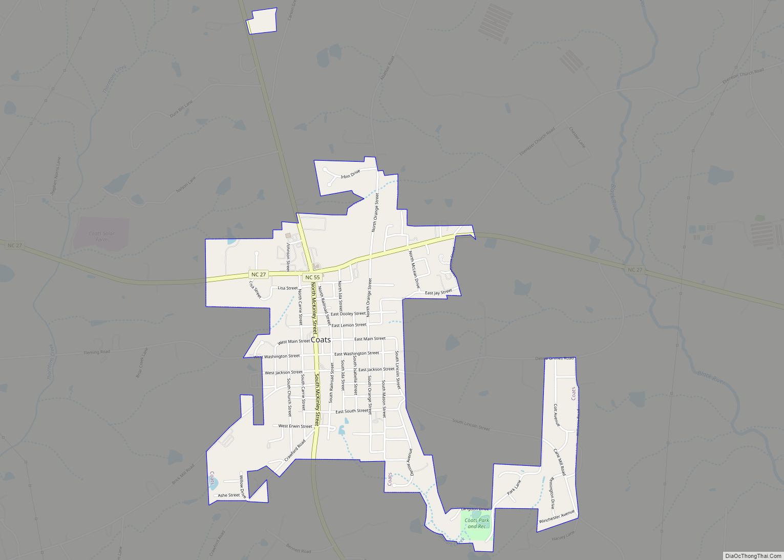
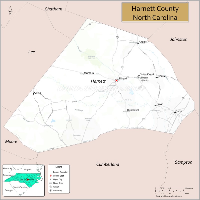
| Seat: | Lillington |
| Largest city: | Dunn |
| Total Area: | 601 sq mi (1,560 km²) |
| Land Area: | 595 sq mi (1,540 km²) |
| Total Population: | 135,966 |
| Population Density: | 228.5/sq mi (88.2/km²) |
| Time zone: | UTC−5 (Eastern) |
| Summer Time Zone (DST): | UTC−4 (EDT) |
| Website: | www.harnett.org |
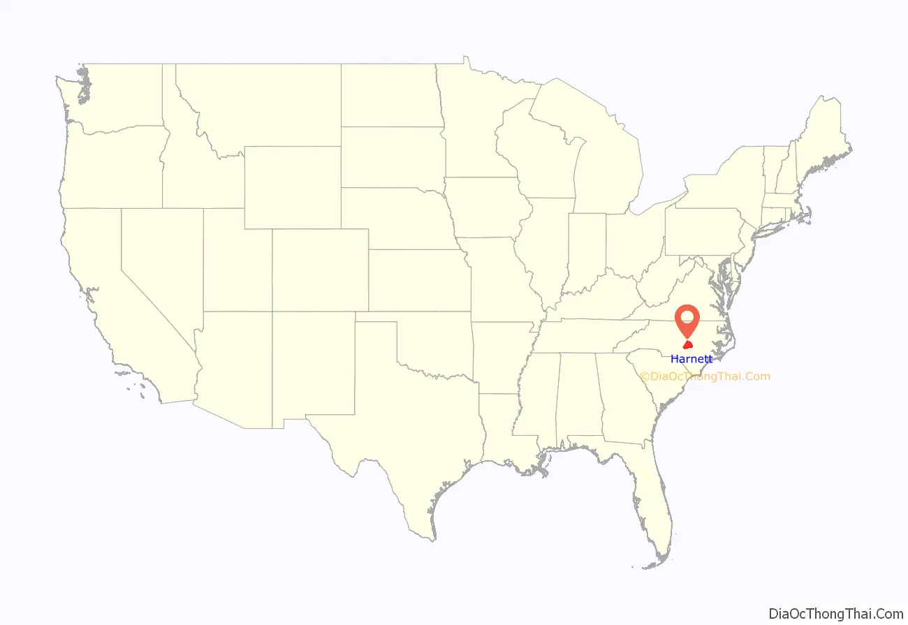
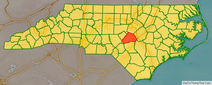
Harnett County location map. Where is Harnett County?
History
Harnett County was formed in 1855 from land given by Cumberland County. It was named for American Revolutionary war soldier Cornelius Harnett, who was also a delegate to the Continental Congress. The first settlers came to the region in the mid-1720s, and were followed by Highland Scots immigrants. The Scots settled in the foothills, where land was more affordable, rather than in the rich alluvial soil area of the coastal plain. After the defeat by the British of Bonny Prince Charles at Culloden, Scots immigrants came up the Cape Fear River in ever increasing numbers and settled in western Harnett County. British immigrants had settled primarily along the banks of the Cape Fear River in the coastal area, generally from Erwin to Wilmington.
During the American Revolutionary War, many of the Scots were Loyalists. In their defeat in Scotland, they had been forced to take ironclad vows that prohibited taking up arms against the British. Some Rebels considered them traitors to the cause of Independence. Public executions of suspected spies occurred. One site near Lillington was the scene of a mass execution of “Scots traitors”.
Though Harnett County was not a site of warfare during the Civil War, one of the last battles took place near Averasborough, which was once the third-most populated town in North Carolina, but is no longer in existence. During the Carolinas Campaign, the Left Wing of General William Sherman’s army under the command of Maj. General Henry W. Slocum defeated the army of General William Hardee in the Battle of Averasborough and proceeded eastward. A centennial celebration of the event was held in 1965 at the site of the battlefield.
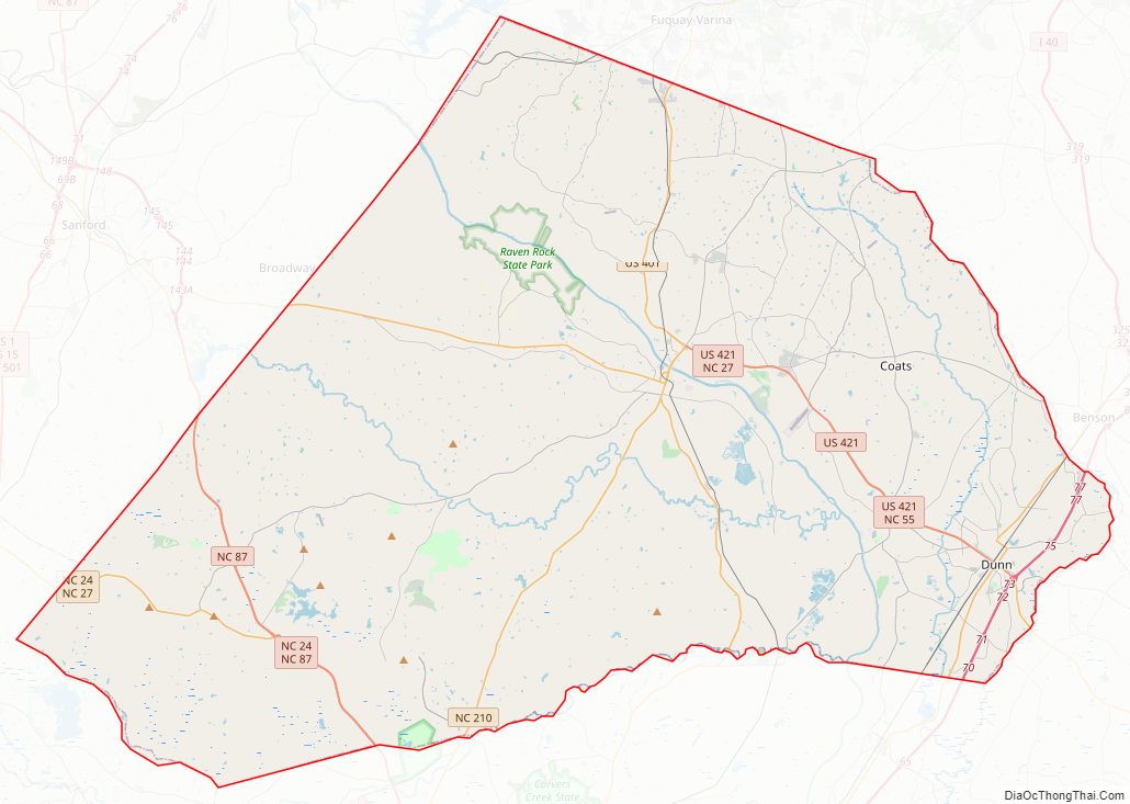
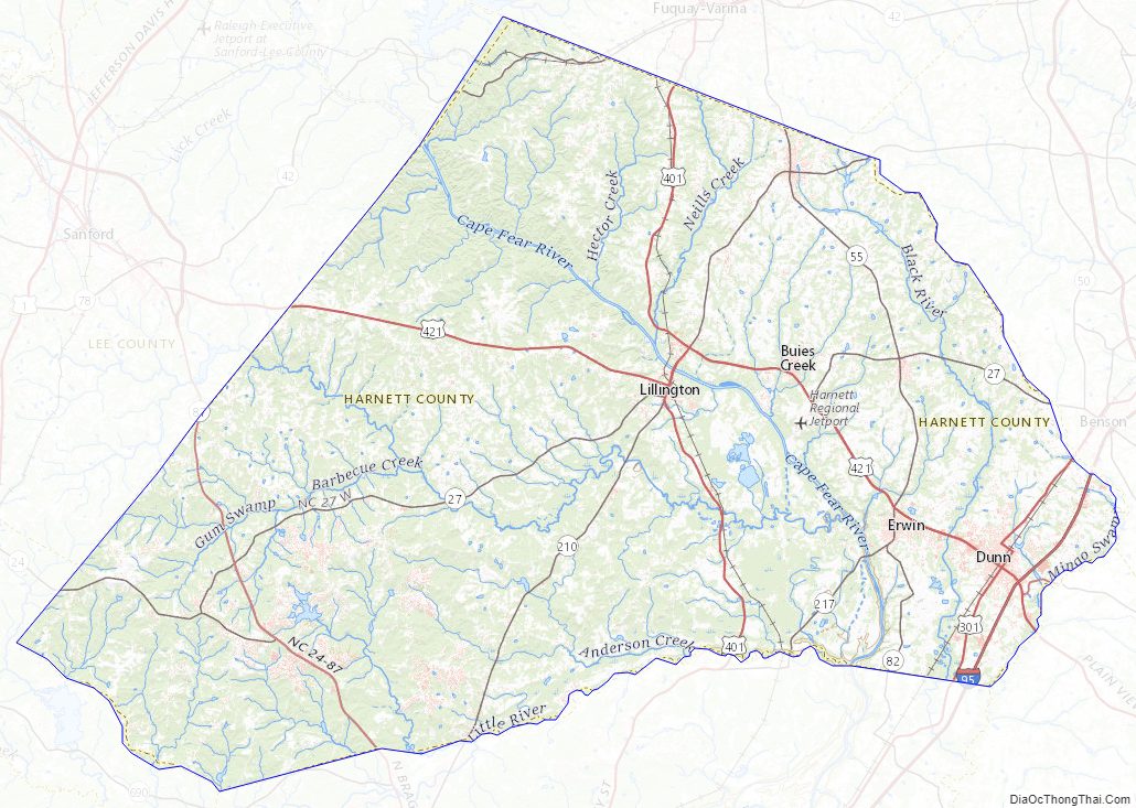
Harnett County Road Map
Geography
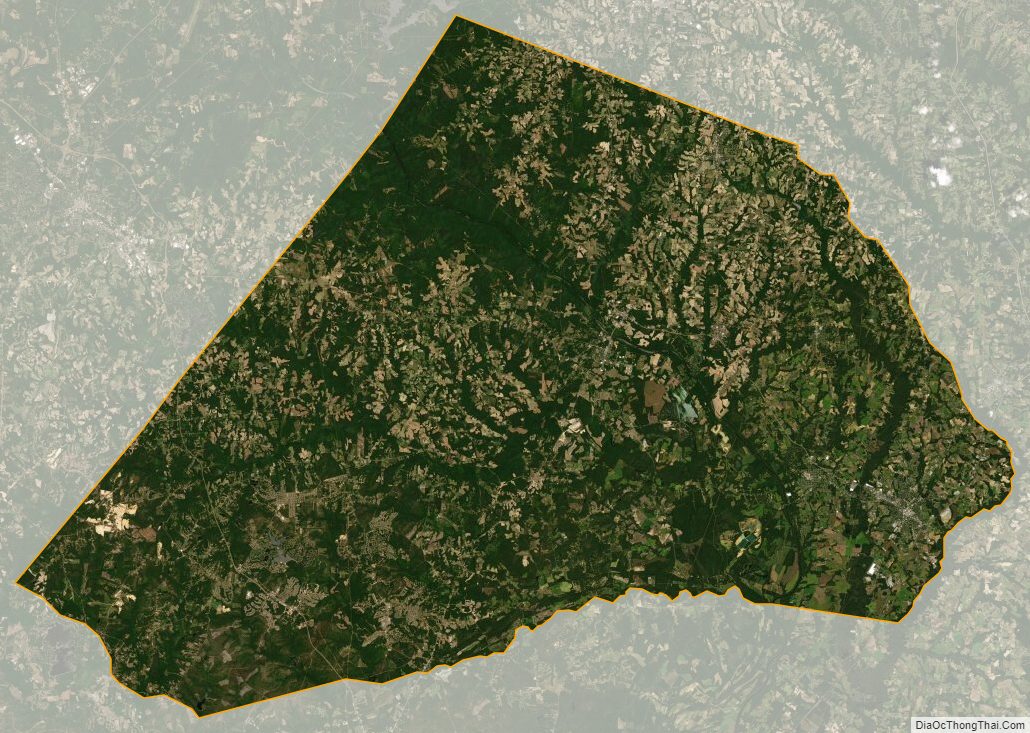
According to the U.S. Census Bureau, the county has a total area of 601 square miles (1,560 km), of which 6.3 square miles (16 km) (1.1%) are covered by water.
State and local protected areas/sites
- Anderson Creek County Park
- Averasboro Battlefield and Museum
- Raven Rock State Park
Major water bodies
- Black River
- Cape Fear River
- Little River (Cape Fear River tributary)
- Mingo Swamp (South River tributary)
- Neills Creek
- Upper Little River (Cape Fear River tributary)
Adjacent counties
- Wake County – north
- Johnston County – northeast
- Sampson County – southeast
- Cumberland County – south
- Moore County – west-southwest
- Lee County – west-northwest
- Chatham County – northwest
Major highways
- I-95
- Future I-685 (Concurrency with US 421)
- US 301
- US 401
- US 421
- NC 24
- NC 27
- NC 42
- NC 55
- NC 82
- NC 87
- NC 210
- NC 217
Major infrastructure
- Fort Bragg (Linden Oaks)
- Harnett Regional Jetport
Harnett County Topographic Map
Harnett County Satellite Map
Harnett County Outline Map