Hawaii County (Hawaiian: Kalana o Hawaiʻi) (officially known as the County of Hawaiʻi) is a county in the U.S. state of Hawaii in the Hawaiian Islands. It is coextensive with the Island of Hawaii, often called the “Big Island” to distinguish it from the state as a whole. The 2020 Census population was 200,629. The county seat is Hilo. There are no incorporated cities in Hawaii County (see Hawaii Counties). The Hilo Micropolitan Statistical Area includes all of Hawaii County. Hawaii County has a mayor–council form of government. Hawaii County is the largest county in the state in terms of geography.
The mayor of Hawaii County is Mitch Roth, who took office in 2020. Legislative authority is vested in a nine-member Hawaii County Council.
Hawaii County is one of seven counties in the United States to share the same name as the state they are in (the other six are Arkansas County, Idaho County, Iowa County, New York County, Oklahoma County, and Utah County).
| Name: | Hawaii County |
|---|---|
| FIPS code: | 15-001 |
| State: | Hawaii |
| Founded: | 1905 |
| Named for: | Hawaiian Islands |
| Seat: | Hilo |
| Total Area: | 5,086.70 sq mi (13,174.5 km²) |
| Land Area: | 4,028.02 sq mi (10,432.5 km²) |
| Total Population: | 200,629 |
| Population Density: | 46/sq mi (17.7/km²) |
| Time zone: | UTC−10 (Hawaii–Aleutian) |
| Summer Time Zone (DST): | HADT |
| Website: | www.hawaiicounty.gov |
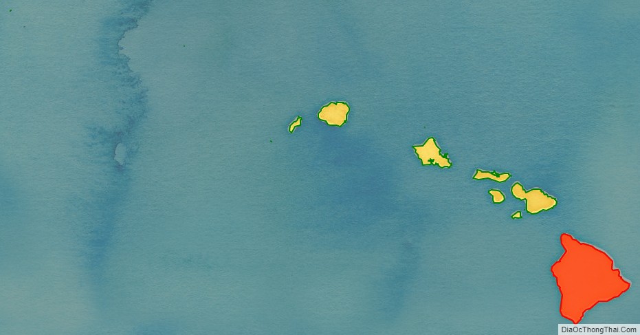
Hawaii County location map. Where is Hawaii County?
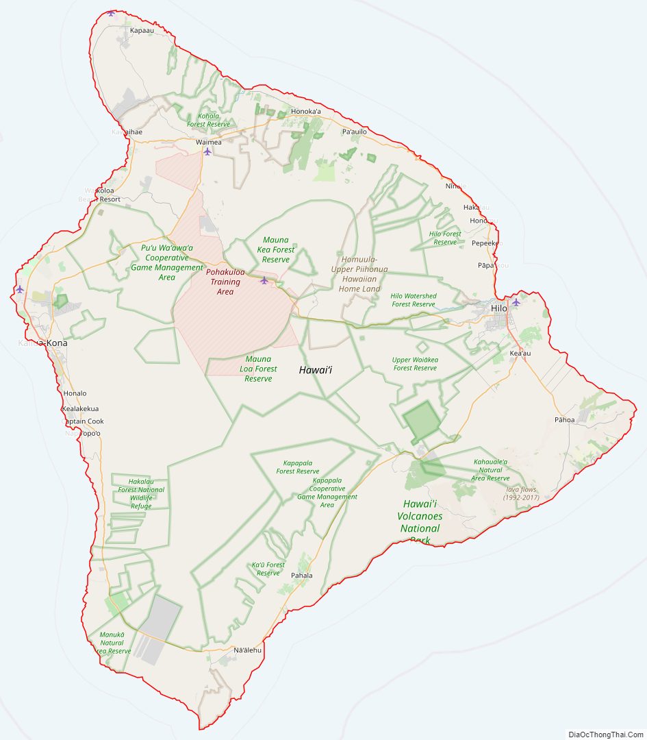
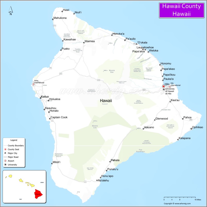
Hawaii County Road Map
Geography
Hawaii County has a total area of 5,086.70 square miles (13,174.5 km); 4,028.02 square miles (10,432.5 km) is land and 1,058.69 square miles (2,742.0 km) is water (mostly all off the ocean shoreline but counted in the total area by the U.S. Census Bureau). The county’s land area comprises 62.7 percent of the state’s land area. It is the highest percentage by any county in the United States. (Delaware‘s Sussex County comes in second at 48.0 percent, while Rhode Island‘s Providence County is third at 39.55 percent.)
Major highways
- Route 11
- Route 19
- Route 130
- Route 132
- Route 137
- Route 190
- Route 200
- Route 250
- Route 270
- Route 2000
Adjacent county
- Maui County – northwest
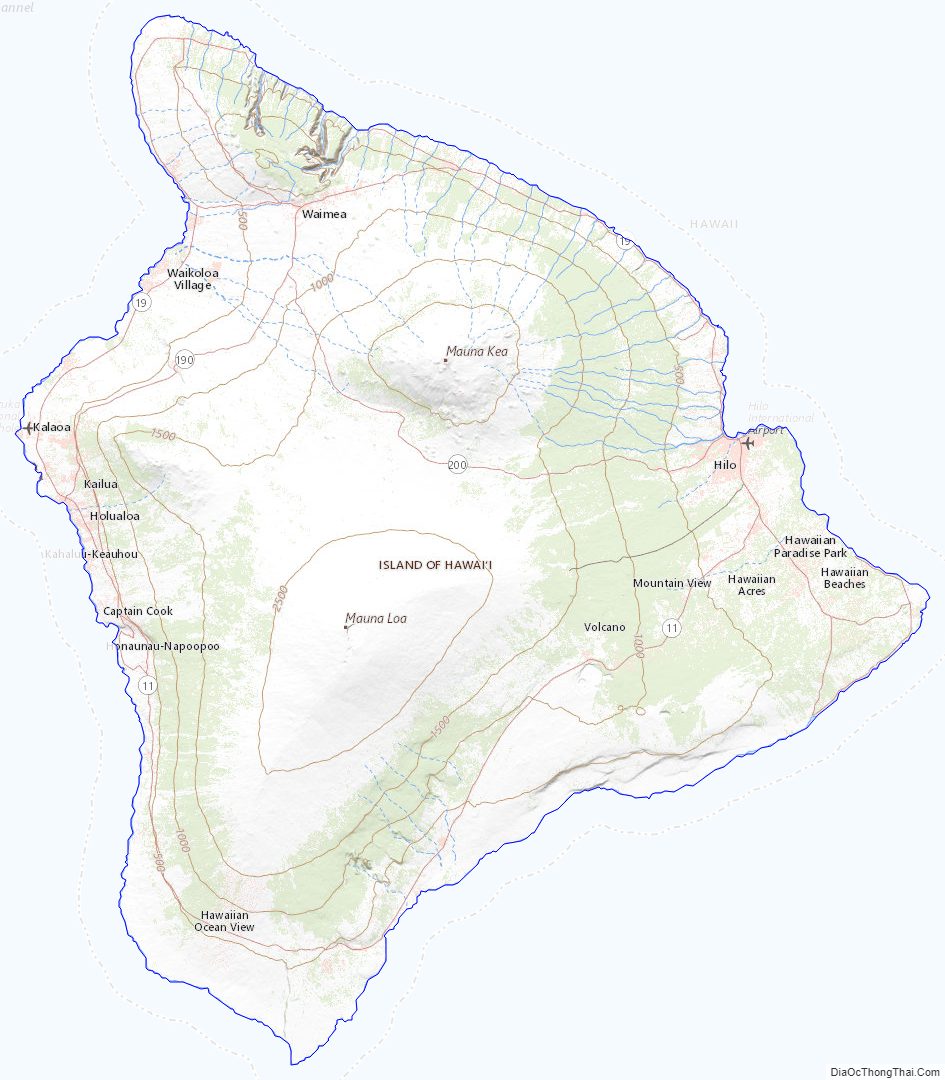
Hawaii County Topographic Map
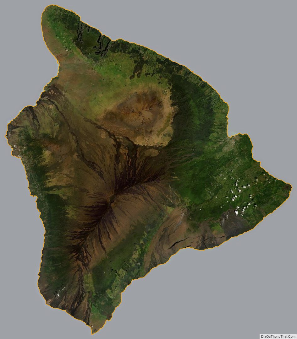
Hawaii County Satellite Map
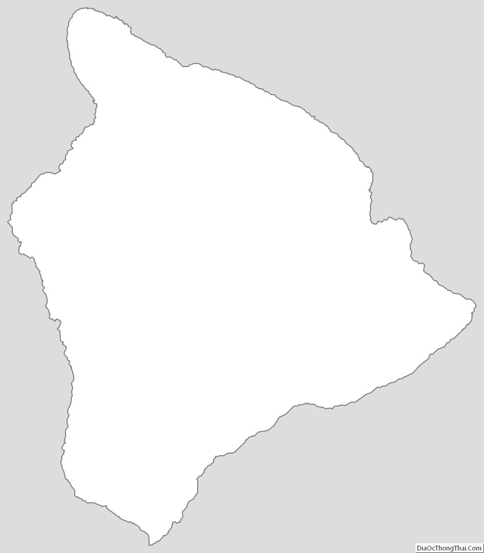
Hawaii County Outline Map
See also
Map of Hawaii State and its subdivision: Map of other states:- Alabama
- Alaska
- Arizona
- Arkansas
- California
- Colorado
- Connecticut
- Delaware
- District of Columbia
- Florida
- Georgia
- Hawaii
- Idaho
- Illinois
- Indiana
- Iowa
- Kansas
- Kentucky
- Louisiana
- Maine
- Maryland
- Massachusetts
- Michigan
- Minnesota
- Mississippi
- Missouri
- Montana
- Nebraska
- Nevada
- New Hampshire
- New Jersey
- New Mexico
- New York
- North Carolina
- North Dakota
- Ohio
- Oklahoma
- Oregon
- Pennsylvania
- Rhode Island
- South Carolina
- South Dakota
- Tennessee
- Texas
- Utah
- Vermont
- Virginia
- Washington
- West Virginia
- Wisconsin
- Wyoming