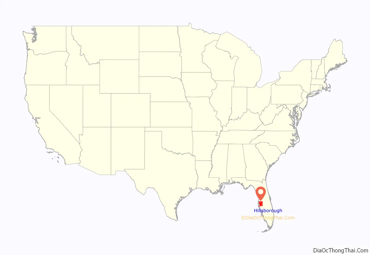
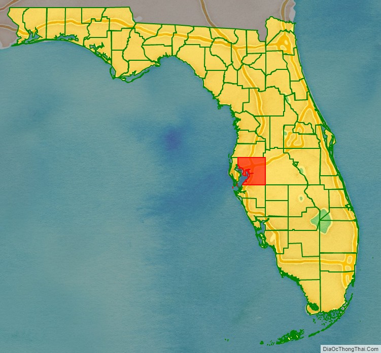
Hillsborough County is located in the west central portion of the U.S. state of Florida. In the 2020 census, the population was 1,459,762, making it the fourth-most populous county in Florida and the most populous county outside the Miami metropolitan area. A 2021 estimate has the population of Hillsborough County at 1,512,070 people with a yearly growth rate of 1.34%, which itself is greater than the populations of 12 states according to their 2019 population estimates. Its county seat and largest city is Tampa. Hillsborough County is part of the Tampa–St. Petersburg–Clearwater Metropolitan Statistical Area.
| Name: | Hillsborough County |
|---|---|
| FIPS code: | 12-057 |
| State: | Florida |
| Founded: | January 25, 1834 |
| Named for: | Wills Hill, Earl of Hillsborough |
| Seat: | Tampa |
| Largest city: | Tampa |
| Total Area: | 1,266 sq mi (3,280 km²) |
| Land Area: | 1,020 sq mi (2,600 km²) |
| Total Population: | 1,459,762 |
| Population Density: | 1,431/sq mi (553/km²) |
| Time zone: | UTC−5 (Eastern) |
| Summer Time Zone (DST): | UTC−4 (EDT) |
| Website: | www.hillsboroughcounty.org |
Hillsborough County location map. Where is Hillsborough County?
History
Hillsborough County was created on January 25, 1834, from Alachua and Monroe Counties, during the U.S. territorial period (1822–1845). The new county was named for Wills Hill, the Earl of Hillsborough, who served as British Secretary of State for the Colonies from 1768 to 1772. The County was created through efforts by Augustus Steele.
The county’s 1834 area was much larger and included eight other present-day counties: Charlotte County, DeSoto, Hardee, Manatee, Pasco, Pinellas, Polk, and Sarasota.
The last significant change in Hillsborough County’s borders was the separation of its western section to create Pinellas County in 1911.
On New Year’s Day in 1914, the St. Petersburg-Tampa Airboat Line initiated the first scheduled commercial airline service in the world, from St. Petersburg to Tampa.
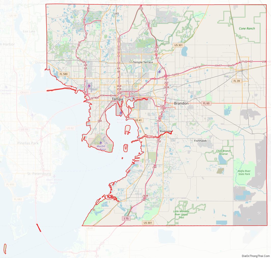
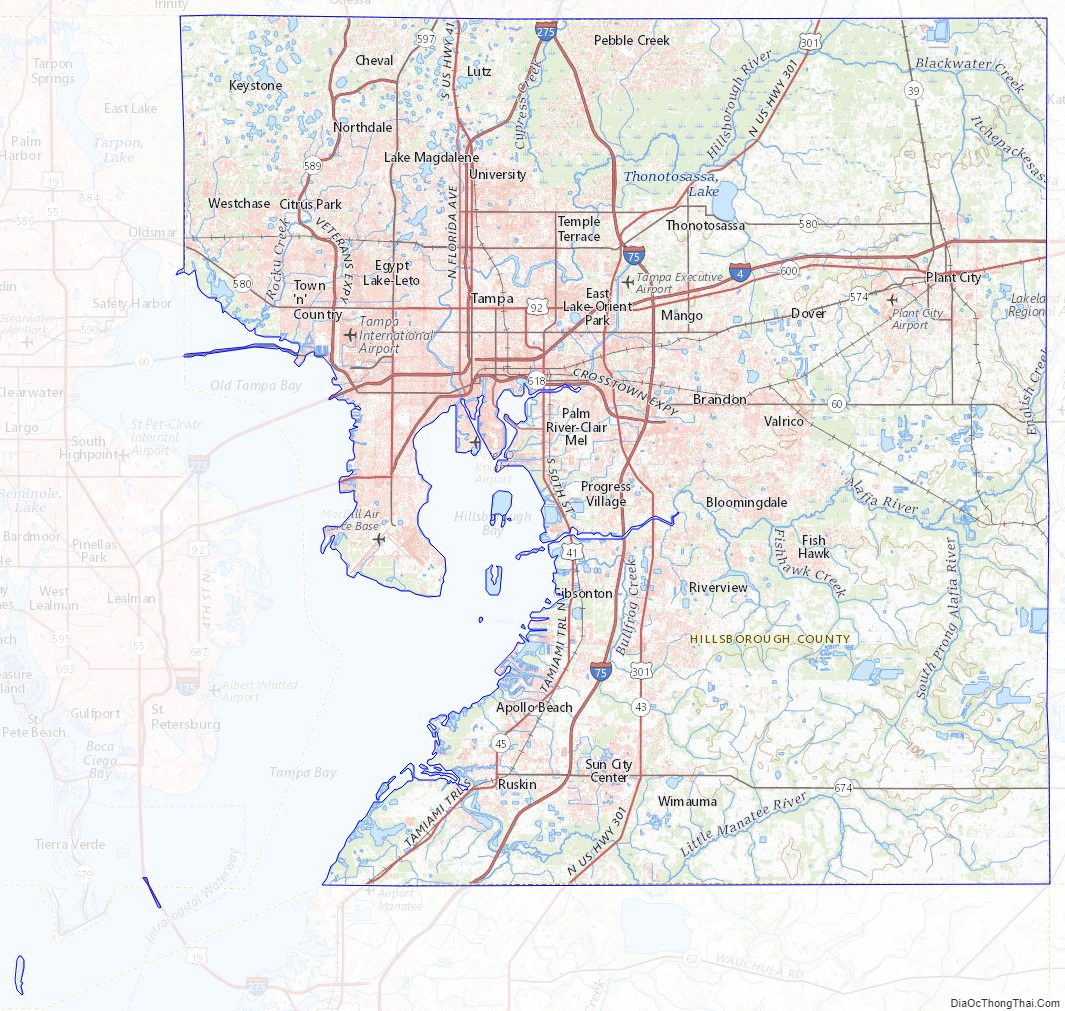
Hillsborough County Road Map
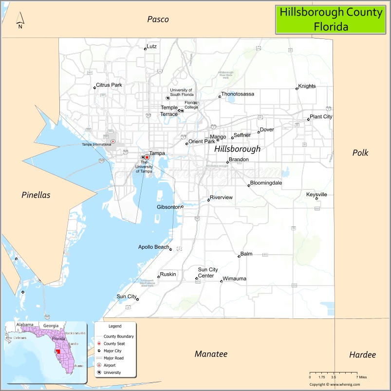
Geography
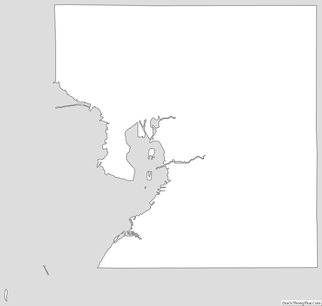
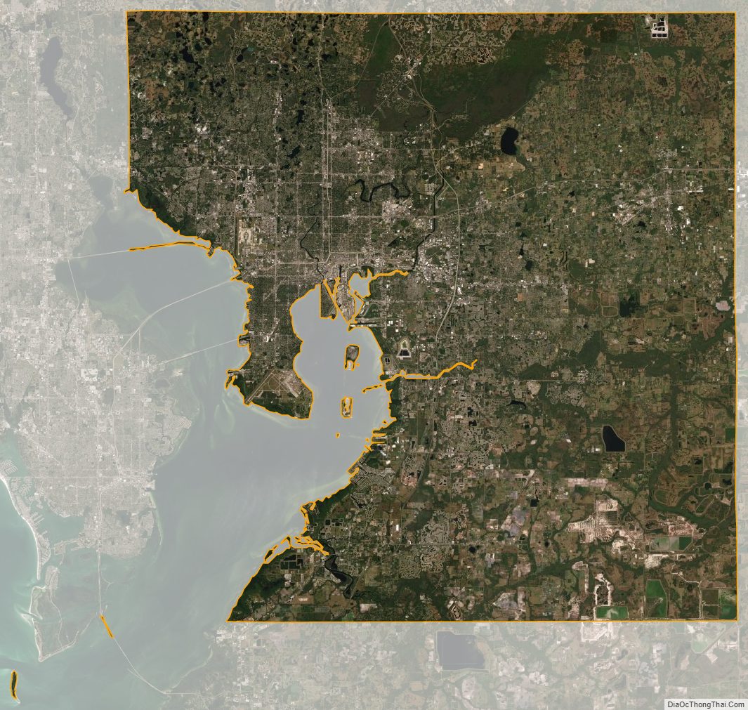
According to the U.S. Census Bureau, the county has a total area of 1,266 square miles (3,280 km), of which 1,020 square miles (2,600 km) are land and 246 square miles (640 km) (19.4%) are covered by water. About 158.27 miles (254.71 km) of shoreline are on Tampa Bay.
The county’s unincorporated area is around 888 square miles (2,300 km), more than 84% of the total land area. Municipalities account for 163 square miles (420 km). The modern boundaries of the county place it midway along the west coast of Florida.
A narrow portion of Hillsborough County to the south, consisting almost exclusively of water, extends west to the Gulf of Mexico roughly along the Tampa Port Shipping Channel. This has the effect of keeping Hillsborough County from being technically landlocked. The central portion of the Sunshine Skyway Bridge is in Hillsborough County. So is Egmont Key, at the entrance to Tampa Bay; this narrow strip of land separates Pinellas County from Manatee County. The northernmost tip of a spoil island just west of Port Manatee also lies in Hillsborough County.
Hillsborough is home to Alafia River State Park and Hillsborough River state parks, and to the C. W. Bill Young Regional Reservoir and Lithia Springs, one of the largest natural springs in Florida.
On the Alafia River near Lithia Springs Park
An alligator in the Alafia River State Park
Hurrah Lake on the Alafia River
Sandhill crane at Hillsborough River State Park
On the Hillsborough River near Lettuce Lake Park
Adjacent counties
- Pasco County – north
- Polk County – east
- Manatee County – south
- Pinellas County – west
- Hardee County – southeast
Hillsborough County Topographic Map
Hillsborough County Satellite Map
Hillsborough County Outline Map