Jefferson County is located in the north central portion of the U.S. state of Kentucky. As of the 2020 census, the population was 782,969. It is the most populous county in the commonwealth (with more than twice the population of second ranked Fayette County).
Since a city-county merger in 2003, the county’s territory, population and government have been coextensive with the city of Louisville, which also serves as county seat. The administrative entity created by this merger is the Louisville/Jefferson County Metro Government, abbreviated to Louisville Metro.
Jefferson County is the anchor of the Louisville-Jefferson County, KY-IN Metropolitan Statistical Area, locally referred to as Kentuckiana.
| Name: | Jefferson County |
|---|---|
| FIPS code: | 21-111 |
| State: | Kentucky |
| Founded: | 1780 |
| Named for: | Thomas Jefferson |
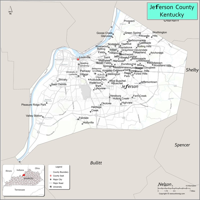
| Seat: | Louisville |
| Largest city: | Louisville |
| Total Area: | 398 sq mi (1,030 km²) |
| Land Area: | 380 sq mi (1,000 km²) |
| Total Population: | 782,969 |
| Population Density: | 2,000/sq mi (760/km²) |
| Time zone: | UTC−5 (Eastern) |
| Summer Time Zone (DST): | UTC−4 (EDT) |
| Website: | www.louisvilleky.gov |
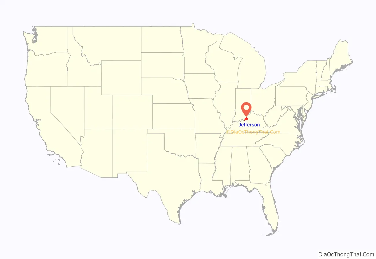
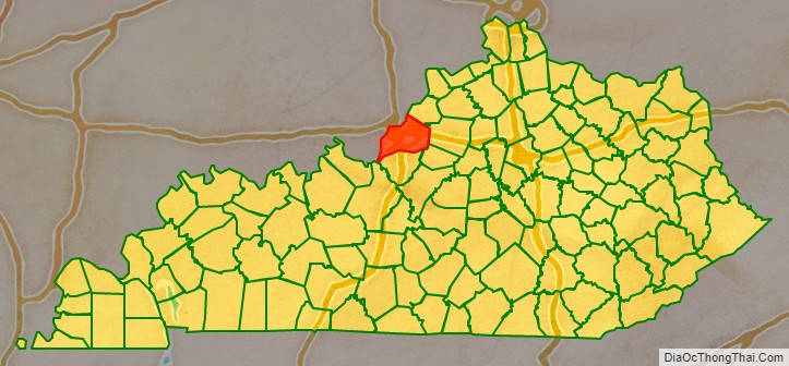
Jefferson County location map. Where is Jefferson County?
History
Jefferson County—originally Jefferson County, Virginia—was established by the Virginia General Assembly in June 1780, when it abolished and partitioned Kentucky County into three counties: Fayette, Jefferson and Lincoln. Named for Thomas Jefferson, who was governor of Virginia at the time, it was one of Kentucky’s nine original counties on June 1, 1792.
In 1778, during the American Revolutionary War, George Rogers Clark’s militia and 60 civilian settlers, established the first American settlement in the county on Corn Island in the Ohio River, at head of the Falls of the Ohio. They moved to the mainland the following year, establishing Louisville.
Richard Mentor Johnson, the 9th Vice President of the United States, was born in Jefferson County in 1780, while the family was living in a settlement along the Beargrass Creek.
The last major American Indian raid in present-day Jefferson County was the Chenoweth Massacre on July 17, 1789.
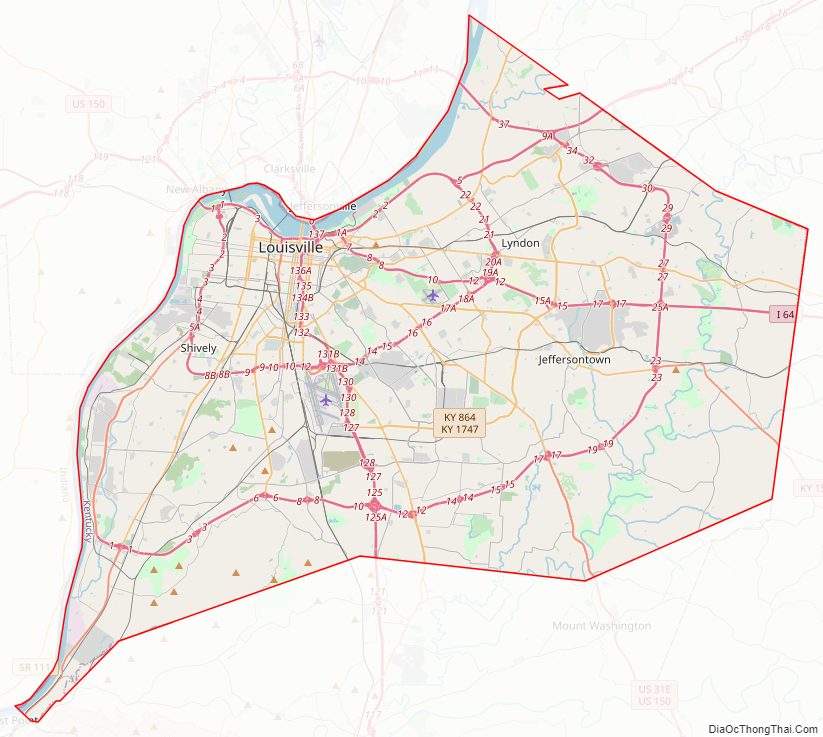
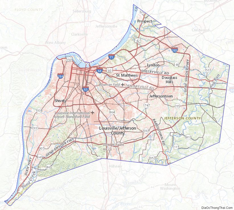
Jefferson County Road Map
Geography
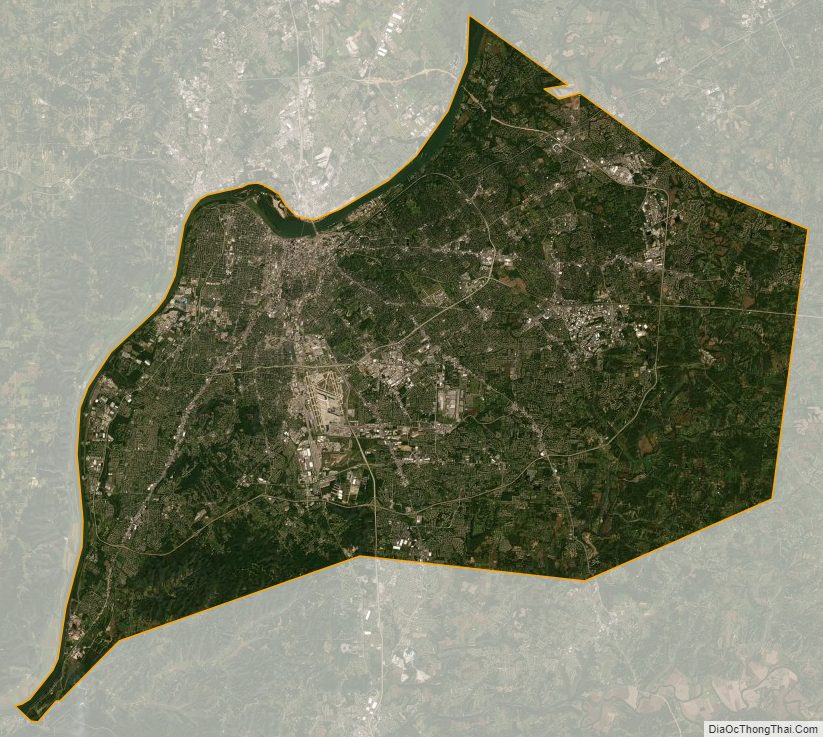
According to the United States Census Bureau, the county has a total area of 398 square miles (1,030 km), of which 380 square miles (980 km) is land and 17 square miles (44 km) (4.3%) is water. The Ohio River forms its northern boundary with the state of Indiana.
The highest point is South Park Hill, elevation 902 feet (275 m), located in the southern part of the county. The lowest point is 383 feet (117 m) along the Ohio River just north of West Point.
Adjacent counties
- Bullitt County (south)
- Shelby County (east)
- Oldham County (northeast)
- Spencer County (southeast)
- Hardin County (southwest)
- Clark County, Indiana (north)
- Harrison County, Indiana (west)
- Floyd County, Indiana (northwest)
Jefferson County Topographic Map
Jefferson County Satellite Map
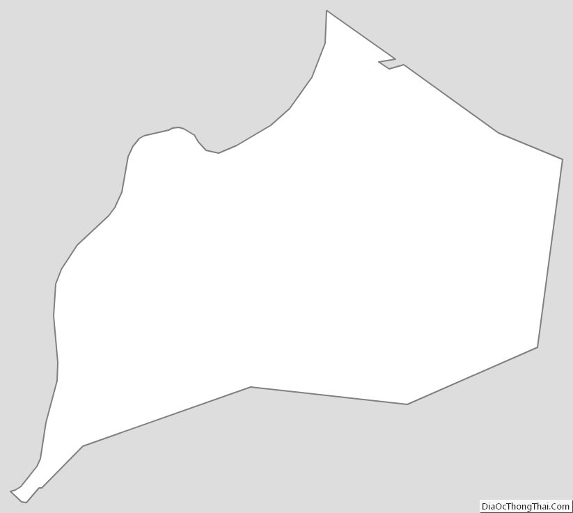
Jefferson County Outline Map