Anchorage is a home rule-class city in eastern Jefferson County, Kentucky, United States. The population was 2,348 at the 2010 census and an estimated 2,432 in 2018. It is a suburb of Louisville.
| Name: | Anchorage city |
|---|---|
| LSAD Code: | 25 |
| LSAD Description: | city (suffix) |
| State: | Kentucky |
| County: | Jefferson County |
| Elevation: | 712 ft (217 m) |
| Total Area: | 2.97 sq mi (7.69 km²) |
| Land Area: | 2.96 sq mi (7.66 km²) |
| Water Area: | 0.01 sq mi (0.03 km²) |
| Total Population: | 2,500 |
| Population Density: | 844.88/sq mi (326.22/km²) |
| ZIP code: | 40223 |
| Area code: | 502 |
| FIPS code: | 2101504 |
| GNISfeature ID: | 0485930 |
| Website: | www.cityofanchorage.org |
Online Interactive Map
Click on ![]() to view map in "full screen" mode.
to view map in "full screen" mode.
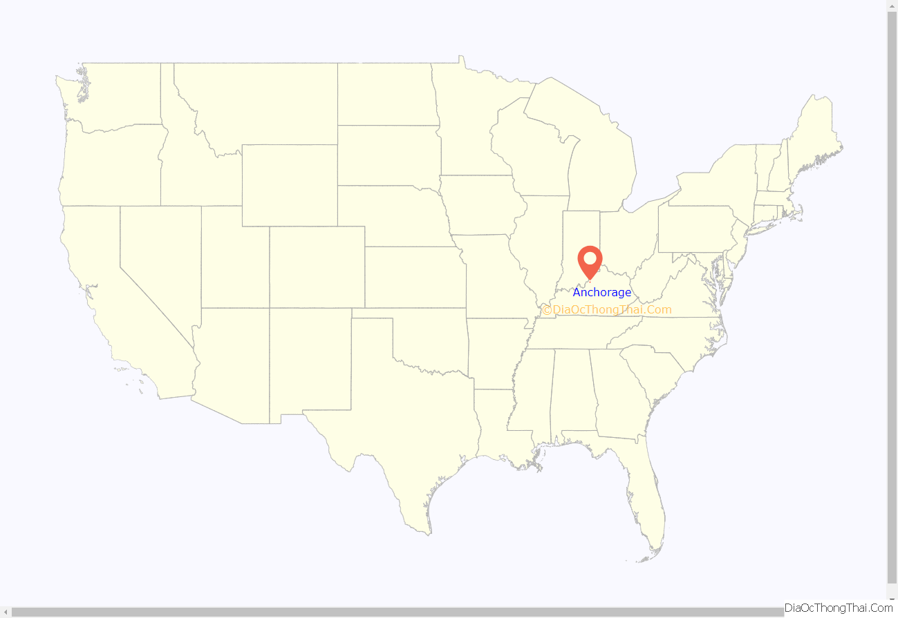
Anchorage location map. Where is Anchorage city?
History
The land that is now Anchorage was a part of Isaac Hite’s 1773 land grant, which awarded most of the land in today’s Jefferson County to officers in the Virginia militia, in exchange for their service in the French and Indian War. Early maps refer to the area as “Hite’s Mill”, and it has also been known as “Hobbs Station”. Part of Hite’s original grant now makes up the grounds of Central State Hospital and E. P. “Tom” Sawyer State Park.
The nautical name is a bit odd, considering the city is over 12 miles (19 km) from the Ohio River. The origin is The Anchorage, the estate of riverboat captain and early resident James W. Goslee, and was chosen to honor him when the city incorporated in 1878, three years after his death. Tradition says that an anchor hanging inside the rim of a locomotive wheel at the center of town was taken by Goslee from his ship, the Matamora.
The Louisville and Frankfort Railroad (later purchased by the Louisville & Nashville Railroad) was built through the area in 1849. The development of an interurban rail line in 1901 allowed faster travel between Anchorage and Louisville, as well as other towns in the area.
The heavily shaded city, with temperatures often noticeably cooler than in Downtown Louisville, became a popular location for summer homes for wealthy Louisvillians. One such resident was brewing magnate Isaac Wolfe Bernheim, still remembered locally for his philanthropy. In 1914, Bernheim commissioned the firm of Frederick Law Olmsted to design a plan for Anchorage, which would incorporate stone bridges and triangle intersections, similar to Olmsted’s plans for Louisville’s park system.
The city has long been known as home of some of the area’s wealthiest citizens, though the large old estates have mostly been divided up and many new, still upscale, houses have been built in the area, especially since 1977. Part of the city is designated as the Anchorage Historic District, which was listed on the National Register of Historic Places in 1982.
Papa John’s Pizza founder John Schnatter is a resident and owns about 6% of the land in Anchorage, including much of the city center. He restored an interurban rail station, three historic buildings and built a fourth in a similar style in the city’s center, with plans to build a bank, an upscale restaurant, and a hiking trail, which opened as the Anchorage Trail in June 2008. In an interview, he told the Courier-Journal that his goal was purely to “preserve the city’s character”.
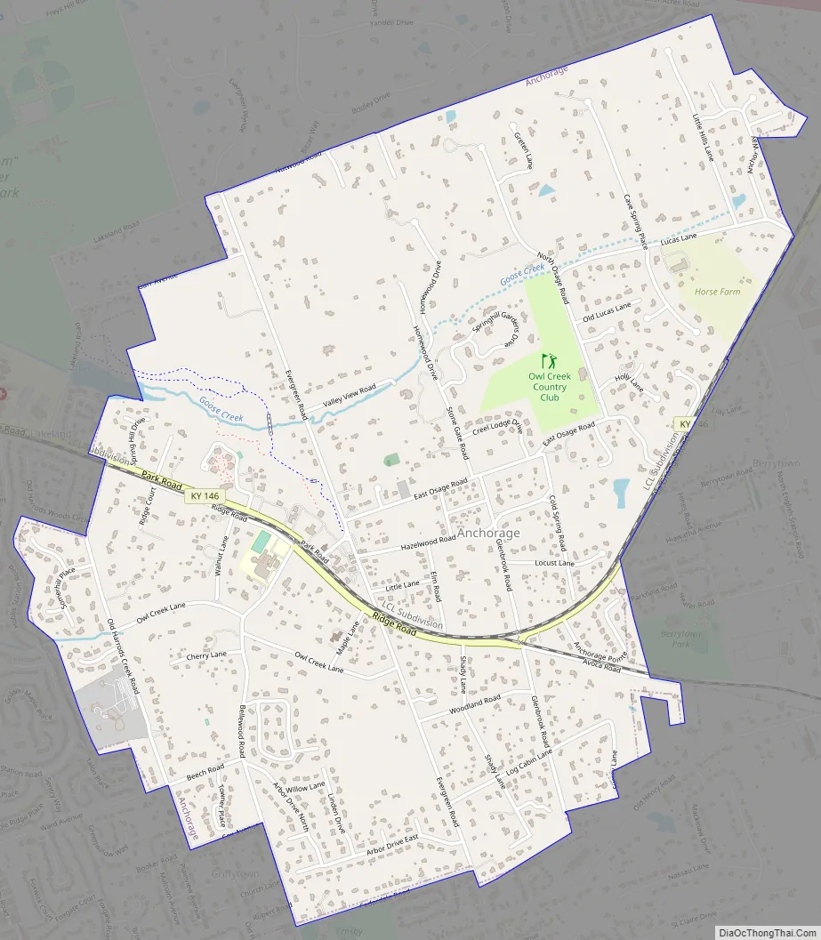
Anchorage Road Map
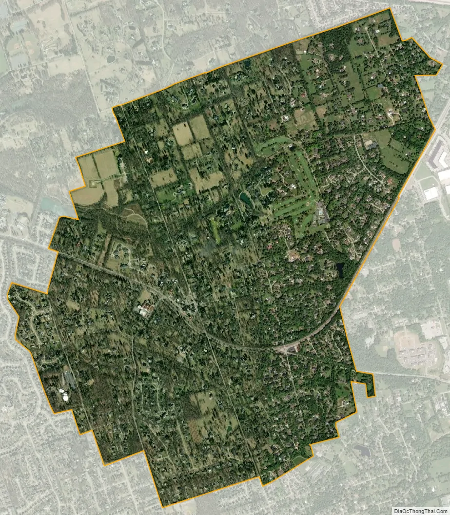
Anchorage city Satellite Map
Geography
Anchorage is located in northeastern Jefferson County at 38°15′55″N 85°32′15″W / 38.26528°N 85.53750°W / 38.26528; -85.53750 (38.265370, −85.537571). It is bordered to the south by Middletown. Downtown Louisville is 15 miles (24 km) to the west. Interstate 265 passes north and east of Anchorage, with access from Exits 29 (Old Henry Road) and 30 (Kentucky Route 146).
According to the United States Census Bureau, the city has a total area of 3.0 square miles (7.7 km), of which 0.01 square miles (0.03 km), or 0.38%, are water.
See also
Map of Kentucky State and its subdivision:- Adair
- Allen
- Anderson
- Ballard
- Barren
- Bath
- Bell
- Boone
- Bourbon
- Boyd
- Boyle
- Bracken
- Breathitt
- Breckinridge
- Bullitt
- Butler
- Caldwell
- Calloway
- Campbell
- Carlisle
- Carroll
- Carter
- Casey
- Christian
- Clark
- Clay
- Clinton
- Crittenden
- Cumberland
- Daviess
- Edmonson
- Elliott
- Estill
- Fayette
- Fleming
- Floyd
- Franklin
- Fulton
- Gallatin
- Garrard
- Grant
- Graves
- Grayson
- Green
- Greenup
- Hancock
- Hardin
- Harlan
- Harrison
- Hart
- Henderson
- Henry
- Hickman
- Hopkins
- Jackson
- Jefferson
- Jessamine
- Johnson
- Kenton
- Knott
- Knox
- Larue
- Laurel
- Lawrence
- Lee
- Leslie
- Letcher
- Lewis
- Lincoln
- Livingston
- Logan
- Lyon
- Madison
- Magoffin
- Marion
- Marshall
- Martin
- Mason
- McCracken
- McCreary
- McLean
- Meade
- Menifee
- Mercer
- Metcalfe
- Monroe
- Montgomery
- Morgan
- Muhlenberg
- Nelson
- Nicholas
- Ohio
- Oldham
- Owen
- Owsley
- Pendleton
- Perry
- Pike
- Powell
- Pulaski
- Robertson
- Rockcastle
- Rowan
- Russell
- Scott
- Shelby
- Simpson
- Spencer
- Taylor
- Todd
- Trigg
- Trimble
- Union
- Warren
- Washington
- Wayne
- Webster
- Whitley
- Wolfe
- Woodford
- Alabama
- Alaska
- Arizona
- Arkansas
- California
- Colorado
- Connecticut
- Delaware
- District of Columbia
- Florida
- Georgia
- Hawaii
- Idaho
- Illinois
- Indiana
- Iowa
- Kansas
- Kentucky
- Louisiana
- Maine
- Maryland
- Massachusetts
- Michigan
- Minnesota
- Mississippi
- Missouri
- Montana
- Nebraska
- Nevada
- New Hampshire
- New Jersey
- New Mexico
- New York
- North Carolina
- North Dakota
- Ohio
- Oklahoma
- Oregon
- Pennsylvania
- Rhode Island
- South Carolina
- South Dakota
- Tennessee
- Texas
- Utah
- Vermont
- Virginia
- Washington
- West Virginia
- Wisconsin
- Wyoming


