| Name: | New London County |
|---|---|
| FIPS code: | 09-011 |
| State: | Connecticut |
| Founded: | 1646 |
| Named for: | London, England |
| Seat: | none (since 1960) New London, Connecticut (before 1960) |
| Largest city: | Norwich |
| Total Area: | 772 sq mi (2,000 km²) |
| Land Area: | 665 sq mi (1,720 km²) |
| Total Population: | 268,555 |
| Population Density: | 403.8/sq mi (155.9/km²) |
| Time zone: | UTC−5 (Eastern) |
| Summer Time Zone (DST): | UTC−4 (EDT) |
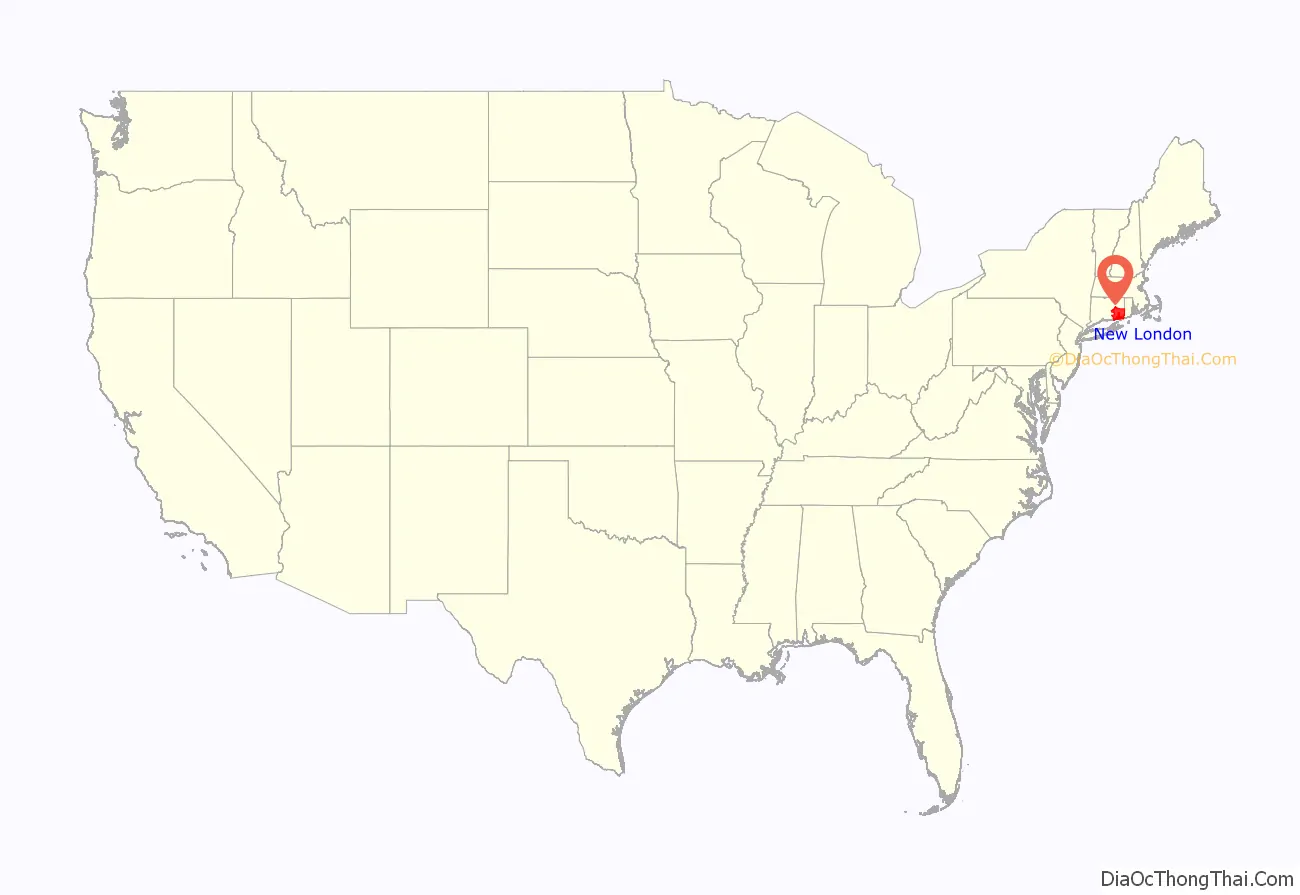
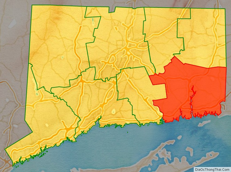
New London County location map. Where is New London County?
History
Southeastern New England was dominated by the Pequot people at the time of English colonization. They spoke the Mohegan-Pequot language and were one of the Algonquian-speaking tribes in the coastal areas. After years of conflict, the Colonists and their Indian allies defeated the Pequots in the Pequot War of 1637, ending their dominance. Two descendant Pequot tribes are recognized by the state today, as are three other tribes.
New London County was one of four original counties in Connecticut that were established on May 10, 1666 by an act of the Connecticut General Court, which states:
New London County in 1666 consisted of the towns of Stonington, Norwich, New London, and Saybrook. The “Homonoscet Plantation” was settled in March 1663, at first as Kenilworth, but was incorporated as the town of Killingworth in 1667. Several new towns were incorporated and added to New London over the next few decades: Preston in 1687, Colchester in 1699, and Lebanon in 1700. The settlements along the Quinebaug Valley were placed in New London County in 1697, and incorporated as Plainfield in 1699. By 1717, more towns were established in northeastern Connecticut and added to New London County between the Quinebaug Valley and the Rhode Island border.
Windham County was constituted from Hartford and New London counties on May 12, 1726, consisting of towns in northeastern Connecticut. New London County lost the towns of Voluntown, Pomfret, Killingly, Canterbury, Plainfield, and Lebanon to the newly formed county. In 1785, Middlesex County was constituted, consisting of towns along the lower Connecticut River Valley, taking away the towns of Killingworth and Saybrook from New London County. Several additional boundary adjustments took place in the 19th century: the establishment of the town of Marlborough in 1803, the transfer of the town of Lebanon from Windham County in 1824, and the transfer of the town of Voluntown from Windham County in 1881.
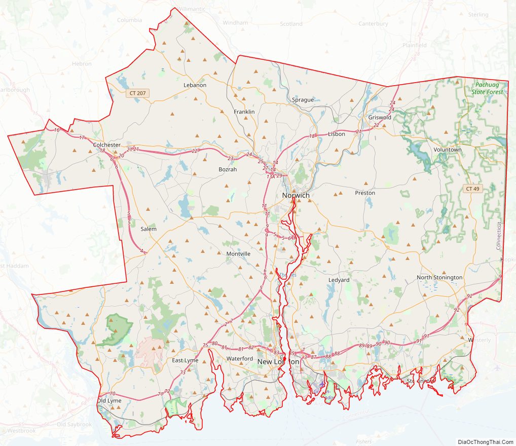
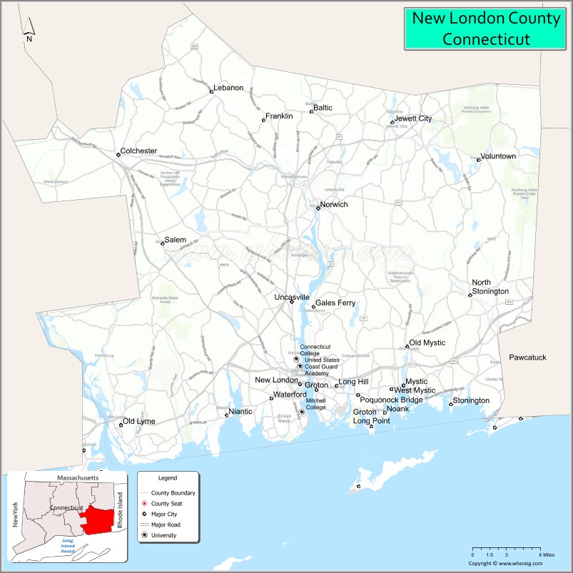
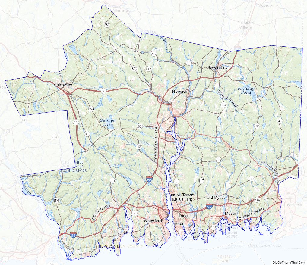
New London County Road Map
Geography
According to the U.S. Census Bureau, the county has a total area of 772 square miles (2,000 km), of which 665 square miles (1,720 km) is land and 107 square miles (280 km) (13.8%) is water.
The terrain of the county is mostly level, becoming more elevated only in its northern extreme. The highest point in the county is Gates Hill in the Town of Lebanon at approximately 660 feet (201 m) above sea level, and the lowest point is sea level.
Adjacent counties
- Windham County (north)
- Kent County, Rhode Island (northeast)
- Washington County, Rhode Island (east)
- Middlesex County (west)
- Tolland County (northwest)
- Hartford County (northwest)
- Suffolk County, New York (south)
New London County Topographic Map
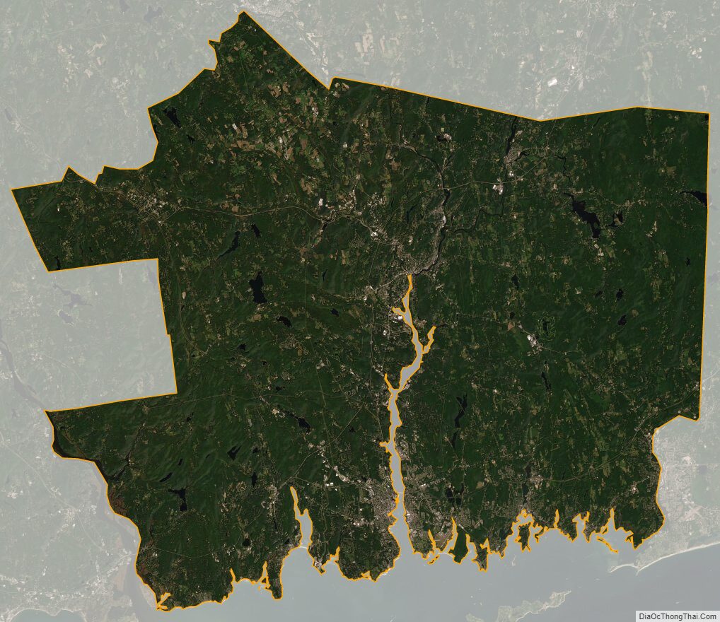
New London County Satellite Map
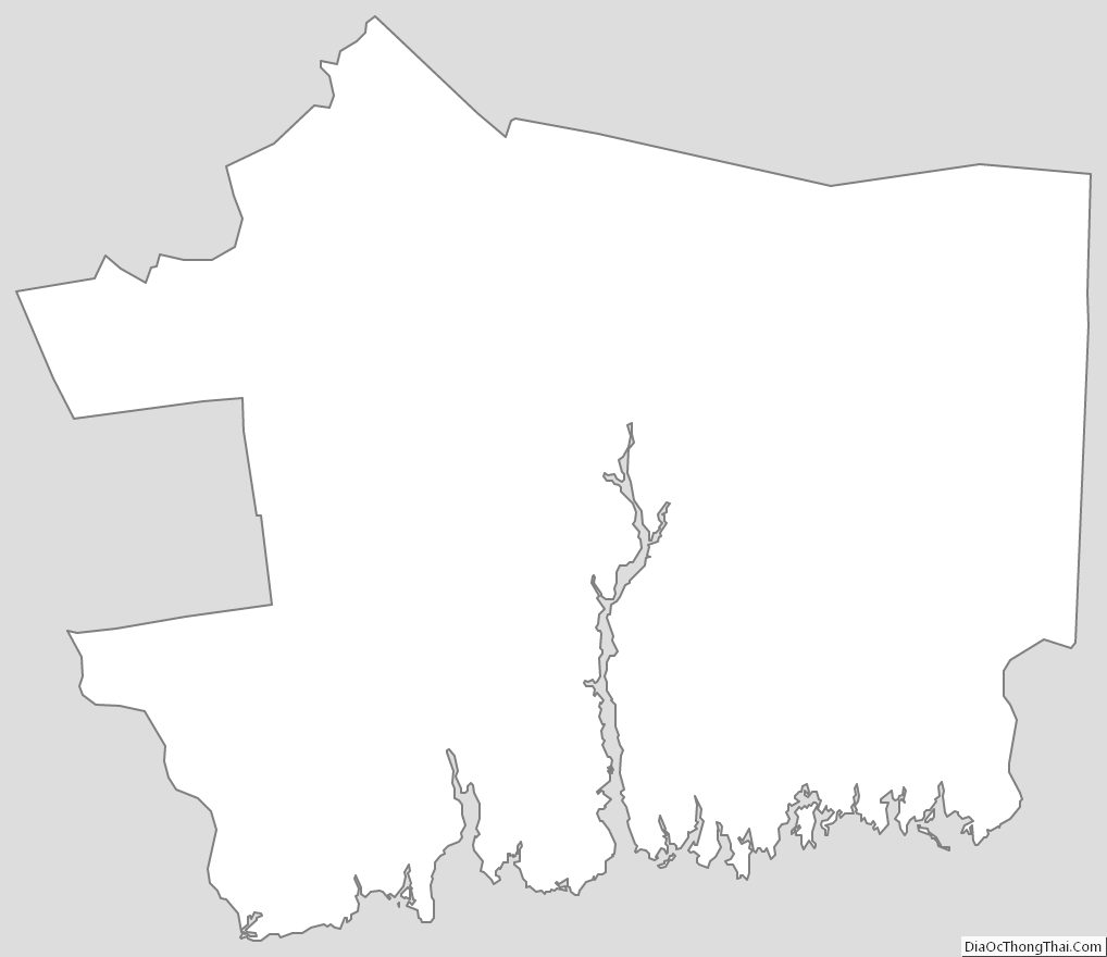
New London County Outline Map
See also
Map of Connecticut State and its subdivision: Map of other states:- Alabama
- Alaska
- Arizona
- Arkansas
- California
- Colorado
- Connecticut
- Delaware
- District of Columbia
- Florida
- Georgia
- Hawaii
- Idaho
- Illinois
- Indiana
- Iowa
- Kansas
- Kentucky
- Louisiana
- Maine
- Maryland
- Massachusetts
- Michigan
- Minnesota
- Mississippi
- Missouri
- Montana
- Nebraska
- Nevada
- New Hampshire
- New Jersey
- New Mexico
- New York
- North Carolina
- North Dakota
- Ohio
- Oklahoma
- Oregon
- Pennsylvania
- Rhode Island
- South Carolina
- South Dakota
- Tennessee
- Texas
- Utah
- Vermont
- Virginia
- Washington
- West Virginia
- Wisconsin
- Wyoming