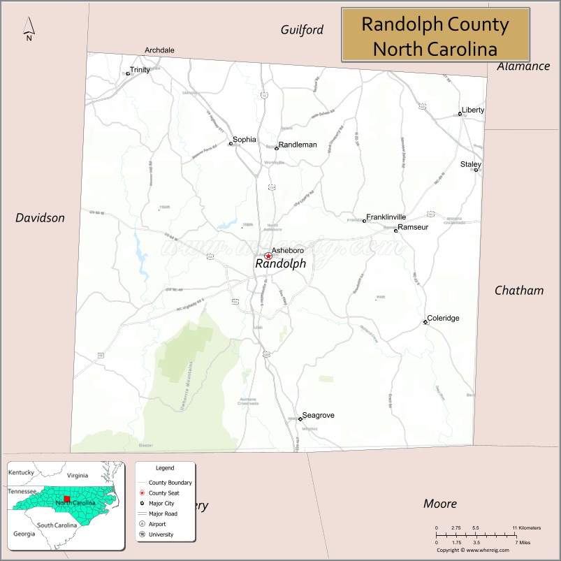
Randolph County is a county located in the U.S. state of North Carolina. As of the 2020 census, the population was 144,171. Its county seat is Asheboro.
Randolph County is included in the Greensboro–High Point, NC Metropolitan Statistical Area, which is also included in the Greensboro-Winston-Salem-High Point, NC Combined Statistical Area.
In 2010, the center of population of North Carolina was located in Randolph County, near the town of Seagrove.
| Name: | Randolph County |
|---|---|
| FIPS code: | 37-151 |
| State: | North Carolina |
| Founded: | 1779 |
| Named for: | Peyton Randolph |
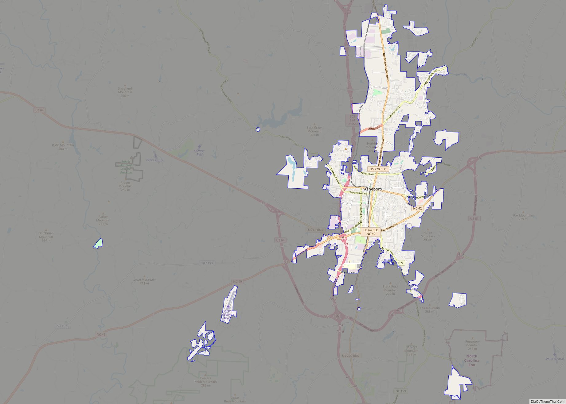
| Seat: | Asheboro |
| Largest city: | Asheboro |
| Total Area: | 789 sq mi (2,040 km²) |
| Land Area: | 783 sq mi (2,030 km²) |
| Total Population: | 145,172 |
| Population Density: | 185.4/sq mi (71.6/km²) |
| Time zone: | UTC−5 (Eastern) |
| Summer Time Zone (DST): | UTC−4 (EDT) |
| Website: | www.randolphcountync.gov |
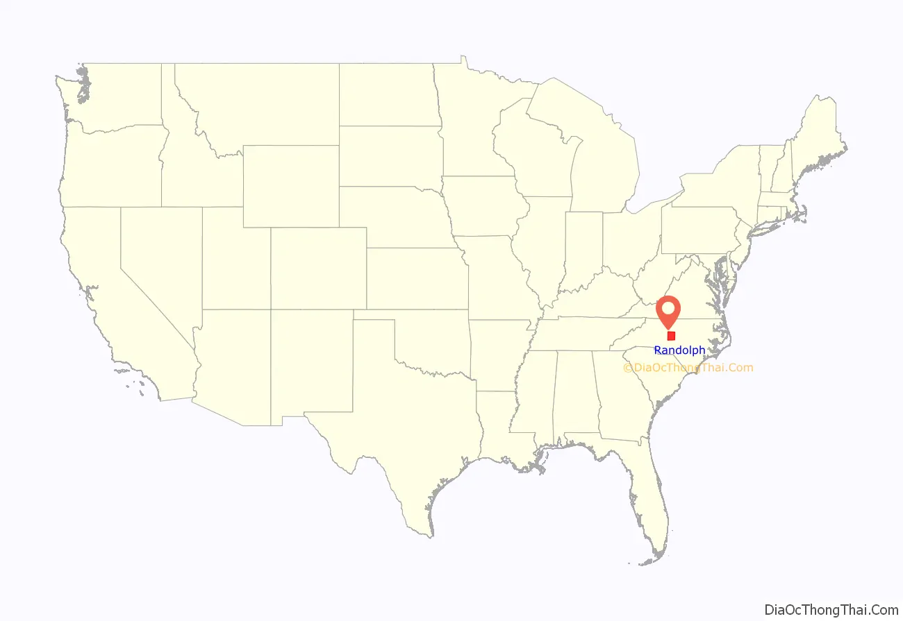
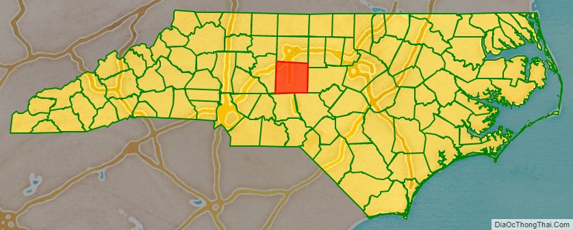
Randolph County location map. Where is Randolph County?
History
Some of the first European settlers in this area of the Piedmont and what would become the county were English Quakers, who settled along the Haw, Deep, and Eno rivers The county was formed in 1779 from Guilford County. It was named for Peyton Randolph, first president of the Continental Congress.
County formation
The Legislature of 1779, then sitting at Halifax, passed an act providing for the formation of a new county from parts of Guilford and Rowan, to be called Randolph.
Randolph County was the original location of the school that developed as Duke University.
The county is home to one of the last remaining covered bridges in the state. The Pisgah Covered Bridge, in Union Township in the southwestern part of the county, was destroyed by a flood in 2003, but has been rebuilt.
In 1911, a new county called Piedmont County was proposed, with High Point as its county seat, to be created from Guilford, Davidson, and Randolph counties. Many people appeared at the Guilford County courthouse to oppose the plan, vowing to go to the state legislature to protest. The state legislature voted down the plan in February 1911.
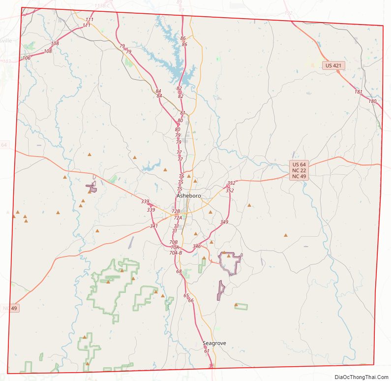
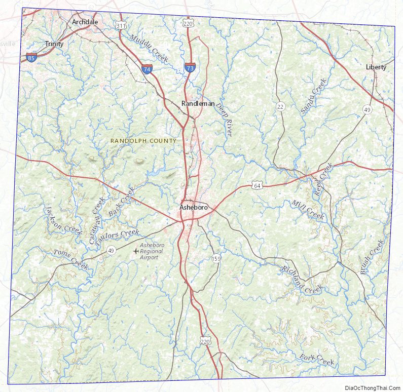
Randolph County Road Map
Geography
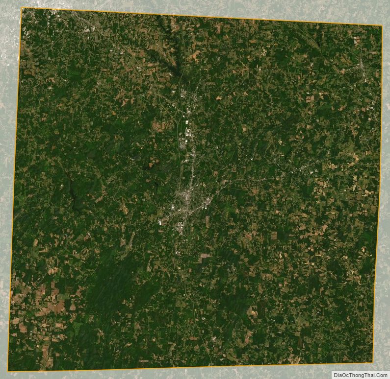
According to the U.S. Census Bureau, the county has a total area of 789 square miles (2,040 km), of which 783 square miles (2,030 km) is land and 6.8 square miles (18 km) (0.9%) is covered by water.
Randolph County is located in the center of North Carolina, and the city of Asheboro (in the county) is the center point of North Carolina. Randolph County is located in the Piedmont section of central North Carolina, generally a region of gently rolling hills and woodlands. The central and western parts of the county contain the Uwharrie Mountains and the Caraway Mountains. These two ranges are the remnants of a much-higher range of ancient peaks. Today, they rarely top 1,000 feet (300 m) above sea level, yet due to the relative low terrain around them, they still rise 200–500 feet (61–152 m) above their base.
The highest point in Randolph County is Shepherd Mountain, a peak in the Caraways. The North Carolina Zoo is located atop Purgatory Mountain, one of the peaks of the Uwharries.
National protected area
- Birkhead Mountains Wilderness
- Uwharrie National Forest
State and local protected areas/sites
- Liberty Raceway Park
- North Carolina Zoo
- Pisgah Covered Bridge
Major water bodies
- Back Creek (Caraway Creek tributary)
- Bush Creek (Deep River tributary)
- Caraway Creek (Uwharrie River tributary)
- Deep River
- Little Caraway Creek (Caraway Creek tributary)
- Little River
- Little Uwharrie River
- Randleman Lake
- Reed Creek (Deep River tributary)
- Rocky River
- Toms Creek (Uwharrie River tributary)
- Uwharrie River
Adjacent counties
- Guilford County – north
- Alamance County – northeast
- Chatham County – east
- Moore County – southeast
- Montgomery County – southwest
- Davidson County – west
Major highways
- I-73
- I-74
- I-85
- I-85 BL
- Future I-685 (Concurrency with US 421)
- US 29
- US 64
- US 64 Bus.
- US 70
- US 220
- US 220 Alt.
- US 220 Bus.
- US 311
- US 421
- NC 22
- NC 42
- NC 47
- NC 49
- NC 62
- NC 109
- NC 134
- NC 159
- NC 159 Spur (Spur Route)
- NC 705
Major infrastructure
- Asheboro Regional Airport
Randolph County Topographic Map
Randolph County Satellite Map
Randolph County Outline Map