High Point is a city in the Piedmont Triad region of the U.S. state of North Carolina. Most of the city is in Guilford County, with parts extending into Randolph, Davidson, and Forsyth counties. High Point is North Carolina’s only city that extends into four counties. As of the 2020 census the city had a total population of 114,059. High Point is the ninth-largest municipality in North Carolina, the third-largest municipality in the Piedmont Triad metropolitan area, and the 259th-largest city in the U.S.
Major industries in High Point include furniture, textiles, and bus manufacturing. The city’s official slogan is “North Carolina’s International City” due to the semi-annual High Point Furniture Market that attracts 100,000 exhibitors and buyers from around the world. It is home to High Point University, a private Methodist-affiliated institution founded in 1924.
| Name: | High Point city |
|---|---|
| LSAD Code: | 25 |
| LSAD Description: | city (suffix) |
| State: | North Carolina |
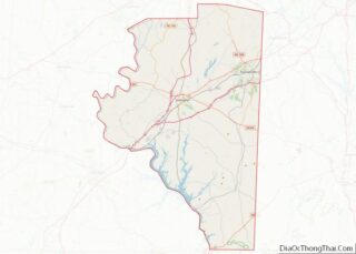
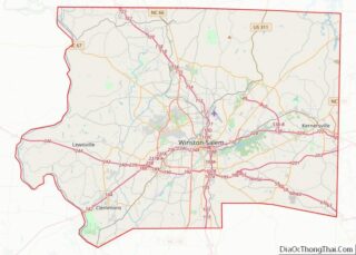
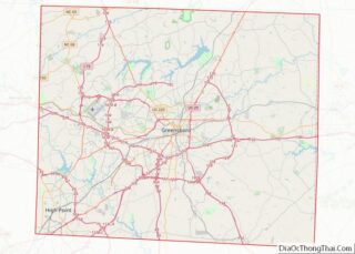
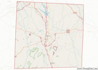
| County: | Davidson County, Forsyth County, Guilford County, Randolph County |
| Elevation: | 922 ft (281 m) |
| Land Area: | 56.91 sq mi (147.39 km²) |
| Water Area: | 1.52 sq mi (3.94 km²) |
| Population Density: | 2,004.31/sq mi (773.87/km²) |
| Area code: | 336 |
| FIPS code: | 3731400 |
| GNISfeature ID: | 0986755 |
| Website: | www.highpointnc.gov |
Online Interactive Map
Click on ![]() to view map in "full screen" mode.
to view map in "full screen" mode.
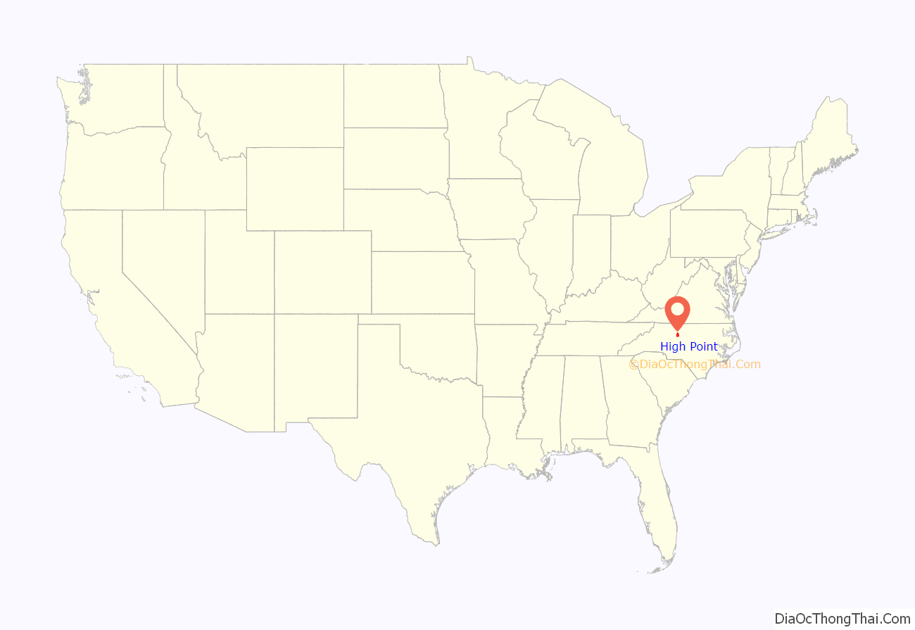
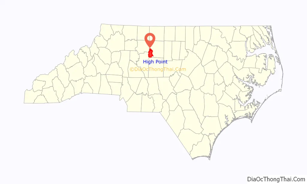
High Point location map. Where is High Point city?
History
High Point was at the highest point of the 1856 North Carolina Railroad between Charlotte and Goldsboro, where it intersected the 1852 Great Western Plank Road. Its central location and transportation allowed for the delivery of raw materials like cotton and lumber as well as import and export of processed goods, contributing to its early growth. High Point was settled by Europeans, including English Quakers and German immigrants, before 1750, but was not incorporated until 1859. Before it became a major manufacturing center, the most important industries were tobacco, woodworking and textiles. The High Point furniture factory opened in 1889. High Point College was founded in 1924 as a private Methodist-affiliated institution. The college later became a liberal arts university, now with approximately 4,400 undergraduate and graduate students from 51 countries and 46 states.
Historic places
Sites on the National Register of Historic Places
- John H. Adams House
- High Point Central High School
- Deep River Friends Meeting House and Cemetery
- Enterprise Building
- First Baptist Church
- Dr. C. S. Grayson House
- Guilford County Office and Court Building
- John Haley House
- Hardee Apartments
- Highland Cotton Mills Village Historic District
- Allen Jay School Rock Gymnasium
- Kilby Hotel
- O. Arthur Kirkman House and Outbuildings
- Model Farm
- Eli Moore House
- Oakwood Historic District
- William Penn High School
- Sherrod Park
- J. C. Siceloff House
- Spring Hill Methodist Protestant Church Cemetery
- Spurgeon House
- A. E. Taplin Apartment Building
- Tomlinson Chair Manufacturing Company Complex
- Uptown Suburbs Historic District
- Washington Street Historic District
- West High Street Historic District
- Lucy and J. Vassie Wilson House
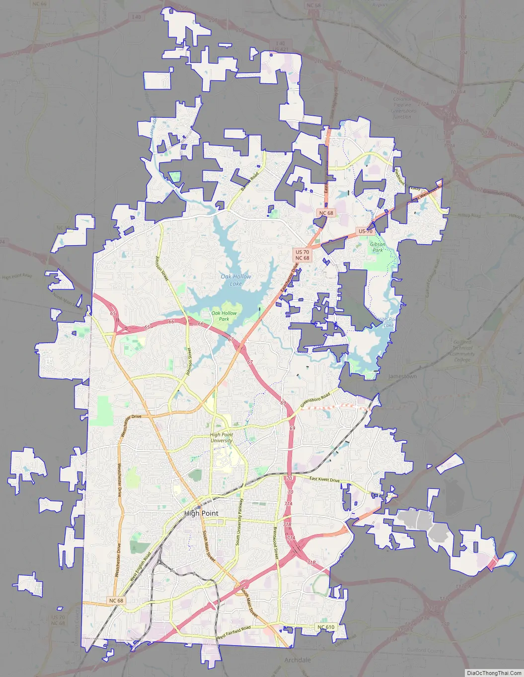
High Point Road Map
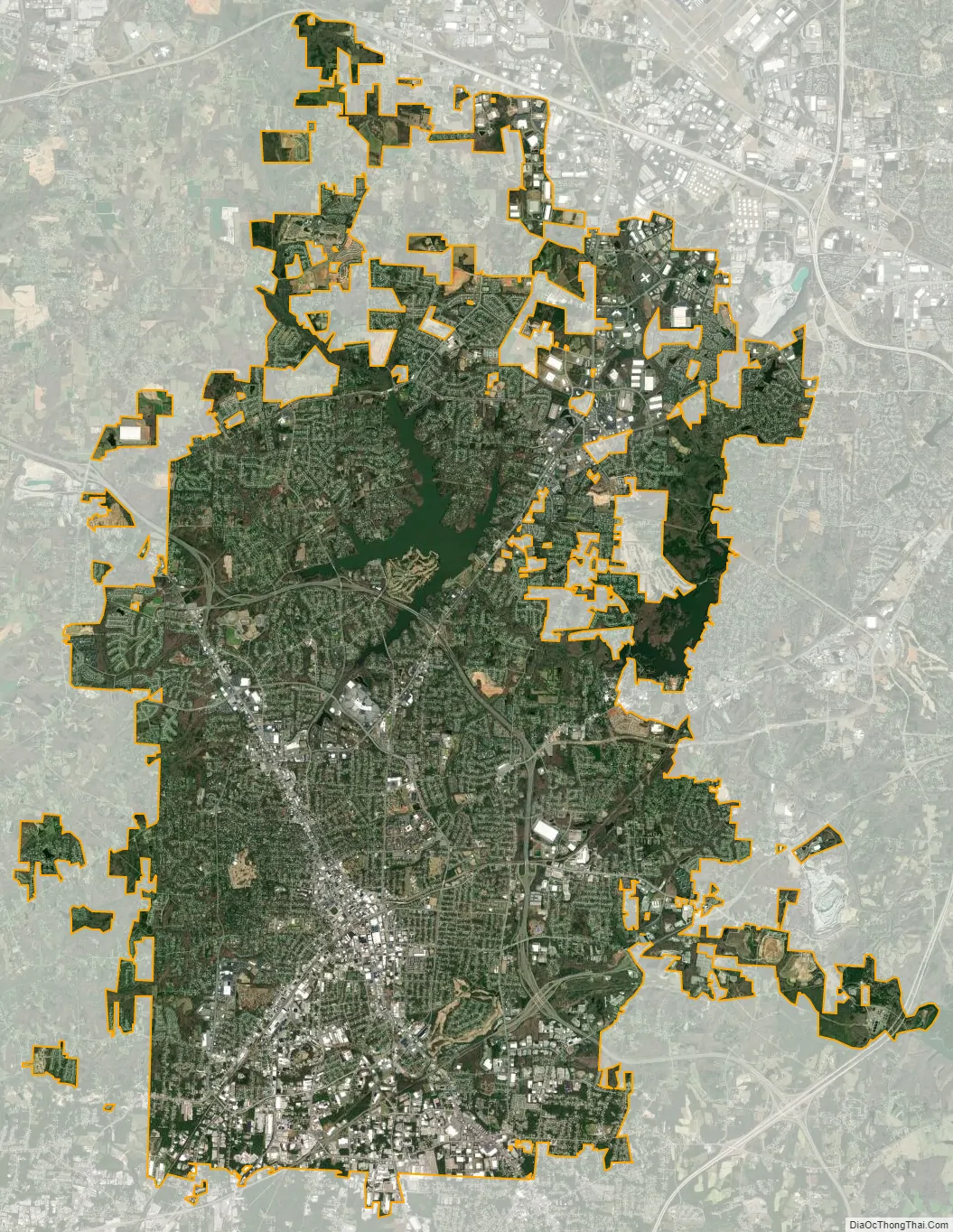
High Point city Satellite Map
Geography
High Point is the only city in North Carolina that exists within four counties: Davidson, Forsyth, Guilford and Randolph. It also stands within two major watersheds: the Yadkin–Pee Dee to the west and the Cape Fear to the east. Parts of the city rise above 1,000 feet (300 m), making it among the highest cities in North Carolina’s Piedmont.
High Point is located at 35°58′14″N 79°59′51″W / 35.97056°N 79.99750°W / 35.97056; -79.99750. It is bordered by Greensboro to the north, Jamestown to the northeast, and Archdale to the southeast. The city limits of Trinity and Thomasville come within half a mile of High Point’s city limits to the south and southwest, respectively.
According to the United States Census Bureau, the city has an area of 55.4 square miles (143.6 km), of which 53.8 square miles (139.3 km) is land and 1.7 square miles (4.3 km), or 2.96%, is water.
Climate
High Point experiences a humid subtropical climate. Summers are hot and humid, and the dew points will often climb to near or even above 70 °F (21 °C) by late June through much of August. Nights usually remain warm above 70 degrees. Most summers the hottest day will record a maximum between 96 and 98 °F (36 and 37 °C). About once every 5 to 10 years the city will climb to or above 100 °F (38 °C). Winters are cool to cold. Nights average near 30 °F (−1 °C), with the coldest averages in the upper 20s from late December through early February. Most winters the coldest temperature will dip to between 10 and 15 °F (−12 and −9 °C). About once every 10 years the minimum will dip below 5 °F (−15 °C) and to near or below 0 °F (−18 °C) approximately once every 20 years. Daytime highs average near 50 °F (10 °C) in the winter, with the coldest stretch between late December through early February with highs averaging in the upper 40s. Most winters there will be 2 to 4 days that remain below freezing. The hottest temperature on record for the area was 103 °F (39 °C) on August 18, 1988 (in nearby Greensboro the high reached 104 °F (40 °C) in 1914), and the coldest was −8 °F (−22 °C) on January 21, 1985.
Rainfall patterns are generally spread evenly throughout the year, with between seven and eleven wet days per month. The city averages around 43 inches (1,100 mm) of rain per year. Snowfall varies from year to year, with most years totaling less than 5 inches (13 cm). However, there are some years that exceed 20 inches (51 cm), and this brings the overall average to more than 8 inches (20 cm) per year. In the winter of 1959/60 the city had just over 30 inches (76 cm) of snowfall, which stands as the most dating back to the start of snowfall record-keeping in 1928. In addition to snowfall, some years the city can be impacted by significant ice storms. Cold air wedging up on the east side of the mountains can lock this part of the state into cold air while warmer moist air moves in aloft. This proximity to the mountains creates what is known as the Appalachian Wedge and can produce crippling ice storms.
High Point was one of several communities affected by a 2010 tornado outbreak. The twister reached its most powerful EF3 classification as it crossed the northern suburbs of the city.
In 1989, High Point sustained minor wind damage from Hurricane Hugo as it raced through the western Piedmont region of North Carolina after making landfall 5 hours away in Charleston, South Carolina.
See also
Map of North Carolina State and its subdivision:- Alamance
- Alexander
- Alleghany
- Anson
- Ashe
- Avery
- Beaufort
- Bertie
- Bladen
- Brunswick
- Buncombe
- Burke
- Cabarrus
- Caldwell
- Camden
- Carteret
- Caswell
- Catawba
- Chatham
- Cherokee
- Chowan
- Clay
- Cleveland
- Columbus
- Craven
- Cumberland
- Currituck
- Dare
- Davidson
- Davie
- Duplin
- Durham
- Edgecombe
- Forsyth
- Franklin
- Gaston
- Gates
- Graham
- Granville
- Greene
- Guilford
- Halifax
- Harnett
- Haywood
- Henderson
- Hertford
- Hoke
- Hyde
- Iredell
- Jackson
- Johnston
- Jones
- Lee
- Lenoir
- Lincoln
- Macon
- Madison
- Martin
- McDowell
- Mecklenburg
- Mitchell
- Montgomery
- Moore
- Nash
- New Hanover
- Northampton
- Onslow
- Orange
- Pamlico
- Pasquotank
- Pender
- Perquimans
- Person
- Pitt
- Polk
- Randolph
- Richmond
- Robeson
- Rockingham
- Rowan
- Rutherford
- Sampson
- Scotland
- Stanly
- Stokes
- Surry
- Swain
- Transylvania
- Tyrrell
- Union
- Vance
- Wake
- Warren
- Washington
- Watauga
- Wayne
- Wilkes
- Wilson
- Yadkin
- Yancey
- Alabama
- Alaska
- Arizona
- Arkansas
- California
- Colorado
- Connecticut
- Delaware
- District of Columbia
- Florida
- Georgia
- Hawaii
- Idaho
- Illinois
- Indiana
- Iowa
- Kansas
- Kentucky
- Louisiana
- Maine
- Maryland
- Massachusetts
- Michigan
- Minnesota
- Mississippi
- Missouri
- Montana
- Nebraska
- Nevada
- New Hampshire
- New Jersey
- New Mexico
- New York
- North Carolina
- North Dakota
- Ohio
- Oklahoma
- Oregon
- Pennsylvania
- Rhode Island
- South Carolina
- South Dakota
- Tennessee
- Texas
- Utah
- Vermont
- Virginia
- Washington
- West Virginia
- Wisconsin
- Wyoming