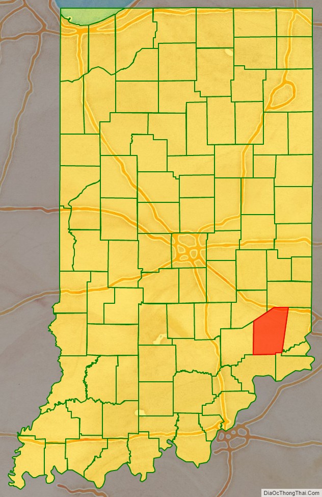
Ripley County is a county located at the southeastern corner of the U.S. state of Indiana. According to the 2010 Census, the population was 28,818. The county seat is Versailles.
| Name: | Ripley County |
|---|---|
| FIPS code: | 18-137 |
| State: | Indiana |
| Founded: | December 27, 1816 |
| Named for: | Eleazer Wheelock Ripley |
| Seat: | Versailles |
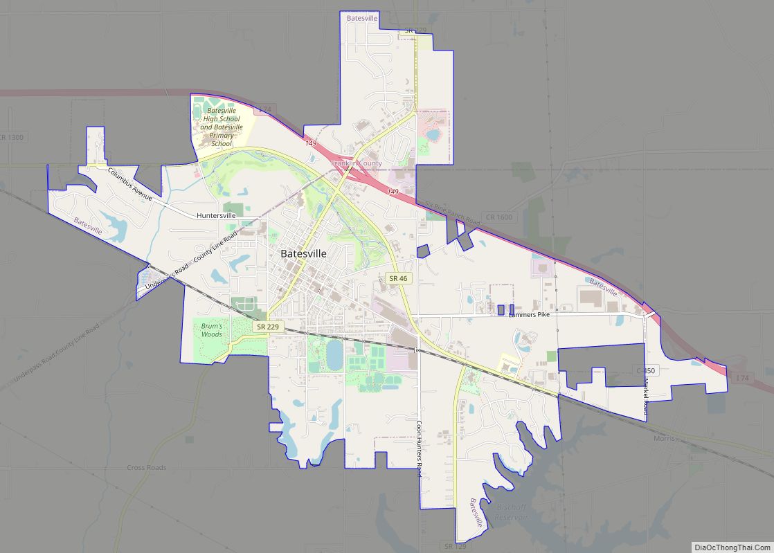
| Largest city: | Batesville |
| Total Area: | 448.06 sq mi (1,160.5 km²) |
| Land Area: | 446.43 sq mi (1,156.2 km²) |
| Population Density: | 65/sq mi (24.93/km²) |
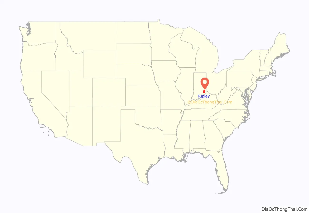
Ripley County location map. Where is Ripley County?
History
Ripley County was formed on December 27, 1816, in the same legislative act that created Jennings County. It was named for Gen. Eleazer Wheelock Ripley, an officer in the War of 1812, who figured in the Battle of Lundy’s Lane and the Siege of Fort Erie during 1814.
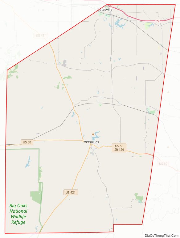
Ripley County Road Map
Geography
The county seat of Ripley County is Versailles, Indiana. It was selected as the county seat in 1818, and was laid out in 1819.
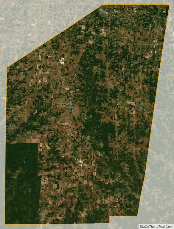
According to the 2010 census, the county has a total area of 448.06 square miles (1,160.5 km), of which 446.43 square miles (1,156.2 km) (or 99.64%) is land and 1.64 square miles (4.2 km) (or 0.37%) is water.
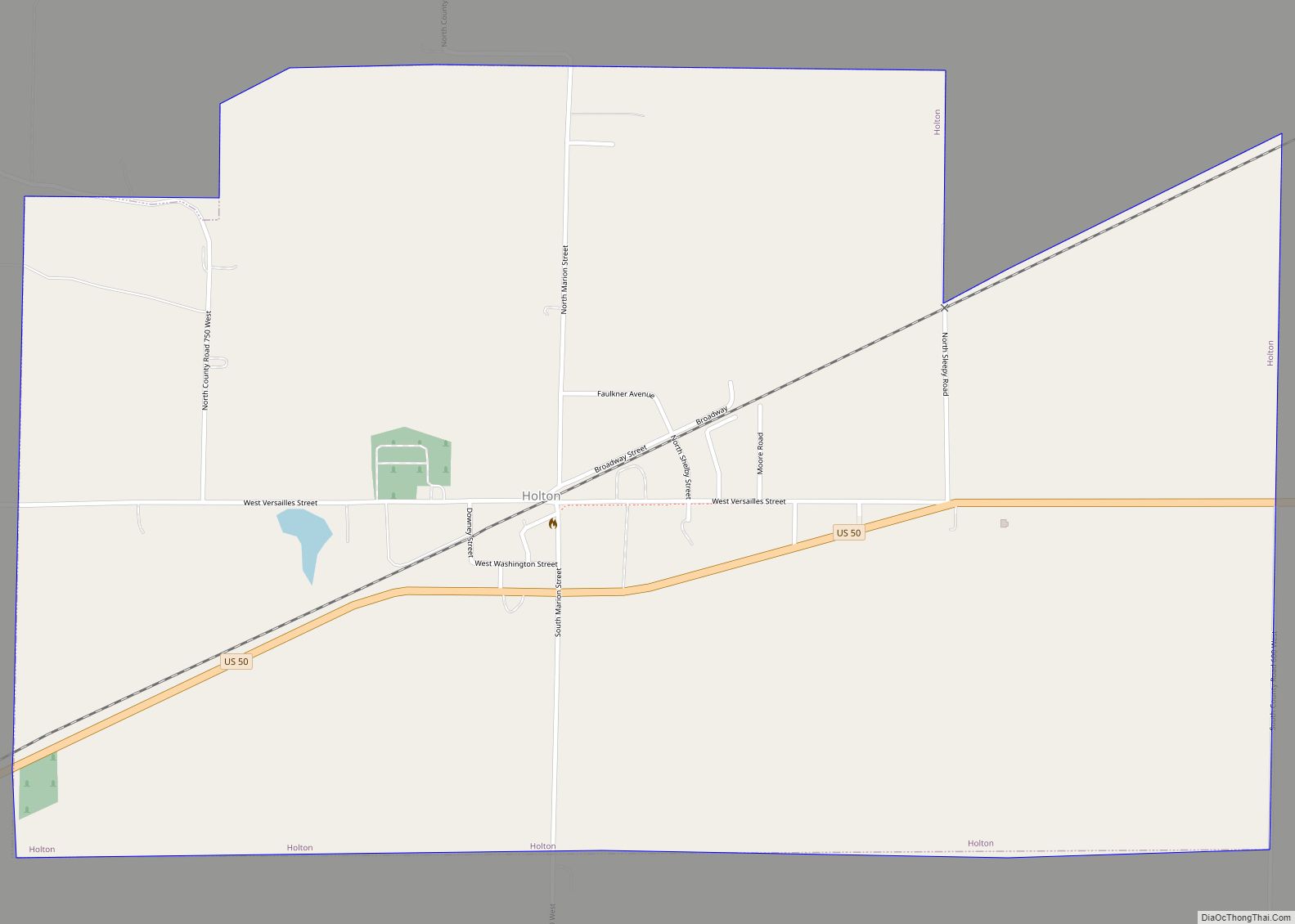
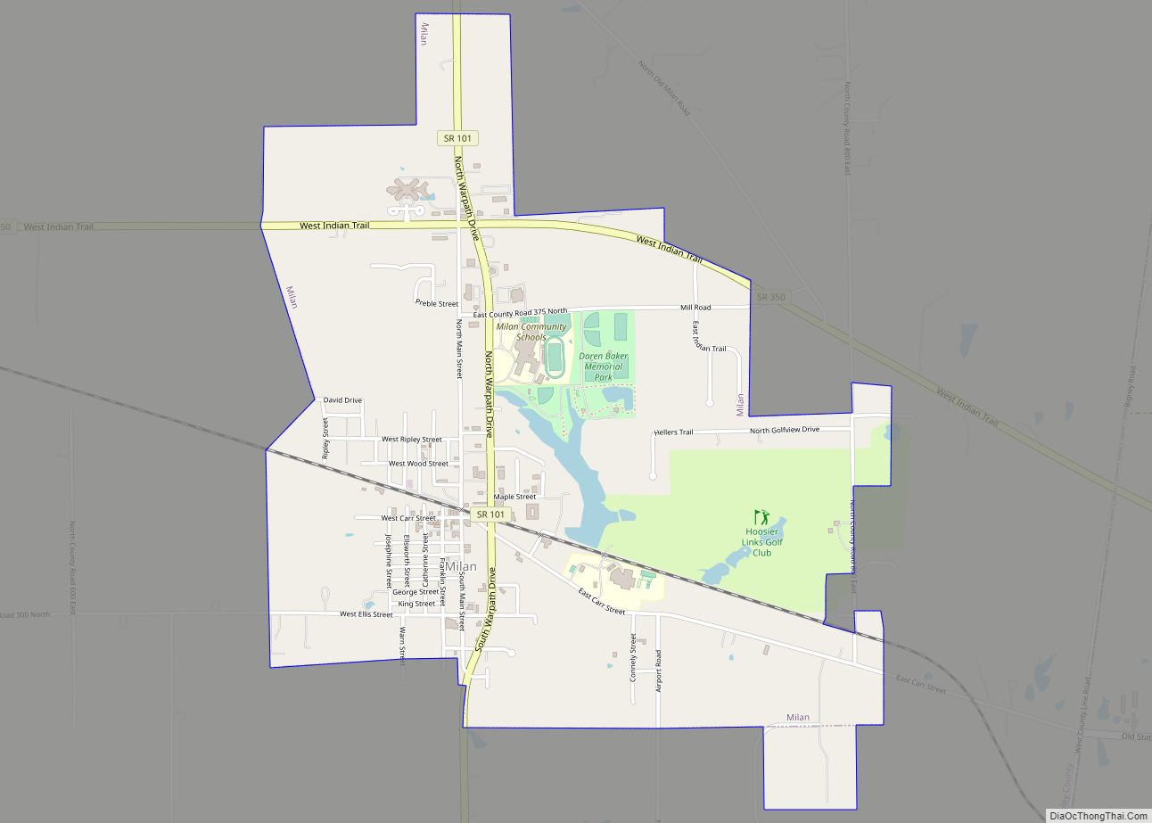
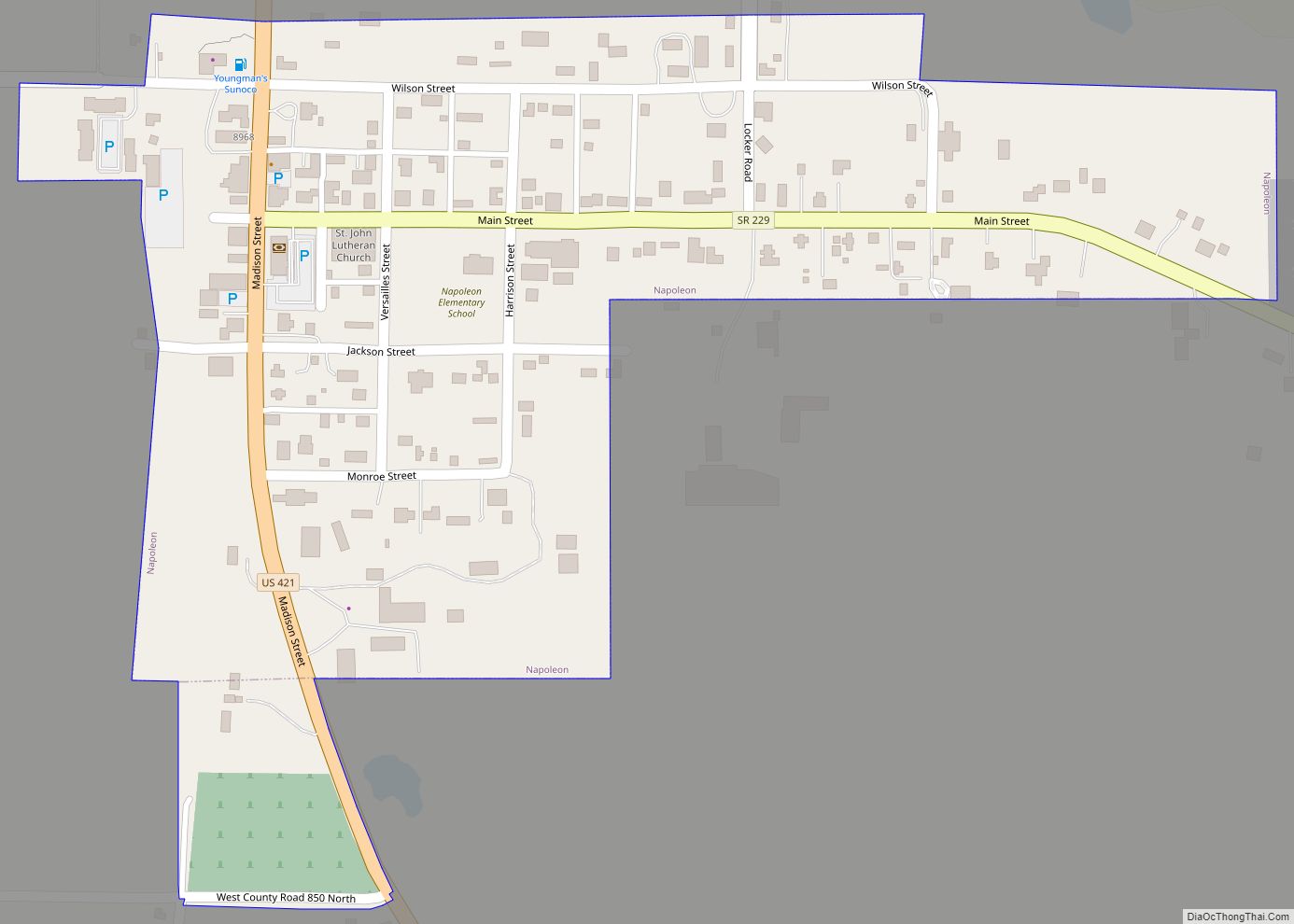
Unincorporated towns
- Allen Crossing
- Ballstown
- Behlmer Corner
- Benham
- Clinton
- Correct
- Cross Plains
- Cross Roads
- Dabney
- Delaware
- Dewberry
- Elrod
- Friendship
- Haney Corner
- Jackson
- Jolleyville
- Laugheryville
- Lookout
- Morris
- Negangards Corner
- New Carrollton
- New Marion
- Old Milan
- Olean
- Otter Village
- Penntown
- Pierceville
- Prattsburg
- Rexville
- Spades
- Stringtown
- Stumpke Corner
Ghost towns
- Saint Magdalen
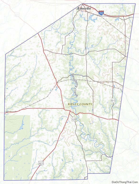
Adjacent counties
- Dearborn County (east)
- Decatur County (northwest)
- Franklin County (north)
- Jefferson County (south)
- Jennings County (west)
- Ohio County (east–southeast)
- Switzerland County (at southeast tip)
Major highways
- Interstate 74 – runs east–west across northern tip of county.
- US Route 50 – runs east–west across middle of county, through Holton and Versailles.
- US Route 421 – enters from Decatur County near northwest tip of Ripley County. Runs SSE to Versailles, then SSW into Jefferson County.
- State Road 46 – runs east–west across northern tip of county, paralleling Interstate 74 on its south side.
- State Road 48 – runs east–west across upper portion of county, through Napoleon.
- State Road 62 – begins at intersection with State Road 129, north of Cross Plains. Runs east through Friendship to Dearborn County.
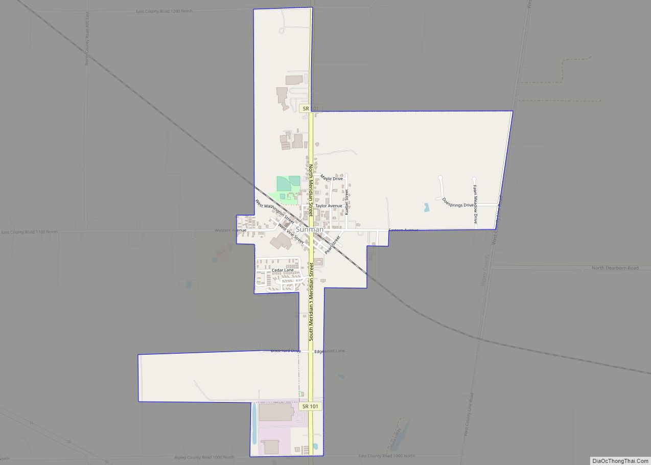
- State Road 101 – begins at intersection with US Route 50 near east county line. Runs north to Penntown.
- State Road 129 – begins at intersection with State Road 46 east of Batesville, runs south to Versailles, then SSE through Cross Plains into Switzerland County.
- State Road 229 – enters from Franklin County at Batesville, runs SSW to Ballstown then south and west to Napoleon. Runs west to Decatur County.
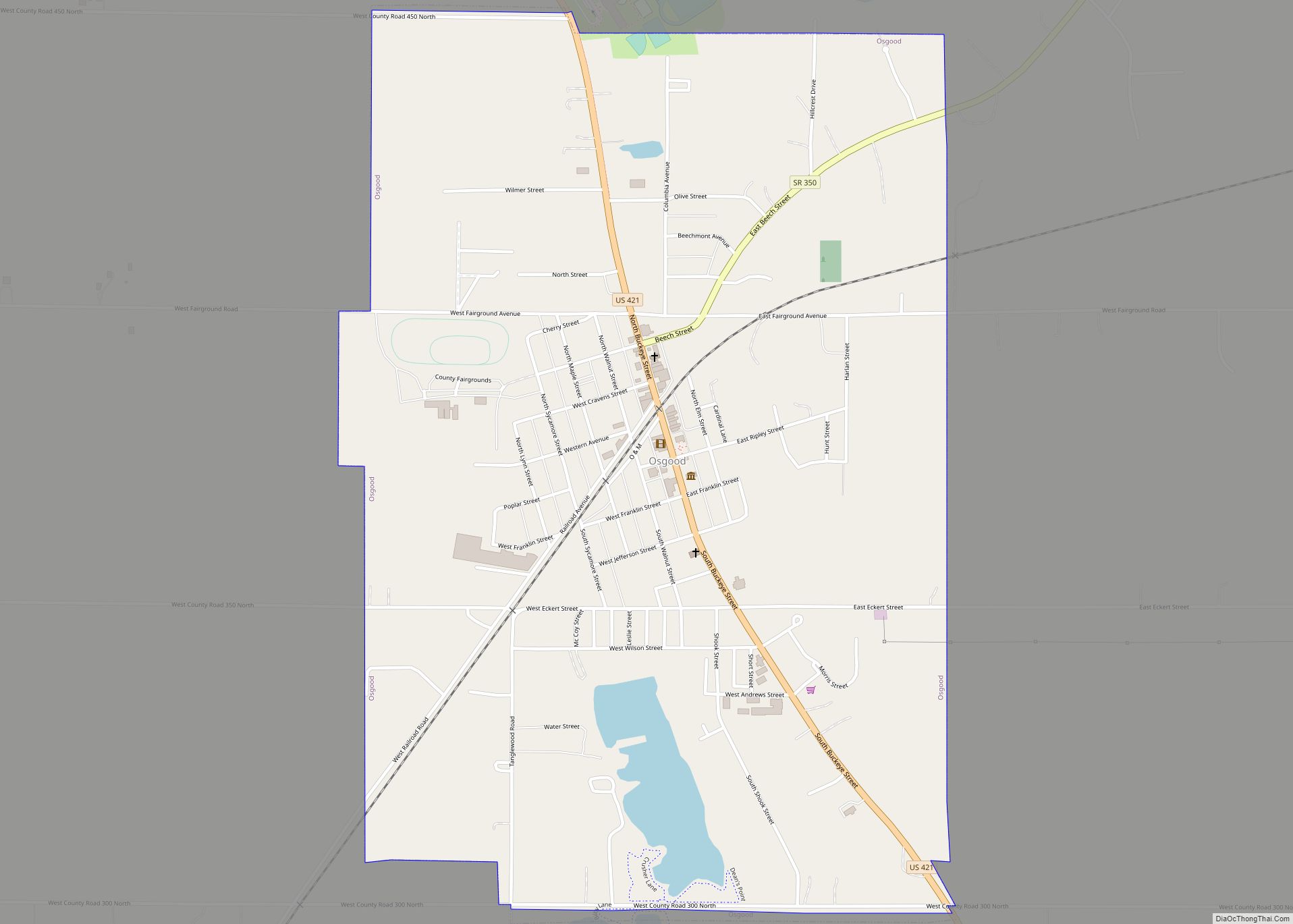
- State Road 350 – begins at intersection with US 421 at Osgood, runs east through Delaware and Pierceville into Dearborn County.
National protected area
- Big Oaks National Wildlife Refuge (part)
Ripley County Topographic Map
Ripley County Satellite Map
Ripley County Outline Map