St. Mary’s County, established in 1637, is a county located in the U.S. state of Maryland. As of the 2020 census, the population was 113,777. Its county seat is Leonardtown. The name is in honor of Mary, the mother of Jesus. St. Mary’s County comprises the California–Lexington Park, Maryland Metropolitan Statistical Area, which also is included in the Washington–Baltimore–Arlington, DC-MD-VA–WV–PA Combined Statistical Area. It is part of the Southern Maryland region. The county was the home to the first Maryland Colony, and the first capital of the Colony of Maryland. Settled by English Catholics, it is considered to be the birthplace of religious freedom in North America, at a time when the British colonies were settled primarily by Protestants. The county is home to the Patuxent River Naval Air Station and St. Mary’s College of Maryland. Traditionally, St. Mary’s County has been known for its unique and historic culture of Chesapeake Bay tidewater farming, fishing, and crabbing communities. But with the advent of the military bases, growth of an extensive defense contractor presence, and the growth of St. Mary’s College of Maryland, as well as increasing numbers of long-distance Washington, D.C. commuters, it has been undergoing a decades-long transformation which has seen the county’s population double since 1970.
| Name: | St. Mary’s County |
|---|---|
| FIPS code: | 24-037 |
| State: | Maryland |
| Founded: | January 24, 1637 |
| Named for: | Mary the mother of Jesus |
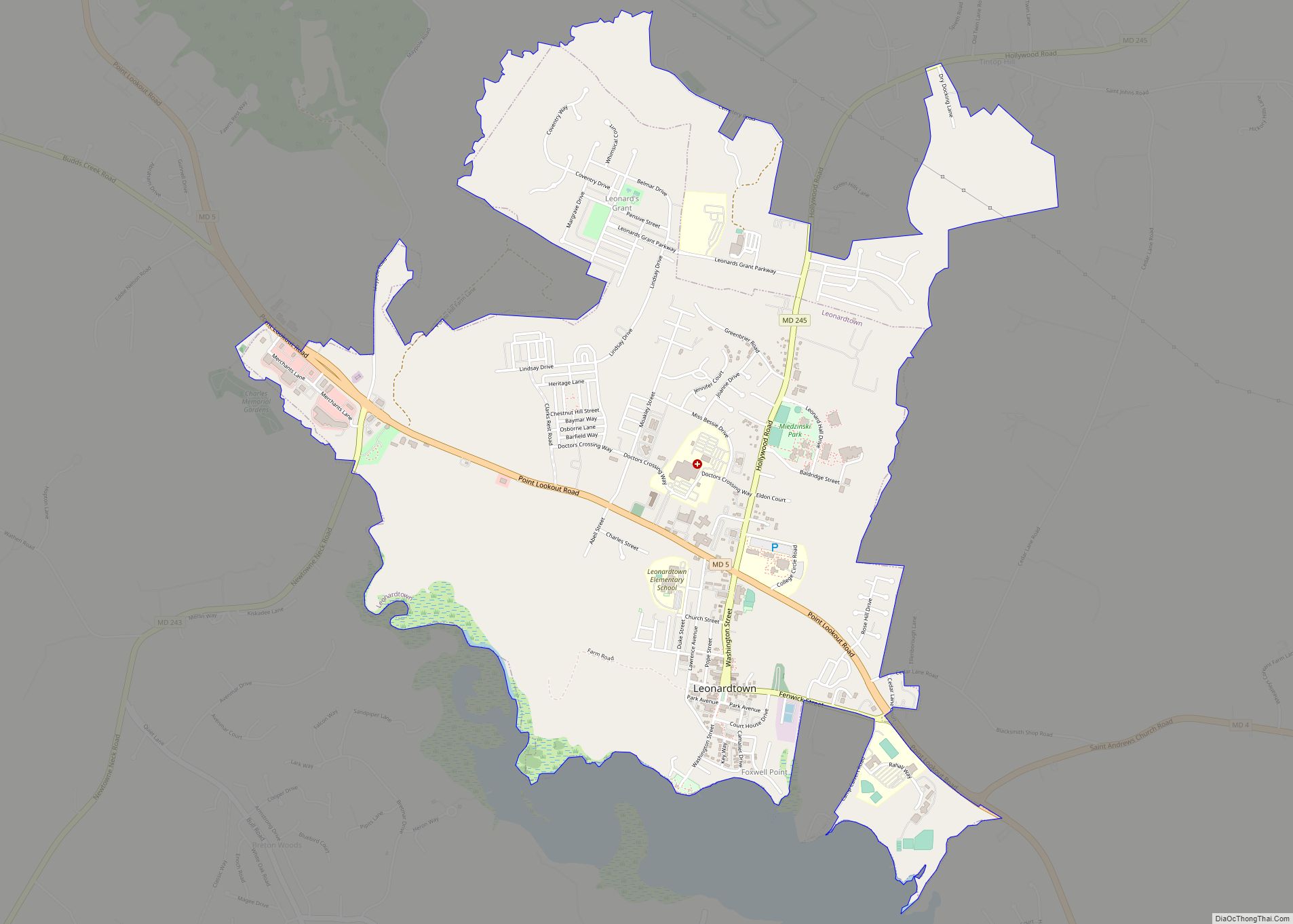
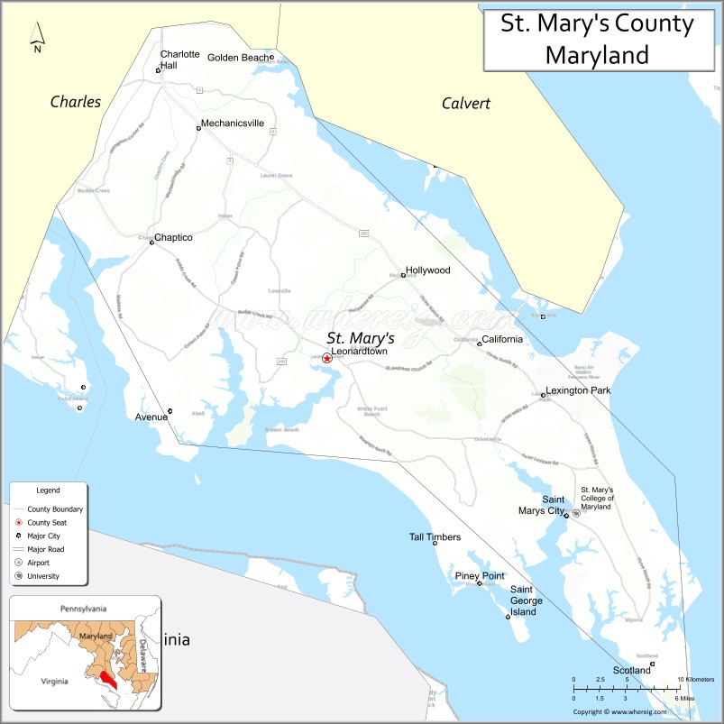
| Seat: | Leonardtown |
| Total Area: | 764 sq mi (1,980 km²) |
| Land Area: | 357 sq mi (920 km²) |
| Total Population: | 113,777 |
| Population Density: | 150/sq mi (60/km²) |
| Time zone: | UTC−5 (Eastern) |
| Summer Time Zone (DST): | UTC−4 (EDT) |
| Website: | www.stmarysmd.com |
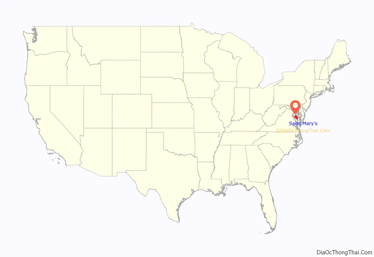
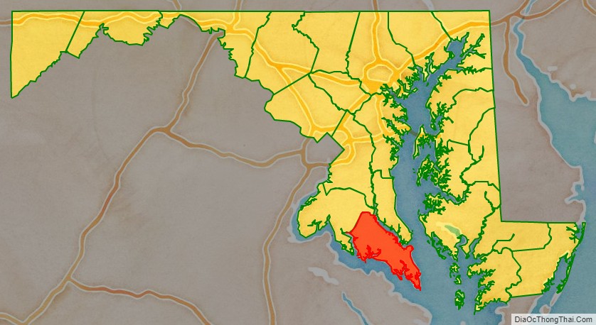
St. Mary’s County location map. Where is St. Mary’s County?
History
Settlement
The settlement of Lord Baltimore’s Maryland began with the arrival of passengers from England at St. Clement’s Island in the Potomac River in what is now southwestern St. Mary’s County on March 25, 1634, and the annual anniversary of this landing is celebrated as Maryland Day. The passengers arrived in two vessels, the Ark and the Dove that had set sail from the Isle of Wight on November 22, 1633. The county is the site of the first Catholic Mass celebrated in one of the original thirteen colonies (after they had become English colonies). Earlier dates of masses being said were during 1526–1527 at San Miguel de Gualdape.
Due to the small size of the island and its lack of resources, there was no intention to make a permanent settlement on the island. Instead St. Clement’s was used as a base for the settlers while scouting for a more suitable site. This was how a bluff overlooking the nearby St. Mary’s River was chosen for numerous reasons, and became the site of the first permanent settlement. It would soon be named, “St. Mary’s City”.
St. Mary’s City, Maryland is the site of the first Maryland Capitol and remained so for more than 50 years, until 1695, when the state capital was moved to Annapolis.
Today Historic St. Mary’s City is a major attraction in Maryland with four museums, a reconstructed colonial village, and the reconstructed Maryland Dove settlers ship. It also has become one of the top archeological research sites in North America.
St. Mary’s County was the first county established in Maryland, in 1637, probably by an order of the governor.
In 1649, Lord Baltimore, with the Maryland General Assembly, passed the Maryland Toleration Act, which provided religious freedom for any (Christian) sect and which was the first law of its kind in the New World. There is a statue in St. Mary’s City commemorating this event, along with extensive museums, a reconstructed Colonial town, living history actors, and a replica of the Maryland Dove.
Miscellaneous historical data
St. Mary’s County is where Maryland’s leading war ace, (WWII) Capt. Walter Duke, and the professional wrestler, Scott Hall, grew up. St. Mary’s County was the birthplace of Dashiell Hammett and Orlando “Tubby” Smith, head basketball coach at High Point University. The largest employer is Patuxent River Naval Air Station and its related aerospace contract firms. There are both Amish and Mennonite communities in the county who follow traditional ways. Tobacco, once a dominant crop, has declined in recent years. The Maryland International Raceway at Budd’s Creek attracts many automobile racing enthusiasts.
Historic buildings
St. Mary’s County has some of the oldest extant buildings in English North America. Many of these properties are listed on the National Register of Historic Places. These buildings range through many historical periods, from the 1600s to the 1800s. There are notable buildings of the early twentieth century, as well.
Memorial
The United States Colored Troops Memorial Statue is a memorial to the more than 700 African-American soldiers and sailors from St. Mary’s County who served among the Union forces during the American Civil War. The memorial site includes an educational display and special celebrations are held there each year.
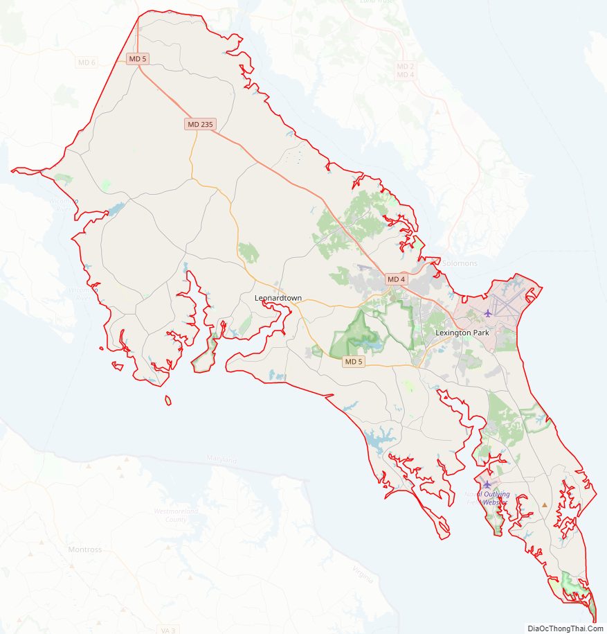
St. Mary’s County Road Map
Geography
According to the U.S. Census Bureau, the county has a total area of 764 square miles (1,980 km), of which 357 square miles (920 km) is land and 407 square miles (1,050 km) (%) is water. It is the second-largest county in Maryland by total area.
Located on the St. Mary’s Peninsula, St. Mary’s County is largely bordered by water: the Patuxent River (northeast), the Chesapeake Bay (east), the Potomac River (southwest), and the Wicomico River (west). Its coastline has many coves, tidal creeks, bays, and inlets. Many coastal areas are made up of mixed clay-and-sand cliffs and bluffs, which protect many parts of the county from storm surges, however, there are low-lying coastal areas with coarse sand or gravel beaches or tidal marshlands, as well. The county has a tiny exclave on the other side of the Potomac river due to the Maryland-Virginia border cutting through a beach near the little wicomico river.
The interior of much of the county is hilly to varying degrees, with forests and agricultural fields. There also are coastal plain areas, much of which are under agriculture or under new development. Residential development has been increasing steadily for decades.
The county’s very extensive waters are mostly brackish, ranging from significant degrees of saltwater in tidal areas that are on or near the Chesapeake Bay, to a greater predominance of freshwater and lower-salt-concentrations in its interior tidal waterways and also further up its bordering rivers.
Climate
According to the Köppen climate classification, the county has a humid subtropical climate (Cfa.) According to the Trewartha climate classification, the climate is Cf or oceanic (Do) depending on whether eight or seven months average above 50 °F (10 °C,) respectively. Average monthly temperatures in Leonardtown range from 36.3 °F in January to 78.1 °F in July. [1]
Adjacent counties
- Calvert County (northeast)
- Charles County (northwest)
- Somerset County (southeast)
- Northumberland County, Virginia (South)
- Westmoreland County, Virginia (southwest)
- Dorchester County (east)
St. Mary’s County borders Virginia, across the Potomac River. St. Mary’s County waters also are bordered by Virginia’s territorial waters in Potomac tributary mouths on the Virginia side, tidal interface zones, and the Chesapeake Bay. Sometimes, water rights in all of these areas are still disputed.
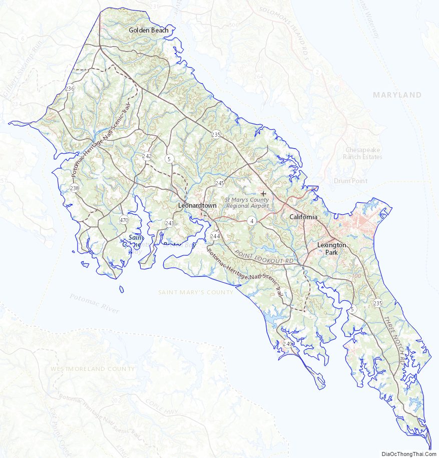
St. Mary’s County Topographic Map
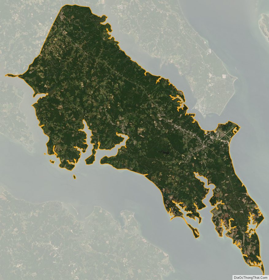
St. Mary’s County Satellite Map
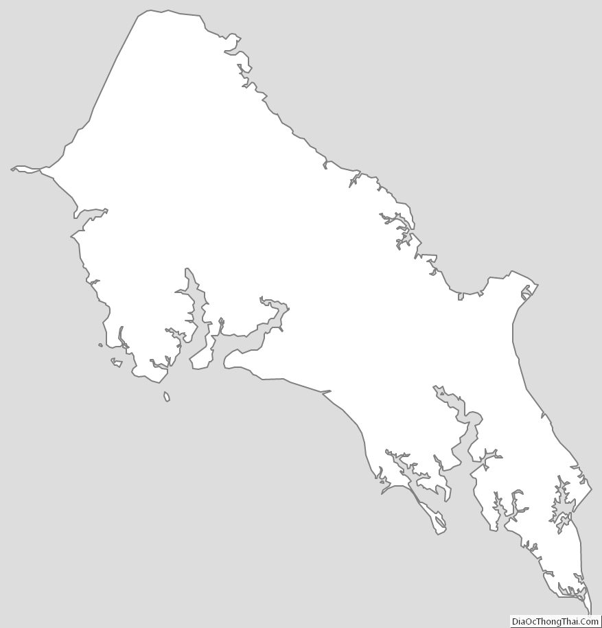
St. Mary’s County Outline Map