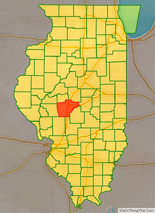
Sangamon County is located in the center of the U.S. state of Illinois. According to the 2010 census, it had a population of 197,465. Its county seat and largest city is Springfield, the state capital.
Sangamon County is included in the Springfield, IL Metropolitan Statistical Area.
| Name: | Sangamon County |
|---|---|
| FIPS code: | 17-167 |
| State: | Illinois |
| Founded: | 1821 |
| Named for: | Sangamon River |
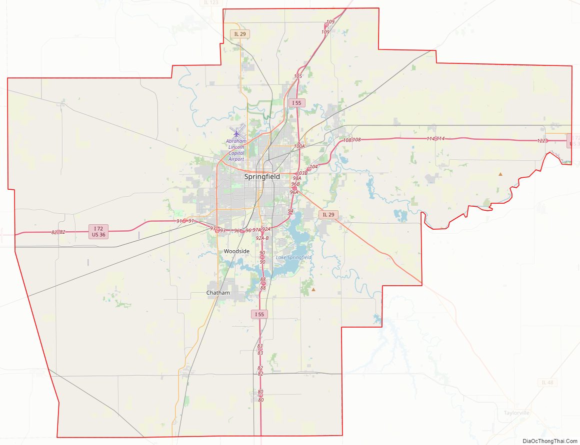
| Seat: | Springfield |
| Largest city: | Springfield |
| Total Area: | 877 sq mi (2,270 km²) |
| Land Area: | 868 sq mi (2,250 km²) |
| Total Population: | 197,465 |
| Population Density: | 230/sq mi (87/km²) |
| Website: | www.co.sangamon.il.us |
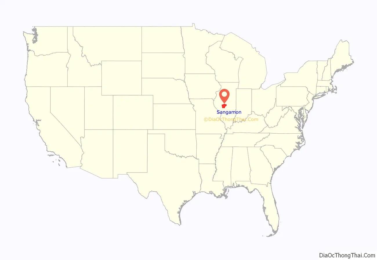
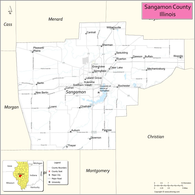
Sangamon County location map. Where is Sangamon County?
History
Sangamon County was formed in 1821 out of Madison and Bond counties. The county was named for the Sangamon River, which runs through it. The origin of the name of the river is unknown; among several explanations is the theory that it comes from the Pottawatomie word Sain-guee-mon (pronounced “sang gä mun”), meaning “where there is plenty to eat.” Published histories of neighboring Menard County (formed from Sangamon County) suggest that the name was first given to the river by the French explorers of the late 17th century as they passed through the region. The river was named to honor “St. Gamo”, or Saint Gamo, an 8th-century French Benedictine monk. The French pronunciation “San-Gamo” is the legacy.
Prior to being elected President of the United States, Abraham Lincoln represented Sangamon County in the Illinois Legislature. Lincoln, along with several other legislators, was instrumental in securing Springfield, the Sangamon County seat, as the state’s capital. Sangamon County was also within the congressional district represented by Lincoln when he served in the US House of Representatives. Another legislator who represented Sangamon County was Colonel Edmund Dick Taylor, also known as “Father of the Greenback”. The prominent financiers and industrialists Jacob Bunn and John Whitfield Bunn were based in Springfield, Sangamon County, Illinois, as well as in Chicago, during the nineteenth century and the early twentieth century. The careers of these men and the people with whom they collaborated helped to shape much of the history and development of Sangamon County, Illinois.
Sangamon County from the time of its creation to 1823
Sangamon County between 1823 and 1825
Sangamon County between 1825 and 1839
Sangamon in 1839, when the creation of Logan and Menard Counties reduced it to its present borders
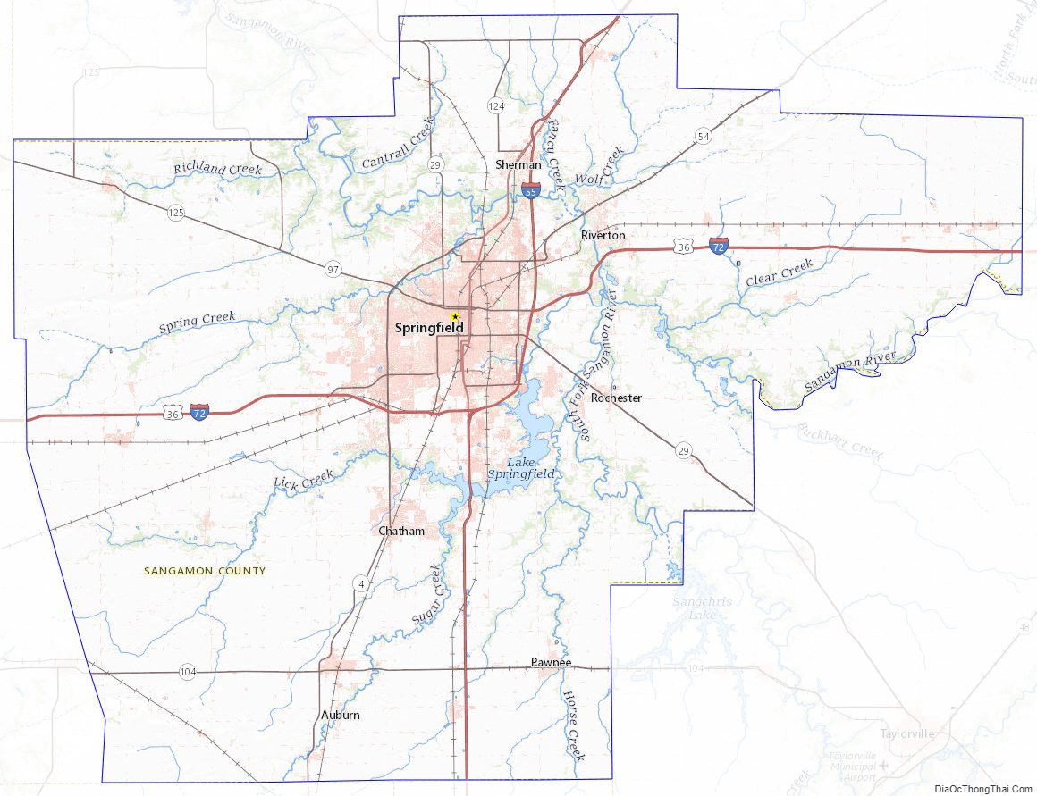
Sangamon County Road Map
Geography
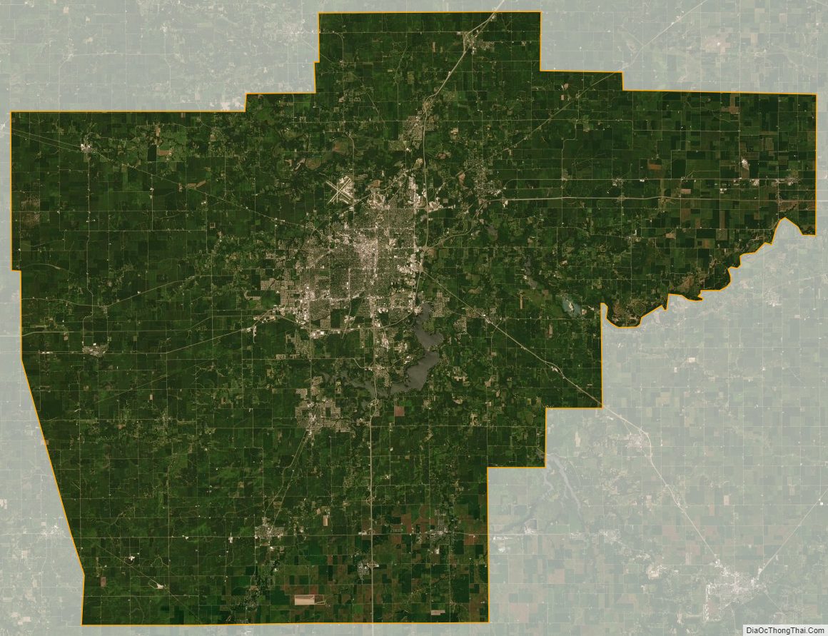
According to the U.S. Census Bureau, the county has a total area of 877 square miles (2,270 km), of which 868 square miles (2,250 km) is land and 8.7 square miles (23 km) (1.0%) is water.
Climate and weather
In recent years, average temperatures in the county seat of Springfield have ranged from a low of 17 °F (−8 °C) in January to a high of 87 °F (31 °C) in July, although a record low of −24 °F (−31 °C) was recorded in February 1905 and a record high of 112 °F (44 °C) was recorded in July 1954. Average monthly precipitation ranged from 1.62 inches (41 mm) in January to 4.06 inches (103 mm) in May.
Major highways
- Interstate 55
- Interstate 55 Business Loop
- Interstate 72
- U.S. Route 36
- Illinois Route 4
- Illinois Route 29
- Illinois Route 54
- Illinois Route 97
- Illinois Route 104
- Illinois Route 124
- Illinois Route 123
- Illinois Route 125
Transit
- Sangamon Mass Transit District
- Springfield station
- List of intercity bus stops in Illinois
Adjacent counties
- Menard County – north
- Logan County – northeast
- Macon County – east
- Christian County – southeast
- Montgomery County – south
- Macoupin County – south
- Morgan County – west
- Cass County – northwest
National protected areas
- Lincoln Home National Historic Site
State protected areas
- Sangchris Lake State Recreation Area
Sangamon County Topographic Map
Sangamon County Satellite Map
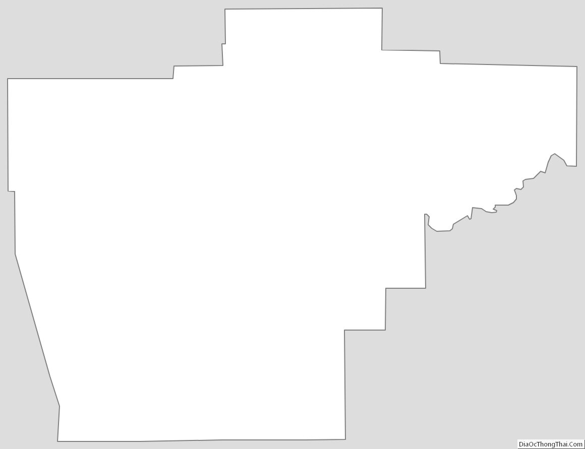
Sangamon County Outline Map