Stanislaus County (/ˈstænɪslɔː(s)/ (listen); Spanish: Condado de Estanislao) is a county located in the San Joaquin Valley of the U.S. state of California. As of the 2020 census, the population was 552,878. The county seat is Modesto.
Stanislaus County makes up the Modesto Metropolitan Statistical Area. The county is located just east of the San Francisco Bay Area and serves as a bedroom community for those who work in the eastern part of the Bay Area.
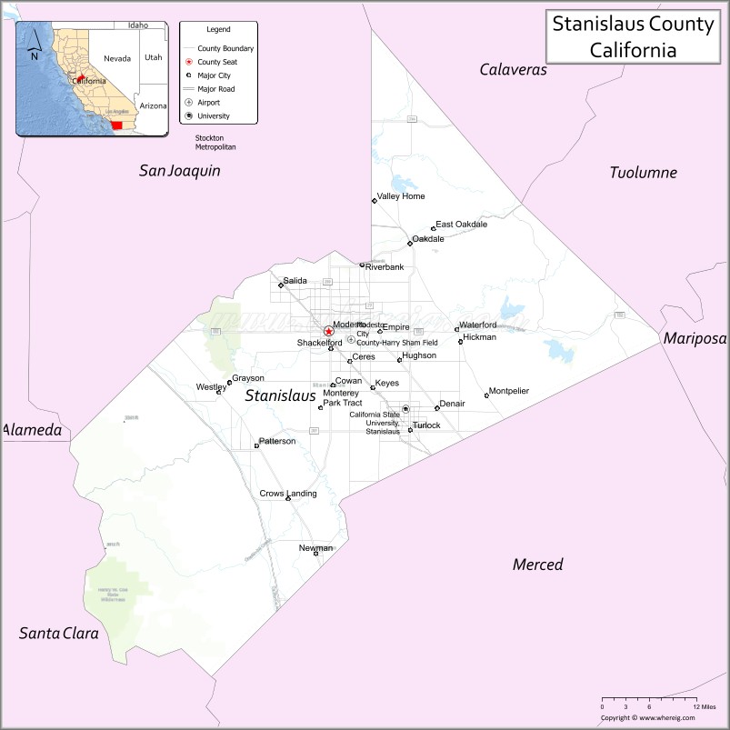
| Name: | Stanislaus County |
|---|---|
| FIPS code: | 06-099 |
| State: | California |
| Founded: | 1854 |
| Named for: | Estanislao |
| Seat: | Modesto |
| Total Area: | 1,515 sq mi (3,920 km²) |
| Land Area: | 1,495 sq mi (3,870 km²) |
| Total Population: | 552,878 |
| Population Density: | 360/sq mi (140/km²) |
| Time zone: | UTC−8 (Pacific Time Zone) |
| Summer Time Zone (DST): | UTC−7 (Pacific Daylight Time) |
| Website: | www.stancounty.com |
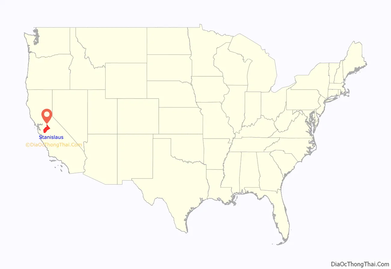
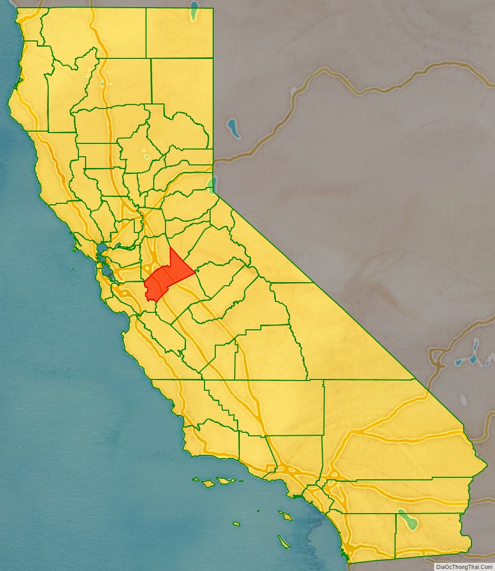
Stanislaus County location map. Where is Stanislaus County?
History
The first European to see the area was Gabriel Moraga in 1806.
The county was named after the Estanislao river, which in turn was named in honor of Estanislao, a mission-educated renegade Native American chief who led a band of Native Americans in a series of battles against Mexican troops until finally being defeated by General Mariano Vallejo in 1826. Estanislao was his baptismal name, the Spanish name version after Saint Stanislaus the Martyr.
Between 1843 and 1846, when California was a province of independent Mexico, five Mexican land grants totaling 113,135 acres (458 km; 177 sq mi) were granted in Stanislaus County. Rancho Orestimba y Las Garzas, Rancho Pescadero and Rancho Del Puerto were located on the west side of the San Joaquin River, and Rancho Del Rio Estanislao and Rancho Thompson on the north side of the Stanislaus River. Additionally, in 1844 Salomon Pico received a Mexican land grant of 58,000 acres (235 km; 91 sq mi) in the San Joaquin Valley, somewhere near the Stanislaus River and the San Joaquin River in what is now Stanislaus County. However, the grant was never confirmed by the Land Commission.
Stanislaus County was formed from part of Tuolumne County in 1854. The county seat was first situated at Adamsville, then moved to Empire in November, La Grange in December, and Knights Ferry in 1862, and was ultimately fixed at the present location in Modesto in 1871.
As the price of housing has increased in the San Francisco Bay Area, many people who work in the southern reaches of the Bay Area have opted for the longer commute and moved to Stanislaus County for the relatively affordable housing.
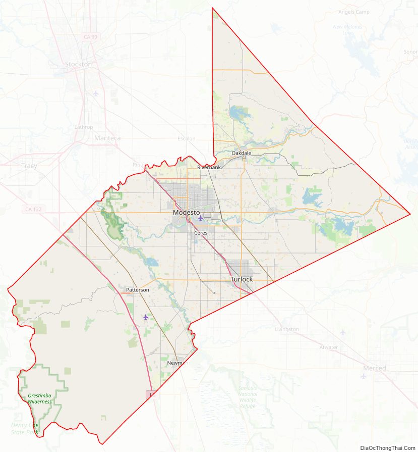
Stanislaus County Road Map
Geography
According to the U.S. Census Bureau, the county has a total area of 1,515 square miles (3,920 km), of which 1,495 square miles (3,870 km) is land and 20 square miles (52 km) (1.3%) is water.
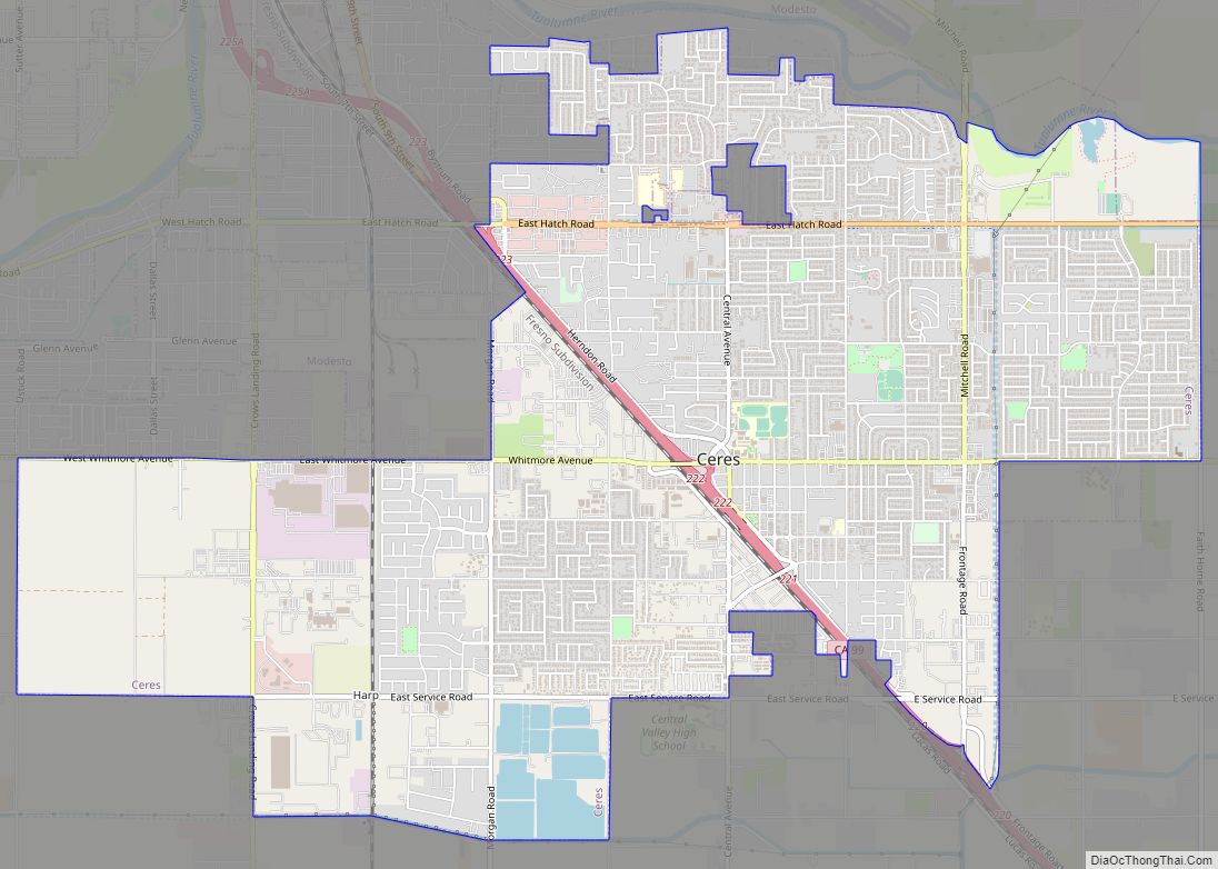
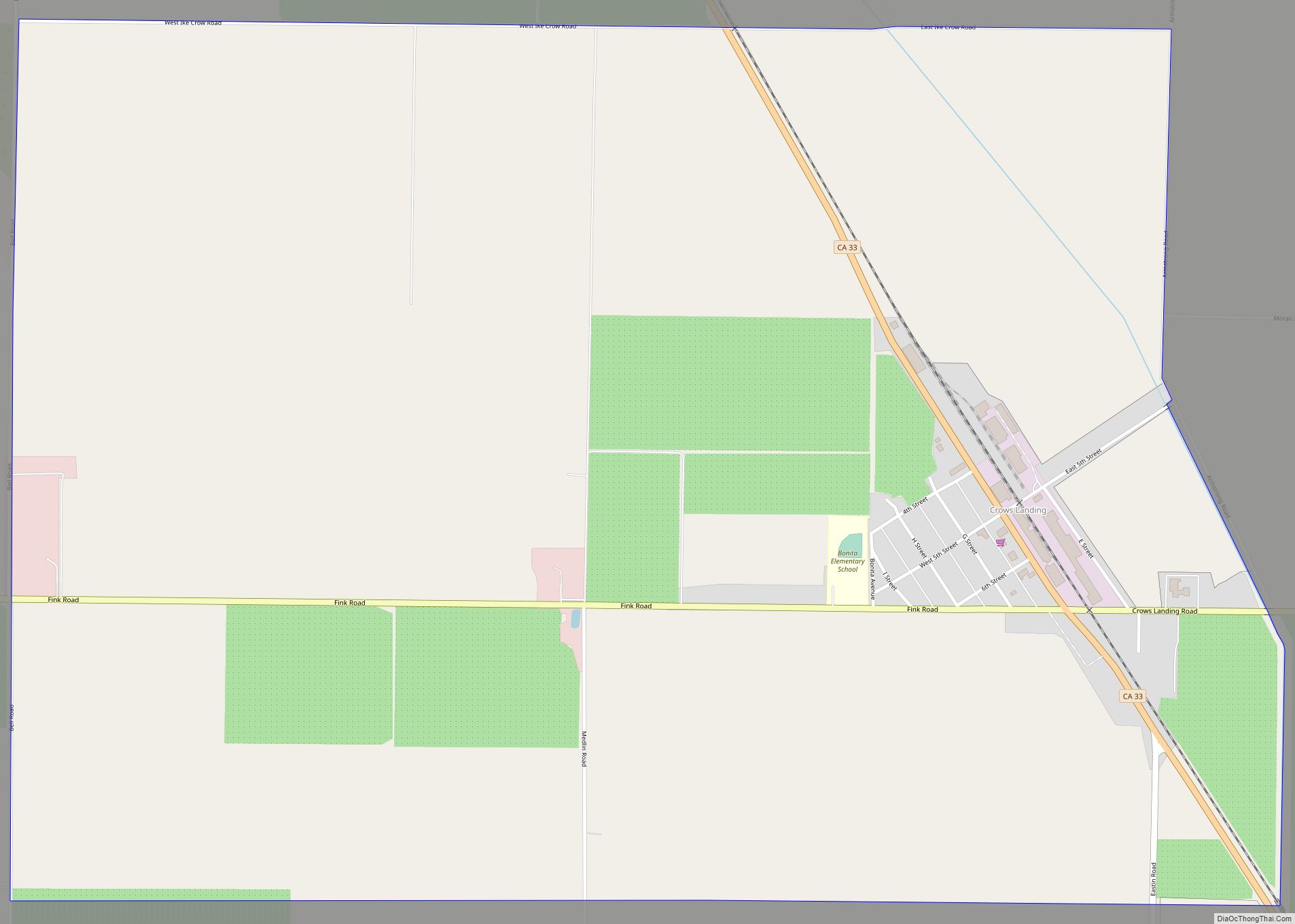
Stanislaus County has historically been divided socially and economically by the north-flowing San Joaquin River, which provided a natural barrier to trade and travel for much of the county’s history. Isolated from the main rail corridors through the county and the irrigation projects that generated much of the region’s economic prosperity, the part of Stanislaus County west of the river (known to locals as the “West Side” of the county) has largely remained rural and economically dependent on agricultural activities. Because of its proximity to Interstate 5 and the California Aqueduct some towns within this area, including Patterson and Newman, have experienced tremendous growth and are being transformed into bedroom communities for commuters from the nearby San Francisco Bay Area, while others (including Westley and Crows Landing) have been almost entirely overlooked by development and remain tiny farming communities.
Flora and fauna
There are a number or rare and endangered species found in Stanislaus County. The Beaked Clarkia, (Clarkia rostrata), is listed as a candidate for the Federal Endangered Species List. It has only been found in blue oak-gray pine associations in the foothills of the Sierra Nevada, a habitat which occurs at moderately high elevations. Colusa Grass, (Neostapfsia colusana) is listed as endangered by the State. It is restricted to vernal pools. (Torrey, 1989)
National protected area
- San Joaquin River National Wildlife Refuge (part)
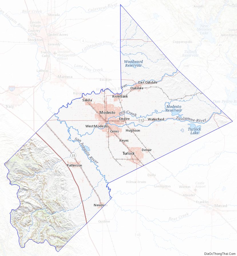
Stanislaus County Topographic Map
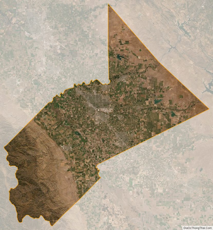
Stanislaus County Satellite Map
Stanislaus County Outline Map