Wilson County (standard abbreviation: WL) is a county located in Southeast Kansas. As of the 2020 census, the county population was 8,624. Its county seat is Fredonia.
| Name: | Wilson County |
|---|---|
| FIPS code: | 20-205 |
| State: | Kansas |
| Founded: | 1855 |
| Named for: | Hiero T. Wilson |
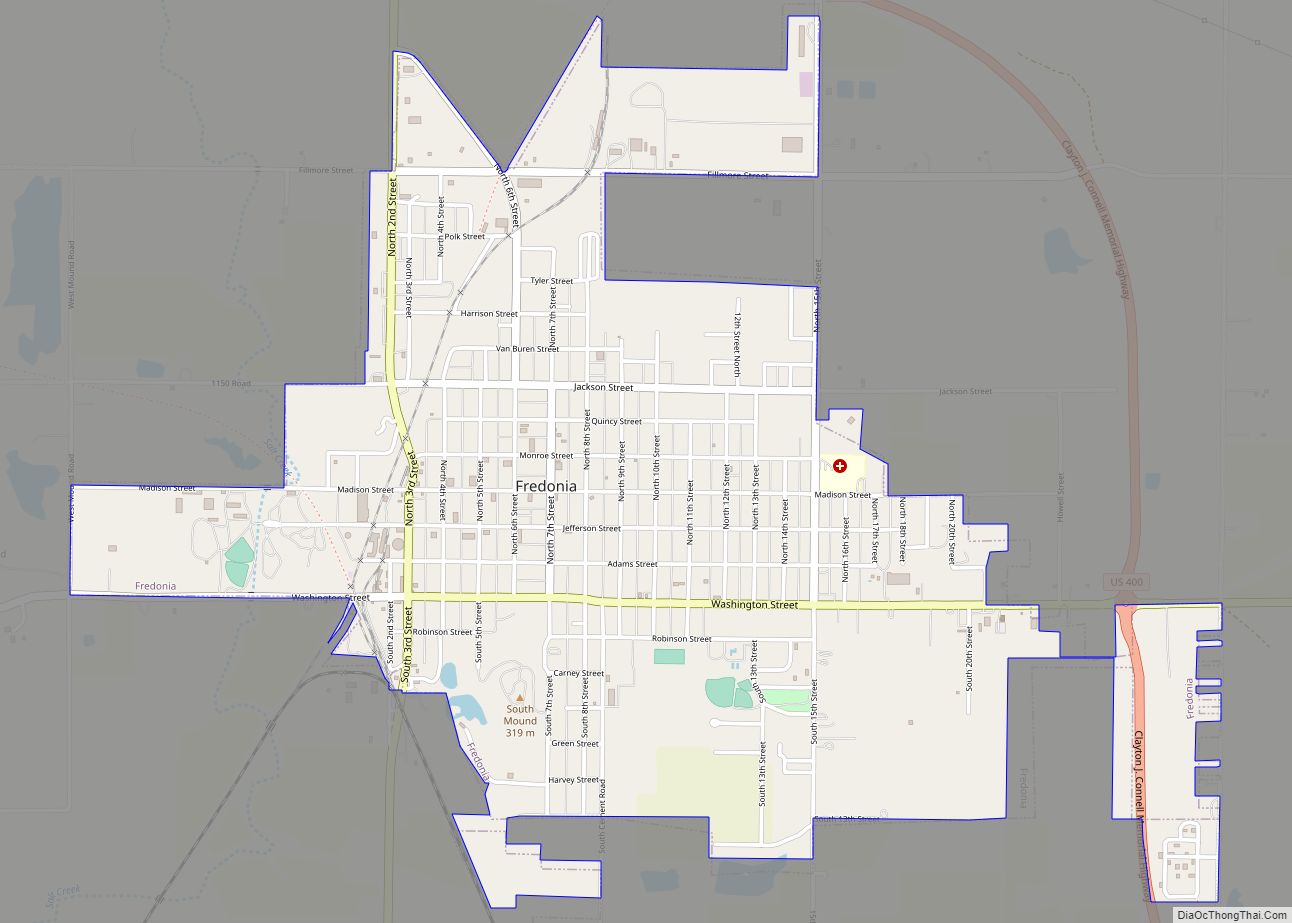
| Seat: | Fredonia |
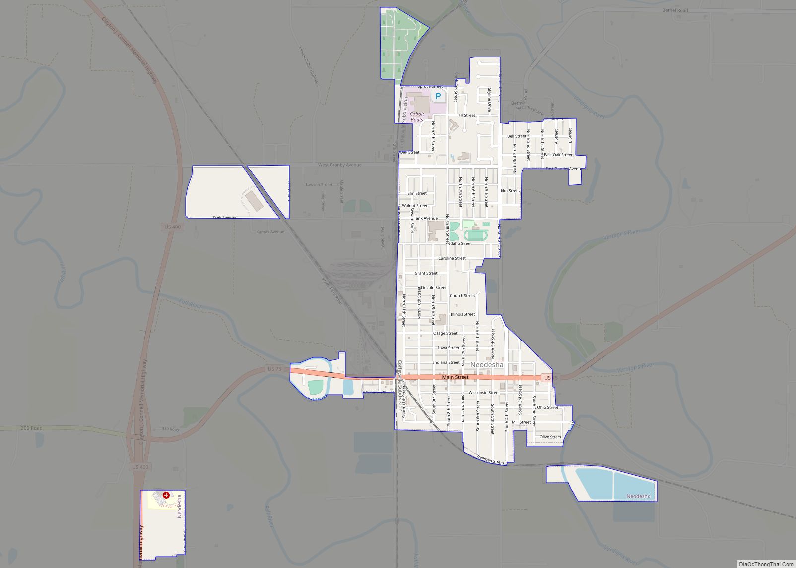
| Largest city: | Neodesha |
| Total Area: | 575 sq mi (1,490 km²) |
| Land Area: | 570 sq mi (1,500 km²) |
| Total Population: | 8,624 |
| Population Density: | 15.1/sq mi (5.8/km²) |
| Time zone: | UTC−6 (Central) |
| Summer Time Zone (DST): | UTC−5 (CDT) |
| Website: | wilsoncountykansas.org |
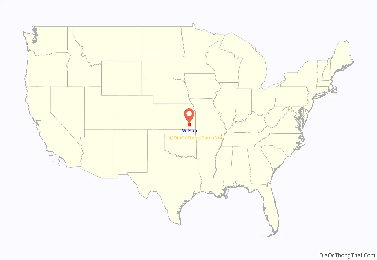
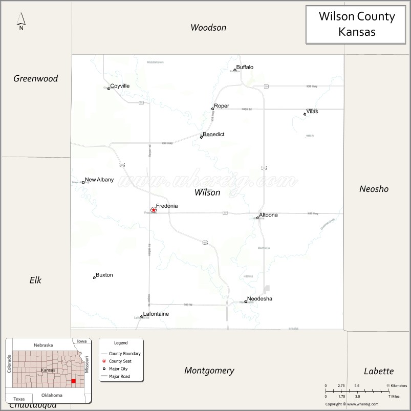
Wilson County location map. Where is Wilson County?
History
Early history
For many millennia, the Great Plains of North America was inhabited by nomadic Native Americans. From the 16th century to 18th century, the Kingdom of France claimed ownership of large parts of North America. In 1762, after the French and Indian War, France secretly ceded New France to Spain, per the Treaty of Fontainebleau.
19th century
In 1802, Spain returned most of the land to France, but keeping title to about 7,500 square miles. In 1803, most of the land for modern day Kansas was acquired by the United States from France as part of the 828,000 square mile Louisiana Purchase for 2.83 cents per acre.
In 1854, the Kansas Territory was organized. In 1855, Wilson County was established and included what is now Wilson County and Montgomery County. It was named for Colonel Hiero T. Wilson. He was a successful Indian trader who had been the first white settler of Fort Scott, Kansas and had served as postmaster and sutler at the fort. He could speak Cherokee, Creek, and Osage and the Osage called him “Big White Chief”. He was a delegate to the Lecompton Constitutional Convention.
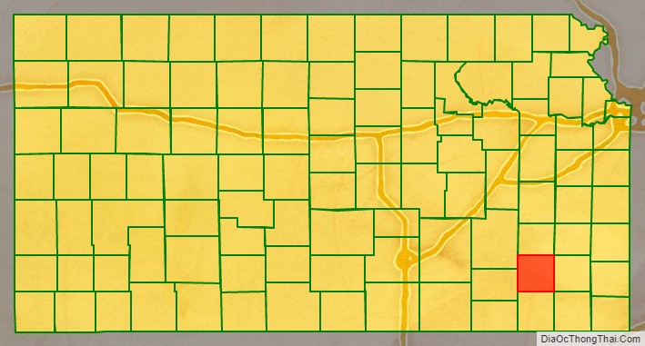
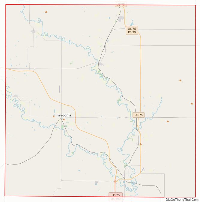
Wilson County Road Map
Geography
According to the U.S. Census Bureau, the county has a total area of 575 square miles (1,490 km), of which 570 square miles (1,500 km) is land and 4.7 square miles (12 km) (0.8%) is water.
Adjacent counties
- Woodson County (north)
- Allen County (northeast)
- Neosho County (east)
- Montgomery County (south)
- Elk County (west)
- Greenwood County (northwest)
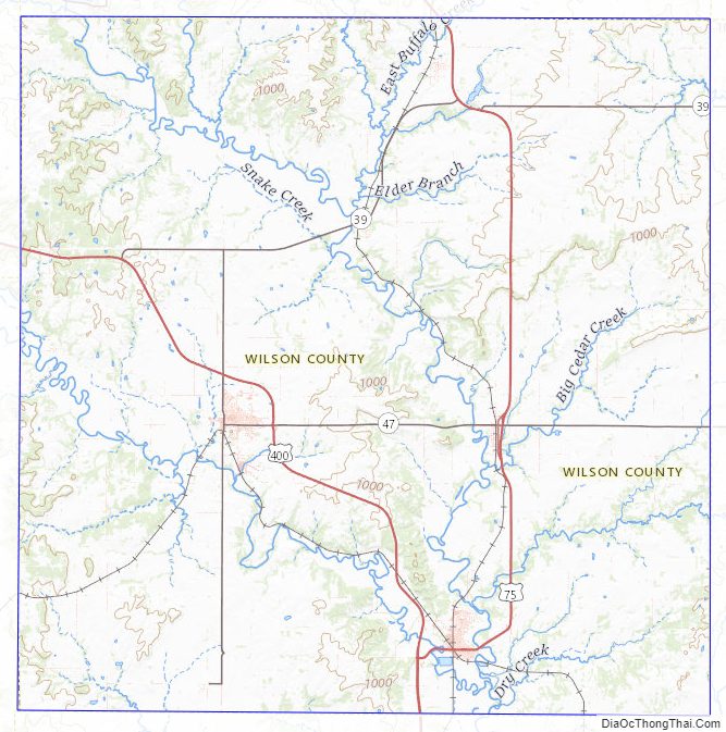
Wilson County Topographic Map
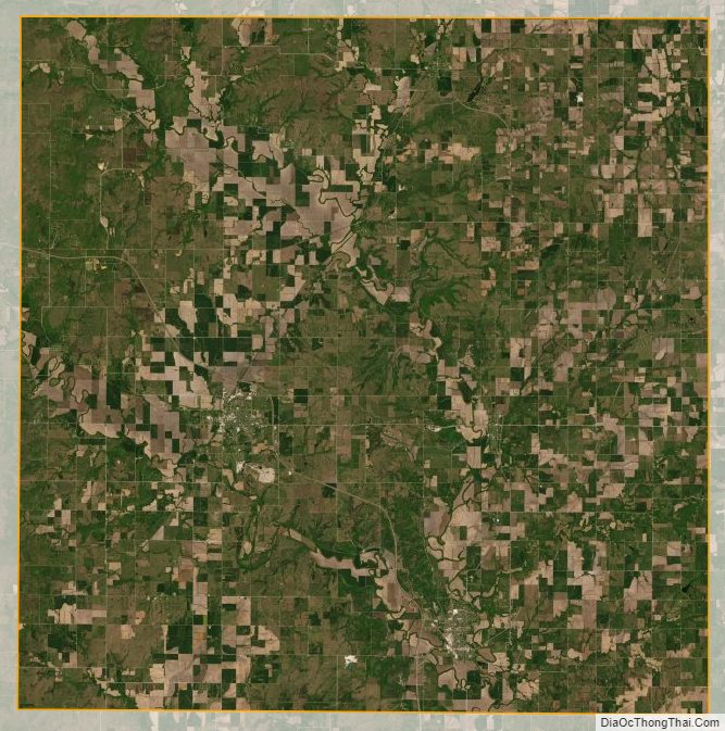
Wilson County Satellite Map
Wilson County Outline Map