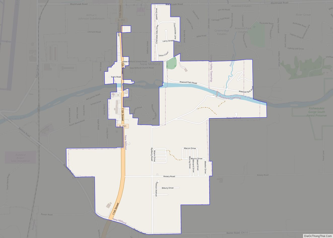
Winnebago County is a county located in the U.S. state of Illinois. According to the 2020 census, it had a population of 285,350 making it the seventh most populous county in Illinois behind Cook County and its five surrounding collar counties. Its county seat is Rockford. Winnebago County is the central county of the Rockford Metropolitan Statistical Area.
| Name: | Winnebago County |
|---|---|
| FIPS code: | 17-201 |
| State: | Illinois |
| Founded: | January 16, 1836 |
| Named for: | Winnebago Tribe |
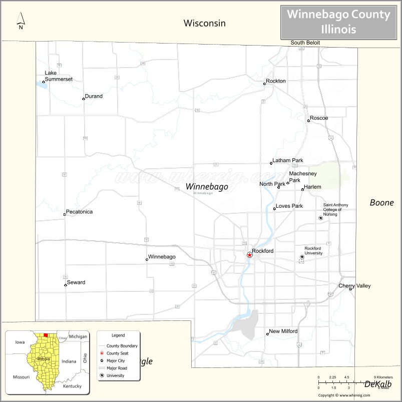
| Seat: | Rockford |
| Largest city: | Rockford |
| Total Area: | 519 sq mi (1,340 km²) |
| Land Area: | 513 sq mi (1,330 km²) |
| Total Population: | 285,350 |
| Population Density: | 550/sq mi (210/km²) |
| Time zone: | UTC−6 (Central) |
| Summer Time Zone (DST): | UTC−5 (CDT) |
| Website: | www.wincoil.us |
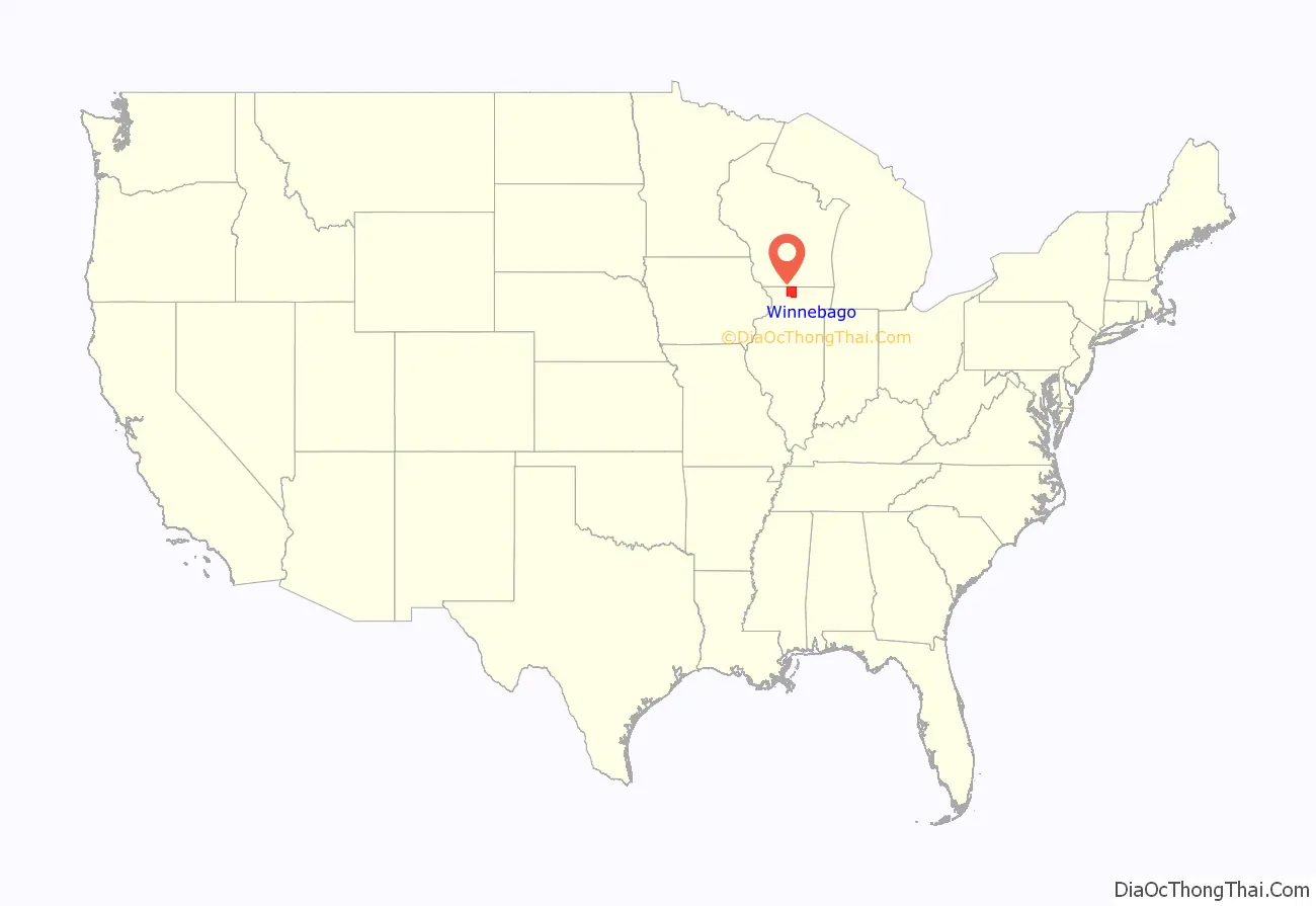
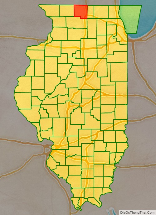
Winnebago County location map. Where is Winnebago County?
History
Winnebago County was formed on January 16, 1836, out of Jo Daviess and LaSalle counties. It was named for the Winnebago Tribe of American Indians. At the time the county was founded its inhabitants consisted almost entirely of New Englanders and New England transplants from upstate New York. These were “Yankee” settlers, meaning they were descended from the English Puritans who settled New England during the early 1600s. They made up virtually all of Winnebago County’s inhabitants during the first several decades of its history. In this regard the county was similar to most of the northern portion of the state of Illinois, and almost all of the neighboring state of Wisconsin. After the conclusion of the Black Hawk War there was an additional surge of immigration from New England. As a result of this heritage the inhabitants of Winnebago County considered themselves, and functioned as, a cultural expansion of early New England culture. In the Presidential election of 1860, Abraham Lincoln won 3,985 votes in Winnebago County, whereas Stephen A. Douglas only won 817 votes.
Winnebago County for its first year of existence
Winnebago County in 1837, reduced to its current borders by the creation of Stephenson and Boone Counties
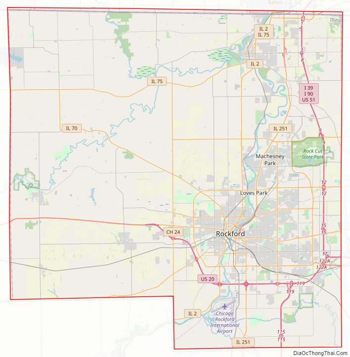
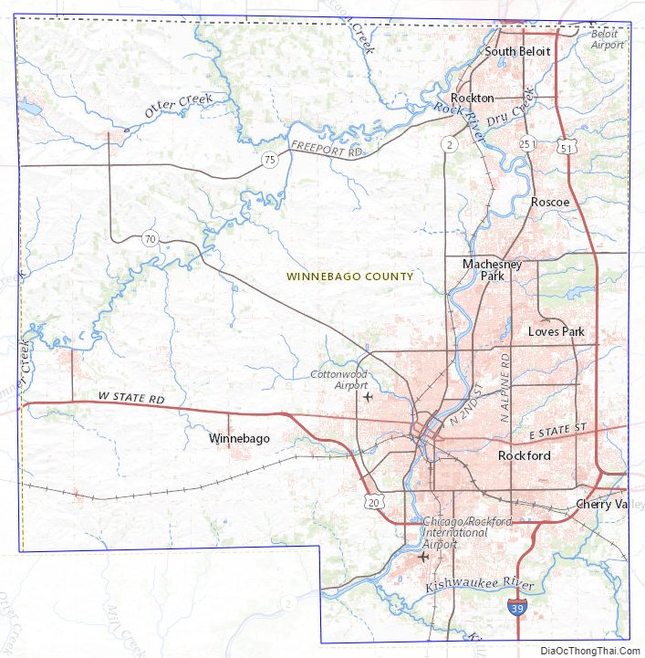
Winnebago County Road Map
Geography
According to the U.S. Census Bureau, the county has a total area of 519 square miles (1,340 km), of which 513 square miles (1,330 km) is land and 5.9 square miles (15 km) (1.1%) is water.
Climate and weather
In recent years, average temperatures in the county seat of Rockford have ranged from a low of 11 °F (−12 °C) in January to a high of 83 °F (28 °C) in July, although a record low of −27 °F (−33 °C) was recorded in January 1982 and a record high of 112 °F (44 °C) was recorded in July 1936. Average monthly precipitation ranged from 1.34 inches (34 mm) in February to 4.80 inches (122 mm) in June.
Major highways
- Interstate 39
- Interstate 90
- U.S. Highway 20
- U.S. Highway 51
- Illinois Route 2
- Illinois Route 70
- Illinois Route 75
- Illinois Route 173
- Illinois Route 251
Transit
- Beloit Transit
- Rockford Mass Transit District
- List of intercity bus stops in Illinois
Adjacent counties
- Rock County, Wisconsin (north)
- Boone County (east)
- DeKalb County (southeast)
- Ogle County (south)
- Stephenson County (west)
- Green County, Wisconsin (northwest)
Winnebago County Topographic Map
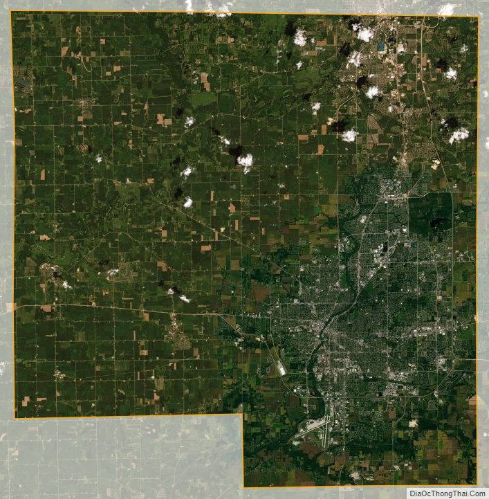
Winnebago County Satellite Map
Winnebago County Outline Map