Machesney Park is a village located in Winnebago County, Illinois, United States. The population was 23,499 at the 2010 census, up from 20,759 in 2000. Machesney Park is part of the Rockford, Illinois Metropolitan Statistical Area.
| Name: | Machesney Park village |
|---|---|
| LSAD Code: | 47 |
| LSAD Description: | village (suffix) |
| State: | Illinois |
| County: | Winnebago County |
| Elevation: | 741 ft (226 m) |
| Total Area: | 13.03 sq mi (33.74 km²) |
| Land Area: | 12.69 sq mi (32.85 km²) |
| Water Area: | 0.34 sq mi (0.89 km²) |
| Total Population: | 22,950 |
| Population Density: | 1,809.22/sq mi (698.53/km²) |
| Area code: | 815 |
| FIPS code: | 1745726 |
| Website: | machesneypark.org |
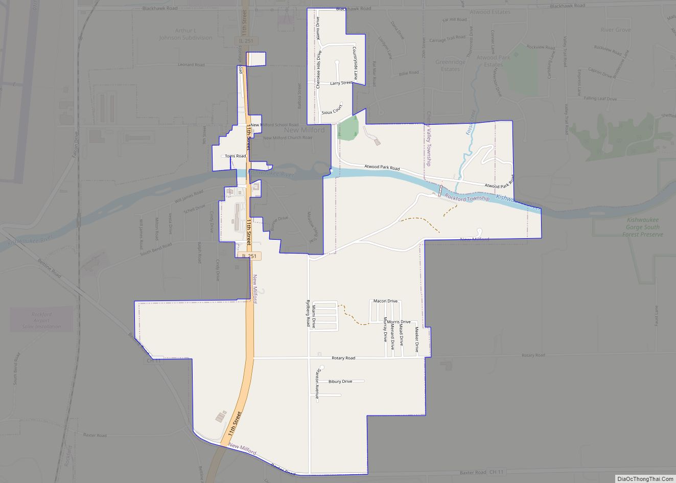
Online Interactive Map
Click on ![]() to view map in "full screen" mode.
to view map in "full screen" mode.
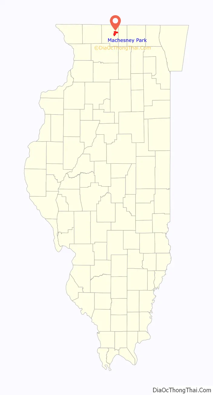
Machesney Park location map. Where is Machesney Park village?

History
The name Machesney Park has its roots in Machesney Airport, which was located on the main street North Second where the Machesney Mall stands today, which was founded in 1927 by Fred Machesney, a Barnstorming aviator. The Machesney Elementary School across the street from where the airport was located was also named after Fred Machesney’s airport. The airfield was Rockford’s main airport until the 1950s, when the Greater Rockford Airport came on line. In 1928 a famous flight from Rockford to Sweden took off from the field. The attempt failed as the two pilots crashed in Greenland, later being safely rescued. Machesney Field was used by the Army Air Corps during World War II as a stop by fighter aircraft being ferried to the Soviet Union.
This area of unincorporated Winnebago county saw growth pick up after World War II. This led to the formation of North Park, a public water district and volunteer firefighting company, and the unofficial name for the area.
Machesney Park became a village in 1981, after being approved in a referendum. Steve Johnson is the current village president.
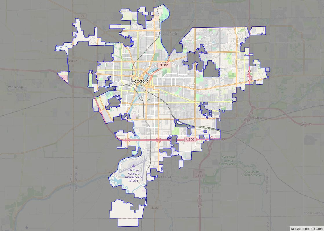
Machesney Park Road Map

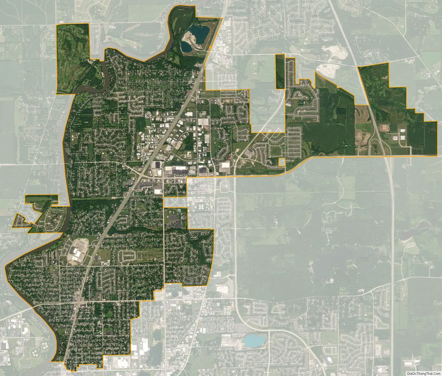
Machesney Park city Satellite Map
Geography
Machesney Park is located at 42°21′18″N 89°2′27″W / 42.35500°N 89.04083°W / 42.35500; -89.04083 (42.354989, -89.040827).
According to the 2010 census, Machesney Park has a total area of 13.005 square miles (33.68 km), of which 12.68 square miles (32.84 km) (or 97.5%) is land and 0.325 square miles (0.84 km) (or 2.5%) is water.
See also
Map of Illinois State and its subdivision:- Adams
- Alexander
- Bond
- Boone
- Brown
- Bureau
- Calhoun
- Carroll
- Cass
- Champaign
- Christian
- Clark
- Clay
- Clinton
- Coles
- Cook
- Crawford
- Cumberland
- De Kalb
- De Witt
- Douglas
- Dupage
- Edgar
- Edwards
- Effingham
- Fayette
- Ford
- Franklin
- Fulton
- Gallatin
- Greene
- Grundy
- Hamilton
- Hancock
- Hardin
- Henderson
- Henry
- Iroquois
- Jackson
- Jasper
- Jefferson
- Jersey
- Jo Daviess
- Johnson
- Kane
- Kankakee
- Kendall
- Knox
- La Salle
- Lake
- Lake Michigan
- Lawrence
- Lee
- Livingston
- Logan
- Macon
- Macoupin
- Madison
- Marion
- Marshall
- Mason
- Massac
- McDonough
- McHenry
- McLean
- Menard
- Mercer
- Monroe
- Montgomery
- Morgan
- Moultrie
- Ogle
- Peoria
- Perry
- Piatt
- Pike
- Pope
- Pulaski
- Putnam
- Randolph
- Richland
- Rock Island
- Saint Clair
- Saline
- Sangamon
- Schuyler
- Scott
- Shelby
- Stark
- Stephenson
- Tazewell
- Union
- Vermilion
- Wabash
- Warren
- Washington
- Wayne
- White
- Whiteside
- Will
- Williamson
- Winnebago
- Woodford
- Alabama
- Alaska
- Arizona
- Arkansas
- California
- Colorado
- Connecticut
- Delaware
- District of Columbia
- Florida
- Georgia
- Hawaii
- Idaho
- Illinois
- Indiana
- Iowa
- Kansas
- Kentucky
- Louisiana
- Maine
- Maryland
- Massachusetts
- Michigan
- Minnesota
- Mississippi
- Missouri
- Montana
- Nebraska
- Nevada
- New Hampshire
- New Jersey
- New Mexico
- New York
- North Carolina
- North Dakota
- Ohio
- Oklahoma
- Oregon
- Pennsylvania
- Rhode Island
- South Carolina
- South Dakota
- Tennessee
- Texas
- Utah
- Vermont
- Virginia
- Washington
- West Virginia
- Wisconsin
- Wyoming