Winona County is a county in the U.S. state of Minnesota. As of the 2020 census, its population was 49,671. Its county seat is Winona. Winona County comprises the Winona, MN Micropolitan Statistical Area.
| Name: | Winona County |
|---|---|
| FIPS code: | 27-169 |
| State: | Minnesota |
| Founded: | February 23, 1854 |
| Named for: | Winona (Native American) |
| Seat: | Winona |
| Largest city: | Winona |
| Total Area: | 642 sq mi (1,660 km²) |
| Land Area: | 626 sq mi (1,620 km²) |
| Total Population: | 49,671 |
| Population Density: | 79.3/sq mi (30.6/km²) |
| Time zone: | UTC−6 (Central) |
| Summer Time Zone (DST): | UTC−5 (CDT) |
| Website: | www.co.winona.mn.us |
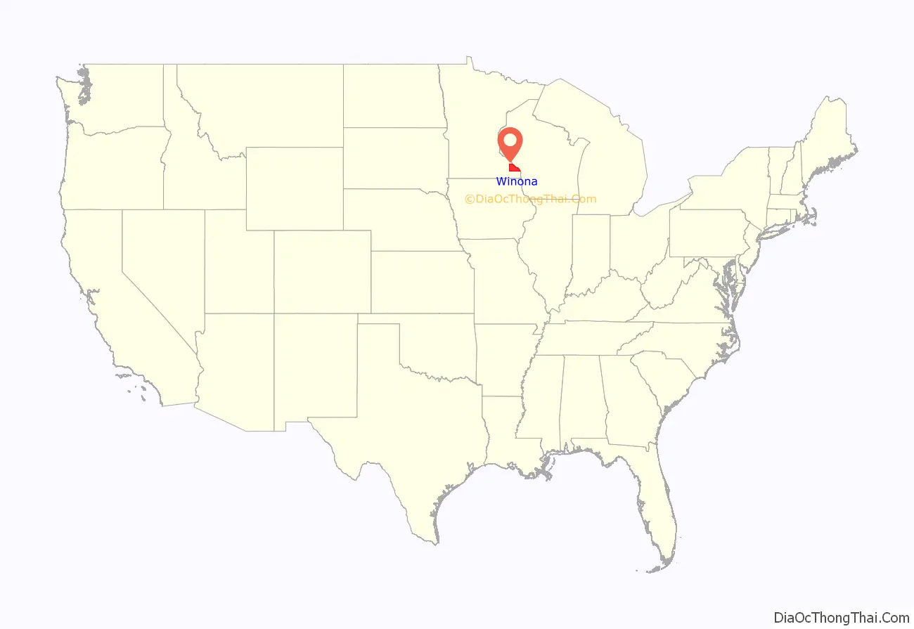
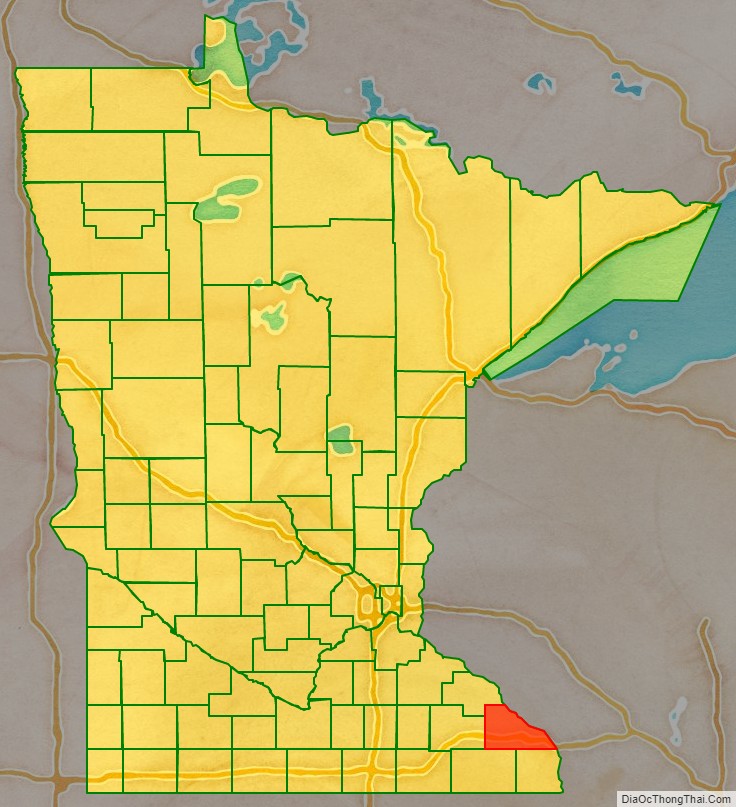
Winona County location map. Where is Winona County?
History
The Wisconsin Territory was established by the federal government effective July 3, 1836, and existed until its eastern portion was granted statehood (as Wisconsin) in 1848. The federal government set up the Minnesota Territory effective March 3, 1849. The newly organized territorial legislature created nine counties across the territory in October of that year. One of those original counties, Wabasha, had its southern section partitioned off on March 5, 1853, into a new county, Fillmore. On February 23, 1854, the legislature partitioned the northern part of Fillmore County, plus a small section of Wabasha, to create Winona County, with the village of Winona as county seat. The county name was taken from the village name, which is said to derive from a Dakota legend about a woman, Winona, (a relative of Chief Wabasha) who was betrothed to a warrior she did not love. Rather than marry him, she jumped to her death from a rock on Lake Pepin now called “Maiden’s Rock”. This is known as the Winona legend.
The county boundaries have remained unchanged since 1854.
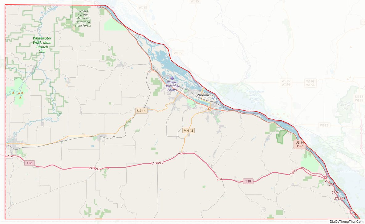
Winona County Road Map

Geography
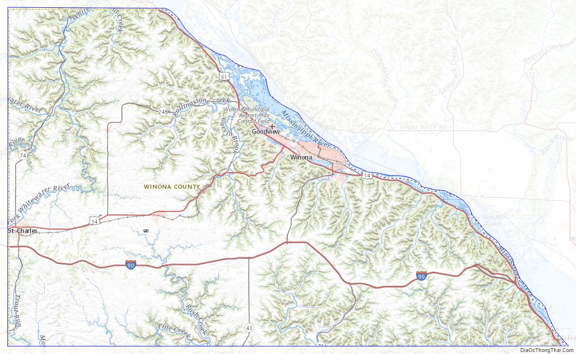
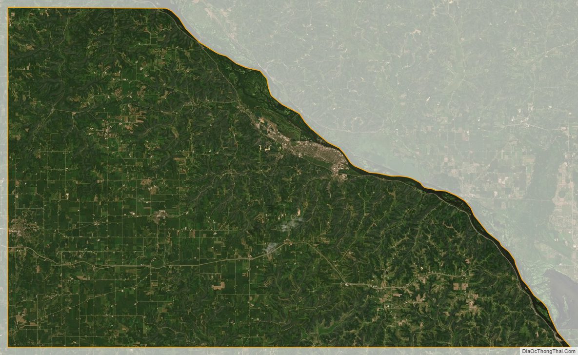
Winona County lies on Minnesota’s border with Wisconsin and is part of the driftless area that defines southeastern Minnesota, northeastern Iowa, southwestern Wisconsin and northwestern Illinois. The Mississippi, flowing south-southeast, defines the county’s eastern border. The U.S. Army Corps of Engineers (St. Paul District) maintains the lock and dam system in this region.
The Whitewater River flows north-northeast through the northwest part of the county toward its discharge into the Mississippi just above Winona County. The eastern part of the county is drained into the Mississippi by east-flowing streams including Rollingstone Creek, Garvin Brook, Cedar Creek, and Big Trout Creek. The county terrain consists of low rolling hills with the east portion particularly etched by drainages, and lightly sprinkled with lakes. The land is devoted to agriculture where possible. The terrain slopes to the south and east, with its highest point at 1,365′ (416m) ASL on a hill two miles (3 km) east of Wilson. The county has an area of 642 square miles (1,660 km), of which 626 square miles (1,620 km) is land and 15 square miles (39 km) (2.4%) is water.
Within Minnesota, Winona County borders Wabasha County, Olmsted County, Fillmore County and Houston County.
Major highways
- Interstate 90
- U.S. Highway 14
- U.S. Highway 61
- Minnesota State Highway 43
- Minnesota State Highway 74
- Minnesota State Highway 76
- Minnesota State Highway 248
Public airports
- Winona Municipal Airport (ONA) (Max Conrad Field), NW of Winona
Adjacent counties
- Wabasha County – northwest
- Buffalo County, Wisconsin – north
- Trempealeau County, Wisconsin – northeast
- La Crosse County, Wisconsin – east
- Houston County – south
- Fillmore County – southwest
- Olmsted County – west
Protected areas
- Great River Bluffs State Park
- John A Latsch State Park
- Richard John Dorer Memorial Hardwood State Forest
- Upper Mississippi River National Wildlife and Fish Refuge (part)
- Whitewater State Park
- Whitewater State Wildlife Management Area (part)
- Callahan Unit
- McCarthy Ravine Unit
- South Branch Unit
- Upper South Branch Unit
Lakes
- Airport Lake
- Bartlet Lake
- Bollers Lake
- Hunters Lake
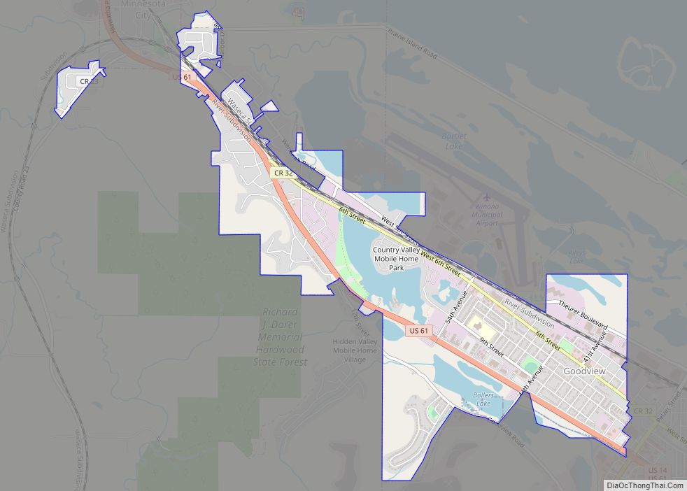
- Lake Goodview
- Lake Winona
- Rileys Lake
Winona County Topographic Map
Winona County Satellite Map
Winona County Outline Map