Zakarpattia Oblast (Rusyn and Ukrainian: Закарпатська область, romanized: Zakarpatska oblast; Hungarian: Kárpátalja) is an oblast in western Ukraine, mostly coterminous with the historical region of Carpathian Ruthenia. Its administrative centre is the city of Uzhhorod, Other major cities within the oblast include Mukachevo, Khust, Berehove, and Chop, the last of which is home to railroad transport infrastructure.
Zakarpattia Oblast was established on 22 January 1946, after Czechoslovakia gave up its claim to the territory of Subcarpathian Ruthenia (Czech: Podkarpatská Rus) under a treaty between Czechoslovakia and the Soviet Union. The territory of Subcarpathian Ruthenia was then taken over by the Soviet Union and became part of the Ukrainian Soviet Socialist Republic.
Some scholars say that during the Ukrainian independence referendum held in 1991, Zakarpatska Oblast voters were given a separate option on whether or not they favoured autonomy for the region. Although a large majority favoured autonomy, it was not granted. However, this referendum was about self-government status, not about autonomy (like in Crimea).
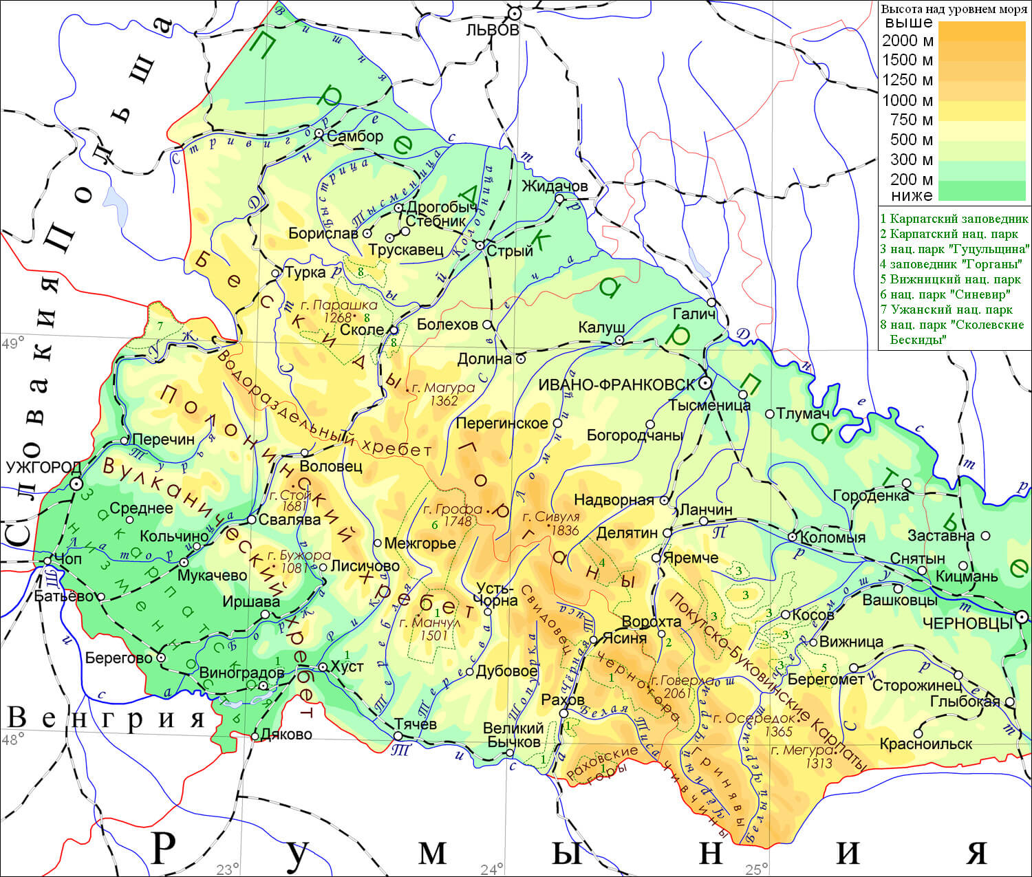
Situated in the Carpathian Mountains of western Ukraine, except the southwestern Hungarian-populated region that belongs to the Hungarian plain, Zakarpattia Oblast is the only Ukrainian administrative division which borders upon four countries: Poland, Slovakia, Hungary, and Romania. The Carpathians are an important tourist and travel destination housing many ski and spa resorts, meaning that they play a major part in the oblast’s economy.
With a land area of almost 13,000 square kilometres (5,000 sq mi), the oblast is ranked 23rd by area and 15th by population as according to the 2001 Ukrainian Census, the population of Zakarpatska Oblast was 1,254,614. The current population is 1,244,476 (2022 est.). This total includes people of many different nationalities of which Hungarians, Romanians, and Rusyns constitute significant minorities in some of the province’s cities, while in others, they form the majority of the population (as in the case of Berehove).
| Unit Name | Transcarpathia Oblast |
|---|---|
| Administrative center | Uzhhorod |
| Total area | 12.777 km² (4.933 sq mi) |
| Area Rank | Rank 23th |
| Population (2021) | 1.250.129 |
| Time zone | UTC+2 (EET) |
| Summer (DST) | UTC+3 (EEST) |
| Postal code | 88-90xxx |
| Area code | +380-31 |
| ISO 3166 code | UA-21 |
| Website | www.carpathia.gov.ua www.rada.gov.ua |
| Flag |  |
| Coat of arms |  |
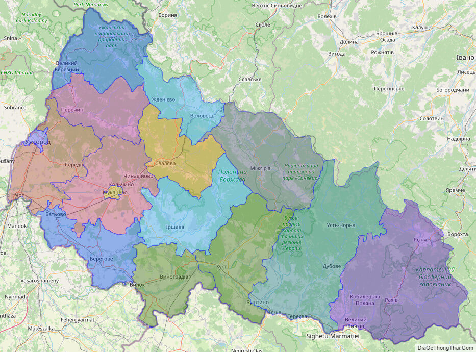
Online subdivision map of Zakarpattia oblast
Zakarpattia Oblast, located in western Ukraine, is a region of significant cultural and historical importance. Its diverse landscapes and rich cultural heritage make it an attractive destination for tourists and scholars alike. An online subdivision map of the region provides a valuable tool for those interested in exploring this fascinating region in more detail.
Using an online base map, such as OpenStreetMap or satellite imagery, one can examine the different sub-administrative units of Zakarpattia Oblast in detail. The map’s cover layer offers distinct colors to show the borders and boundaries of each area, providing an easy way to distinguish between them.
The online subdivision map allows users to zoom in and out of the map, providing a detailed view of the different towns, villages, and cities within Zakarpattia Oblast. This makes it possible to explore the region’s unique architecture, landmarks, and natural beauty, such as the Carpathian Mountains, the Tisza River, and the Synevyr Lake.
An online subdivision map of Zakarpattia Oblast also provides a valuable tool for researchers interested in studying the region’s cultural and historical heritage. The map can be used to identify significant cultural sites and historical landmarks, allowing scholars to gain a better understanding of the region’s past.
Overall, an online subdivision map of Zakarpattia Oblast is an excellent resource for anyone interested in exploring this region’s diverse landscapes, cultural heritage, and historical significance.
Click on ![]() to view map in "full screen" mode.
to view map in "full screen" mode.
List administrative sub-division of Zakarpattia oblast
| # | Name | Type |
|---|---|---|
| 1 | Mukachivs’ka | Misto |
| 2 | Uzhhorods’ka | Misto |
| 3 | Berehivs’kyi | Raion |
| 4 | Irshavs’kyi | Raion |
| 5 | Khusts’kyi | Raion |
| 6 | Mizhhirs’kyi | Raion |
| 7 | Mukachivs’kyi | Raion |
| 8 | Perechyns’kyi | Raion |
| 9 | Rakhivs’kyi | Raion |
| 10 | Svaliavs’kyi | Raion |
| 11 | Tiachivs’kyi | Raion |
| 12 | Uzhhorods’kyi | Raion |
| 13 | Velykobereznians’kyi | Raion |
| 14 | Volovets’kyi | Raion |
| 15 | Vynohradivs’kyi | Raion |
Explaination:
- Mis’ka Rada: City municipalities (governed by a mayor and a city council)
- Misto: city at least 10,000 people (not a town).
- Raion: often translated as “district”.
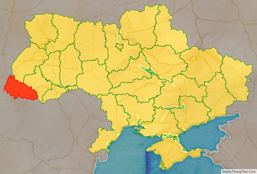
Location map of Zakarpattia oblast, Ukraine

Political map of Zakarpattia oblast
Detail map of Zakarpattia oblast
Zakarpattia oblast streeet map

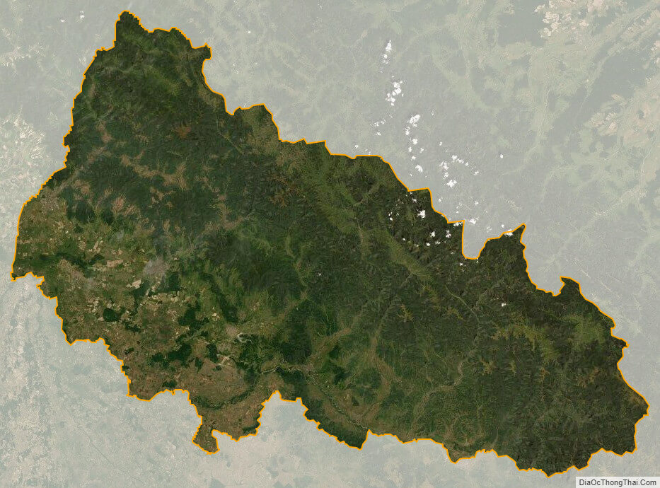
Zakarpattia oblast satellite map