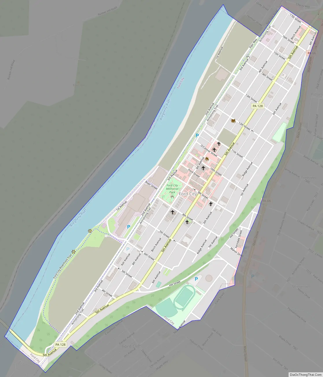
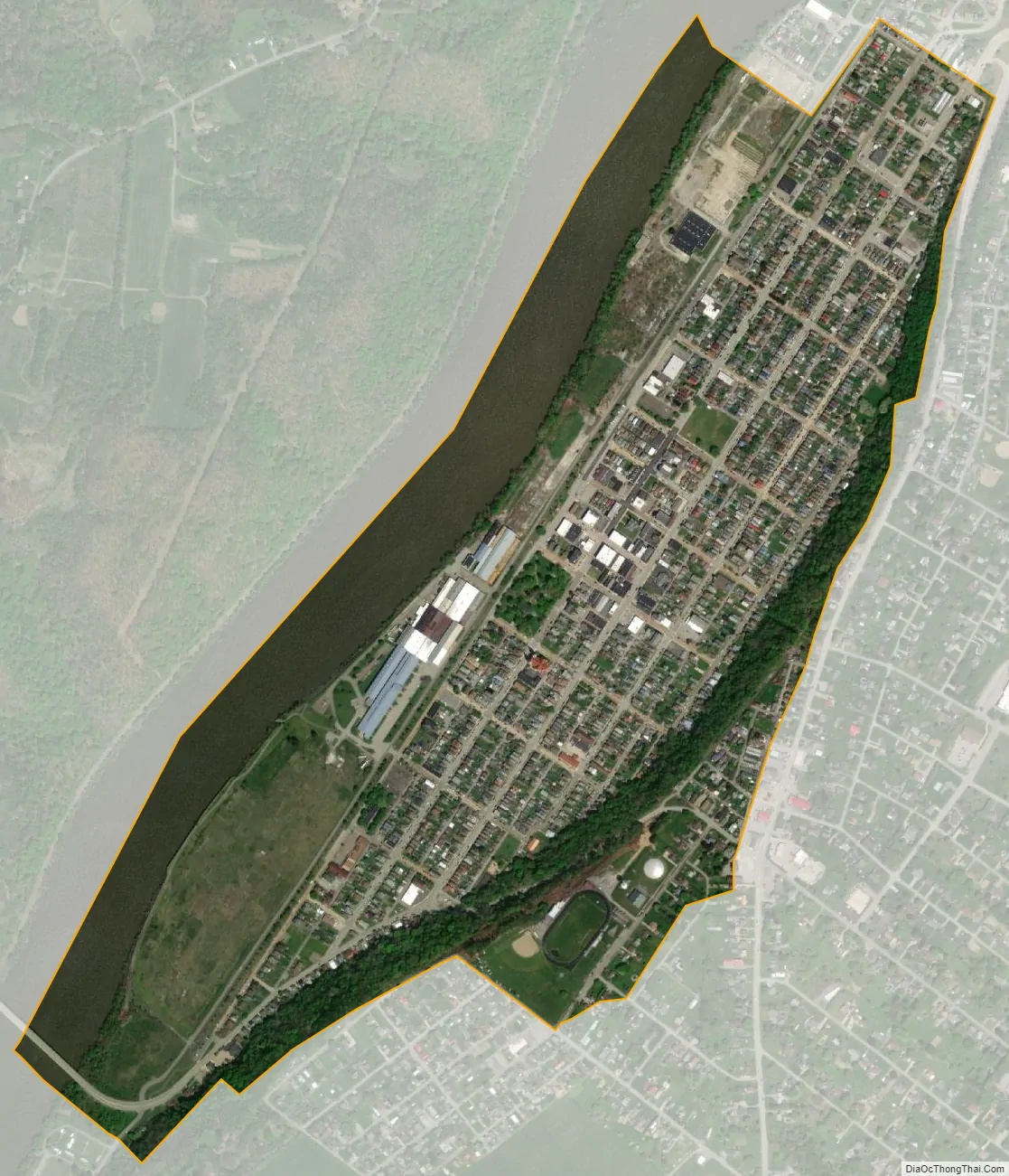
Ford City is a borough in Armstrong County, Pennsylvania, United States, 40 miles (64 km) northeast of Pittsburgh along the east bank of the Allegheny River and 4 miles (6 km) south of Kittanning, the county seat. The population was 2,859 at the 2020 census. It is part of the Pittsburgh metropolitan area.
| Name: | Ford City borough |
|---|---|
| LSAD Code: | 21 |
| LSAD Description: | borough (suffix) |
| State: | Pennsylvania |
| County: | Armstrong County |
| Incorporated: | 1889 |
| Elevation: | 794 ft (242 m) |
| Total Area: | 0.76 sq mi (1.97 km²) |
| Land Area: | 0.65 sq mi (1.67 km²) |
| Water Area: | 0.12 sq mi (0.30 km²) |
| Total Population: | 2,859 |
| Population Density: | 4,432.56/sq mi (1,712.51/km²) |
| Area code: | 724, 878 |
| FIPS code: | 4226512 |
| Website: | www.fordcityborough.org |
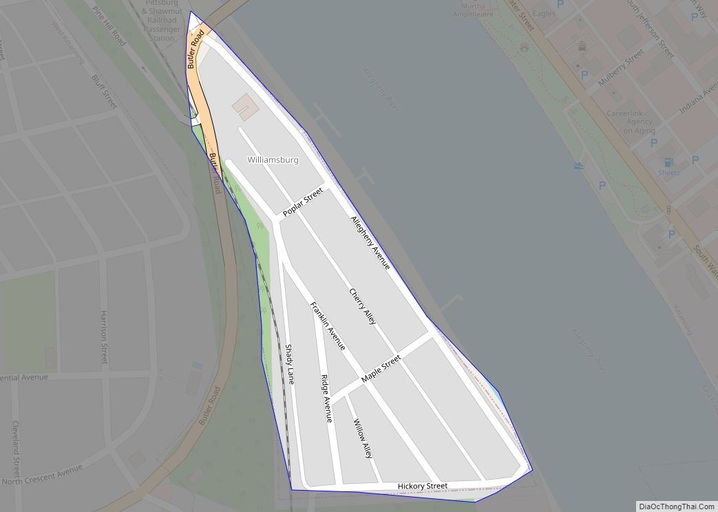
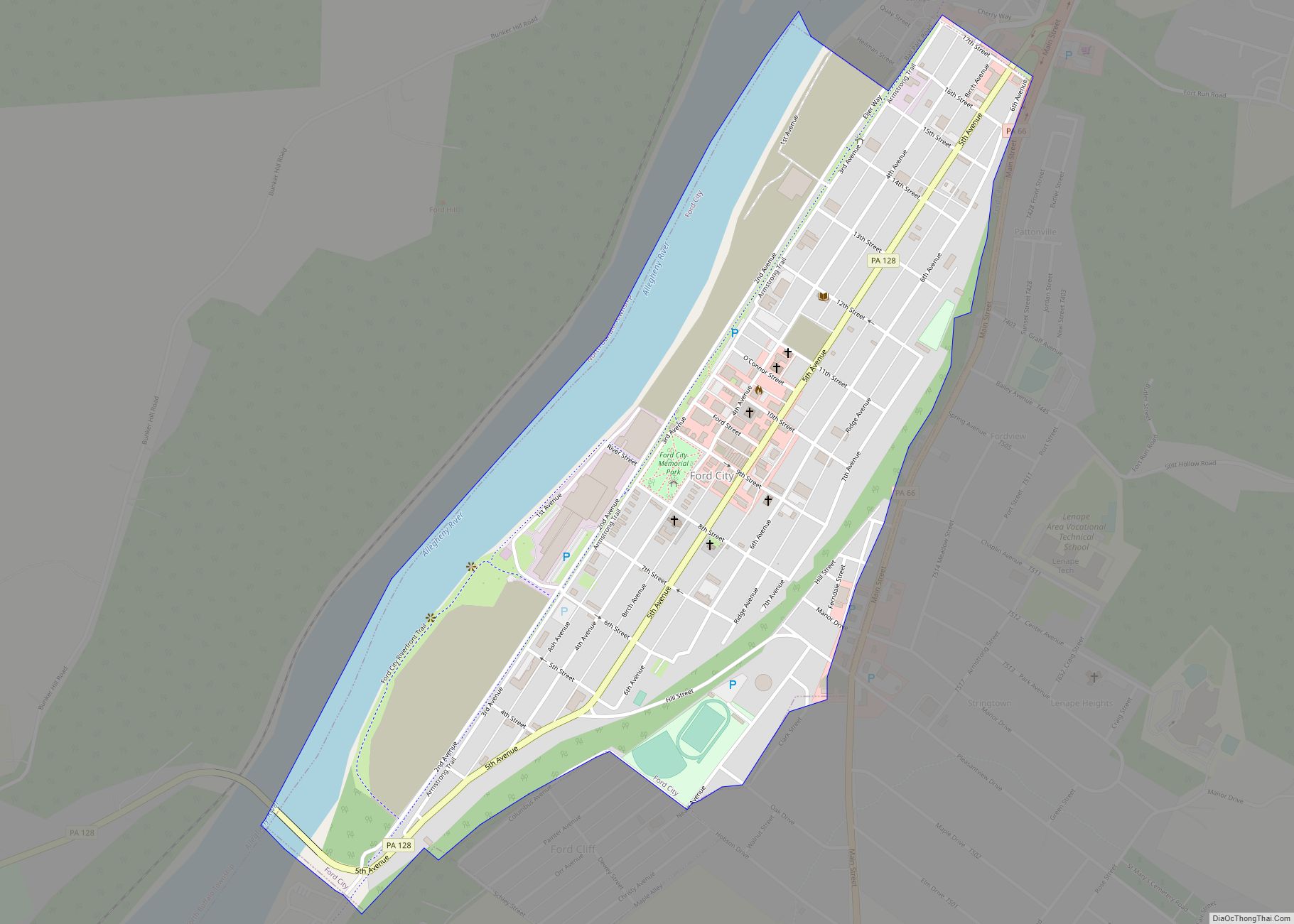
Online Interactive Map
Click on ![]() to view map in "full screen" mode.
to view map in "full screen" mode.
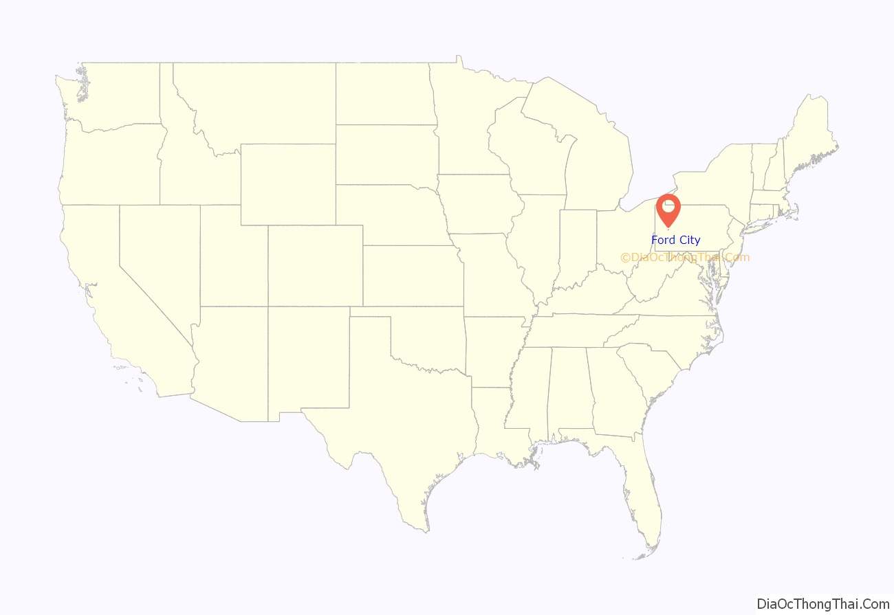
Ford City location map. Where is Ford City borough?

History
Ford City was founded in 1887 as a company town by the Pittsburgh Plate Glass Company (now PPG Industries) as the site for its Works No. 3 glass factory. The town was named in honor of the company founder, John Baptiste Ford (1811–1903). The factory employed as many as 5,000 workers in its heyday. PPG shut down its Ford City operations in the 1990s. The once largest employer in Armstrong County, Eljer Plumbing, shut down its Ford City plant in 2008.
Ford City Road Map
Ford City city Satellite Map
Geography
Ford City is located at 40°46′17″N 79°31′48″W / 40.77139°N 79.53000°W / 40.77139; -79.53000 (40.771410, -79.529906).
According to the United States Census Bureau, the borough has a total area of 0.77 square miles (2.0 km), of which 0.66 square miles (1.7 km) is land and 0.12 square miles (0.3 km), or 15.28%, is water.
Climate
See also
Map of Pennsylvania State and its subdivision:- Adams
- Allegheny
- Armstrong
- Beaver
- Bedford
- Berks
- Blair
- Bradford
- Bucks
- Butler
- Cambria
- Cameron
- Carbon
- Centre
- Chester
- Clarion
- Clearfield
- Clinton
- Columbia
- Crawford
- Cumberland
- Dauphin
- Delaware
- Elk
- Erie
- Fayette
- Forest
- Franklin
- Fulton
- Greene
- Huntingdon
- Indiana
- Jefferson
- Juniata
- Lackawanna
- Lancaster
- Lawrence
- Lebanon
- Lehigh
- Luzerne
- Lycoming
- Mc Kean
- Mercer
- Mifflin
- Monroe
- Montgomery
- Montour
- Northampton
- Northumberland
- Perry
- Philadelphia
- Pike
- Potter
- Schuylkill
- Snyder
- Somerset
- Sullivan
- Susquehanna
- Tioga
- Union
- Venango
- Warren
- Washington
- Wayne
- Westmoreland
- Wyoming
- York
- Alabama
- Alaska
- Arizona
- Arkansas
- California
- Colorado
- Connecticut
- Delaware
- District of Columbia
- Florida
- Georgia
- Hawaii
- Idaho
- Illinois
- Indiana
- Iowa
- Kansas
- Kentucky
- Louisiana
- Maine
- Maryland
- Massachusetts
- Michigan
- Minnesota
- Mississippi
- Missouri
- Montana
- Nebraska
- Nevada
- New Hampshire
- New Jersey
- New Mexico
- New York
- North Carolina
- North Dakota
- Ohio
- Oklahoma
- Oregon
- Pennsylvania
- Rhode Island
- South Carolina
- South Dakota
- Tennessee
- Texas
- Utah
- Vermont
- Virginia
- Washington
- West Virginia
- Wisconsin
- Wyoming