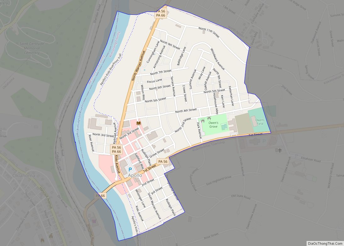
Kittanning (/kɪˈtænɪŋ/ pronounced ki-TAN-ing) is a borough in and the county seat of Armstrong County, Pennsylvania, United States. It is situated 36 miles (58 km) northeast of Pittsburgh, along the east bank of the Allegheny River. The population was 3,921 at the 2020 census.
The name is derived from Kithanink, which means ‘on the main river’ in Lenape or the Delaware language, from kit- ‘big’ + hane ‘mountain river’ + –ink (suffix used in place names). “The main river” is a Lenape term for the Allegheny and Ohio combined, which they considered as all one river. The borough and its bridge have been used as a setting for several recent films.
| Name: | Kittanning borough |
|---|---|
| LSAD Code: | 21 |
| LSAD Description: | borough (suffix) |
| State: | Pennsylvania |
| County: | Armstrong County |
| Total Area: | 1.25 sq mi (3.24 km²) |
| Land Area: | 1.00 sq mi (2.58 km²) |
| Water Area: | 0.25 sq mi (0.66 km²) |
| Population Density: | 3,936.75/sq mi (1,519.46/km²) |
| ZIP code: | 16201 |
| Area code: | 724 |
| FIPS code: | 4240040 |
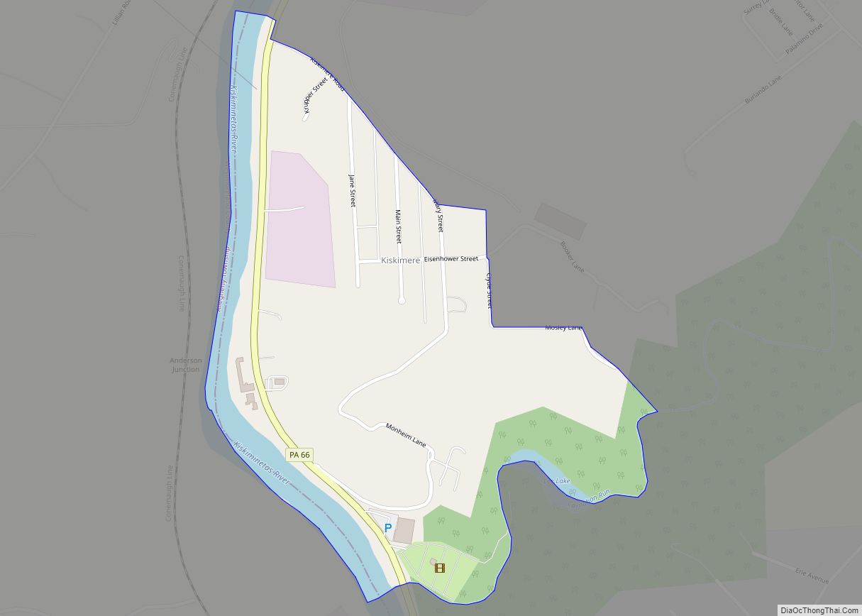
Online Interactive Map
Click on ![]() to view map in "full screen" mode.
to view map in "full screen" mode.
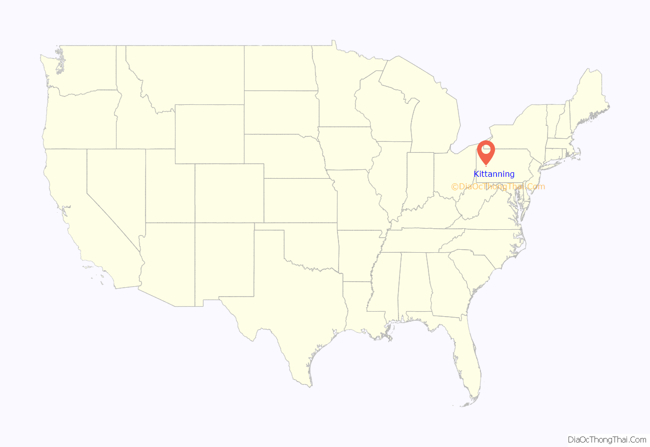
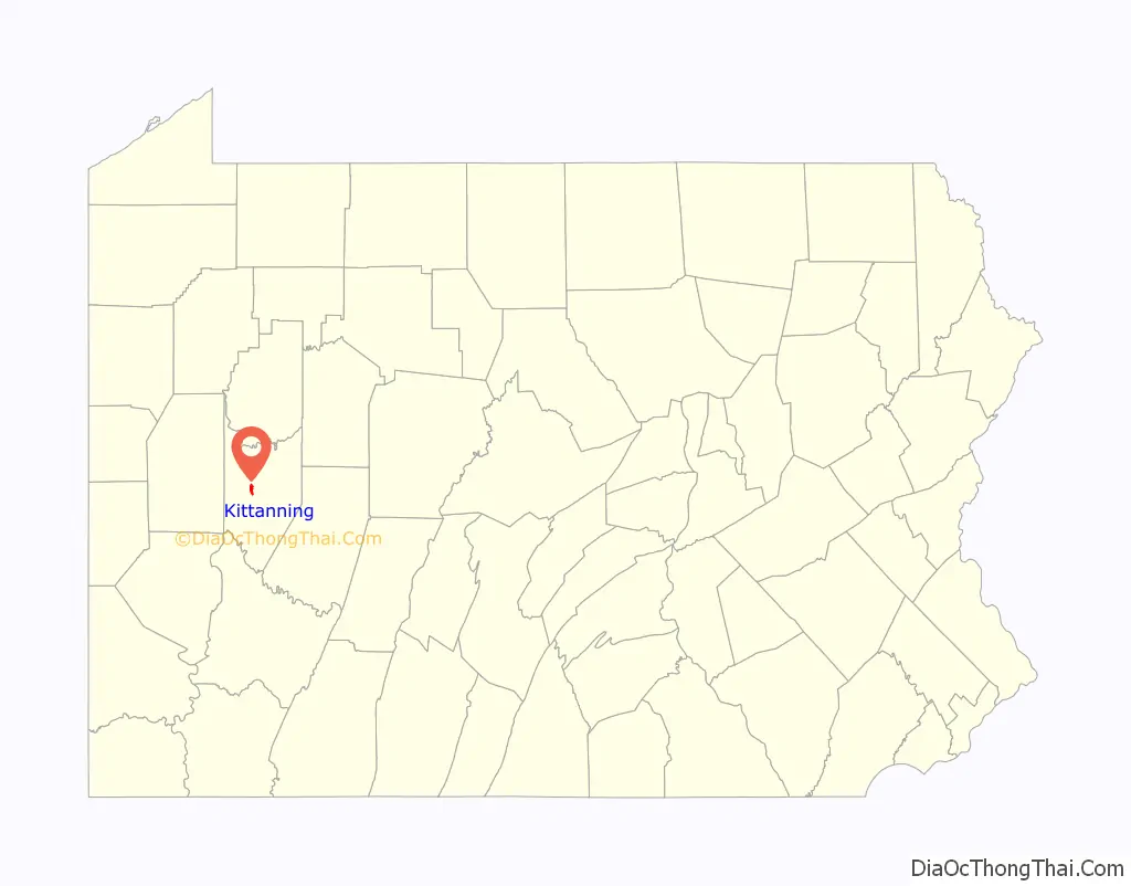
Kittanning location map. Where is Kittanning borough?
History
The borough is located on the east bank of the Allegheny River, founded on the site of the eighteenth-century Lenape (Delaware) village of Kittanning at the western end of the Kittanning Path, an ancient Native American path.
In 1756, the village was destroyed by John Armstrong, Sr. at the Battle of Kittanning during the French and Indian War. During the attack, a blast from the explosion of gunpowder stored in Captain Jacobs’s house was heard at Fort Duquesne, present day Pittsburgh, Pennsylvania, 44 miles away.
Kittanning was designated as the seat of Armstrong County when the county was organized. It was settled by European Americans largely after the American Revolutionary War, although Anthony Sadowski (also recorded by the anglicized name of Sandusky), a prominent Polish-American trader, and other Native American traders operated here before the Revolutionary War.
During the American Civil War, the 103rd Regiment of Pennsylvania Infantry volunteers was organized at Kittanning from September 7, 1861 – February 22, 1862. Among other engagements, the unit participated in the Siege of Yorktown (1862) as well as the Battle of Plymouth (1864), during which most of the regiment was captured.
By the early in the 20th century, the city had developed considerable industry: large iron and steel works, foundries, and coal mines, all associated with the steel and iron industries of Pittsburgh; glassworks, flour and lumber mills; china, pottery, brick, lime, and clay works; and mirror and typewriter factories, breweries, etc. It reached its peak of population in 1930 and was adversely affected by the Great Depression. After World War II, changes in industry and restructuring of heavy industry caused a loss of jobs in many of these works, with an associated population decline.
The playground on North Jefferson Street was developed on the former site of the historic Kittanning Cemetery. In order to enable this, the city moved 274 graves in 1960 to a new cemetery formed along Troy Hill Road.
In 1900, 3,902 people lived in Kittanning, and in 1910, there were 4,311 inhabitants. After Kittanning merged with Wickboro (1910 population 2,775), in 1914, the population was estimated at 10,000, which was likely high. The 1920 census counted 7,153 residents. In 1930, there were 7,808 residents; in 1940, 7,550. Since late 20th century industrial decline, the population was 4,044 at the 2010 census.
The Allegheny River Lock and Dam No. 7 and Armstrong County Courthouse and Jail are each listed on the National Register of Historic Places.
Kittanning Road Map
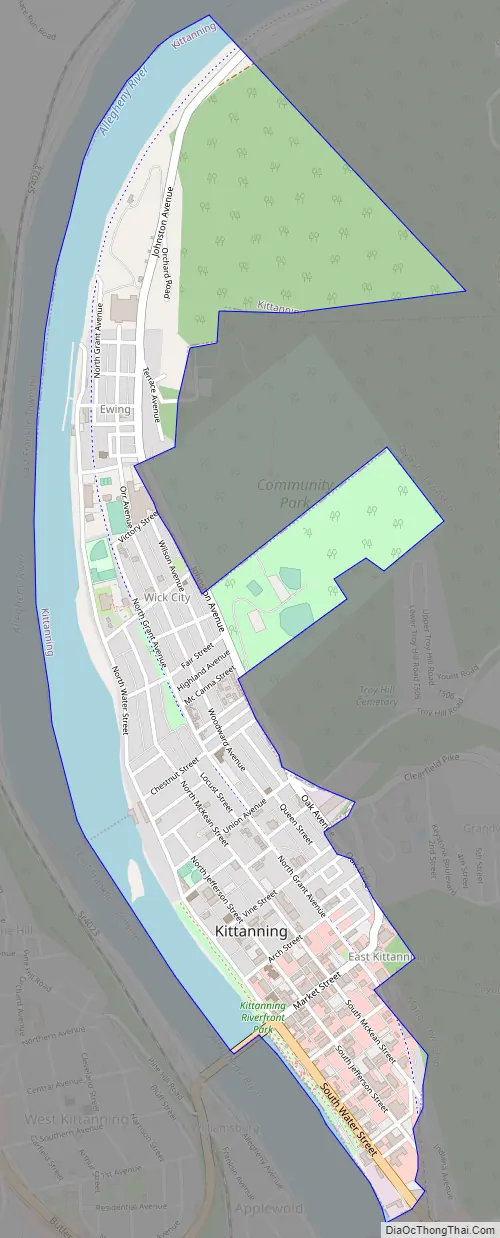
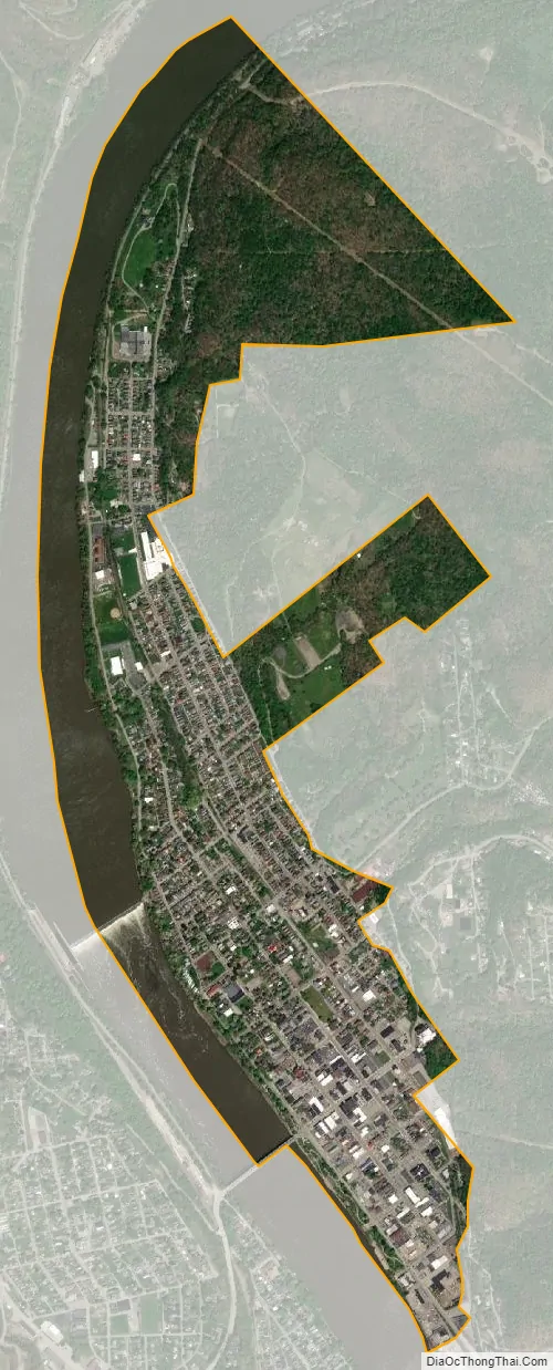
Kittanning city Satellite Map
Geography
Kittanning is located at 40°49′12″N 79°31′17″W / 40.82000°N 79.52139°W / 40.82000; -79.52139 (40.820085, -79.521398). According to the United States Census Bureau, the borough has a total area of 1.0 square mile (2.6 km), all land.
See also
Map of Pennsylvania State and its subdivision:- Adams
- Allegheny
- Armstrong
- Beaver
- Bedford
- Berks
- Blair
- Bradford
- Bucks
- Butler
- Cambria
- Cameron
- Carbon
- Centre
- Chester
- Clarion
- Clearfield
- Clinton
- Columbia
- Crawford
- Cumberland
- Dauphin
- Delaware
- Elk
- Erie
- Fayette
- Forest
- Franklin
- Fulton
- Greene
- Huntingdon
- Indiana
- Jefferson
- Juniata
- Lackawanna
- Lancaster
- Lawrence
- Lebanon
- Lehigh
- Luzerne
- Lycoming
- Mc Kean
- Mercer
- Mifflin
- Monroe
- Montgomery
- Montour
- Northampton
- Northumberland
- Perry
- Philadelphia
- Pike
- Potter
- Schuylkill
- Snyder
- Somerset
- Sullivan
- Susquehanna
- Tioga
- Union
- Venango
- Warren
- Washington
- Wayne
- Westmoreland
- Wyoming
- York
- Alabama
- Alaska
- Arizona
- Arkansas
- California
- Colorado
- Connecticut
- Delaware
- District of Columbia
- Florida
- Georgia
- Hawaii
- Idaho
- Illinois
- Indiana
- Iowa
- Kansas
- Kentucky
- Louisiana
- Maine
- Maryland
- Massachusetts
- Michigan
- Minnesota
- Mississippi
- Missouri
- Montana
- Nebraska
- Nevada
- New Hampshire
- New Jersey
- New Mexico
- New York
- North Carolina
- North Dakota
- Ohio
- Oklahoma
- Oregon
- Pennsylvania
- Rhode Island
- South Carolina
- South Dakota
- Tennessee
- Texas
- Utah
- Vermont
- Virginia
- Washington
- West Virginia
- Wisconsin
- Wyoming