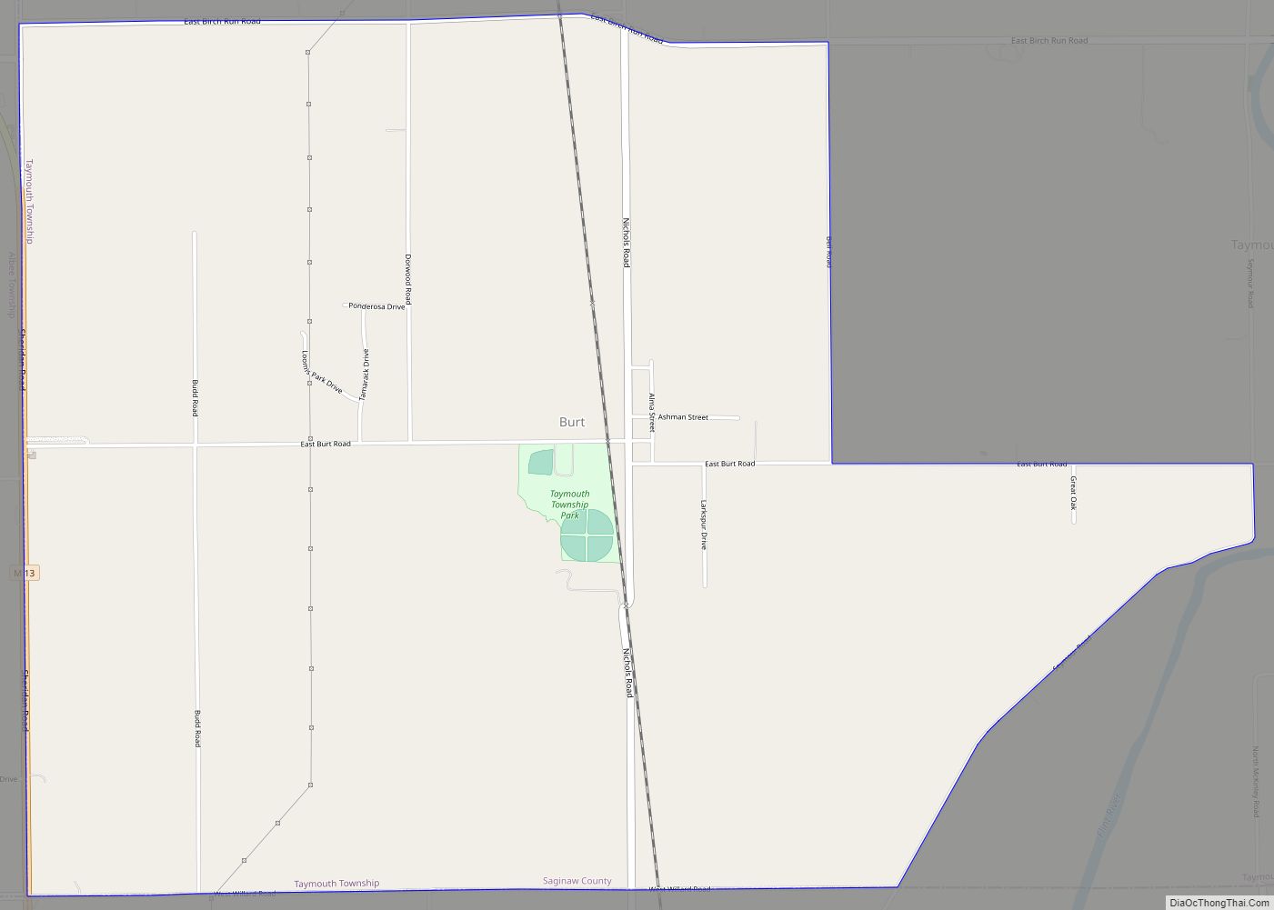
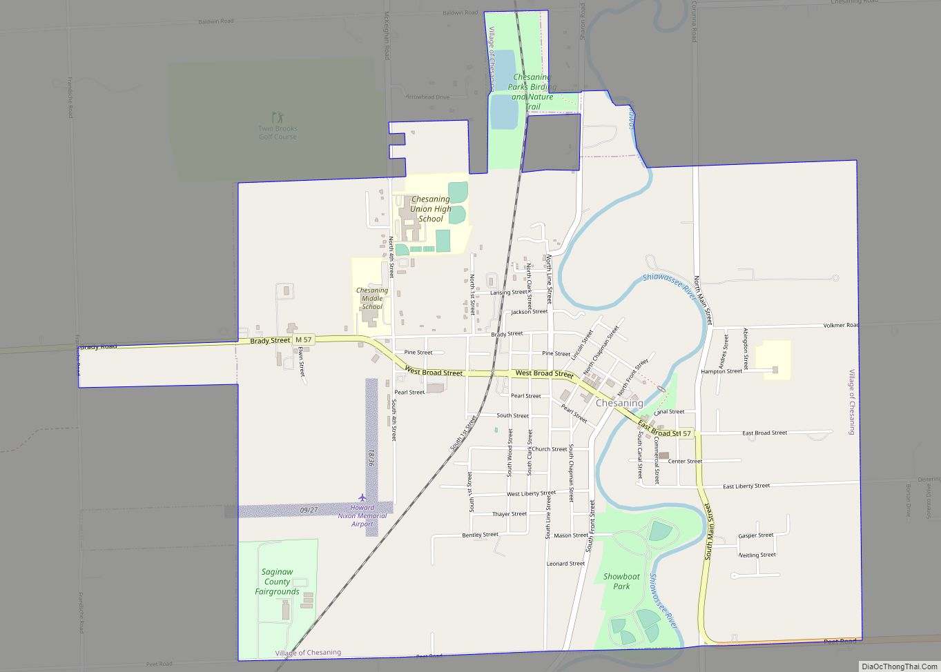
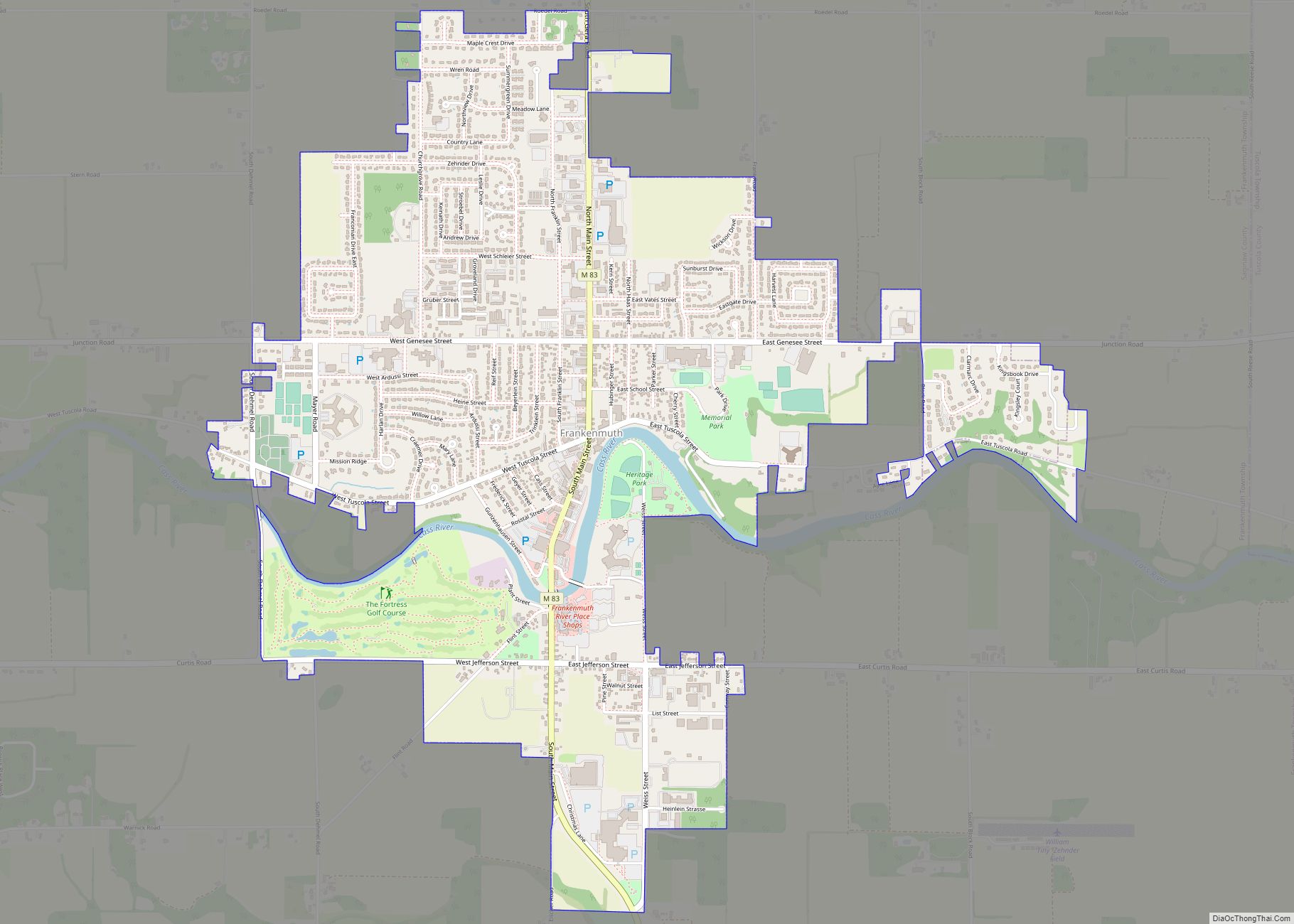
Saginaw County, officially the County of Saginaw, is a county located in the U.S. state of Michigan. As of the 2020 Census, the population was 190,124. The county seat is Saginaw. The county was created by September 10, 1822, and was fully organized on February 9, 1835. The etymology of the county’s name is uncertain. It may be derived from Sace-nong or Sak-e-nong (English: Sauk land), as the Sauk (French: Sac) tribe is believed by some to have once lived there. A more likely possibility is that it comes from Ojibwe words meaning “place of the outlet” –sag (English: an opening) and ong (English: place of). See List of Michigan county name etymologies.
Saginaw County comprises the Saginaw, MI Metropolitan Statistical Area and is included in the Saginaw-Midland-Bay City Combined Statistical Area, the 5th largest metropolitan area in Michigan.
| Name: | Saginaw County |
|---|---|
| FIPS code: | 26-145 |
| State: | Michigan |
| Founded: | February 9, 1835 |
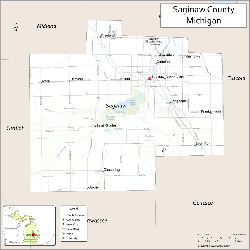
| Seat: | Saginaw |
| Largest city: | Saginaw |
| Total Area: | 816 sq mi (2,110 km²) |
| Land Area: | 800 sq mi (2,000 km²) |
| Total Population: | 190,124 |
| Population Density: | 250/sq mi (100/km²) |
| Time zone: | UTC−5 (Eastern) |
| Summer Time Zone (DST): | UTC−4 (EDT) |
| Website: | www.saginawcounty.com |
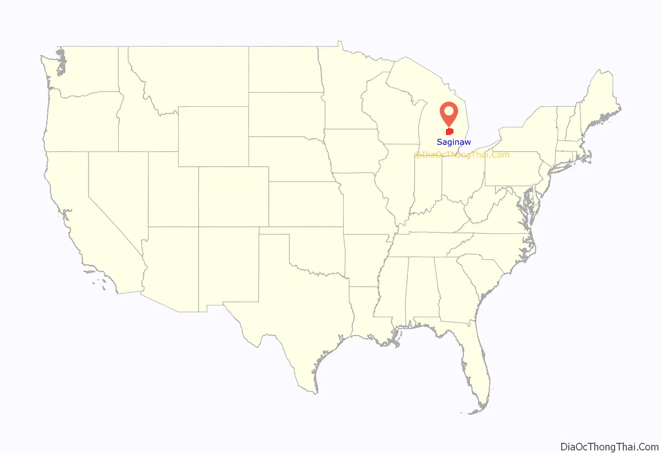
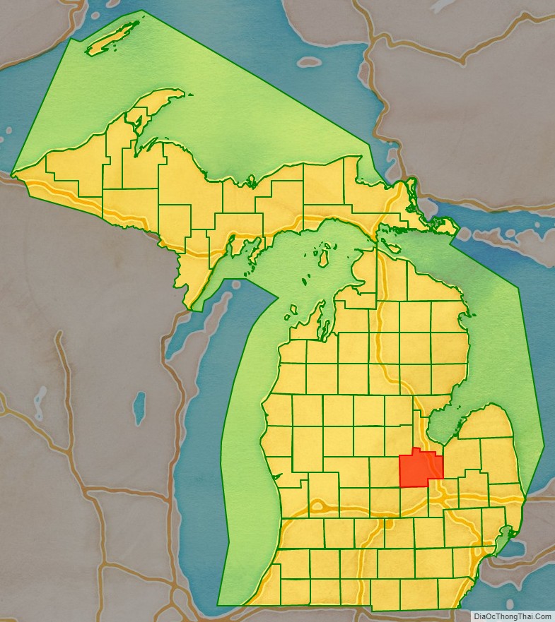
Saginaw County location map. Where is Saginaw County?
History
The area was inhabited from about 1000 B.C. to 1000 A.D. by the Native American Hopewell culture, followed by the Anishnabeg. Some historians believe that the Sauk at one time lived in the area and were driven out by Ojibwe (Chippewa), before the area was first visited by Europeans.
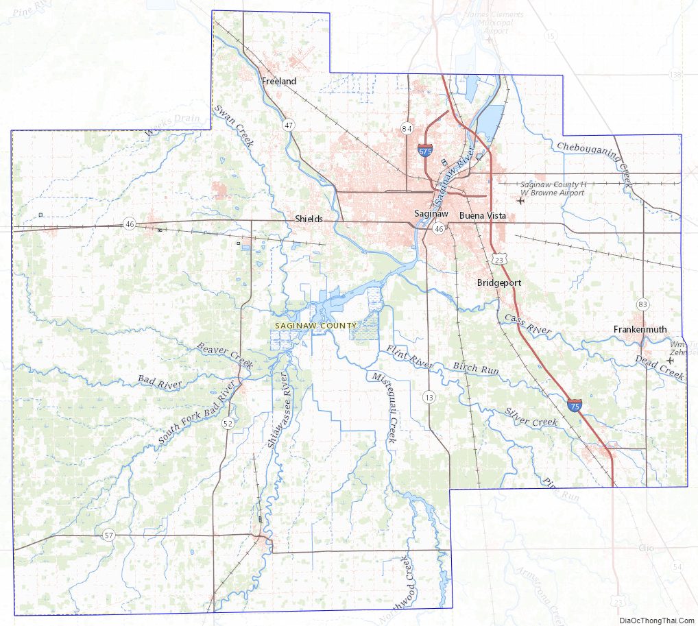
The Saginaw region includes an extensive network of many rivers and streams which converge into the Saginaw River and provided a means for easy travel for the Native American population among numerous settlements and hunting areas, as well as access to Lake Huron. Saginaw was also a frequent meeting location for councils of the Ojibwe, Pottawatomi, and Ottawa—the Three Fires of the Anishnabeg.
What is today Saginaw County was inhabited by the Ojibwe at the time of the arrival of Euro-Americans. The Ojibwe were still the dominant force in the area in the 1820s, and in 1827 they were attacked by a two groups of Winnebago people coming from Wisconsin. The Ojibwe prevailed in this fight with the aid of local Euro-American settlers.
In 1853 the Ojibwe and Ottawa both established large hunting camps along the Saginaw River, although Euro-American settlers were beginning to establish saw mills and farms in the area by that point.
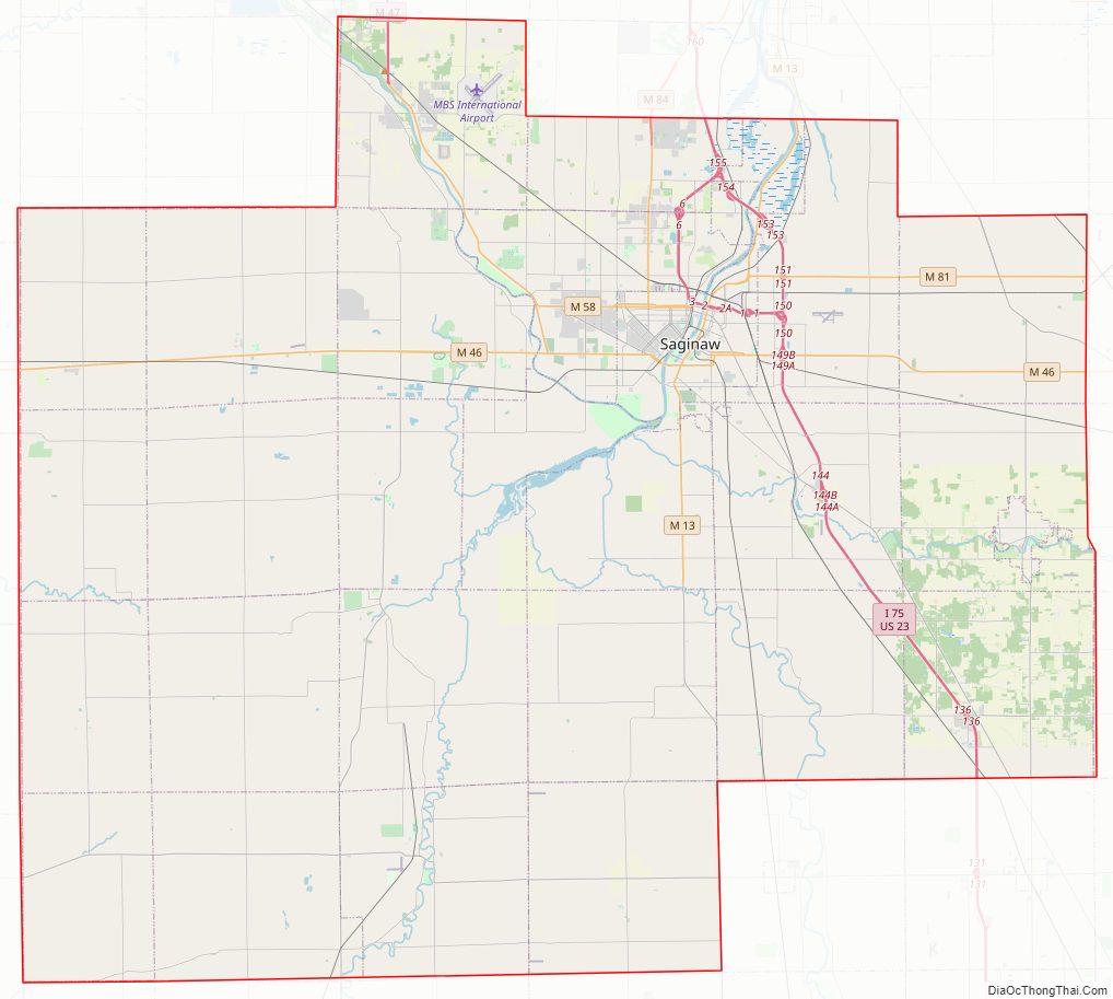
Saginaw County Road Map
Geography
According to the U.S. Census Bureau, the county has a total area of 816 square miles (2,110 km), of which 800 square miles (2,100 km) is land and 16 square miles (41 km) (1.9%) is water. It is part of the Flint/Tri-Cities region of Mid-Michigan. The median elevation in Saginaw County, Michigan is 620 feet (190 m) above sea level.
Primary rivers
- Saginaw River
- Shiawassee River
- Cass River
- Flint River
- Bad River
- Tittabawassee River
- Shiawassee River
Wildlife refuge
- Shiawassee National Wildlife Refuge
Adjacent counties
- Bay County (northeast)
- Midland County (northwest)
- Tuscola County (east)
- Gratiot County (west)
- Genesee County (southeast)
- Shiawassee County (south)
- Clinton County (southwest)
Saginaw County Topographic Map
Saginaw County Satellite Map
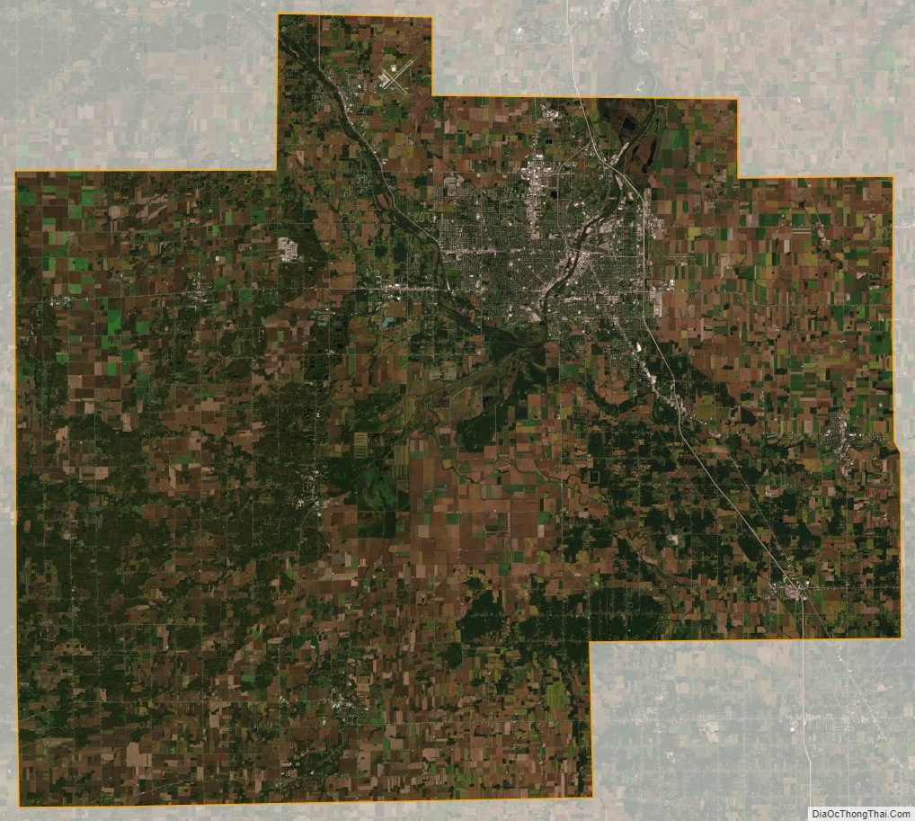
Saginaw County Outline Map