| Name: | Buena Vista City |
|---|---|
| FIPS code: | 51-530 |
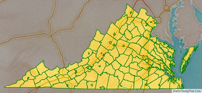
| State: | Virginia |
| Total Area: | 6.52 sq mi (16.89 km²) |
| Land Area: | 6.44 sq mi (16.67 km²) |
| Total Population: | 6,641 |
| Population Density: | 1,000/sq mi (390/km²) |
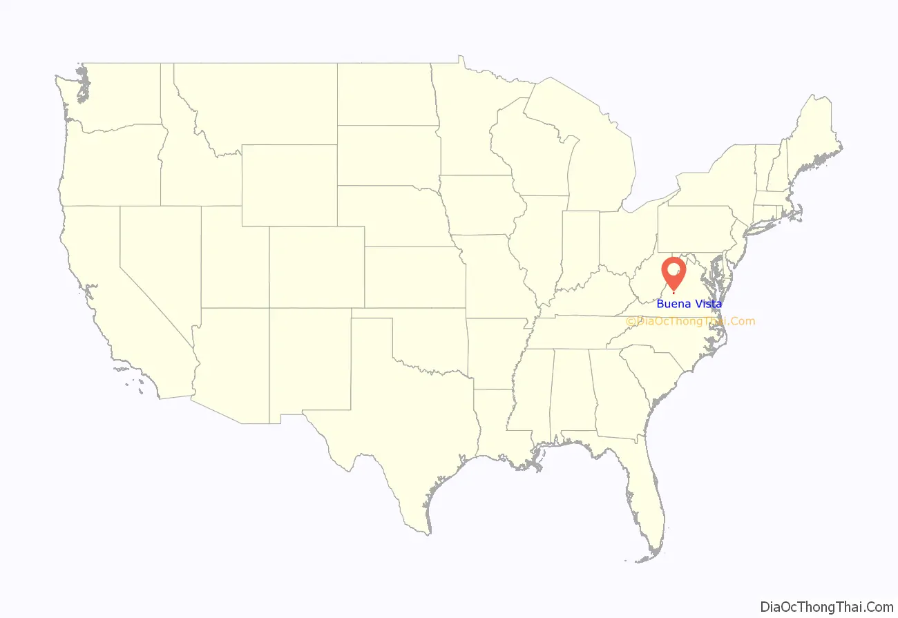
Buena Vista City location map. Where is Buena Vista City?
History
Formerly named Hart’s Bottom, Green Forest or Green Valley until 1888, and chartered as a town in 1890, Buena Vista separated politically from surrounding Rockbridge County when granted a city charter on February 15, 1892.
The Buena Vista Downtown Historic District, Buena Vista Colored School, Cedar Hill, Glen Maury, Old Courthouse, Southern Seminary Main Building, and W.N. Seay House are listed on the National Register of Historic Places.
Early history
Founded by Benjamin C. Moomaw in the late 1800s, the town consisted only of a simple tannery at the intersection of two railroads and a canal. The Richmond and Alleghany Railroad and the Shenandoah Valley Railroad, stood alongside the James River Canal that had been used to transport materials from the Atlantic ports of Virginia to Lexington since the 18th century, but by the founding of the city had been converted for the distribution of water power. After opening the tannery, Moomaw opened a pulp mill and a canning factory. In 1882 Appold & Sons Tannery opened, and the first public school opened in 1885.
In 1893, the town was described as “one of the many new towns that seem to have sprung up as if by magic in some parts of Virginia.” Previous to 1889 none of the 600 dwellings, churches, stores, hotels and other buildings in the town had been built “but where are streets and all that goes to make a booming city the reapers that year gathered a luxuriant crop of wheat.” In December 1888, Moomaw wrote the Buena Vista Prospectus to organize a town and began selling stock. “It took only 30 days for all the stock to be sold for a total of $400,000. With the sale completed, it was time to lay out the town and begin recruiting people and industries.” On February 22, 1889, a large deposit of iron ore was reportedly discovered that resulted in a boom of economic activity that lasted until March 4, 1892. In just those three years the community grew extensively, adding a new brick school house, an opera house, two churches, a luxury hotel, a new Masonic Lodge (Buena Vista Lodge No. 186), a paper and pulp mill, a saddle factory, a cashmere mill, two brick and clay works, a wagon works, two banks, an egg crate factory, an electric light plant, a furniture and chair factory, a boiler factory, an iron furnace and steel factory, a glass foundry, and several wood and lumber establishments.
Flooding
Buena Vista is situated on the east side of the Maury River at the western foot of the Blue Ridge Mountains. The Maury has a history of destructive floods damaging nearby communities. Particularly notable were floods on Oct 12, 1870, on the death of Robert E. Lee, when the Maury River provided Lee a temporary coffin due to a dock washed away up river (source: Library Virginia Military Institute), and in 1936, 1969, 1985 and 1995. The Flood of ’69 was the result of rainfall from the inland movement of Hurricane Camille. The Flood of ’85 resulted from the convergence of three systems, including Hurricane Juan, which dumped tremendous amounts of rain on western Virginia. The flood of record for the lower Maury River (downstream of the confluence with the South River), including Buena Vista and Glasgow, occurred on August 20, 1969, at a stage of 31.23 feet (9.52 m) on the Buena Vista gauge. (Flooding begins at 17.0 feet (5.2 m) and major flooding at 21.0 feet (6.4 m).) The downtowns of Buena Vista and Glasgow were submerged in over 5 feet (1.5 m) of water. The upper Maury River including Lexington saw its flood of record during the Flood of 1985 when the gauging station at Rockbridge Baths recorded a value of 19.19 feet (5.85 m) from flood marks. The difference in flooding results from differing contributions of the South River depending on rainfall in the respective watersheds.
The James C. Olin Flood Control Project was completed in 1997 to reduce the potential for damage from flooding of the Maury River and inland streams in Buena Vista. The project consists of a 2.5-mile levee wall, topped by a walking trail known as the River Walk.
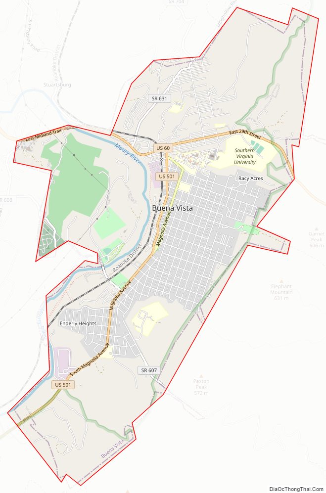
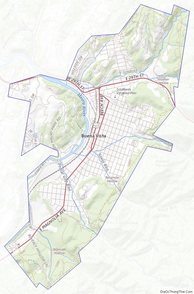
Buena Vista City Road Map
Geography
Buena Vista is located at 37°44′04″N 79°21′15″W / 37.73444°N 79.35417°W / 37.73444; -79.35417 (37.734455, -79.354277). It is surrounded by, but separate from, Rockbridge County. The Maury River forms part of the western boundary of Buena Vista, with the city limits crossing the river in one area to encompass Glen Maury Park on the west side.
U.S. Route 60 passes through the north side of Buena Vista, leading northwest 6 miles (10 km) to Lexington and east across the Blue Ridge Mountains 26 miles (42 km) to Amherst. US 60 intersects Interstate 81 3.5 miles (5.6 km) west of Buena Vista. U.S. Route 501 has its northern terminus in the city and leads south 38 miles (61 km) to Lynchburg, passing through the James River gorge.
According to the United States Census Bureau, the city has a total area of 6.8 square miles (17.6 km), of which 6.7 square miles (17.4 km) is land and 0.1 square miles (0.2 km), or 1.27%, is water.
Buena Vista City Topographic Map
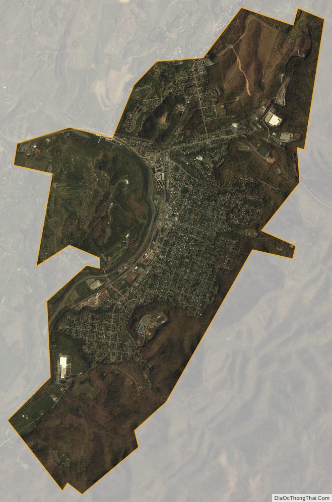
Buena Vista City Satellite Map
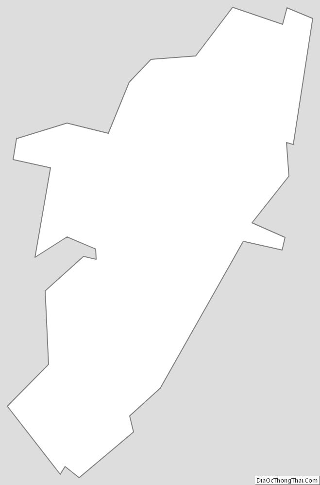
Buena Vista City Outline Map