Amherst (formerly Dearborn) is a town in Amherst County, Virginia, United States. The population was 2,231 at the 2010 census. It is the county seat of Amherst County.
Amherst is part of the Lynchburg Metropolitan Statistical Area.
| Name: | Amherst town |
|---|---|
| LSAD Code: | 43 |
| LSAD Description: | town (suffix) |
| State: | Virginia |
| County: | Amherst County |
| Elevation: | 761 ft (232 m) |
| Total Area: | 4.92 sq mi (12.75 km²) |
| Land Area: | 4.90 sq mi (12.70 km²) |
| Water Area: | 0.02 sq mi (0.05 km²) |
| Total Population: | 2,231 |
| Population Density: | 444.72/sq mi (171.70/km²) |
| ZIP code: | 24521 |
| Area code: | 434 |
| FIPS code: | 5101672 |
| GNISfeature ID: | 1498447 |
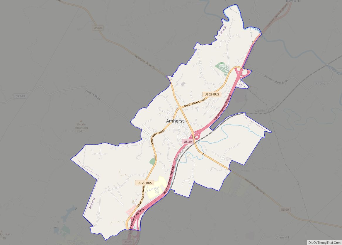
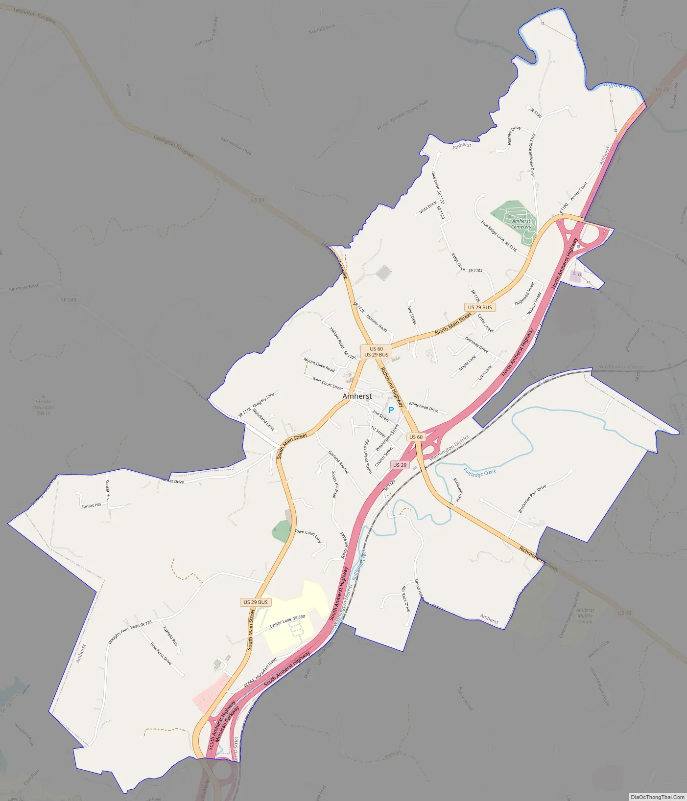
Online Interactive Map
Click on ![]() to view map in "full screen" mode.
to view map in "full screen" mode.
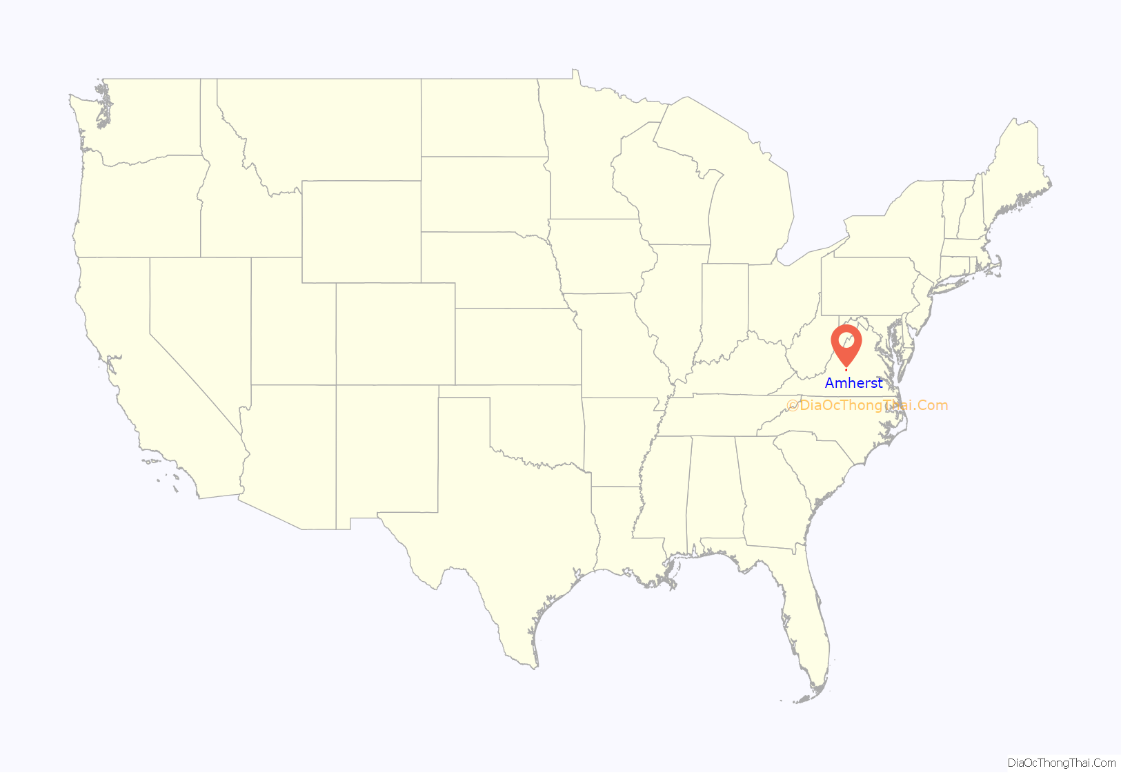
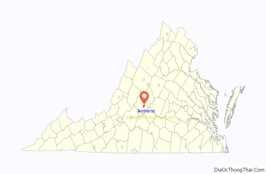
Amherst location map. Where is Amherst town?
History
Amherst was founded in 1807. Originally known as “The Oaks” and “Seven Oaks”, it began as a mere stagecoach station on the Charlottesville-Lynchburg road. Once Nelson County was separated from Amherst County in 1807, the community became the seat of Amherst County. It was at this time that the village decided to rename itself in honor of French and Indian War hero Jeffery Amherst, 1st Baron Amherst. Major-General Amherst had been the hero of the Battle of Ticonderoga and later served as the governor of the Colony of Virginia from 1763 to 1768.
In 1847, local planter William Waller, aged 58, walked from Amherst to Louisiana with about 20 slaves for sale. His letters home during the trip, held by the Virginia Historical Society, provide rare documentation of a slave coffle.
On April 15, 1910, Amherst was incorporated by the order of the Circuit Court. A charter was granted to the town by the General Assembly in 1950.
The official town seal was created by Ward Cruea, a commercial artist from Dayton, Ohio. His original proposal featured the “sleeping giant” (the Blue Ridge Mountain ridgeline west of Amherst), but this was rejected since it represented an area outside the town’s limits. According to town legend, while a group was in the Clerk’s office in the town hall engaged in conversation on the topics of the day, and looking eastward along E. Court Street, it was suggested that the Amherst courthouse be used as a model for the official seal. During that era, a large letter “A” was attached to a radio antenna tower beside the telephone company building that was adjacent to the courthouse. This internally illuminated “A” was used as a visual navigation beacon by aircraft pilots. Approximately six months later Cruea returned to the town and delivered a framed original of a proposed seal. His proposal incorporated the courthouse, the “A” and the town’s date of incorporation. Cruea’s proposal was adopted soon thereafter and became Amherst’s official seal. The original seal is located on the wall of the town council chambers.
One of the main landmarks of Amherst is the roundabout located at the intersection of Main Street and U.S. Route 60. “The Circle,” as it is affectionately referred to by Amherst residents, is the oldest traffic circle in the VDOT system. The fountain and the landscaping at the circle were installed and are maintained by the Village Garden Club.
Another landmark of Amherst is the Amherst County courthouse. An original courthouse was built in 1809 but was torn down in 1872, and the current courthouse was built shortly thereafter. All Amherst County records have been stored in the courthouse since 1761 when Amherst‑Nelson counties were divided from Albemarle County.
The Thompson’s Mill-Amherst Mill Complex was previously home to Amherst Milling Co. The main building is an “evolved” structure with elements dating from at least the late 19th-century. It was active in the production of cornmeal and flour before closing in 2017. In 2018, the Virginia Department of Historic Resources placed the building on its Virginia Landmarks Register.
Other important sites located in or near the town include the Bear Mountain Indian Mission School, Edgewood, 1818, Edgewood, 1858, Fairview, Forest Hill, The Glebe, Dulwich Manor, and Tusculum. These places are also listed on the National Register of Historic Places.
Amherst Road Map
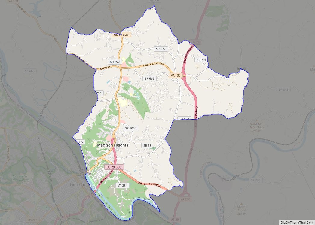
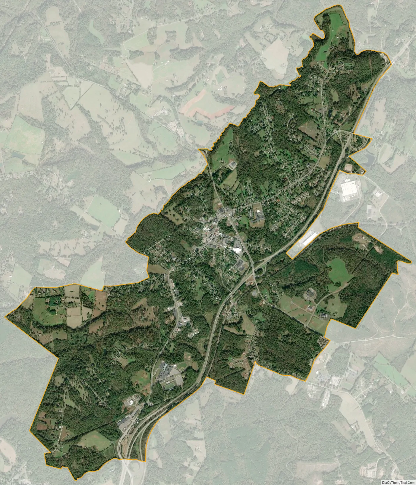
Amherst city Satellite Map
Geography
Amherst is located at 37°34′37″N 79°3′2″W / 37.57694°N 79.05056°W / 37.57694; -79.05056 (37.576899, −79.050424). According to the United States Census Bureau, the town has a total area of 5.0 square miles (12.9 km), all of it land.
Amherst is 25 miles southeast of Lexington, 44 miles southwest from Charlottesville, 20 miles northwest from Appomattox, and only 13 miles north of Lynchburg.
See also
Map of Virginia State and its subdivision:- Accomack
- Albemarle
- Alexandria
- Alleghany
- Amelia
- Amherst
- Appomattox
- Arlington
- Augusta
- Bath
- Bedford
- Bedford City
- Bland
- Botetourt
- Bristol
- Brunswick
- Buchanan
- Buckingham
- Buena Vista
- Campbell
- Caroline
- Carroll
- Charles City
- Charlotte
- Charlottesville
- Chesapeake
- Chesterfield
- Clarke
- Clifton Forge City
- Colonial Heights
- Covington
- Craig
- Culpeper
- Cumberland
- Danville
- Dickenson
- Dinwiddie
- Emporia
- Essex
- Fairfax
- Fairfax City
- Falls Church
- Fauquier
- Floyd
- Fluvanna
- Franklin
- Frederick
- Fredericksburg
- Galax
- Giles
- Gloucester
- Goochland
- Grayson
- Greene
- Greensville
- Halifax
- Hampton
- Hanover
- Harrisonburg
- Henrico
- Henry
- Highland
- Hopewell
- Isle of Wight
- James City
- King and Queen
- King George
- King William
- Lancaster
- Lee
- Lexington
- Loudoun
- Louisa
- Lunenburg
- Lynchburg
- Madison
- Manassas
- Manassas Park
- Martinsville
- Mathews
- Mecklenburg
- Middlesex
- Montgomery
- Nelson
- New Kent
- Newport News
- Norfolk
- Northampton
- Northumberland
- Norton
- Nottoway
- Orange
- Page
- Patrick
- Petersburg
- Pittsylvania
- Poquoson
- Portsmouth
- Powhatan
- Prince Edward
- Prince George
- Prince William
- Pulaski
- Radford
- Rappahannock
- Richmond
- Roanoke
- Roanoke City
- Rockbridge
- Rockingham
- Russell
- Salem
- Scott
- Shenandoah
- Smyth
- Southampton
- Spotsylvania
- Stafford
- Staunton
- Suffolk
- Surry
- Sussex
- Tazewell
- Virginia Beach
- Warren
- Washington
- Waynesboro
- Westmoreland
- Williamsburg
- Winchester
- Wise
- Wythe
- York
- Alabama
- Alaska
- Arizona
- Arkansas
- California
- Colorado
- Connecticut
- Delaware
- District of Columbia
- Florida
- Georgia
- Hawaii
- Idaho
- Illinois
- Indiana
- Iowa
- Kansas
- Kentucky
- Louisiana
- Maine
- Maryland
- Massachusetts
- Michigan
- Minnesota
- Mississippi
- Missouri
- Montana
- Nebraska
- Nevada
- New Hampshire
- New Jersey
- New Mexico
- New York
- North Carolina
- North Dakota
- Ohio
- Oklahoma
- Oregon
- Pennsylvania
- Rhode Island
- South Carolina
- South Dakota
- Tennessee
- Texas
- Utah
- Vermont
- Virginia
- Washington
- West Virginia
- Wisconsin
- Wyoming