Located on the West African coast, Liberia covers an area of 111,369 sq. km.
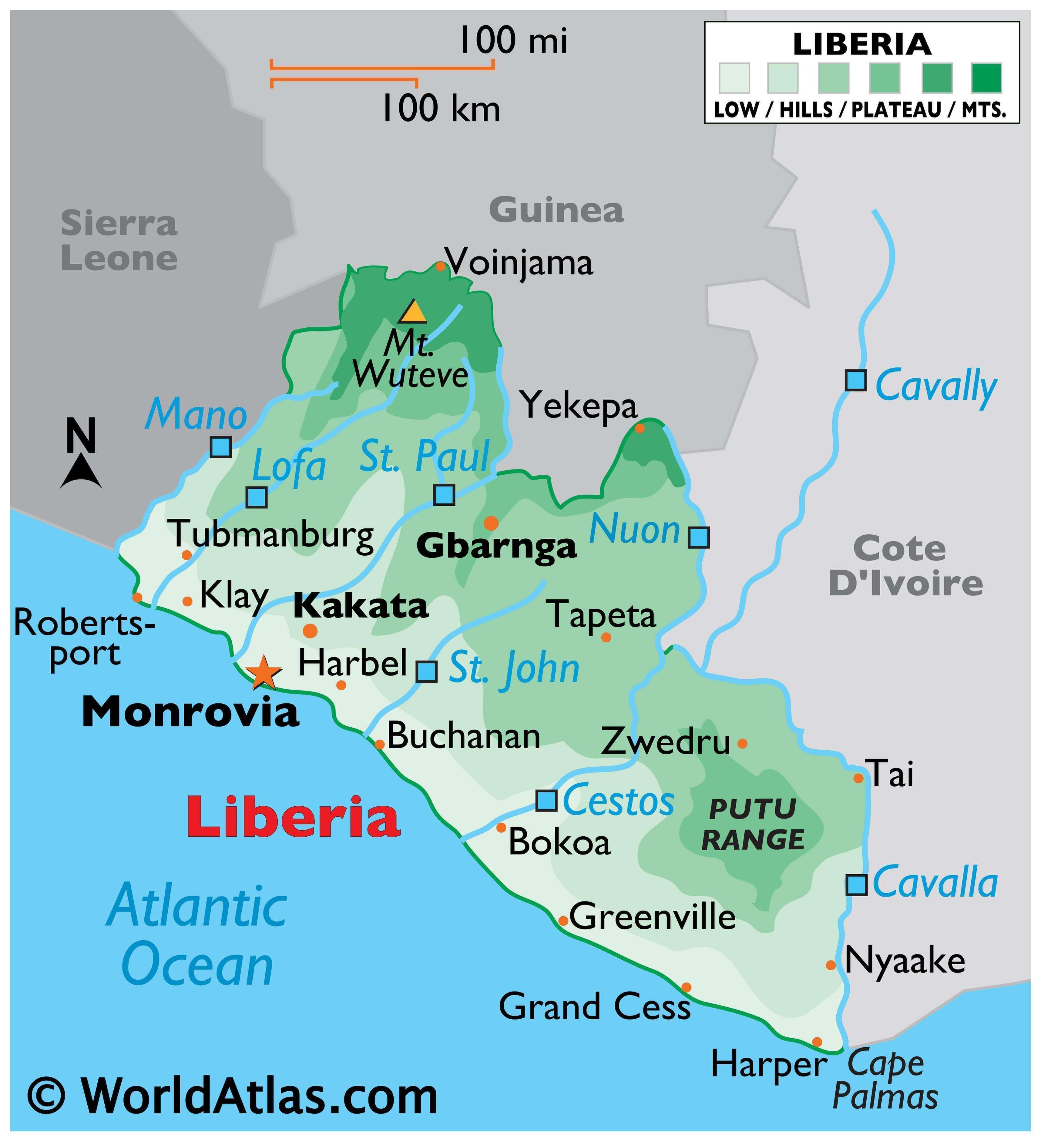
Four physiographic regions run nearly parallel to the Atlantic coast of the country. As observed on Liberia’s physical map, the elevation of the land gradually increases with distance from the coast.
The coastal plains are around 560 km long and 40 km wide and feature sandy beaches, lagoons, mangrove swamps, and some rocky outcrops.
Next is the region of rolling hills about 32 km wide and an average elevation of 90 m.
Beyond that is a dissected plateau with scattered mountains.
Finally, there is a mountainous highland region to the north hosting the country’s highest point, the 1,440 m high Mount Wuteve, which has been marked on the map by an upright yellow triangle.
The lowest point of the country is the Atlantic Ocean at 0m.
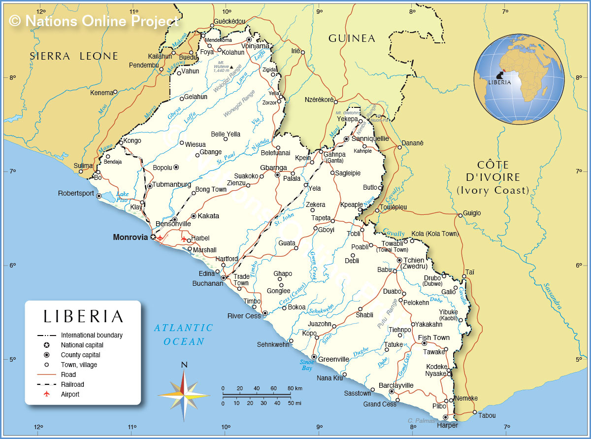
The country’s major rivers include the Mano River in the northwest and the Cavalla River in the southeast.
The Cavalla is the longest river in the nation at 320 mi (515 km). 15th-century Portuguese navigators named it for the cavalla (or horse mackerel) found at its mouth.
Additional rivers of note are the Lofa, St. Paul, St. John and Cestos River, all of which flow into the Atlantic.
| Flag: |  |
|---|---|
| Legal Name: | Republic of Liberia |
| Capital Value: | Monrovia |
| Largest City: |
Monrovia (1,517,235) |
| Official languages: | English |
| Demonym(s): | Liberian |
| Government: | Unitary presidential constitutional republic |
| Legislature: | Legislature of Liberia |
| Total Area: | 111,369 km² |
| Land Area: | 96,320 km² |
| Water Area: | 15,049 km² |
| Population: | 4,937,374 |
| Density: | 92.0/sq mi (35.5/km) (180th) |
| GDP: | $3.07 Billion |
| GDP Per Capita: | $621.89 |
| Currency Value: | Liberian dollars (LRD) |
| Driving side: | right |
| Calling code: | +231 |
| Internet TLD: | .lr |
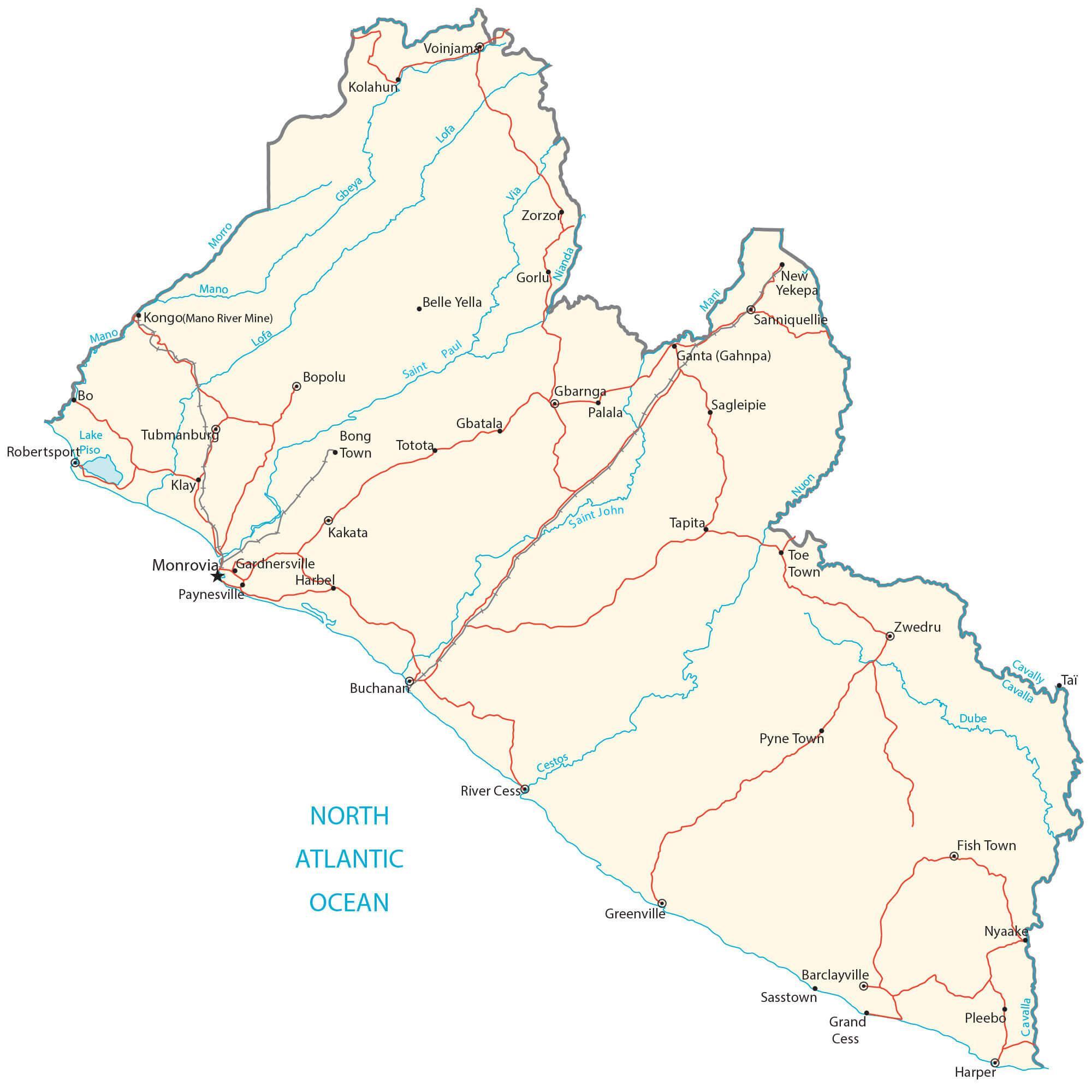
Liberia is a country in West Africa that is home to some of the most unique and beautiful landscapes. From its coastal plains to the Guinea Highlands, explore the terrain of Liberia via this interactive map. Discover its major cities, towns, roads, lakes, and rivers and get a better understanding of the country’s topography.
Online Interactive Political Map
Click on ![]() to view map in "full screen" mode.
to view map in "full screen" mode.
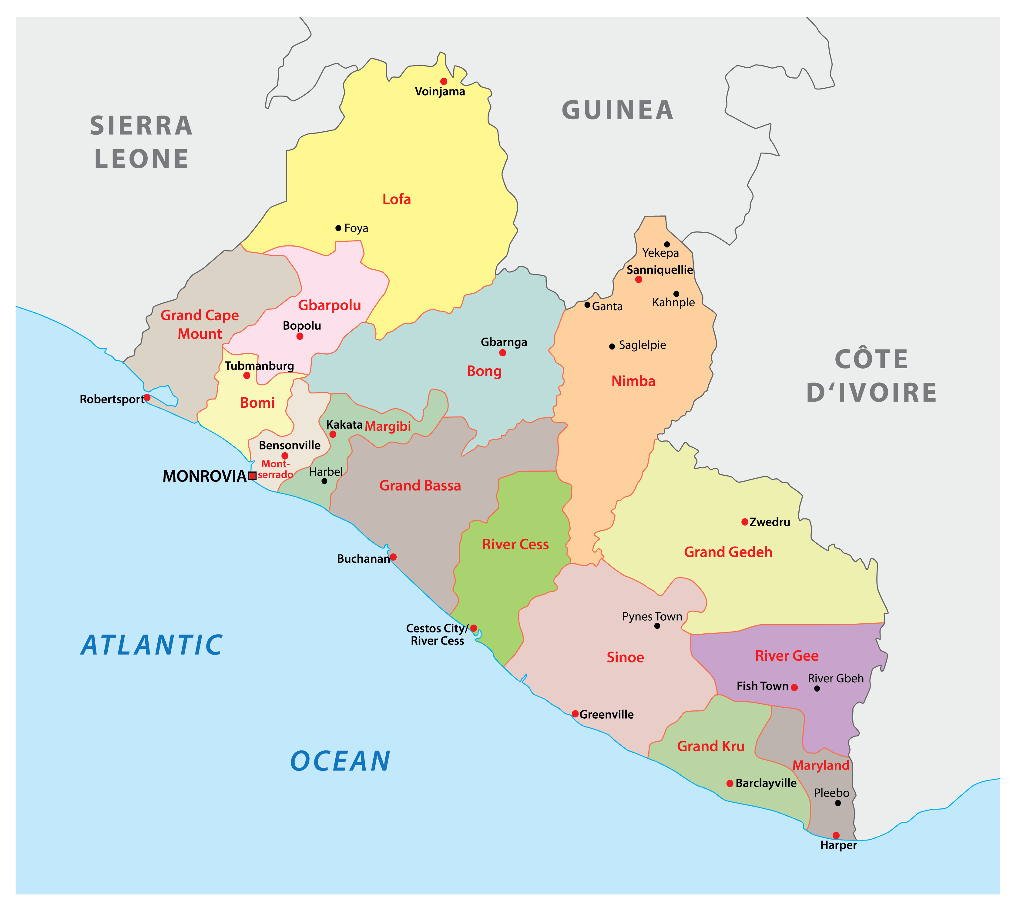
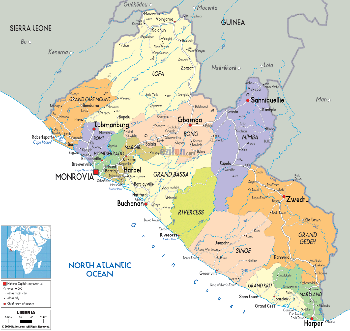
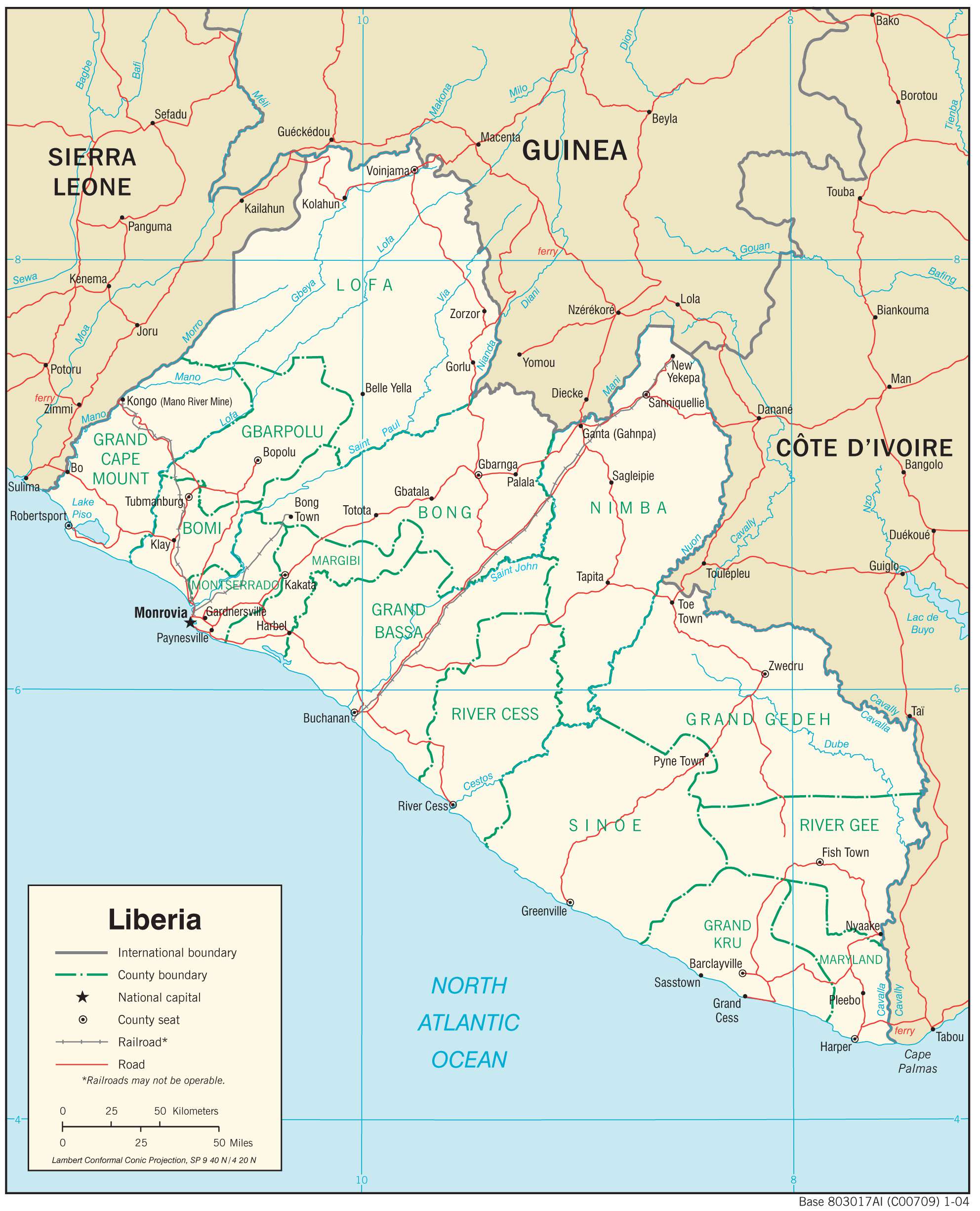
Liberia is divided into 15 counties which are subdivided into 90 and further into clans.
In alphabetical order, the 15 counties are Bomi, Bong, Gbarpolu, Grand Bassa, Grand Cape Mount, Grand Gedeh, Grand Kru, Lofa, Margibi, Maryland, Montserrado, Nimba, River Cess, River Gee, and Sinoe.
With an area of 11,551 sq. km, Nimba is the largest country and Montserrado is the most populous one.
The national capital of Monrovia is located in Montserrado.
Location Maps
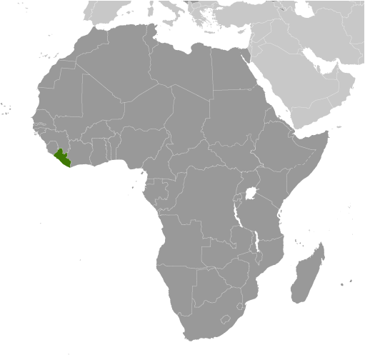
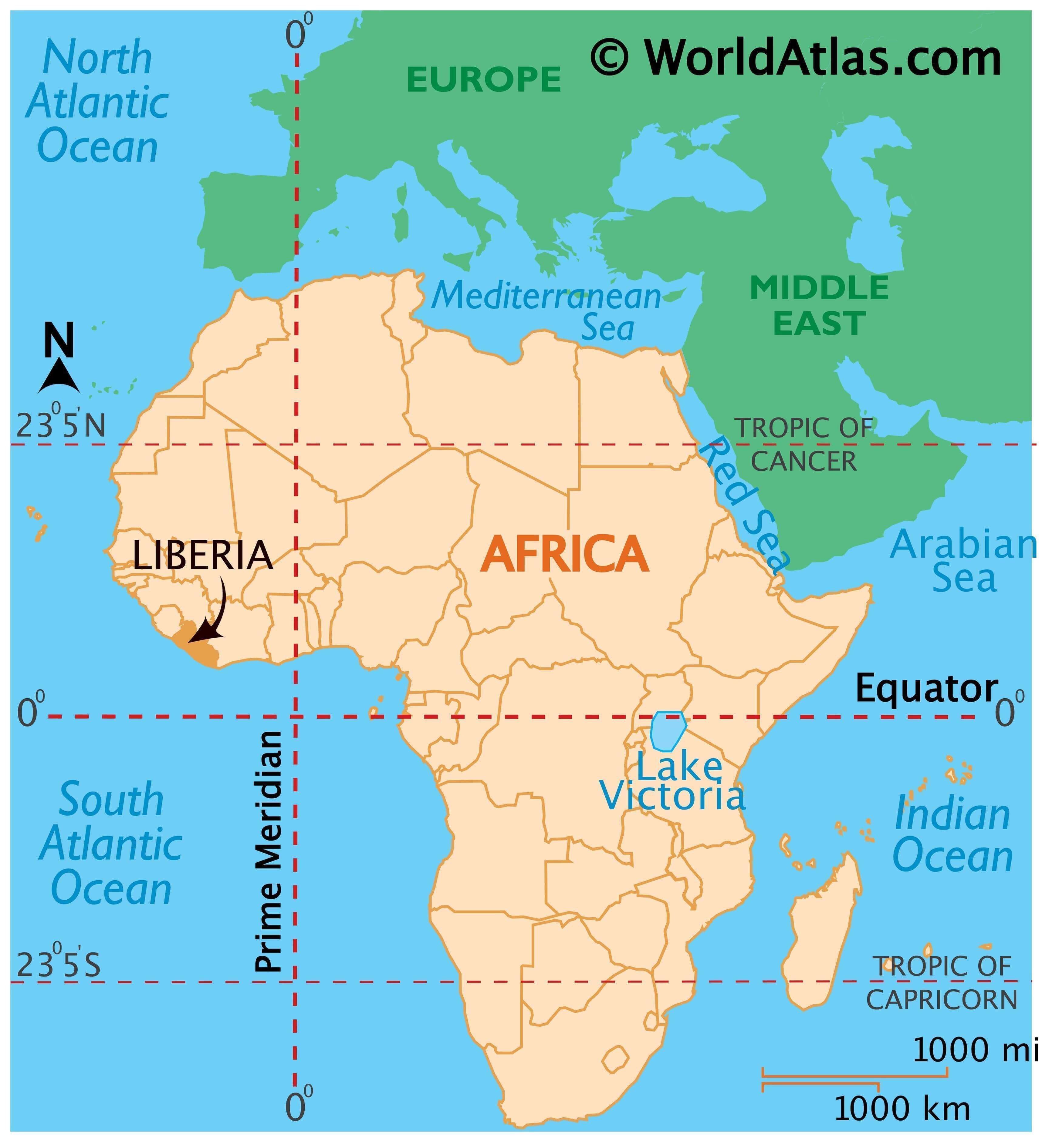
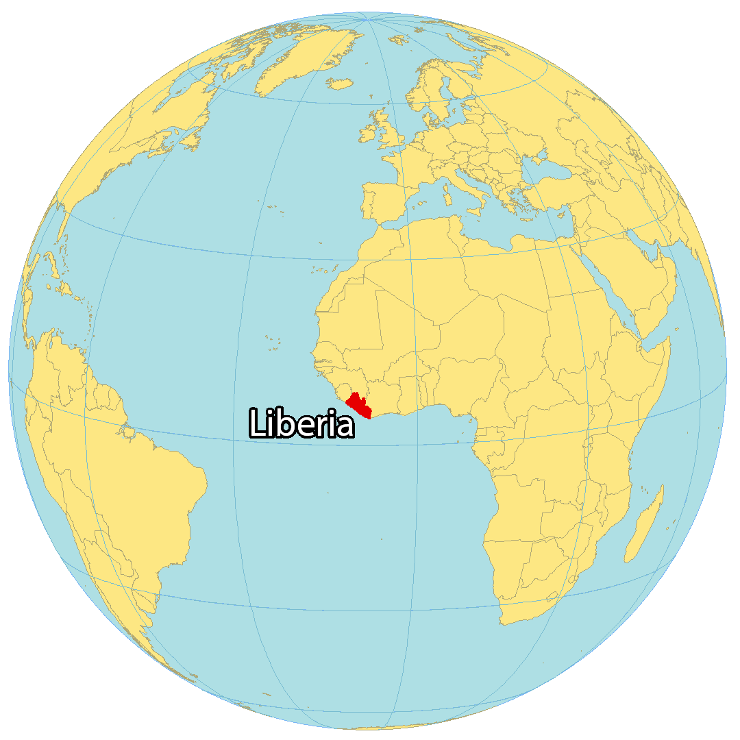
Where is Liberia?
Liberia is situated in Western Africa, and is bordered by Sierra Leone to the northwest, Guinea to the north, and Ivory Coast to the east. Its coastline is 580 kilometers (360 mi) long, and borders the Atlantic Ocean. The nation is known for its long-standing civil war, its status as Africa’s oldest republic, and its clean cities.
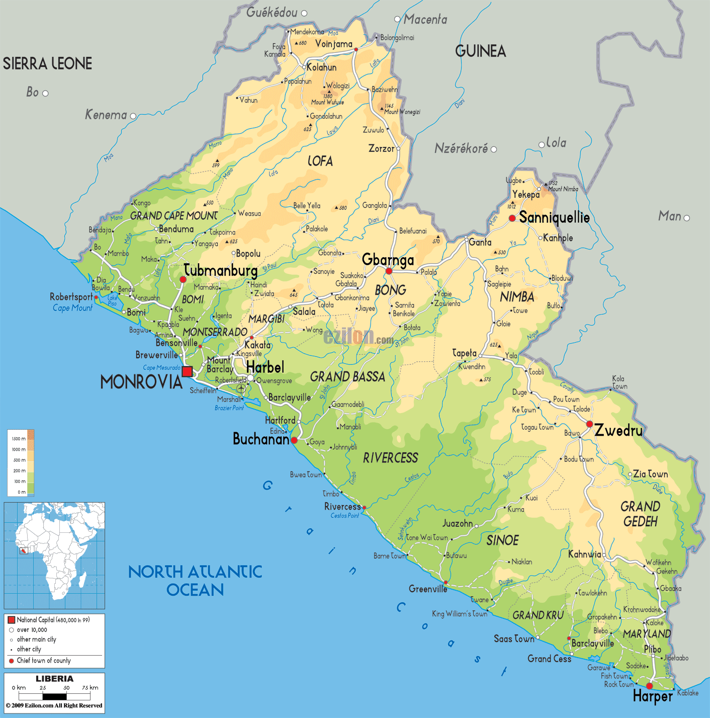
Monrovia is the capital and largest city in Liberia. Other major cities are Gbarnga, Kakata, and Bensonville. The terrain in Liberia is mainly flat plains, with some rolling hills in the northeast and southeast.
High Definition Political Map of Liberia
Physical Map of Liberia

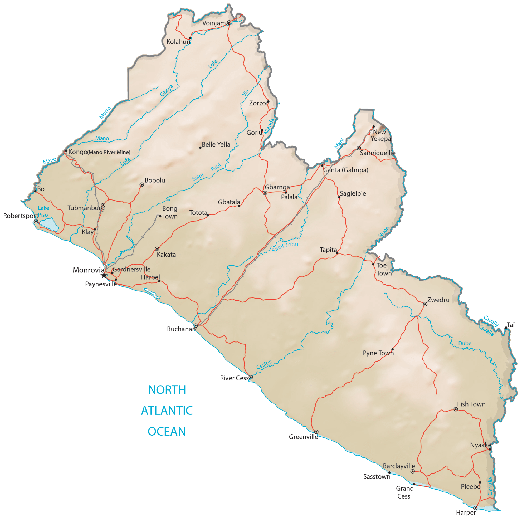
Transportation Map of Liberia
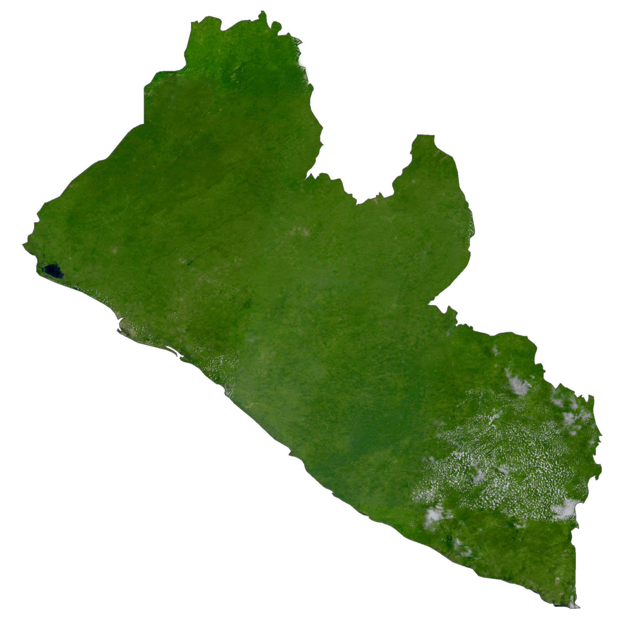
Liberia Satellite Map