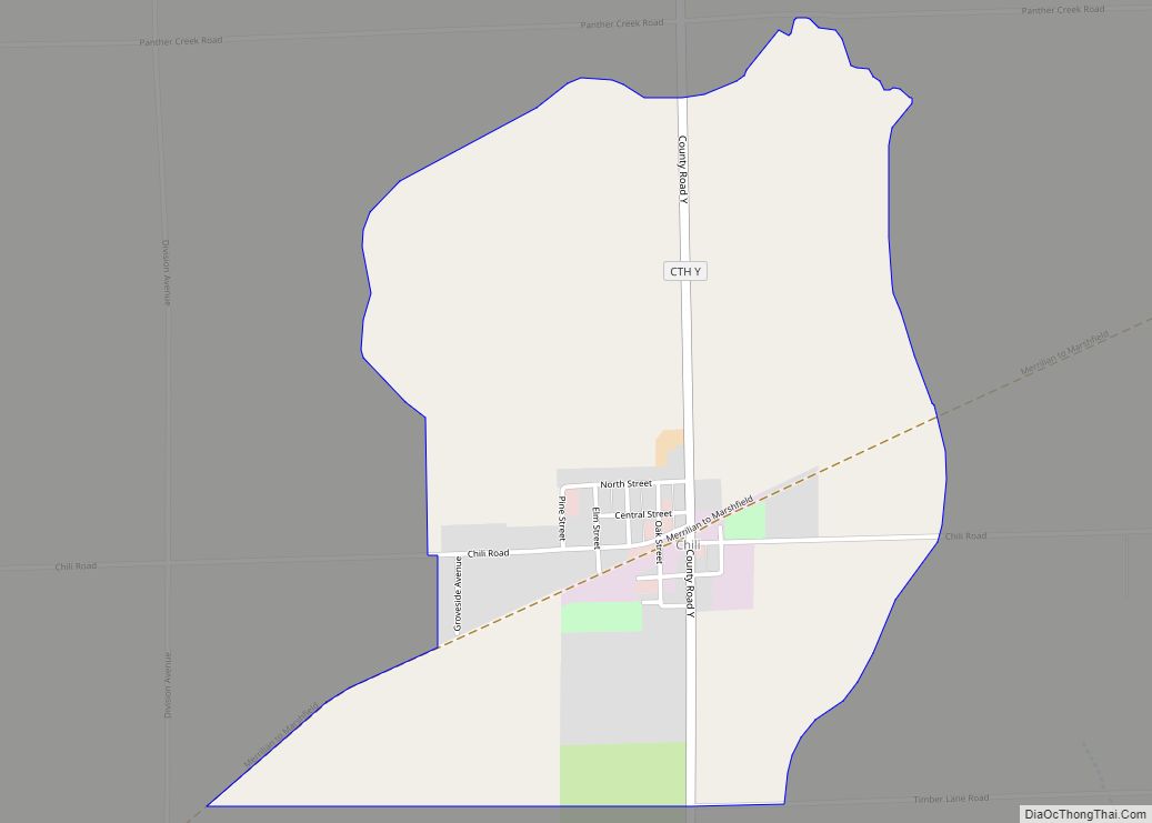
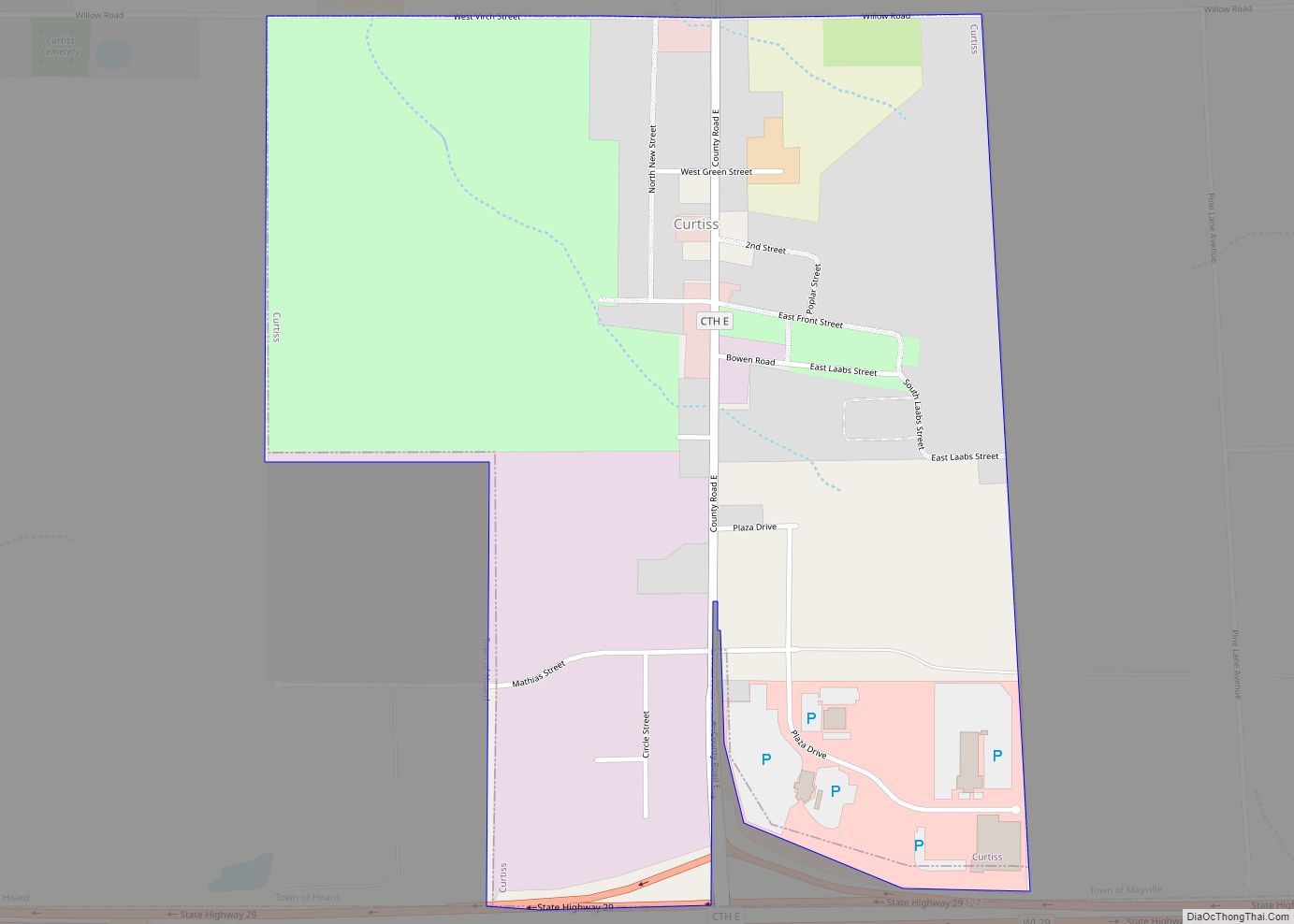
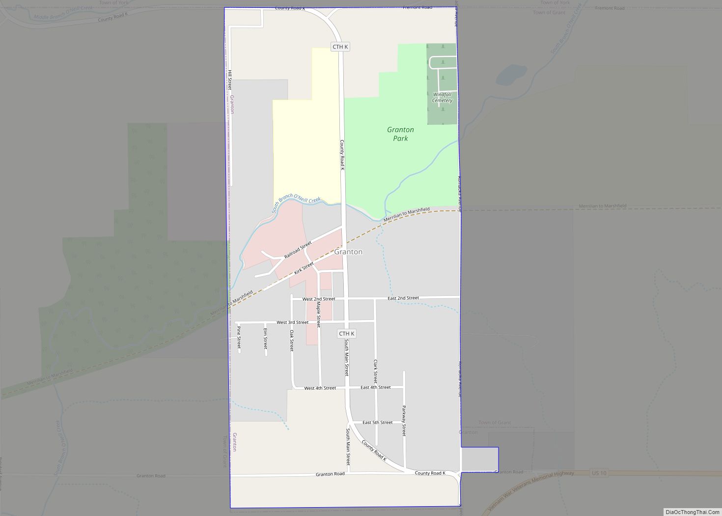
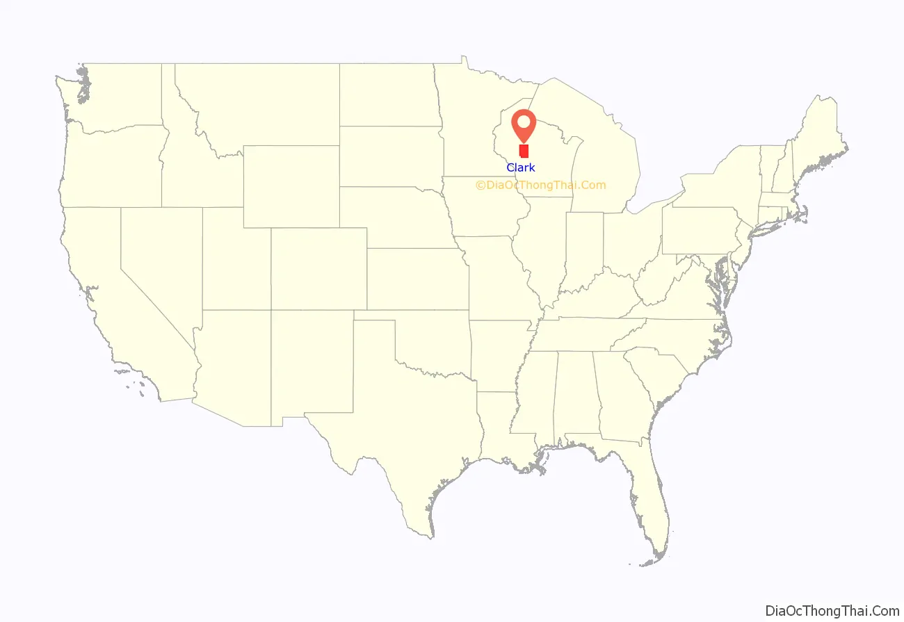
Clark County is a county in the U.S. state of Wisconsin. As of the 2020 census, the population was 34,659. Its county seat is Neillsville.
| Name: | Clark County |
|---|---|
| FIPS code: | 55-019 |
| State: | Wisconsin |
| Founded: | 1854 |
| Named for: | George Rogers Clark |
| Seat: | Neillsville |
| Largest city: | Neillsville |
| Total Area: | 1,219 sq mi (3,160 km²) |
| Land Area: | 1,210 sq mi (3,100 km²) |
| Total Population: | 34,659 |
| Population Density: | 28.7/sq mi (11.1/km²) |
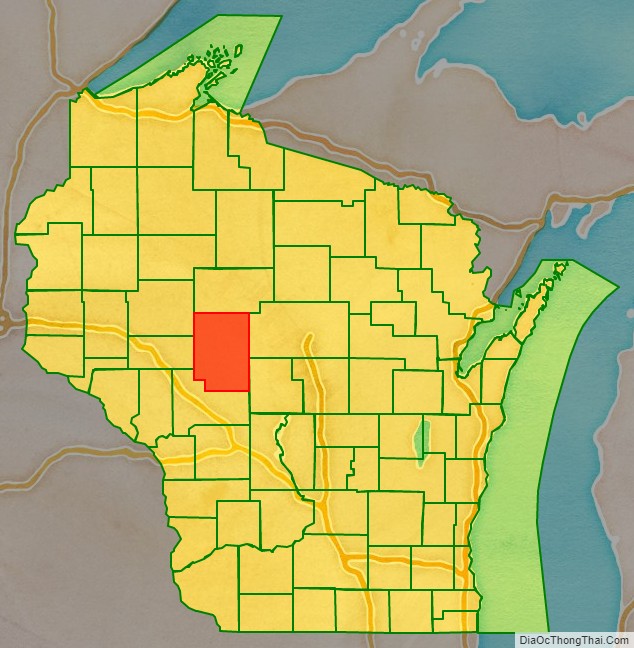
Clark County location map. Where is Clark County?
History
By the early 1800s, the land and streams that are now Clark County were the hunting grounds of Chippewa, Dakota, Ho-Chunk and possibly Menominee peoples. In 1836 these Indians were joined by a party of French-Canadian fur traders who started a temporary post for the American Fur Company on the Black River’s East Fork.
The next White arrival was probably Mormon loggers in 1844, come to cut pine logs from the forests along the Black River and float them down to a sawmill at Black River Falls. From there the sawed wood would be floated down the river to be used in construction of the Mormon temple in Nauvoo, Illinois. They had camps on the river at what is called Mormon Riffle, a mile below Neillsville, near Weston’s Rapids, and south of Greenwood. This project probably ended by 1846, when most of the Mormons headed west after the murder of Joseph Smith.
In June of 1845, James and Henry O’Neill led a party overland from Black River Falls, cutting a road up through the brush, with a wagon of tools and supplies pulled by oxen. They built a cabin on O’Neill Creek, then a sawmill. Lumber sawed by the mill was rafted down the river to Black River Falls, and from there to Alexander O’Neill in Burlington, Iowa. Not all was good, as a storm in June 1847 flooded the Black River and took out all mills then existing. But the pioneers rebuilt.
Clark County was founded in 1853 and organized the following year. It was named for A. W. Clark, an early settler, or for General George Rogers Clark.
Electricity became available around 1900 in some of the towns and villages from private power plants – e.g. in 1902 the Paulsen mill began offering electrical service within the village of Withee. For farms out in the country, it took another 35 years, with electric lines finally put up starting around 1937 by the new Clark Electric Cooperative, funded by a loan from the New Deal Rural Electrification Administration.
In 1920 construction began on the Clark County Asylum two miles east of Owen – the forerunner of today’s Clark County Rehab and Living Center. It was the last built of a network of 35 county mental hospitals in Wisconsin, providing long-term care for patients who were unlikely to recover. Twelve patients from the Wausau asylum helped with construction, and they became the first patients. Some of the patients farmed, both keeping themselves busy and supplying the facility. In 1924 they grew 60 acres of corn, 25 acres of potatoes, 16 acres of barley, 40 acres of oats, 6 acres of buckwheat, and 3 acres of millet. Soon a dairy herd was added, and hogs and a slaughterhouse by 1948. Over the years the institution’s mission has shifted from “custodial asylum” to “treatment hospital,” to skilled nursing facility.
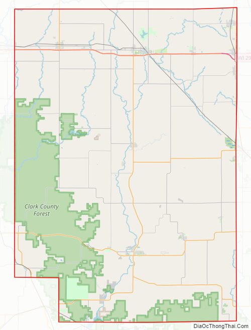
Clark County Road Map
Geography
According to the U.S. Census Bureau, the county has a total area of 1,219 square miles (3,160 km), of which 1,210 square miles (3,100 km) is land and 9.0 square miles (23 km) (0.7%) is water.
Adjacent counties
- Taylor County – north
- Marathon County – east
- Wood County – southeast
- Jackson County – south
- Eau Claire County – west
- Chippewa County – northwest
Major highways
Railroads
- Union Pacific
- Watco
- Canadian National
Buses
- List of intercity bus stops in Wisconsin
Airport
- KVIQ – Neillsville Municipal Airport
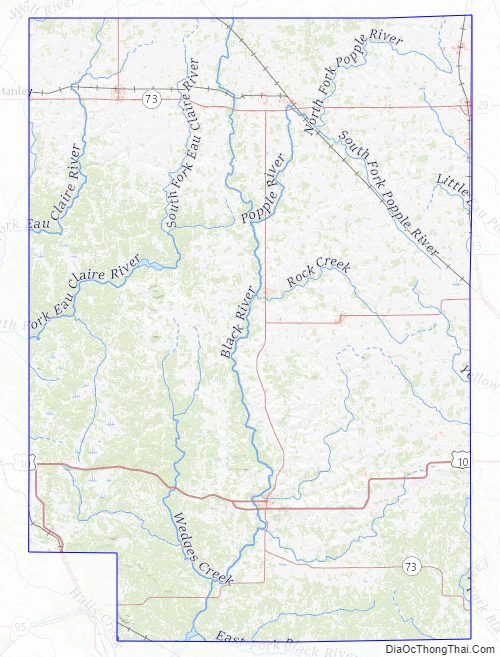
Clark County Topographic Map
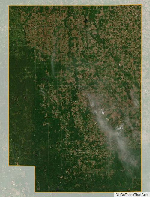
Clark County Satellite Map
Clark County Outline Map