Nauvoo (/ˈnɔːvuː/ NAW-voo; from the Hebrew: נָאווּ, Modern: Navu, Tiberian: Nâwû, ‘they are beautiful’) is a small city in Hancock County, Illinois, United States, on the Mississippi River near Fort Madison, Iowa. The population of Nauvoo was 950 at the 2020 census. Nauvoo attracts visitors for its historic importance and its religious significance to members of several groups: The Church of Jesus Christ of Latter-day Saints; the Community of Christ, formerly the Reorganized Church of Jesus Christ of Latter Day Saints (RLDS); other groups stemming from the Latter Day Saint movement; and the Icarians. The city and its immediate surrounding area are listed on the National Register of Historic Places as the Nauvoo Historic District.
| Name: | Nauvoo city |
|---|---|
| LSAD Code: | 25 |
| LSAD Description: | city (suffix) |
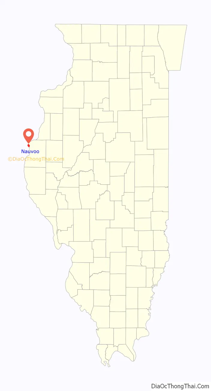
| State: | Illinois |
| County: | Hancock County |
| Elevation: | 574 ft (175 m) |
| Total Area: | 4.83 sq mi (12.50 km²) |
| Land Area: | 3.39 sq mi (8.77 km²) |
| Water Area: | 1.44 sq mi (3.73 km²) |
| Total Population: | 950 |
| Population Density: | 280.57/sq mi (108.32/km²) |
| ZIP code: | 62354 |
| Area code: | 217 |
| FIPS code: | 1751791 |
| GNISfeature ID: | 2395160 |
| Website: | www.beautifulnauvoo.com |
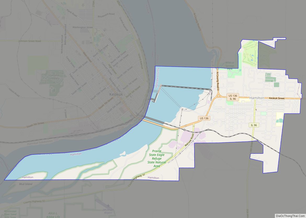
Online Interactive Map
Click on ![]() to view map in "full screen" mode.
to view map in "full screen" mode.
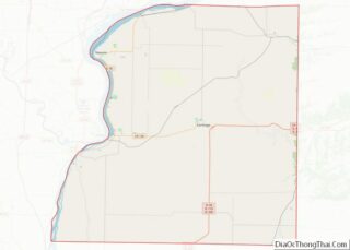
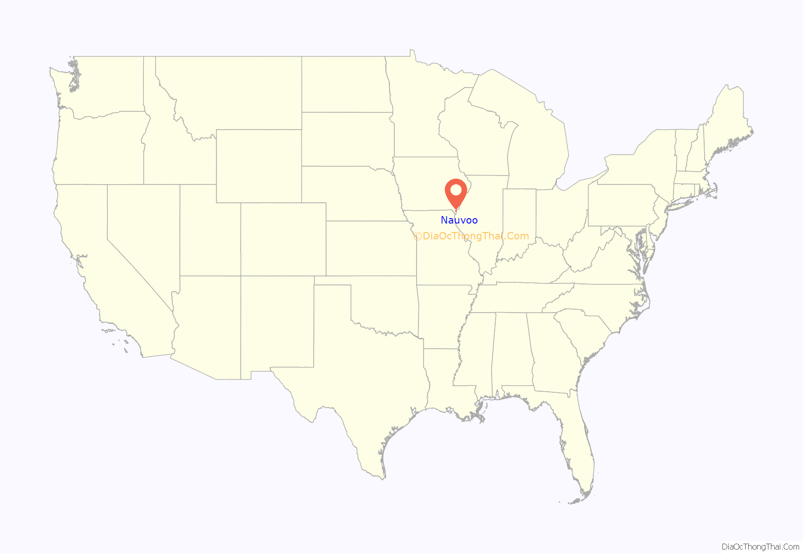
Nauvoo location map. Where is Nauvoo city?
History
The area of Nauvoo was first called Quashquema, named in honor of the Native American chief who headed a Sauk and Fox settlement numbering nearly 500 lodges. By 1827, white settlers had built cabins in the area. By 1829 this area of Hancock County had grown sufficiently so that a post office was needed and in 1832 the town, by then called Venus, was one of the contenders for the new county’s seat. However, the honor was awarded to a nearby city, Carthage. In 1834 the name Venus was changed to Commerce because the settlers felt the new name better suited their plans.
In late 1839, arriving Latter Day Saints bought the small town and in April 1840 it was renamed Nauvoo by Joseph Smith, who led the Latter Day Saints to Nauvoo to escape conflict with the state government in Missouri. The name Nauvoo is derived from the traditional Hebrew language with an anglicized spelling. The word comes from Isaiah 52:7, “How beautiful upon the mountains…” By 1844 “Nauvoo’s population had swollen to 12,000, rivaling the size of Chicago” at the time.
After Joseph Smith’s death in 1844, continued violence from surrounding non-LDS members forced most Latter-Day Saints to leave Nauvoo. Most of these followers, led by Brigham Young, emigrated to the Great Salt Lake Valley. In 1849, Icarians moved to the Nauvoo area to implement a utopian socialist commune based on the ideals of French philosopher Étienne Cabet. The colony had nearly 500 members at its peak, but Cabet’s death in 1856 led some members to leave this parent colony.
After the departure of the Icarians, Nauvoo became the largest German-speaking community in Illinois and remained so for fifty years. German was spoken widely in town and in the Catholic, Lutheran, Presbyterian and Methodist churches. During this period, wine-making and fruit production thrived in Nauvoo. Notable residents from this era included the Swiss memoirist Heinrich Lienhard. During World War I, most of Nauvoo’s native-German speaking residents stopped using German in public, and the use of German had entirely faded away by World War II.
In the early-to-mid 20th century Nauvoo was primarily a Roman Catholic town. Today, a plurality of the population is Methodist or another Christian faith.
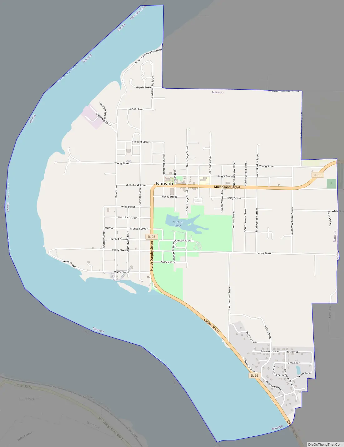
Nauvoo Road Map
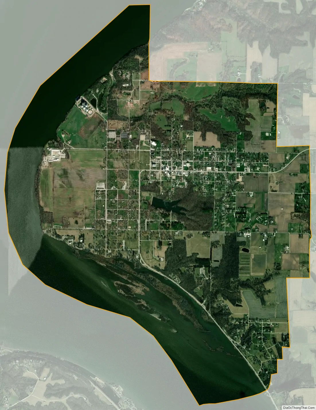
Nauvoo city Satellite Map
Geography
Nauvoo is at 40°33′N 91°22′W / 40.550°N 91.367°W / 40.550; -91.367 (40.5446, −91.3803). Situated on a wide bend in the Mississippi River, Nauvoo has most of the historic district in the lower flat lands (called the flats) that are no more than a few feet above the water line. A prominent hill rises as one moves further east, at the apex of which stands the rebuilt Nauvoo Temple. Beginning with the temple, this elevated land (called the uptown) continues flat for many miles eastward.
According to the 2010 census, Nauvoo has a total area of 4.831 square miles (12.51 km), of which 3.39 square miles (8.78 km) (or 70.17%) is land and 1.441 square miles (3.73 km) (or 29.83%) is water.
See also
Map of Illinois State and its subdivision:- Adams
- Alexander
- Bond
- Boone
- Brown
- Bureau
- Calhoun
- Carroll
- Cass
- Champaign
- Christian
- Clark
- Clay
- Clinton
- Coles
- Cook
- Crawford
- Cumberland
- De Kalb
- De Witt
- Douglas
- Dupage
- Edgar
- Edwards
- Effingham
- Fayette
- Ford
- Franklin
- Fulton
- Gallatin
- Greene
- Grundy
- Hamilton
- Hancock
- Hardin
- Henderson
- Henry
- Iroquois
- Jackson
- Jasper
- Jefferson
- Jersey
- Jo Daviess
- Johnson
- Kane
- Kankakee
- Kendall
- Knox
- La Salle
- Lake
- Lake Michigan
- Lawrence
- Lee
- Livingston
- Logan
- Macon
- Macoupin
- Madison
- Marion
- Marshall
- Mason
- Massac
- McDonough
- McHenry
- McLean
- Menard
- Mercer
- Monroe
- Montgomery
- Morgan
- Moultrie
- Ogle
- Peoria
- Perry
- Piatt
- Pike
- Pope
- Pulaski
- Putnam
- Randolph
- Richland
- Rock Island
- Saint Clair
- Saline
- Sangamon
- Schuyler
- Scott
- Shelby
- Stark
- Stephenson
- Tazewell
- Union
- Vermilion
- Wabash
- Warren
- Washington
- Wayne
- White
- Whiteside
- Will
- Williamson
- Winnebago
- Woodford
- Alabama
- Alaska
- Arizona
- Arkansas
- California
- Colorado
- Connecticut
- Delaware
- District of Columbia
- Florida
- Georgia
- Hawaii
- Idaho
- Illinois
- Indiana
- Iowa
- Kansas
- Kentucky
- Louisiana
- Maine
- Maryland
- Massachusetts
- Michigan
- Minnesota
- Mississippi
- Missouri
- Montana
- Nebraska
- Nevada
- New Hampshire
- New Jersey
- New Mexico
- New York
- North Carolina
- North Dakota
- Ohio
- Oklahoma
- Oregon
- Pennsylvania
- Rhode Island
- South Carolina
- South Dakota
- Tennessee
- Texas
- Utah
- Vermont
- Virginia
- Washington
- West Virginia
- Wisconsin
- Wyoming