Tuscumbia is a city in and the county seat of Colbert County, Alabama, United States. As of the 2010 census, the population was 8,423. The city is part of The Shoals metropolitan area.
Tuscumbia was the hometown of Helen Keller, who lived at Ivy Green. Several sites in the city are listed on the National Register of Historic Places, especially in the Tuscumbia Historic District. The city is also the site of the Alabama Music Hall of Fame.
| Name: | Tuscumbia city |
|---|---|
| LSAD Code: | 25 |
| LSAD Description: | city (suffix) |
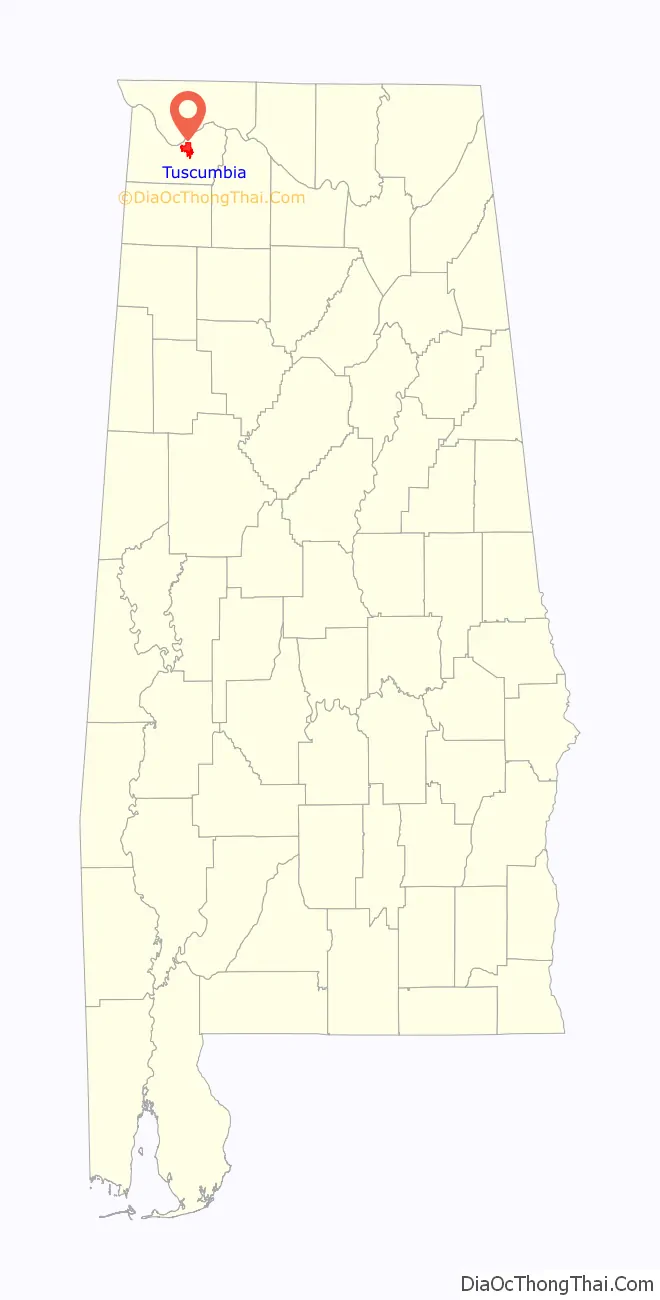
| State: | Alabama |
| County: | Colbert County |
| Elevation: | 427 ft (130 m) |
| Total Area: | 9.26 sq mi (23.98 km²) |
| Land Area: | 9.22 sq mi (23.87 km²) |
| Water Area: | 0.04 sq mi (0.11 km²) |
| Total Population: | 9,054 |
| Population Density: | 982.42/sq mi (379.30/km²) |
| ZIP code: | 35674 |
| FIPS code: | 0177280 |
| GNISfeature ID: | 2405616 |
| Website: | www.cityoftuscumbia.org |
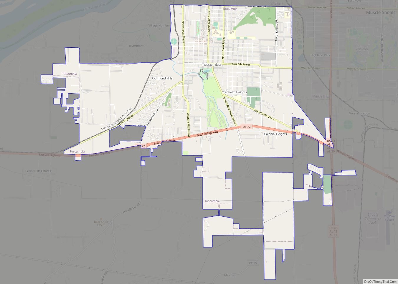
Online Interactive Map
Click on ![]() to view map in "full screen" mode.
to view map in "full screen" mode.
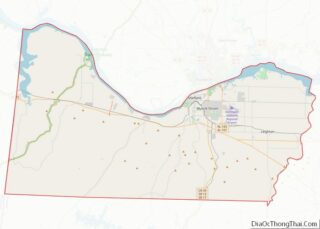
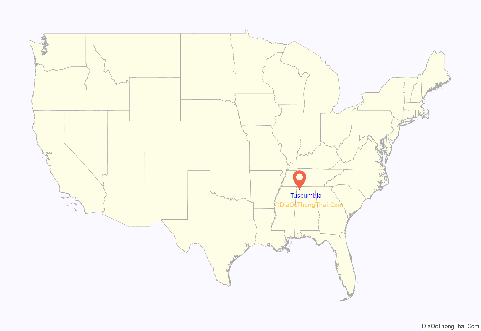
Tuscumbia location map. Where is Tuscumbia city?
History
When the Michael Dixon family arrived about 1816, they were the first European Americans to settle here. It was traditional territory of the Chickasaw people. The settlers traded with Chief Tucumseh for the Tuscumbia Valley and built their home at the head of the big spring. Other settlers joined them and there developed a village known as the Big Spring Community. The men of the community requested that the state legislature incorporate them as a city. The town was incorporated in 1820 as Ococoposa, a Chickasaw word meaning ‘dry watermelon’. It is one of Alabama’s oldest towns. In 1821, its name was changed to Big Spring and on December 22, 1822, to Tuscumbia, after the Chief Rainmaker of the Chickasaw.
Although shoals on the nearby Tennessee River made the river nearly impassable, a federal road completed in 1820 provided the area with good access to markets. Tuscumbia soon became the center for agriculture in northern Alabama. A line to the town on the Tuscumbia, Courtland and Decatur Railroad was completed in 1832, and by 1850 Tuscumbia was a major railroad hub for train traffic throughout the South.
From 1826 to the 1860s, the Tuscumbia Female Academy operated in Tuscumbia. It was one of a number of private schools founded by planters and others wealthy enough to pay for the education of their sons and daughters. There were no public schools until
During the Civil War, the railroad hub made Tuscumbia a target of the Union Army, which destroyed the railroad shops and other parts of the town. The Civil War resulted in the permanent closure of the Tuscumbia Female Academy.
Tuscumbia was designated as the county seat for Colbert County in 1867.
A tornado, estimated at F4 intensity on the Fujita scale, struck Tuscumbia on November 22, 1874, damaging or destroying about a third of the town and killing 14 people.
In April 1894, three African Americans accused of planning to commit arson were taken from the Tuscumbia jail by a mob of 200 men and lynched, hanged from the bridge over the Tennessee River. The turn of the century period was the nadir of race relations in the South, with frequent violence by whites against African Americans to maintain white supremacy.
21st century
The 2019–20 coronavirus pandemic resulted in the temporary closure of two tourist destinations: The Alabama Music Hall of Fame and Ivy Green at the beginning of the month of April 2020 to reduce social contact and help curb the spread of COVID-19.
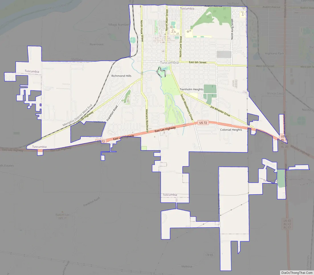
Tuscumbia Road Map
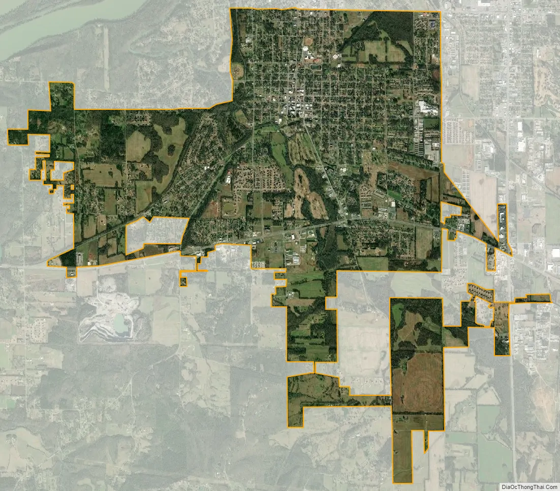
Tuscumbia city Satellite Map
Geography
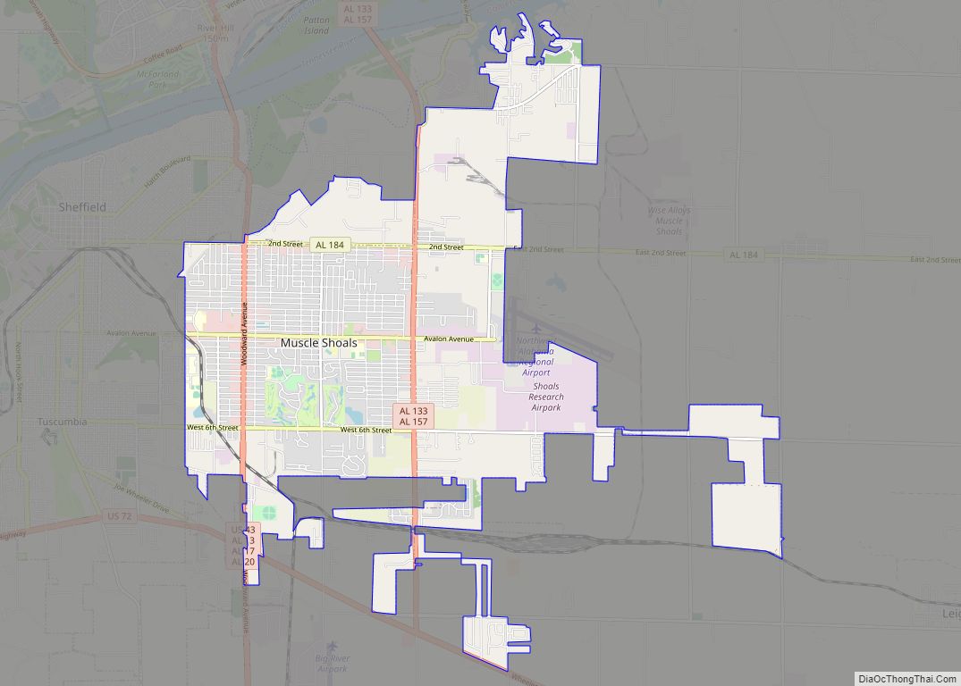
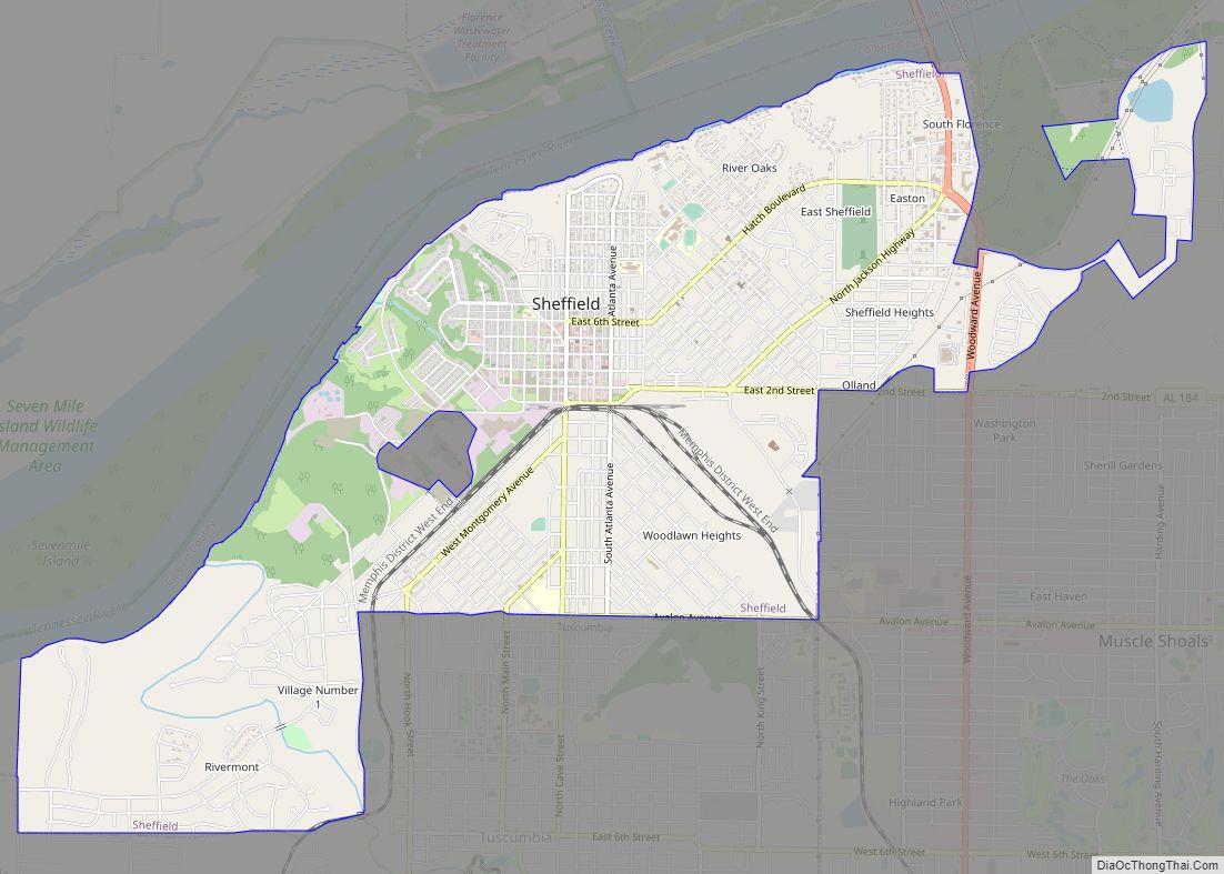
Tuscumbia is located northeast of the center of Colbert County at 34°43′51″N 87°42′10″W / 34.73083°N 87.70278°W / 34.73083; -87.70278 (34.730839, -87.702854). It is bordered to the north by the city of Sheffield and to the northeast by the city of Muscle Shoals. The Tennessee River is 1 mile (1.6 km) to the northwest.
According to the U.S. Census Bureau, the city has a total area of 8.8 square miles (22.8 km), of which 8.8 square miles (22.7 km) is land and 0.039 square miles (0.1 km), or 0.50%, is water.
Climate
According to the Köppen climate classification, Tuscumbia has a humid subtropical climate (abbreviated Cfa).
See also
Map of Alabama State and its subdivision:- Autauga
- Baldwin
- Barbour
- Bibb
- Blount
- Bullock
- Butler
- Calhoun
- Chambers
- Cherokee
- Chilton
- Choctaw
- Clarke
- Clay
- Cleburne
- Coffee
- Colbert
- Conecuh
- Coosa
- Covington
- Crenshaw
- Cullman
- Dale
- Dallas
- De Kalb
- Elmore
- Escambia
- Etowah
- Fayette
- Franklin
- Geneva
- Greene
- Hale
- Henry
- Houston
- Jackson
- Jefferson
- Lamar
- Lauderdale
- Lawrence
- Lee
- Limestone
- Lowndes
- Macon
- Madison
- Marengo
- Marion
- Marshall
- Mobile
- Monroe
- Montgomery
- Morgan
- Perry
- Pickens
- Pike
- Randolph
- Russell
- Saint Clair
- Shelby
- Sumter
- Talladega
- Tallapoosa
- Tuscaloosa
- Walker
- Washington
- Wilcox
- Winston
- Alabama
- Alaska
- Arizona
- Arkansas
- California
- Colorado
- Connecticut
- Delaware
- District of Columbia
- Florida
- Georgia
- Hawaii
- Idaho
- Illinois
- Indiana
- Iowa
- Kansas
- Kentucky
- Louisiana
- Maine
- Maryland
- Massachusetts
- Michigan
- Minnesota
- Mississippi
- Missouri
- Montana
- Nebraska
- Nevada
- New Hampshire
- New Jersey
- New Mexico
- New York
- North Carolina
- North Dakota
- Ohio
- Oklahoma
- Oregon
- Pennsylvania
- Rhode Island
- South Carolina
- South Dakota
- Tennessee
- Texas
- Utah
- Vermont
- Virginia
- Washington
- West Virginia
- Wisconsin
- Wyoming