Leighton is a town in Colbert County, Alabama, United States. It is part of the Florence – Muscle Shoals Metropolitan Statistical Area known as “The Shoals”. At the 2020 census, the population was 665. Leighton has been hit by several tornadoes in the 2000s, including a damaging EF2 on May 8, 2008, that was caught on tape flipping over many cars and damaging buildings.
| Name: | Leighton town |
|---|---|
| LSAD Code: | 43 |
| LSAD Description: | town (suffix) |
| State: | Alabama |
| County: | Colbert County |
| Elevation: | 584 ft (178 m) |
| Total Area: | 2.16 sq mi (5.59 km²) |
| Land Area: | 2.16 sq mi (5.59 km²) |
| Water Area: | 0.00 sq mi (0.00 km²) |
| Total Population: | 665 |
| Population Density: | 308.30/sq mi (119.02/km²) |
| ZIP code: | 35646 |
| Area code: | 256 |
| FIPS code: | 0142160 |
| GNISfeature ID: | 2406001 |
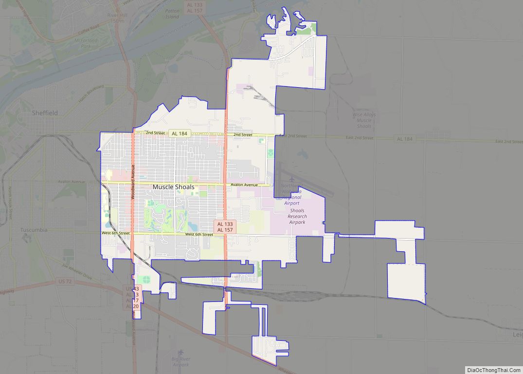
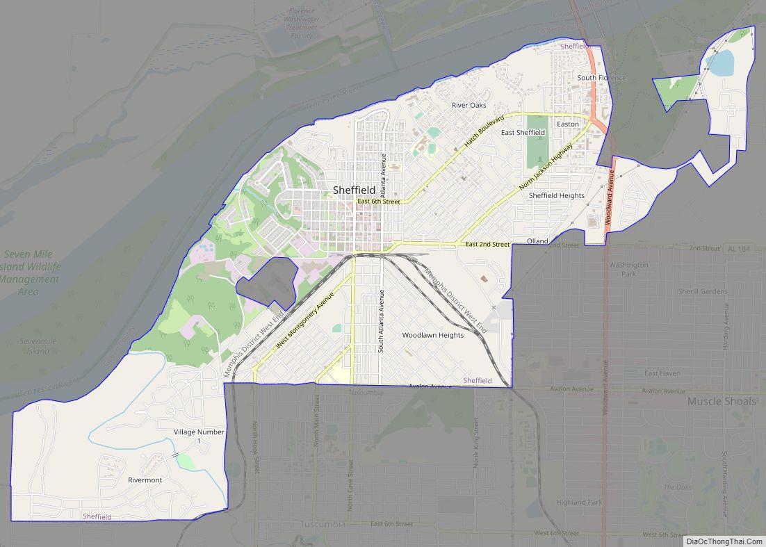
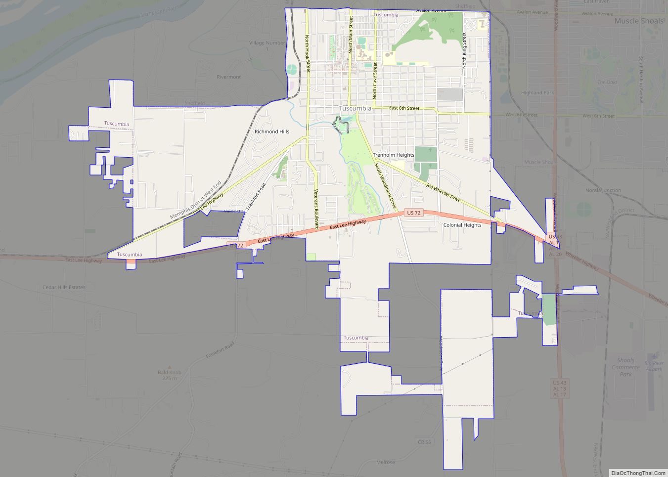
Online Interactive Map
Click on ![]() to view map in "full screen" mode.
to view map in "full screen" mode.
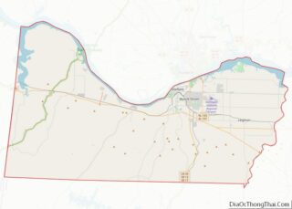
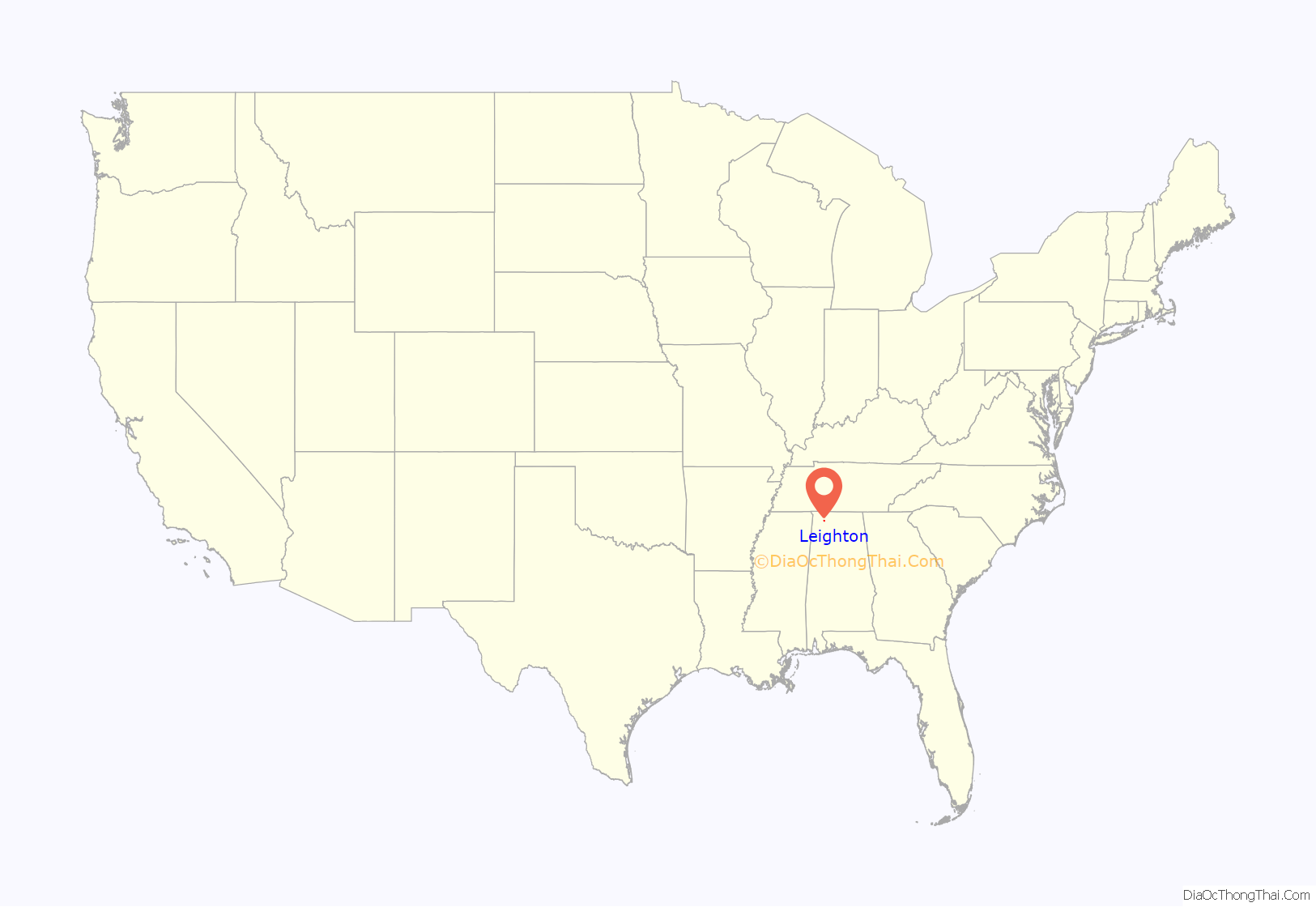
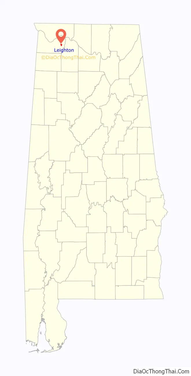
Leighton location map. Where is Leighton town?
History
The first settlers in what is now Leighton arrived in the early 1810s. The community was initially known as “Crossroads” for its location at the intersection of two early stage coach roads. The name was later changed to “Leighton” for town’s first postmaster, the Reverend William Leigh. The town developed as a cotton shipping center in the 1830s after the Tuscumbia, Courtland and Decatur Railroad constructed a railroad line through the area. Leighton incorporated in 1890.
Leighton originally straddled the county line of Franklin and Lawrence Counties. When Colbert County was carved off in 1867, the town still remained divided between the new county and Lawrence. On the 1880 U.S. Census, it reported having 196 residents on the Colbert County side and 83 on the Lawrence County side. After the 1890 Census, Colbert County’s eastern border was expanded eastward several miles to Town Creek, placing Leighton wholly within Colbert.
In 1909, an African-American man named Sam Davenport was lynched by a mob of some two dozen men in Leighton. Davenport was suspected of burning a white man’s barn.
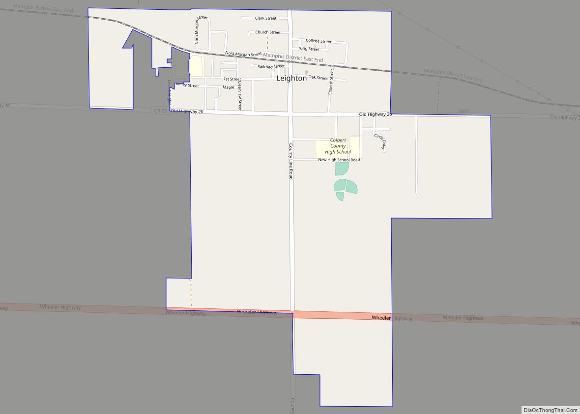
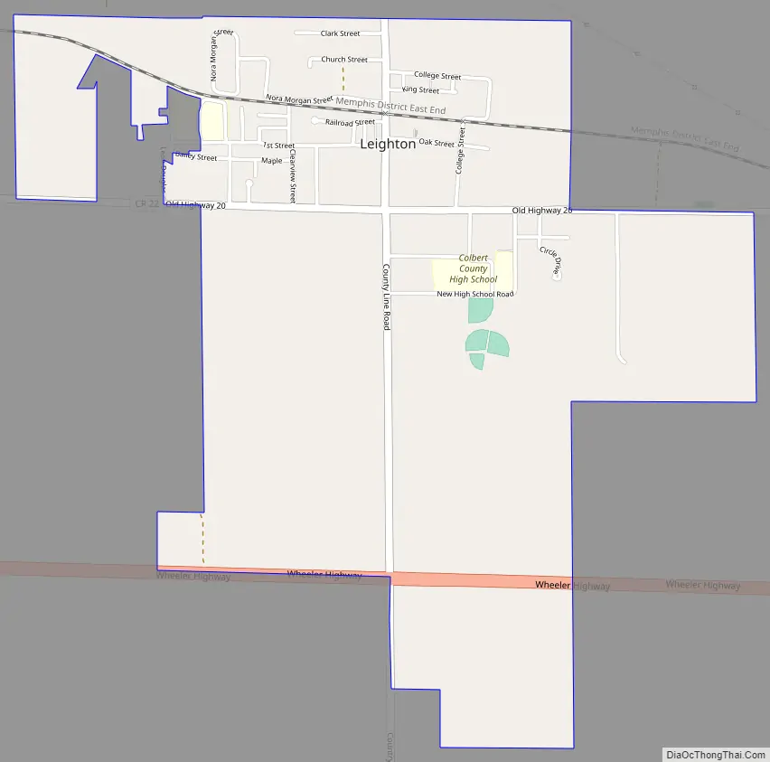
Leighton Road Map
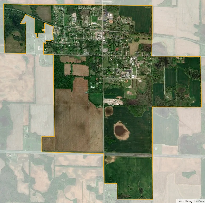
Leighton city Satellite Map
Geography
Leighton is located in eastern Colbert County at 34°41′59″N 87°31′51″W / 34.69972°N 87.53083°W / 34.69972; -87.53083 (34.699642, -87.530699). The town is concentrated around the intersection of County Line Road (signed as Main Street within town limits) and County Road 22 (“Old Highway 20”), southeast of Muscle Shoals. U.S. Route 72 passes just to the south, and the Tennessee River lies a few miles to the north.
According to the U.S. Census Bureau, the town has a total area of 1.0 square mile (2.6 km), all land.
See also
Map of Alabama State and its subdivision:- Autauga
- Baldwin
- Barbour
- Bibb
- Blount
- Bullock
- Butler
- Calhoun
- Chambers
- Cherokee
- Chilton
- Choctaw
- Clarke
- Clay
- Cleburne
- Coffee
- Colbert
- Conecuh
- Coosa
- Covington
- Crenshaw
- Cullman
- Dale
- Dallas
- De Kalb
- Elmore
- Escambia
- Etowah
- Fayette
- Franklin
- Geneva
- Greene
- Hale
- Henry
- Houston
- Jackson
- Jefferson
- Lamar
- Lauderdale
- Lawrence
- Lee
- Limestone
- Lowndes
- Macon
- Madison
- Marengo
- Marion
- Marshall
- Mobile
- Monroe
- Montgomery
- Morgan
- Perry
- Pickens
- Pike
- Randolph
- Russell
- Saint Clair
- Shelby
- Sumter
- Talladega
- Tallapoosa
- Tuscaloosa
- Walker
- Washington
- Wilcox
- Winston
- Alabama
- Alaska
- Arizona
- Arkansas
- California
- Colorado
- Connecticut
- Delaware
- District of Columbia
- Florida
- Georgia
- Hawaii
- Idaho
- Illinois
- Indiana
- Iowa
- Kansas
- Kentucky
- Louisiana
- Maine
- Maryland
- Massachusetts
- Michigan
- Minnesota
- Mississippi
- Missouri
- Montana
- Nebraska
- Nevada
- New Hampshire
- New Jersey
- New Mexico
- New York
- North Carolina
- North Dakota
- Ohio
- Oklahoma
- Oregon
- Pennsylvania
- Rhode Island
- South Carolina
- South Dakota
- Tennessee
- Texas
- Utah
- Vermont
- Virginia
- Washington
- West Virginia
- Wisconsin
- Wyoming