Collingsworth County is a county in the U.S. state of Texas. As of the 2020 census, its population was 2,652. Its county seat is Wellington. The county was created in 1876 and later organized in 1890. It is named for James Collinsworth, a signer of the Texas Declaration of Independence and first chief justice of the Republic of Texas (a recording error in the bill accounts for the error in spelling, which was never corrected). Collingsworth County was one of 30 prohibition, or entirely dry, counties in Texas, but a vote in 2017 changed this law.
| Name: | Collingsworth County |
|---|---|
| FIPS code: | 48-087 |
| State: | Texas |
| Founded: | 1890 |
| Named for: | James Collinsworth |
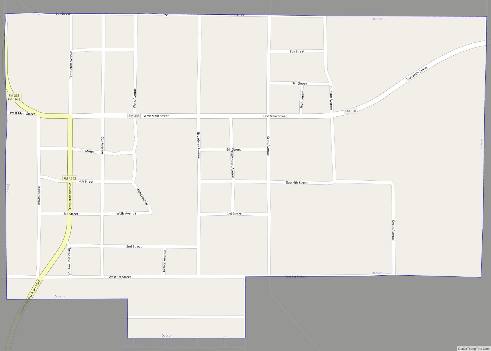
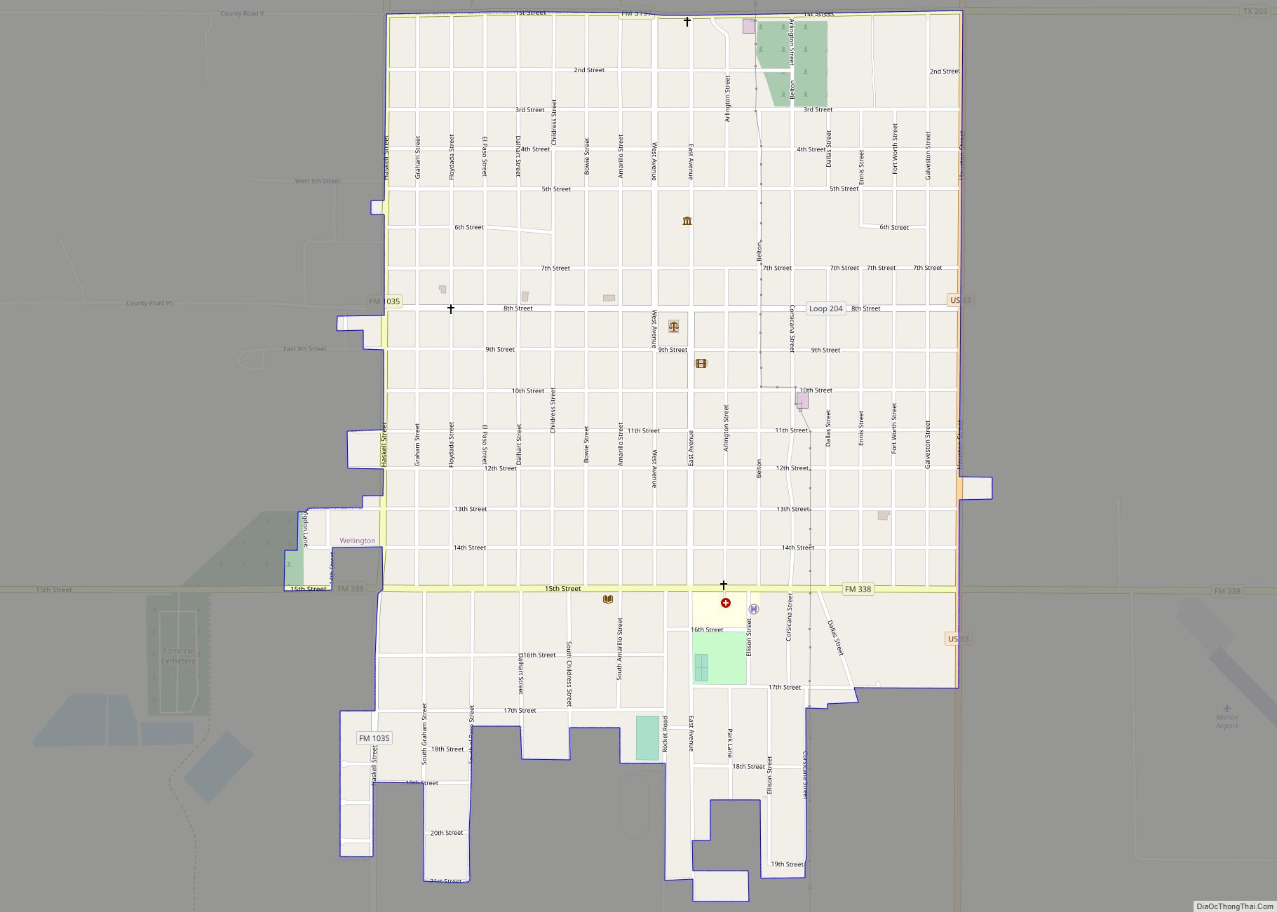
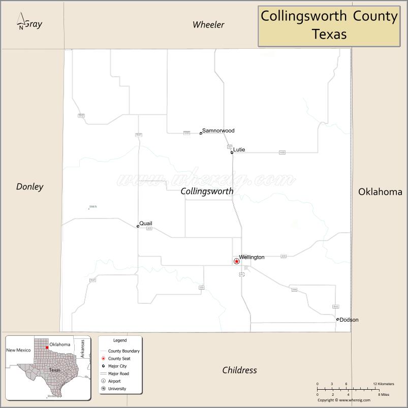
| Seat: | Wellington |
| Largest city: | Wellington |
| Total Area: | 919 sq mi (2,380 km²) |
| Land Area: | 918 sq mi (2,380 km²) |
| Total Population: | 2,652 |
| Population Density: | 2.9/sq mi (1.1/km²) |
| Time zone: | UTC−6 (Central) |
| Summer Time Zone (DST): | UTC−5 (CDT) |
| Website: | www.co.collingsworth.tx.us |
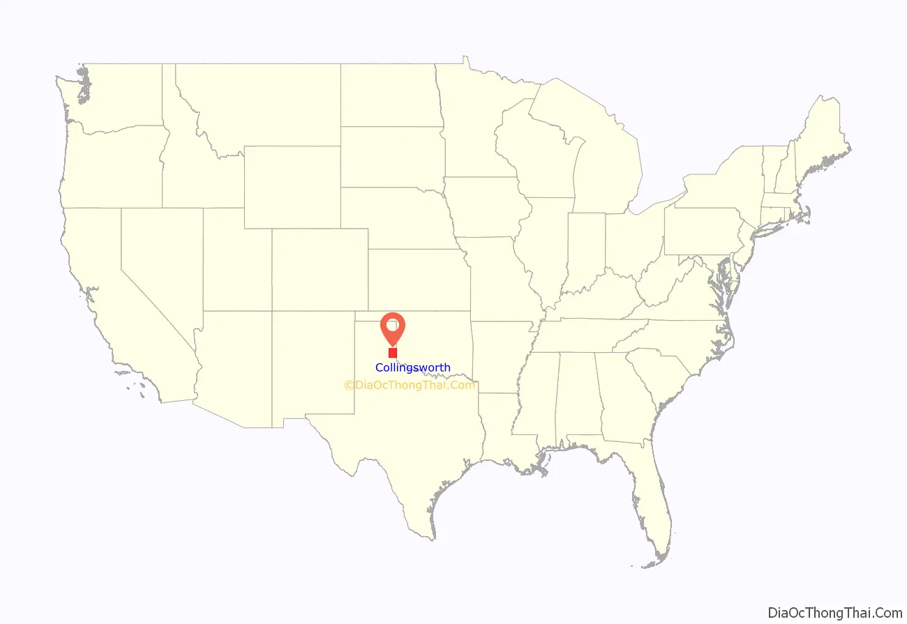
Collingsworth County location map. Where is Collingsworth County?
History
The county was created in 1876 from the Bexar and Young land district of Texas. Collingsworth County was organized in 1890 with Wellington as the county seat. From 1883 until 1896 the county was home to the English owned Rocking Chair Ranche.
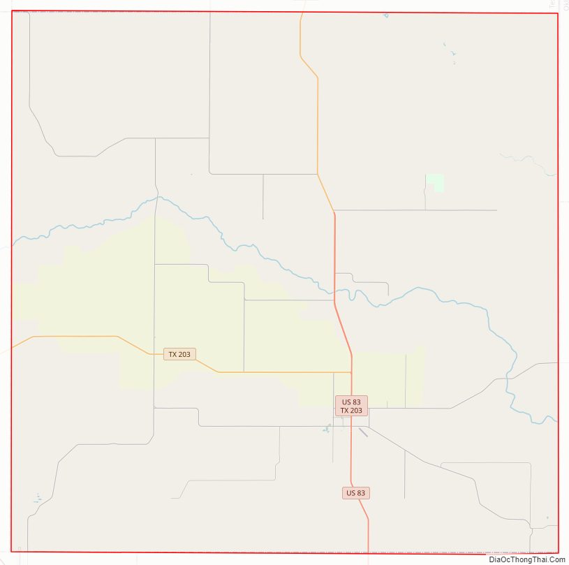
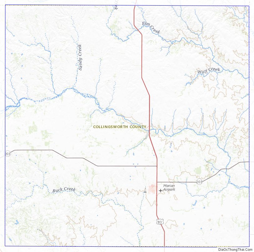
Collingsworth County Road Map
Geography
According to the U.S. Census Bureau, the county has a total area of 919 square miles (2,380 km), of which 918 square miles (2,380 km) is land and 0.9 square miles (2.3 km) (0.1%) is water.
Major highways
- U.S. Highway 83
- State Highway 203
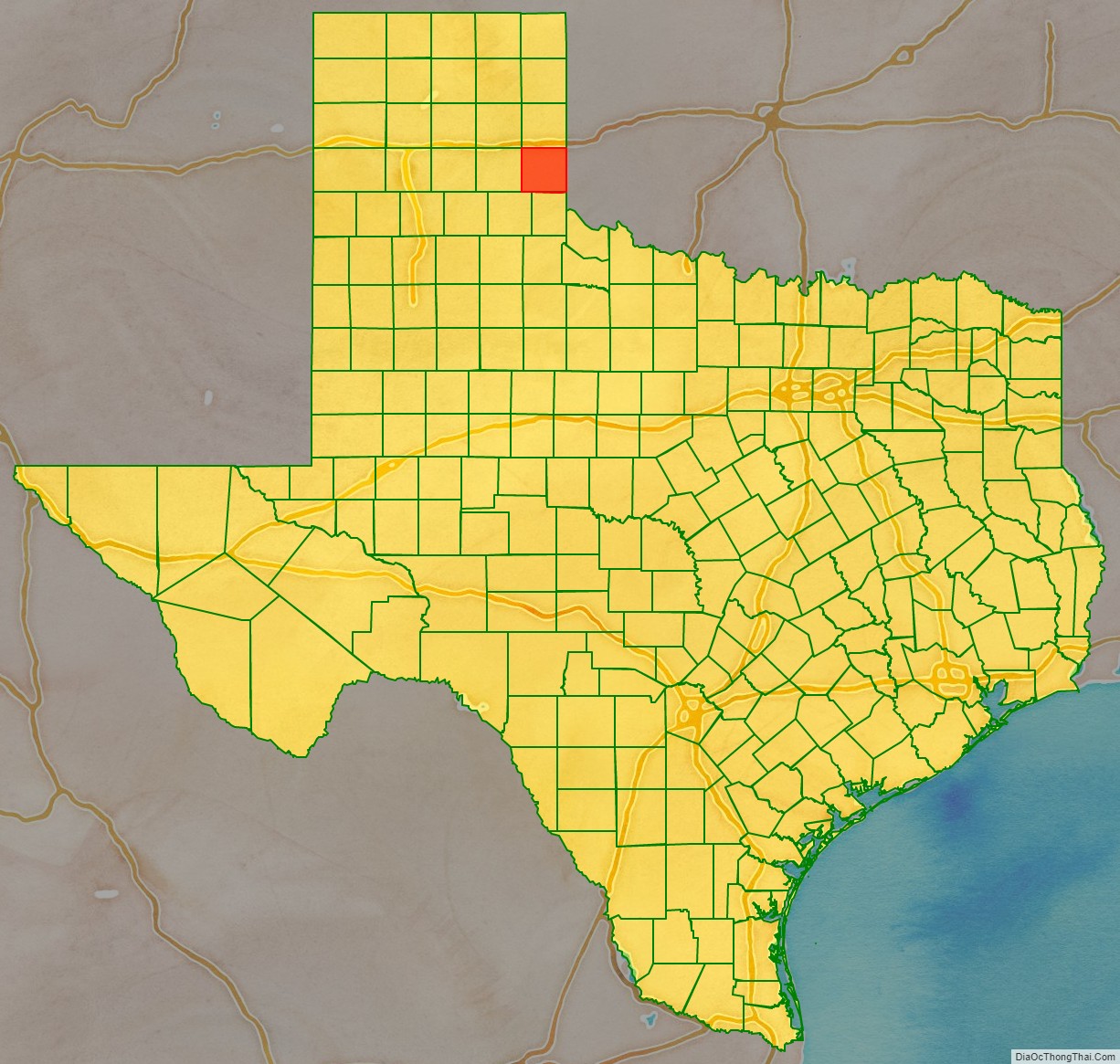
Adjacent counties
- Wheeler County (north)
- Beckham County, Oklahoma (northeast)
- Harmon County, Oklahoma (southeast)
- Childress County (south)
- Hall County (southwest)
- Donley County (west)
- Gray County (northwest)
Collingsworth County Topographic Map
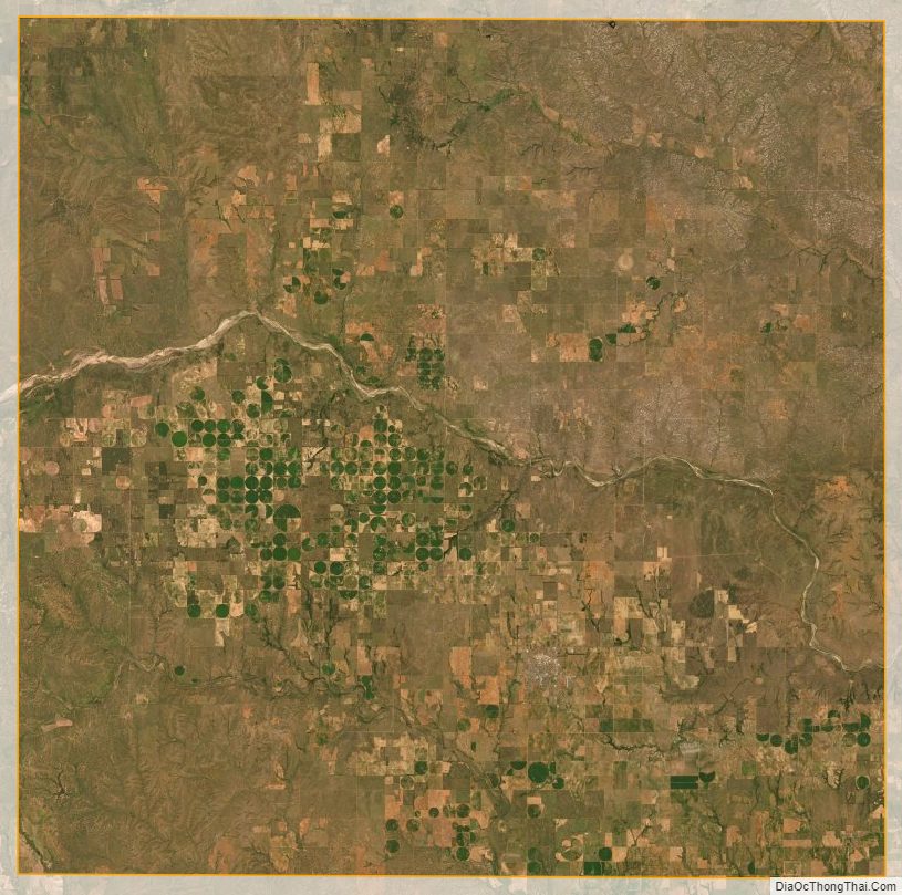
Collingsworth County Satellite Map
Collingsworth County Outline Map