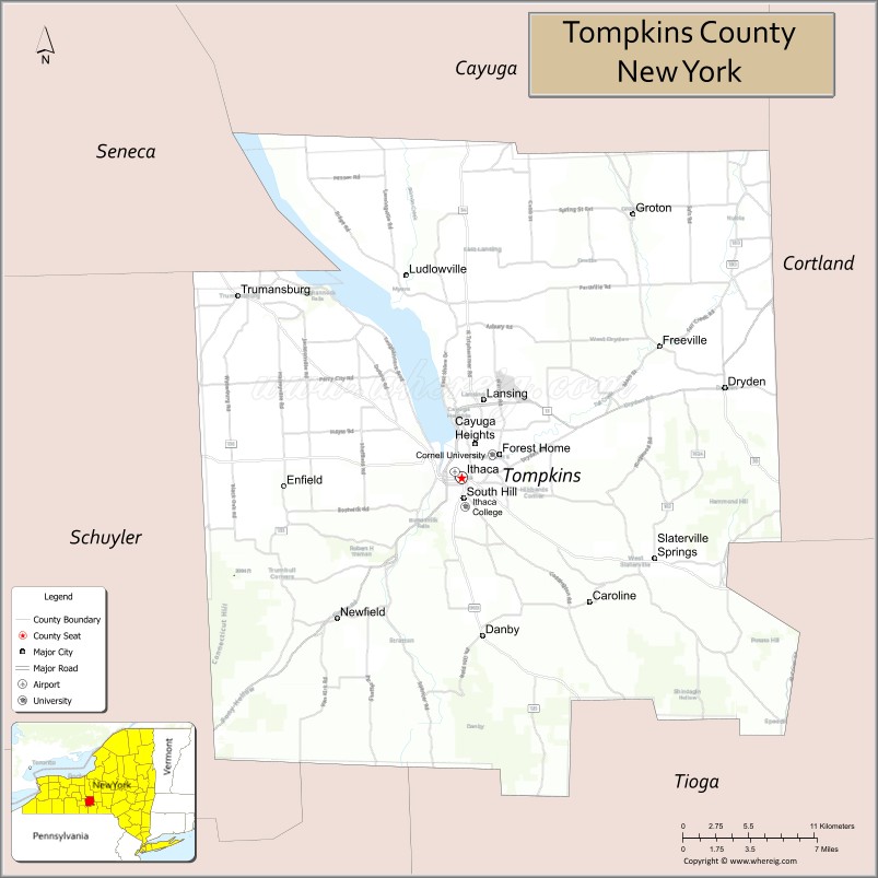
Tompkins County is a county located in the U.S. state of New York. As of the 2020 census, the population was 105,740. The county seat is Ithaca. The name is in honor of Daniel D. Tompkins, who served as Governor of New York and Vice President of the United States.
Tompkins County comprises the Ithaca Metropolitan Statistical Area. It is home to Cornell University, Ithaca College and Tompkins Cortland Community College.
| Name: | Tompkins County |
|---|---|
| FIPS code: | 36-109 |
| State: | New York |
| Founded: | April 17, 1817 |
| Named for: | Daniel D. Tompkins |
| Seat: | Ithaca |
| Total Area: | 492 sq mi (1,270 km²) |
| Land Area: | 475 sq mi (1,230 km²) |
| Total Population: | 105,740 |
| Population Density: | 222.8/sq mi (86.0/km²) |
| Time zone: | UTC−5 (Eastern) |
| Summer Time Zone (DST): | UTC−4 (EDT) |
| Website: | tompkinscountyny.gov |
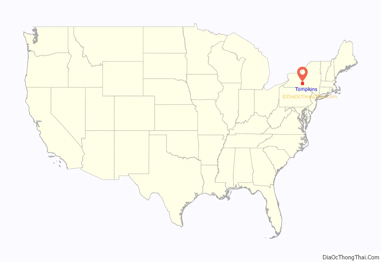
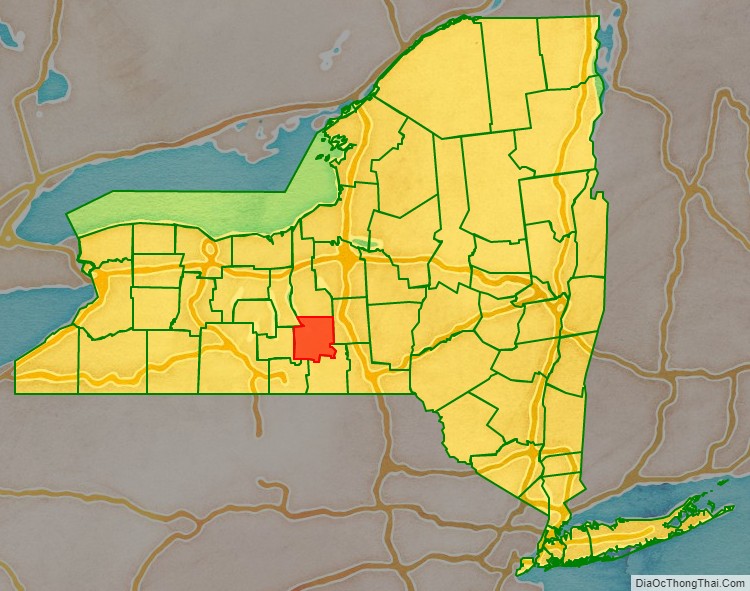
Tompkins County location map. Where is Tompkins County?
History
When counties were established in the British Province of New York in 1683, the present Tompkins County was part of Albany County. This was an enormous county, including the northern part of New York State as well as all of the present State of Vermont and, in theory, extending westward to the Pacific Ocean. This county was reduced in size on July 3, 1766, by the creation of Cumberland County, and further on March 16, 1770, by the creation of Gloucester County, both containing territory now in Vermont.
On March 12, 1772, what was left of Albany County was split into three parts, one remaining under the name Albany County. One of the other pieces, Tryon County, contained the western portion (and thus, since no western boundary was specified, theoretically still extended west to the Pacific). The eastern boundary of Tryon County was approximately five miles west of the present city of Schenectady, and the county included the western part of the Adirondack Mountains and the area west of the West Branch of the Delaware River. The area then designated as Tryon County now includes 37 counties of New York State. The county was named for William Tryon, colonial governor of New York.
In the years prior to 1776, most of the Loyalists in Tryon County fled to Canada. In 1784, following the peace treaty that ended the American Revolutionary War, the name of Tryon County was changed to Montgomery County in honor of the general, Richard Montgomery, who had captured several places in Canada and died attempting to capture the city of Quebec, replacing the name of the hated British governor.
In 1789, Montgomery County was reduced in size by the splitting off of Ontario County. The actual area split off from Montgomery County was much larger than the present county, also including the present Allegany, Cattaraugus, Chautauqua, Erie, Genesee, Livingston, Monroe, Niagara, Orleans, Steuben, Wyoming, Yates, and part of Schuyler and Wayne counties.
Herkimer County was one of three counties split off from Montgomery County (the others being Otsego and Tioga counties) in 1791. Onondaga County was formed in 1794 by the splitting of Herkimer County.
Cayuga County was formed in 1799 by the splitting of Onondaga County. This county was, however, much larger than the present Cayuga County. It also included the territory of the present Seneca and Tompkins counties.
In 1804, Seneca County was formed by the splitting of Cayuga County.
On April 7, 1817, Tompkins County was created by combining portions of Seneca and the remainder of Cayuga County. The county was named after then Vice-President (to President James Monroe) and former New York Governor Daniel Tompkins. Tompkins almost certainly never visited the county named for him.
In 1854, the county lost the town of Hector and the west line of lots in Newfield to the newly formed Schuyler County, New York.
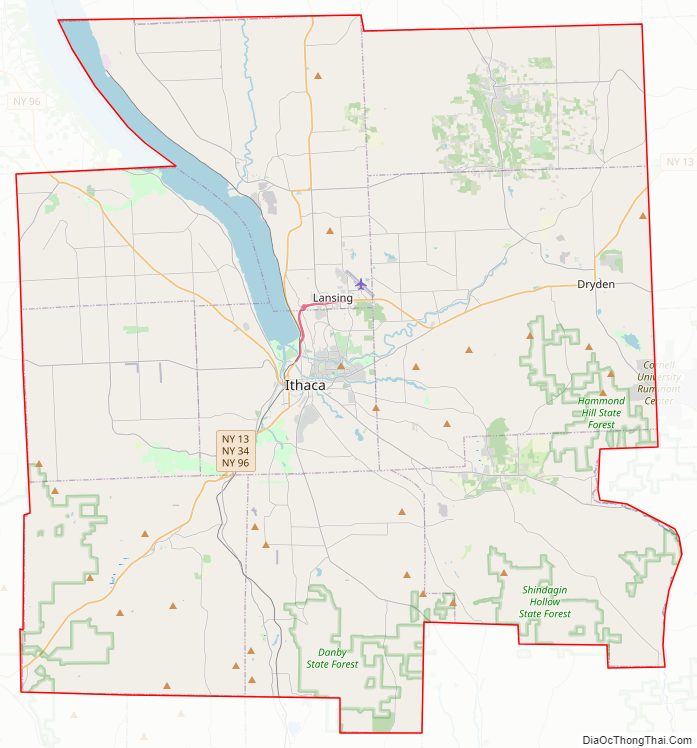
Tompkins County Road Map
Geography
According to the U.S. Census Bureau, the county has a total area of 492 square miles (1,270 km), of which 475 square miles (1,230 km) is land and 17 square miles (44 km) (3.4%) is water.
Tompkins County is in the west central part of New York State, south of Syracuse and northwest of Binghamton. It is usually geographically grouped with the Finger Lakes region, but some locals consider themselves to be part of Central New York or the Southern Tier.
Adjacent counties
- Cayuga County – north
- Cortland County – east
- Tioga County – south
- Chemung County – southwest
- Schuyler County – west
- Seneca County – northwest
Major highways
- New York State Route 13
- New York State Route 13A
- New York State Route 34
- New York State Route 34B
- New York State Route 38
- New York State Route 79
- New York State Route 89
- New York State Route 96
- New York State Route 96B
- New York State Route 222
- New York State Route 227
- New York State Route 327
- New York State Route 366
- New York State Route 392
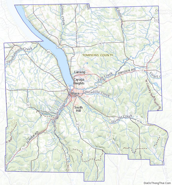
Tompkins County Topographic Map
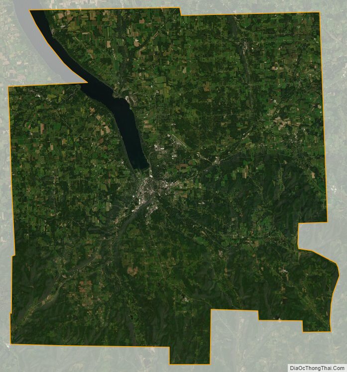
Tompkins County Satellite Map
Tompkins County Outline Map