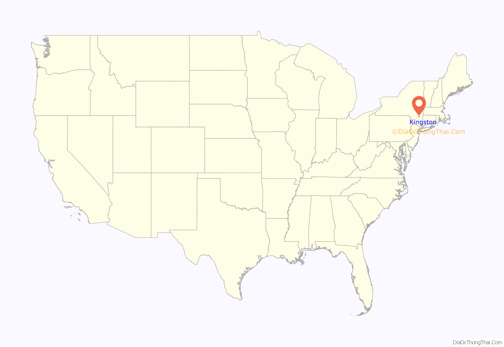
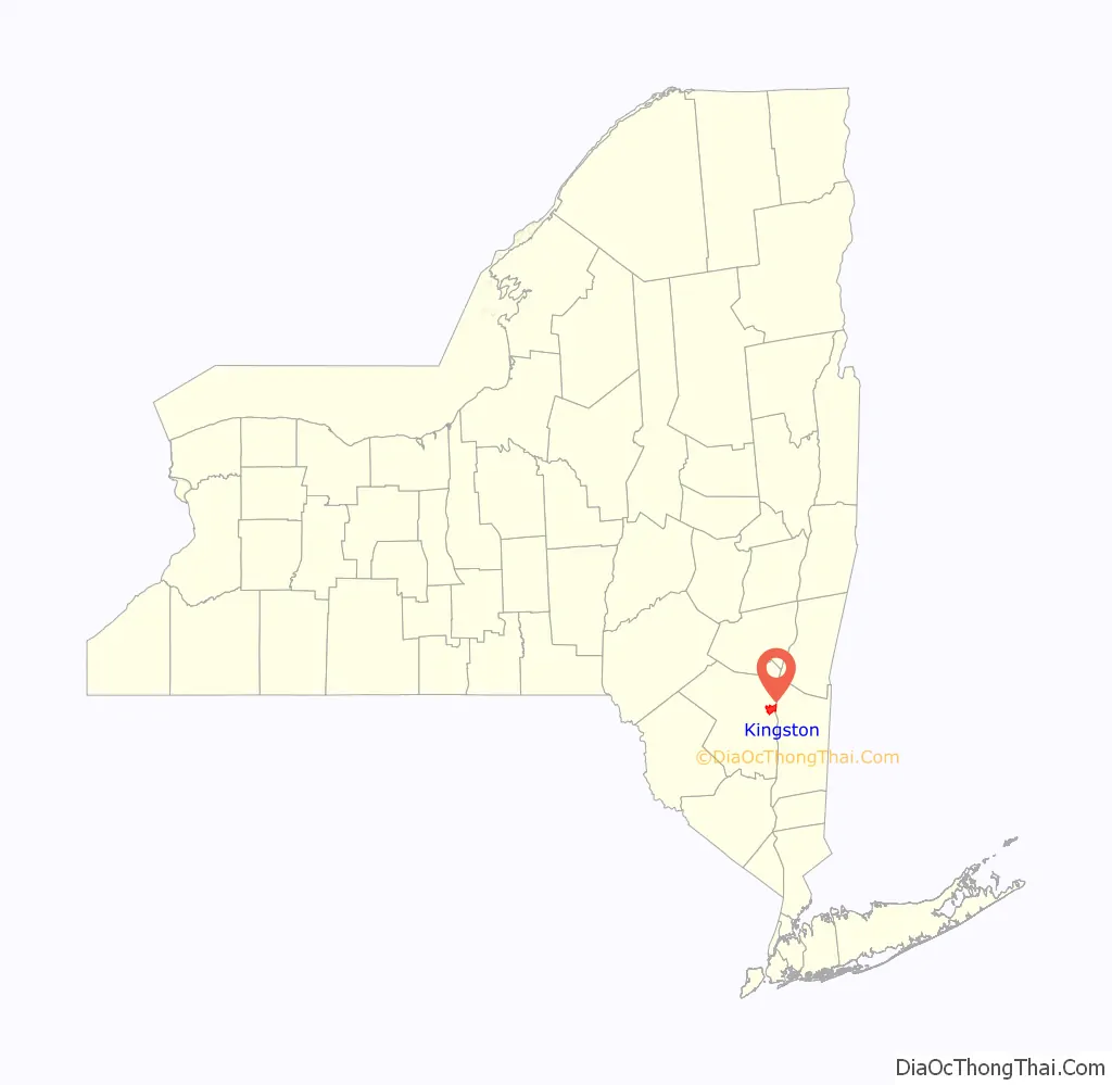
Kingston is the only city in, and the county seat of, Ulster County, New York, United States. It is 91 miles (146 km) north of New York City and 59 miles (95 km) south of Albany. The city’s metropolitan area is grouped with the New York metropolitan area around Manhattan by the United States Census Bureau. The population was 24,069 at the 2020 United States Census.
Kingston became New York’s first capital in 1777. During the American Revolutionary War, the city was burned by the British on October 13, 1777, after the Battles of Saratoga. In the 19th century, it became an important transport hub after the discovery of natural cement in the region. It had connections to other markets through both the railroad and canal connections.
Many of the older buildings are considered contributing as part of three historic districts, including the Stockade District uptown, the Midtown Neighborhood Broadway Corridor, and the Rondout-West Strand Historic District downtown. Each district is listed on the National Register of Historic Places.
| Name: | Kingston city |
|---|---|
| LSAD Code: | 25 |
| LSAD Description: | city (suffix) |
| State: | New York |
| County: | Ulster County |
| Elevation: | 191 ft (58 m) |
| Land Area: | 7.48 sq mi (19.38 km²) |
| Water Area: | 1.29 sq mi (3.33 km²) |
| Population Density: | 3,216.92/sq mi (1,242.00/km²) |
| Area code: | 845 |
| FIPS code: | 3639727 |
| GNISfeature ID: | 0979119 |
| Website: | kingston-ny.gov |
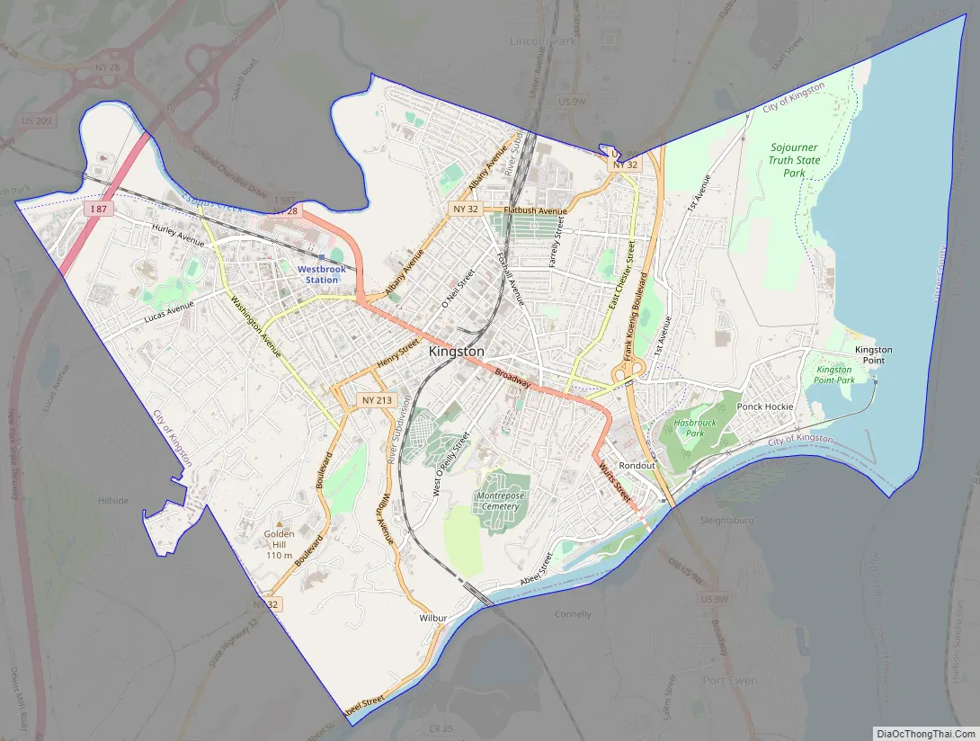
Online Interactive Map
Click on ![]() to view map in "full screen" mode.
to view map in "full screen" mode.
Kingston location map. Where is Kingston city?
History
Colonial history
Kingston is the traditional home of the Esopus people. As early as 1614, the Dutch had set up a factorij (trading post) at Ponckhockie, at the junction of the Rondout Creek and the Hudson River. They traded European goods with the Lenape and Mohican for the furs their trappers collected. The first recorded permanent settler in what would become the city of Kingston was Thomas Chambers. He came from the area of Rensselaerswyck in 1653. The new settlement was called Esopus after the local Lenape people.
In 1654, European settlers began buying land in what now is Kingston from the Esopus Indians, although historians believe the two cultures had drastically different conceptions of property and land use. Tension between the two cultures rose quickly as a result.
Common sources of friction between Dutch settlers and the Esopus included settlers’ livestock trampling Indian cornfields, disputes over trade, and the adverse effects of Dutch brandy on the Native Americans. Prior to the Europeans’ arrival, they had no experience with liquor. In the spring of 1658, Peter Stuyvesant, Director-General of New Amsterdam, ordered the consolidation and fortification of the settlement on high ground in what today is Uptown Kingston. The building of the defensive Stockade increased the conflicts. Tensions broke out in the Esopus Wars.
In 1661 the settlement was granted a charter as a separate municipality; Stuyvesant named it Wiltwijck (Wiltwyck). It was not until 1663 that the Dutch ended the four-year conflict with the Esopus, defeating them with a coalition of Dutch settlers, Wappinger and Mohawk peoples.
Wiltwyck was one of three large Hudson River settlements in New Netherland, the other two being Beverwyck, now Albany; and New Amsterdam, now New York City. With the English seizure of New Netherland in 1664, relations between the Dutch settlers and the English soldiers garrisoned there were often strained. In 1669, the English renamed Wiltwyck as Kingston, in honor of the family seat of Governor Lovelace’s mother. In 1683, citizens of Kingston petitioned the Kingston court to buy more land from the Esopus people. Officials from Ulster County maintained contact with the Esopus until 1727.
Many descendants of the Esopus people who inhabited the area became remnant members of several other related, displaced tribes. Some in the diaspora are among the federally recognized Stockbridge–Munsee Community, who moved from New York to Shawano County, Wisconsin; the Munsee-Delaware of the Six Nations Reserve in Ontario, Canada, established after the Revolution by the Crown for its Iroquois and other Indian allies; and the Ramapough Lenape Indian Nation (located primarily in the highland of the New York-New Jersey border area).
In 1777, Kingston was designated as the first capital of the state of New York. During the spring of 1777, when the New York State constitution was being written in White Plains, New York City was occupied by British troops. The work was moved to Kingston, which was deemed safer, and the document completed that April 20. It was never submitted to the people for ratification, but the first governor of the state, George Clinton, was sworn in as the first Governor of New York on July 30, 1777.
The British never reached Albany, having been stopped at Saratoga, but they did reach Kingston. On October 13, 1777, the city was burned by British troops moving up river from New York City, and disembarking at the mouth of the Rondout Creek at “Ponckhockie”. The residents of Kingston knew about the oncoming fleet. By the time the British arrived, the residents and government officials had removed to Hurley, New York. The Kingston area was largely agricultural and a major granary for the colonies at the time, so the British burned large amounts of wheat and all but one or two of the buildings. Kingston celebrates and re-enacts the 1777 burning of the city by the British every other year in a citywide theatrical staging of the event that begins at the Rondout.
Kingston was incorporated as a village on April 6, 1805. In the early 1800s, four sloops plied the river, carrying passengers and freight from Kingston to New York. By 1829, river steamers made the trip to Manhattan in a little over twelve hours, usually travelling by night. Columbus Point (now known as Kingston Point) was the river landing for Kingston, and stage lines ran from the village to the Point. The Dutch cultural influence in Kingston remained strong through the nineteenth century.
Rondout
Rondout was a small farming village until 1825, when construction of the Delaware and Hudson Canal from Rondout to Honesdale, Pennsylvania, attracted an influx of laborers. When they completed the canal in 1828, Rondout became an important tidewater coal terminal. Natural cement deposits were found throughout the valley, and in 1844 quarrying began in the “Ponchockie” section of Rondout. The Newark Lime and Cement Company shipped cement throughout the United States, a thriving business until the invention of cheaper, quicker drying Portland Cement. Workers cut and stored ice from the Hudson River each winter, keeping it in large warehouses of ice near the river. The ice would be cut in chunks and delivered to customers around the city. It was preserved in straw all year and ice chunks served as an early method of refrigeration.
Large brick making factories also were built near this shipping hub. Rondout’s primacy as a shipping hub ended with the advent of railroads. These lines were built through Rondout and Kingston, with stations in each place. They could also transport their loads through the city without stopping.
Wilbur
Wilbur (aka Twaalfskill) was a hamlet upstream from Rondout, where the Twaalfskill Creek met the Rondout Creek. There was a sloop landing there. The hamlet became the center for the shipment of bluestone to lay the sidewalks of New York City.
Kingston officially became a city on May 29, 1872, with the merger of the villages of Rondout and Kingston, and the hamlet of Wilbur.
Historic churches
The congregation of the Fair Street Reformed Church meets in the oldest public worship building in Kingston. Established as the Second Reformed Church of Kingston in January 1849, the small group of 27 people originally met for worship in the County Court House on Wall Street. In 1850 construction of the church began, using local dolomite limestone taken from a quarry on upper Pearl Street. The church was originally graced by a steeple purported to be the highest of its time out of New York City.
Kingston is home to many historic churches. The oldest is the First Reformed Protestant Dutch Church of Kingston, which was organized in 1659. Referred to as The Old Dutch Church, it is in uptown Kingston. George Clinton, first governor of New York and fourth US vice president, is buried in the churchyard. Many of the city’s historic churches are on Wurts street (six are in one block). What is now called the Hudson Valley Wedding Chapel was built in 1867; it has been restored and is used for weddings.
Trinity Evangelical Lutheran Church at 75 Spring Street was founded in 1842. The original church building at the corner of Hunter and Ravine streets burned to the ground in the late 1850s. The current church on Spring Street was built in 1874.
St. John’s Episcopal Church was named for St. John the Evangelist. It was founded in 1832, on June 24, the feast of St. John the Baptist. Therefore, both are considered patrons of the parish. Rev. Reuben Sherwood of Saugerties, New York was the first rector. The first church was built on Wall Street and opened November 24, 1835.
In 1926, the property was sold to the Up-to-Date clothing company. The church structure was dismantled and relocated to Albany Ave. In 1992, St. John’s established “Angel Food East”, a ministry that delivers food prepared at the church kitchen to persons in need throughout Ulster County.
In 1891, Lewis T. Wattson, rector of St. John’s, established the Church of the Holy Cross as a mission of St. John’s, to serve working-class families living near the West Shore Railroad. Many of them worked for the railroad. Holy Cross had a more Anglo-Catholic tradition and a particular mission to the poor. Since the late 20th century, given increased Latino immigration from Mexico, Central and South America, Holy Cross/Santa Cruz has become a bilingual (Spanish/English), multicultural Episcopal parish.
St. Joseph’s Parish began in 1863 as a one-room Roman Catholic mission school to serve the children of the Wilbur area. It was founded by Father Felix Farrelly, pastor of St. Mary’s Parish in Rondout. The building was later sold to the city of Kingston in 1871.
In 1867, Rev. James Coyne was appointed pastor of St. Mary’s in Rondout. The following year he established St. Joseph’s in Kingston. He purchased the Young Men’s Gymnasium on the corner of Fair and Bowery streets. The first Mass was said on September 21, 1868, by Fr. James Dougherty, an alumnus of St. Mary’s parochial school. Dougherty became the first pastor of St. Joseph’s parish. Fr. Dougherty is buried in St. Mary’s Cemetery.
As the chapel was deemed too small, the parish purchased the former Kingston Armory at the corner of Wall and Main streets for use as a church. Many new Catholic immigrants had arrived in the mid-century from Ireland and southern and eastern Europe. The new church was dedicated on July 26, 1869. In 1877 Jockey Hill was made a mission of St. Joseph’s. In 1962 a mission was established in Hurley.
In 1893, St. Joseph’s Church underwent a major renovation, including the installation of the side altars. The new church front was completed in 1898. The interior was renovated in 1905.
The frame building on the Bowery was adapted as a schoolhouse. This was replaced in 1905 with the acquisition of the former mansion of Judge Alton B. Parker at 1 Pearl Street, for a new St. Joseph’s School and Convent. The Fair Street school building continued to be used as the parish hall until the property was sold in 1911. Also in 1911 a site for a larger school and convent was secured and 1 Pearl Street was sold. In 1943 the Sisters of St. Ursula replaced the Sisters of Charity at the school.
In February 1962, construction began on the current St Joseph School, which housed eight additional classrooms. Old St. Joseph School was renamed as the Msgr. Stephen Connolly Bldg. A plaque donated by the Holy Name Society in honor of Father John Broidy, the pastor who oversaw construction of the building in 1912, is installed on the right front of the building.
The A.M.E. Zion Church of Kingston (previously known as Franklin Street AME Zion Church) is an African Methodist Episcopal Zion Church established in 1848. Its current building at 26 Franklin Street was completed in 1929. It also owns the historic Mount Zion Cemetery.
Kingston Road Map
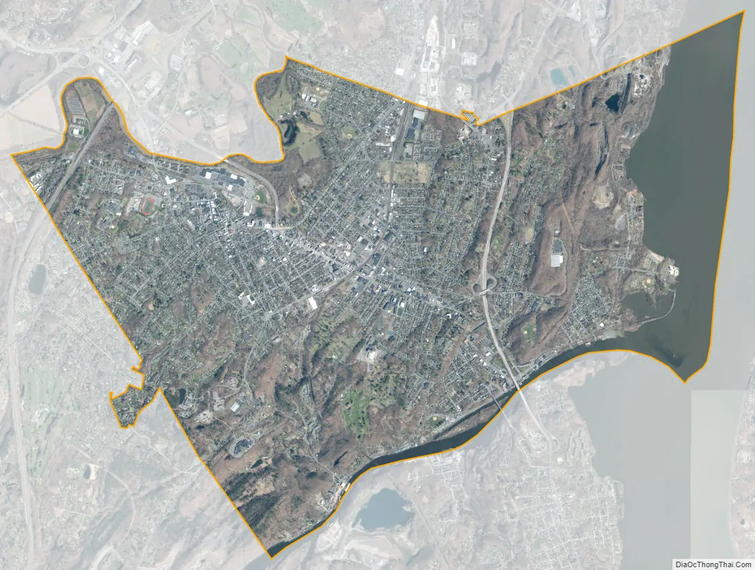
Kingston city Satellite Map
Geography
Kingston has three recognized area neighborhoods. The Uptown Stockade Area, The Midtown Area, and The Downtown Waterfront Area. The Uptown Stockade District was the first capital of New York State. Meanwhile, the Midtown area is known for its early 20th century industries and is home to the Ulster Performing Arts Center and the historic City Hall building.
The downtown area, once the village of Rondout and now the Rondout-West Strand Historic District, borders the Rondout Creek and includes a recently redeveloped waterfront. The creek empties into the Hudson River through a large, protected tidal area which was the terminus of the Delaware and Hudson Canal, built to haul coal from Pennsylvania to New York City.
The Rondout neighborhood is known for its artists’ community and its many art galleries; in 2007 Business Week online named it as among “America’s best places for artists.” It is also the site of a number of festivals, including the Kingston Jazz Festival and the Artists Soapbox Derby.
Midtown is the largest of Kingston’s neighborhoods, home to Kingston High School and both campuses of HealthAlliance Hospital, part of the Westchester Medical Center Health Network; HealthAlliance Broadway Campus (formerly The Kingston Hospital) and HealthAlliance Mary’s Avenue Campus (formerly Benedictine Hospital).
While the Uptown area is noted for its “antique” feeling, the overhangs attached to buildings along Wall and North Front streets were added to historic buildings in the late 1970s and are not authentically part of the 19th century Victorian architecture. The historic covered storefront walks, known as the Pike Plan, were recently reinforced and modernized with skylights. In the Stockade district of Uptown, many 17th century stone buildings remain. Among these is the Senate House, which was built in the 1670s and was used as the state capitol during the revolution. Many of these old buildings were burned by the British Oct. 17, 1777, and restored later. A controversial restoration of 1970s-era canopies was marred by the sudden appearance of painted red goats on planters just prior to the neighborhood’s rededication. This part of the city is also the location of the Ulster County Office Building.
According to the United States Census Bureau, the city has an area of 8.6 square miles (22 km), of which 7.3 square miles (19 km) is land and 1.3 square miles (3.4 km), or 15.03%, is water. The city is on the west bank of the Hudson River. Neighboring towns include Hurley, Saugerties, Rhinebeck, and Red Hook.
The city’s Hasbrouck Park was created in 1920; it includes a 45 acres (18 ha) area and includes a nature trail.
Sidewalks with porticos in the Stockade District uptown
Historic commercial buildings in Kingston
Downtown Kingston NY, called The Rondout
See also
Map of New York State and its subdivision:- Albany
- Allegany
- Bronx
- Broome
- Cattaraugus
- Cayuga
- Chautauqua
- Chemung
- Chenango
- Clinton
- Columbia
- Cortland
- Delaware
- Dutchess
- Erie
- Essex
- Franklin
- Fulton
- Genesee
- Greene
- Hamilton
- Herkimer
- Jefferson
- Kings
- Lake Ontario
- Lewis
- Livingston
- Madison
- Monroe
- Montgomery
- Nassau
- New York
- Niagara
- Oneida
- Onondaga
- Ontario
- Orange
- Orleans
- Oswego
- Otsego
- Putnam
- Queens
- Rensselaer
- Richmond
- Rockland
- Saint Lawrence
- Saratoga
- Schenectady
- Schoharie
- Schuyler
- Seneca
- Steuben
- Suffolk
- Sullivan
- Tioga
- Tompkins
- Ulster
- Warren
- Washington
- Wayne
- Westchester
- Wyoming
- Yates
- Alabama
- Alaska
- Arizona
- Arkansas
- California
- Colorado
- Connecticut
- Delaware
- District of Columbia
- Florida
- Georgia
- Hawaii
- Idaho
- Illinois
- Indiana
- Iowa
- Kansas
- Kentucky
- Louisiana
- Maine
- Maryland
- Massachusetts
- Michigan
- Minnesota
- Mississippi
- Missouri
- Montana
- Nebraska
- Nevada
- New Hampshire
- New Jersey
- New Mexico
- New York
- North Carolina
- North Dakota
- Ohio
- Oklahoma
- Oregon
- Pennsylvania
- Rhode Island
- South Carolina
- South Dakota
- Tennessee
- Texas
- Utah
- Vermont
- Virginia
- Washington
- West Virginia
- Wisconsin
- Wyoming


