Mountain Lake is a city in Cottonwood County, Minnesota, United States. The population was 2,104 at the 2010 census.
Mountain Lake was initially composed mostly of the 1,800 Low German (or more specifically, Plautdietsch) speaking Mennonites from Russia who settled there between 1873 and 1880. Although the city has gradually become more diverse, with the more recent addition of immigrant groups including Lao, Hmong, and Hispanic people, a significant percentage of its inhabitants still have Mennonite surnames.
| Name: | Mountain Lake city |
|---|---|
| LSAD Code: | 25 |
| LSAD Description: | city (suffix) |
| State: | Minnesota |
| County: | Cottonwood County |
| Elevation: | 1,306 ft (398 m) |
| Total Area: | 1.65 sq mi (4.27 km²) |
| Land Area: | 1.63 sq mi (4.23 km²) |
| Water Area: | 0.02 sq mi (0.04 km²) |
| Total Population: | 1,999 |
| Population Density: | 1,225.63/sq mi (473.12/km²) |
| ZIP code: | 56159 |
| Area code: | 507 |
| FIPS code: | 2744566 |
| GNISfeature ID: | 648194 |
| Website: | www.mountainlakemn.com |
Online Interactive Map
Click on ![]() to view map in "full screen" mode.
to view map in "full screen" mode.
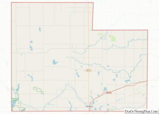
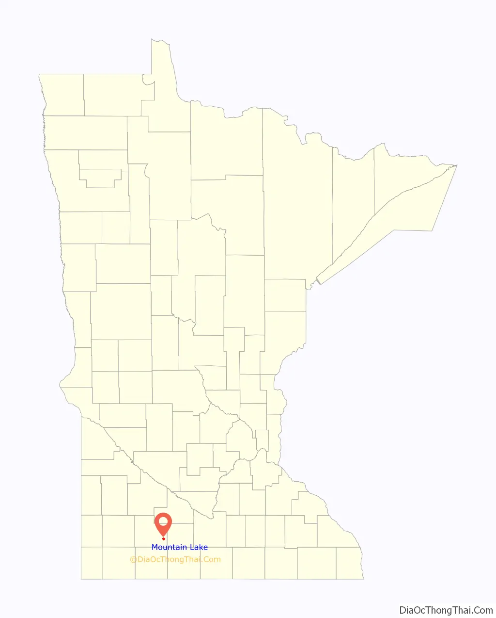
Mountain Lake location map. Where is Mountain Lake city?

History
The city of Mountain Lake was formally platted on May 25, 1872. It has had a post office in operation since 1871.
Original settlement
The name “Mountain Lake” is usually attributed to early settler William Mason. The city’s official website recalls, “the first white settler to the area, William Mason, found a shallow 900-acre lake with three islands. The two smaller islands just broke the water’s surface. The third much larger, higher island looked to Mason like a mountain rising from the lake. He named the lake Mountain Lake and the island Mountain Island.” The top of the island was covered with trees, and could be seen for miles around, thus serving as a landmark to early settlers. The story continues that in 1871 the St. Paul & Sioux City Railway had selected “Midway” as the name of the village, since it was located midway between Saint Paul, Minnesota and Sioux City, Iowa. However, Mason insisted that the village being platted be named “Mountain Lake”.
Demand for more tillable farmland and construction advances led to the draining of the original lake in 1905–1906, which was located in Mountain Lake township, southeast of town. However, in 1937–1938 a dam, bridge, and outlet were constructed by the Works Progress Administration at a new site in Midway township to create a new Mountain Lake. This lake, located on the north edge of town, also has an island.
The large island of the original lake – now just a hill amidst the surrounding cornfields – became a county park which has since 1973 been listed on the National Register of Historic Places. Archeological evidence suggests that early settler William Mason was not the first to appreciate the unique qualities of the original lake’s island. Artifacts unearthed in a 1976 dig indicated evidence of habitation as early as 500 BC, thus making the location the oldest human habitation yet to be discovered in the state of Minnesota.
Mennonite immigration and influence
The coming of the railroad in 1873 played a big role in the expansion of the village. By the time Mountain Lake was formally incorporated in 1886, it had a population of three hundred people, primarily composed of Mennonites immigrating from southern Russia (present-day Ukraine).
In 1873, Mennonite immigrants from the Ukraine (at that time, Ukraine was part of the Russian Empire) began to arrive in Mountain Lake, having been recruited by William Seeger, a member of the Minnesota State Board of Immigration. Seeger had specifically targeted Mennonites, “because they were believed to be hard workers of good character.” The majority of these Mennonite families came from the Molotschna Colony, located near the present-day city of Melitopol, Ukraine. However, a number of Manitoba Mennonites originally from the Chortitza Colony, near the present-day Ukrainian city of Zaporizhzhia, also settled in the Mountain Lake area. By 1880, it is estimated that some 295 Mennonite families had settled there.
Because Mountain Lake was already an established community and its surrounding farmland largely surveyed, the Mennonites could not arrange themselves in the traditional communal villages they had been accustomed to in their Ukrainian colonies. This forced them to adapt to American-style, single family farms and to live amongst their non-Mennonite neighbors. As settlement continued, the Mennonites of Mountain Lake had soon established a successful and cohesive community, “based primarily on agriculture and local commerce.” For many decades thereafter, they retained the speaking of Plautdietsch, the Mennonite variation of Low German.
On October 14, 1889, the Konference der Vereinigten Mennoniten-Brueder von Nord America was founded in Mountain Lake. Elder Aaron Wall, founder of the Bruderthaler Church of Mountain Lake and Elder Isaac Peters of the Ebenezer Church of Henderson, Nebraska were instrumental in the establishment of this new Mennonite denomination. Known today as the Fellowship of Evangelical Bible Churches (FEBC), for many years the conference was popularly called the Bruderthaler Conference, because of the influential nature of the Mountain Lake founding church. In 1914 the name was officially changed to The Defenceless Mennonite Brethren in Christ of North America. The name was changed once again, in 1937, to Evangelical Mennonite Brethren (EMB). The denominational headquarters was located in Mountain Lake until 1956.
Around the year 1905, several local men founded the Mennonite hospital of Mountain Lake. The institution struggled until 1912, when it was sold and reorganized as the Bethel Deaconess Hospital. The physicians in charge were Dr. Piper of Mountain Lake and Dr. Sogge of Windom, who were assisted by three deaconess sisters. The hospital was managed by a local board of directors consisting of one member from each of the town’s five Mennonite churches.
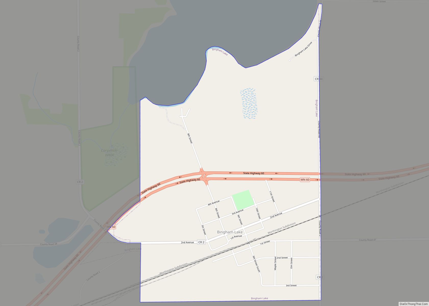
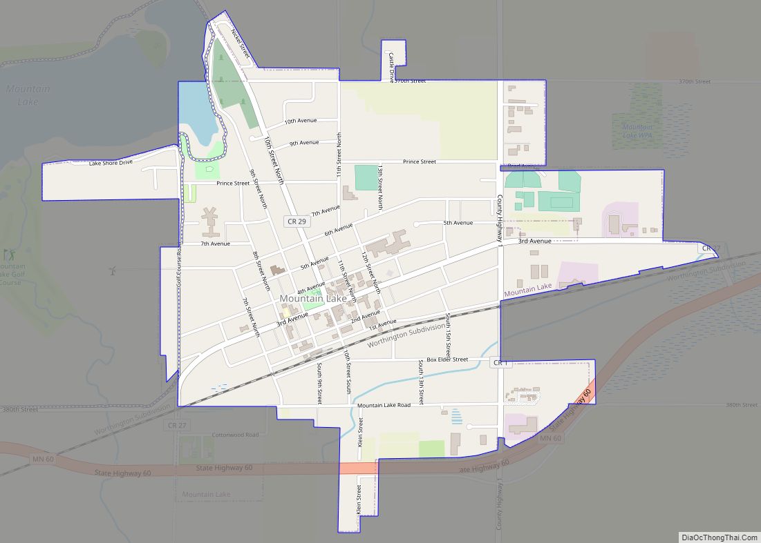
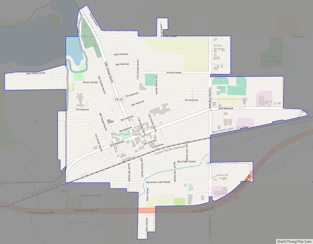
Mountain Lake Road Map
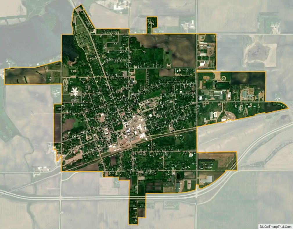
Mountain Lake city Satellite Map
Geography
According to the United States Census Bureau, the city has a total area of 1.55 square miles (4.01 km), of which 1.53 square miles (3.96 km) is land and 0.02 square miles (0.05 km) is water.
Minnesota State Highway 60 serves as a main route around the city, running generally east to west. Secondarily, County Road 1 runs north and south through town.
Mountain Lake is located at coordinates 43°56′20″N 94°55′47″W / (43.9388460, -94.9297089). The elevation is 1,306 feet (398 m).
See also
Map of Minnesota State and its subdivision:- Aitkin
- Anoka
- Becker
- Beltrami
- Benton
- Big Stone
- Blue Earth
- Brown
- Carlton
- Carver
- Cass
- Chippewa
- Chisago
- Clay
- Clearwater
- Cook
- Cottonwood
- Crow Wing
- Dakota
- Dodge
- Douglas
- Faribault
- Fillmore
- Freeborn
- Goodhue
- Grant
- Hennepin
- Houston
- Hubbard
- Isanti
- Itasca
- Jackson
- Kanabec
- Kandiyohi
- Kittson
- Koochiching
- Lac qui Parle
- Lake
- Lake of the Woods
- Lake Superior
- Le Sueur
- Lincoln
- Lyon
- Mahnomen
- Marshall
- Martin
- McLeod
- Meeker
- Mille Lacs
- Morrison
- Mower
- Murray
- Nicollet
- Nobles
- Norman
- Olmsted
- Otter Tail
- Pennington
- Pine
- Pipestone
- Polk
- Pope
- Ramsey
- Red Lake
- Redwood
- Renville
- Rice
- Rock
- Roseau
- Saint Louis
- Scott
- Sherburne
- Sibley
- Stearns
- Steele
- Stevens
- Swift
- Todd
- Traverse
- Wabasha
- Wadena
- Waseca
- Washington
- Watonwan
- Wilkin
- Winona
- Wright
- Yellow Medicine
- Alabama
- Alaska
- Arizona
- Arkansas
- California
- Colorado
- Connecticut
- Delaware
- District of Columbia
- Florida
- Georgia
- Hawaii
- Idaho
- Illinois
- Indiana
- Iowa
- Kansas
- Kentucky
- Louisiana
- Maine
- Maryland
- Massachusetts
- Michigan
- Minnesota
- Mississippi
- Missouri
- Montana
- Nebraska
- Nevada
- New Hampshire
- New Jersey
- New Mexico
- New York
- North Carolina
- North Dakota
- Ohio
- Oklahoma
- Oregon
- Pennsylvania
- Rhode Island
- South Carolina
- South Dakota
- Tennessee
- Texas
- Utah
- Vermont
- Virginia
- Washington
- West Virginia
- Wisconsin
- Wyoming