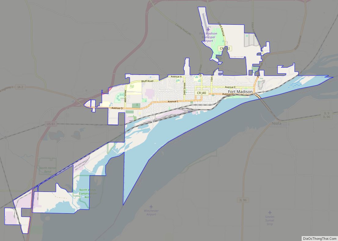
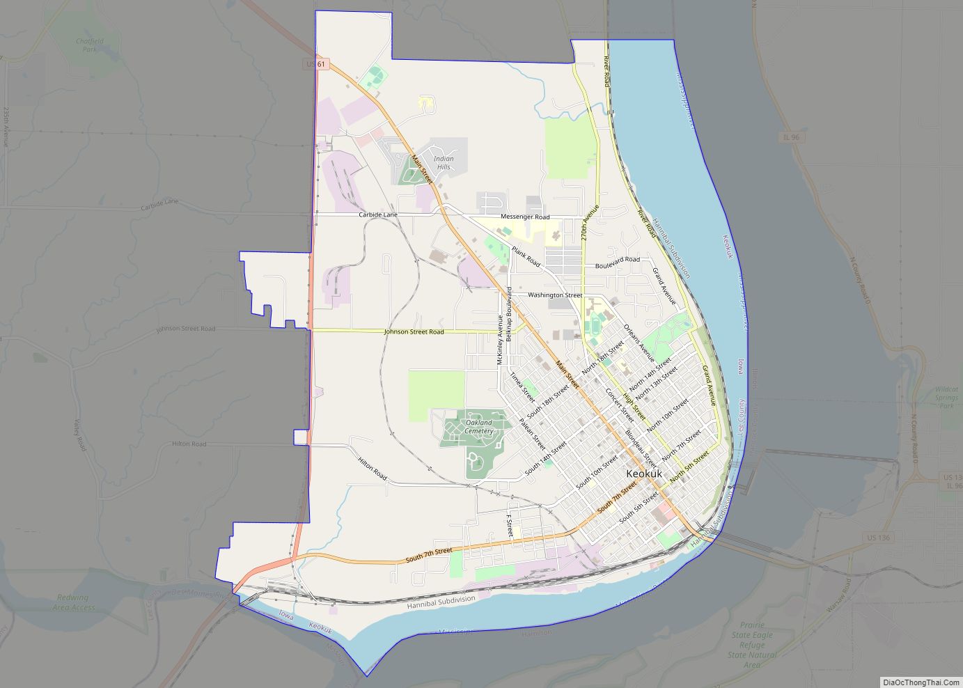
Keokuk /ˈkiːəkʌk/ is a city in and a county seat of Lee County, Iowa, United States. It is Iowa’s southernmost city. The population was 9,900 at the time of the 2020 census. The city is named after the Sauk chief Keokuk, who is thought to be buried in Rand Park. It is in the extreme southeast corner of Iowa, where the Des Moines River meets the Mississippi. It is at the junction of U.S. Routes 61, 136 and 218. Just across the rivers are the towns of Hamilton and Warsaw, Illinois, and Alexandria, Missouri. Keokuk, along with the city of Fort Madison, is a principal city of the Fort Madison-Keokuk micropolitan area, which includes all of Lee County, Iowa, Hancock County, Illinois and Clark County, Missouri.
| Name: | Keokuk city |
|---|---|
| LSAD Code: | 25 |
| LSAD Description: | city (suffix) |
| State: | Iowa |
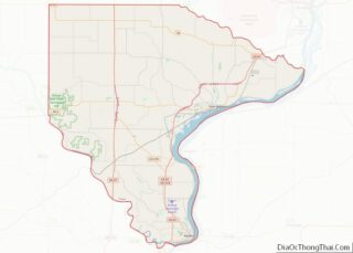
| County: | Lee County |
| Founded: | 1832 |
| Incorporated: | December 13, 1848 |
| Elevation: | 568 ft (173 m) |
| Total Area: | 10.55 sq mi (27.32 km²) |
| Land Area: | 9.10 sq mi (23.57 km²) |
| Water Area: | 1.45 sq mi (3.75 km²) |
| Total Population: | 9,900 |
| Population Density: | 1,088/sq mi (420.08/km²) |
| ZIP code: | 52632 |
| Area code: | 319 |
| FIPS code: | 1940845 |
| Website: | www.cityofkeokuk.org |
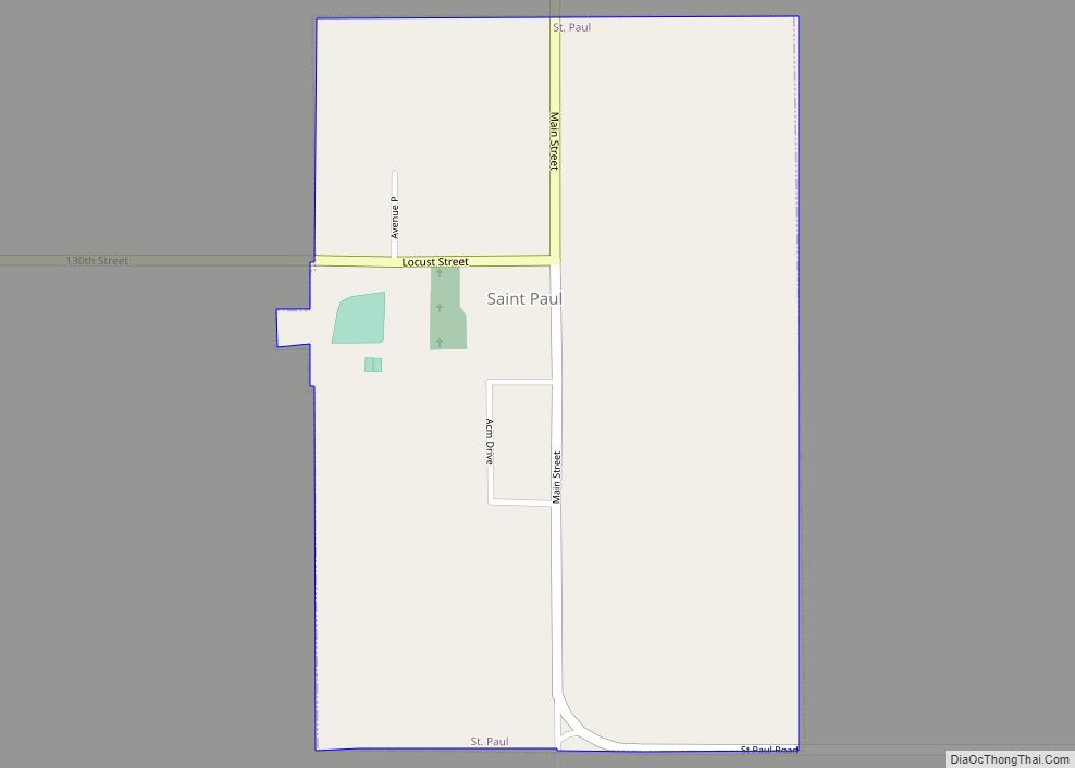
Online Interactive Map
Click on ![]() to view map in "full screen" mode.
to view map in "full screen" mode.
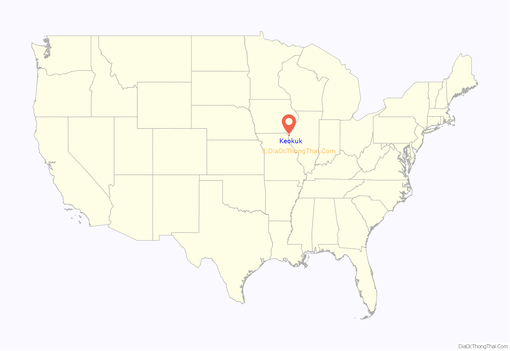
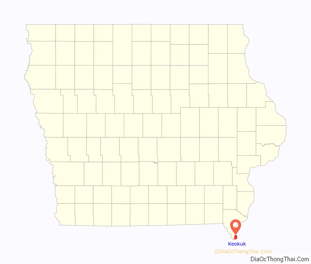
Keokuk location map. Where is Keokuk city?
History
Situated between the Des Moines and Mississippi rivers, the area that became Keokuk had access to a large trading area and was an ideal location for settlers. In 1820, the US Army prohibited soldiers stationed along the Mississippi River from having wives who were Native American. Dr. Samuel C. Muir, a surgeon stationed at Fort Edwards (near present-day Warsaw, Illinois), resigned his commission rather than leave his Indian wife and crossed the river to resettle. He built a log cabin for them at the bottom of the bluff, and became the area’s first white settler.
As steamboat traffic on the Mississippi increased, more European Americans began to settle here. Around 1827, John Jacob Astor established a post of his American Fur Company at the foot of the bluff. Five buildings were erected to house workers and the business. This area became known as the “Rat Row”.
One of the earliest descriptions of Keokuk was by Caleb Atwater in 1829:
The settlement was part of the land designated in 1824 as a Half-Breed Tract by the United States Government for allotting land to mixed-race descendants of the Sauk and Fox tribes. Typically children of European or British men (fur traders and trappers) and Native women, they were often excluded from tribal communal lands because their fathers were not tribal members. Native Americans considered the settlement a neutral ground. Rules for the tract prohibited individual sale of the land, but the US Congress ended this provision in 1837, creating a land rush and instability.
Centering on the riverboat trade, the settlement continued to grow. The village became known as Keokuk shortly after the Blackhawk War in 1832. Why residents named it after the Sauk chief is unknown. Keokuk was incorporated on December 13, 1847.
Barnard States Merriam was elected mayor in 1852 and reelected in 1854.
In 1853, Keokuk was one of the centers for outfitting additional immigrant Latter-Day Saints pioneers for their handcart journey west; 2,000 Christian Latter-Day Saints passed through the city.
Keokuk was the longtime home of Orion Clemens, brother of Samuel Clemens, better known as Mark Twain. Samuel’s visits to his brother’s home led him to write of the beauty of Keokuk and southeastern Iowa in Life on the Mississippi.
At one time, because of its position at the foot of the lower rapids of the Mississippi, Keokuk was known as the Gate City. During the American Civil War, Keokuk became an embarking point for Union troops heading to fight in southern battles. Injured soldiers were returned to Keokuk for treatment, so several hospitals were established. A national cemetery was designated for those who did not survive. After the war was over, Keokuk continued its expansion. A medical college was founded, along with a major-league baseball team, the Keokuk Westerns, in 1875.
In 1913, Lock and Dam No. 19 was completed nearby on the Mississippi River. The population of Keokuk reached 15,106 by 1930. During the last half of the 20th century, Keokuk became less engaged in Mississippi River trade and more dependent on jobs in local factories. The town celebrated 150 years in 1997.
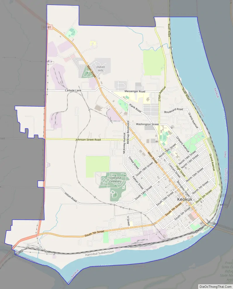
Keokuk Road Map
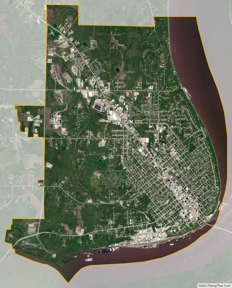
Keokuk city Satellite Map
Geography
Keokuk is in Iowa’s southeast corner along the Mississippi River and just northeast of the Des Moines River. Hamilton, Illinois, lies to the east across the Mississippi on U.S. Route 136.
According to the United States Census Bureau, the city has a total area of 10.58 square miles (27.40 km), of which 9.13 square miles (23.65 km) is land and 1.45 square miles (3.76 km) is water. The lowest point in the state of Iowa is 480 feet (150 m), located to the immediate south-west of Keokuk where the confluence of the Des Moines and Mississippi Rivers creates a tripoint between Iowa, Illinois and Missouri.
Climate
Keokuk has a humid continental climate. It is known for having recorded the highest temperature ever in Iowa, 118 °F (48 °C), on July 20, 1934.
See also
Map of Iowa State and its subdivision:- Adair
- Adams
- Allamakee
- Appanoose
- Audubon
- Benton
- Black Hawk
- Boone
- Bremer
- Buchanan
- Buena Vista
- Butler
- Calhoun
- Carroll
- Cass
- Cedar
- Cerro Gordo
- Cherokee
- Chickasaw
- Clarke
- Clay
- Clayton
- Clinton
- Crawford
- Dallas
- Davis
- Decatur
- Delaware
- Des Moines
- Dickinson
- Dubuque
- Emmet
- Fayette
- Floyd
- Franklin
- Fremont
- Greene
- Grundy
- Guthrie
- Hamilton
- Hancock
- Hardin
- Harrison
- Henry
- Howard
- Humboldt
- Ida
- Iowa
- Jackson
- Jasper
- Jefferson
- Johnson
- Jones
- Keokuk
- Kossuth
- Lee
- Linn
- Louisa
- Lucas
- Lyon
- Madison
- Mahaska
- Marion
- Marshall
- Mills
- Mitchell
- Monona
- Monroe
- Montgomery
- Muscatine
- O'Brien
- Osceola
- Page
- Palo Alto
- Plymouth
- Pocahontas
- Polk
- Pottawattamie
- Poweshiek
- Ringgold
- Sac
- Scott
- Shelby
- Sioux
- Story
- Tama
- Taylor
- Union
- Van Buren
- Wapello
- Warren
- Washington
- Wayne
- Webster
- Winnebago
- Winneshiek
- Woodbury
- Worth
- Wright
- Alabama
- Alaska
- Arizona
- Arkansas
- California
- Colorado
- Connecticut
- Delaware
- District of Columbia
- Florida
- Georgia
- Hawaii
- Idaho
- Illinois
- Indiana
- Iowa
- Kansas
- Kentucky
- Louisiana
- Maine
- Maryland
- Massachusetts
- Michigan
- Minnesota
- Mississippi
- Missouri
- Montana
- Nebraska
- Nevada
- New Hampshire
- New Jersey
- New Mexico
- New York
- North Carolina
- North Dakota
- Ohio
- Oklahoma
- Oregon
- Pennsylvania
- Rhode Island
- South Carolina
- South Dakota
- Tennessee
- Texas
- Utah
- Vermont
- Virginia
- Washington
- West Virginia
- Wisconsin
- Wyoming