Map of Malaysia

Map of Malaysia

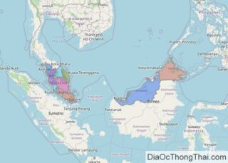
With an area of 329,847 sq. km, Malaysia is the 66th largest country in the world. As observed on the physical map above, Malaysia consists of the Peninsular Malaysia, which is part of mainland Southeast Asia, and the states of Sabah and Sarawak (east Malaysia) on the northern edges of the island of Borneo. In … Read more

Map of South Africa

Map of South Africa

The southernmost African country of South Africa encompasses an area of 1,221,037 sq. km.  South Africa is mostly covered by a plateau that drops in elevation from the east (about 2,400 m) to west (about 600 m). In the west, it gives way to the Kalahari Desert. The central part of the plateau is called … Read more

Map of Denmark

Map of Denmark

A Nordic country in Northern Europe, Denmark occupies an area of 42,933 km2(16,577 sq mi).  As observed on the physical map of Denmark above, for the most part Denmark consists of flat lands with very little elevation, except for the hilly central area on the Jutland Peninsula.  Its average height above sea level is only 31 meters (101 … Read more

Map of Colombia

Map of Colombia

Covering an area of 1,141,748 sq. km, Colombia is a country located in the northwestern part of South America. As observed on the map, the Colombian Andes dominates the landscape in the western part of the country. The Colombian Andes is further divided into three branches: The Cordillera Central (Central Range), Cordillera Oriental (Eastern Range), … Read more

Map of Egypt

Map of Egypt

The transcontinental country of Egypt covers an area of 1,010,408 sq. km. As observed on the physical map above, Egypt is largely covered by desert with the Nile River running south to north through the middle of the eastern half of the country to drain into the Mediterranean Sea. The river stretches from Lake Nasser … Read more

Map of Bangladesh

Map of Bangladesh

Bangladesh occupies an area of  148,460 sq. km in South Asia.  As observed on the physical map of the country above, it is mostly a low-lying country. The geography can be divided into three regions. The highly fertile Ganga-Brahmaputra delta dominates the landscape of Bangladesh. The Barind and Madhupur plateaus define the central and northwestern … Read more

Map of Chile

Map of Chile

Covering an area of about 756,096 sq.km (291,930.4 sq mi) and with a toothy coastline of almost 4,000 miles, pencil-thin Chile is wedged between the Pacific Ocean and the rugged Andes, the world’s longest mountain range; in southwestern part of South America. This land of incredible and unusual contrasts is also home to the numerous beaches, fjords, … Read more

Map of Pakistan

Map of Pakistan

Pakistan occupies an area of 881,913 in South Asia. Located at the juncture of the Indian and Eurasian plates, the country is highly prone to earthquakes due to plate tectonics.  The country can be divided into three major geographic zones as observed on the physical map of the country above. These are the highlands in … Read more

Map of Finland

Map of Finland

Finland, a North European Nordic country, covers an area of 338,455 km2(130,678 sq mi). During the last Ice Age, Finland was covered by a thick layer of ice. When that ice sheet retreated (or melted) about 10,000 years ago, it gouged the surface of the land and left in its wake innumerable islands, rivers and streams, as well … Read more

Map of Romania

Map of Romania

Romania is a European nation occupying an area of 238,397 sq. km. As can be observed on the physical map of Romania, the country’s landscape is almost evenly divided among mountains, hills, and plains. As for mountains, the medium-sized Carpathians extend through the center of the country in a wide arc, and they are the … Read more

Map of Czech Republic

Map of Czech Republic

The Czech Republic, a landlocked Central European country, covers an area of 78,866 square kilometers (30,450 sq mi).   In general terms, the Czech Republic is a hilly plateau surrounded by relatively low mountains. The bordering mountain ranges can be observed on the physical map of the Czech Republic above. These include the Carpathian, Ore, Sudetic and … Read more

Map of Portugal

Map of Portugal

Located mostly in the Iberian Peninsula of Europe, Portugal covers an area of 92,212 sq. km.  As observed on the physical map of Portugal above, mountains and high hills cover the northern third of Portugal, including an extension of the Cantabrian Mountains from Spain. The mainland’s highest point is a peak in the Serra da … Read more