With an area of 329,847 sq. km, Malaysia is the 66th largest country in the world.
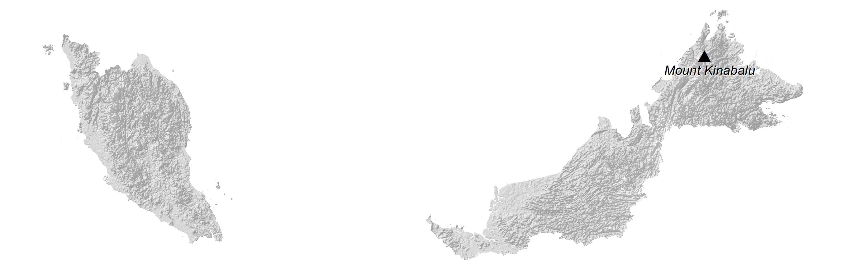
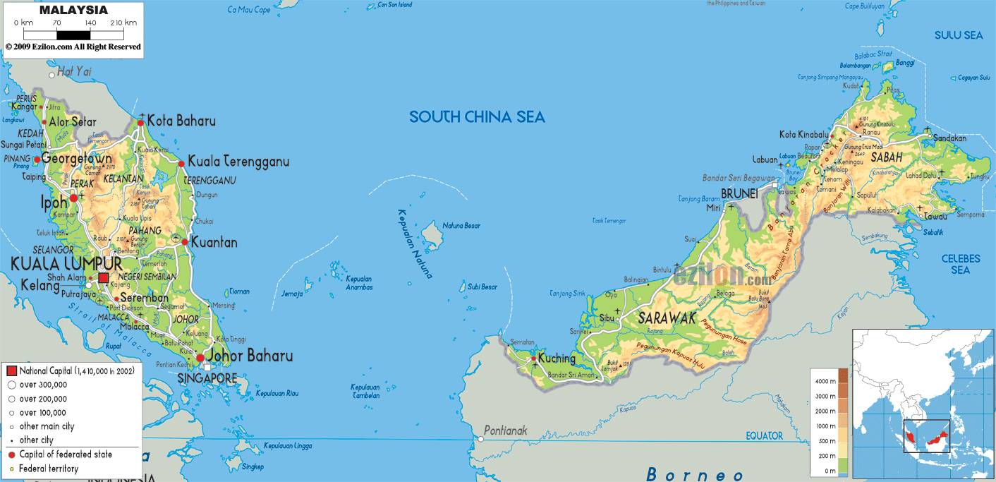
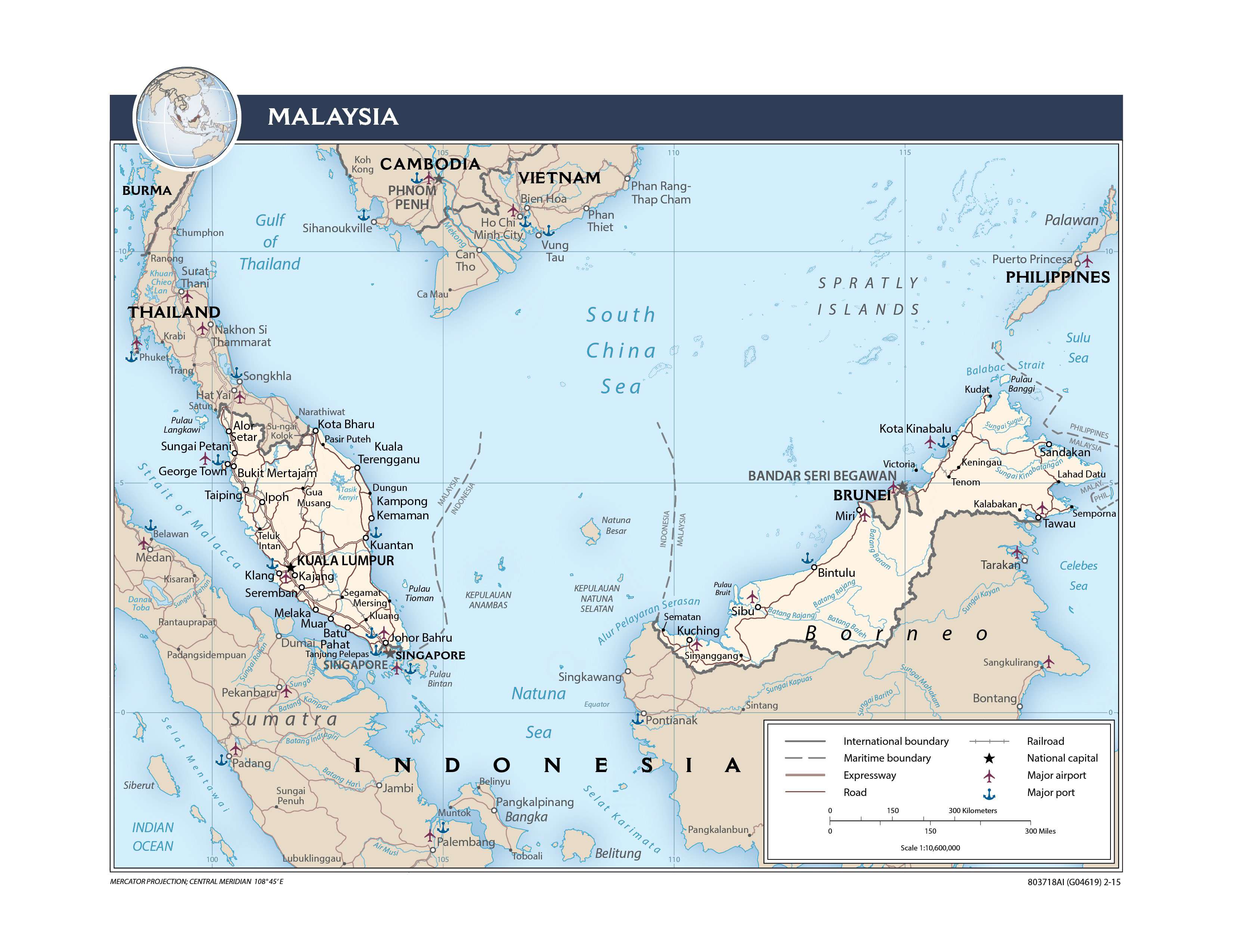
As observed on the physical map above, Malaysia consists of the Peninsular Malaysia, which is part of mainland Southeast Asia, and the states of Sabah and Sarawak (east Malaysia) on the northern edges of the island of Borneo.
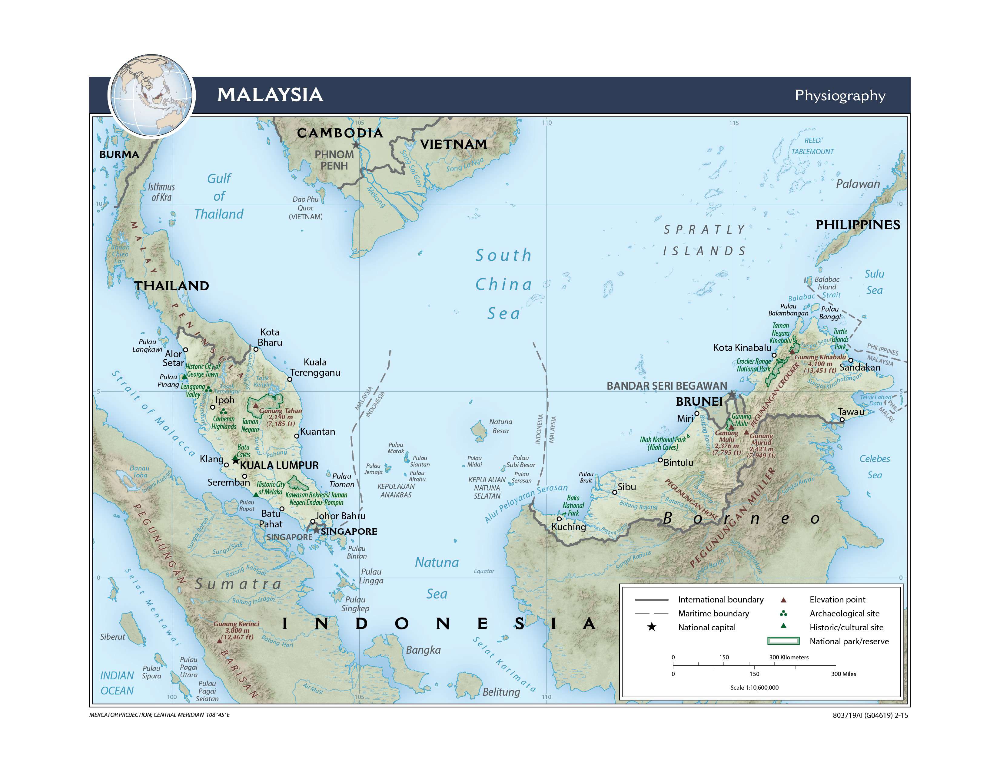
In essence, the coastal plains here (in some areas rather wide) rise gently into hills and mountains, all covered by dense rain forests.
Countrywide, elevations average between 3,500 to 6,000 feet, with the major exception being Malaysia’s highest point, Mt. Kinabalu, at 13,451 ft. (4,100 m) in the State of Sabah. It has been marked on the map above.
The lowest point of the country is the South China Sea at 0 m. Off the coastlines of Malaysia are hundreds of very small islands (dots on a sea of blue).
Running along the peninsula are numerous caves, carved out by water eroding limestone, with the Mulu Caves in East Malaysia being one of the largest cave systems in the world.
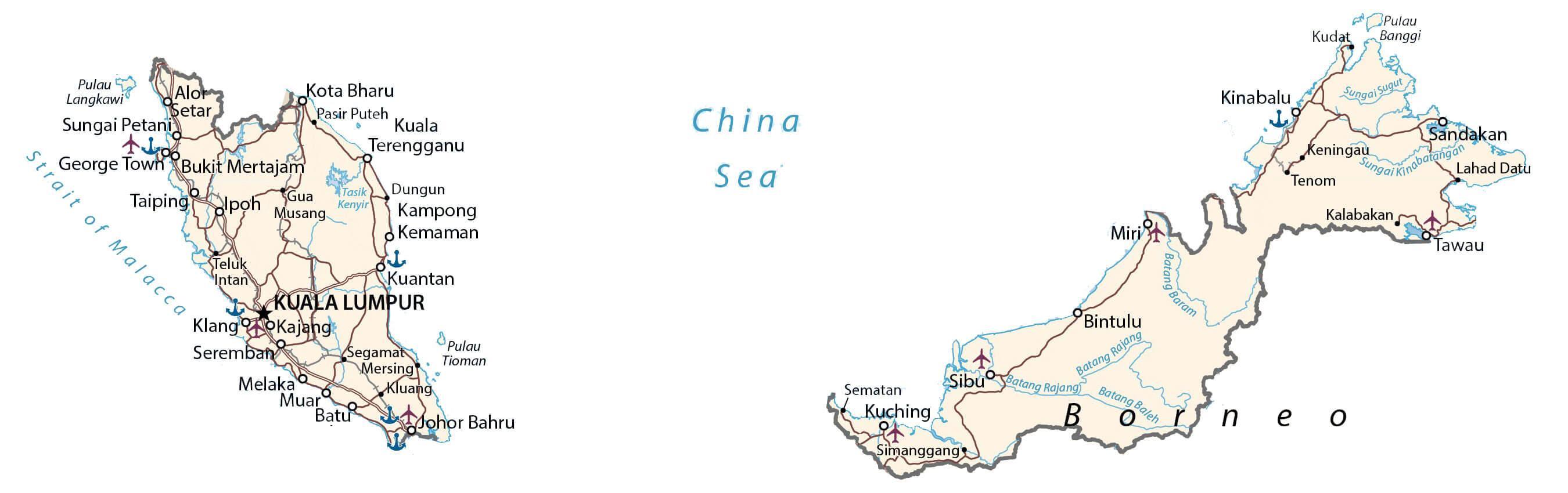
Over two dozen rivers of size flow from the mountains, with the Pahang, Rajang and Sugut being the most significant.
There are only two natural lakes within Malaysia’s borders: Bera Lake and Tasik Chini. Created in 1985, Kenyir Lake is an artificial lake that is said to be the largest in the world, covering some 100 sq miles (260 sq km).
| Flag: |  |
|---|---|
| Legal Name: | Malaysia |
| Capital Value: | Kuala Lumpur; note – nearby Putrajaya is referred to as a federal government administrative center but not the capital; Parliament meets in Kuala Lumpur |
| Demonym(s): | Malaysian |
| Government: | Federal parliamentary constitutional elective monarchy |
| Legislature: | Parliament |
| Total Area: | 329,847 km² |
| Land Area: | 328,657 km² |
| Water Area: | 1,190 km² |
| Population: | 31,949,777 |
| Density: | 98/km (253.8/sq mi) (116th) |
| GDP: | $364.70 Billion |
| GDP Per Capita: | $11,414.84 |
| Currency Value: | Ringgits (MYR) |
| Driving side: | left |
| Calling code: | +60 |
| Internet TLD: | .my |
Discover the beauty of Malaysia with this interactive map! Get a better understanding of the country’s topography by viewing the satellite imagery and elevation map. You can find major cities, towns, highways, lakes, and rivers on this map of Malaysia.
Online Interactive Political Map
Click on ![]() to view map in "full screen" mode.
to view map in "full screen" mode.
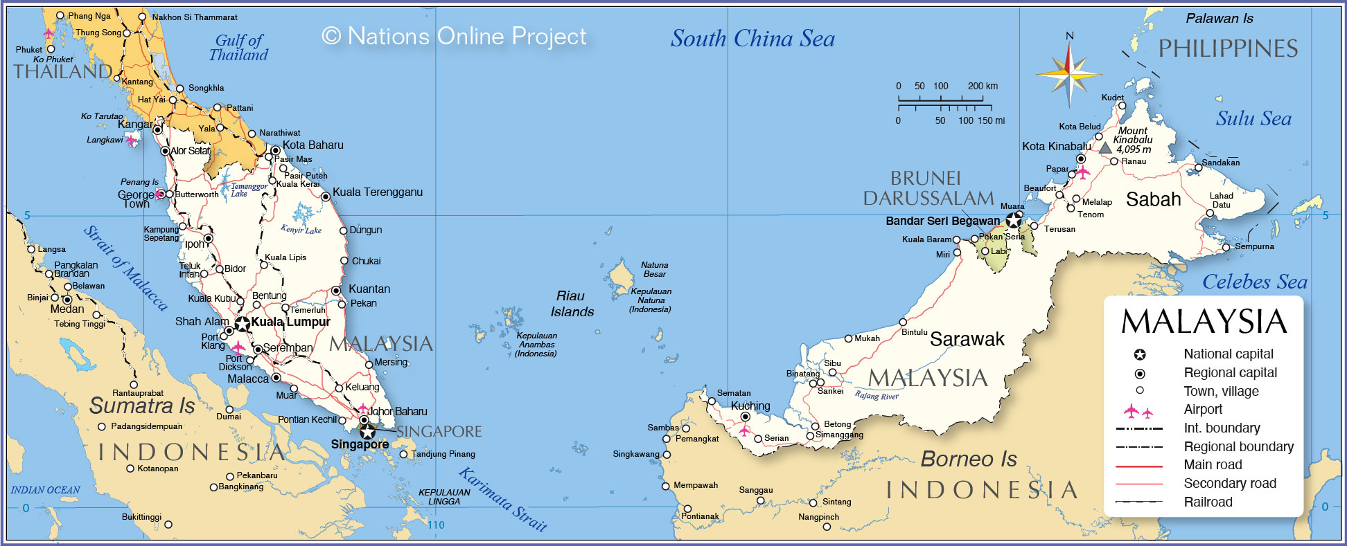
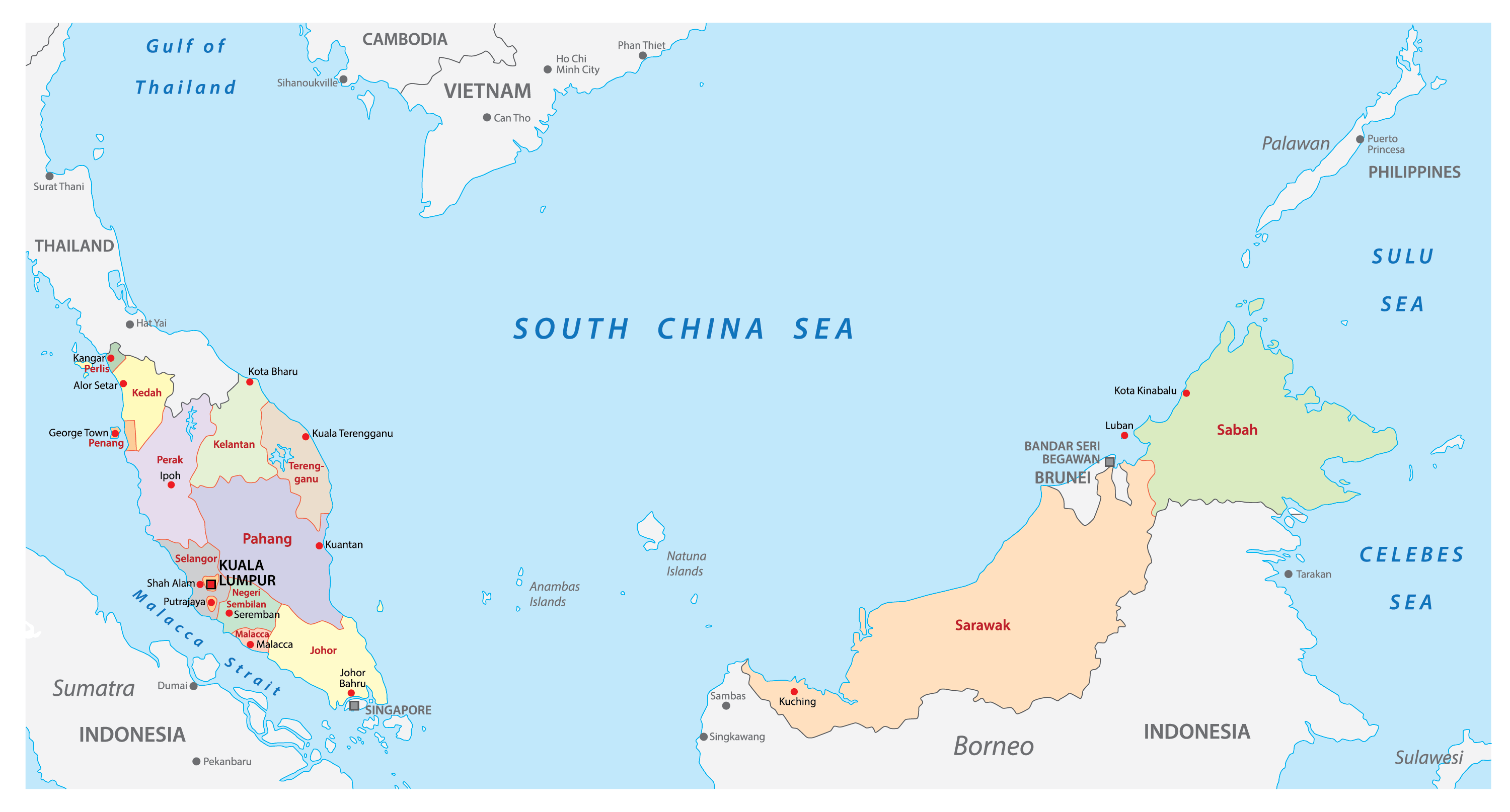
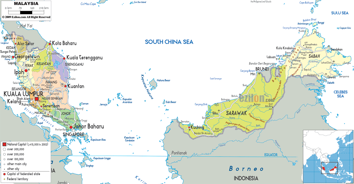
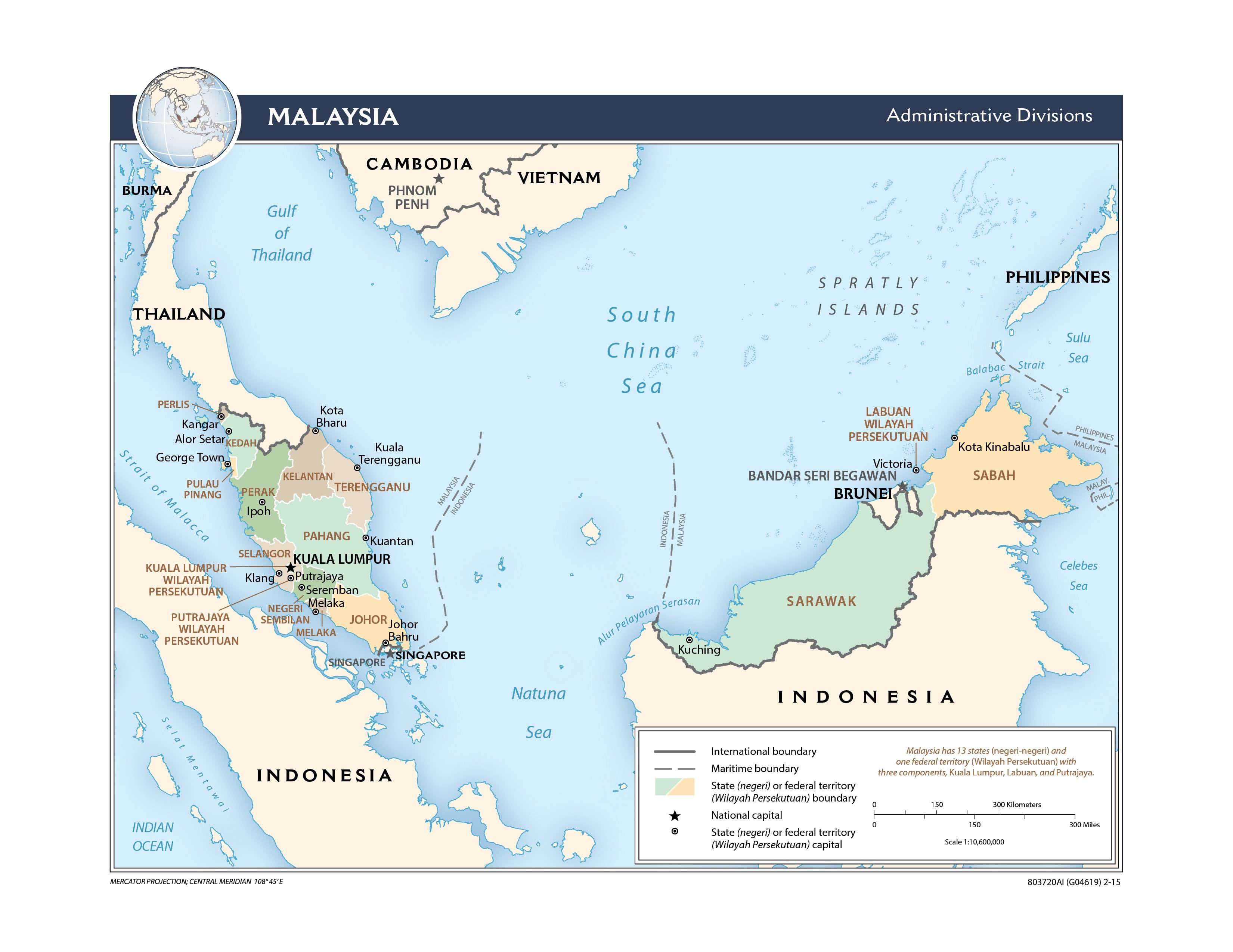
Malaysia is divided into 13 states (Negeri) and 3 federal territories (Wilayah Persekutuan). Out of these – 11 states and 2 federal territories are situated in West Malaysia; 2 states and 1 federal territory in Borneo Island (East Malaysia). In alphabetical order, the 13 states are: Johor, Kedah, Kelantan, Malacca, Negeri Sembilan, Pahang, Penang, Perak, Perlis, Sabah, Sarawak, Selangor and Terengganu. Kuala Lumpur, Labuan and Putrajaya are the federal territories in Malaysia. The states are further subdivided into districts and smaller subdivisions.
Located in the Klang Valley, Kuala Lumpur is the capital and the biggest city in Malaysia. Besides being, the cultural and economic center of Malaysia, Kuala Lumpur is also one of the top tourist destinations in the world.
Location Maps
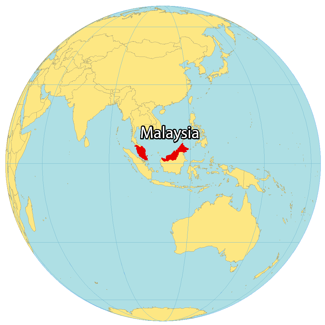
Where is Malaysia?
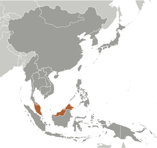
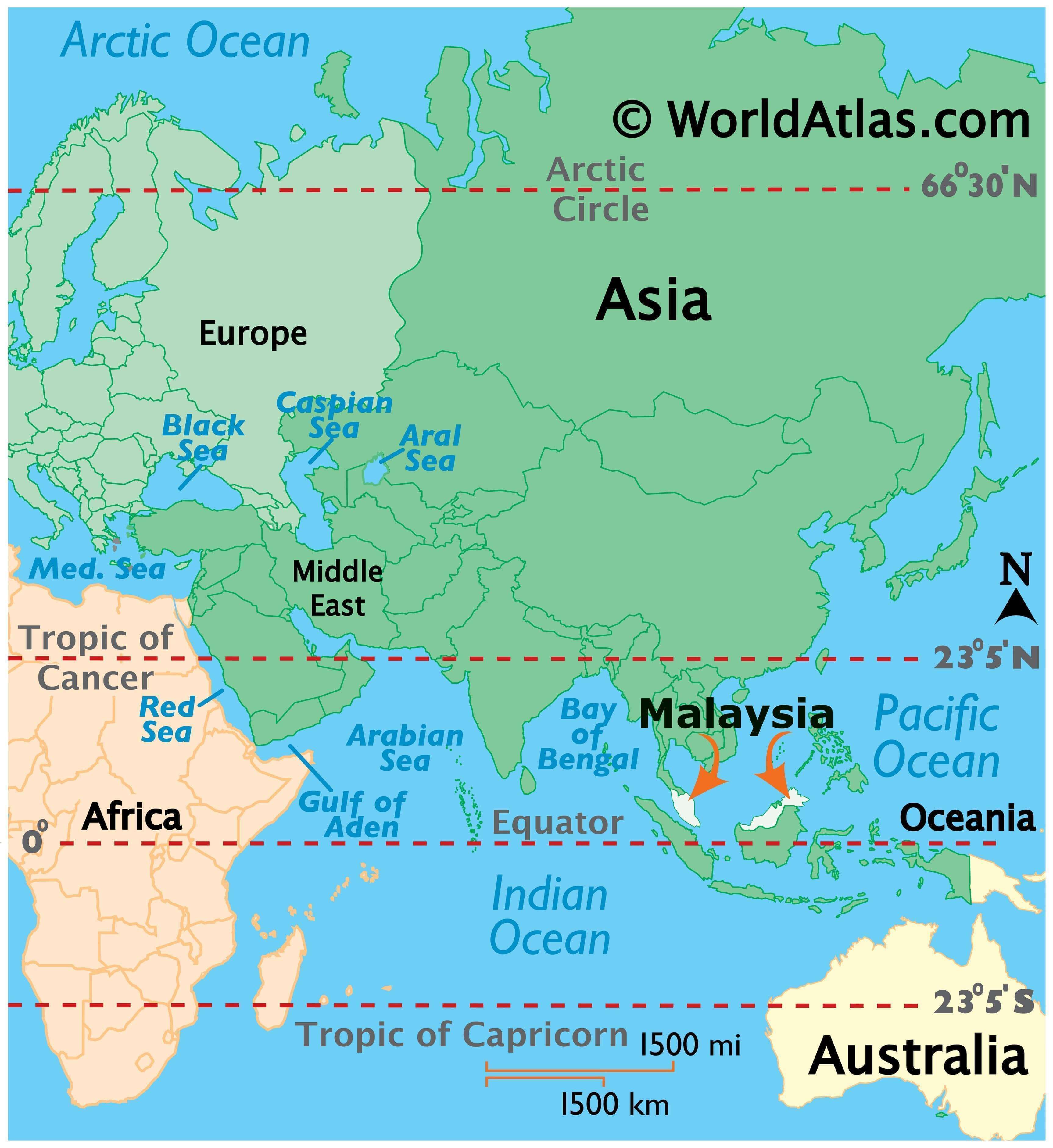
Malaysia is a country located in the heart of Southeastern Asia. It is divided into two regions by the South China Sea and shares borders with Indonesia, Thailand, and Brunei. It consists of two major land areas; the western portion being Peninsula Malaysia, and the eastern portion being East Malaysia, which mainly contains the northern part of Borneo. Malaysia also consists of 878 islands, such as Banggi Island, Betruit Island, and Langkawi. It is famous for its beaches, mountains, rainforests, friendly people, and Kuala Lumpur, the capital and largest city of Malaysia.
High Definition Political Map of Malaysia
Malaysia Administrative Map
Physical Map of Malaysia

Geography
Malaysia is the 66th largest country by total land area, with a land area of 329,613 km (127,264 sq mi). It has land borders with Thailand in West Malaysia, and Indonesia and Brunei in East Malaysia. It is linked to Singapore by a narrow causeway and a bridge. The country also has maritime boundaries with Vietnam and the Philippines. The land borders are defined in large part by geological features such as the Perlis River, the Golok River and the Pagalayan Canal, whilst some of the maritime boundaries are the subject of ongoing contention. Brunei forms what is almost an enclave in Malaysia, with the state of Sarawak dividing it into two parts. Malaysia is the only country with territory on both the Asian mainland and the Malay archipelago. The Strait of Malacca, lying between Sumatra and Peninsular Malaysia, is one of the most important thoroughfares in global commerce, carrying 40 per cent of the world’s trade.
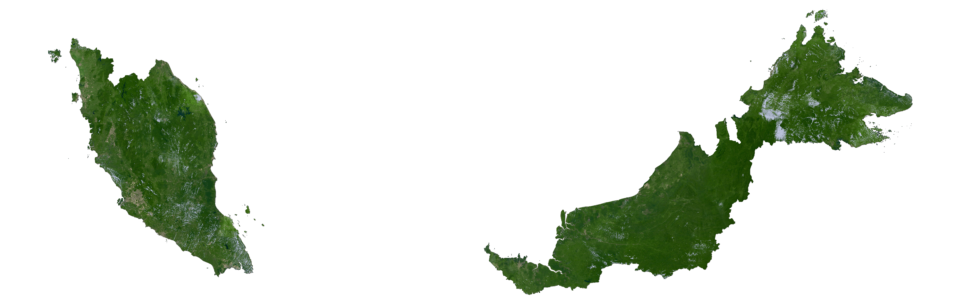
The two parts of Malaysia, separated from each other by the South China Sea, share a largely similar landscape in that both Peninsular and East Malaysia feature coastal plains rising to hills and mountains. Peninsular Malaysia, containing 40 per cent of Malaysia’s land area, extends 740 km (460 mi) from north to south, and its maximum width is 322 km (200 mi). It is divided between its east and west coasts by the Titiwangsa Mountains, rising to a peak elevation of 2,183 metres (7,162 ft) at Mount Korbu, part of a series of mountain ranges running down the centre of the peninsula. These mountains are heavily forested, and mainly composed of granite and other igneous rocks. Much of it has been eroded, creating a karst landscape. The range is the origin of some of Peninsular Malaysia’s river systems. The coastal plains surrounding the peninsula reach a maximum width of 50 kilometres (31 mi), and the peninsula’s coastline is nearly 1,931 km (1,200 mi) long, although harbours are only available on the western side.
East Malaysia, on the island of Borneo, has a coastline of 2,607 km (1,620 mi). It is divided between coastal regions, hills and valleys, and a mountainous interior. The Crocker Range extends northwards from Sarawak, dividing the state of Sabah. It is the location of the 4,095 m (13,435 ft) high Mount Kinabalu, the tallest mountain in Malaysia. Mount Kinabalu is located in the Kinabalu National Park, which is protected as one of the four UNESCO World Heritage Sites in Malaysia. The highest mountain ranges form the border between Malaysia and Indonesia. Sarawak contains the Mulu Caves, the largest cave system in the world, in the Gunung Mulu National Park which is also a World Heritage Site. The largest river in Malaysia is the Rajang.
Around these two halves of Malaysia are numerous islands, the largest of which is Banggi. The local climate is equatorial and characterised by the annual southwest (April to October) and northeast (October to February) monsoons. The temperature is moderated by the presence of the surrounding oceans. Humidity is usually high, and the average annual rainfall is 250 cm (98 in). The climates of the Peninsula and the East differ, as the climate on the peninsula is directly affected by wind from the mainland, as opposed to the more maritime weather of the East. Local climates can be divided into three regions, highland, lowland, and coastal. Climate change will cause sea level rise and increased rainfall, increasing flood risks and leading to droughts.
Biodiversity and conservation
Malaysia signed the Rio Convention on Biological Diversity on 12 June 1993, and became a party to the convention on 24 June 1994. It has subsequently produced a National Biodiversity Strategy and Action Plan, which was received by the convention on 16 April 1998. The country is megadiverse with a high number of species and high levels of endemism. It is estimated to contain 20 per cent of the world’s animal species. High levels of endemism are found on the diverse forests of Borneo’s mountains, as species are isolated from each other by lowland forest.
There are about 210 mammal species in the country. Over 620 species of birds have been recorded in Peninsular Malaysia, with many endemic to the mountains there. A high number of endemic bird species are also found in Malaysian Borneo. 250 reptile species have been recorded in the country, with about 150 species of snakes and 80 species of lizards. There are about 150 species of frogs, and thousands of insect species. The Exclusive economic zone of Malaysia is 334,671 km (129,217 sq mi) and 1.5 times larger than its land area. It is mainly in the South China Sea. Some of its waters are in the Coral Triangle, a biodiversity hotspot. The waters around Sipadan island are the most biodiverse in the world. Bordering East Malaysia, the Sulu Sea is a biodiversity hotspot, with around 600 coral species and 1200 fish species. The unique biodiversity of Malaysian Caves always attracts lovers of ecotourism from all over the world.
Nearly 4,000 species of fungi, including lichen-forming species have been recorded from Malaysia. Of the two fungal groups with the largest number of species in Malaysia, the Ascomycota and their asexual states have been surveyed in some habitats (decaying wood, marine and freshwater ecosystems, as parasites of some plants, and as agents of biodegradation), but have not been or have been only poorly surveyed in other habitats (as endobionts, in soils, on dung, as human and animal pathogens); the Basidiomycota are only partly surveyed: bracket fungi, and mushrooms and toadstools have been studied, but Malaysian rust and smut fungi remain very poorly known. Without doubt, many more fungal species in Malaysia have not yet been recorded, and it is likely that many of those, when found, will be new to science.
About two thirds of Malaysia was covered in forest as of 2007, with some forests believed to be 130 million years old. The forests are dominated by dipterocarps. Lowland forest covers areas below 760 m (2,490 ft), and formerly East Malaysia was covered in such rainforest, which is supported by its hot wet climate. There are around 14,500 species of flowering plants and trees. Besides rainforests, there are over 1,425 km (550 sq mi) of mangroves in Malaysia, and a large amount of peat forest. At higher altitudes, oaks, chestnuts, and rhododendrons replace dipterocarps. There are an estimated 8,500 species of vascular plants in Peninsular Malaysia, with another 15,000 in the East. The forests of East Malaysia are estimated to be the habitat of around 2,000 tree species, and are one of the most biodiverse areas in the world, with 240 different species of trees every hectare. These forests host many members of the Rafflesia genus, the largest flowers in the world, with a maximum diameter of 1 m (3 ft 3 in).
Logging, along with cultivation practices has devastated tree cover, causing severe environmental degradation in the country. Over 80 per cent of Sarawak’s rainforest has been logged. Floods in East Malaysia have been worsened by the loss of trees, and over 60 per cent of the Peninsula’s forest have been cleared. With current rates of deforestation, mainly for the palm oil industry, the forests are predicted to be extinct by 2020. Deforestation is a major problem for animals, fungi and plants, having caused species such as Begonia eiromischa to go extinct. Most remaining forest is found inside reserves and national parks. Habitat destruction has proved a threat for marine life. Illegal fishing is another major threat, with fishing methods such as dynamite fishing and poisoning depleting marine ecosystems. Leatherback turtle numbers have dropped 98 per cent since the 1950s. Hunting has also been an issue for some animals, with overconsumption and the use of animal parts for profit endangering many animals, from marine life to tigers. Marine life is also detrimentally affected by uncontrolled tourism.
The Malaysian government aims to balance economic growth with environmental protection, but has been accused of favouring big business over the environment. Some state governments are now trying to counter the environmental impact and pollution created by deforestation; and the federal government is trying to cut logging by 10 per cent each year. A total of 28 national parks have been established, 23 in East Malaysia and five in the Peninsula. Tourism has been limited in biodiverse areas such as Sipadan island. Wildlife trafficking is a large issue, and the Malaysian government has held talks with the governments of Brunei and Indonesia to standardise anti-trafficking laws.
Transportation Map of Malaysia
Malaysia Satellite Map
Elevation Map