Bangladesh occupies an area of 148,460 sq. km in South Asia.
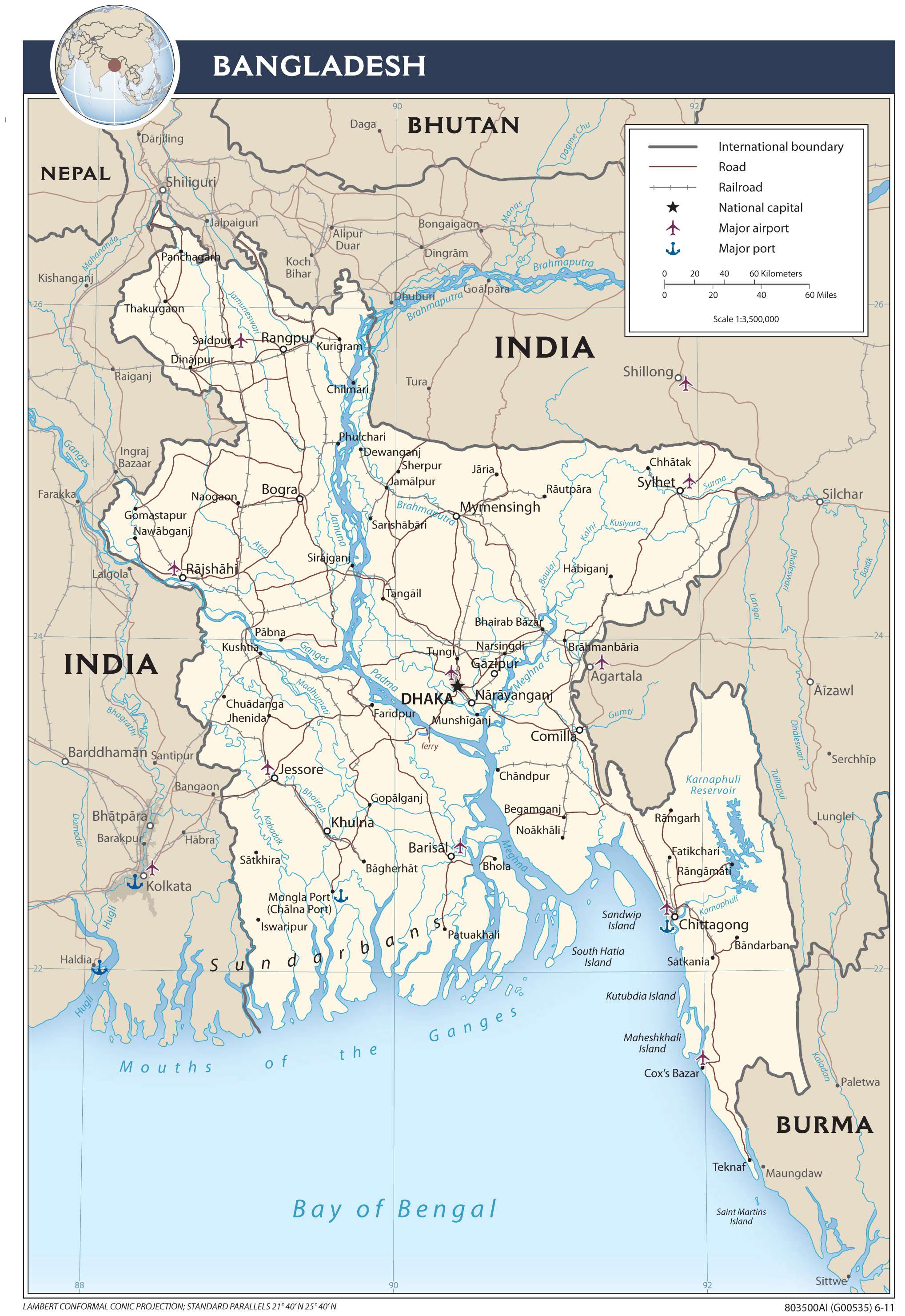
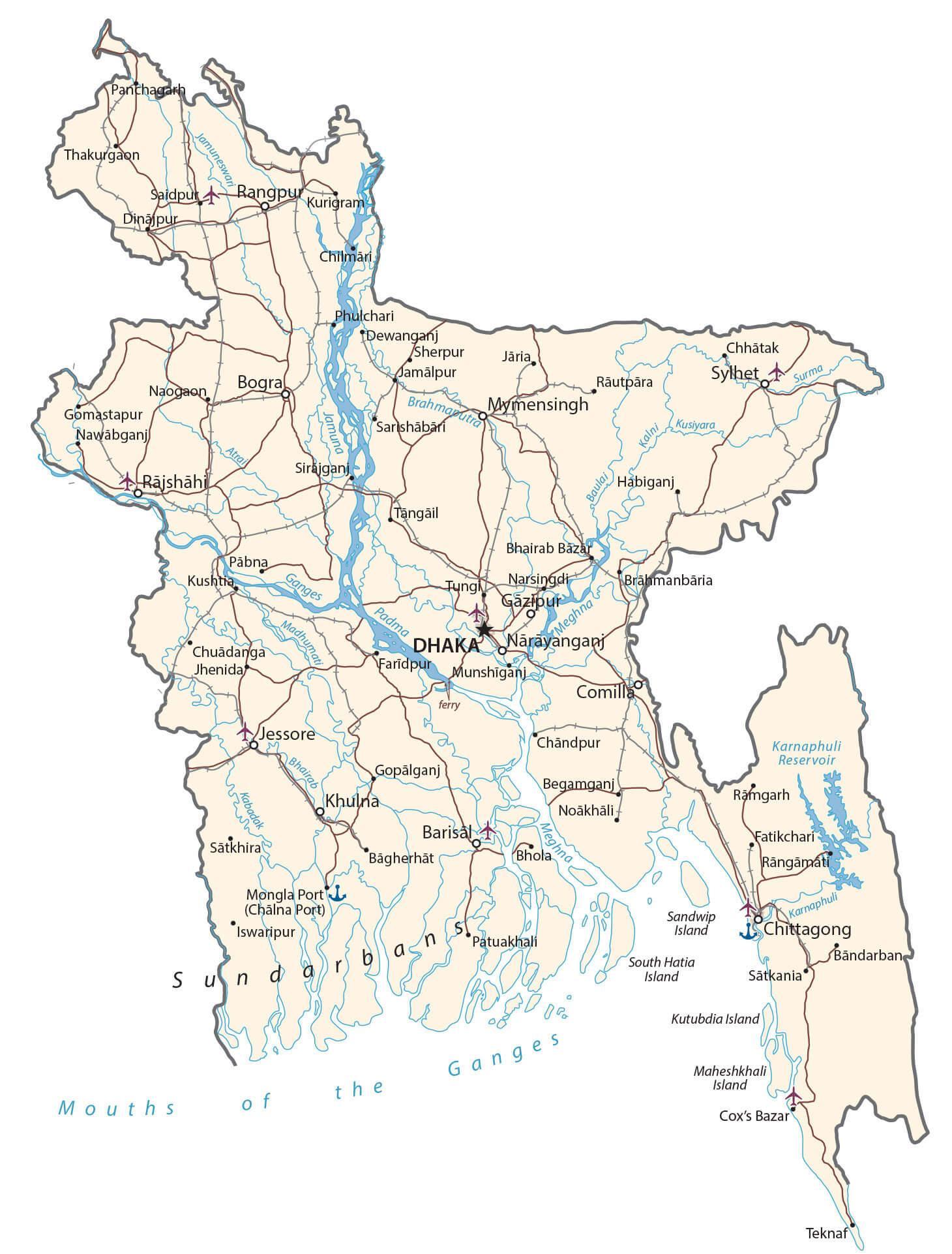
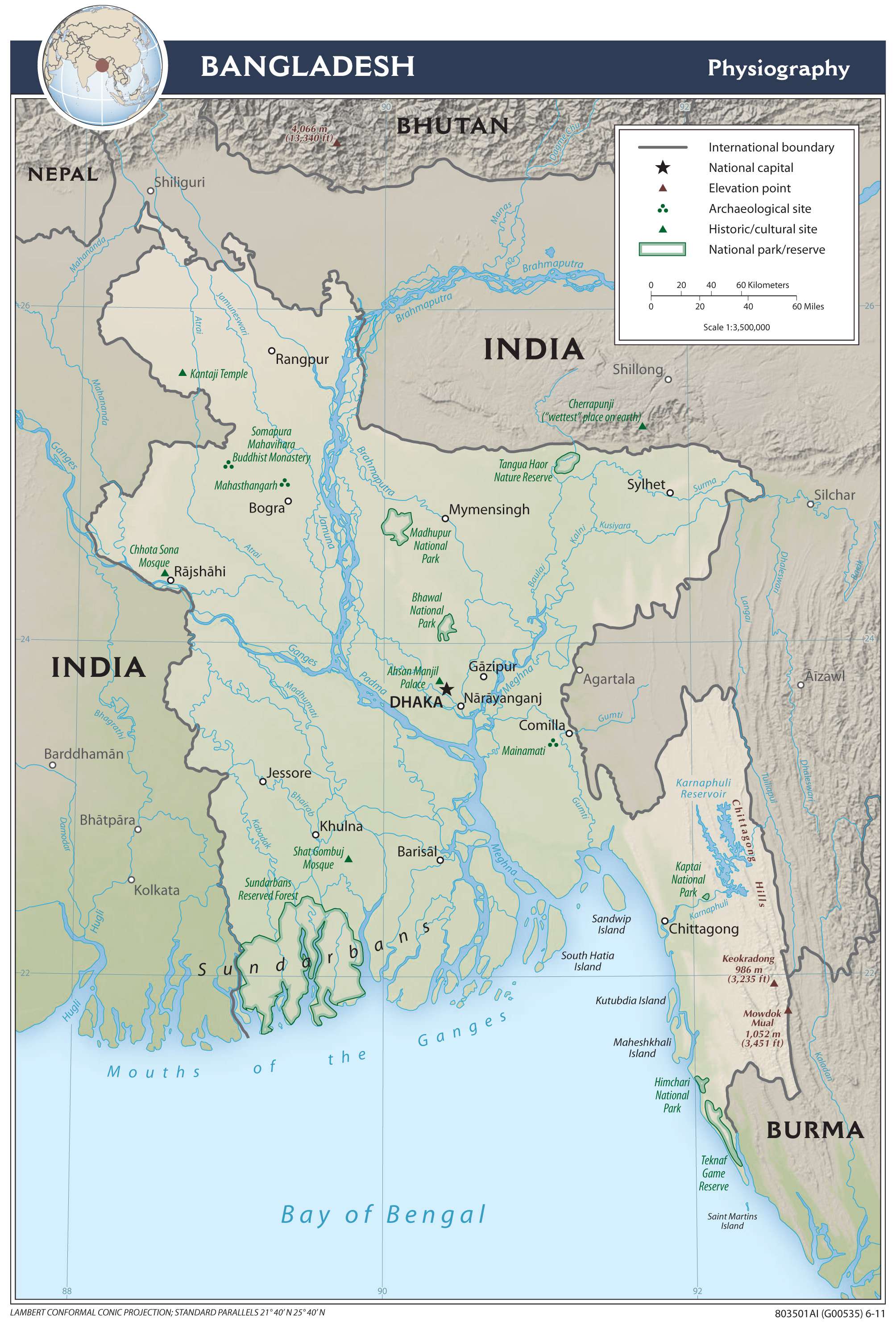
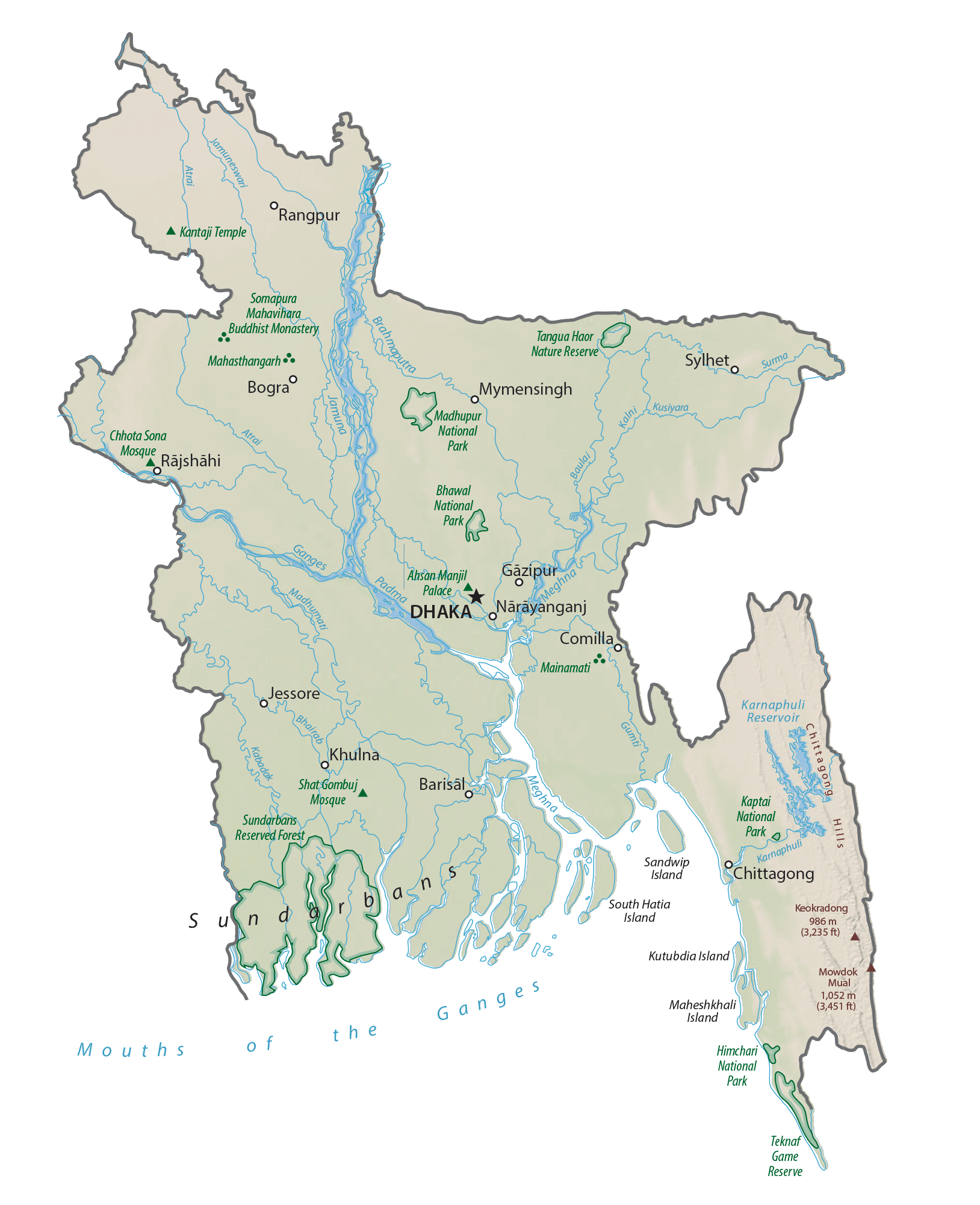
As observed on the physical map of the country above, it is mostly a low-lying country. The geography can be divided into three regions. The highly fertile Ganga-Brahmaputra delta dominates the landscape of Bangladesh. The Barind and Madhupur plateaus define the central and northwestern parts of the country while hills occur to the northeast and southeast.
Bangladesh is often referred to as a nation of rivers. It is in essence a large delta comprised of three significant rivers; the Ganges, Brahmaputra and Meghna. The map above exhibits the courses these rivers take in the country. Subsequently, Bangladesh is also one of the most flood-prone countries in the world. When the spring snows melt in the Himalayan Mountains the rivers often overflow running south to the sea.
The highest point in Bangladesh, Keokradong, peaks at 4,035 ft. (1,230 m), while the lowest point of the country is the Indian Ocean (0 m).
| Flag: |  |
|---|---|
| Legal Name: | People’s Republic of Bangladesh |
| Capital Value: | Dhaka |
| Demonym(s): | Bangladeshi |
| Government: | Unitary dominant-party parliamentary republic |
| Legislature: | Jatiya Sangsad |
| Total Area: | 148,460 km² |
| Land Area: | 130,170 km² |
| Water Area: | 18,290 km² |
| Population: | 163,046,161 |
| Density: | 1,106/km (2,864.5/sq mi) (7th) |
| GDP: | $302.57 Billion |
| GDP Per Capita: | $1,855.74 |
| Currency Value: | Taka (BDT) |
| Driving side: | left |
| Calling code: | +880 |
| Internet TLD: | .bd .বাংলা |
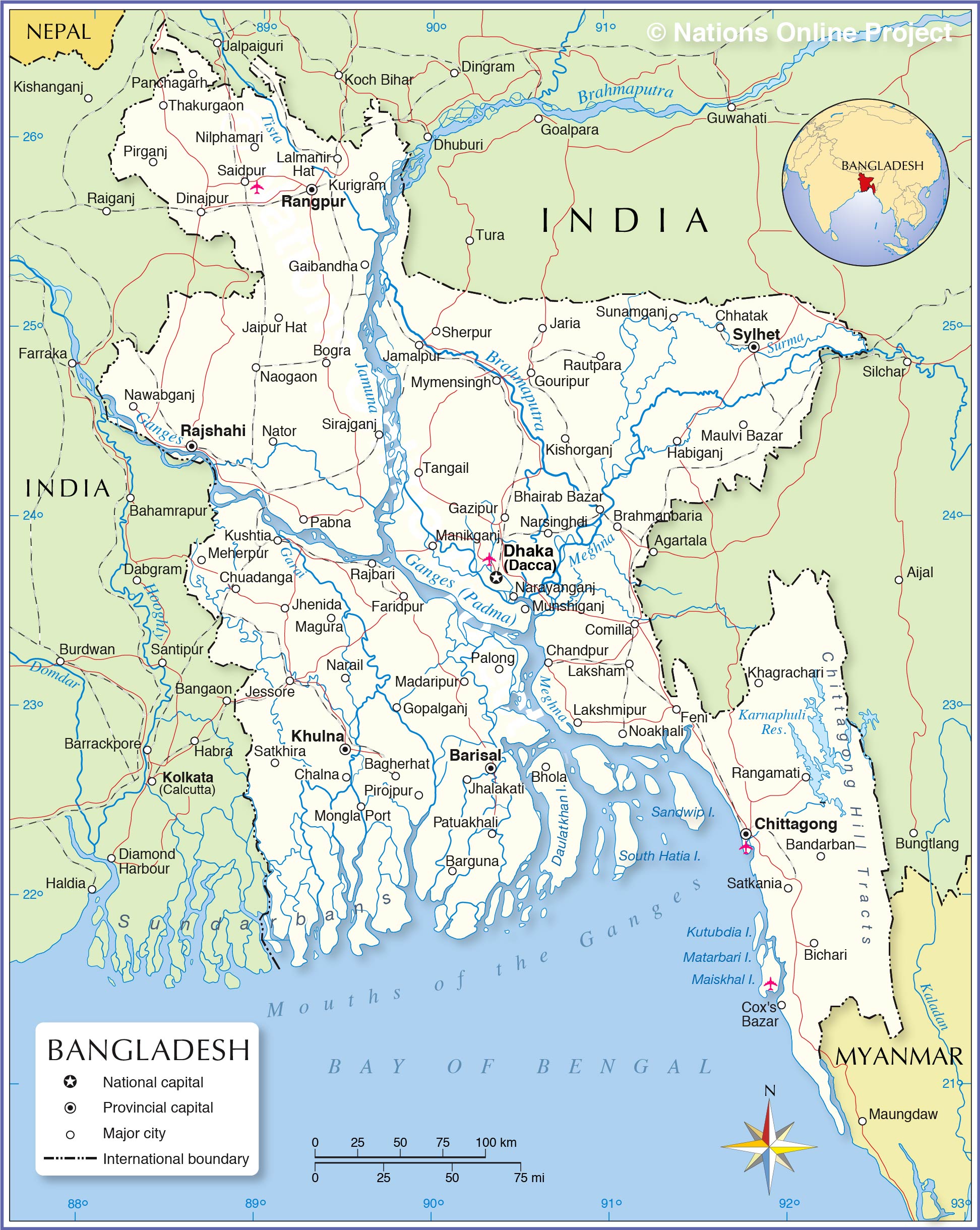
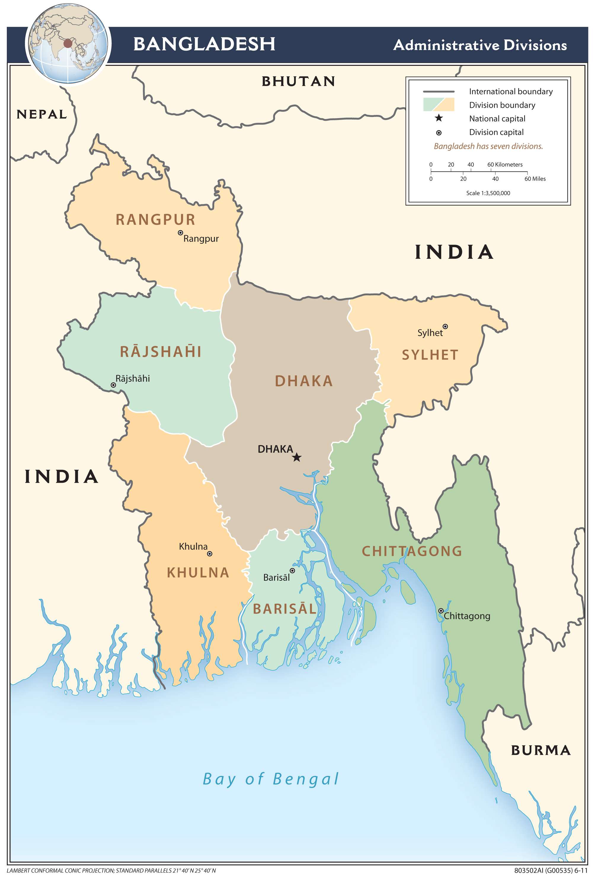
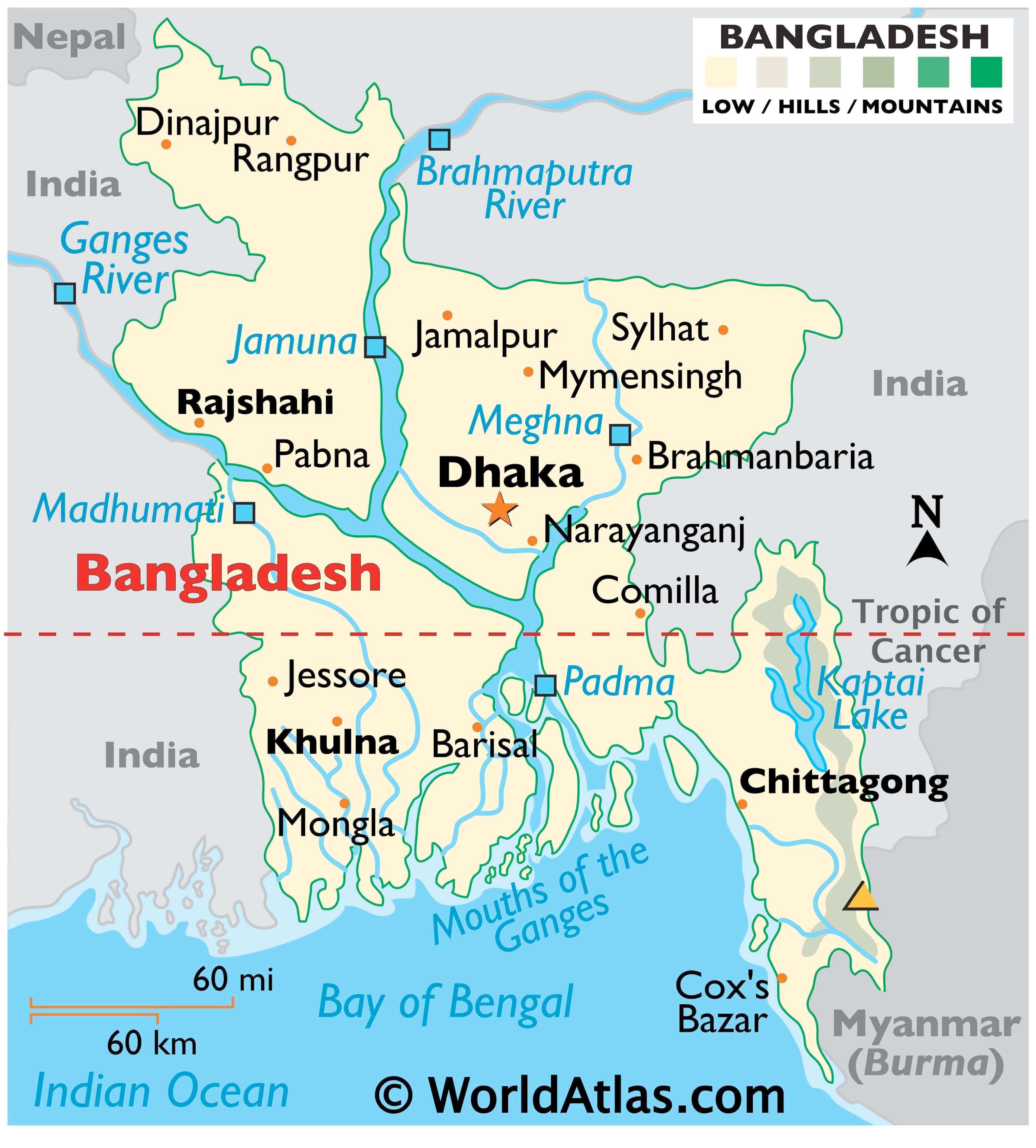
Explore the beauty of Bangladesh with this interactive map! From major cities and towns to roads and rivers, this map of Bangladesh provides an overview of the nation’s geography. See the transboundary Ganges River in the terrain map, and the divisions of Bangladesh in the administrative map.
Online Interactive Political Map
Click on ![]() to view map in "full screen" mode.
to view map in "full screen" mode.
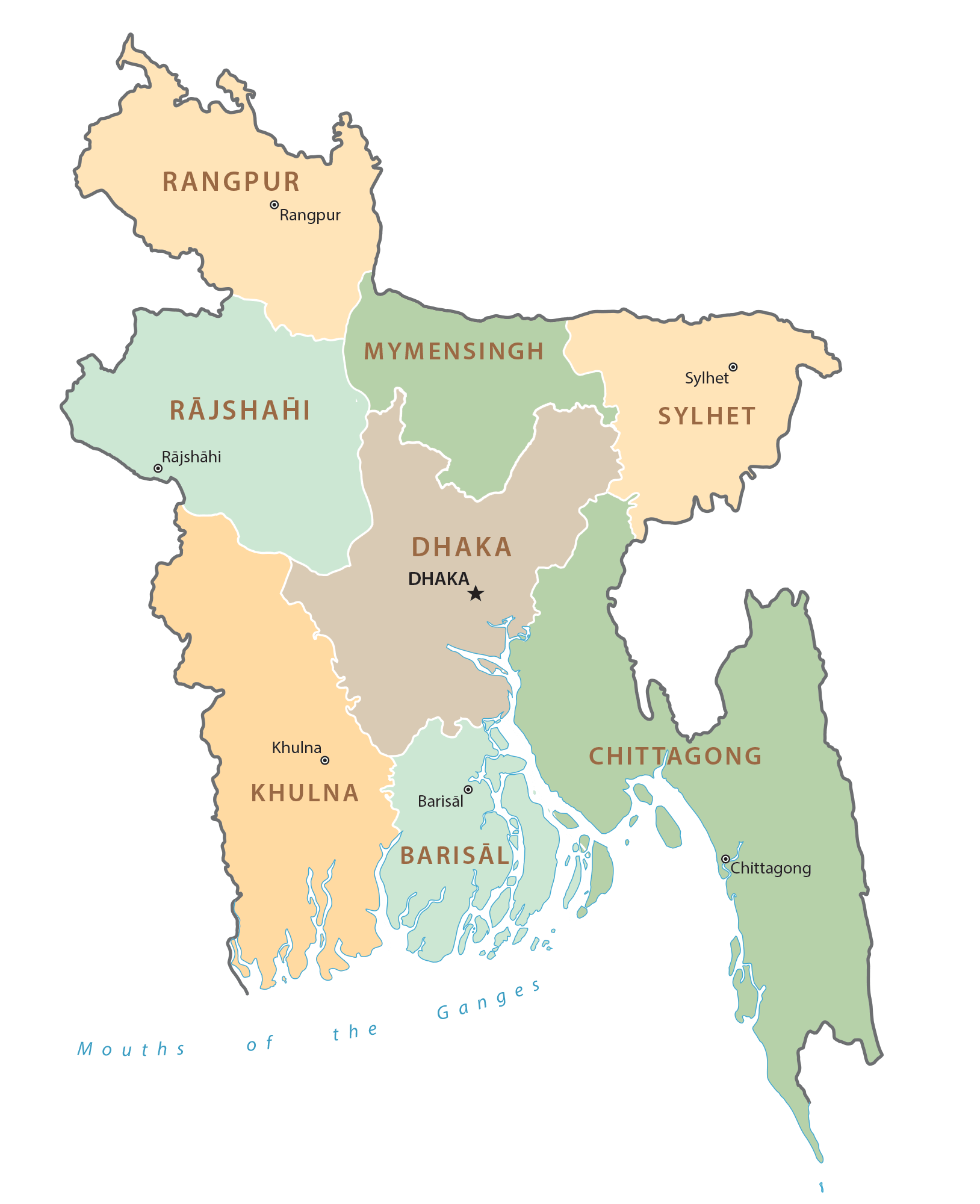
Bangladesh (officially, The People’s Republic of Bangladesh) is divided into 8 administrative divisions (Bibhag). In alphabetical order, these divisions are: Barisal, Chittagong, Dhaka, Khulna, Mymensingh, Rajshahi, Rangpur and Sylhet. The administrative divisions are further divided into 64 districts and a number of smaller subdivisions.
Located in central Bangladesh is Dhaka – the capital and largest city of Bangladesh. Dhaka is the administrative, cultural, commercial and economic center of Bangladesh. With a population of more than 7 million people, Dhaka is the most populous city in Bangladesh. With an area of 148,460 sq. km, Bangladesh is the eighth most populous country as well as one of the most densely populated countries in the world. Chittagong – is the second-largest city of Bangladesh. A major sea port and a coastal city, it serves as the largest sea port, thus playing a vital role in the economy of Bangladesh.
Location Maps
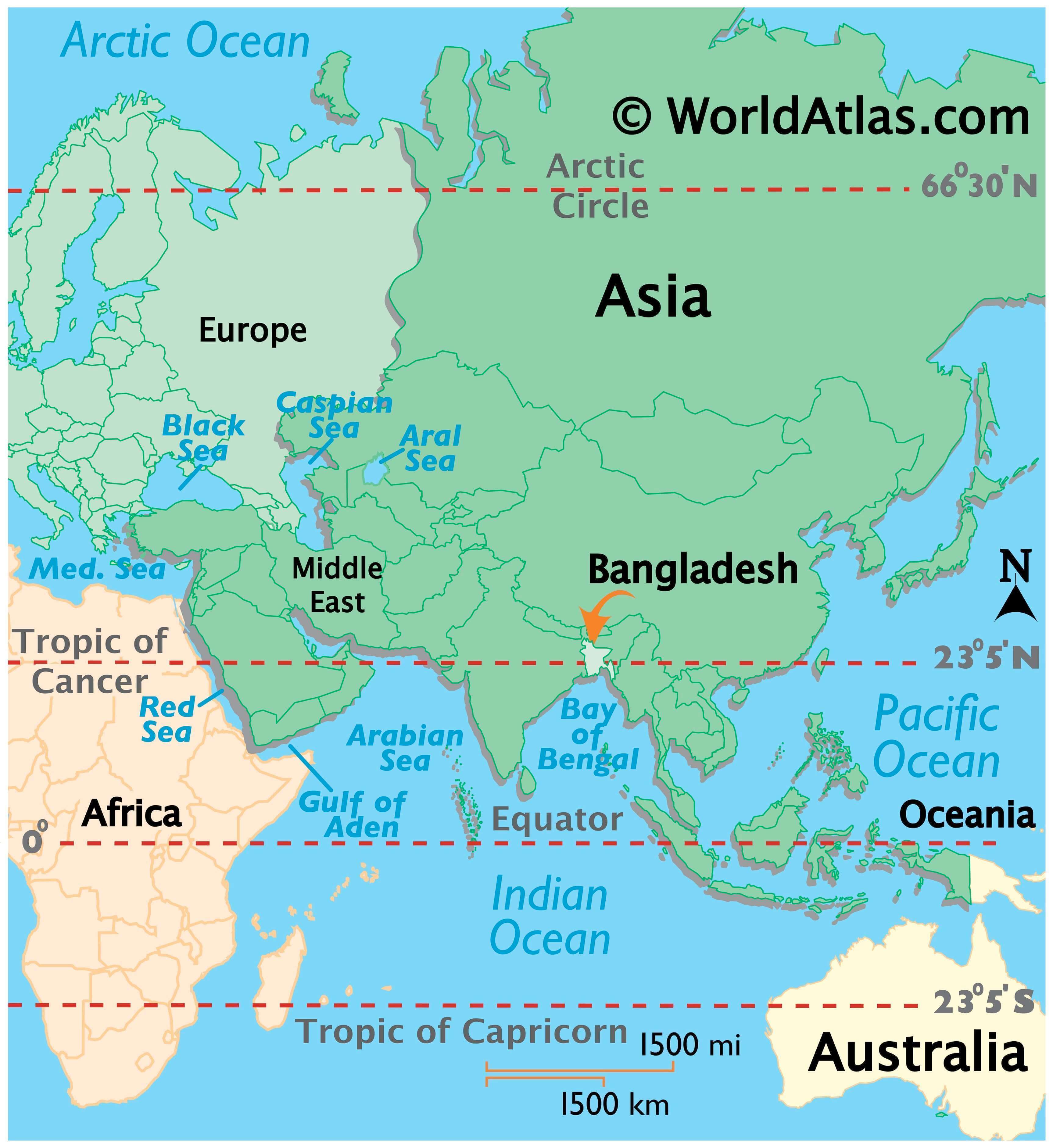
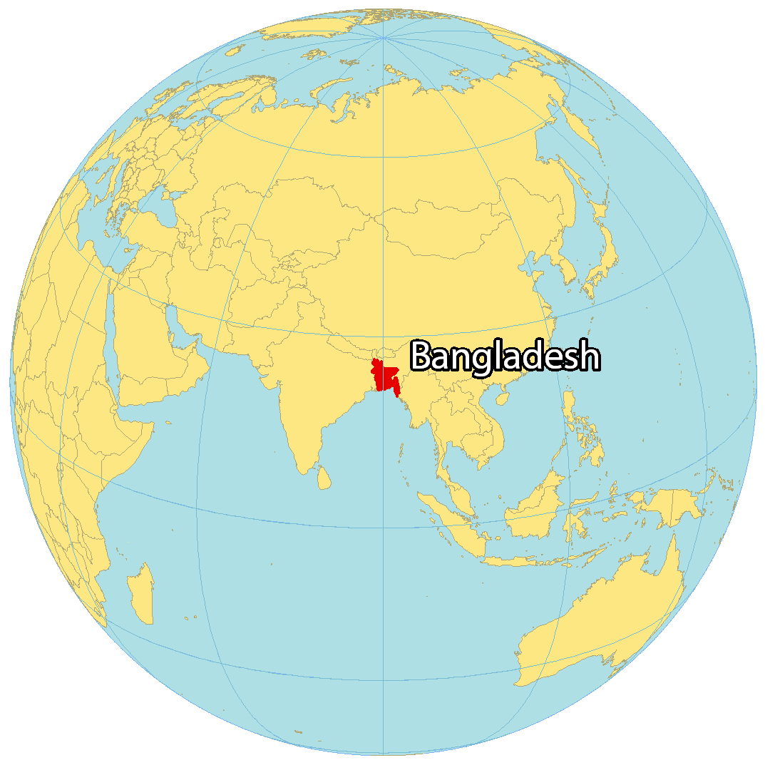
Where is Bangladesh?
Bangladesh is a country located in Southern Asia. It’s situated along the Bay of Bengal and borders two countries. To the southeast, Bangladesh shares a border with Myanmar. India wraps around Bangladesh from west to east. The country is one of the most densely populated in the world, occupying an area of 148,560 square kilometers (57,360 sq mi) and hosting the eighth-most populous population. The capital of Bangladesh is Dhaka, which is also the largest city in the country.
High Definition Political Map of Bangladesh
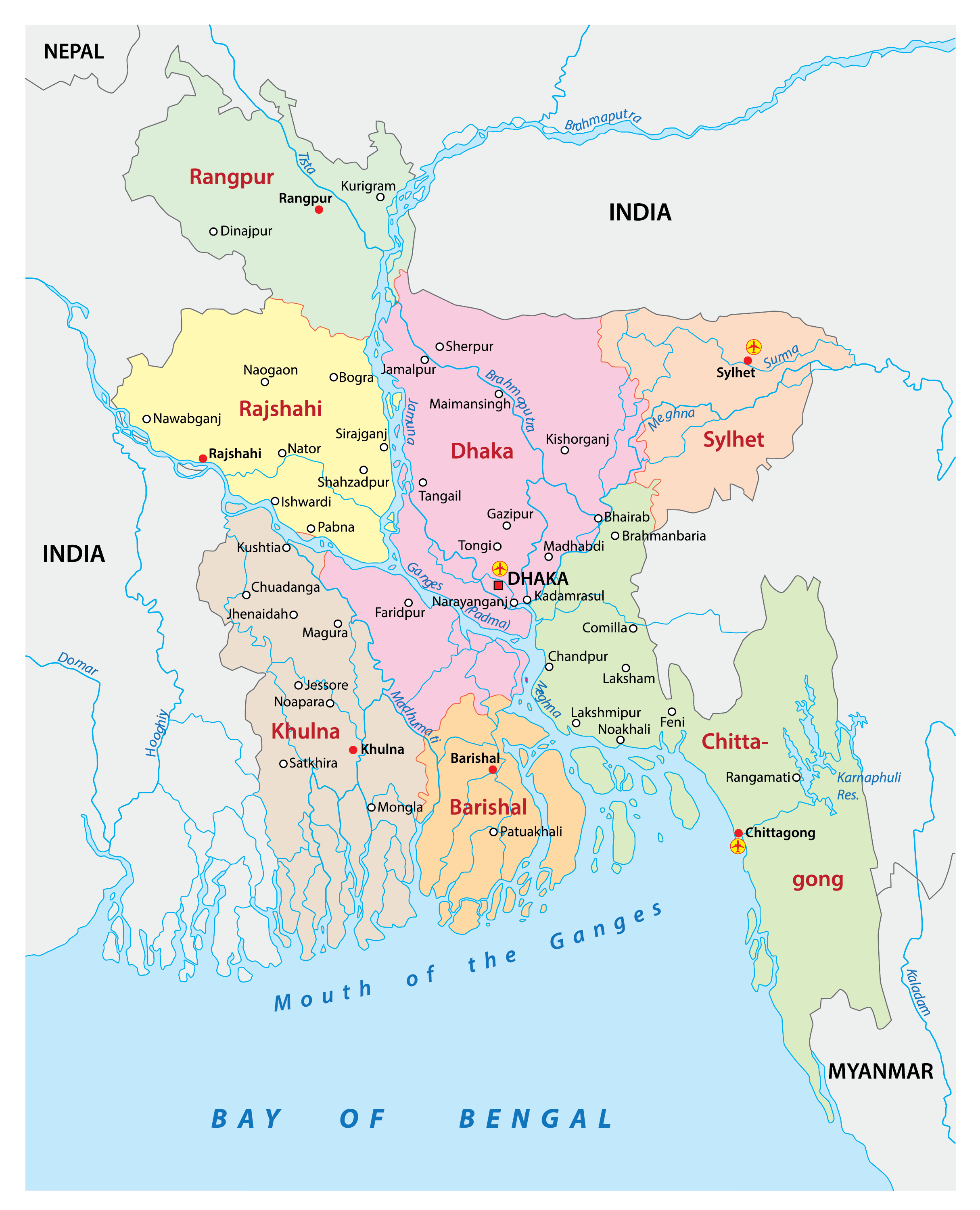
Bangladesh Administrative Map
Physical Map of Bangladesh
Transportation Map of Bangladesh