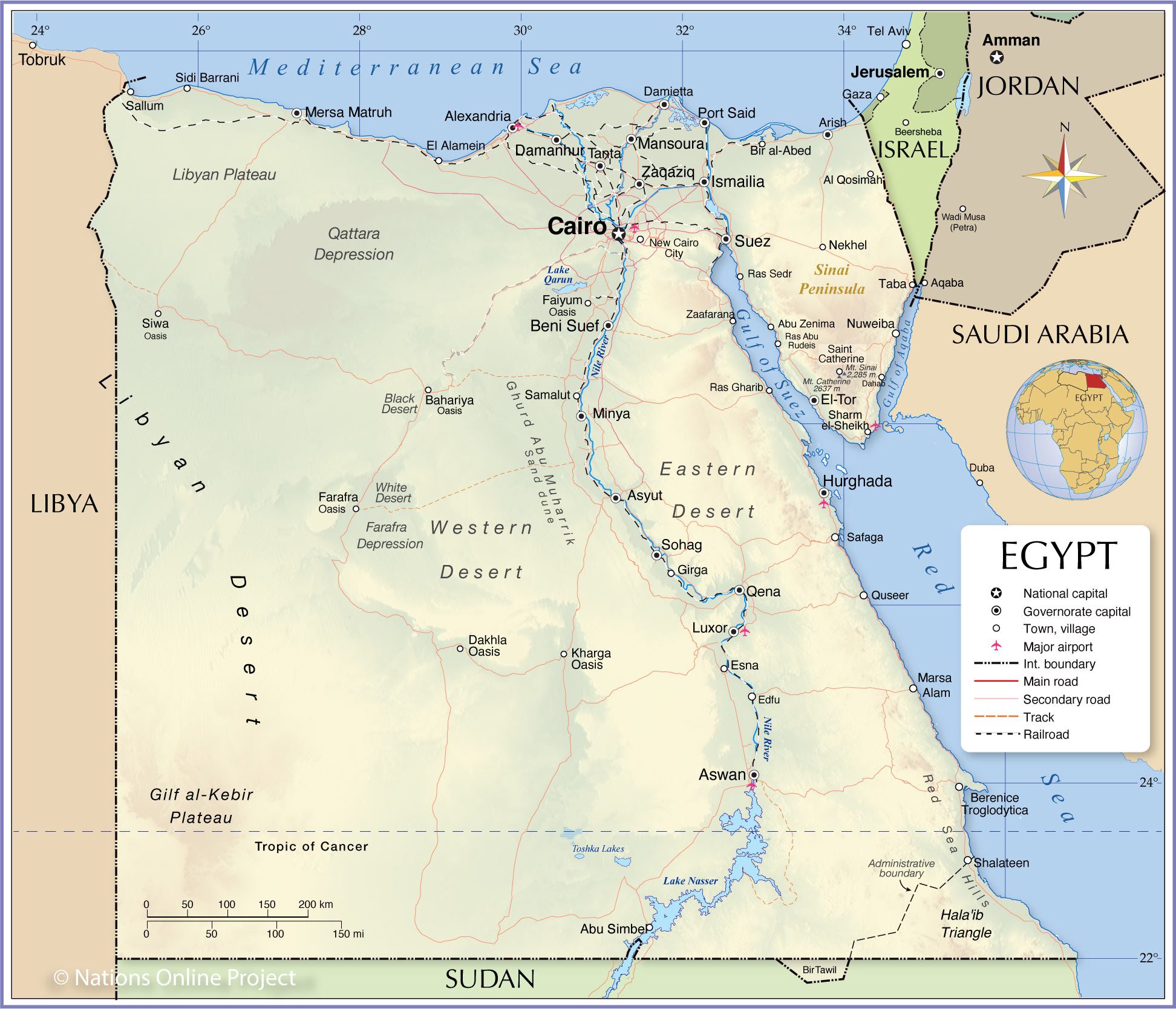
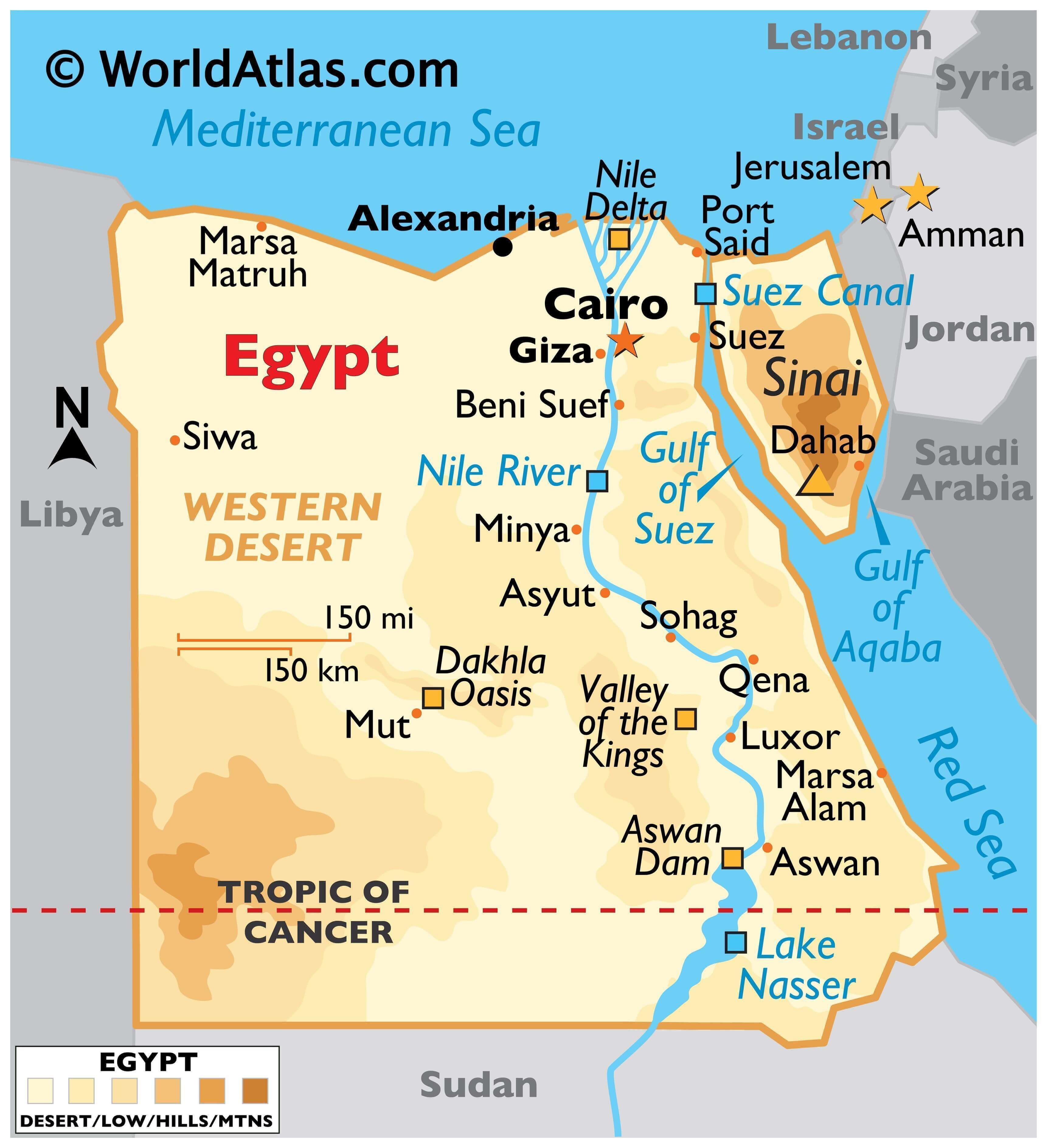
The transcontinental country of Egypt covers an area of 1,010,408 sq. km. As observed on the physical map above, Egypt is largely covered by desert with the Nile River running south to north through the middle of the eastern half of the country to drain into the Mediterranean Sea. The river stretches from Lake Nasser in southern Egypt and runs through a narrow valley with bordering cliffs to enter Cairo where it spreads out to finally form a delta at its mouth. The Nile is called the lifeline of Egypt. Around 98% of the country’s population resides in the Nile River Valley.
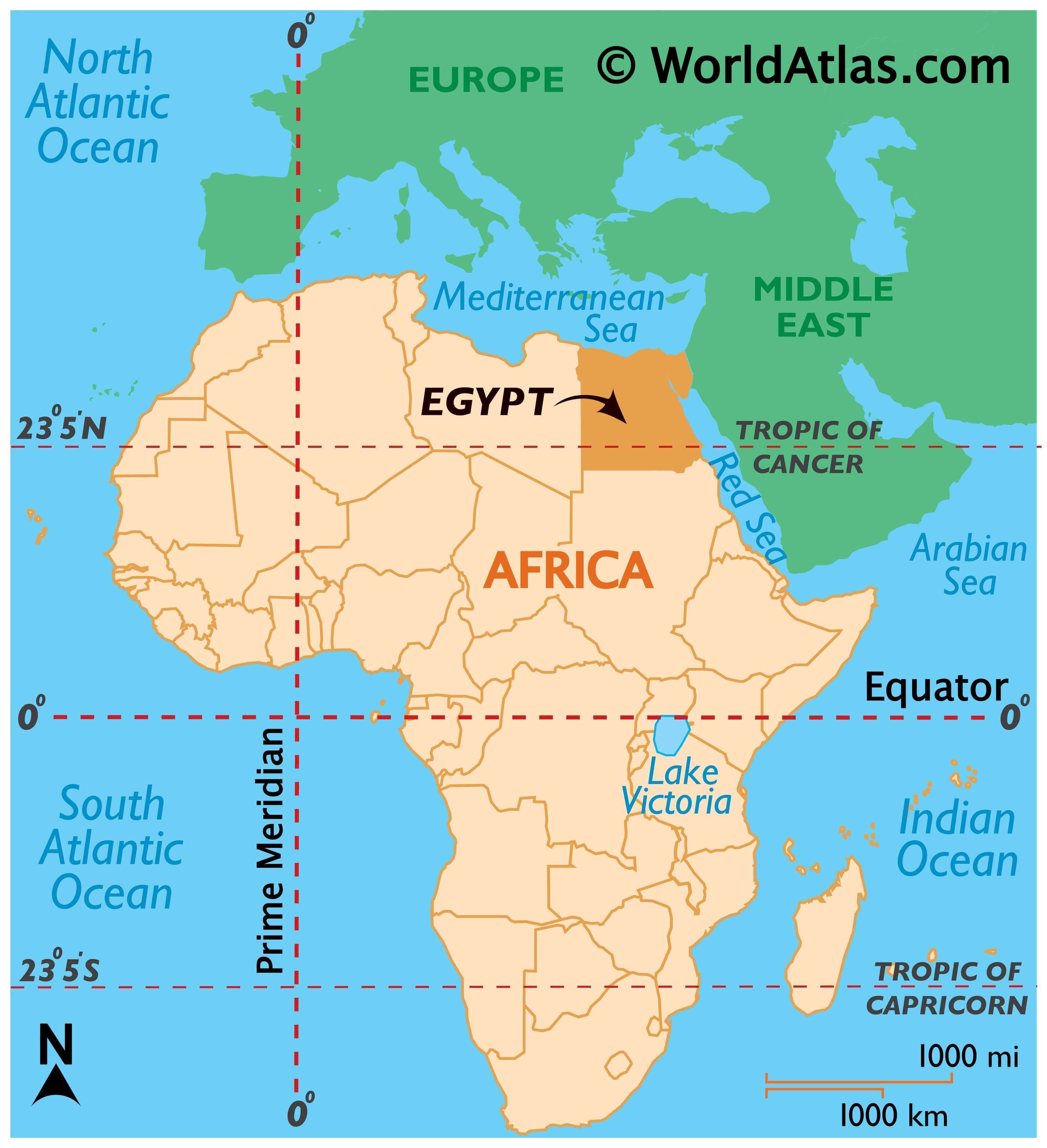
As observed on the map, most of Egypt is in Africa while a part of it, the Sinai Peninsula, acts as the land bridge between Africa and Asia. The Mediterranean and the Red Sea are connected through the man-made Suez Canal with the Sinai Peninsula lying to the east of this canal.
On both sides of the Nile River Valley are vast stretches of desert designated as the Eastern Desert and the Western Desert.
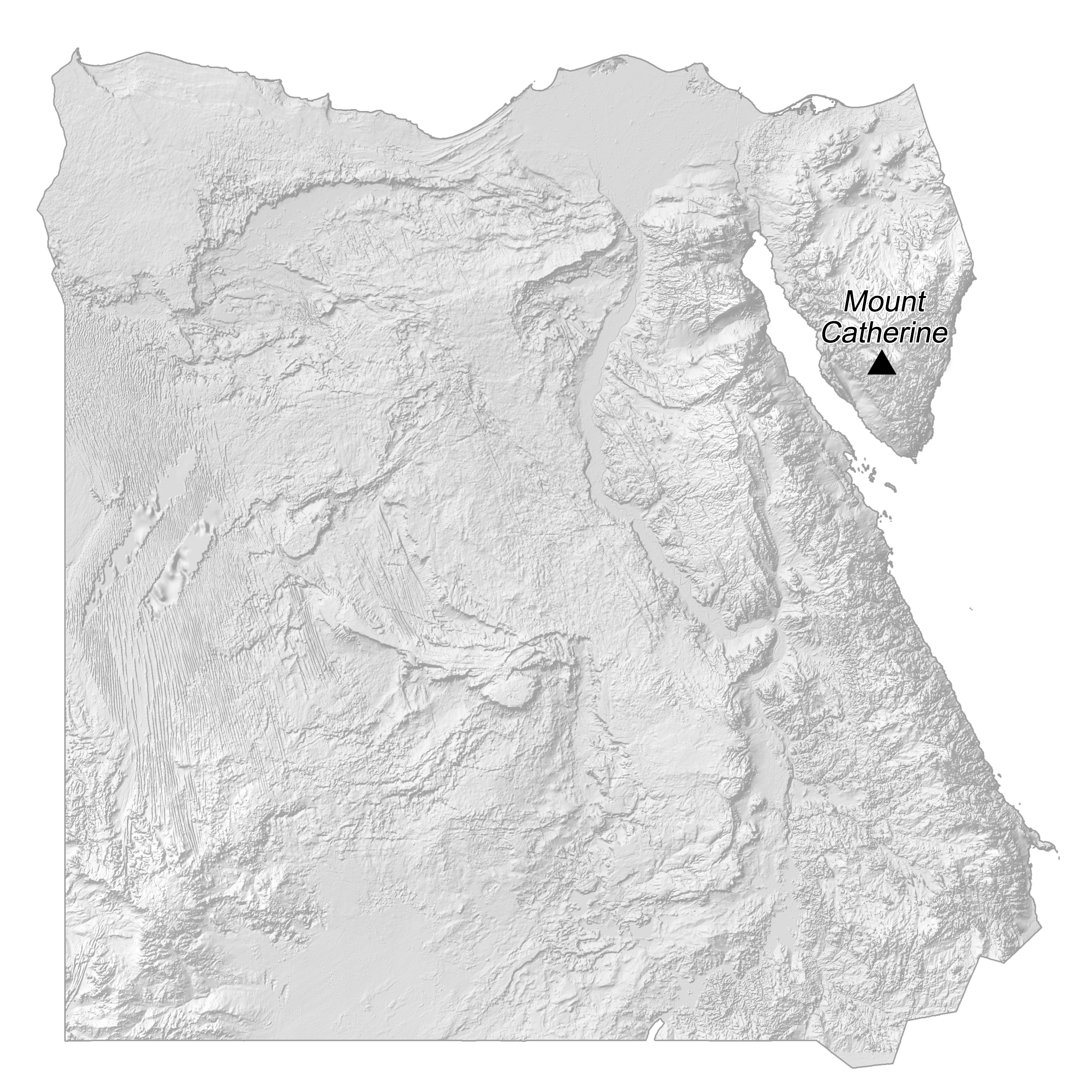
In the far southwest, the land rises into the Gilf Kebir Plateau, with elevations near 609 m. Sandstone plateaus front the Nile and the Red Sea, with cliffs as high as 548 m. In the far southeast, the Red Sea Mountains, an extension of the Ethiopian Highlands, continue into Sudan.
Lake Nassar, the largest lake in Egypt can be observed on the map in southeastern Egypt. It is man-made and was created when the Aswan dam was constructed, then finished in 1970.
The 2,642 m high Mount Catherine in the Sinai Peninsula is the highest point in Egypt.
The lowest point of Egypt is the Qattara Depression at -436 ft (-133 m).
| Flag: |  |
|---|---|
| Legal Name: | Arab Republic of Egypt |
| Capital Value: | Cairo |
| Official languages: | Arabic |
| Demonym(s): | Egyptian |
| Government: | Unitary semi-presidential republic |
| Legislature: | Parliament |
| Total Area: | 1,001,450 km² |
| Land Area: | 995,450 km² |
| Water Area: | 6,000 km² |
| Population: | 100,388,073 |
| Density: | 102/km (264.2/sq mi) (118th) |
| GDP: | $303.18 Billion |
| GDP Per Capita: | $3,020.03 |
| Currency Value: | Egyptian pounds (EGP) |
| Driving side: | right |
| Calling code: | +20 |
| Internet TLD: |
|
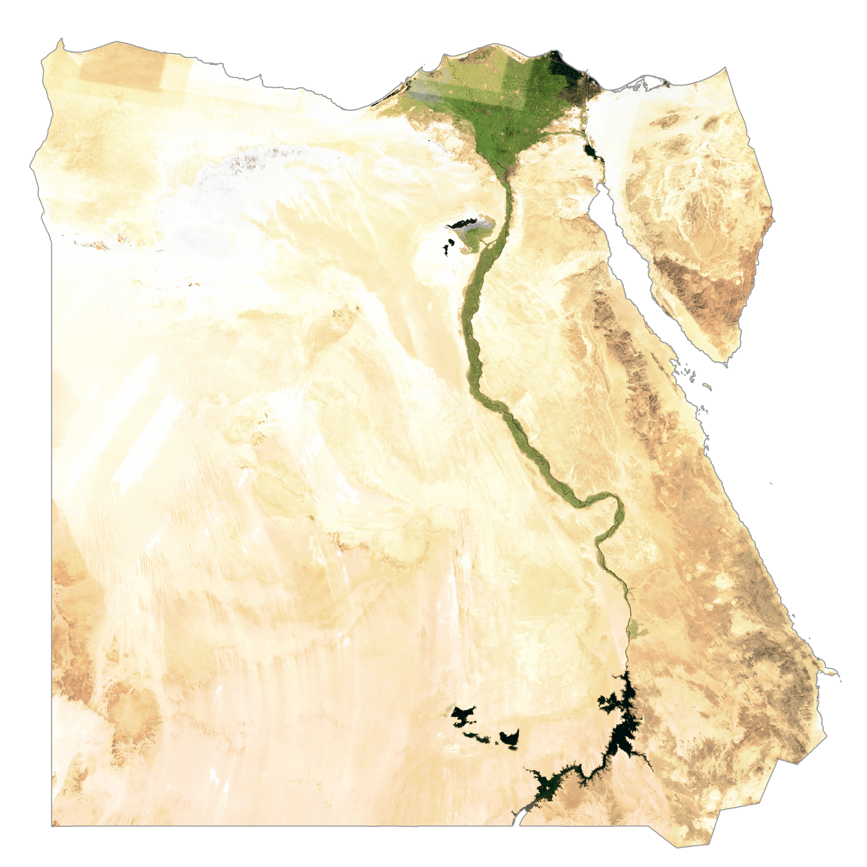
Egypt is a geographically diverse country, with its majestic Nile River running through the heart of the country and the Sahara Desert to the west. This map of Egypt highlights the country’s major cities, roads, rivers, and lakes, as well as its elevation map and satellite imagery that gives us a glimpse of the topography of the Nile River and its vast number of deserts.
Online Interactive Political Map
Click on ![]() to view map in "full screen" mode.
to view map in "full screen" mode.
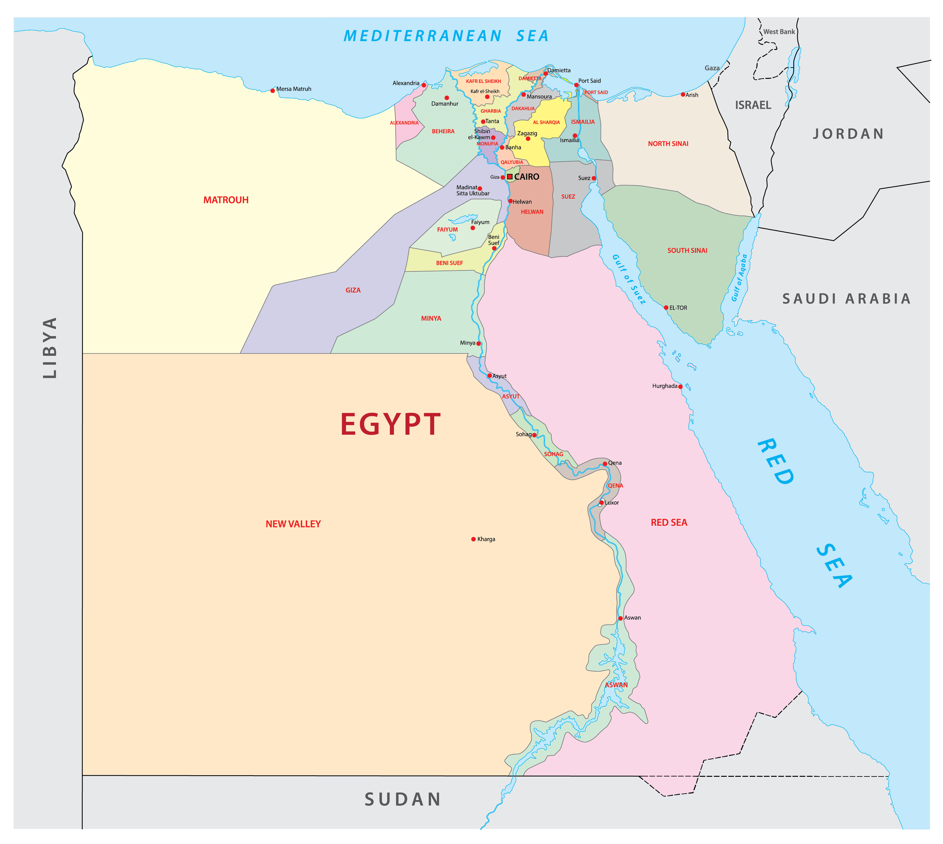
Egypt has 27 governorates. These are Ad Daqahliyah, Al Bahr al Ahmar (Red Sea), Al Buhayrah, Al Fayyum, Al Gharbiyah, Al Iskandariyah (Alexandria), Al Isma’iliyah (Ismailia), Al Jizah (Giza), Al Minufiyah, Al Minya, Al Qahirah (Cairo), Al Qalyubiyah, Al Uqsur (Luxor), Al Wadi al Jadid (New Valley), As Suways (Suez), Ash Sharqiyah, Aswan, Asyut, Bani Suwayf, Bur Sa’id (Port Said), Dumyat (Damietta), Janub Sina’ (South Sinai), Kafr ash Shaykh, Matruh, Qina, Shamal Sina’ (North Sinai), Suhaj.
With an area of 440,098 sq. km, New Valley is the largest governorate of the country by area. Cairo, the nation’s capital is the most populous one.
Location Maps
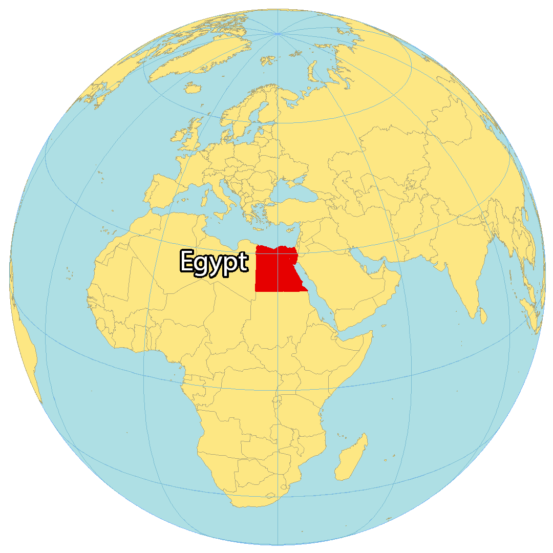
Where is Egypt?
Egypt is a country located in northeastern Africa along the Mediterranean and the Red Sea. It borders Libya to the west, Sudan to the south, as well as Israel and the Gaza Strip (Palestine) to the east. Cairo is the capital and largest city of Egypt with the largest metropolitan area in the Middle East.
Egypt has a rich history as one of the world’s earliest and greatest civilizations. For example, the Great Pyramids of Giza and the Great Sphinx are absolute marvels and world-renowned monuments. Egyptians were also the first to use hieroglyphics and pioneered developments in agriculture and human settlements.
High Definition Political Map of Egypt
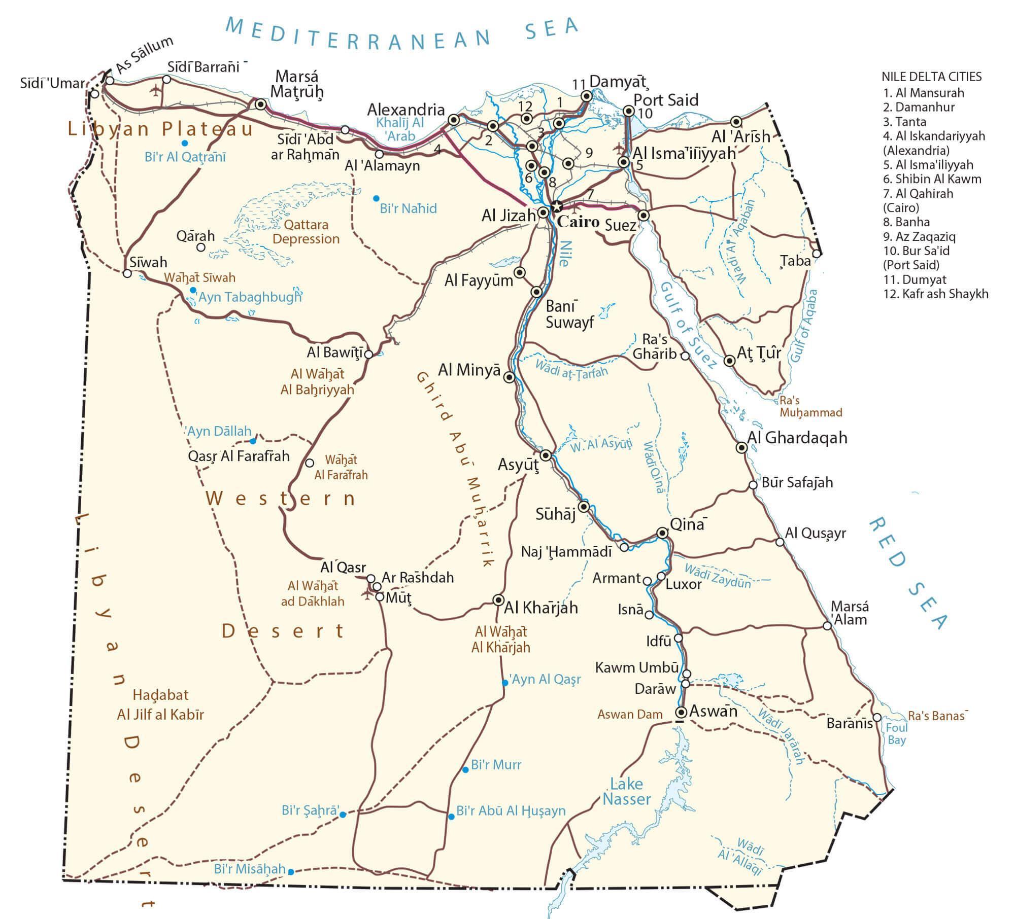
Physical Map of Egypt
Egypt Satellite Map
Elevation Map