The southernmost African country of South Africa encompasses an area of 1,221,037 sq. km.
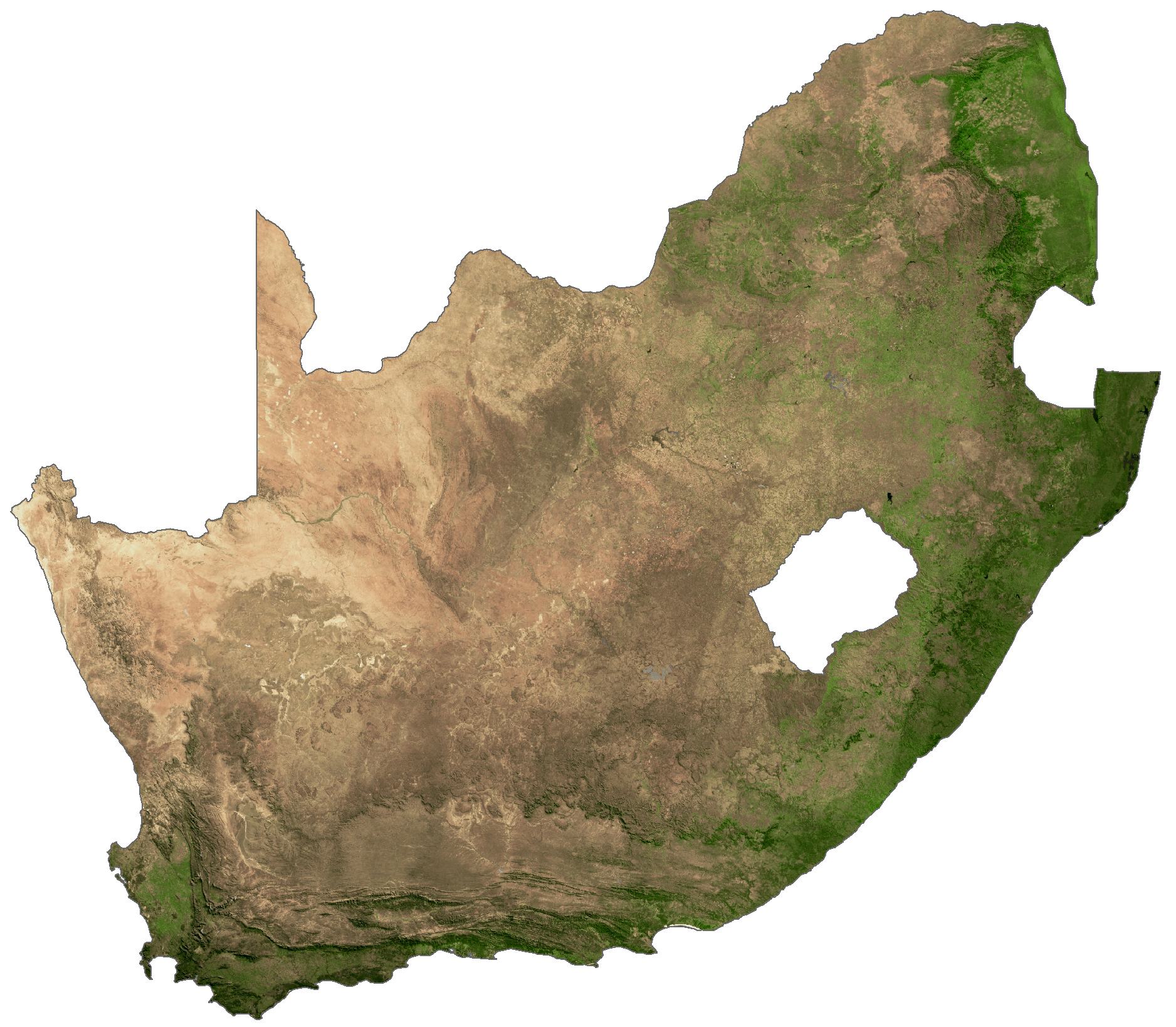
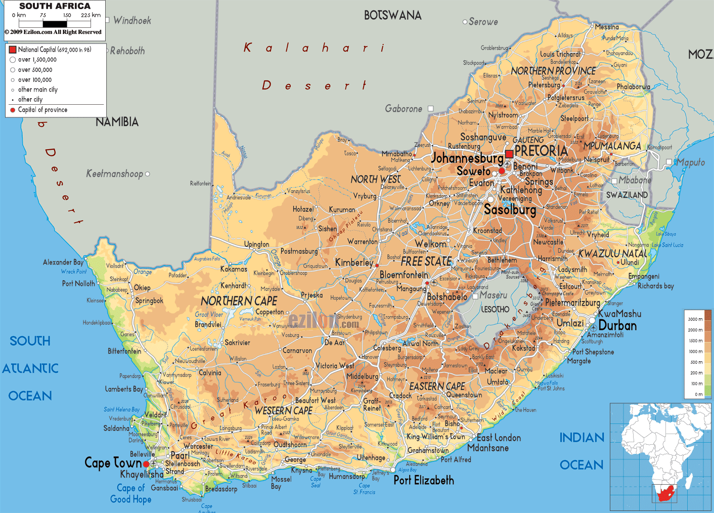
South Africa is mostly covered by a plateau that drops in elevation from the east (about 2,400 m) to west (about 600 m). In the west, it gives way to the Kalahari Desert. The central part of the plateau is called the Highveld and has elevations ranging from 1,200 to 1,800m.
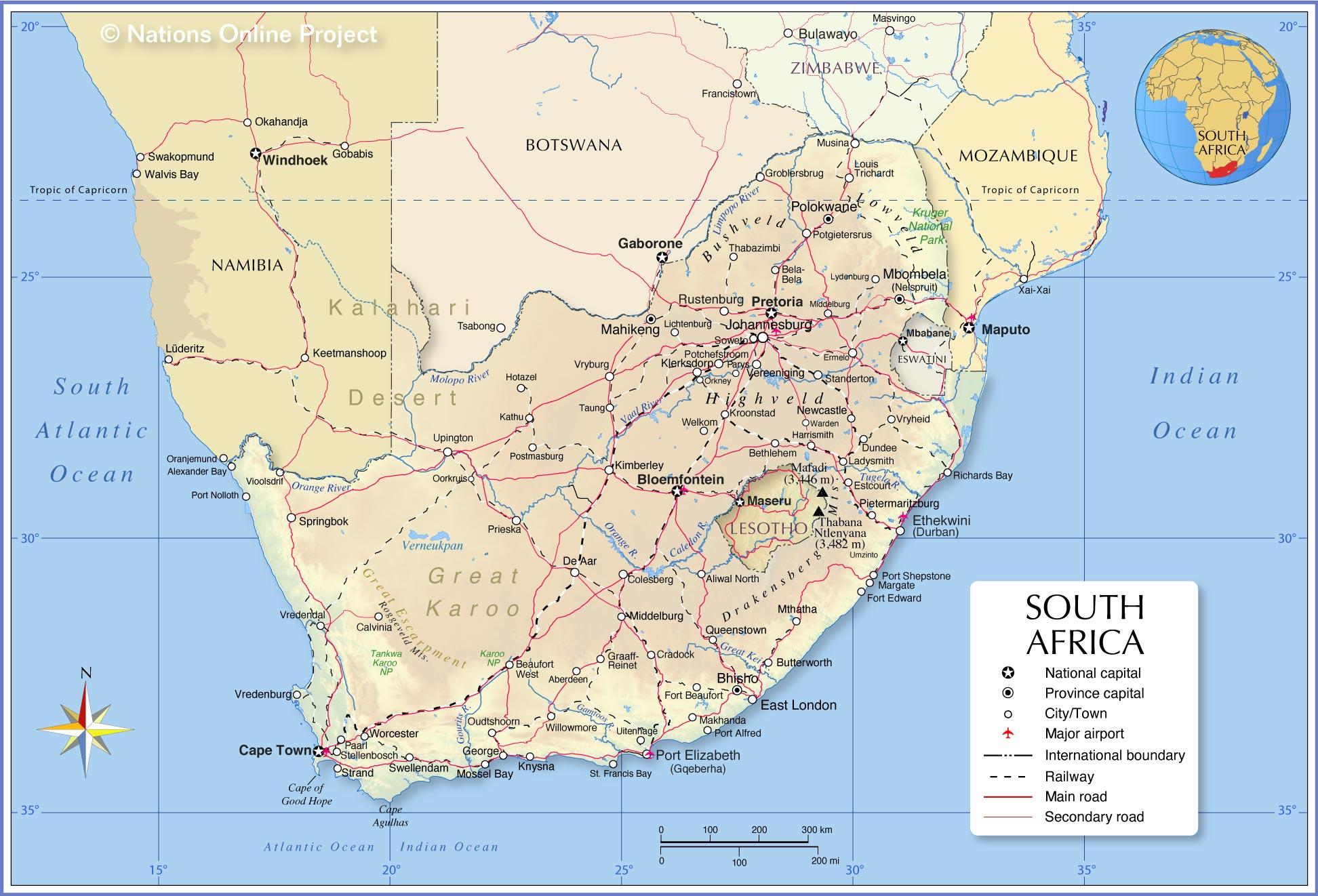
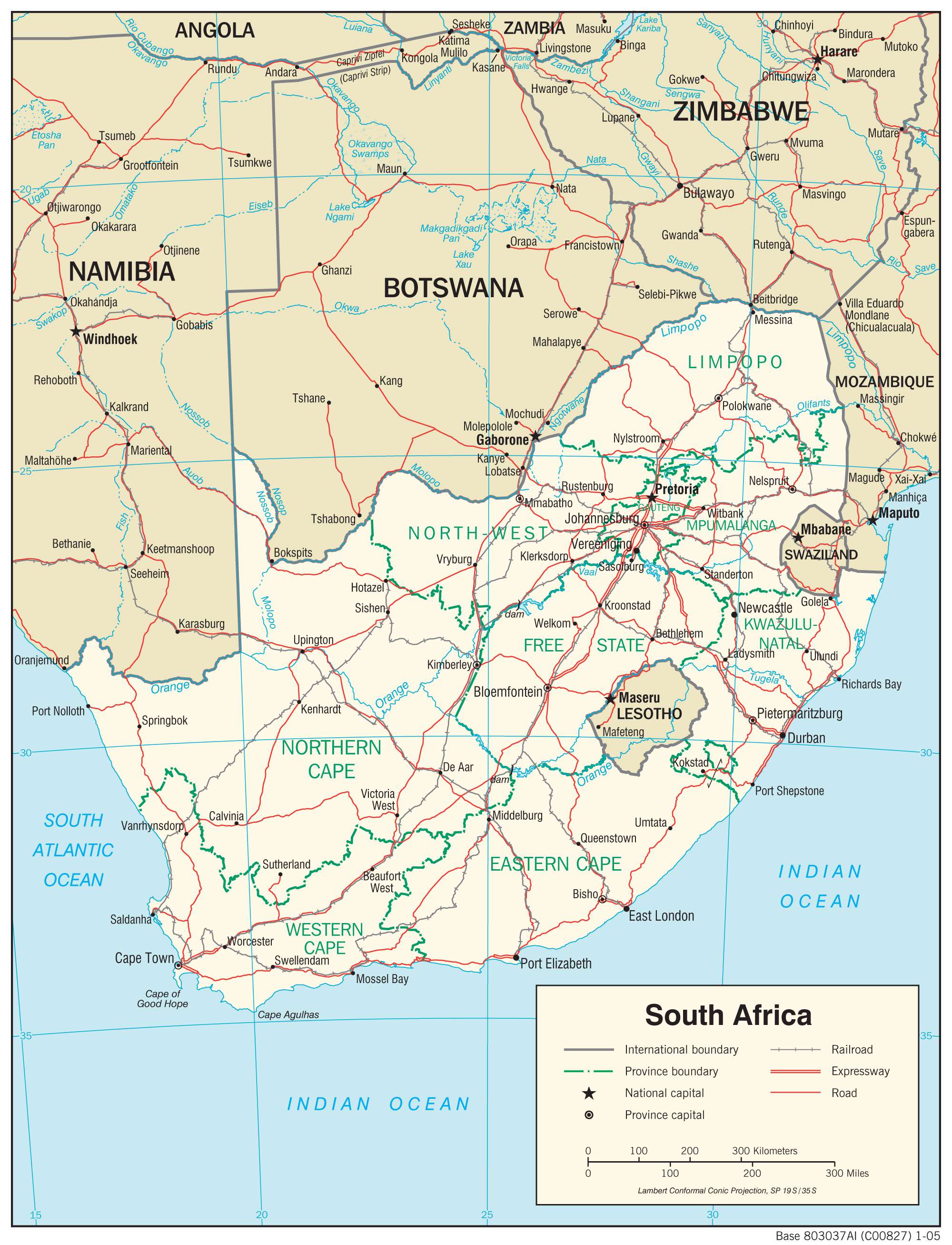
The Drakensberg, marked on the map above, is another major geographical feature of the country. It is the eastern part of the Great Escarpment enclosing the plateau land to the north. The region hosts South Africa’s highest peak, the 3,450 m tall Mafadi located on the border between South Africa and Lesotho. The Drakensberg is a UNESCO World Heritage Site famous for its spectacular landscapes.
There is very little coastal plain in South Africa except for some parts of KwaZulu-Natal and Western Cape. Most of the 2,955-km coastline rises steeply from the coast with elevations rising further inland.
Table Mountain is a notable geographical landmark in South Africa. It is a flat-topped mountain that is part of the Table Mountain National Park. It overlooks the city of Cape Town and attracts many visitors.
As marked on the map, the Orange River and Limpopo River systems are two major river systems draining South Africa. Many other rivers also crisscross the country.
Cape of Good Hope and Cape Agulhas of South Africa are two notable capes in the country and can be observed on the map above. The former is the meeting point of the warm Agulhas current and the cold Benguela current creating extreme weather events and choppy seas. The latter hosts the southernmost tip of mainland Africa.
South Africa also has several islands. The most well-known island of the country, the Robben Island, a UNESCO World Heritage Site, has been marked on the map.
| Flag: |  |
|---|---|
| Legal Name: | Republic of South Africa |
| Capital Value: |
|
| Official languages: | 11 languages
Languages with special status
|
| Demonym(s): | South African |
| Government: | Unitary dominant-party parliamentary republic with an executive presidency |
| Legislature: | Parliament |
| Total Area: | 1,219,090 km² |
| Land Area: | 1,214,470 km² |
| Water Area: | 4,620 km² |
| Population: | 58,558,270 |
| Density: | 42.4/km (109.8/sq mi) (169th) |
| GDP: | $351.43 Billion |
| GDP Per Capita: | $6,001.40 |
| Currency Value: | Rand (ZAR) |
| Driving side: | left |
| Calling code: | +27 |
| Internet TLD: | .za |
Experience the beauty of South Africa with this interactive map. From the Drakensberg Mountains in the east to the Kalahari Desert in the west, this map of South Africa showcases the country’s major cities, towns, rivers, lakes, and roads. Explore the terrain with satellite imagery and get a better understanding of this stunning country.
Online Interactive Political Map
Click on ![]() to view map in "full screen" mode.
to view map in "full screen" mode.
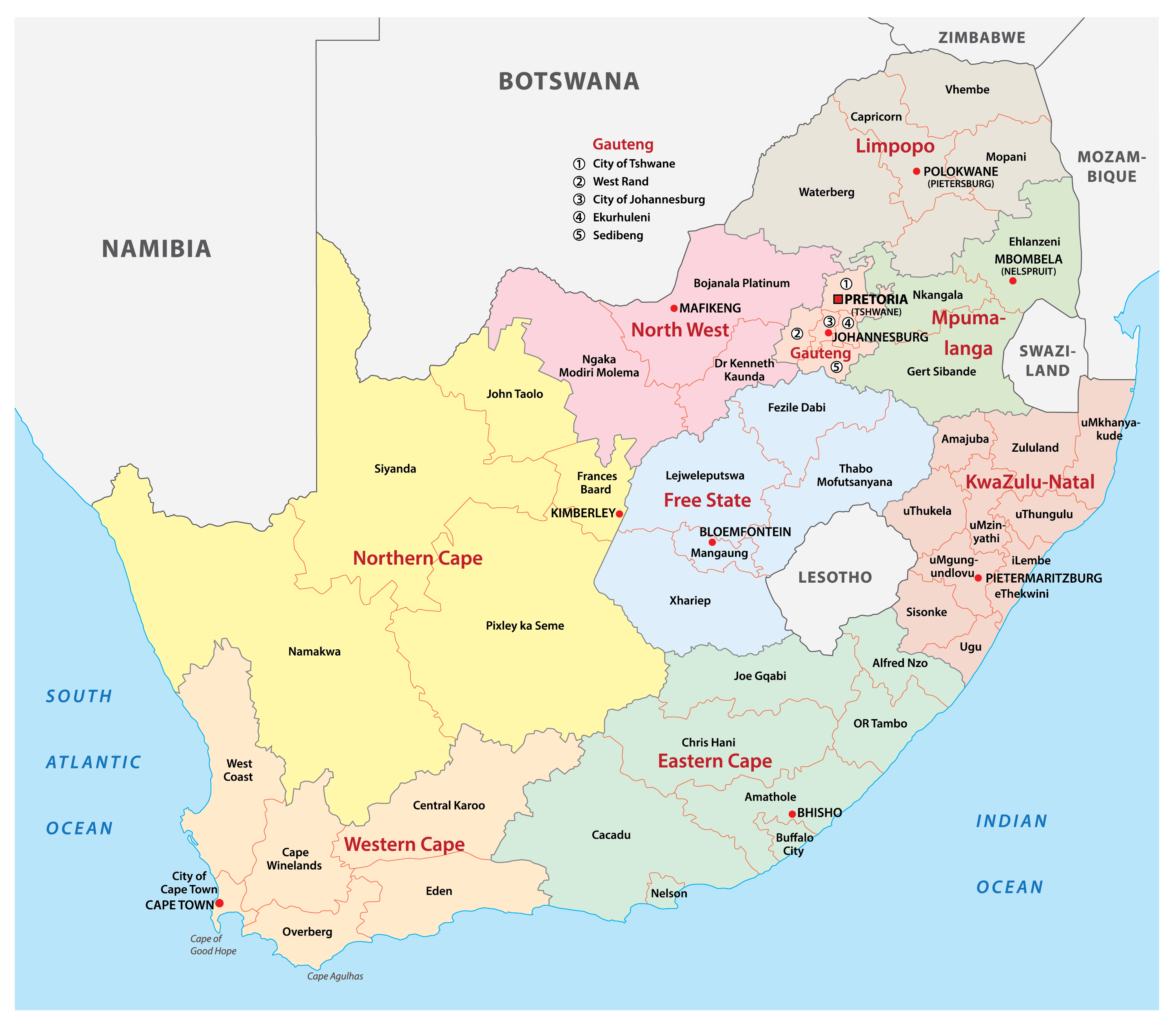
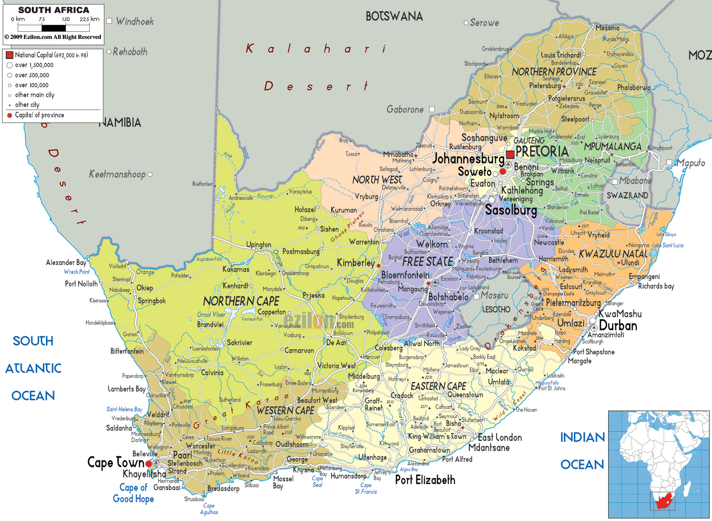
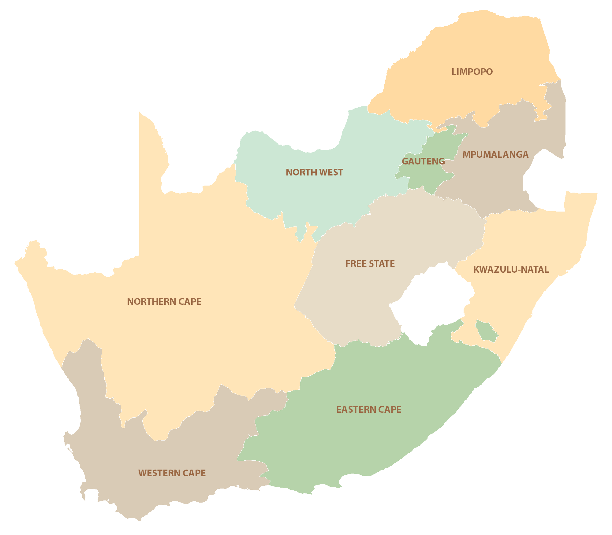
South Africa is divided into nine provinces as shown on the political map above. These are Eastern Cape, Free State, Gauteng, KwaZulu-Natal, Limpopo, Mpumalanga, Northern Cape, North West, and Western Cape. The provinces are further divided into metropolitan and district municipalities. The latter is further sectioned into local municipalities. All municipalities are divided int still smaller units called wards.
With an area of 372,889 sq. km, Northern Cape is South Africa’s largest province while Gauteng is the most populous one.
The country has three capital cities. Pretoria, Cape Town, and Bloemfontein served as the executive, legislative, and judicial capitals of the country respectively. Johannesburg is the country’s largest city.
Location Maps
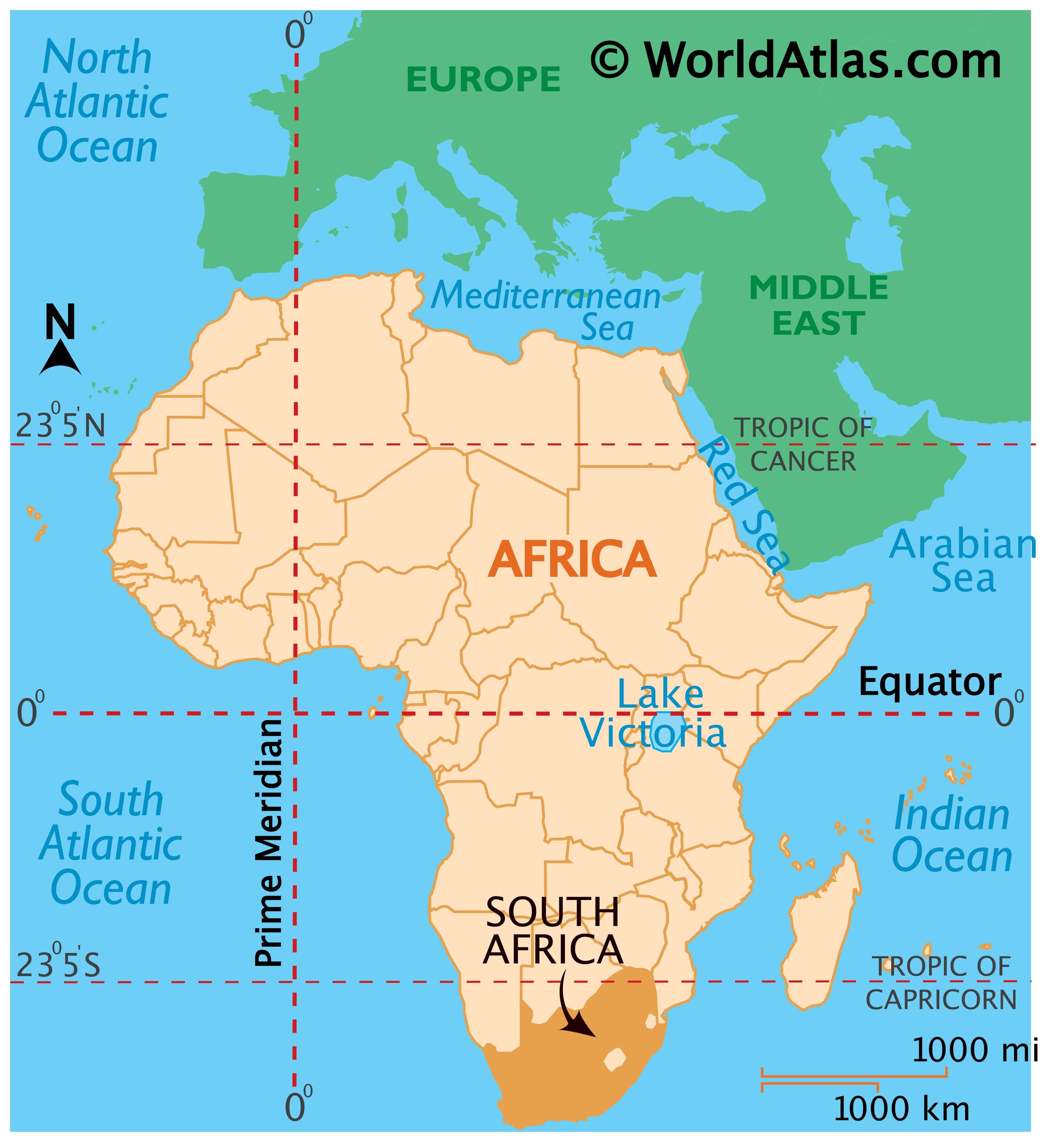
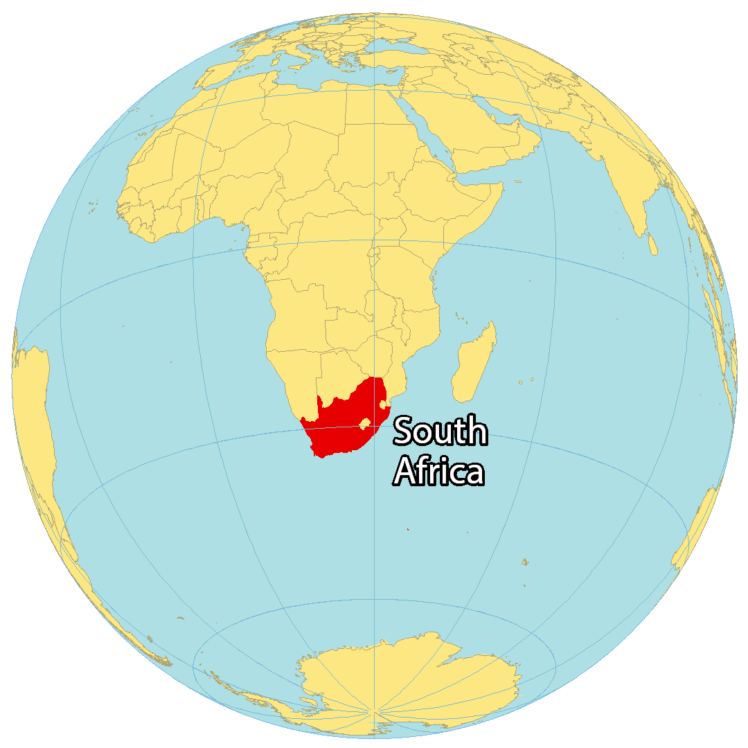
Where is South Africa?
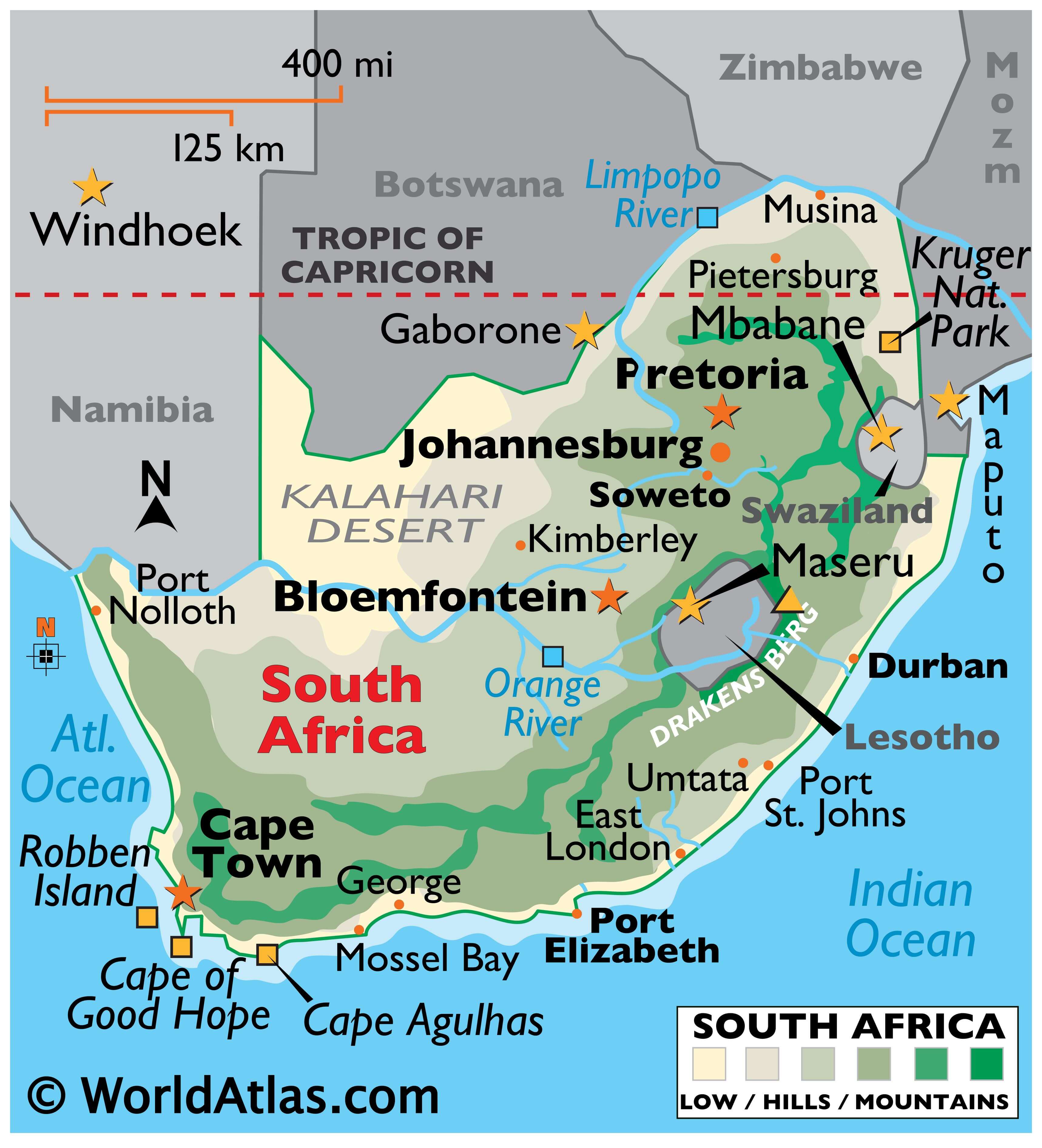
South Africa is located at the southern tip of the continent of Africa, along both the Indian Ocean and South Atlantic Ocean. It borders Namibia, Botswana, Mozambique, and Zimbabwe to the north. But South Africa also completely surrounds Lesotho, and nearly surrounds Eswatini (Swaziland) as well.
South Africa is the most populous country located entirely south of the equator with over 60 million people. Additionally, South Africa is the only country in the world to have 3 capitals – Bloemfontein, Pretoria, and Cape Town. While Bloemfontein is the judicial capital, Pretoria is the executive capital. Finally, Cape Town is the legislative capital and largest city in South Africa. Other major cities are Durban, Johannesburg, and Soweto.

High Definition Political Map of South Africa
South Africa Administrative Map
Physical Map of South Africa

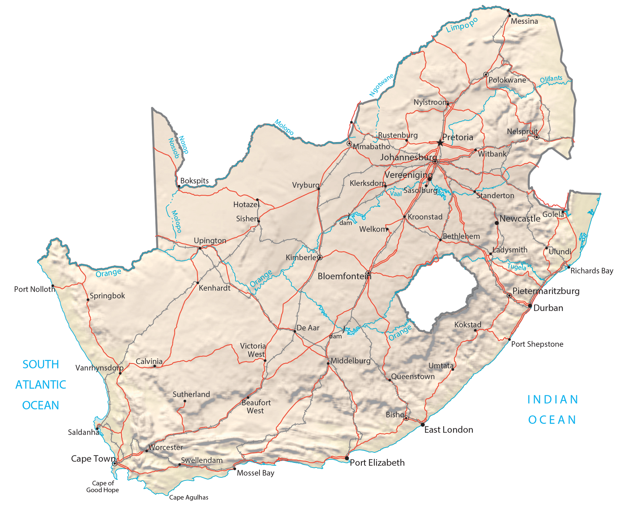
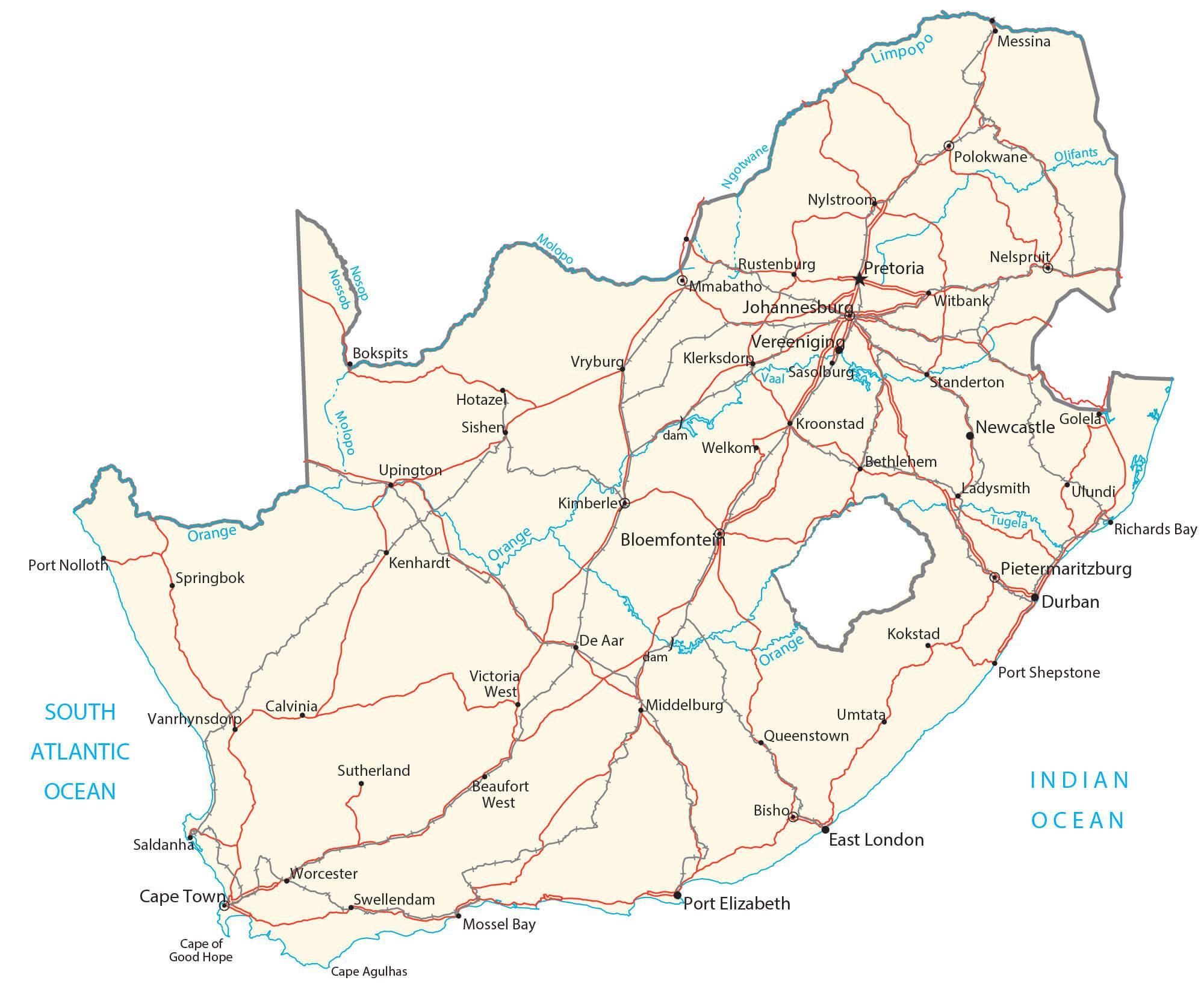
Transportation Map of South Africa
South Africa Satellite Map