Covering an area of 1,141,748 sq. km, Colombia is a country located in the northwestern part of South America.
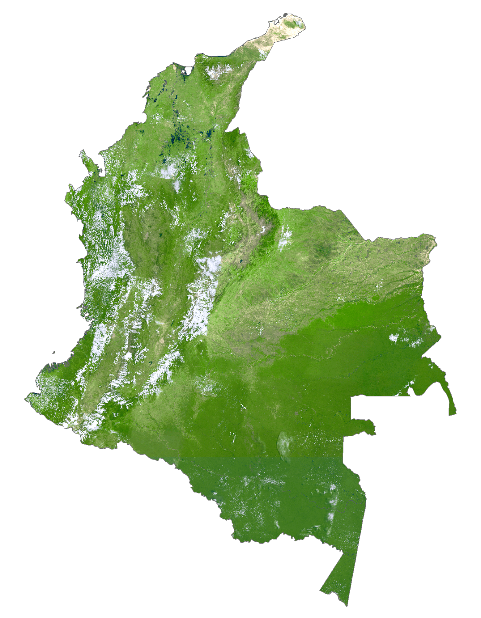
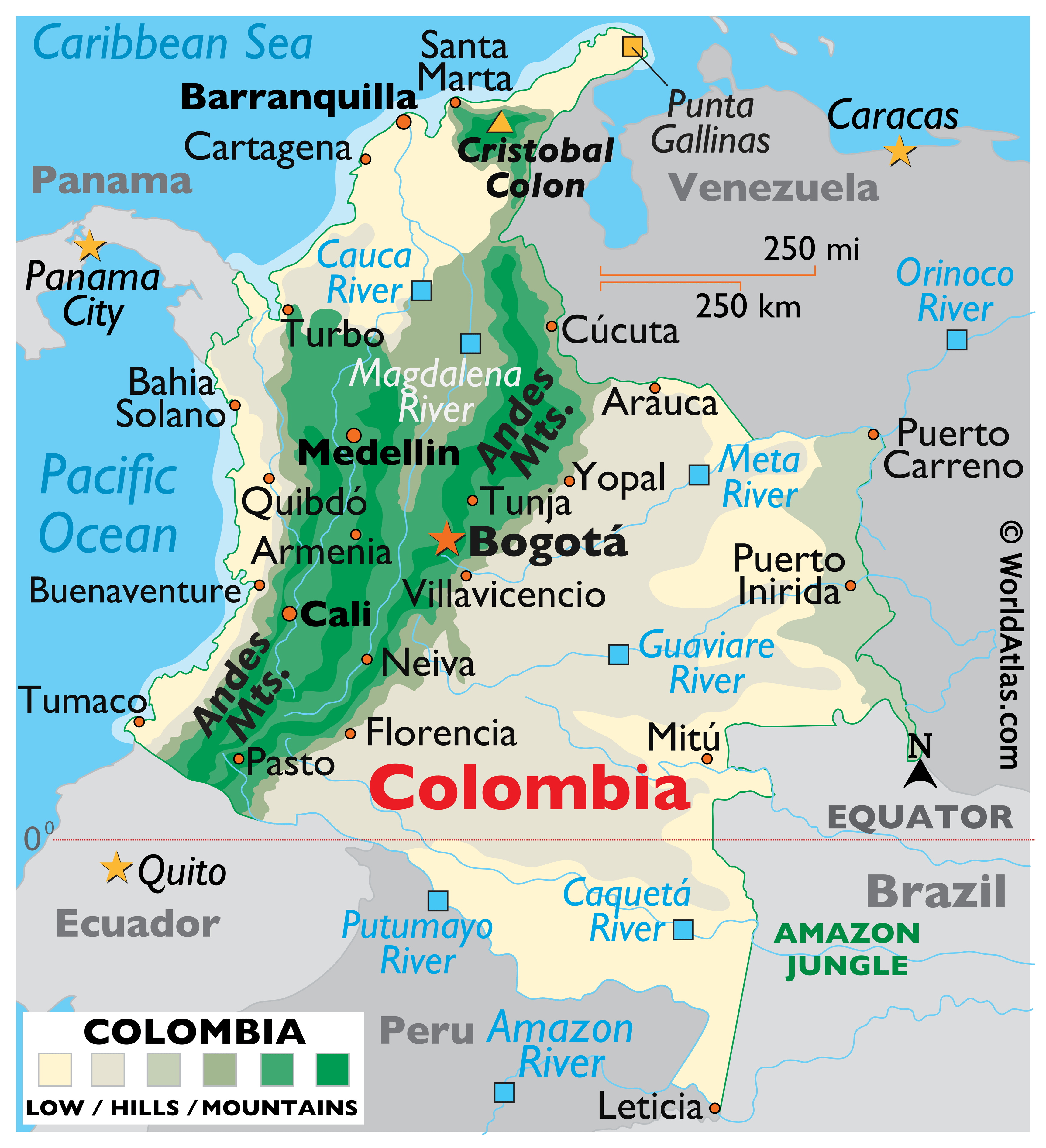
As observed on the map, the Colombian Andes dominates the landscape in the western part of the country. The Colombian Andes is further divided into three branches: The Cordillera Central (Central Range), Cordillera Oriental (Eastern Range), and Cordillera Occidental (Western Range). To the east of the Andes mountain ranges lies the savannas; while the Amazon rainforest is situated in the far south-eastern part of the country. Located in the Sierra Nevada de Santa Marta mountain range in the extreme northern part of the country is, the Pico Cristobal Colon – the highest peak in Colombia, which rises to an elevation of 18,950ft. It is closely followed by the Pico Simon Bolivar, at an elevation of 18,497ft. The major rivers of the country are the Amazon, the Caquetá, Meta, Guaviare, Magdalena, Atrato, Putumayo rivers. The country’s lowest point is the Pacific Ocean (0ft).
| Flag: |  |
|---|---|
| Legal Name: | Republic of Colombia |
| Capital Value: | Bogota |
| Official languages: | Spanish |
| Demonym(s): | Colombian |
| Government: | Unitary presidential republic |
| Legislature: | Congress |
| Total Area: | 1,138,910 km² |
| Land Area: | 1,038,700 km² |
| Water Area: | 100,210 km² |
| Population: | 50,339,443 |
| Density: | 42.23/km (109.4/sq mi) (173rd) |
| GDP: | $323.80 Billion |
| GDP Per Capita: | $6,432.39 |
| Currency Value: | Colombian pesos (COP) |
| Driving side: | right |
| Calling code: | +57 |
| Internet TLD: | .co |
Explore Colombia’s breathtaking beauty with this interactive map of the country. From the towering peaks of the Andes Mountains to the lowland plains of the Llanos, see the diverse landscape that makes Colombia such a captivating destination. Zoom in to see major cities, towns, roads, and rivers, or take a closer look at the satellite imagery to appreciate the country’s topography.
Online Interactive Political Map
Click on ![]() to view map in "full screen" mode.
to view map in "full screen" mode.
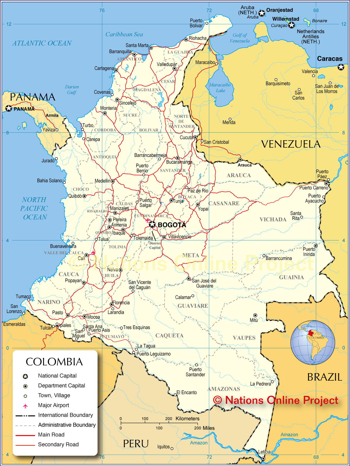
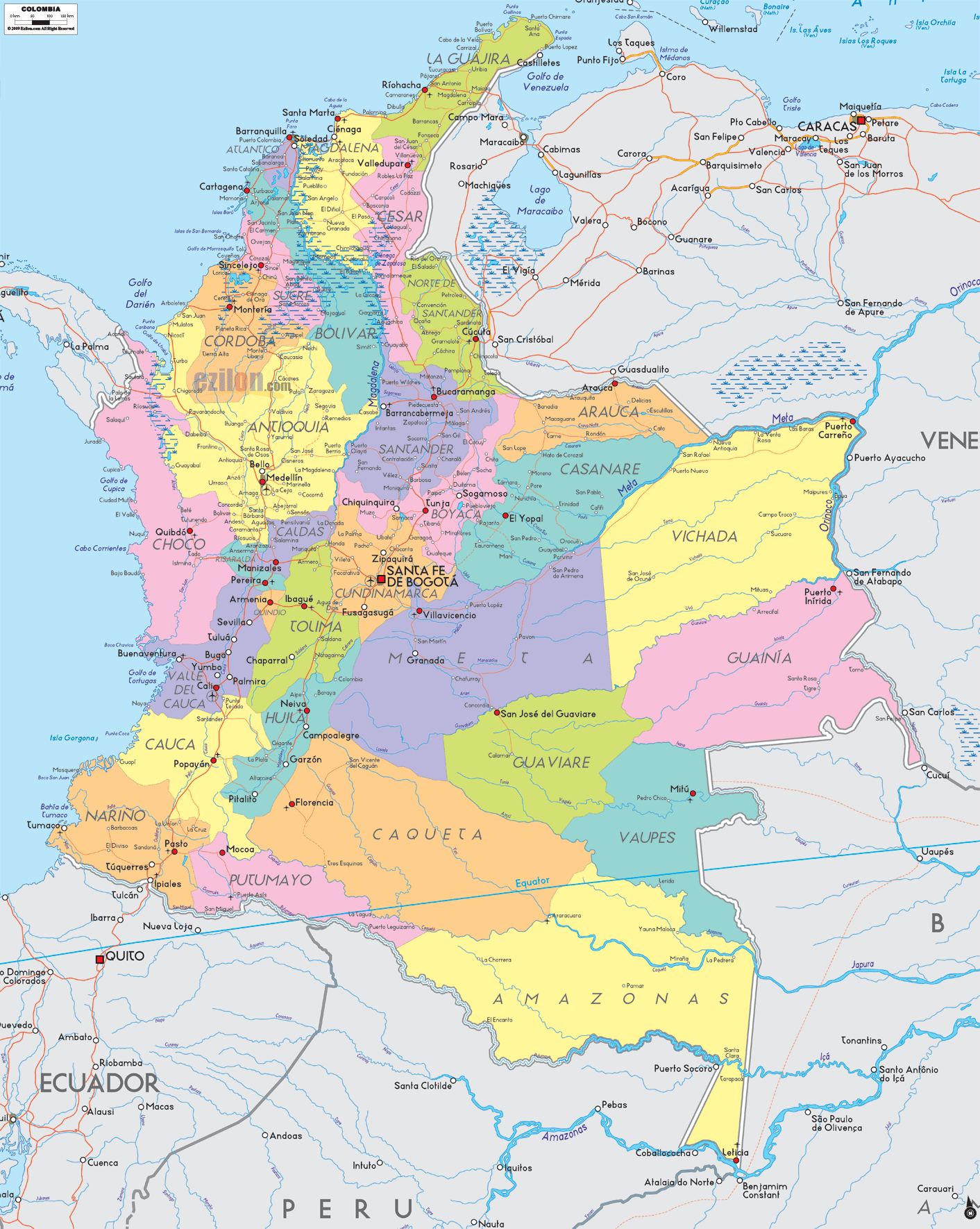
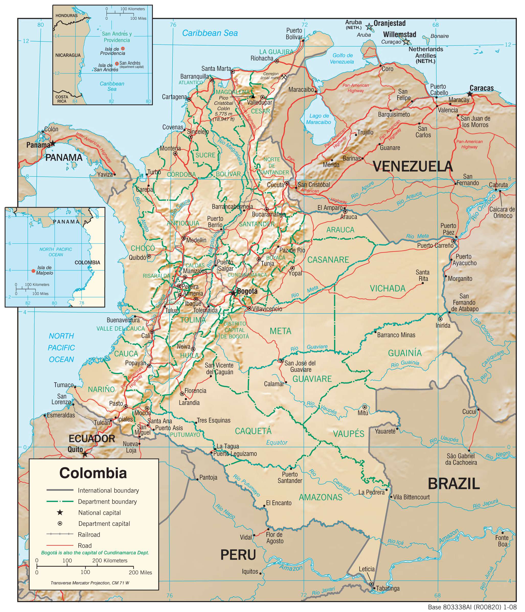
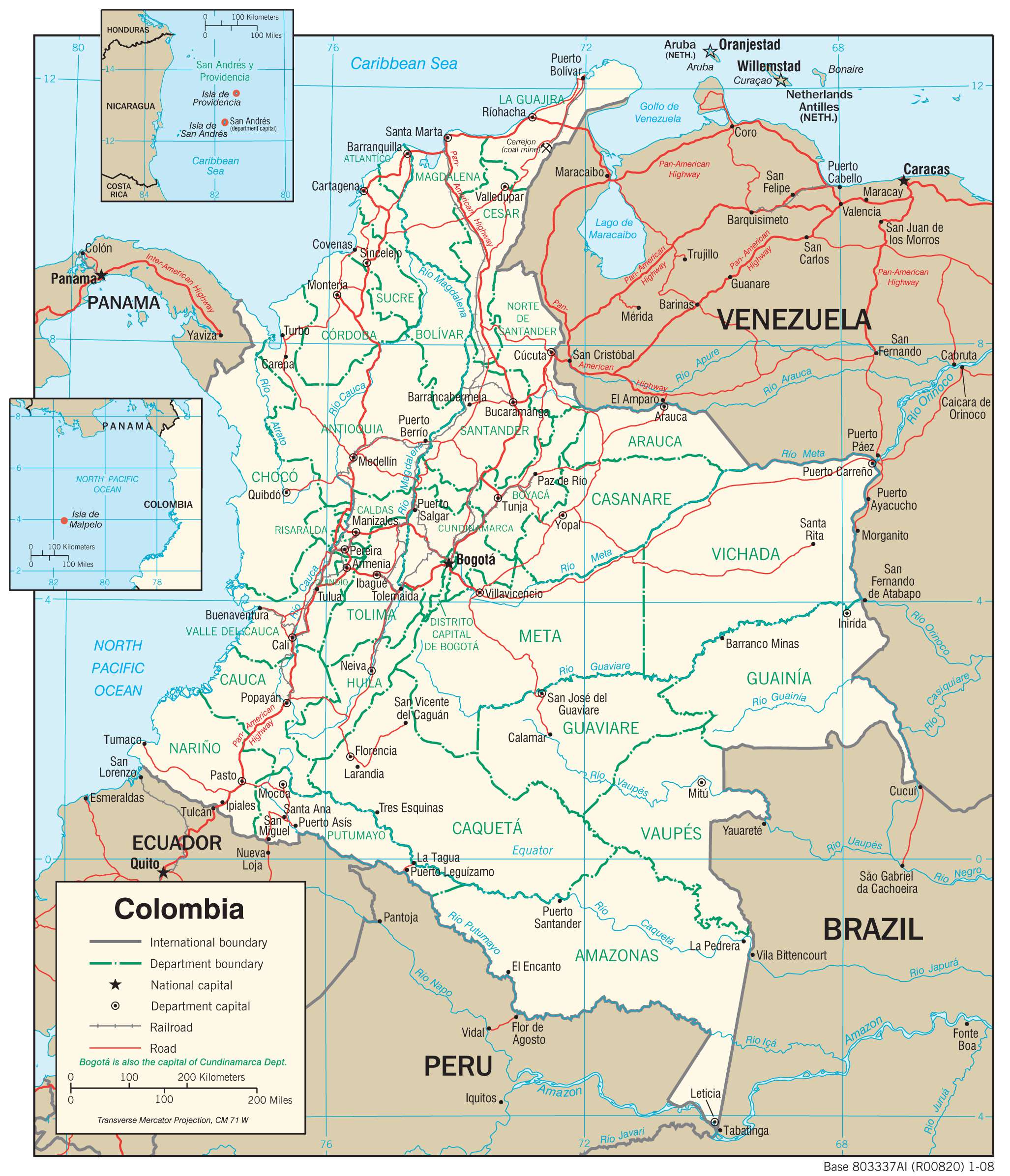
Colombia (officially, Republic of Colombia) is divided into 32 departments (departamentos, singular – departamento) and 1 capital district (distrito capital). In alphabetical order, these departments are: Amazonas, Antioquia, Arauca, Atlantico, Bolivar, Boyaca, Caldas, Caqueta, Casanare, Cauca, Cesar, Choco, Cordoba, Cundinamarca, Guainia, Guaviare, Huila, La Guajira, Magdalena, Meta, Narino, Norte de Santander, Putumayo, Quindio, Risaralda, Archipielago de San Andres, Providencia y Santa Catalina (colloquially San Andres y Providencia), Santander, Sucre, Tolima, Valle del Cauca, Vaupes, and Vichada. Bogota is the capital district.
These departments are subdivided into a total of 1,122 municipalities. The municipalities are further subdivided into comunas in the urban area and into corregimientos in the rural areas.
Covering an area of 1,141,748 sq. km, Colombia is one of the world’s most linguistically and ethnically diverse countries. Situated in the central part of the country and placed on a high plateau in the northern Andes Mountains is Bogotá – the capital and the largest city of Colombia. It serves as the administrative, political, economic, and industrial center of Colombia. Located at 8,530ft (2,600m) above sea level, Bogotá is one of the highest capitals in the world.
Location Maps
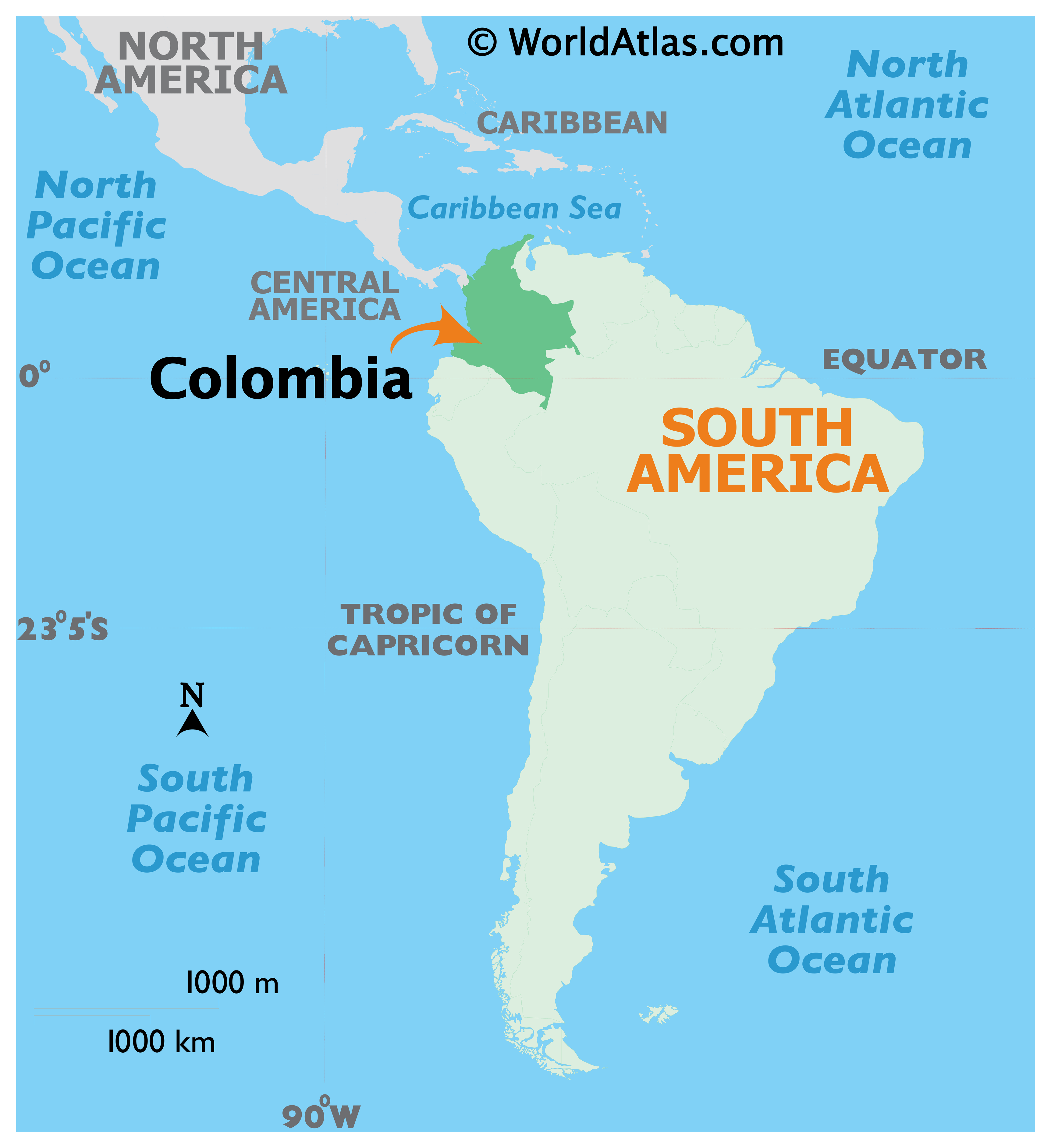
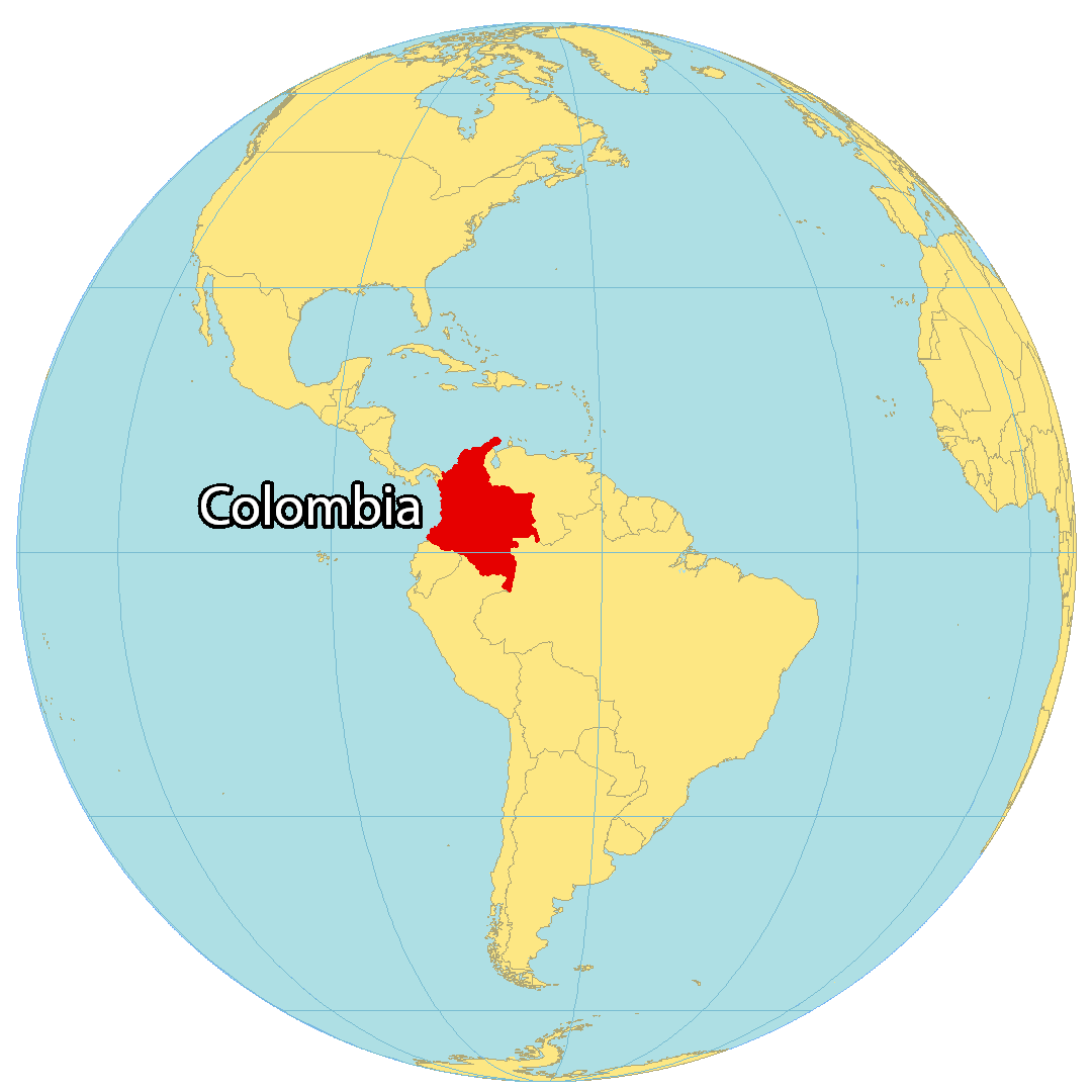
Where is Colombia?
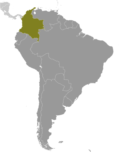
Colombia is situated in the northern region of South America and is the only nation in the continent to border both sides of the ocean. It shares borders with five other countries, including Panama to the north, Venezuela to the east, Brazil to the south, and Ecuador and Peru to the southwest. Its capital and largest city is Bogotá. Colombia enjoys a tropical climate with no significant variation in temperature throughout the year, so it does not have the traditional four seasons. There are 18 UNESCO World Heritage Sites, and the country hosts a variety of festivals and carnivals throughout the year.
High Definition Political Map of Colombia

Physical Map of Colombia
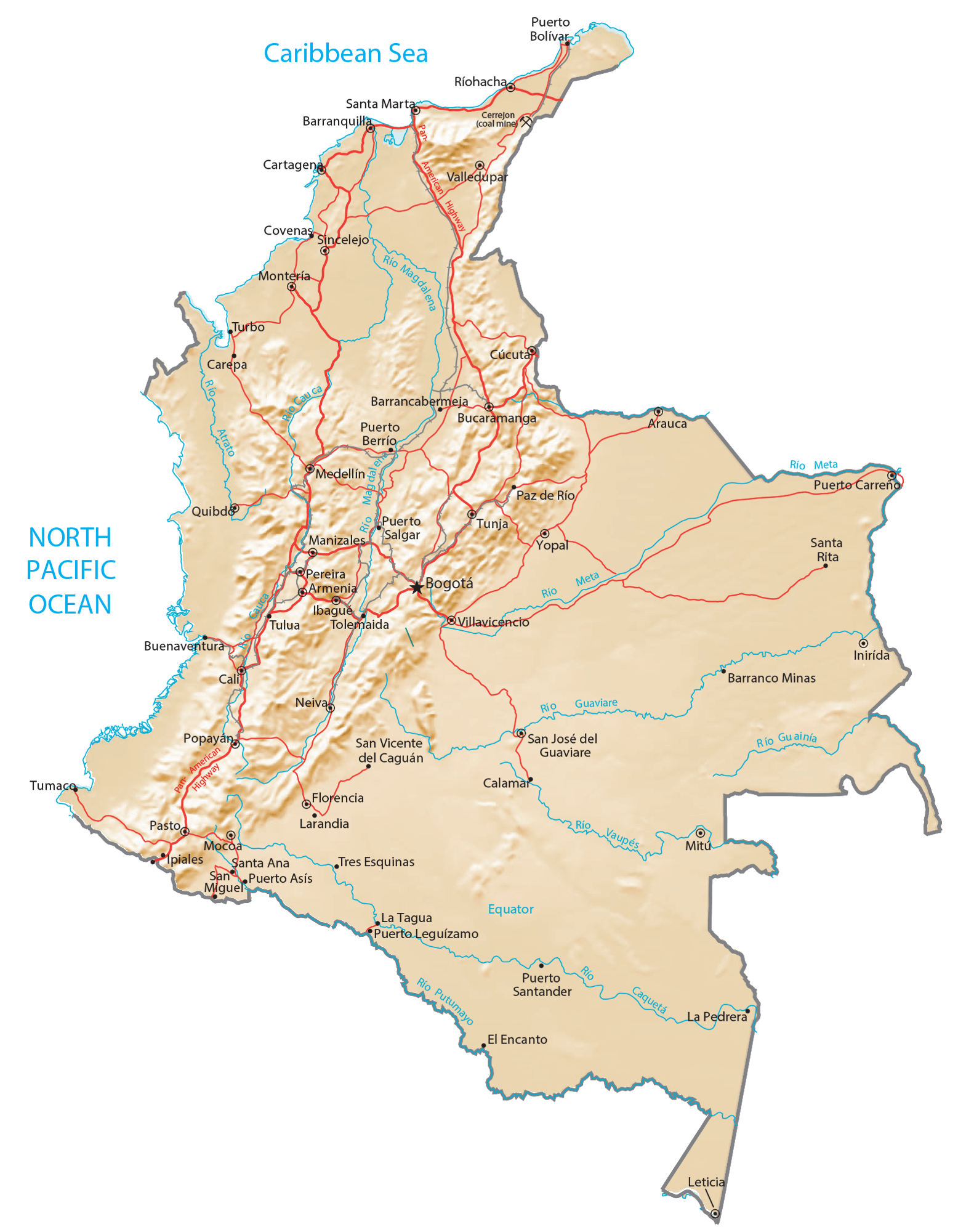
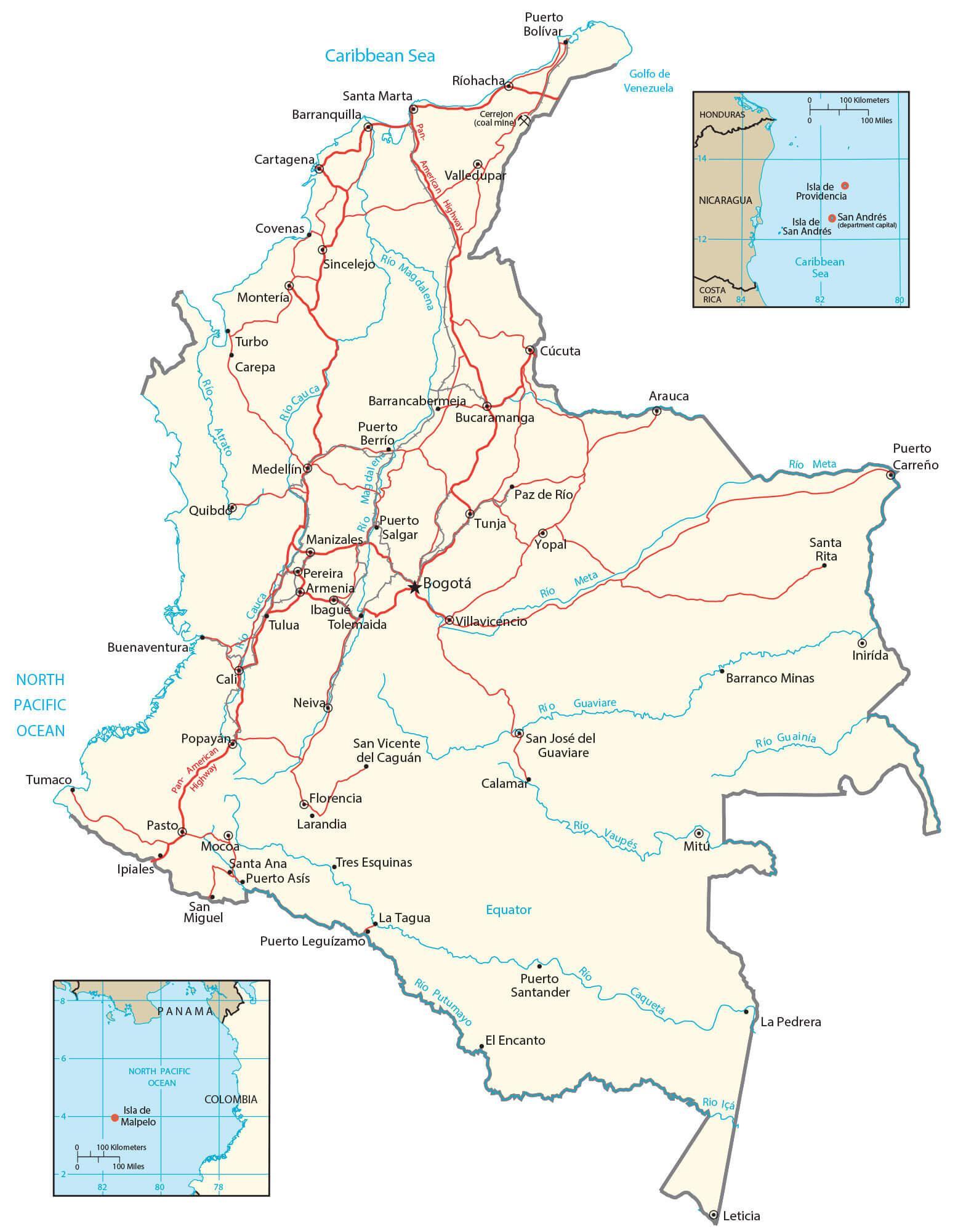
Transportation Map of Colombia
Colombia Satellite Map