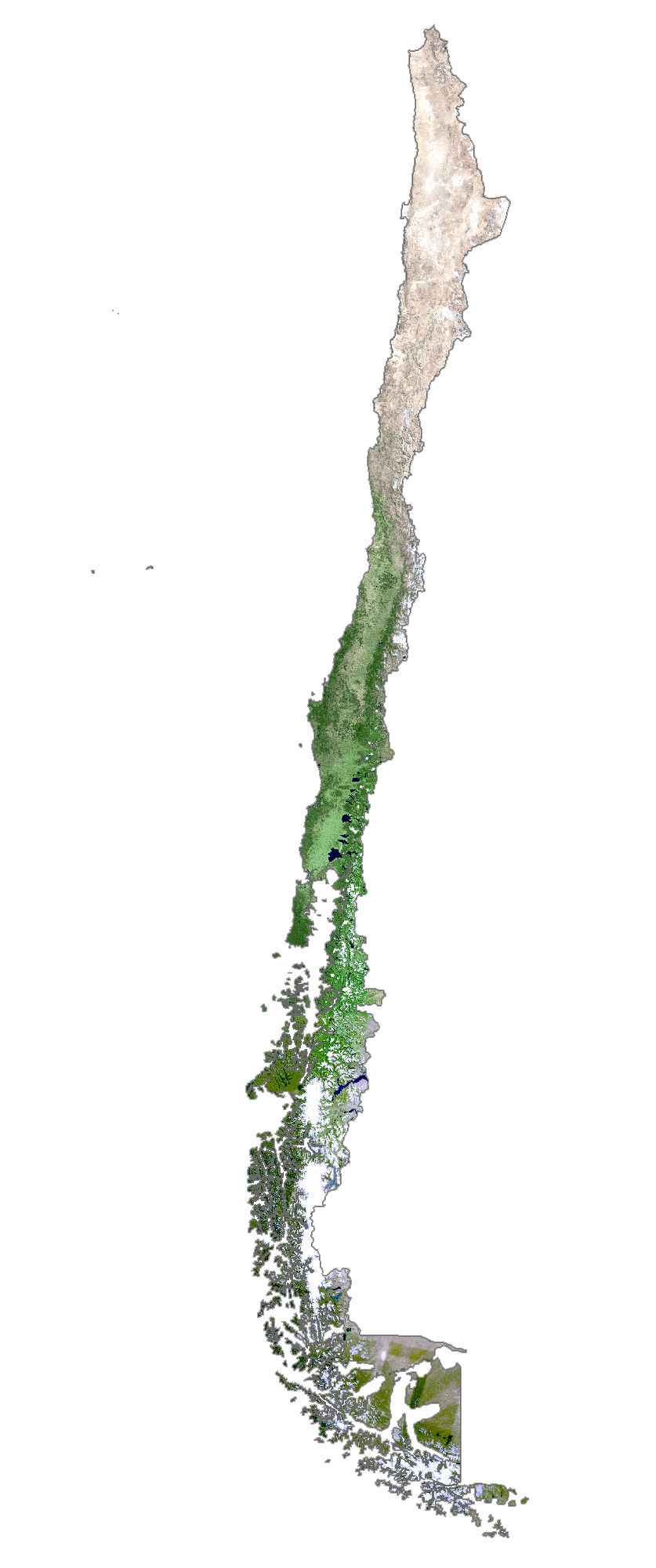
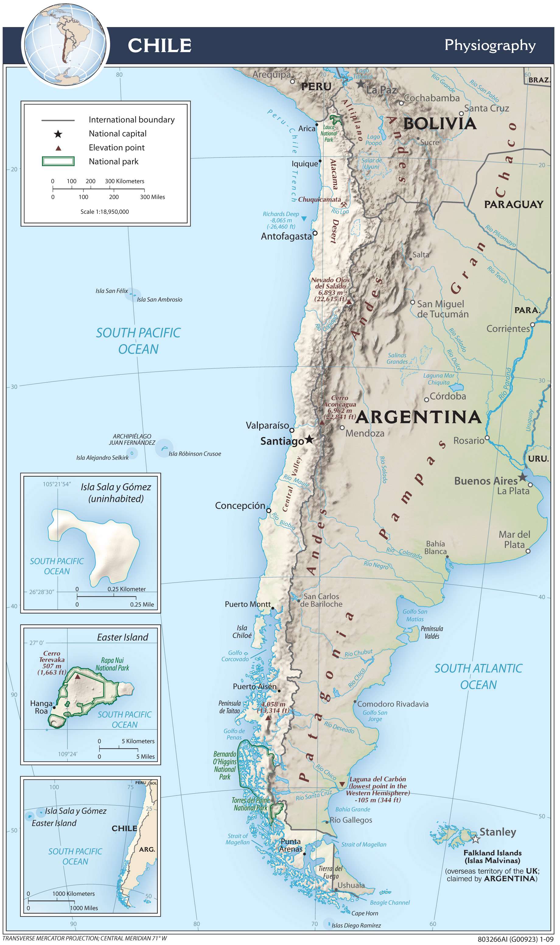
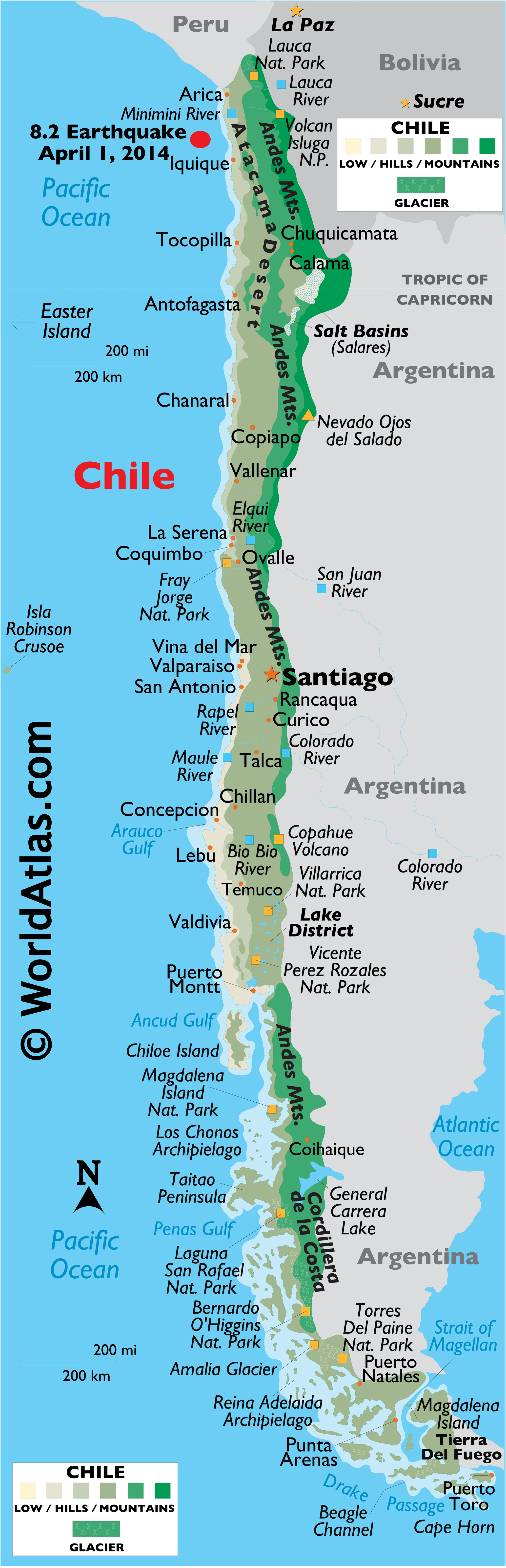
Covering an area of about 756,096 sq.km (291,930.4 sq mi) and with a toothy coastline of almost 4,000 miles, pencil-thin Chile is wedged between the Pacific Ocean and the rugged Andes, the world’s longest mountain range; in southwestern part of South America. This land of incredible and unusual contrasts is also home to the numerous beaches, fjords, deep sea channels, glaciers and icebergs – and the Atacama Desert – a virtually rainless plateau made up of salt basins and lava flows.
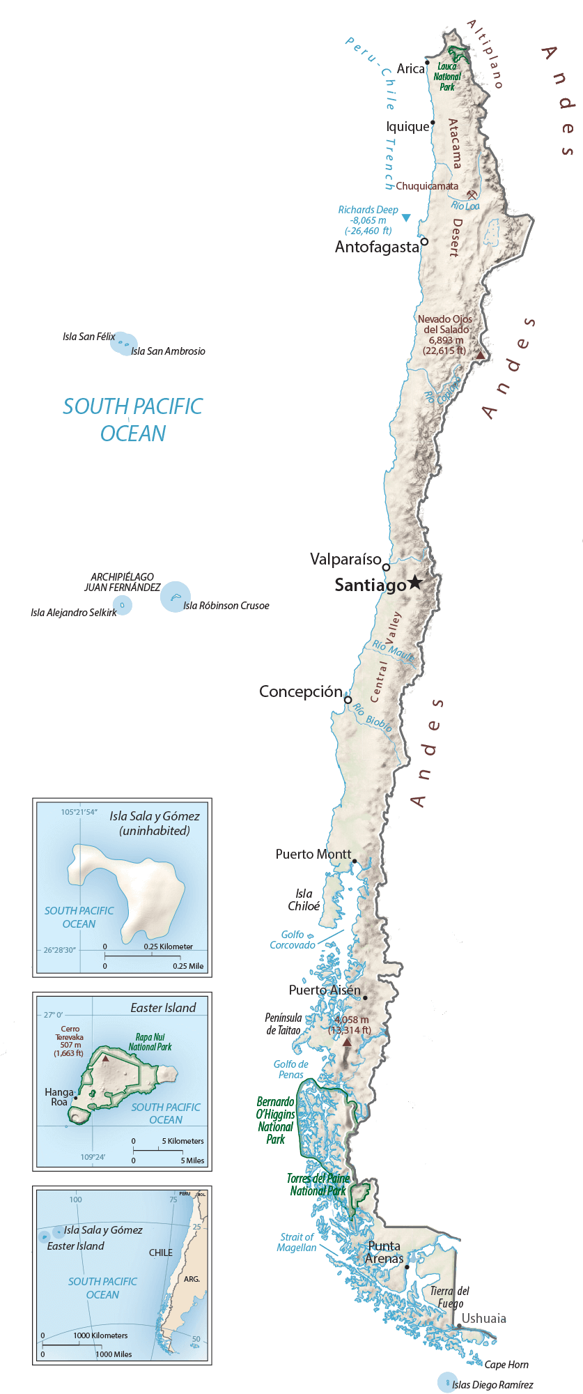
As observed on the physical map of Chile above, most of the country’s interior is covered by mountains. The snowcapped Andes cover almost all of its eastern border. Generally lower, non-Andean ranges dissect Chile (north to south) with the largest being the Cordillera de la Costa in the far south. Located along the Pacific Ring of Fire, the Andes are geologically a young mountain range that includes over 600 volcanoes (within Chile alone), many of them active, and almost 10% have erupted (at least once) within the last century. Throughout the country deep valleys and high plateaus front these mountains, most winding east to west; the central valley (or Pampas) runs to the Pacific Ocean shoreline. Chile’s highest point (as marked on the map, as an upright yellow triangle) is Nevado Ojos del Salado. With an elevation of 22,572ft (6,880m) it is also the 2nd highest mountain in South America. The lowest point is at the Pacific Ocean.
The Lake Region of the South, is a group of mostly small, clear blue cold-water lakes; in this area, waterfalls are common. In the far-south, an almost uncountable group of mountainous islands (forming varied archipelagos) front the coastline, forming a series of winding channels and fjords. Cape Horn, directly south of the island of Tierra del Fuego, is the southern-most point in the world, next to Antarctica. Mixed into the stunning landscape are the Northern and Southern Patagonian Ice Fields that form the largest continental mass of ice in the world, outside of Greenland and Antarctica. Hundreds of glaciers branch off the ice fields, many extend all the way to sea level. Meltwater from the glaciers gather in lakes such as the General Carrera – the 2nd largest lake in South America. And as for rivers – dozens rise in the upper reaches of the Andes and flow either to the Pacific Ocean, or east through the neighboring Argentina.
| Flag: |  |
|---|---|
| Legal Name: | Republic of Chile |
| Capital Value: | Santiago; note – Valparaiso is the seat of the national legislature |
| Demonym(s): |
|
| Government: | Unitary presidential republic |
| Legislature: | National Congress |
| Total Area: | 756,102 km² |
| Land Area: | 743,812 km² |
| Water Area: | 12,290 km² |
| Population: | 18,952,038 |
| Density: | 24/km (62.2/sq mi) (198th) |
| GDP: | $282.32 Billion |
| GDP Per Capita: | $14,896.45 |
| Currency Value: | Chilean pesos (CLP) |
| Driving side: | right |
| Calling code: | +56 |
| Internet TLD: | .cl |
Explore Chile’s diverse landscape with this interactive map. From the snow-capped peaks of the Andes to the lush greenery of the Lake District, discover the country’s topography and notable features. Zoom in to see major cities, roads, lakes, and rivers, or view the entire country in satellite imagery. Dive deeper into the country’s regions with the regions map to learn more about Chile’s culture and history.
Location Maps
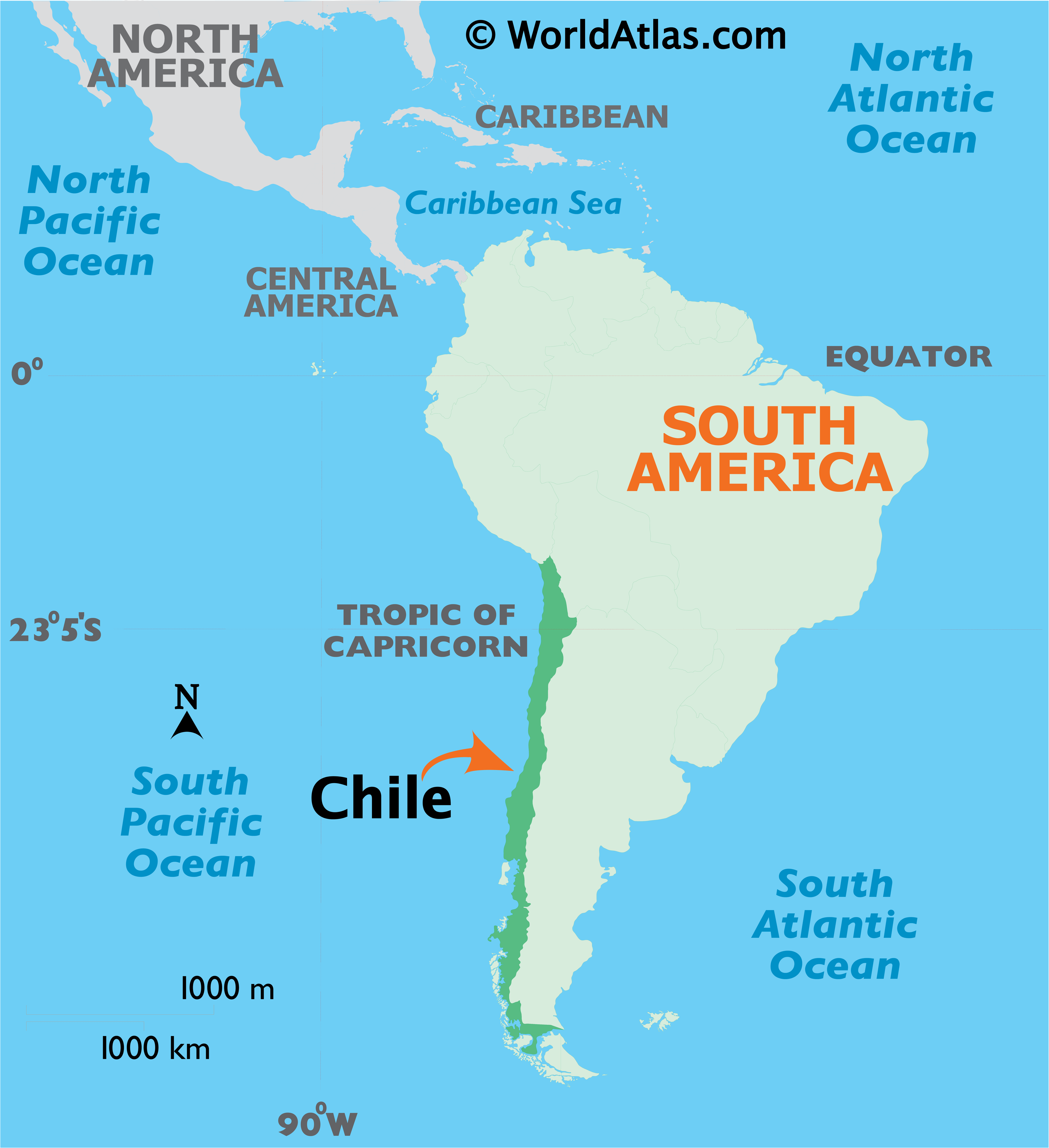
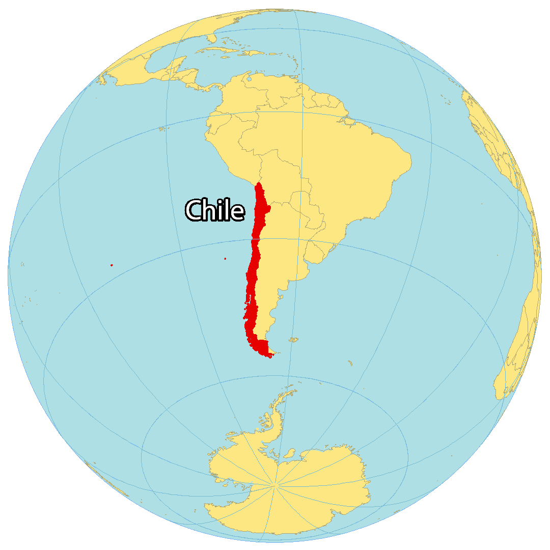
Where is Chile?
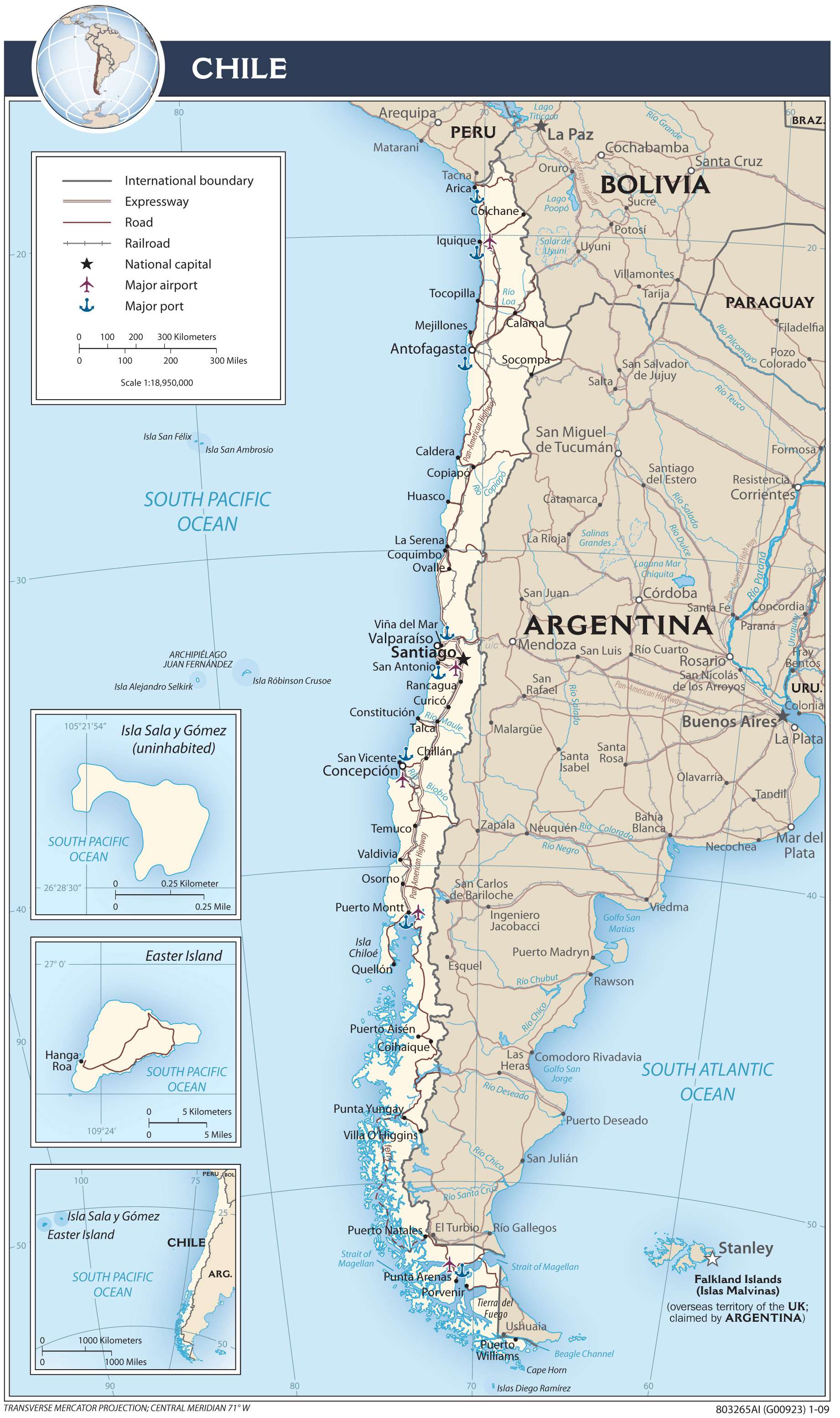
Chile is the longest north-south shaped country in the world, stretching for a total of 39 degrees latitude. If you measure its length from north to south, Chile is 4,620 kilometers long.
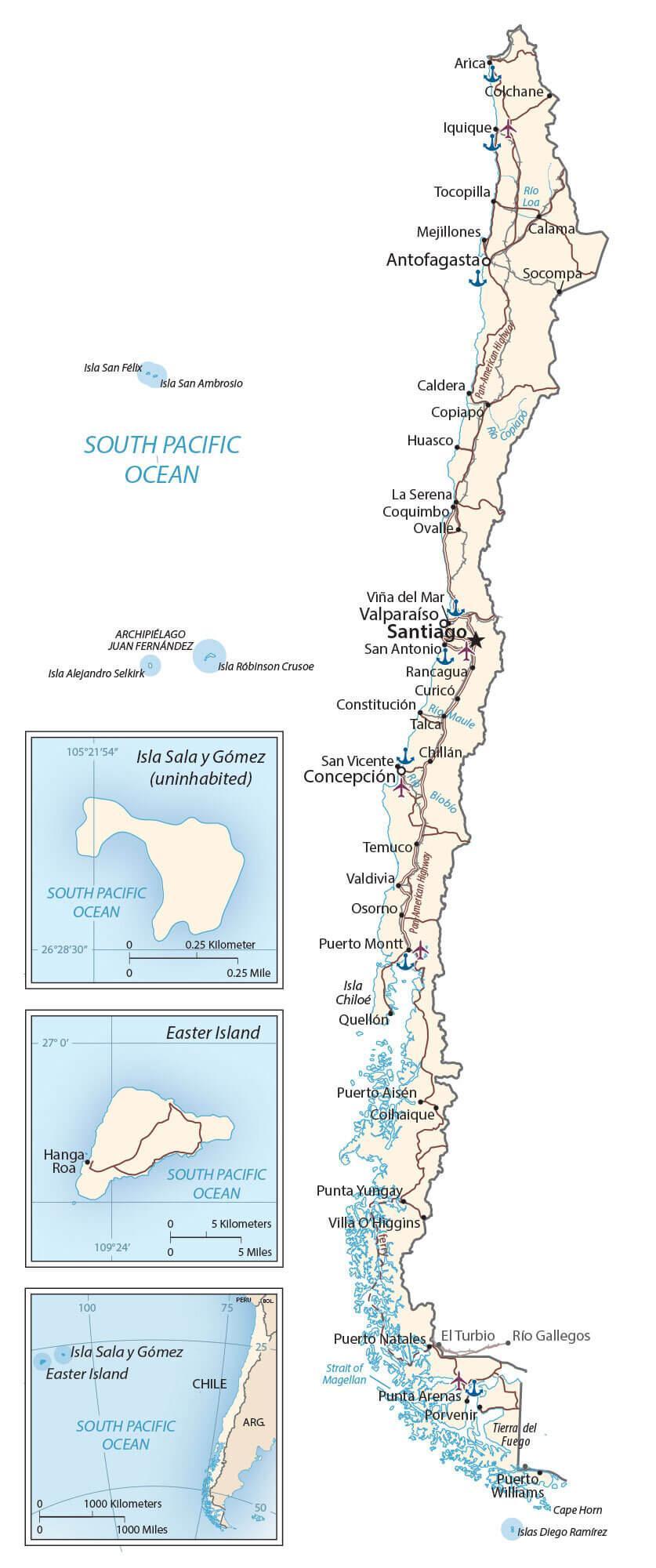
The country includes several islands in the South Pacific Ocean including San Félix, San Ambrosio, Salas y Gómez, Robinson Crusoe, and of course Easter Island. Santiago is Chile’s capital and largest city and it’s also the southernmost mainland country in the world.
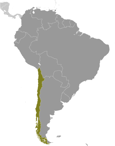
Chile occupies most of the west coast of South America. It borders just 3 countries in South America – Argentina to the east, Bolivia to the northeast, and Peru to the north.
High Definition Political Map of Chile
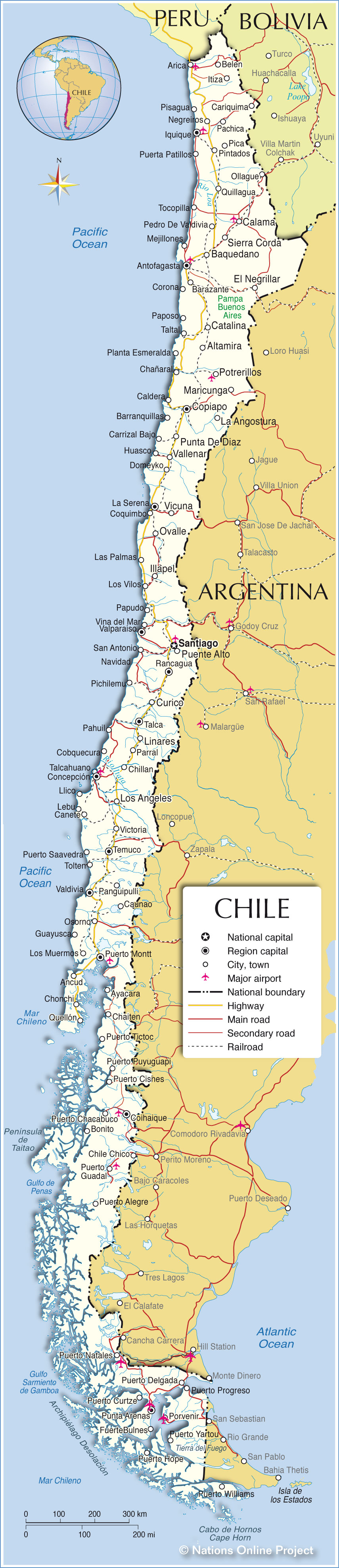

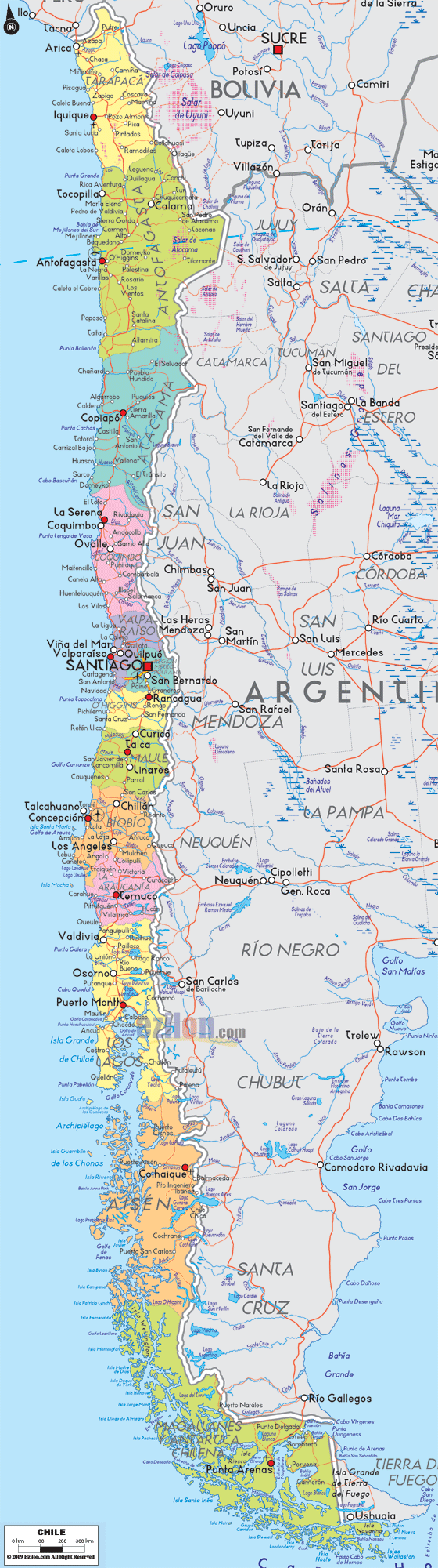
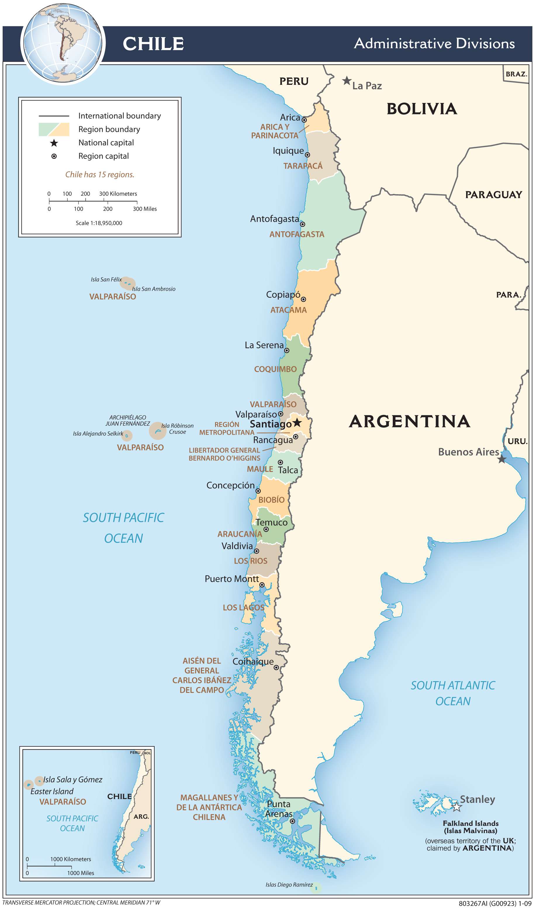
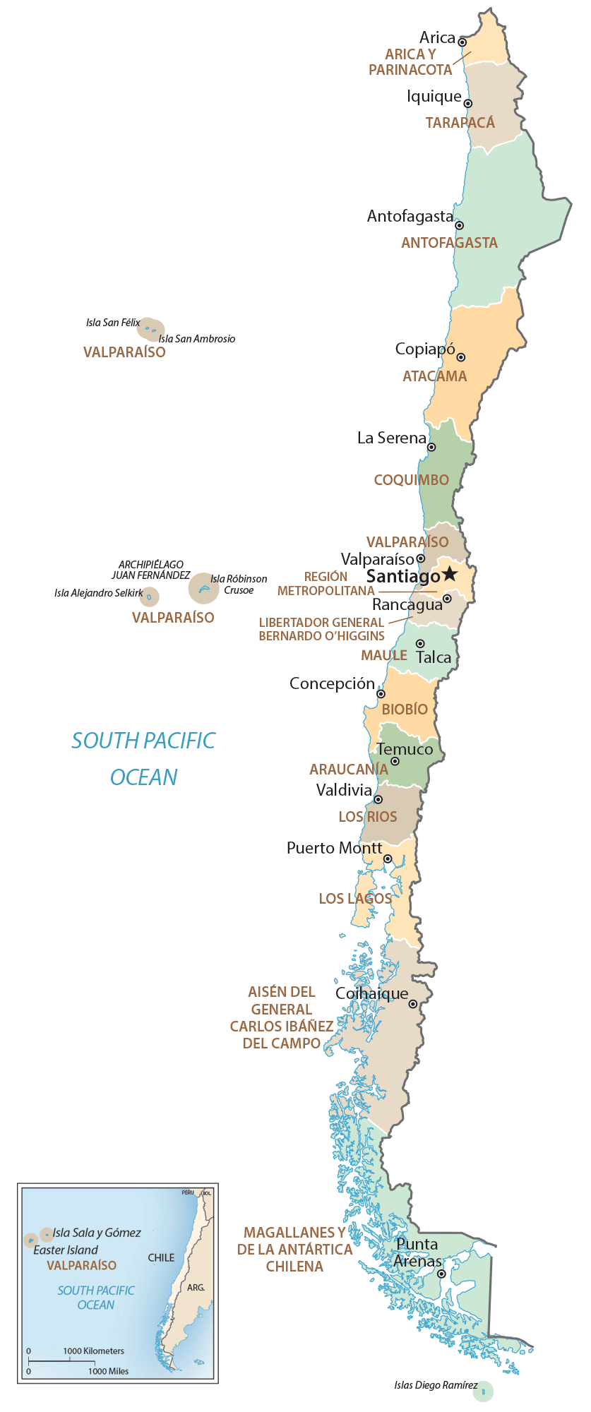
Chile Administrative Map
Physical Map of Chile
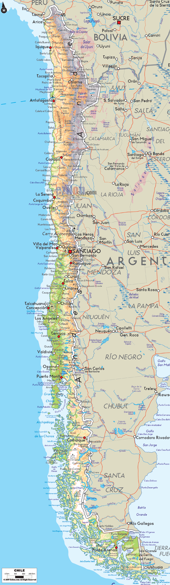
Transportation Map of Chile
Chile Satellite Map