A Nordic country in Northern Europe, Denmark occupies an area of 42,933 km2(16,577 sq mi).
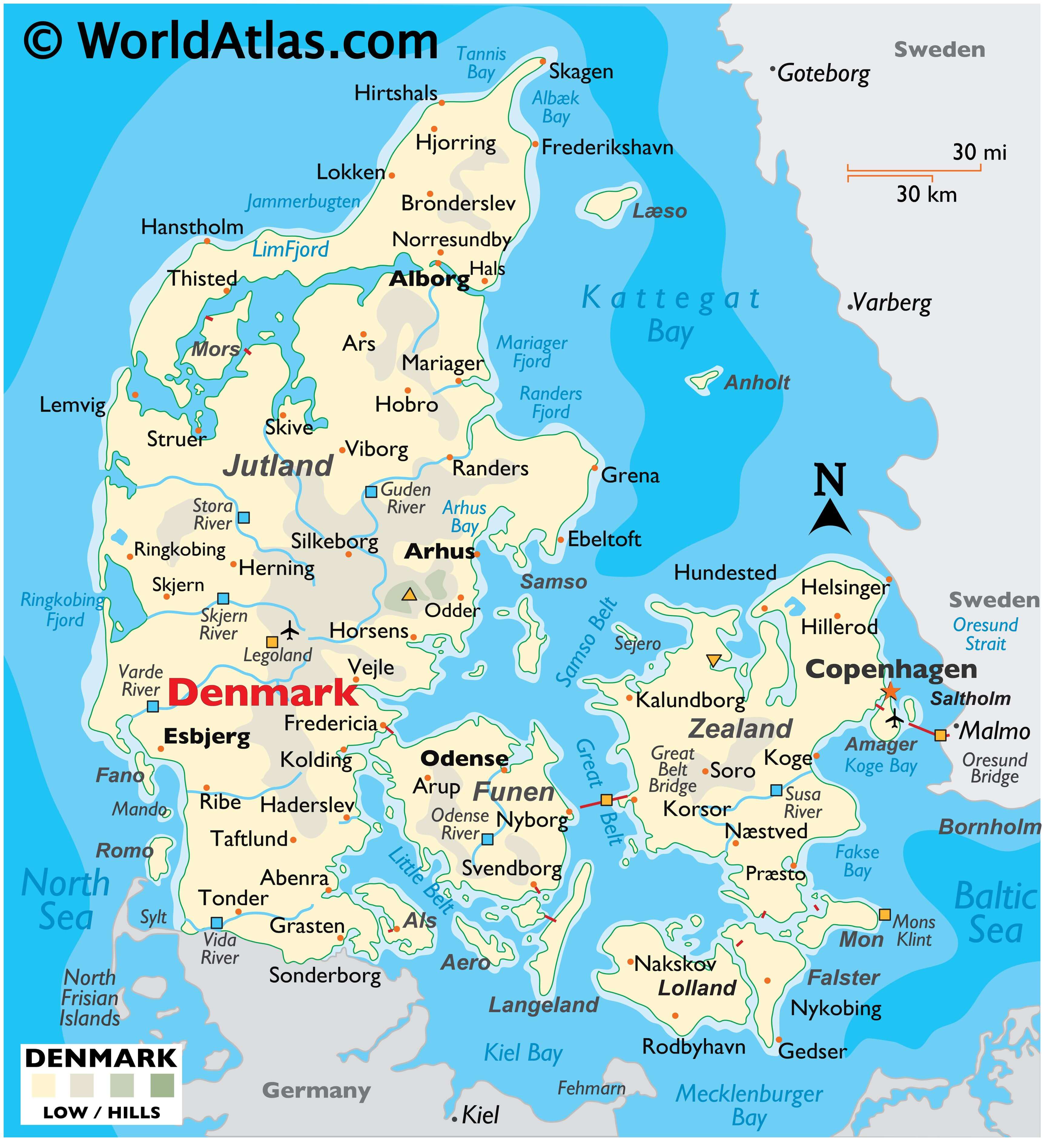
As observed on the physical map of Denmark above, for the most part Denmark consists of flat lands with very little elevation, except for the hilly central area on the Jutland Peninsula.
Its average height above sea level is only 31 meters (101 feet) and the highest natural point is Mollehoj, at 170.86 meters (560.6 ft). A yellow upright triangle marks this extreme point on the map above.
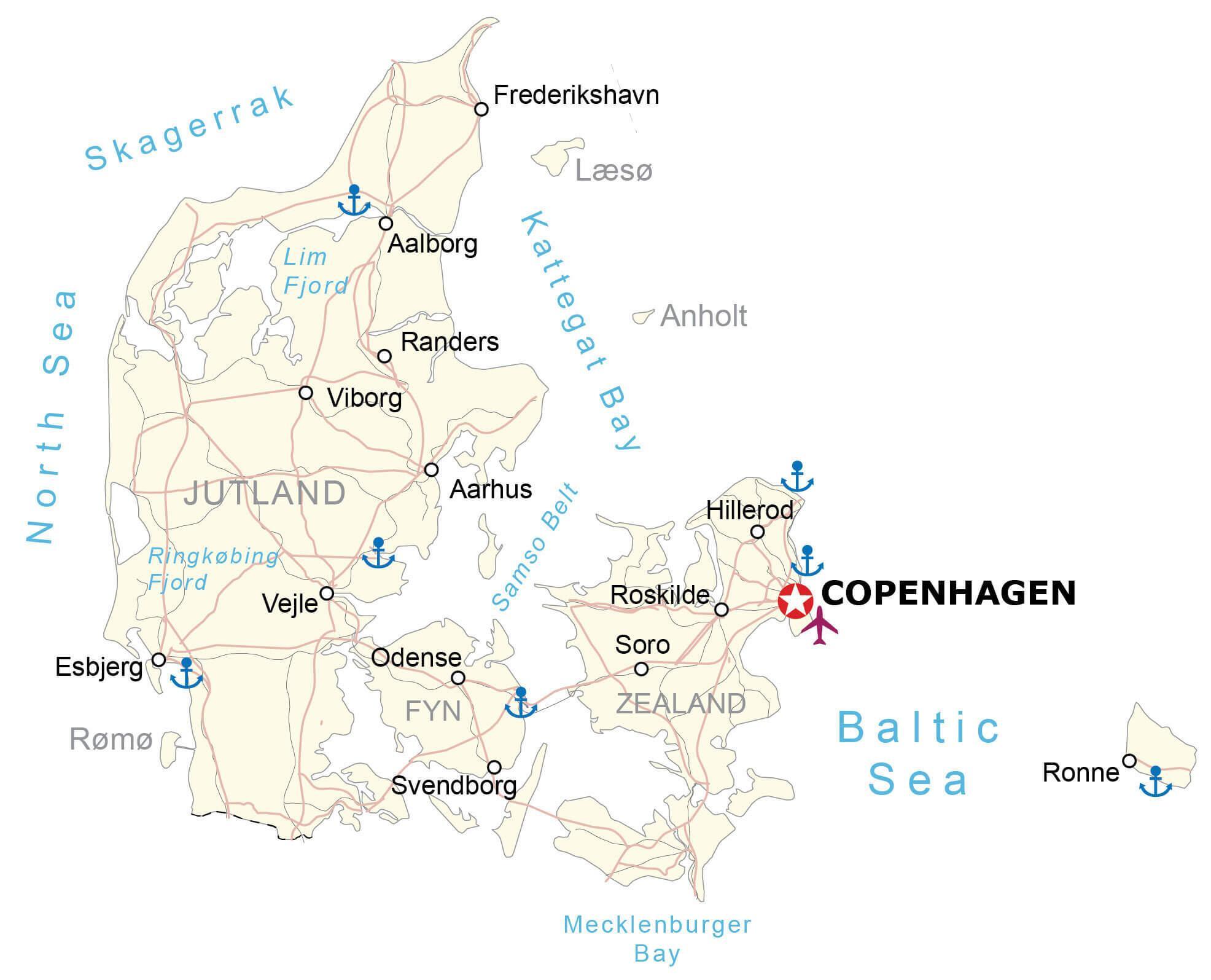
The coastline of Denmark is indented by many fjords, with LimFjord (in the north) the largest.
Denmark’s lowest point is Lammefjord, at 7 meters below sea level. The yellow inverted triangle marks the position of this point on the Zealand islands of Denmark on the map above.
In addition to the Jutland Peninsula, the country includes over 440 named islands; Zealand is the largest, followed by Funen, Lolland, Falster and Bornholm, an island located in the Baltic Sea to the east of Zealand.
The country is drained by a dozen or so rivers, and the most significant include the Guden, Odense, Skjern, Stora, Susa and Vida – a river that flows along its southern border with Germany.
The longest river in Denmark is the Guden at 160 km, (99 miles) in length.
| Flag: |  |
|---|---|
| Legal Name: | Kingdom of Denmark |
| Capital Value: | Copenhagen |
| Largest City: |
København (Copenhagen) (1,346,485) |
| Official languages: | Danish |
| Demonym(s): |
|
| Government: | Unitary parliamentary constitutional monarchy |
| Legislature: | Folketing |
| Total Area: | 43,094 km² |
| Land Area: | 42,434 km² |
| Water Area: | 660 km² |
| Population: | 5,818,553 |
| Density: | 138.22/km (358.0/sq mi) |
| GDP: | $348.08 Billion |
| GDP Per Capita: | $59,822.09 |
| Currency Value: | Danish kroner (DKK) |
| Driving side: | right |
| Calling code: | +45 |
| Internet TLD: | .dk |
Denmark is a small country located in the northern part of Europe. It is made up of the Jutland peninsula and over 400 islands, the largest of which is Zealand. The terrain of the country is mostly low and flat with gently rolling plains. Denmark is bordered by Germany to the south, the North Sea to the west, the Skagerrak to the north, and the Baltic Sea to the east.
Explore Denmark with this interactive map
Discover the beauty of Denmark with this interactive map. You can see the country’s major cities, bays, and seas, as well as its satellite and elevation maps to get a better understanding of the terrain. Denmark is a small country located in the northern part of Europe, made up of the Jutland peninsula and over 400 islands. It is bordered by Germany to the south, the North Sea to the west, the Skagerrak to the north, and the Baltic Sea to the east.
Online Interactive Political Map
Click on ![]() to view map in "full screen" mode.
to view map in "full screen" mode.
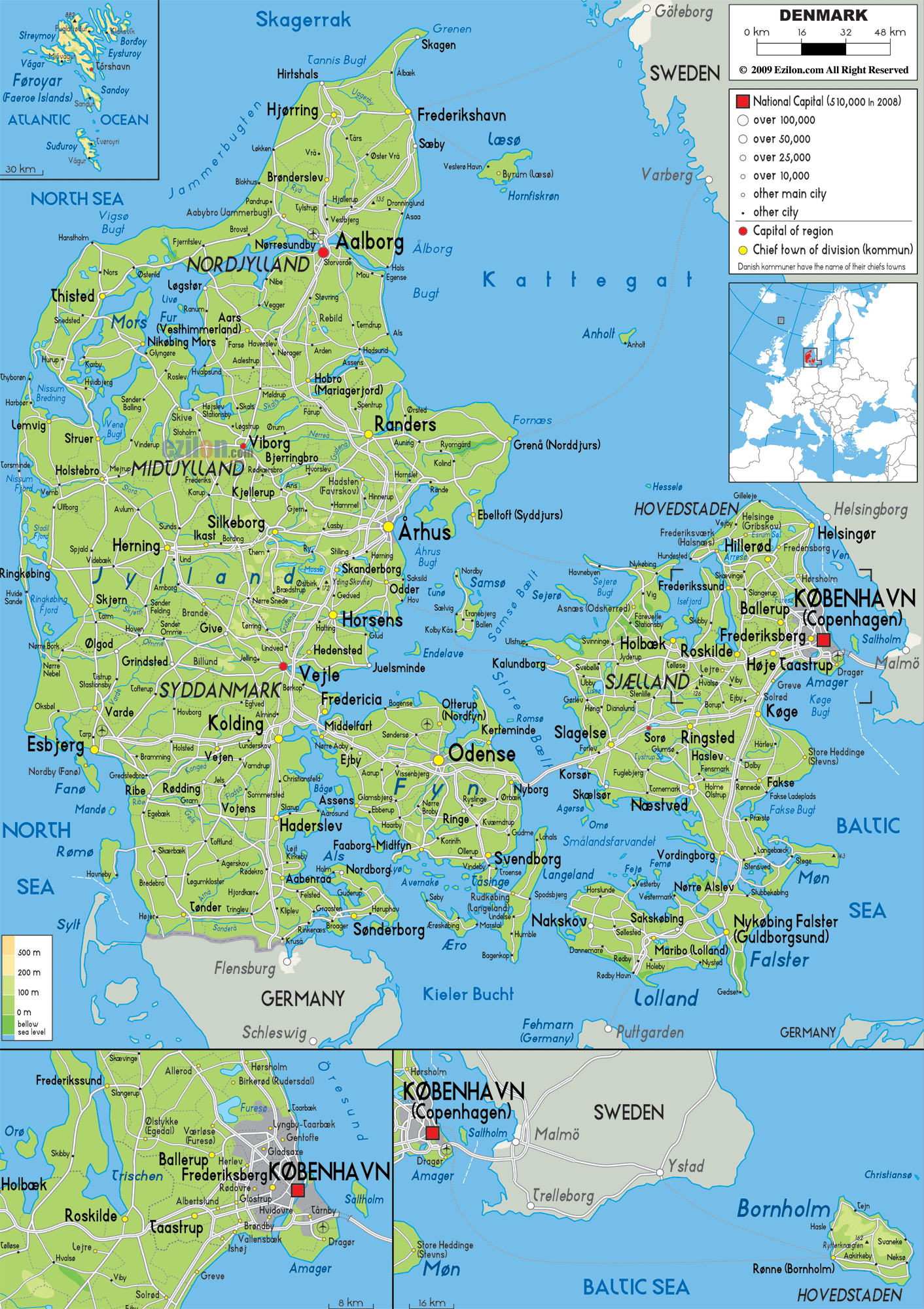
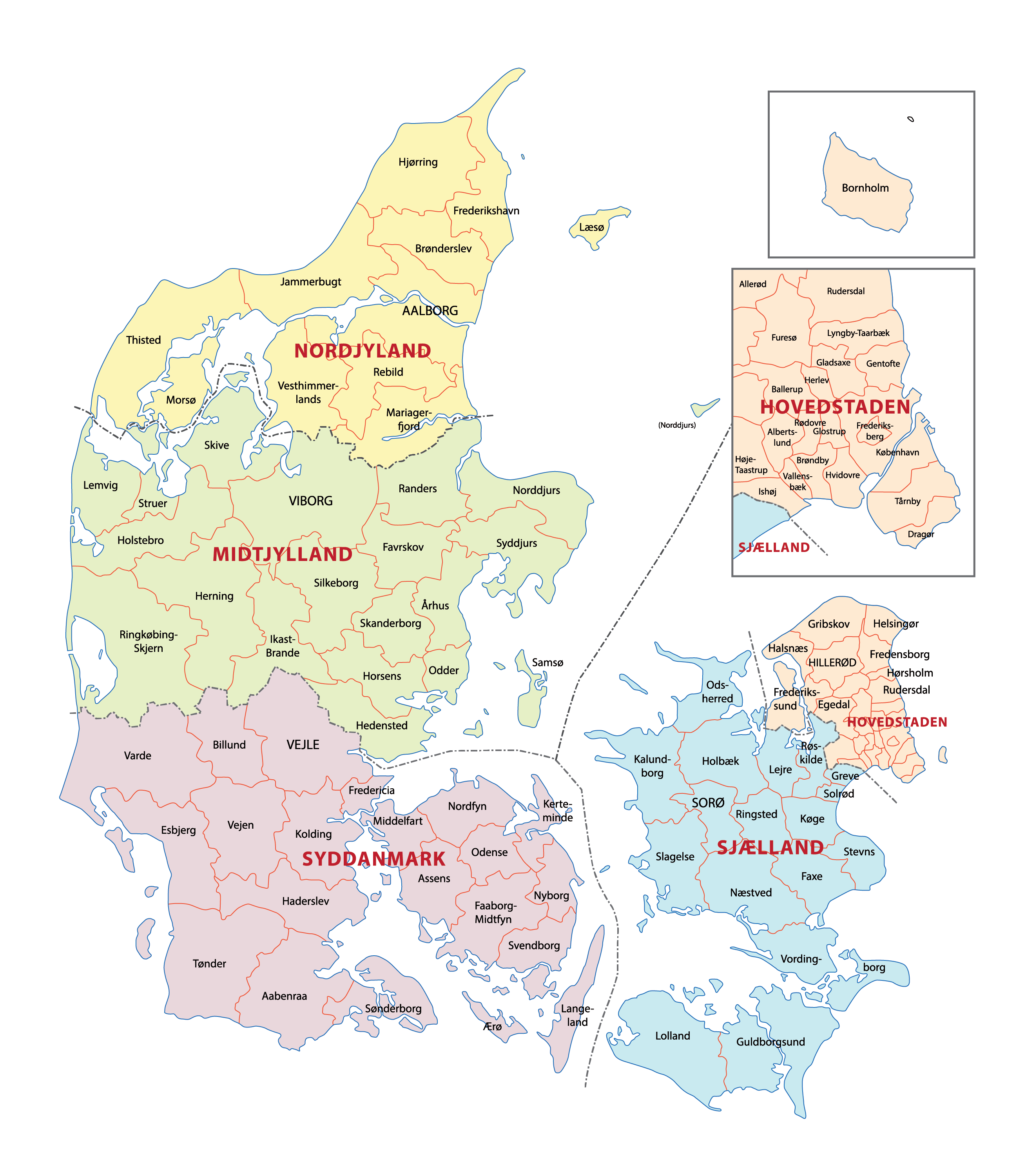
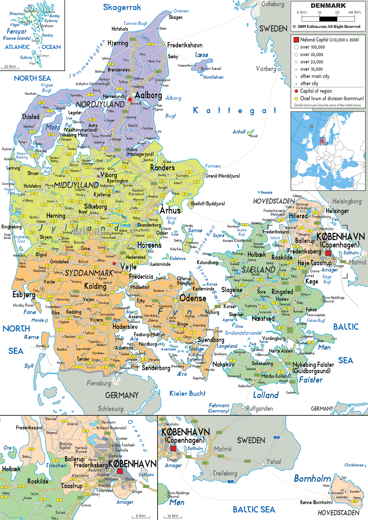
Denmark (officially, the Kingdom of Denmark) is divided into 5 administrative regions (regioner, sing. region). The regions are: Hovedstaden (Capital Region of Denmark), Midtjylland (Central Denmark Region), Nordjylland (North Denmark Region), Sjaelland (Region Zealand) and Syddanmark (Region of Southern Denmark). These regions are further divided into a total of 98 municipalities (kommuner).
Situated on the eastern coast of the Zealand Island, Copenhagen – is the capital, the largest and the most populous city of Denmark. It is also a major cultural, administrative, industrial, commercial, financial and tourism center of the country.
Location Maps
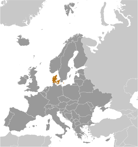
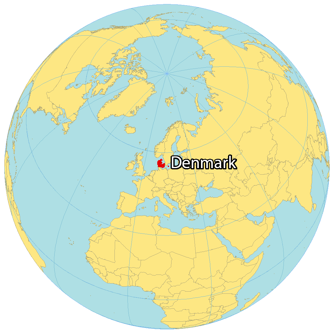
Where is Denmark?
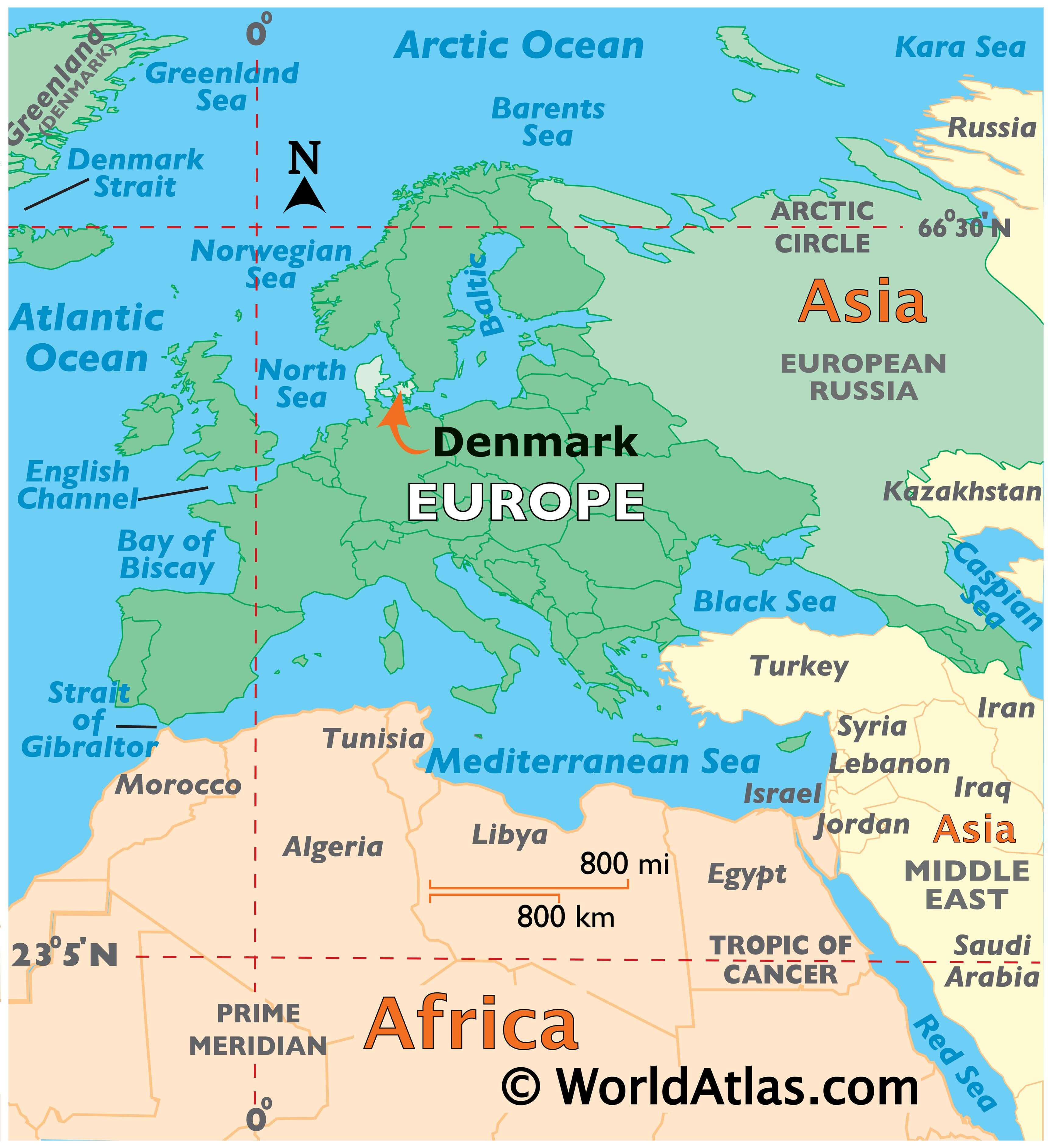
Denmark is a Nordic country located in Northern Europe. It is bordered by the Baltic Sea and the North Sea, and it shares its only border with Germany which is situated directly to the south. The northeast is separated from the Scandinavian border by the Kattegat Sea, with Sweden located across it. The capital and largest city of Denmark is Copenhagen, located on the island of Zealand. The country is composed of the Jutland peninsula and several islands, including Zealand, Funen, and Bornholm. Denmark has a total land area of approximately 42,000 square kilometers and a population of over 5 million people.
High Definition Political Map of Denmark

Physical Map of Denmark