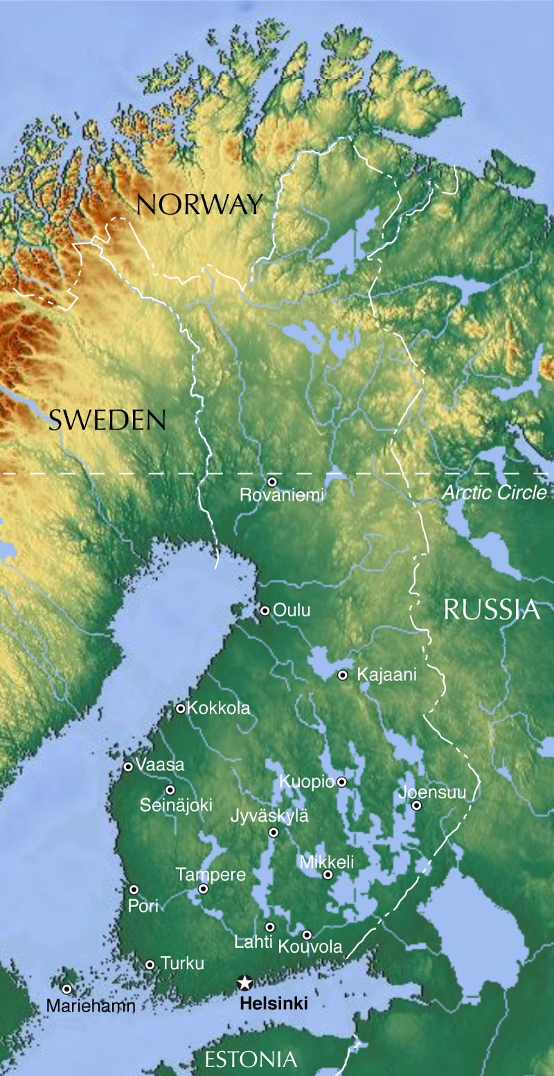
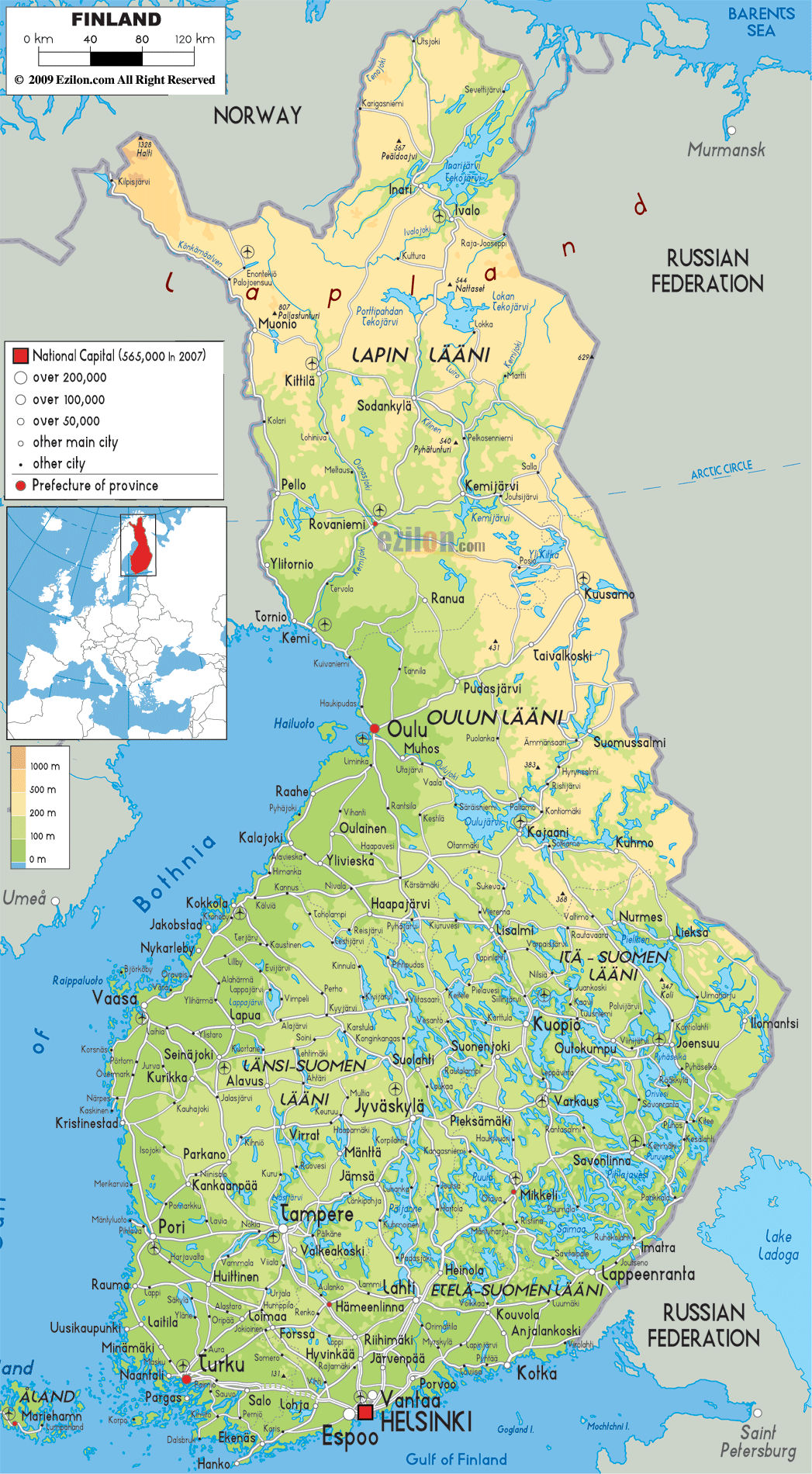
Finland, a North European Nordic country, covers an area of 338,455 km2(130,678 sq mi).
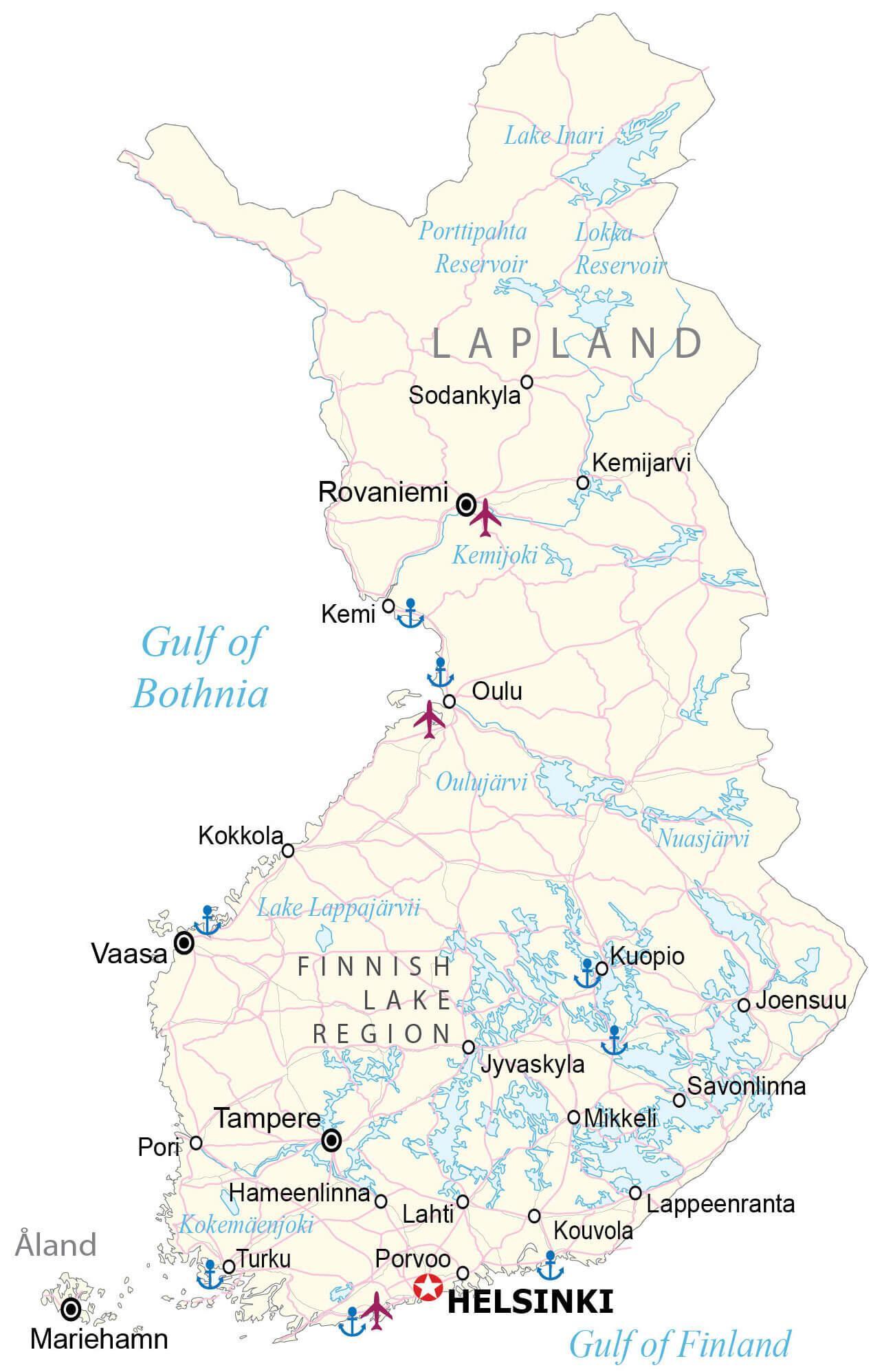
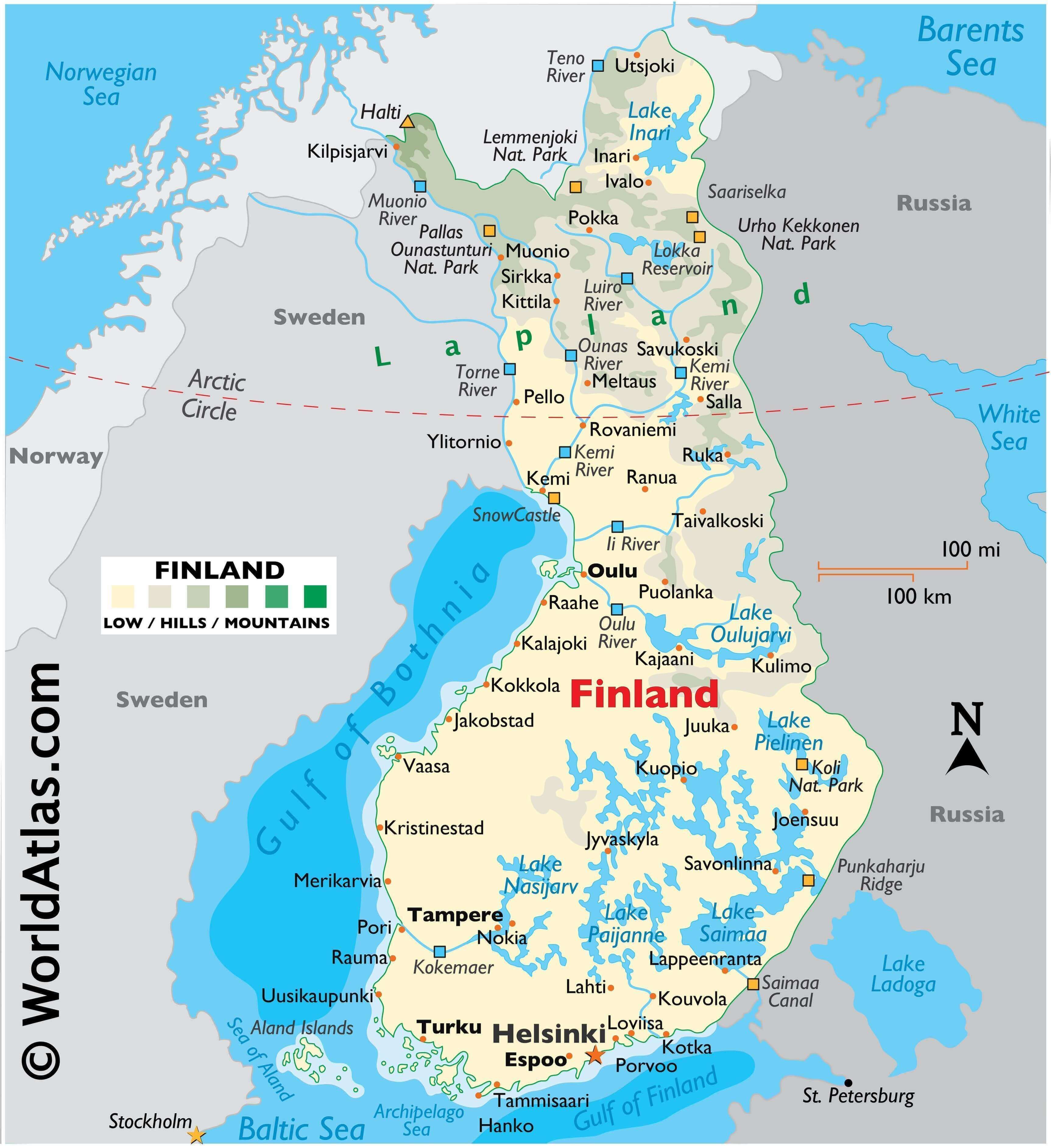
During the last Ice Age, Finland was covered by a thick layer of ice. When that ice sheet retreated (or melted) about 10,000 years ago, it gouged the surface of the land and left in its wake innumerable islands, rivers and streams, as well as an estimated 188,000 lakes. Note that near 60,000 of those lakes measure more than 200 meters wide.
As observed on the physical map of Finland, it is mostly flat land, with more than 70% of it covered by thick forest. In the southern areas, water seems a more common sight than land as countless clear water lakes are everywhere.
To the north of the Arctic Circle, the terrain rises into the hills and low mountains of Lapland. The country’s highest point, Haltiatunturi, at 1,328 meters, stands on the edge of its border with Norway. A yellow upright triangle marks the position of this point on the map.
The Aland Islands (archipelago) sits in the middle of the Gulf of Bothnia between Finland and Sweden. It contains almost three hundred islands (80 inhabited), and over 6,000 small (tiny) rocky islands.
Directly east, in the Archipelago Sea and merging with the Aland Islands and Finland’s southwestern coastline stand tens of thousands of islands, mostly small, with some of the larger ones inhabited.
As observed on the map above, Finland is riddled with lakes. On this land of lakes, the largest ones include Nasijarv, Oulujarvi, Paijanne, Pielinen and Finland’s largest, Lake Saimaa. With a few exceptions, the balance of Finland’s lakes is on the small side.
Finland’s most significant rivers include the Kemi, Luiro, Muonio, Oulu, Teno and Torne.
Numerous canals flow lake to lake in the south. The largest, the Saimaa Canal, connects Lake Saimaa with the Gulf of Finland.
| Flag: |  |
|---|---|
| Legal Name: | Republic of Finland |
| Capital Value: | Helsinki |
| Official languages: |
|
| Demonym(s): |
|
| Government: | Unitary parliamentary republic |
| Legislature: | Parliament |
| Total Area: | 338,145 km² |
| Land Area: | 303,815 km² |
| Water Area: | 34,330 km² |
| Population: | 5,520,314 |
| Density: | 16.4/km (42.5/sq mi) (213th) |
| GDP: | $268.76 Billion |
| GDP Per Capita: | $48,685.85 |
| Currency Value: | Euros (EUR) |
| Driving side: | right |
| Calling code: | +358 |
| Internet TLD: | .fi, .ax |
Finland is a land of countless lakes, with over 188,000 of them dotting the landscape. This map of Finland showcases its vast swaths of lakes in the Finnish Lake Region and to the north, including an elevation and satellite map that shows topographic features like its highest peak, Halti, and rolling plains. From the majestic Saimaa lake system in the southeast to the wild rivers and rapids of the north, Finland’s lakes are an integral part of its character and culture.
The map also shows Finland’s major cities and towns, its network of highways, and its national parks, which are home to some of the country’s most spectacular scenery. Whether you’re planning a trip to Finland or just want to explore the country’s natural beauty, this map of Finland will be a great resource.
Online Interactive Political Map
Click on ![]() to view map in "full screen" mode.
to view map in "full screen" mode.
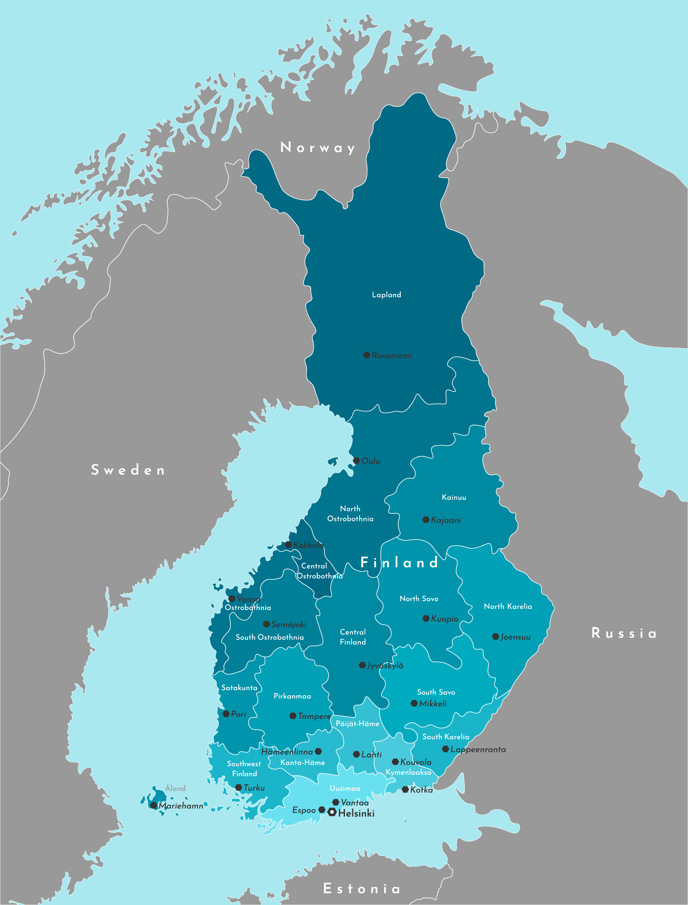
Finland (officially, the Republic of Finland) is divided into 19 administrative regions (maakunnat, singular – maakunta (Finnish)). The regions are: Lapland, North Ostrobothnia, Kainuu, North Karelia, Northern Savonia, Southern Savonia, South Karelia, Central Finland, South Ostrobothnia, Ostrobothnia, Central Ostrobothnia, Pirkanmaa, Satakunta, Paijanne – Tavastia, Kanta-Hame, Kymenlaakso, Uusimaa, Southwest Finland and Aland Islands. These regions are subdivided into 70 sub-regions which have further smaller subdivisions of 311 municipalities.
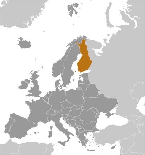
With an area of 338,455 sq. km, Finland is Europe’s 8th largest country and also the EU’s most sparsely populated nation. Located on the shores of the Gulf of Finland in southern Finland’s Uusimaa region is, Helsinki – the capital, the largest and the most populous city of Finland. It serves as a major administrative, cultural, economic and educational hotspot of the country. Helsinki is also the 4th largest metropolitan area in the Nordic region.
Location Maps
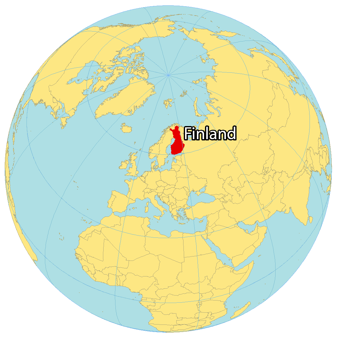
Where is Finland?
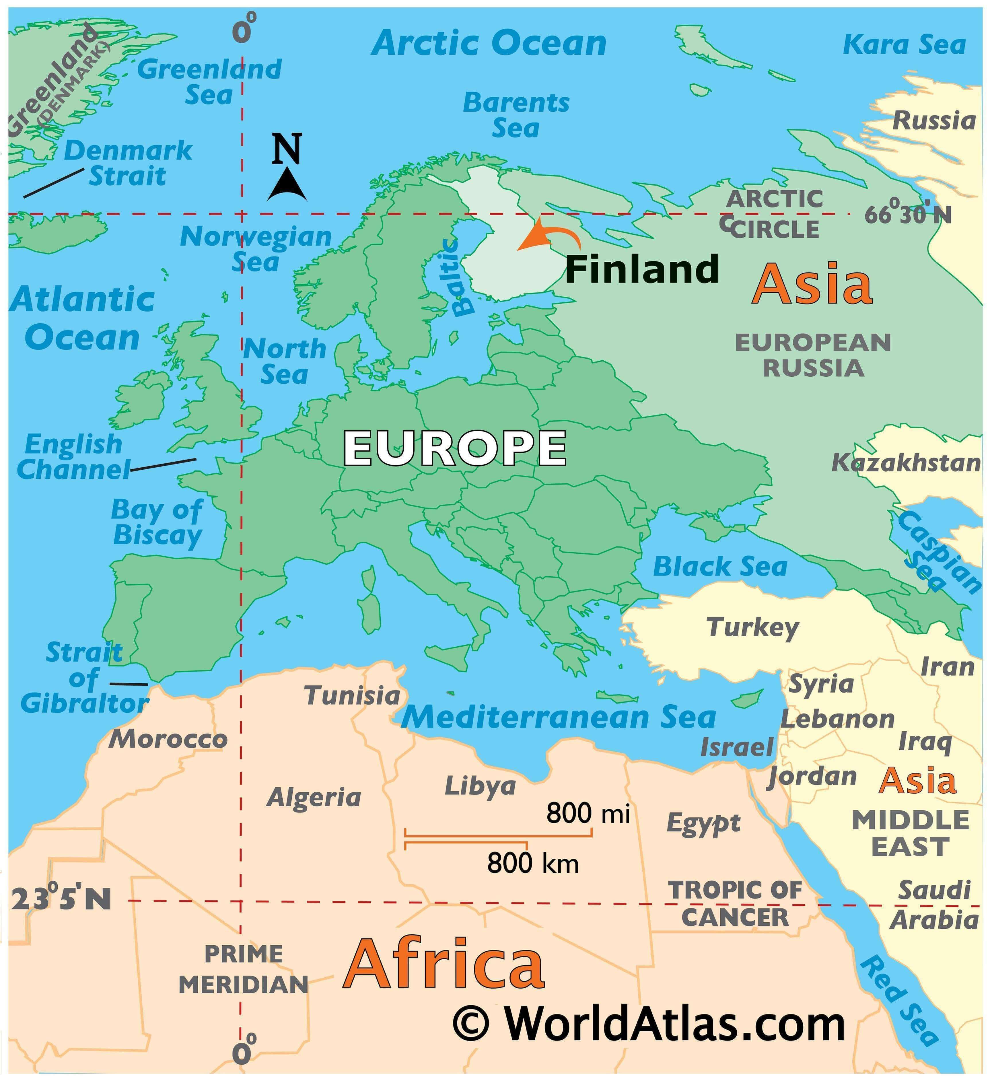
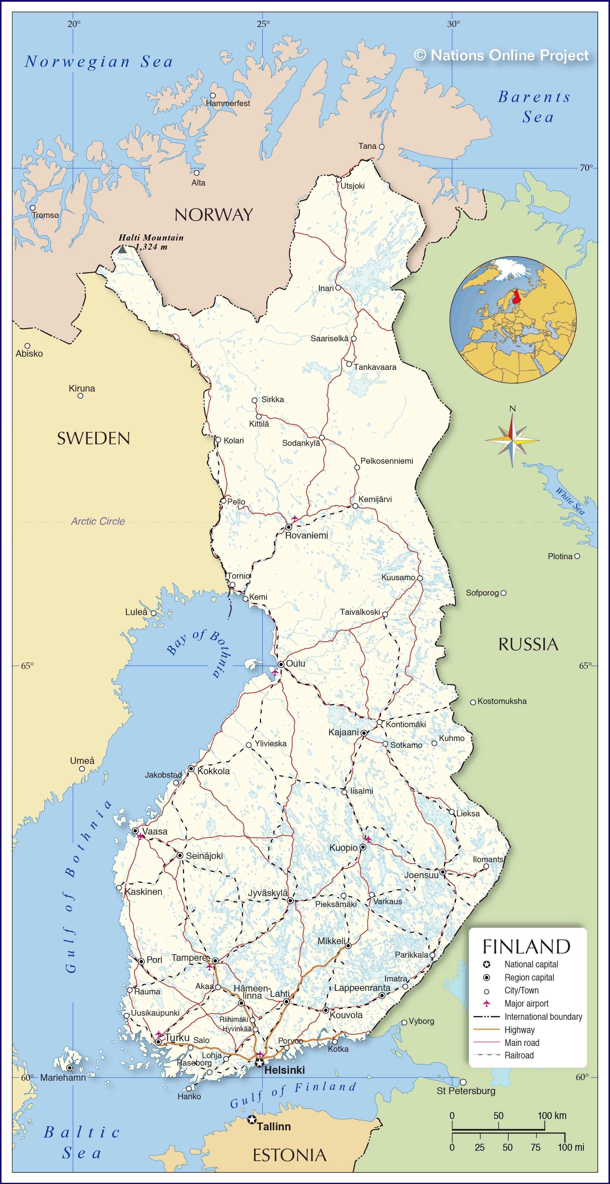
Finland is situated in Northern Europe, along the Baltic Sea and the Gulf of Bothnia. It is a part of Scandinavia, neighbouring Sweden and Norway to the west. The Gulf of Finland separates it from Estonia by a distance of 80 kilometers (50 mi) between Helsinki and Tallinn. It also shares a land border with Russia to the east, which is over 1,300 kilometers (808 mi) long. The capital city of Finland is Helsinki, and it is the northernmost national capital of any European nation.
Finland has many features that make it unique. It is the happiest country in the world, has the cleanest air, and has the world’s best education system. It is also home to the one and only Santa Claus, who resides in Lapland, Finland.
High Definition Political Map of Finland

Physical Map of Finland
Topo Map