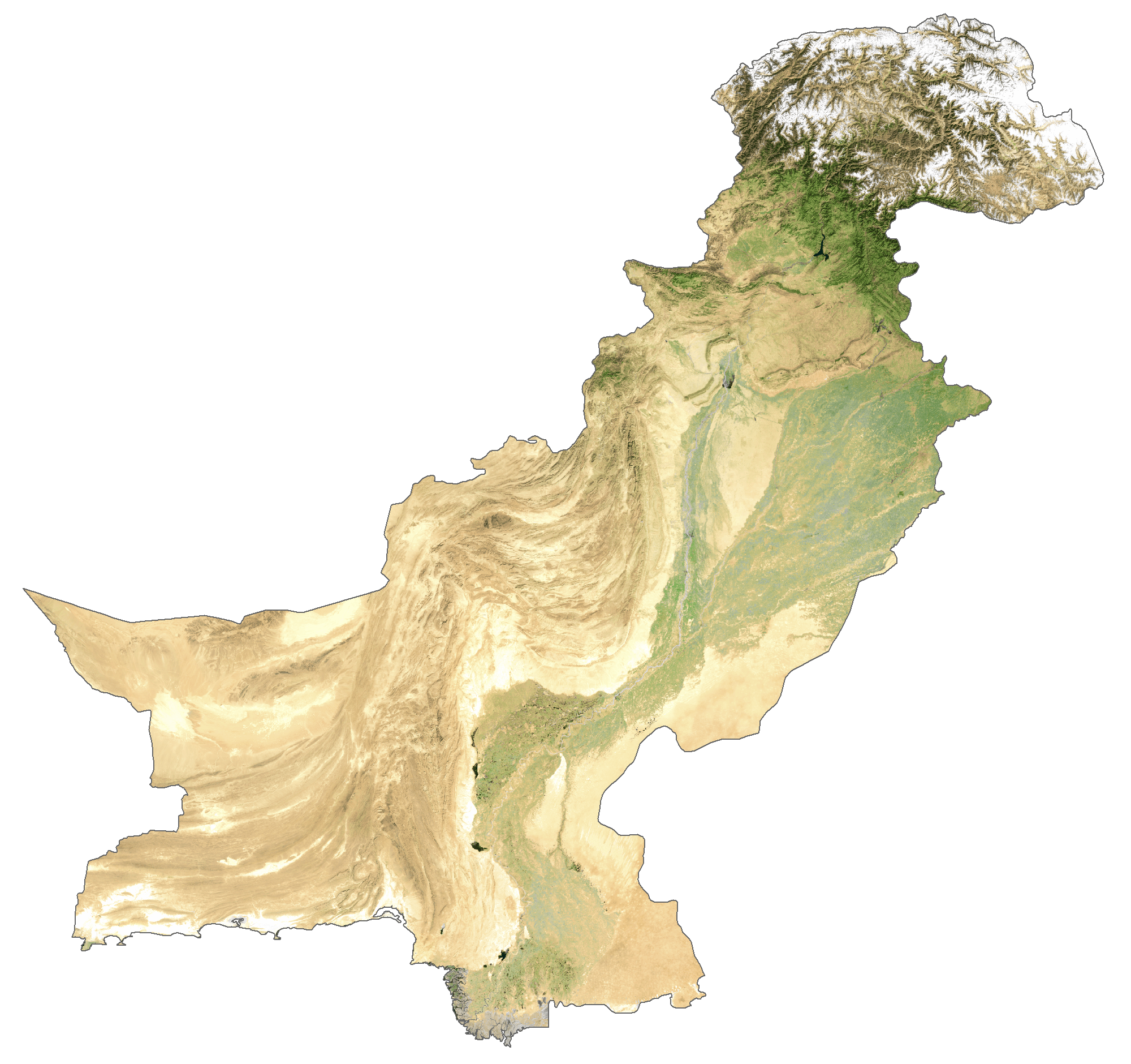
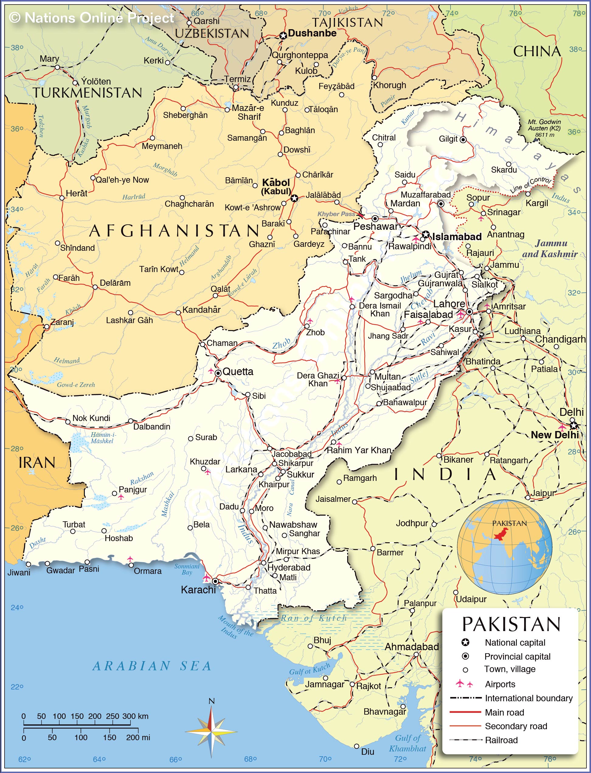
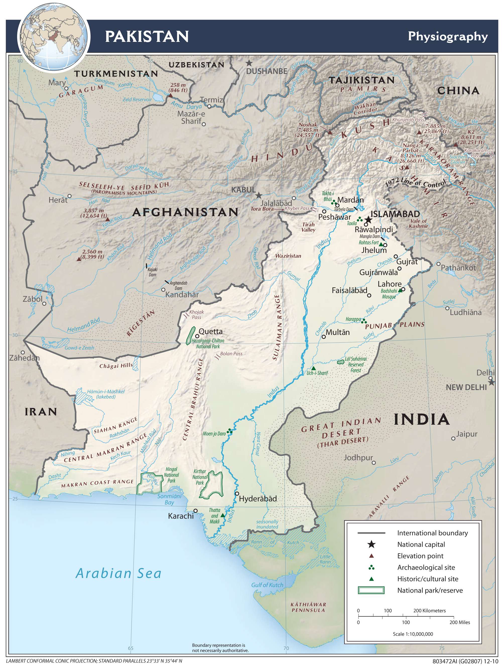
Pakistan occupies an area of 881,913 in South Asia. Located at the juncture of the Indian and Eurasian plates, the country is highly prone to earthquakes due to plate tectonics.
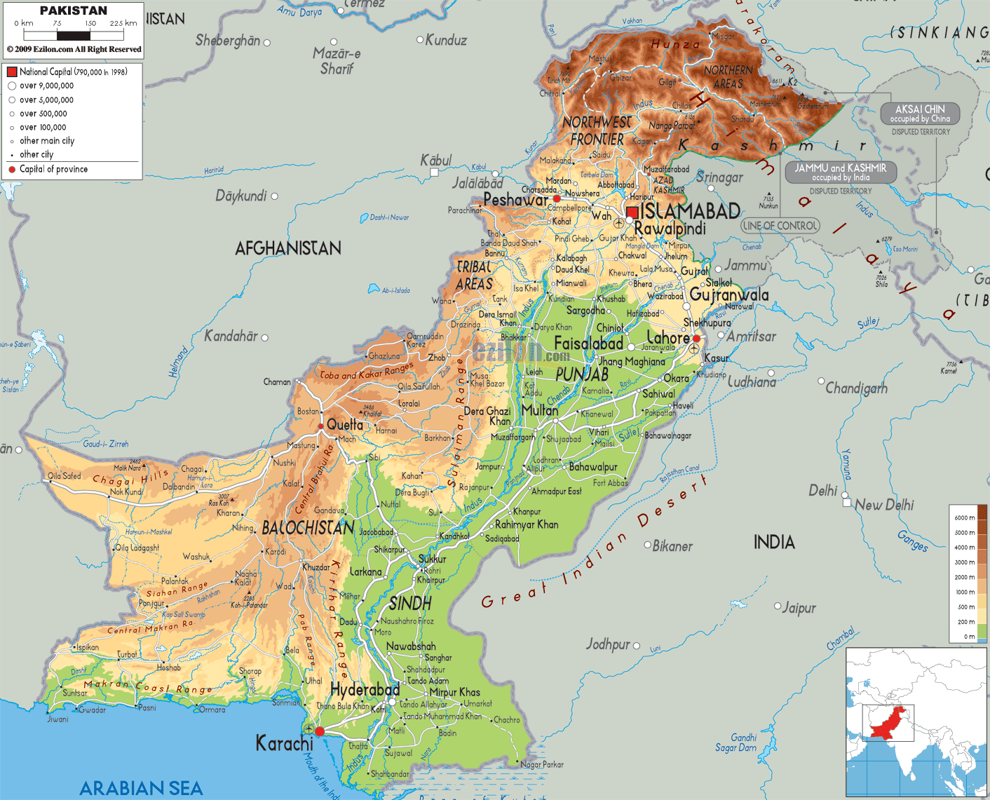
The country can be divided into three major geographic zones as observed on the physical map of the country above. These are the highlands in the north, the plain of the Indus River and the Balochistan Plateau. The country also shares the Thar Desert with India along its eastern border.
The northern mountain region features some really high peaks of the Karakoram, Hindu Kush, and Himalayan mountain ranges. The world’s second highest peak, Mount K2, is located in Pakistan. The peak has been marked on the map and is also the highest point in the country at 8,611 m or 28,250 ft. Over half the peaks in this northern highland region of Pakistan are above 4,500m.
The Indus River and its tributaries drain a large part of the country. The Indus River rises in southwestern Tibet and drains into the Arabian Sea. The course of the river in Pakistan has been marked on the map.
The Balochistan Plateau is located at the eastern edge of the Iranian Plateau and the region is very dry and sparsely populated. The mountainous areas of the west-central, along the border with Afghanistan, include the Ras Koh, Safed Koh and Toba Kakar ranges.
| Flag: |  |
|---|---|
| Legal Name: | Islamic Republic of Pakistan |
| Capital Value: | Islamabad |
| Official languages: |
|
| Demonym(s): | Pakistani |
| Government: | Federal Islamic parliamentary republic |
| Legislature: | Parliament |
| Total Area: | 796,095 km² |
| Land Area: | 770,875 km² |
| Water Area: | 25,220 km² |
| Population: | 216,565,318 |
| Density: | 244.4/km (633.0/sq mi) (56th) |
| GDP: | $278.22 Billion |
| GDP Per Capita: | $1,284.70 |
| Currency Value: | Pakistani rupees (PKR) |
| Driving side: | left |
| Calling code: | +92 |
| Internet TLD: |
|
Explore the beauty of Pakistan with this interactive map. Discover major cities, towns, roads, rivers, and provinces in the country. View satellite imagery and an elevation map and marvel at the beauty of the Himalayas to the Indus River plain.
Online Interactive Political Map
Click on ![]() to view map in "full screen" mode.
to view map in "full screen" mode.
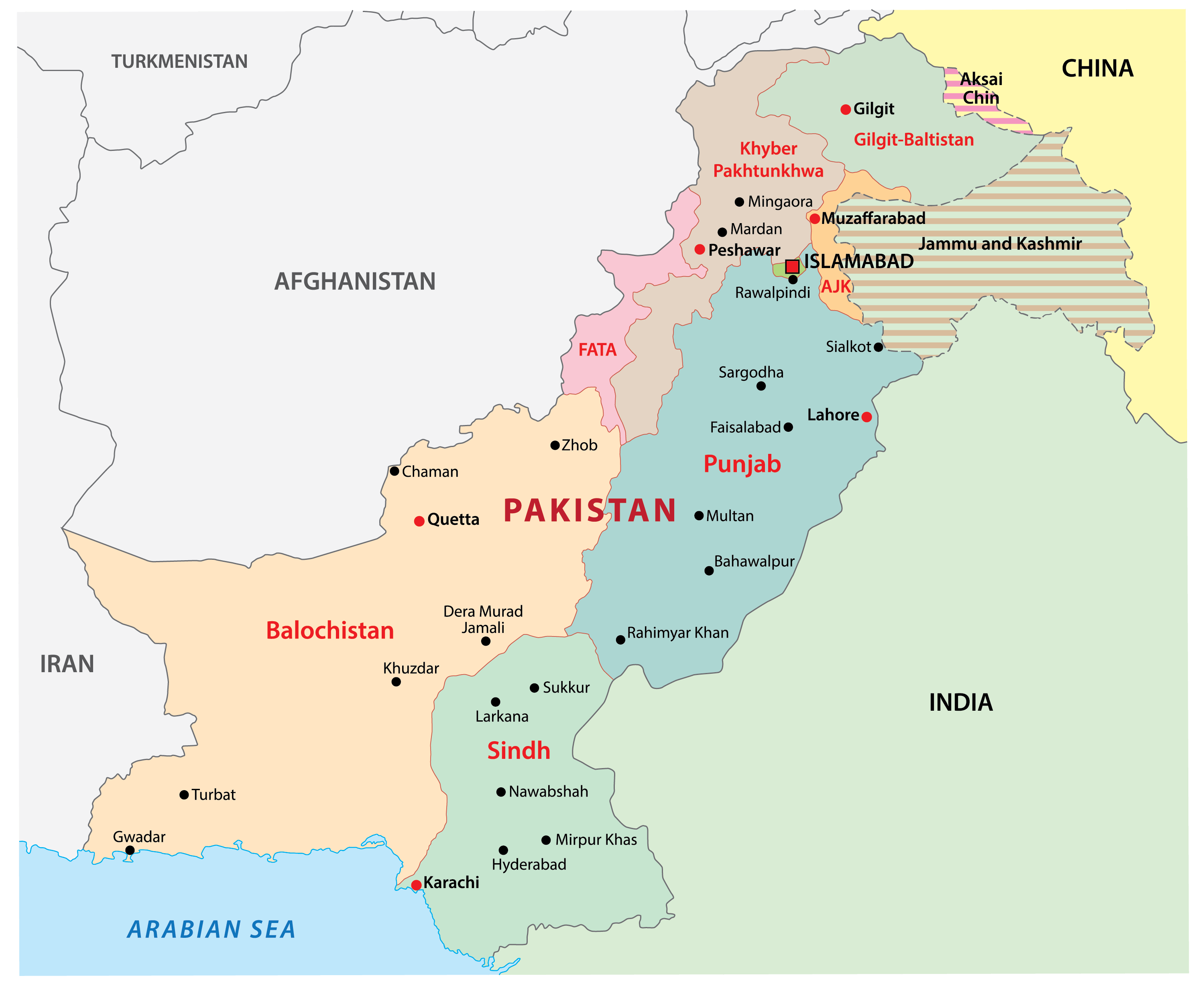
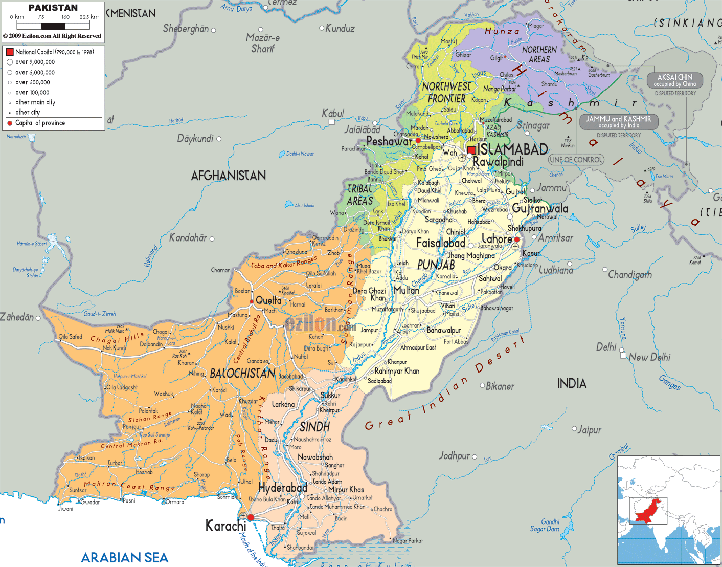
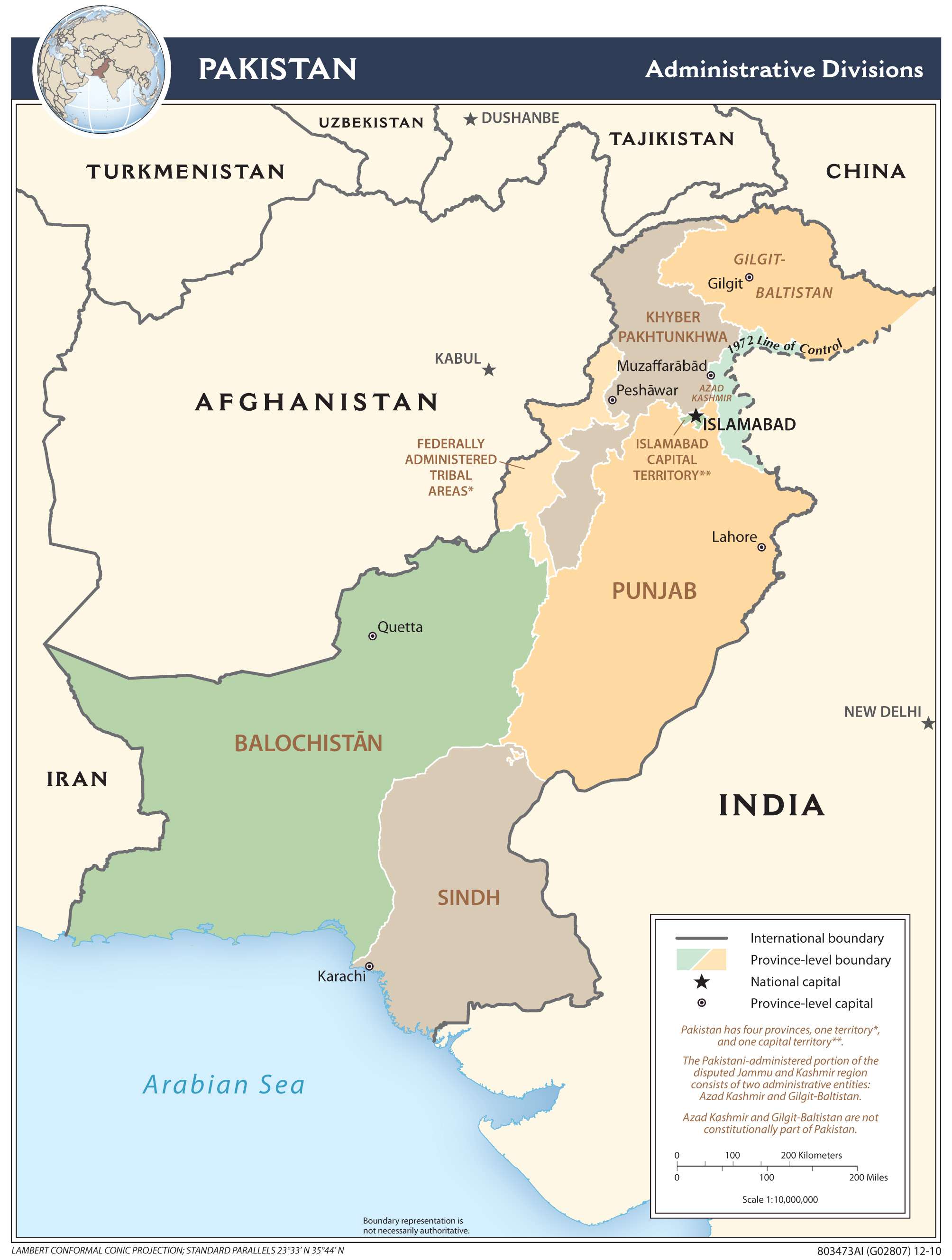
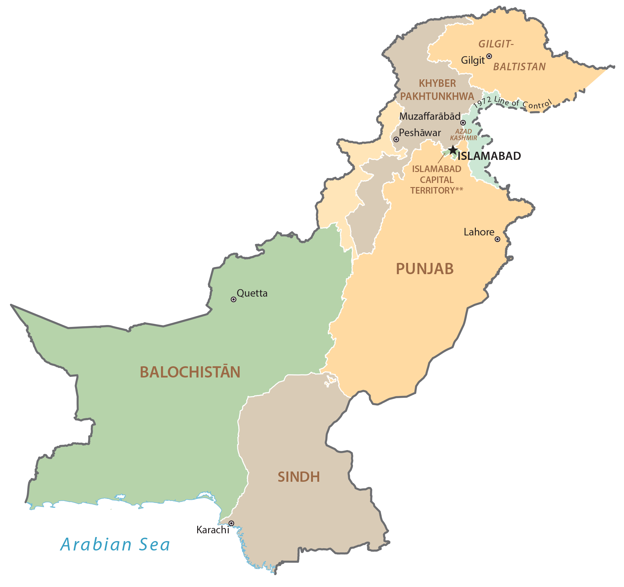
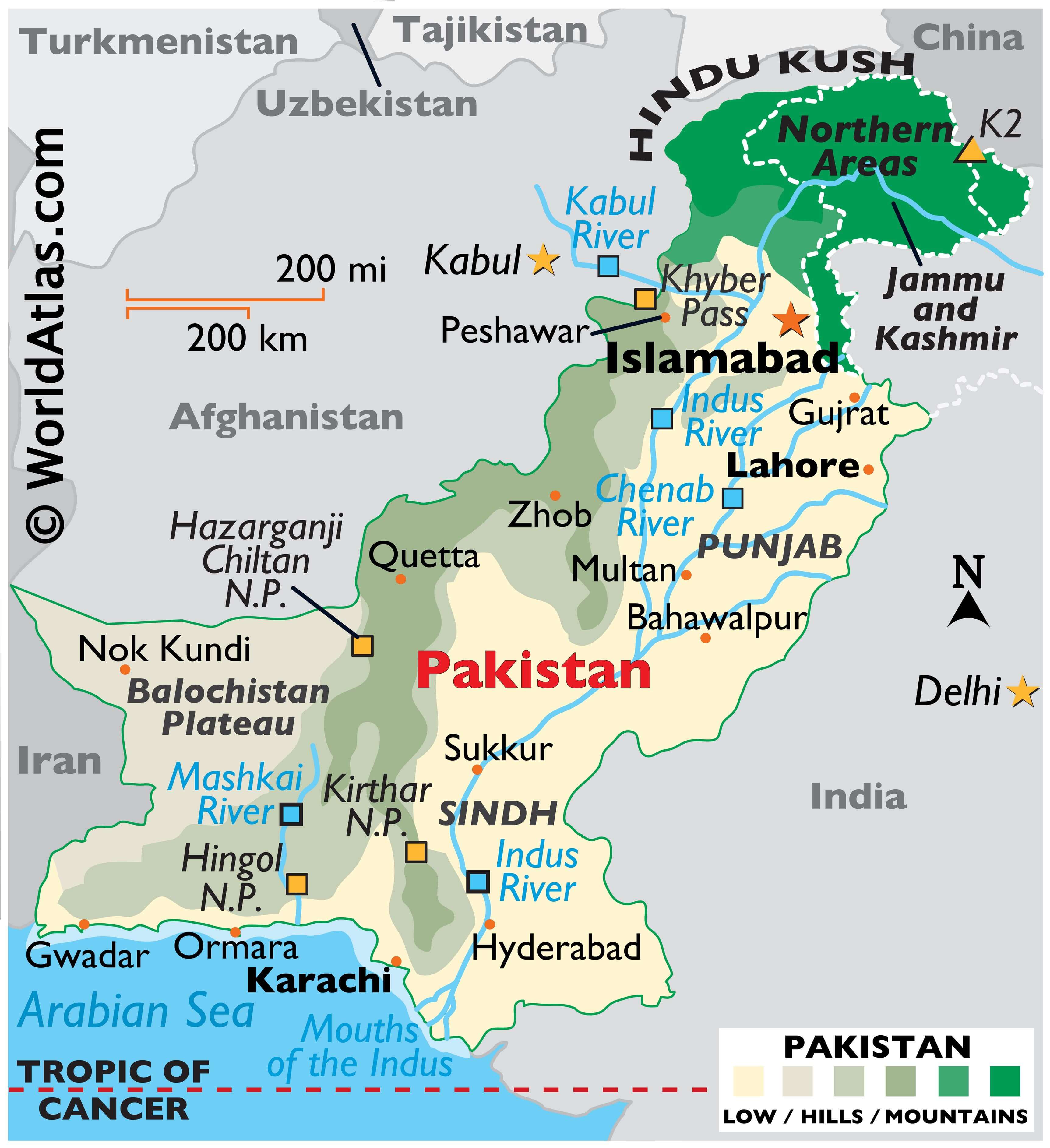
Pakistan (officially, Islamic Republic of Pakistan) is divided into four administrative provinces, two autonomous territories and one federal territory. The administrative provinces are: Punjab, Sindh, Balochistan and Khyber Pakhtunkhwa. Gilgit –Baltistan and Azad Jammu & Kashmir are the two autonomous territories; while Islamabad Capital Territory is a federal territory of Pakistan. These administrative provinces are divided into divisions which are further subdivided into districts and a number of smaller subdivisions.
Located at the eastern edge of the Iranian Plateau, in south western Pakistan – Balochistan is the largest of the four provinces of Pakistan; occupying an area of 347,190 sq. km. Islamabad – the capital city of Pakistan is located in the northern part of the country, along the Himalayan foothills and in The Islamabad Capital Territory. Islamabad is a planned city with high standards of living and is also the 9th largest city of Pakistan.
Karachi is the largest and most populous city of Pakistan. Located in the southern part of the country, on the Arabian Sea coast; Karachi serves as Pakistan’s maritime port and the country’s economic center.
Location Maps
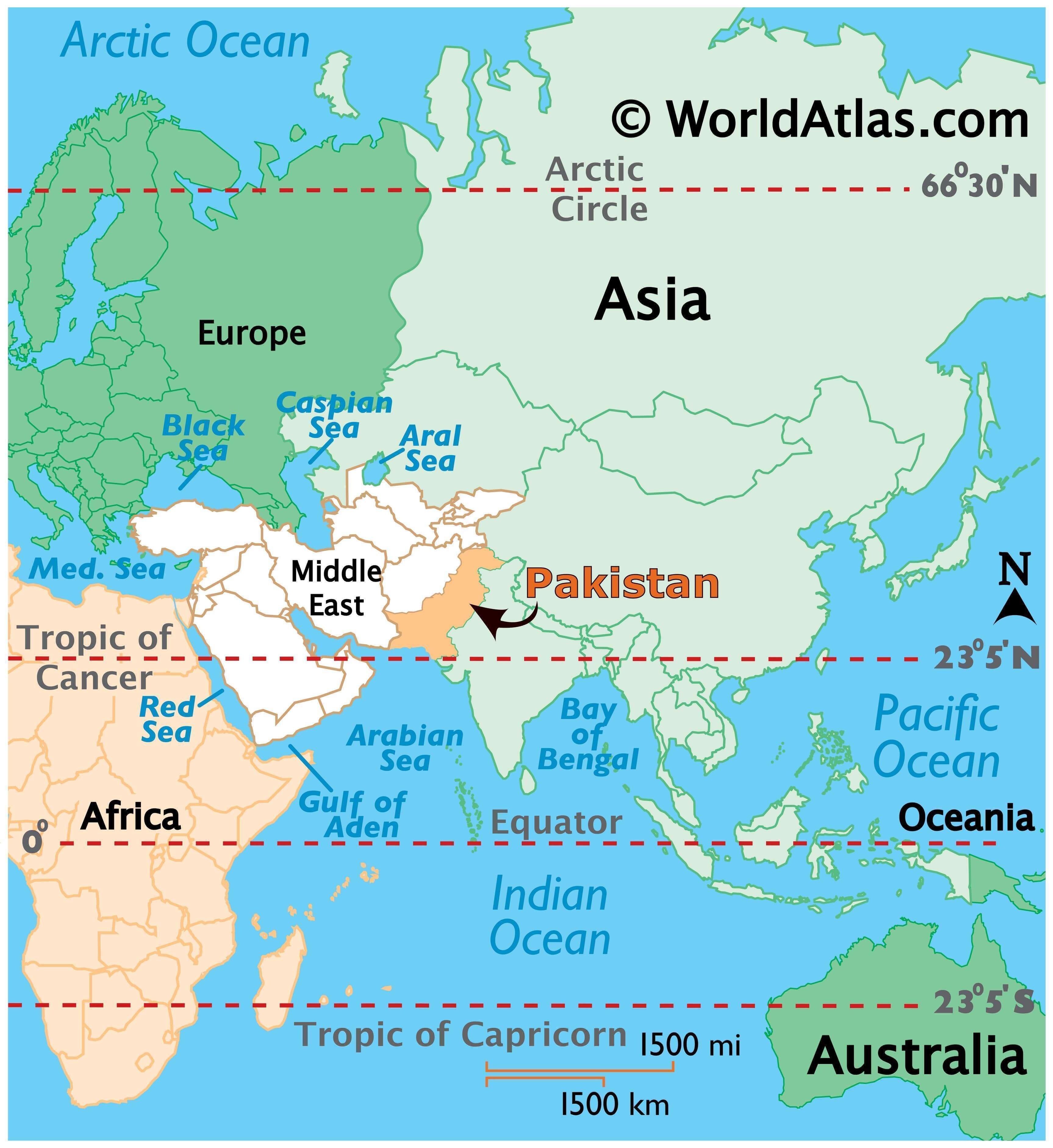
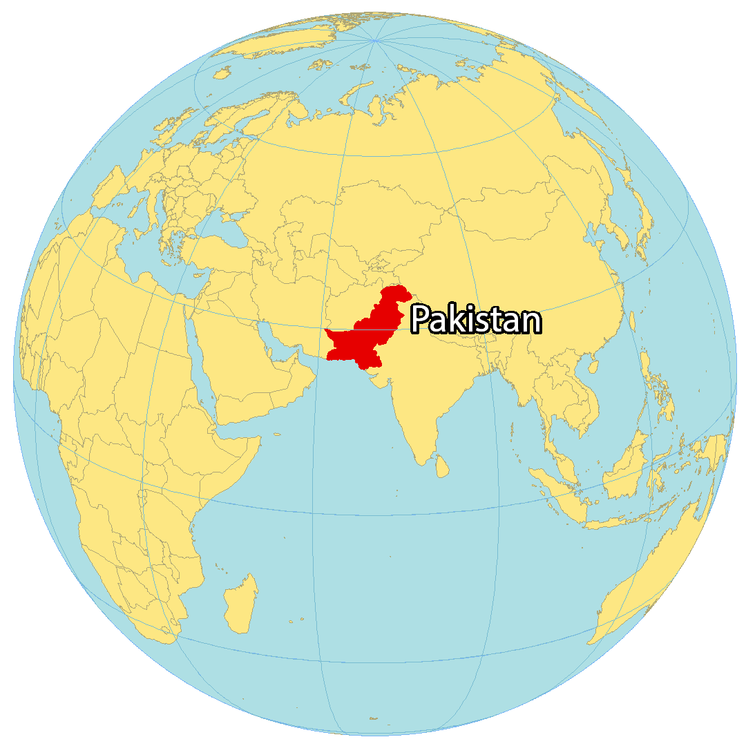
Where is Pakistan?
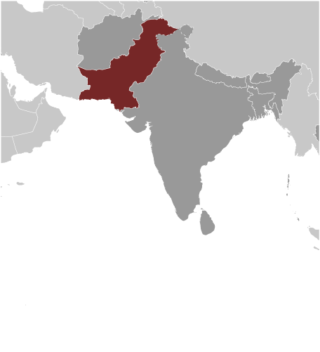
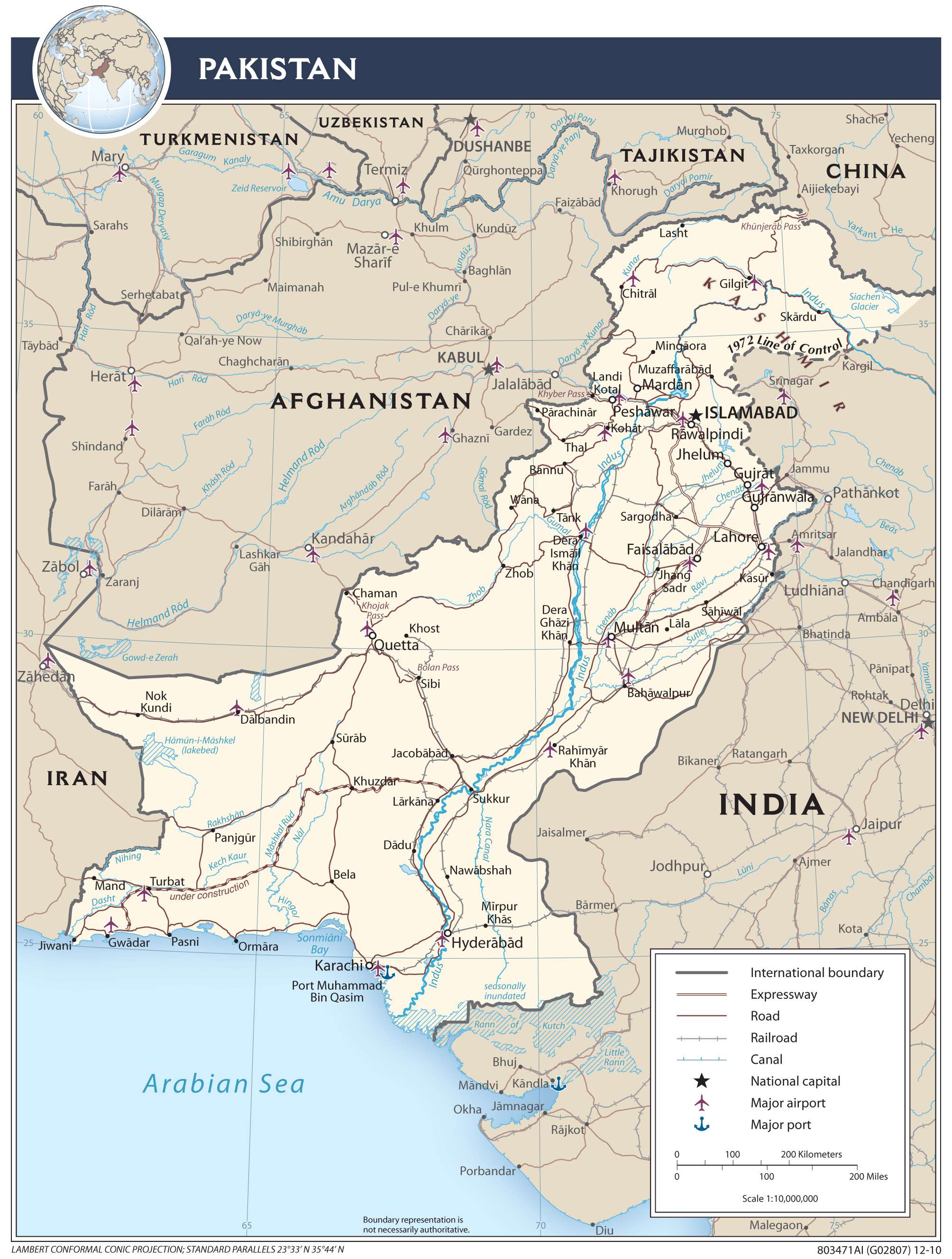
Nestled in Southern Asia, Pakistan is bordered by Iran on the west and Afghanistan on the northwest. India and China, both part of Asia, neighbour it to the east and northeast respectively.
As the fifth most populous country, Pakistan is known for K2, the second highest mountain in the world. The country’s capital is Islamabad while its largest city is Karachi.
High Definition Political Map of Pakistan
Pakistan Administrative Map
Physical Map of Pakistan
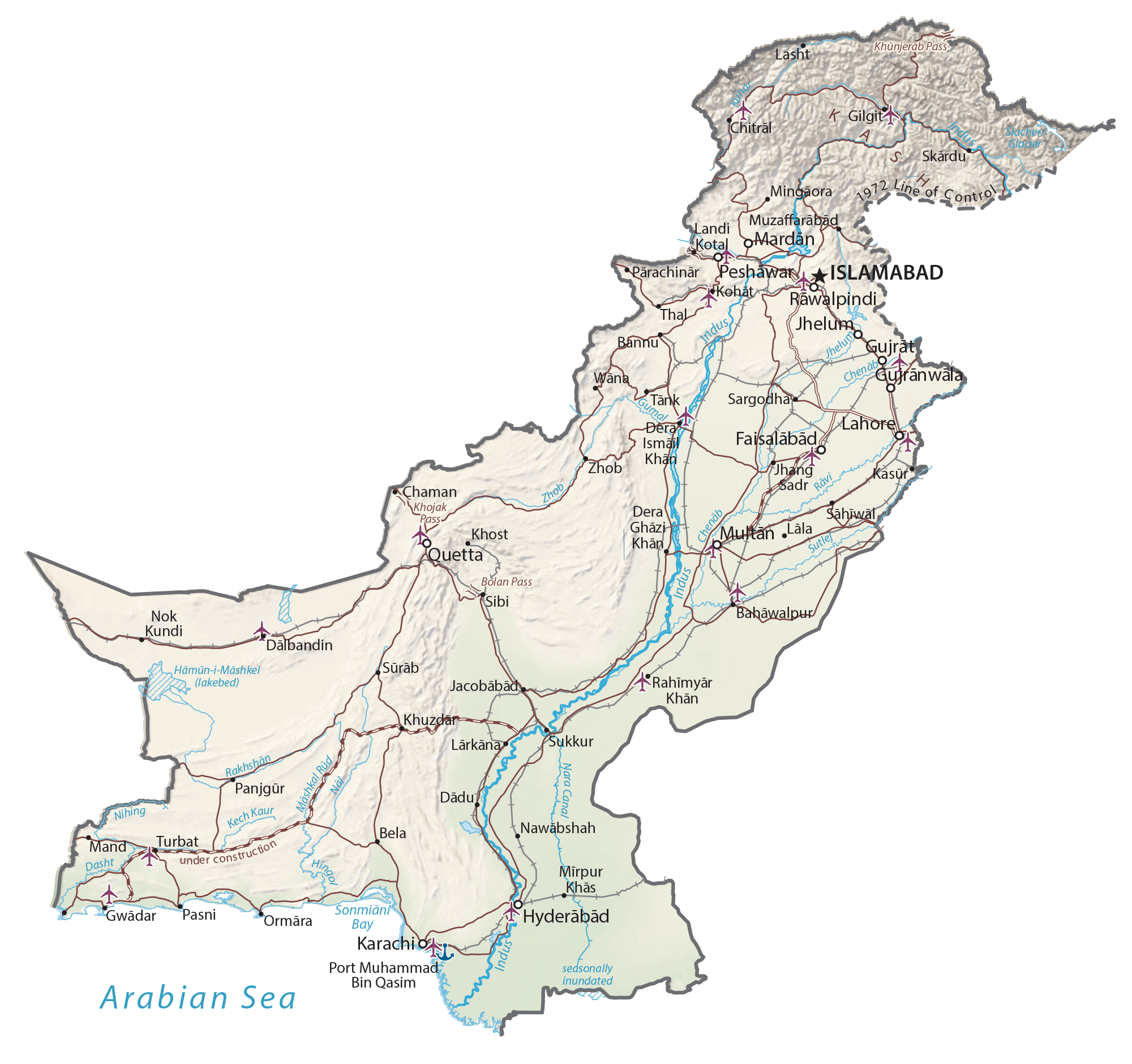
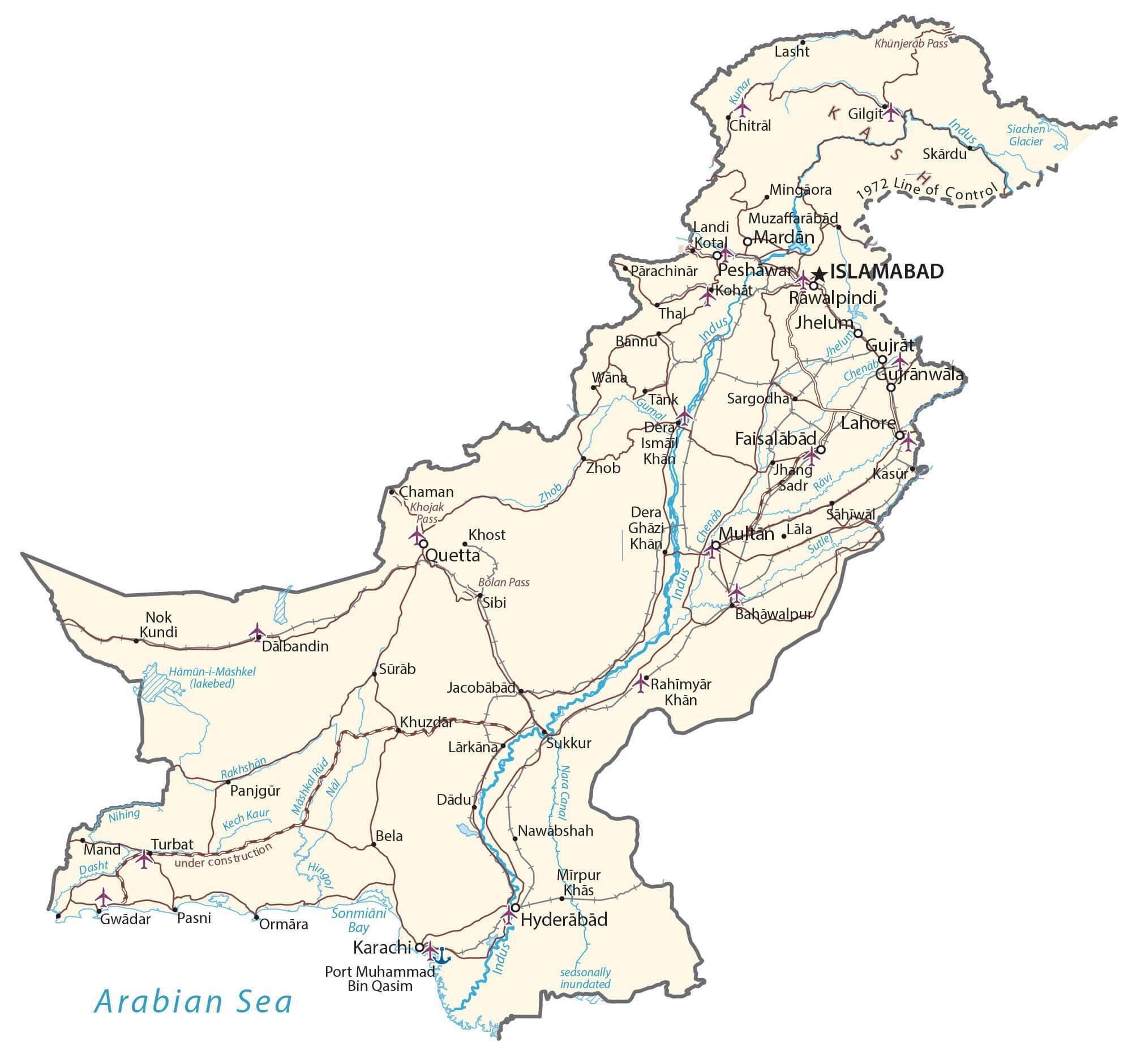
Transportation Map of Pakistan
Pakistan Satellite Map