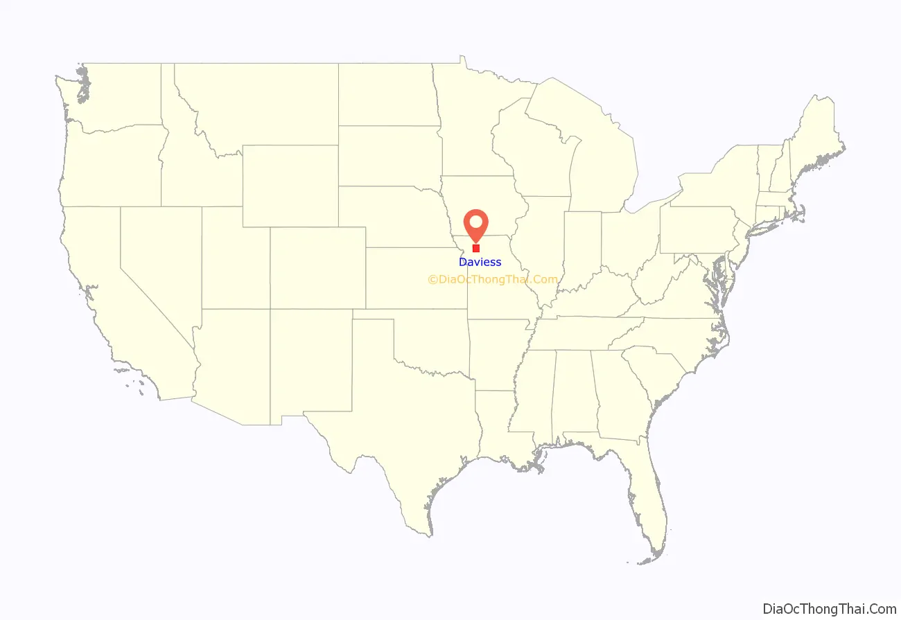
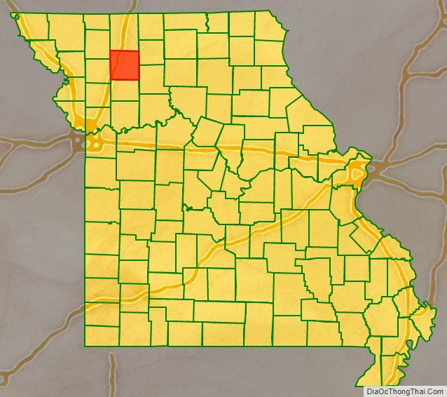
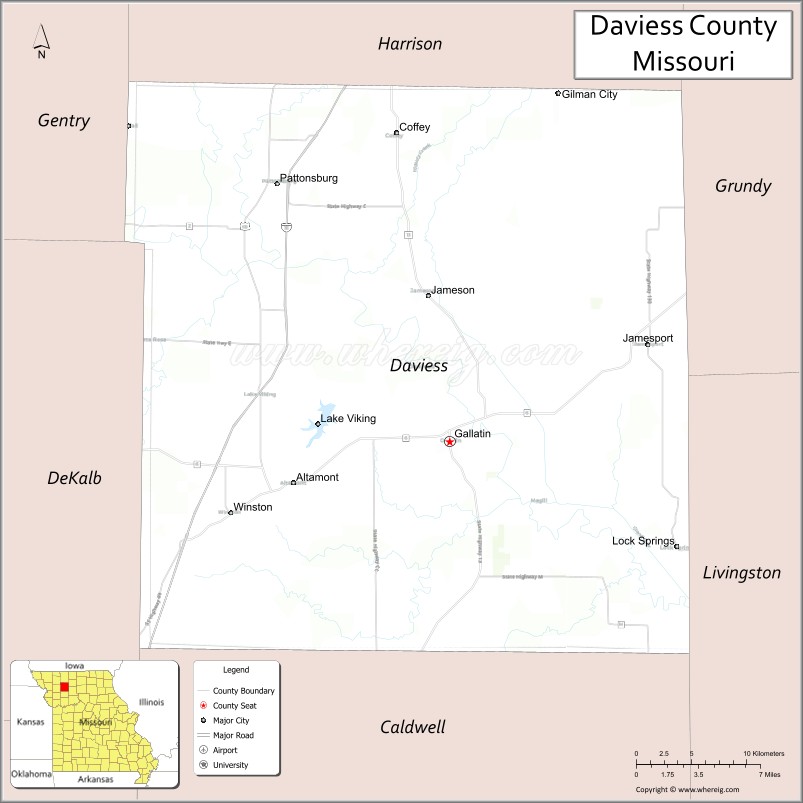
Daviess County is a county located in the U.S. state of Missouri. As of the 2020 census, the population was 8,430. Its county seat is Gallatin. The county was organized December 29, 1836, from Ray County and named for Major Joseph Hamilton Daveiss, a soldier from Kentucky who was killed in 1811 at the Battle of Tippecanoe.
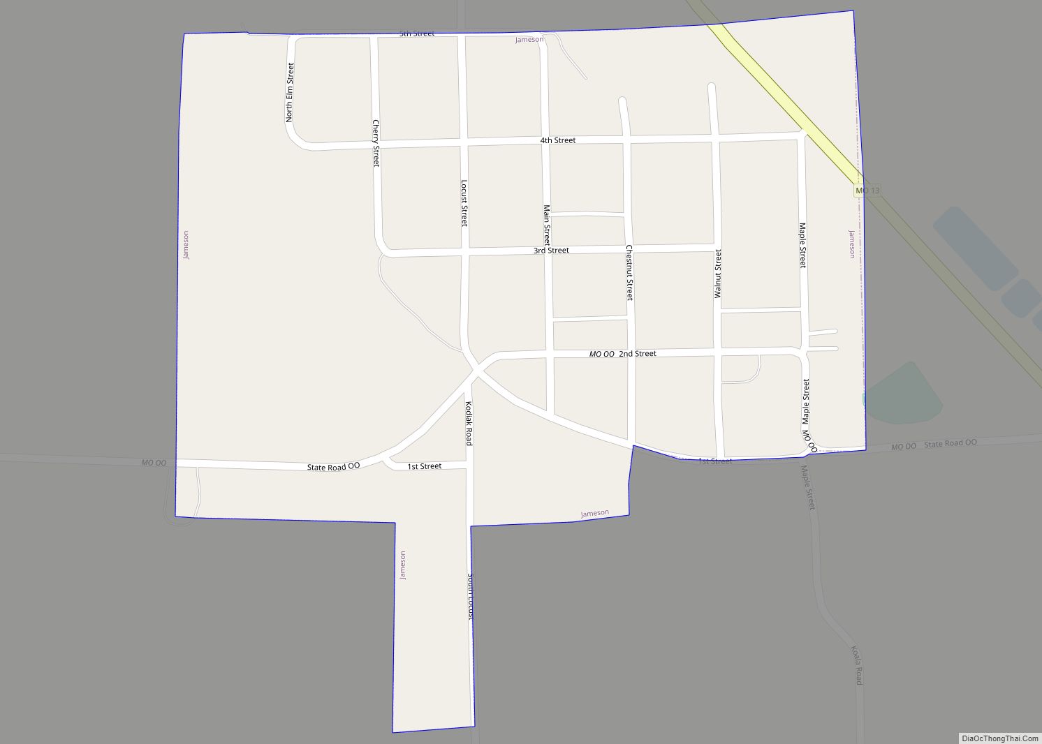
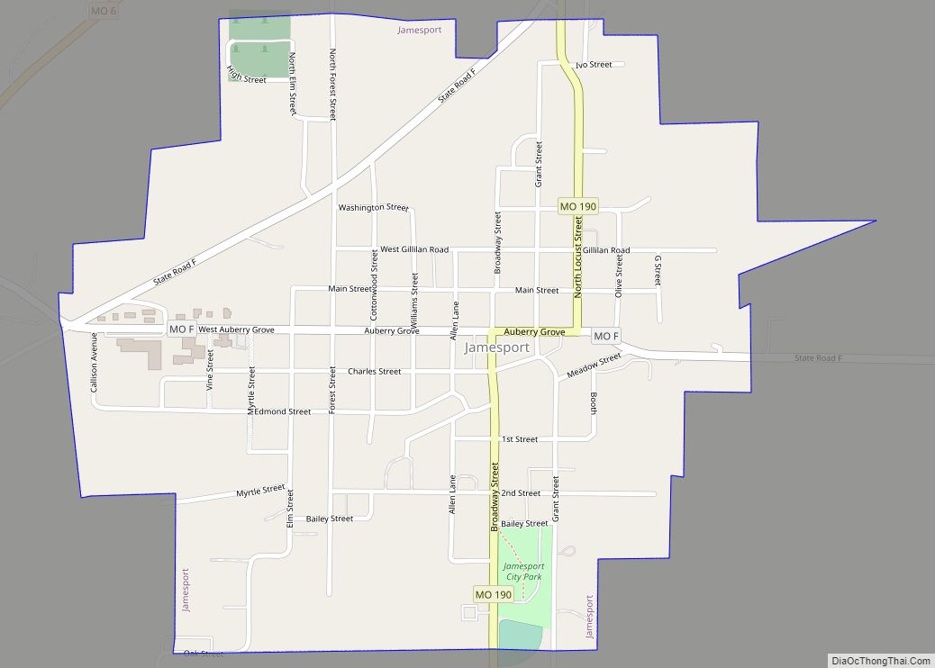
The county includes the town of Jamesport, which has the largest Amish community in Missouri.
| Name: | Daviess County |
|---|---|
| FIPS code: | 29-061 |
| State: | Missouri |
| Founded: | December 29, 1836 |
| Named for: | Major Joseph Hamilton Daviess |
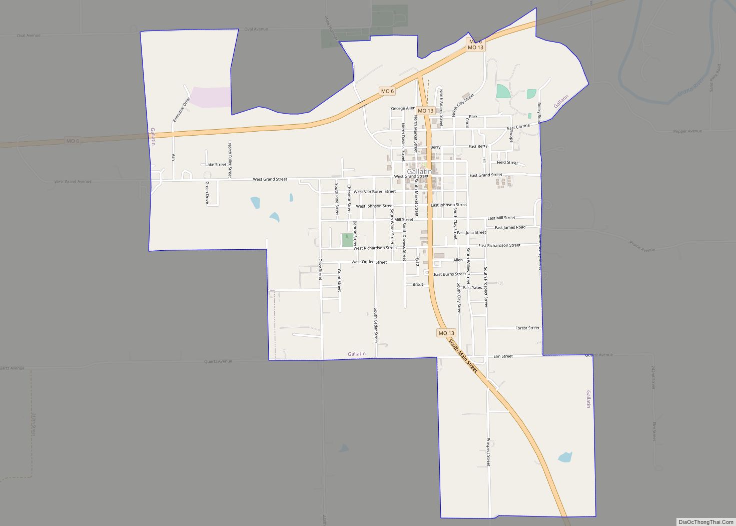
| Seat: | Gallatin |
| Largest city: | Gallatin |
| Total Area: | 569 sq mi (1,470 km²) |
| Land Area: | 563 sq mi (1,460 km²) |
| Total Population: | 8,430 |
| Population Density: | 15/sq mi (5.7/km²) |
| Time zone: | UTC−6 (Central) |
| Summer Time Zone (DST): | UTC−5 (CDT) |
| Website: | www.daviesscountymo.gov |
Daviess County location map. Where is Daviess County?
History
According to Latter Day Saint movement founder Joseph Smith, Adam-ondi-Ahman, situated in the central part of the county, was where Adam and Eve relocated after being banished from the Garden of Eden. According to LDS tradition, the site is to be a gathering spot prior to the Second Coming of Jesus Christ.
In 1838, two years after the county was organized, Joseph Smith’s claims about the history of the area spurred in an influx of Mormon settlers. Non-Mormon residents feared they were going to lose control of the county and attempted to prevent Mormons from voting in the Gallatin Election Day Battle. This was to be the first skirmish in the Mormon War. Later, in retaliation for violence to their families and destruction of their property, some Mormons burned and sacked Gallatin, Grindstone Fork, Millport and other smaller settlements. The plundered goods were deposited in the Bishop’s storehouse at Diahman. Millport, which at the time was the largest city in the county and the center for trade, never recovered, and became a ghost town. Missouri Governor Lilburn Boggs issued an Extermination Order to drive the Mormons from the state after arresting Joseph Smith and other leaders of the church.
Daviess County played a major role in the history of the outlaw James-Younger Gang. The first confirmed bank robbery involving Jesse James occurred on December 7, 1869, at the Daviess County Savings Association in Gallatin. John W. Sheets, the bank cashier, was killed in the process by Jesse James, who believed Sheets was Samuel P. Cox, who had killed James’s bushwhacker colleague Bloody Bill Anderson during the American Civil War. On July 15, 1881, the gang was believed to have been responsible for the robbery of the Rock Island Line at Winston in which a conductor and passenger were killed.
After Jesse James was murdered in St. Joseph, Frank James surrendered in 1882 to face Daviess County charges in connection with the train robbery/murder as well as murder charges in the 1869 bank robbery. Frank James was tried from August 20-September 6, 1883. Interest was so intense that the trial was moved to the Gallatin Opera House to accommodate the crowds. James was found not guilty of involvement in both crimes. Charges were made that the jury was filled with Southern sympathizers who refused to convict one of their own.[1]
The Daviess County Savings Association and the Gallatin Opera House have since been torn down, although the Winston Rock Island Line train station still stands and is operated by the local historical society as a museum.
Daviess County has one of only three Rotary Jails still in existence. Also known as the “Squirrel Cage Jail,” [2] it is now a museum and is on the National Register of Historic Places.
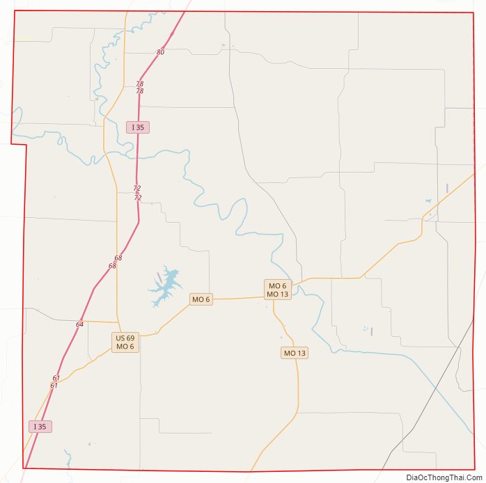
Daviess County Road Map
Geography
According to the U.S. Census Bureau, the county has a total area of 569 square miles (1,470 km), of which 563 square miles (1,460 km) is land and 5.8 square miles (15 km) (1.0%) is water.
Adjacent counties
- Harrison County (north)
- Grundy County (northeast)
- Livingston County (southeast)
- Caldwell County (south)
- DeKalb County (west)
- Gentry County (northwest)
Major highways
- Interstate 35
- U.S. Route 69
- Route 6
- Route 13
- Route 190
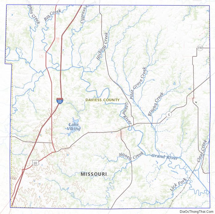
Daviess County Topographic Map
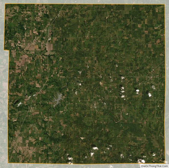
Daviess County Satellite Map
Daviess County Outline Map