DeKalb (/dɪˈkælb/ dih-KALB) is a city in DeKalb County, Illinois, United States. The population was 40,290 at the 2020 census, down from 43,862 at the 2010 census. The city is named after decorated Franconian-French war hero Johann de Kalb, who died during the American Revolutionary War.
Founded in 1856, DeKalb became important in the development and manufacture of barbed wire, especially for agriculture and raising livestock. While agricultural-related industries remain a facet of the city, along with health and services, the city’s largest employer in the 21st century is Northern Illinois University, founded in 1895. DeKalb is about 65 miles (105 km) from downtown Chicago.
| Name: | DeKalb city |
|---|---|
| LSAD Code: | 25 |
| LSAD Description: | city (suffix) |
| State: | Illinois |
| County: | DeKalb County |
| Incorporated: | 1856 |
| Elevation: | 879 ft (268 m) |
| Land Area: | 16.95 sq mi (43.91 km²) |
| Water Area: | 0.17 sq mi (0.43 km²) |
| Population Density: | 2,376.71/sq mi (917.66/km²) |
| ZIP code: | 60115 |
| Area code: | 815 |
| FIPS code: | 1719161 |
| Website: | www.cityofdekalb.com |
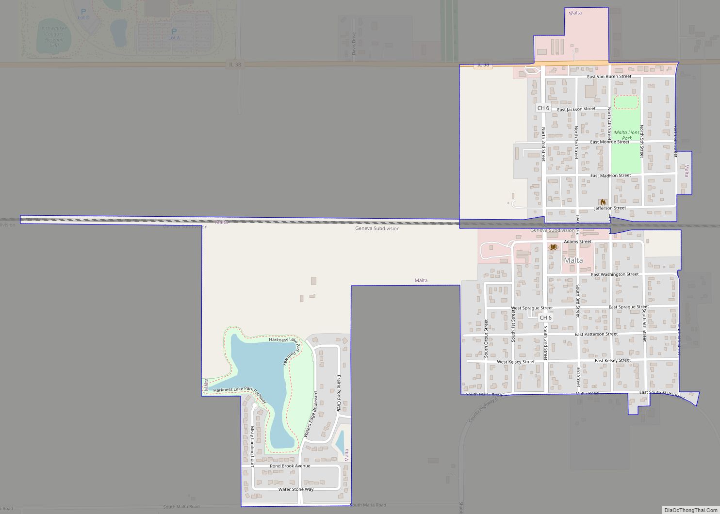
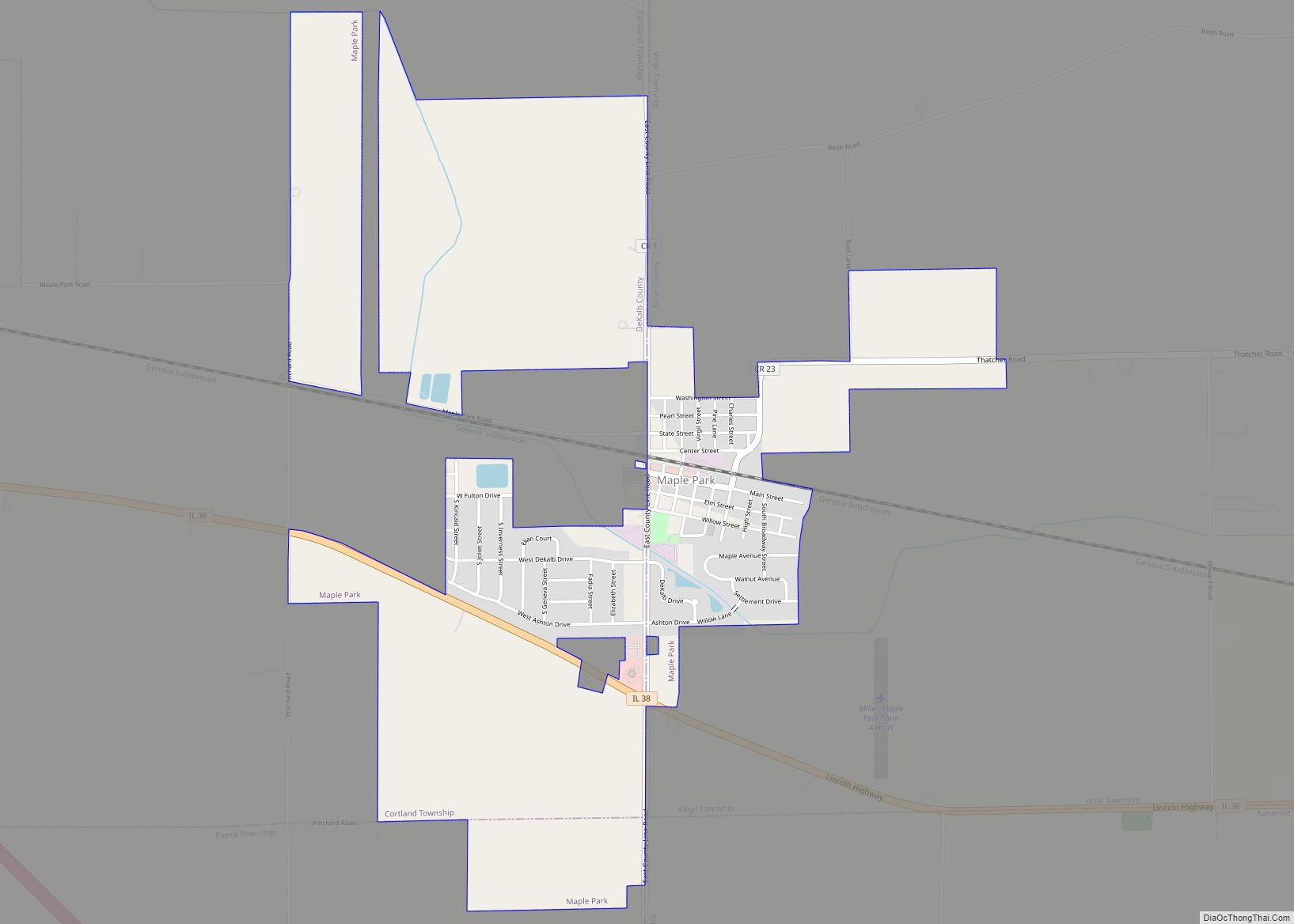
Online Interactive Map
Click on ![]() to view map in "full screen" mode.
to view map in "full screen" mode.
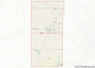
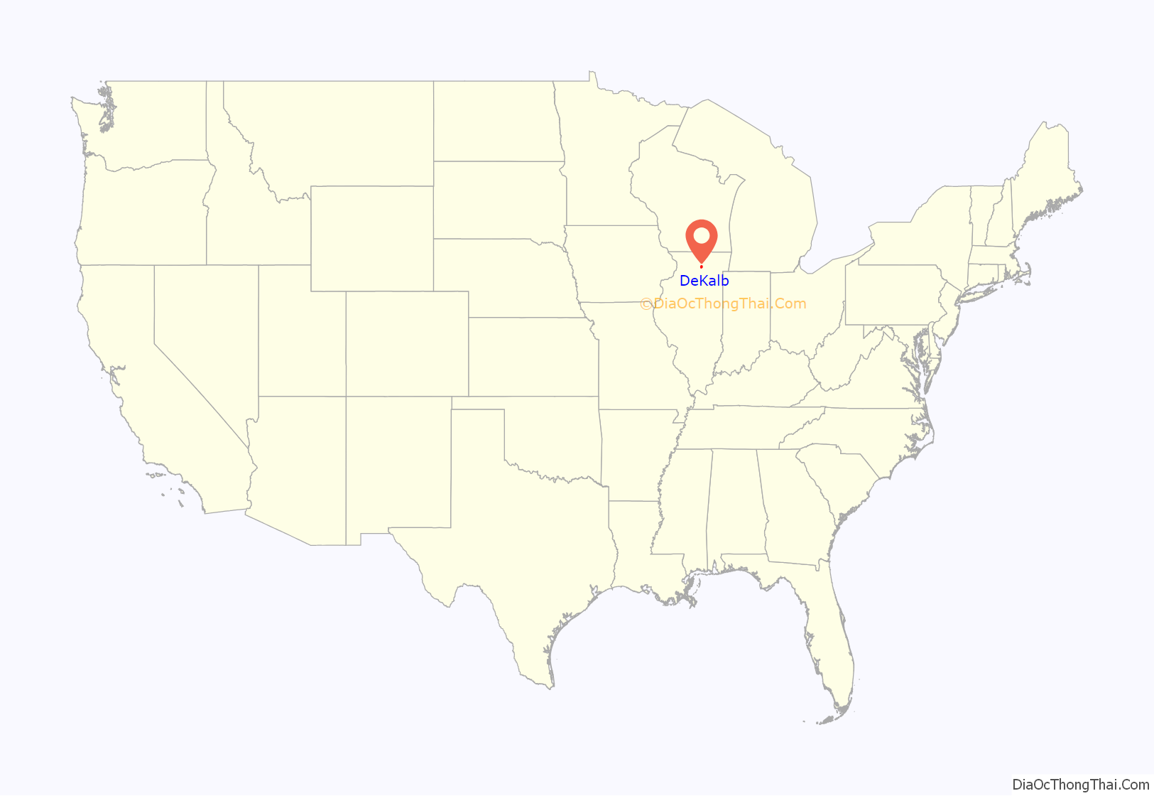
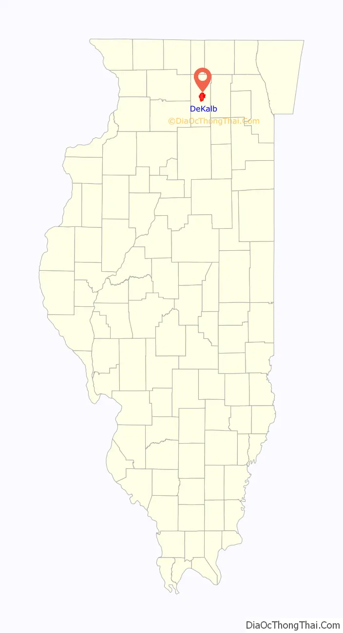
DeKalb location map. Where is DeKalb city?
History
DeKalb was originally called Huntley’s Grove, and under the latter name was platted in 1853. The name is for Baron Johann de Kalb, a major general in the American Revolutionary War. The first church in DeKalb was organized in 1844. Beginning in 1846, a stage coach traveled from Chicago through DeKalb and Dixon to Galena. A post office has been in operation at DeKalb since 1849. The first railroad reached DeKalb in 1853.
Barbed wire was a key product in DeKalb’s history. Joseph Glidden (1813-1906), a DeKalb resident since about 1850, received a patent in 1874 for inventing the conventional double-strand barbed wire that remains in common use around the world today. Glidden and Isaac L. Ellwood (1833-1910) manufactured barbed wire in DeKalb, initially as the Barb Fence Company. Successor companies included the 1881 Superior Barbed Wire Company, which merged into American Steel and Wire in 1898 and finally became United States Steel. Between 1892 and 1898 Glidden and Ellwood played substantial parts in establishing the state teachers college that became Northern Illinois University.
DeKalb played a leading role in the development of commercial hybrid corn. From a base in the early county Farm Bureau, the DeKalb Agricultural Association produced large quantities of high-yield seed varieties, beginning in 1934. Until the mid-1970s, more American farmers planted DeKalb hybrid corn than any other brand. The DeKalb logo was a flying ear of corn. A series of joint ventures and mergers beginning in 1982 resulted in the DeKalb brand of agricultural products being owned by Bayer since 2017.
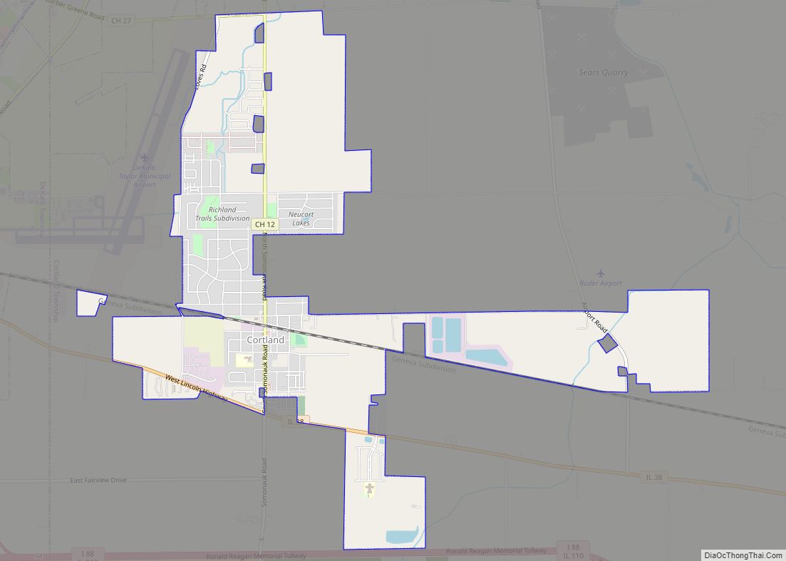
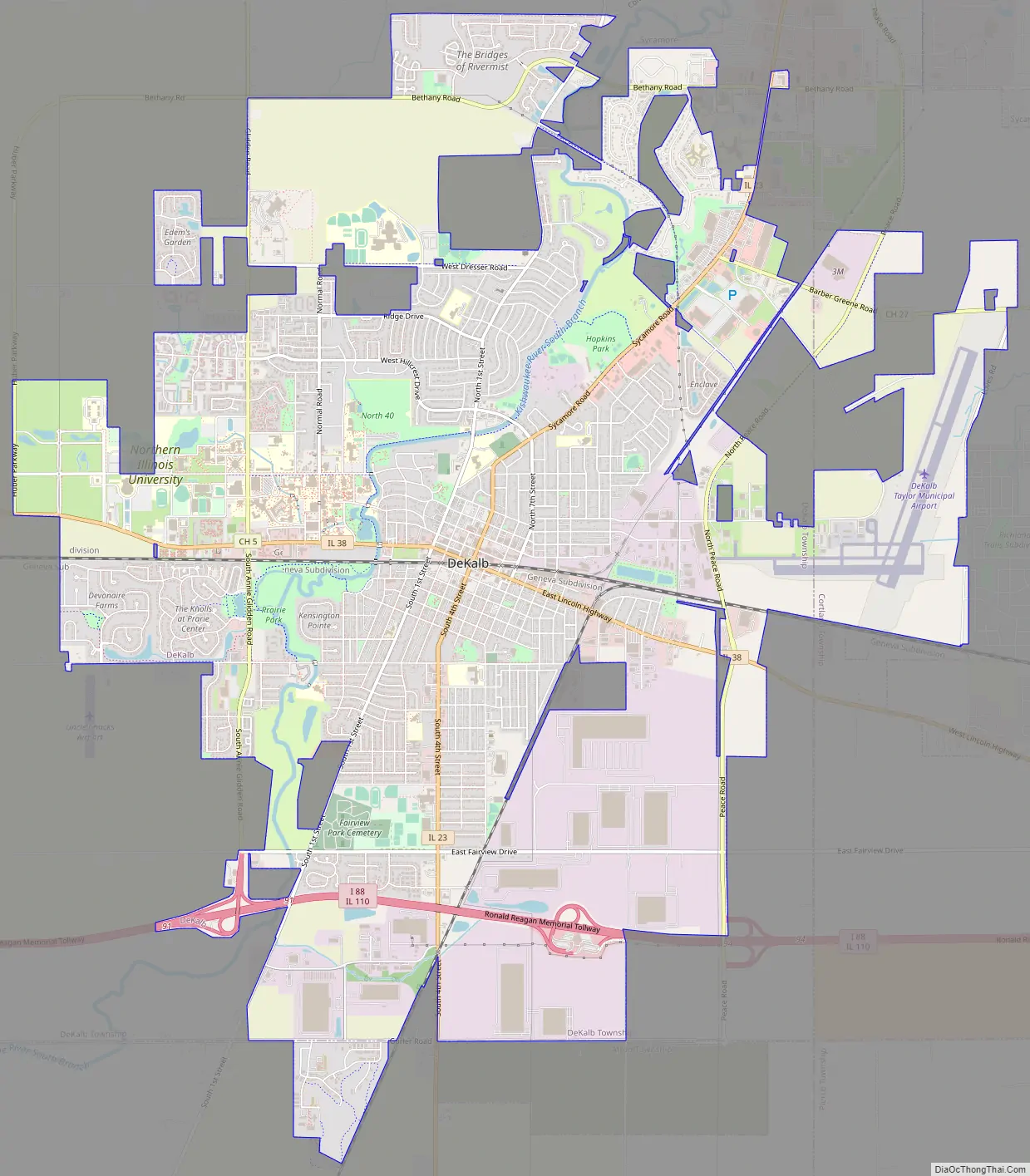
DeKalb Road Map
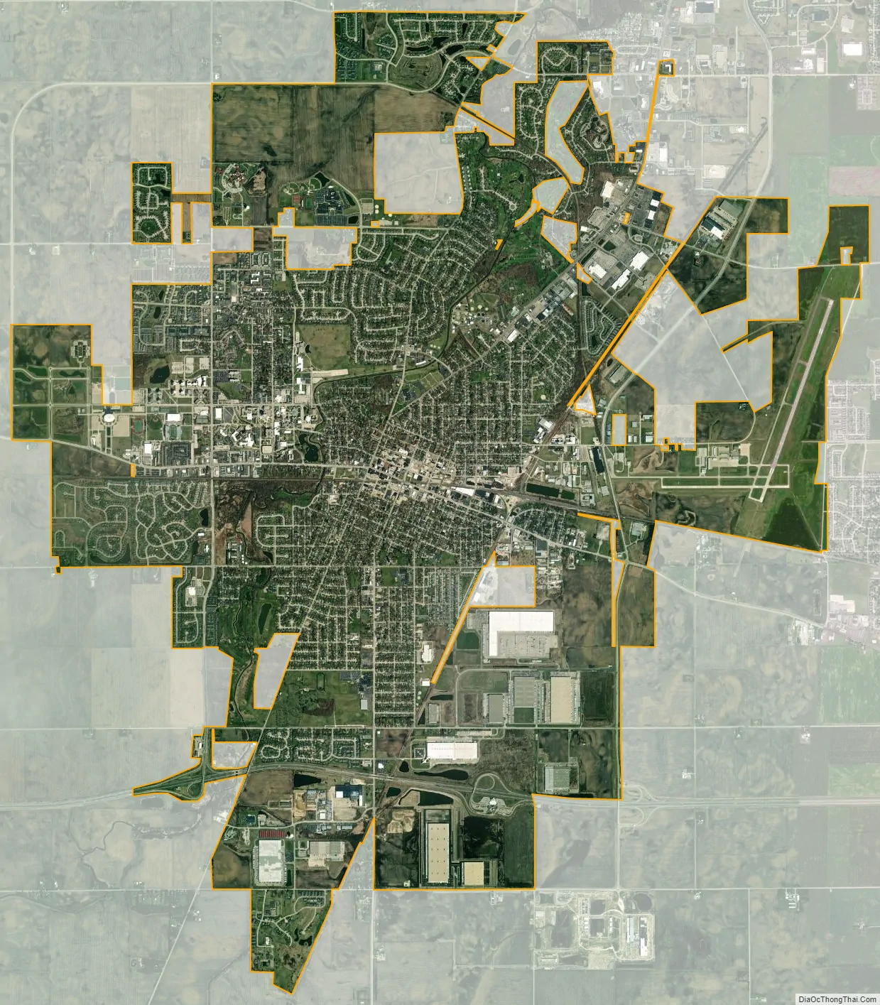
DeKalb city Satellite Map
Geography
DeKalb is in northern Illinois, about 65 miles (105 km) west of downtown Chicago and 30 miles southeast of Rockford. The South Branch Kishwaukee River flows northward through DeKalb.
According to the 2021 census gazetteer files, DeKalb has a total area of 17.12 square miles (44.34 km), of which 16.95 square miles (43.90 km) (or 99.03%) is land and 0.17 square miles (0.44 km) (or 0.97%) is water.
On August 24, 2007, the Kishwaukee River at DeKalb crested at 15.27 feet (4.65 m) (all-time record 15.8 feet (4.8 m)), causing major flooding. This was only the second time the river has risen above 15 feet (4.6 m) since the level of the river has been recorded.
Climate
DeKalb has a humid continental climate (Köppen climate classification Dfa) typical of northern Illinois, with four distinct seasons. Summers can be hot, while winters are cold and snowy. Precipitation is somewhat uniform year-round, although it can be heavier in the spring and summer when the area is prone to strong thunderstorms.
See also
Map of Illinois State and its subdivision:- Adams
- Alexander
- Bond
- Boone
- Brown
- Bureau
- Calhoun
- Carroll
- Cass
- Champaign
- Christian
- Clark
- Clay
- Clinton
- Coles
- Cook
- Crawford
- Cumberland
- De Kalb
- De Witt
- Douglas
- Dupage
- Edgar
- Edwards
- Effingham
- Fayette
- Ford
- Franklin
- Fulton
- Gallatin
- Greene
- Grundy
- Hamilton
- Hancock
- Hardin
- Henderson
- Henry
- Iroquois
- Jackson
- Jasper
- Jefferson
- Jersey
- Jo Daviess
- Johnson
- Kane
- Kankakee
- Kendall
- Knox
- La Salle
- Lake
- Lake Michigan
- Lawrence
- Lee
- Livingston
- Logan
- Macon
- Macoupin
- Madison
- Marion
- Marshall
- Mason
- Massac
- McDonough
- McHenry
- McLean
- Menard
- Mercer
- Monroe
- Montgomery
- Morgan
- Moultrie
- Ogle
- Peoria
- Perry
- Piatt
- Pike
- Pope
- Pulaski
- Putnam
- Randolph
- Richland
- Rock Island
- Saint Clair
- Saline
- Sangamon
- Schuyler
- Scott
- Shelby
- Stark
- Stephenson
- Tazewell
- Union
- Vermilion
- Wabash
- Warren
- Washington
- Wayne
- White
- Whiteside
- Will
- Williamson
- Winnebago
- Woodford
- Alabama
- Alaska
- Arizona
- Arkansas
- California
- Colorado
- Connecticut
- Delaware
- District of Columbia
- Florida
- Georgia
- Hawaii
- Idaho
- Illinois
- Indiana
- Iowa
- Kansas
- Kentucky
- Louisiana
- Maine
- Maryland
- Massachusetts
- Michigan
- Minnesota
- Mississippi
- Missouri
- Montana
- Nebraska
- Nevada
- New Hampshire
- New Jersey
- New Mexico
- New York
- North Carolina
- North Dakota
- Ohio
- Oklahoma
- Oregon
- Pennsylvania
- Rhode Island
- South Carolina
- South Dakota
- Tennessee
- Texas
- Utah
- Vermont
- Virginia
- Washington
- West Virginia
- Wisconsin
- Wyoming