Elgin (/ˈɛldʒɪn/ EL-jin) is a city in Cook and Kane counties in the northern part of Illinois, United States. Elgin is located 35 mi (56 km) northwest of Chicago, along the Fox River. As of the 2020 Census, the city had a population of 114,797, the sixth-largest city in Illinois.
| Name: | Elgin city |
|---|---|
| LSAD Code: | 25 |
| LSAD Description: | city (suffix) |
| State: | Illinois |
| County: | Cook County, Kane County |
| Founded: | 1835 |
| Elevation: | 810 ft (250 m) |
| Total Area: | 38.60 sq mi (99.97 km²) |
| Land Area: | 38.03 sq mi (98.49 km²) |
| Water Area: | 0.57 sq mi (1.49 km²) 1.43% |
| Total Population: | 114,797 |
| Population Density: | 3,018.83/sq mi (1,165.59/km²) |
| Area code: | 331, 847 and 224 |
| FIPS code: | 1723074 |
| Website: | www.cityofelgin.org |
Online Interactive Map
Click on ![]() to view map in "full screen" mode.
to view map in "full screen" mode.
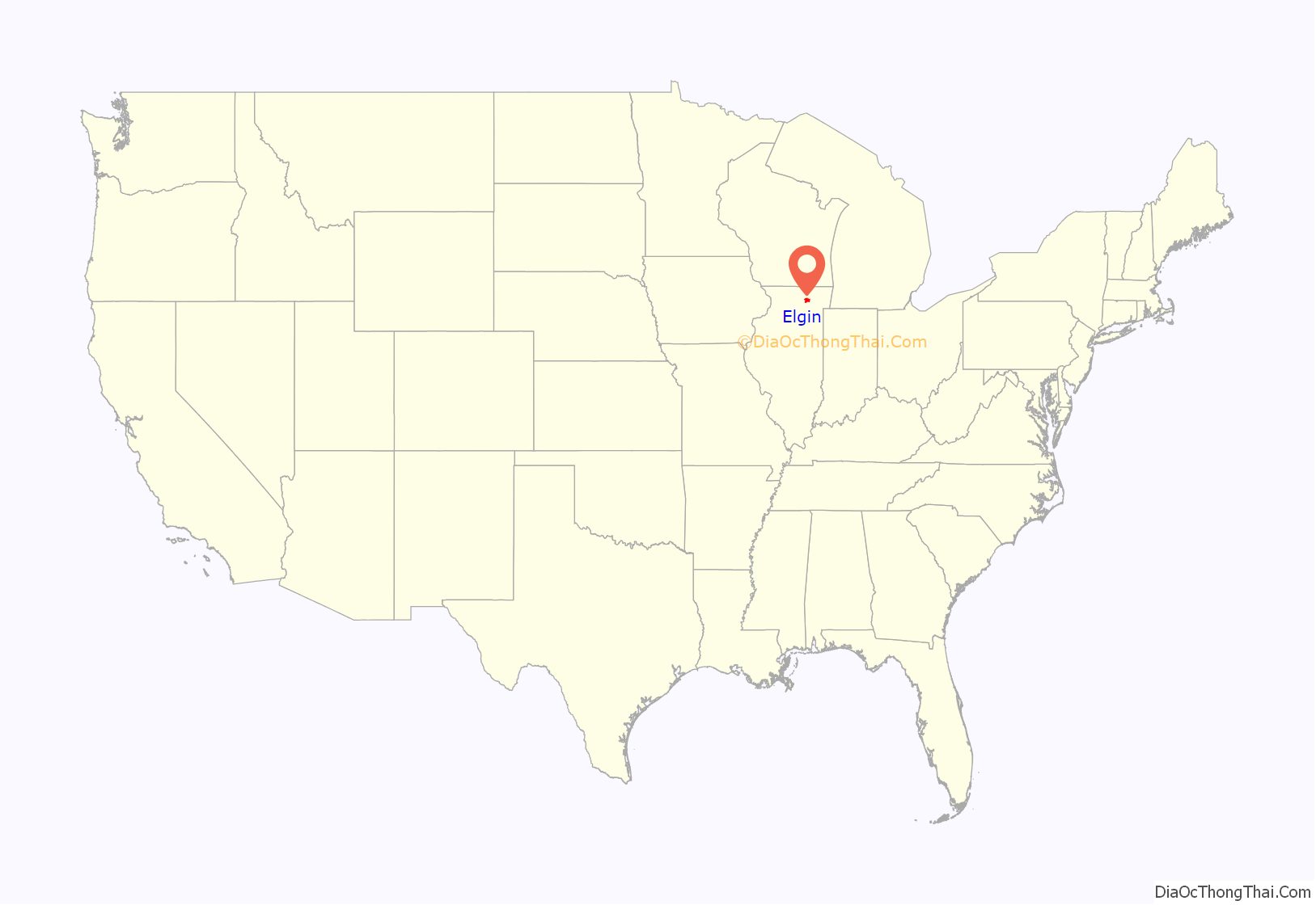
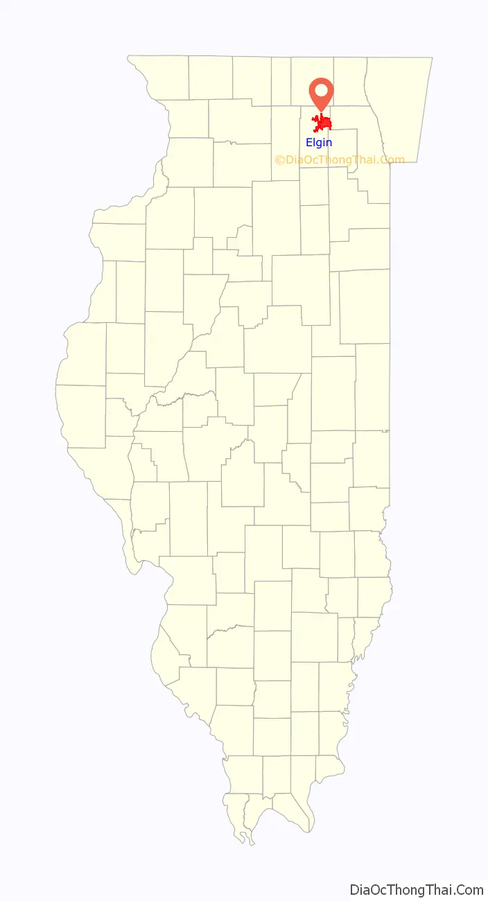
Elgin location map. Where is Elgin city?
History
The Indian Removal Act of 1830 and the Black Hawk Indian War of 1832 led to the expulsion of the Native Americans who had settlements and burial mounds in the area and set the stage for the founding of Elgin. Thousands of militiamen and soldiers of Gen. Winfield Scott’s army marched through the Fox River valley during the war, and accounts of the area’s fertile soils and flowing springs soon filtered east.
In New York, James T. Gifford and his brother Hezekiah Gifford heard tales of this area ripe for settlement, and they traveled west. Looking for a site on the stagecoach route from Chicago to Galena, Illinois, they eventually settled on a spot where the Fox River could be bridged. In April 1835, they established the city, naming it after the Scottish tune “Elgin”.
Early Elgin achieved fame for the butter and dairy goods it sold to the city of Chicago. Gail Borden established a condensed milk factory here in 1866, and the local library was named in his honor. The dairy industry became less important with the arrival of the Elgin Watch Company. The watch factory employed three generations of Elginites from the late 19th century to the mid 20th century, when it was the largest producer of fine watches in the United States (the factory ceased production in 1965 and was torn down in the summer of 1966) and the operator of the largest watchmaking complex in the world. Today, the clocks at Chicago’s Union Station still bear the Elgin name.
Elgin has a long tradition of education and invention. Elgin is home to the Elgin Academy, the oldest coeducational, non-sectarian college preparatory school west of the Allegheny Mountains. Elgin High School boasts five Navy admirals, a Nobel Prize winner, a Pulitzer Prize winner, a Tony Award winner, two Academy Award-winning producers, Olympic athletes and a General Motors CEO among its alumni. Elgin resident John Murphy invented the motorized streetsweeper in 1914 and later formed the Elgin Sweeper Corporation. Pioneering African-American chemist Lloyd Hall was an Elgin native, as was the legendary marketer and car stereo pioneer Earl “Madman” Muntz and Max Adler, founder of the Adler Planetarium in Chicago, America’s first planetarium.
Local historian E. C. Alft wrote several books and a long-running newspaper column about Elgin’s history.
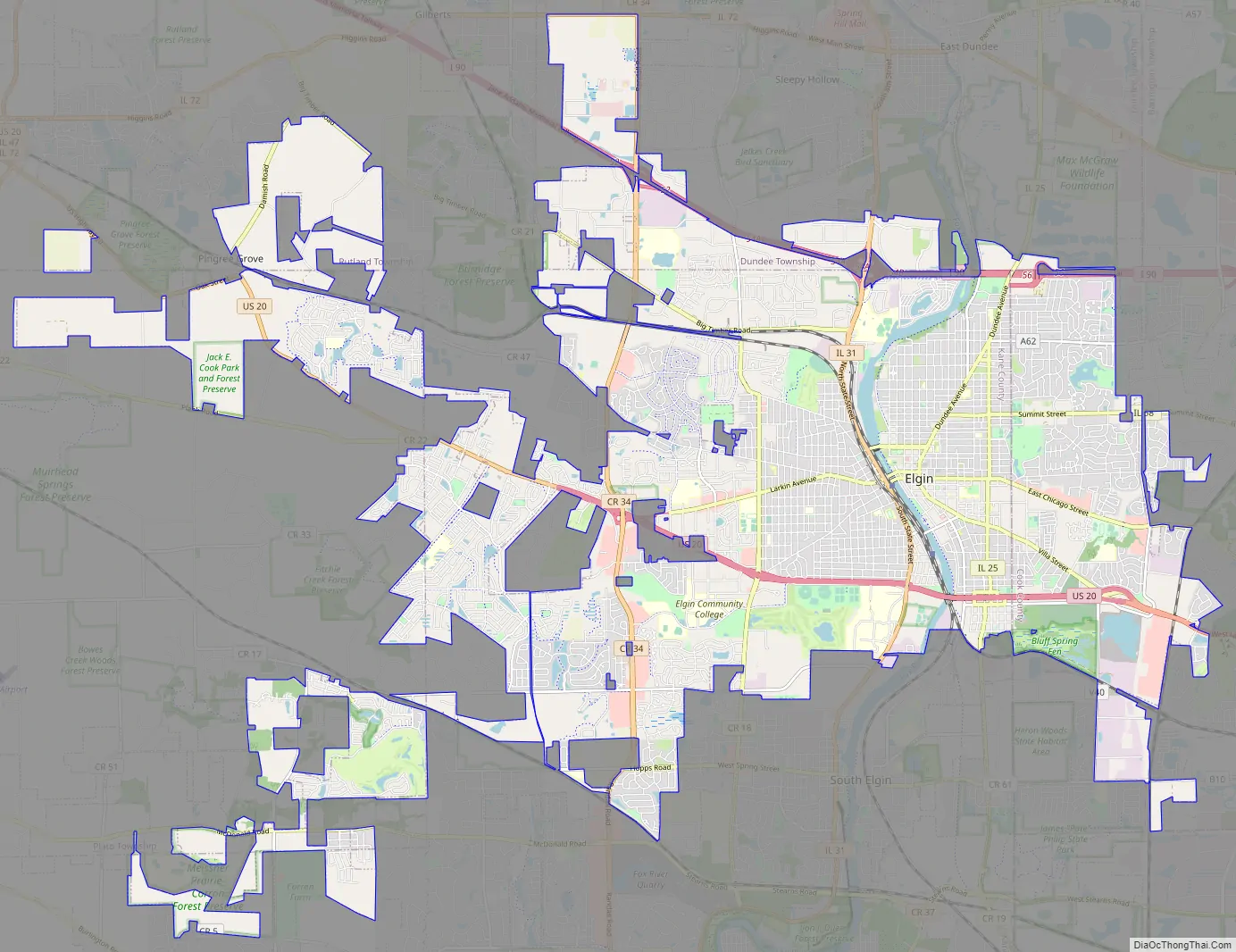
Elgin Road Map
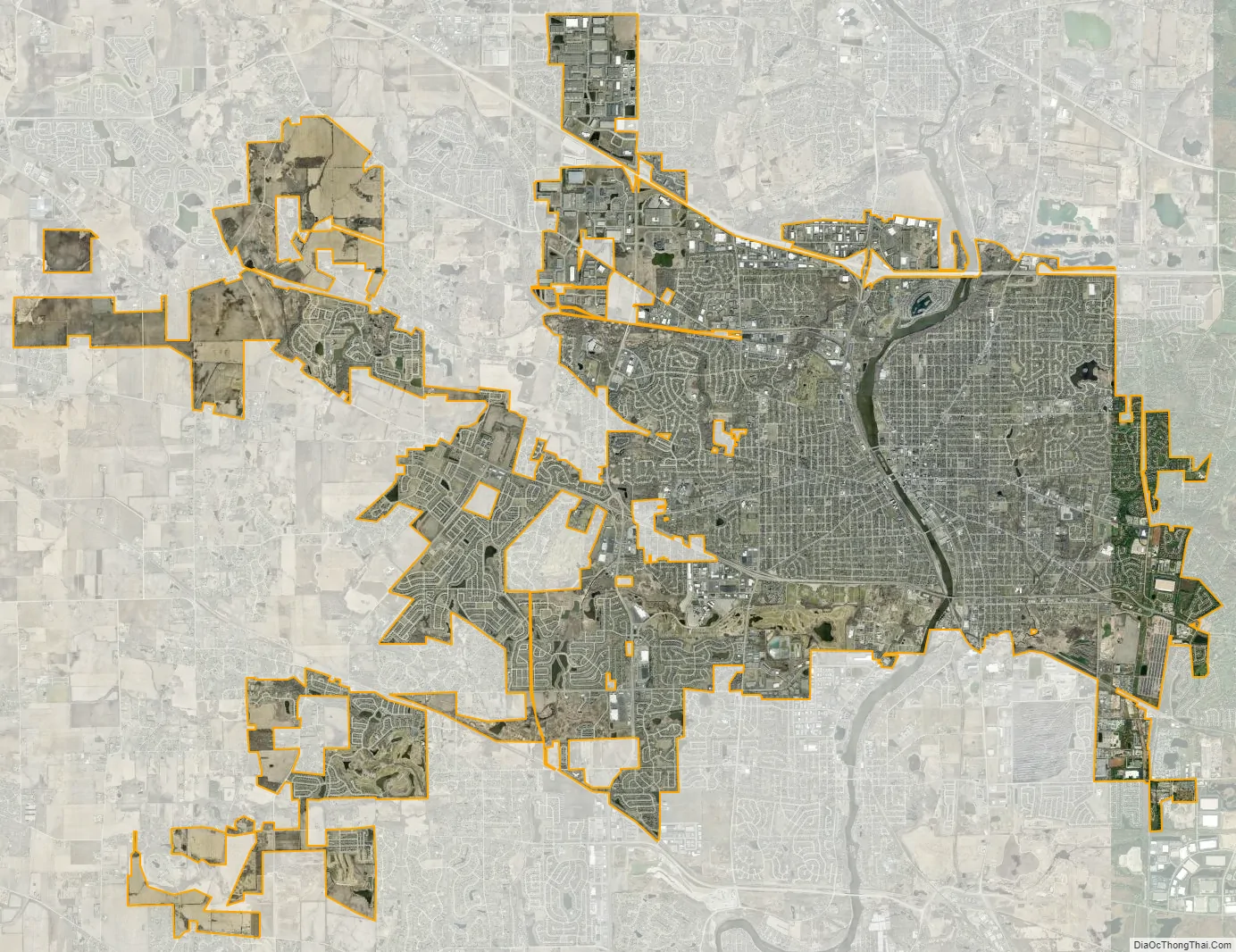
Elgin city Satellite Map
Geography
Topography
Elgin is located at 42°2′18″N 88°19′22″W / 42.03833°N 88.32278°W / 42.03833; -88.32278 (42.0384225, −88.3226510).
According to the 2021 census gazetteer files, Elgin has a total area of 38.60 square miles (99.97 km), of which 38.03 square miles (98.50 km) (or 98.52%) is land and 0.57 square miles (1.48 km) (or 1.48%) is water.
Climate
On March 28, 1920, Elgin was struck by several tornadoes along the Fox River that caused significant damage to Chicago and several western suburbs. Twenty-three people were killed and several businesses and homes were destroyed, including the Opera House and Grant Theater.
See also
Map of Illinois State and its subdivision:- Adams
- Alexander
- Bond
- Boone
- Brown
- Bureau
- Calhoun
- Carroll
- Cass
- Champaign
- Christian
- Clark
- Clay
- Clinton
- Coles
- Cook
- Crawford
- Cumberland
- De Kalb
- De Witt
- Douglas
- Dupage
- Edgar
- Edwards
- Effingham
- Fayette
- Ford
- Franklin
- Fulton
- Gallatin
- Greene
- Grundy
- Hamilton
- Hancock
- Hardin
- Henderson
- Henry
- Iroquois
- Jackson
- Jasper
- Jefferson
- Jersey
- Jo Daviess
- Johnson
- Kane
- Kankakee
- Kendall
- Knox
- La Salle
- Lake
- Lake Michigan
- Lawrence
- Lee
- Livingston
- Logan
- Macon
- Macoupin
- Madison
- Marion
- Marshall
- Mason
- Massac
- McDonough
- McHenry
- McLean
- Menard
- Mercer
- Monroe
- Montgomery
- Morgan
- Moultrie
- Ogle
- Peoria
- Perry
- Piatt
- Pike
- Pope
- Pulaski
- Putnam
- Randolph
- Richland
- Rock Island
- Saint Clair
- Saline
- Sangamon
- Schuyler
- Scott
- Shelby
- Stark
- Stephenson
- Tazewell
- Union
- Vermilion
- Wabash
- Warren
- Washington
- Wayne
- White
- Whiteside
- Will
- Williamson
- Winnebago
- Woodford
- Alabama
- Alaska
- Arizona
- Arkansas
- California
- Colorado
- Connecticut
- Delaware
- District of Columbia
- Florida
- Georgia
- Hawaii
- Idaho
- Illinois
- Indiana
- Iowa
- Kansas
- Kentucky
- Louisiana
- Maine
- Maryland
- Massachusetts
- Michigan
- Minnesota
- Mississippi
- Missouri
- Montana
- Nebraska
- Nevada
- New Hampshire
- New Jersey
- New Mexico
- New York
- North Carolina
- North Dakota
- Ohio
- Oklahoma
- Oregon
- Pennsylvania
- Rhode Island
- South Carolina
- South Dakota
- Tennessee
- Texas
- Utah
- Vermont
- Virginia
- Washington
- West Virginia
- Wisconsin
- Wyoming


