| Name: | Chester County |
|---|---|
| FIPS code: | 42-029 |
| State: | Pennsylvania |
| Founded: | August 24, 1682 |
| Named for: | Chester, England |
| Seat: | West Chester |
| Largest city: | West Chester |
| Total Area: | 759 sq mi (1,970 km²) |
| Land Area: | 751 sq mi (1,950 km²) |
| Total Population: | 534,413 |
| Population Density: | 712.0/sq mi (274.9/km²) |
| Time zone: | UTC−5 (Eastern) |
| Summer Time Zone (DST): | UTC−4 (EDT) |
| Website: | www.chesco.org |
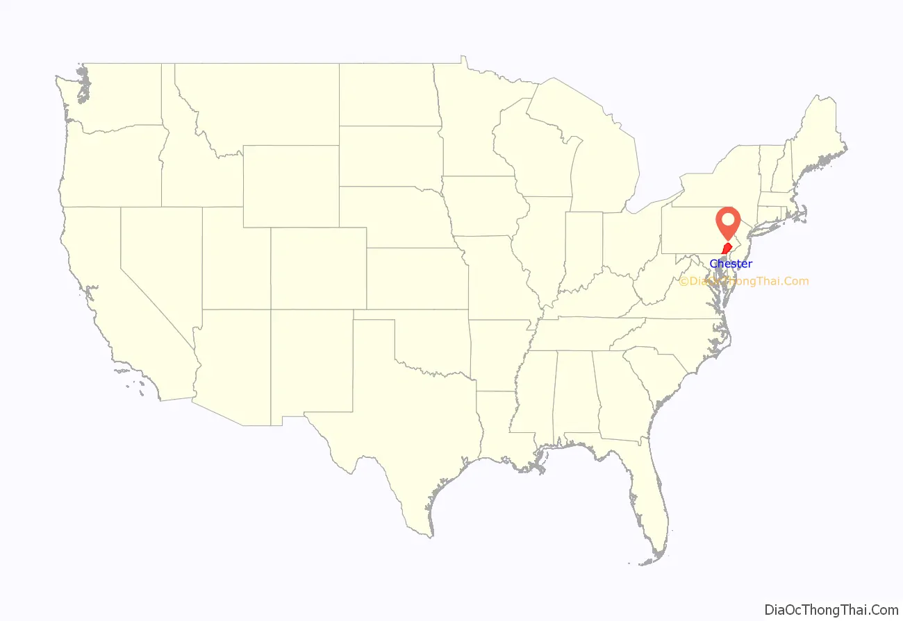
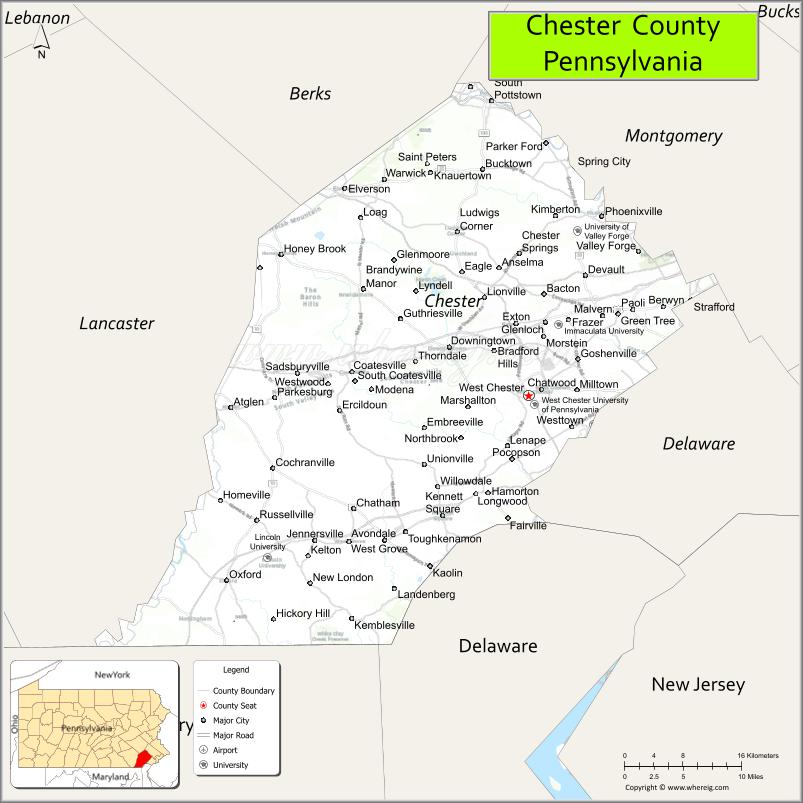
Chester County location map. Where is Chester County?
History
Philadelphia, Bucks, and Chester were the three Pennsylvania counties initially created by William Penn on August 24, 1682. At that time, Chester County’s borders were Philadelphia County to the north, the ill-defined western edge of the colony (approximately the Susquehanna River) to the west, the Delaware River to the east, and Delaware and Maryland to the south. Chester County replaced the Pennsylvania portion of New Netherland/New York’s “Upland”, which was officially eliminated when Pennsylvania was chartered on March 4, 1681, but did not cease to exist until June of that year. Much of the Welsh Tract was in eastern Chester County, and Welsh place names, given by early settlers, continue to predominate there.
The fourth county in the state, Lancaster County, was formed from Chester County on May 10, 1729. On March 11, 1752, Berks County was formed from the northern section of Chester County, as well as parts of Lancaster and Philadelphia counties.
The original Chester County seat was the City of Chester, a center of naval shipbuilding, at the eastern edge of the county. In an effort to accommodate the increased population of the western part of the county, the county seat was moved to a more central location in 1788; in order to mollify the eastern portion of the county, the village, known as Turk’s Head, was renamed West Chester. In response to the new location of the county seat, the eastern portion of the county separated and formed the new Delaware County in 1789 with the City of Chester as its county seat.
Much of the history of Chester County arises from its location between Philadelphia and the Susquehanna River. The first road to “the West” (meaning Lancaster County) passed through the central part of Chester County, following the Great Valley westward; with some re-alignments, it became the Lincoln Highway and later U.S. Route 30. This road is still named Lancaster Avenue in most of the Chester County towns it runs through. The first railroad (which became the Pennsylvania Railroad) followed much the same route, and the Reading Railroad progressed up the Schuylkill River to Reading. Industry tended to concentrate along the rail lines. Easy transportation allowed workers to commute to urban jobs, and the rise of the suburbs followed. To this day, the developed areas form “fingers” extending along major lines of transportation.
During the American Revolutionary War, the Battle of Brandywine was fought at what is now the southeastern fringe of the county. The Valley Forge encampment was at the northeastern edge.
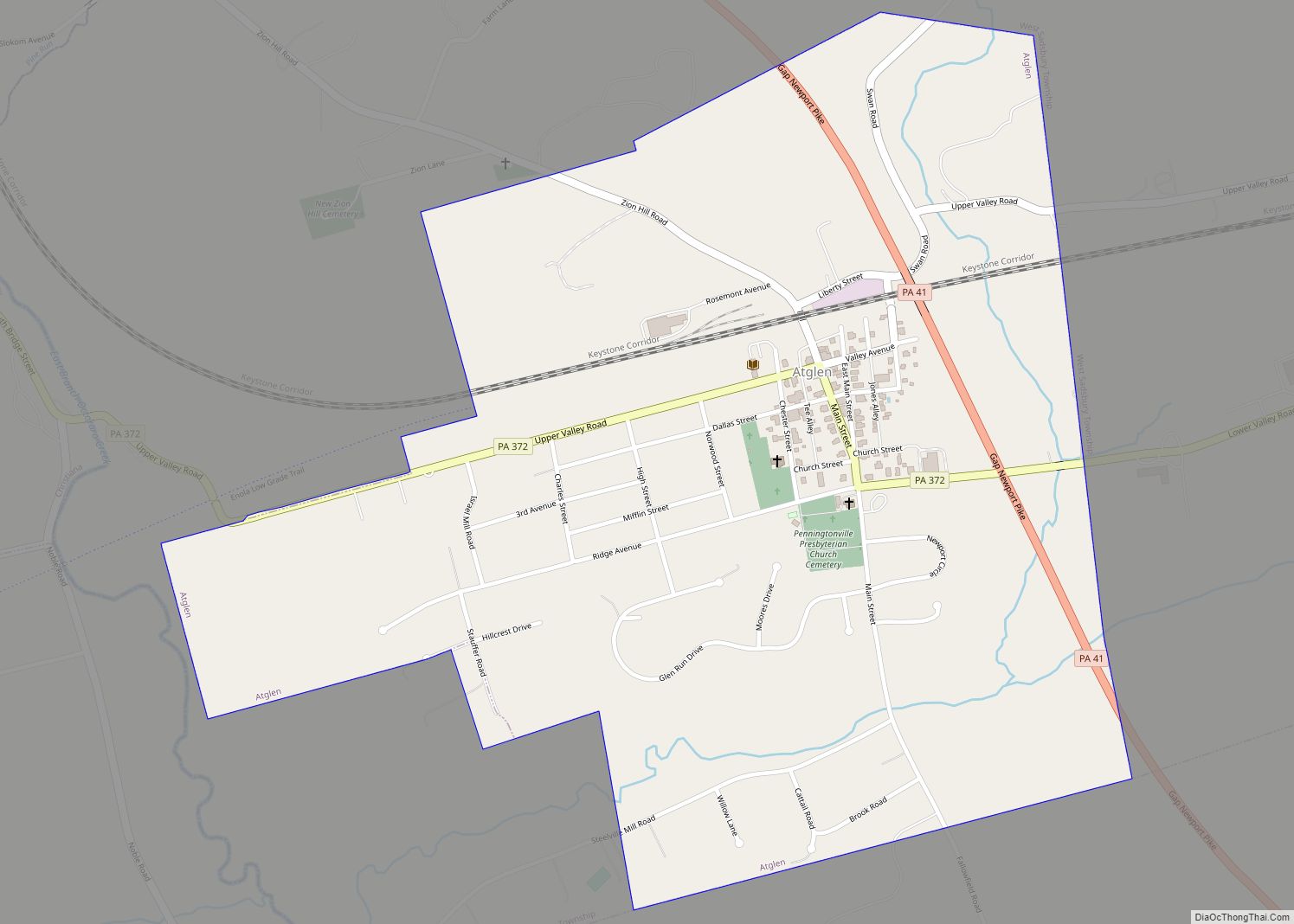
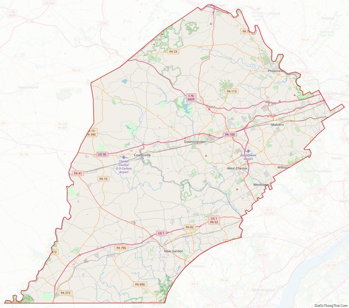
Chester County Road Map
Geography
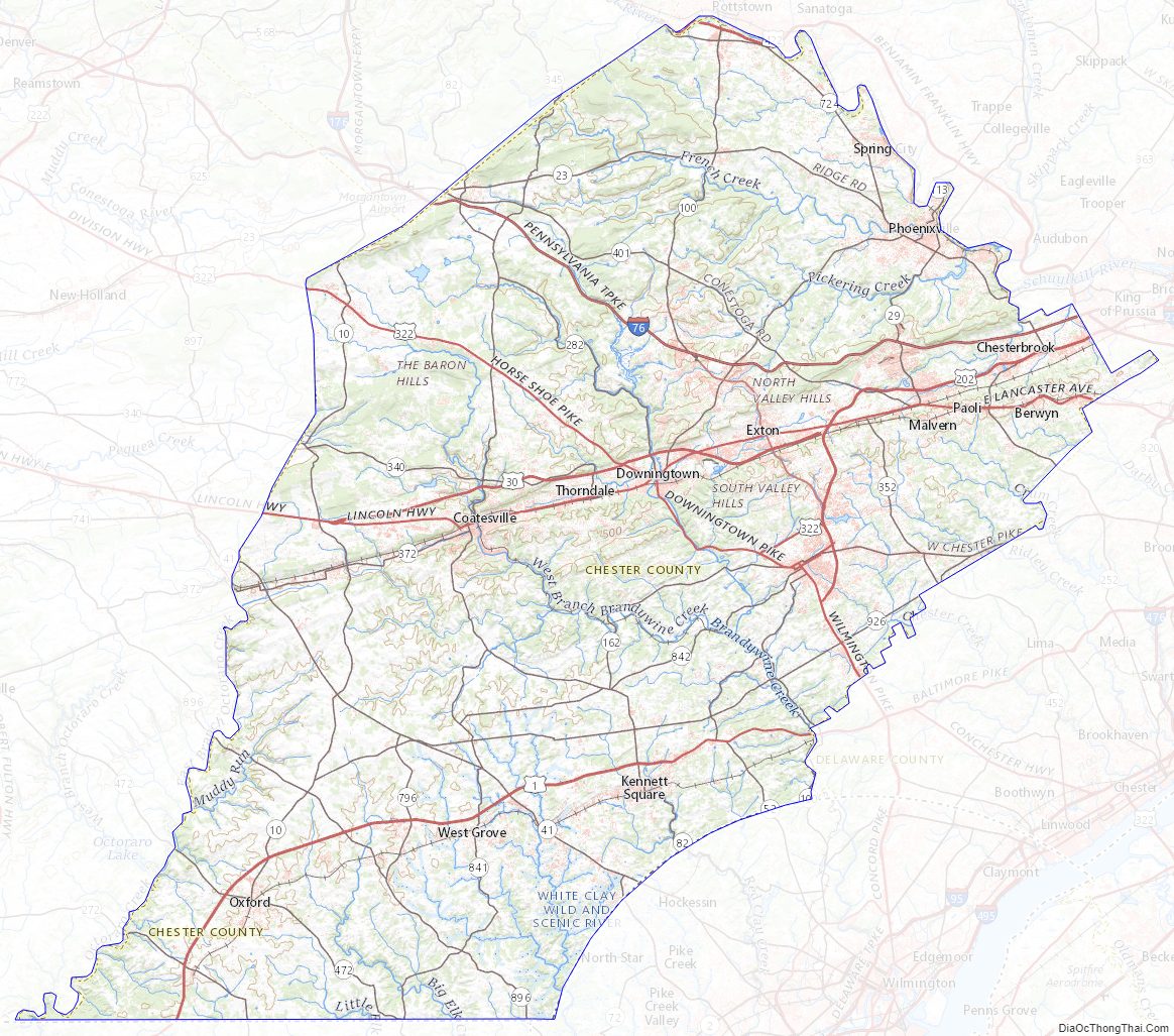
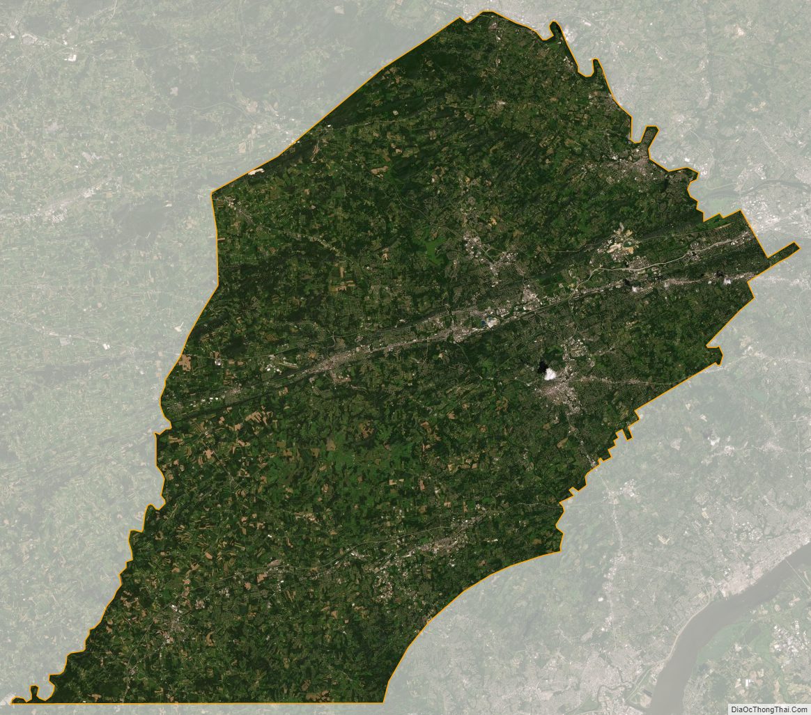
According to the U.S. Census Bureau, the county has a total area of 759 square miles (1,970 km), of which 751 square miles (1,950 km) is land and 8.7 square miles (23 km) (1.1%) is water. The topography consists of rolling hills and valleys and it is part of the region known as the Piedmont.
Watersheds that serve Chester County include the Octoraro, the Brandywine, and Chester creeks, and the Schuylkill River. Many of the soils are fertile, rich loam as much as twenty-four inches thick; together with the temperate climate, this was long a major agricultural area. Because of its proximity to Philadelphia, Chester County has seen large waves of development over the past half-century due to suburbanization. Although development in Chester County has increased, agriculture is still a major part of the county’s economy, and the number of horse farms is increasing in the county. Mushroom growing is a specialty in the southern portion of the county.
Elevations (in feet): High point—1020 Welsh Mt., Honeybrook Twp. Other high points—960 Thomas Hill, Warwick Twp; 960 Barren Hill, West Caln Twp. Low point—66 Schuylkill River, Chester-Montgomery county line. Cities and boroughs: Coatesville 314; Downingtown 255; Kennett Square 300; Oxford 535; Parkesburg 542; Phoenixville 127; Spring City 114; West Chester 459.
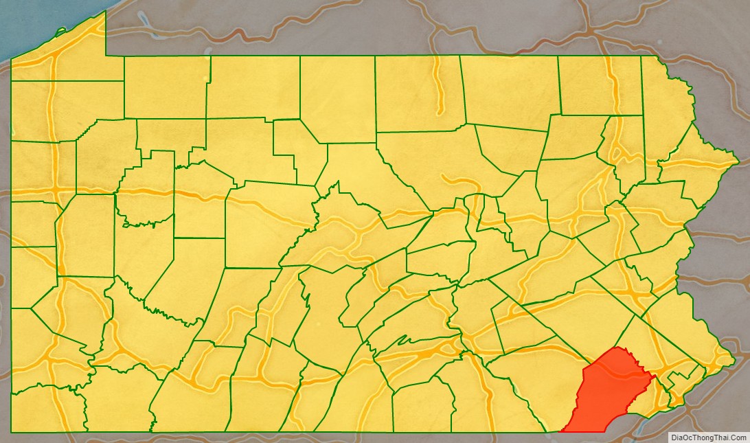
Adjacent counties
- Berks County (north)
- Montgomery County (northeast)
- Delaware County (east)
- New Castle County, Delaware (southeast)
- Cecil County, Maryland (south)
- Lancaster County (west)
National protected area
- Valley Forge National Historical Park (part)
State protected areas
- French Creek State Park
- Marsh Creek State Park
- White Clay Creek Preserve
Major roads and highways
- I-76 / Penna Turnpike
- US 1
- US 30
- US 30 Bus.
- US 202
- US 322
- US 322 Bus.
- US 422
- PA 3
- PA 10
- PA 23
- PA 29
- PA 41
- PA 52
- PA 82
- PA 100
- PA 113
- PA 162
- PA 252
- PA 272
- PA 282
- PA 340
- PA 345
- PA 352
- PA 372
- PA 401
- PA 472
- PA 724
- PA 796
- PA 841
- PA 842
- PA 896
- PA 926
Chester County Topographic Map
Chester County Satellite Map
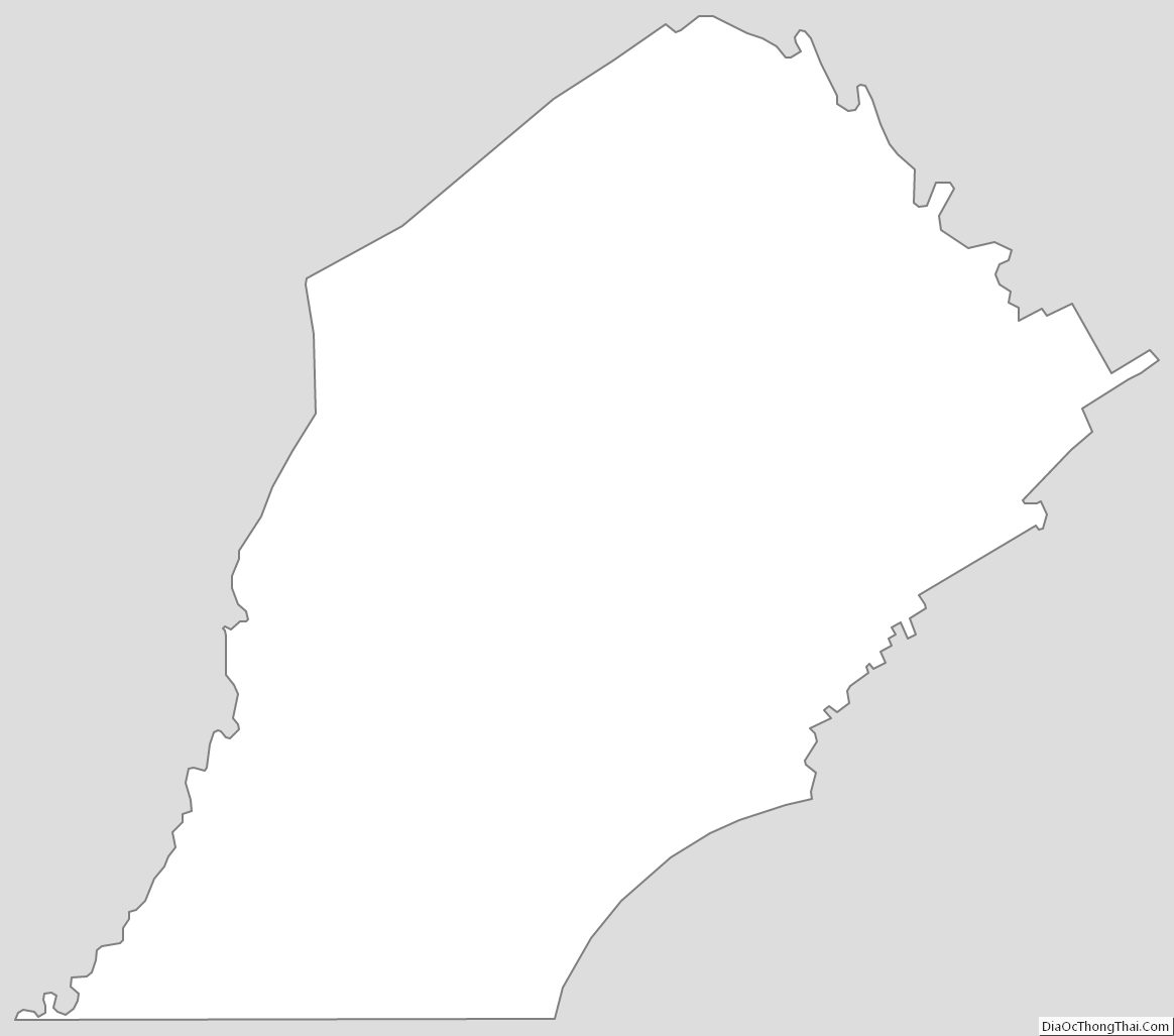
Chester County Outline Map