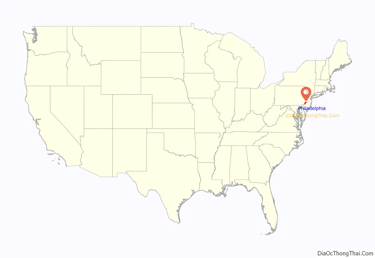
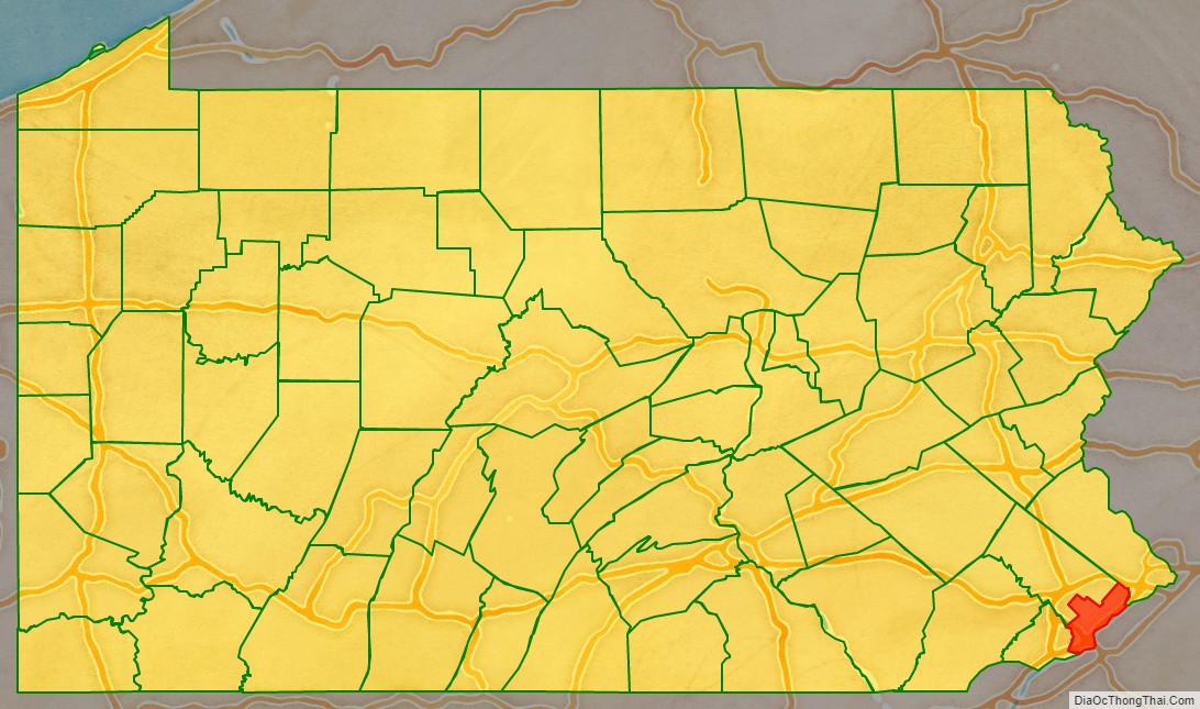
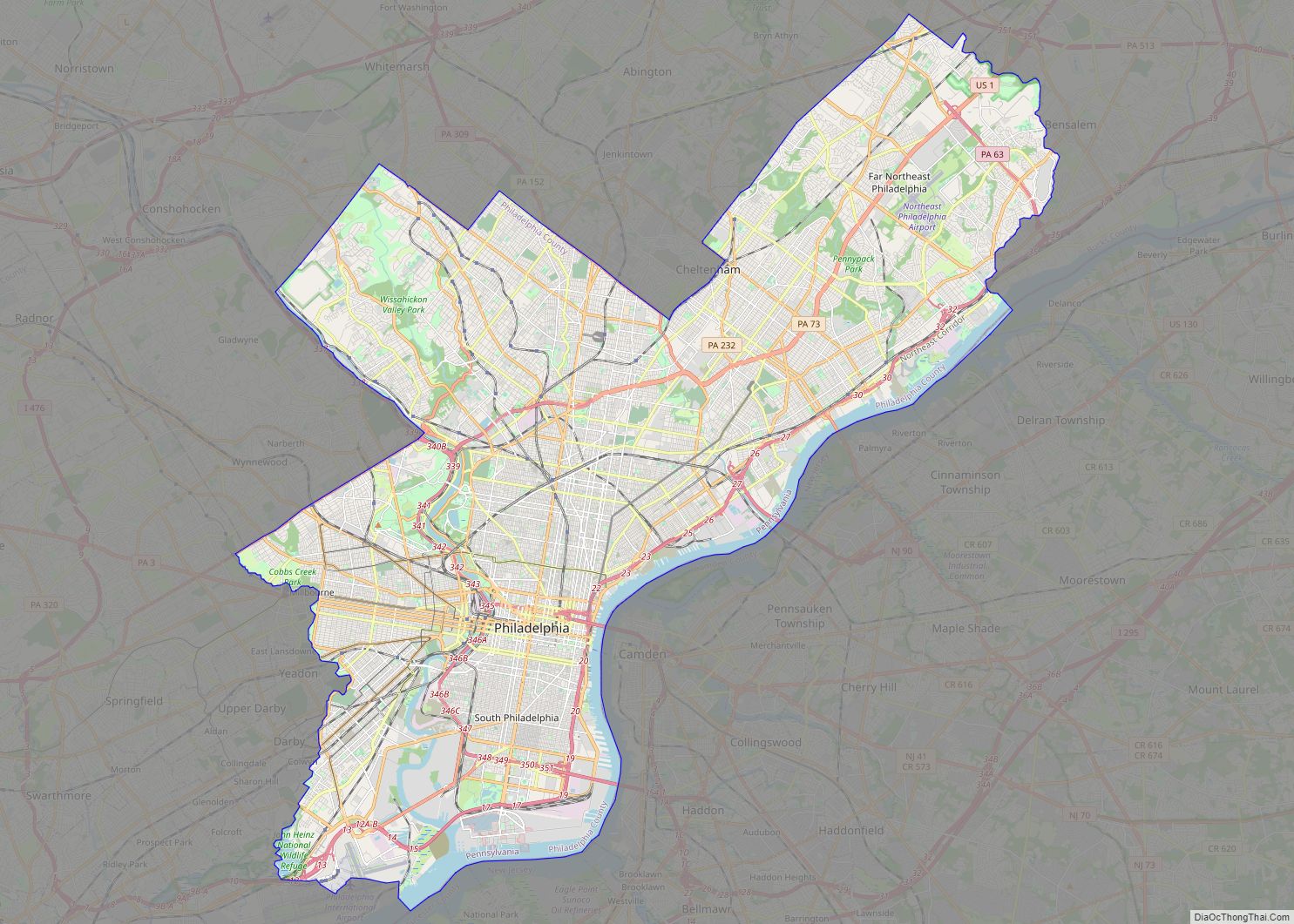
Philadelphia County is a county in the Commonwealth of Pennsylvania. It is the most populous county in Pennsylvania and the 24th most populous county in the nation. As of the 2020 census, Philadelphia County had a population of 1,603,797. Its county seat is Philadelphia, the nation’s sixth-largest city.
Philadelphia County is one of the three original counties, along with Chester and Bucks counties, created by William Penn in November 1682. Since 1854, the county has been coextensive with the City of Philadelphia which is also its county seat. Philadelphia County is the core county in the Philadelphia-Camden–Wilmington Combined Statistical Area (PA-NJ–DE–MD, also known as the Delaware Valley), located along the lower Delaware and Schuylkill Rivers, within the Northeast megalopolis. Philadelphia County is the economic and cultural anchor of the Delaware Valley, the eighth-largest combined statistical area in the United States with an estimated population of 6.096 million as of 2020.
| Name: | Philadelphia County |
|---|---|
| FIPS code: | 42-101 |
| State: | Pennsylvania |
| Founded: | March 10, 1682 |
| Named for: | City of Philadelphia |
| Seat: | Philadelphia |
| Largest city: | Philadelphia |
| Total Area: | 143 sq mi (370 km²) |
| Land Area: | 134 sq mi (350 km²) |
| Total Population: | 1,603,797 |
| Population Density: | 11,969/sq mi (4,621/km²) |
| Time zone: | UTC−5 (Eastern) |
| Summer Time Zone (DST): | UTC−4 (EDT) |
| Website: | www.phila.gov |
Philadelphia County location map. Where is Philadelphia County?
History
Native American tribes of Lenape were the first known occupants in the area that became Philadelphia County. The first European settlers were Swedes and Finns who arrived in 1638. The Netherlands seized the area in 1655, but lost control to England in 1674. William Penn received his charter for Pennsylvania from Charles II of England in 1681, and in November 1682 he divided Pennsylvania into three counties. During the same year, Philadelphia was planned and was made the county seat and the capital of the Province of Pennsylvania.
Penn wanted Philadelphia, meaning “love brotherly”, to be a place where religious tolerance and the freedom to worship were ensured. Philadelphia’s name is shared with an ancient city in Asia Minor mentioned by the Bible’s Book of Revelation. It was William Penn’s desire, as a Quaker, that his “Holy Experiment” would be found blameless at the Last Judgment.
When established, Philadelphia County consisted mainly of the area from the Delaware River west between the Schuylkill River to the south and the border with Bucks County to the north; the western boundary was undefined. Two counties would be formed out of Philadelphia County, Berks County which was formed in 1752 (from parts of Chester, Lancaster, and Philadelphia counties), and Montgomery County established in 1784. From these separations, as well as other border changes, was created the present-day boundaries of the county.
Philadelphia, as planned by Penn, comprised only that portion of the present day city situated between South and Vine Streets and the Delaware and Schuylkill Rivers. Other settlements were made beyond the boundaries of the city, and in the course of time they became incorporated separately and had separate governments.
Several of these settlements were situated immediately contiguous to the City of Philadelphia, such as Southwark and Moyamensing in the south, the Northern Liberties District, Kensington, Spring Garden and Penn District to the north, and West Philadelphia and Blockley to the west — which combined with the City of Philadelphia formed practically one continuously urban area, the whole group being known abroad simply as Philadelphia.
Besides these, there were a number of other outlying townships, villages and settlements throughout the county. Over time, as the population expanded out from the City of Philadelphia, those closer to the City of Philadelphia became absorbed into Philadelphia.
During this period, the city government of Philadelphia and the county government of Philadelphia acted separately. By the mid-19th century, a more structured government bureaucracy was needed. A reform charter, on February 2, 1854, defined all the boroughs, townships and districts of the County of Philadelphia as being within the City of Philadelphia, thus abolishing the patchwork of cities, boroughs, and townships that had comprised Philadelphia County since its founding.
The city-county consolidation was a result of the inability of a colonial-type government by committees to adapt to the needs of a growing city for new public services, for example, better streets, police, transportation, sanitation and schools.
The newly integrated districts had marked characteristics between them, but over time, after the consolidation, these characteristics were generally integrated into the City of Philadelphia. Presently, the names of some of these old districts survive as the names of neighborhoods in the city, with their boundaries roughly matching their historic boundaries.
In 1951, a new law known as the Home Rule Charter merged city and county offices completely. This new charter provided the city with a common structure and outlined the “strong mayor” form of government that is still used.
The county offices were merged with the city government in 1952, effectively eliminating the county as a government. Even though the county no longer has a government structure by law, in both the Unconsolidated Pennsylvania Statutes and The Philadelphia Code and Charter, the County of Philadelphia is still an entity within the Commonwealth of Pennsylvania. It is thus subject to the provisions and laws of the Commonwealth concerning counties. Exceptions include restrictions stated in the Home Rule Charter of Philadelphia, Act of Consolidation, 1854, and subsequent legislation. The county also is the only First Class County, meaning it had a population of 1.5 million or more at the last census, in the Commonwealth.
Philadelphia has become racially and ethnically diverse over the years, and this process continues. Since 1990, (the year that immigration began increasing), thousands of immigrants from Latin America, Asia and Europe have arrived in the county. Presently, the city has some of the largest Irish, Italian, German, Polish, Puerto Rican, Korean, Vietnamese, Russian, Ukrainian, Jamaican, Chinese, Arab, Thai, and Cambodian populations in America. The county has the fourth largest concentration of African Americans in North America, including large numbers of Liberians, Nigerians, and Sudanese. The Northeast section of the city, and more significantly the suburbs of Philadelphia, contain large numbers of Indian Americans and Mexicans.
At the 2010 census, the city was 41.0% White, 43.4% Black or African American, 0.5% American Indian or Alaskan Native, 6.3% Asian, 0.0% Native Hawaiian, 2.8% two or more race, and 5.9% were some other race. 12.3% of the population were Hispanic or Latino.
Philadelphia County Road Map
Geography
According to the U.S. Census Bureau, Philadelphia County has a total area of 143 square miles (370 km), of which 134 square miles (350 km) is land and 8.6 square miles (22 km) (6.0%) is water. It is the second-smallest county in Pennsylvania by area. Bodies of water include the Delaware River, Schuylkill River, Cobbs Creek, Wissahickon Creek, and Pennypack Creek.
The lowest point in the county is 10 feet above sea level near Fort Mifflin in Southwest Philadelphia, at the convergence of the Delaware and Schuylkill Rivers. The highest point is in Chestnut Hill, at 432 feet above sea level, near Evergreen Place, just north and west of Evergreen Avenue. Philadelphia County is Pennsylvania’s second smallest county by land area, after Montour County.
Counties adjacent
- Bucks County (northeast)
- Burlington County, New Jersey (east)
- Camden County, New Jersey (southeast)
- Gloucester County, New Jersey (south)
- Delaware County (southwest)
- Montgomery County (northwest)
Major roads and highways
- I-76
- I-95
- I-676
- US 1
- US 13
- US 30
- PA 3
- PA 63
- PA 73
- PA 232
- PA 291
- PA 309
- PA 532
- PA 611
