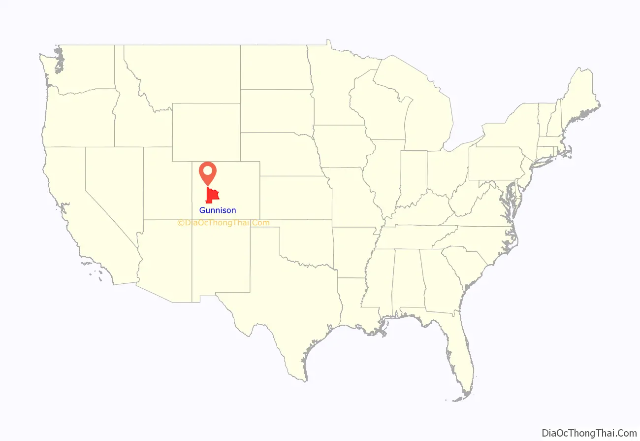
| Name: | Gunnison County |
|---|---|
| FIPS code: | 08-051 |
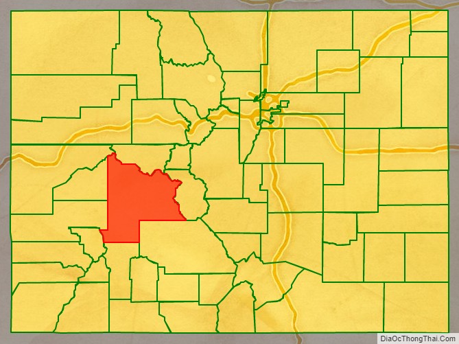
| State: | Colorado |
| Founded: | March 9, 1877 |
| Named for: | John W. Gunnison |
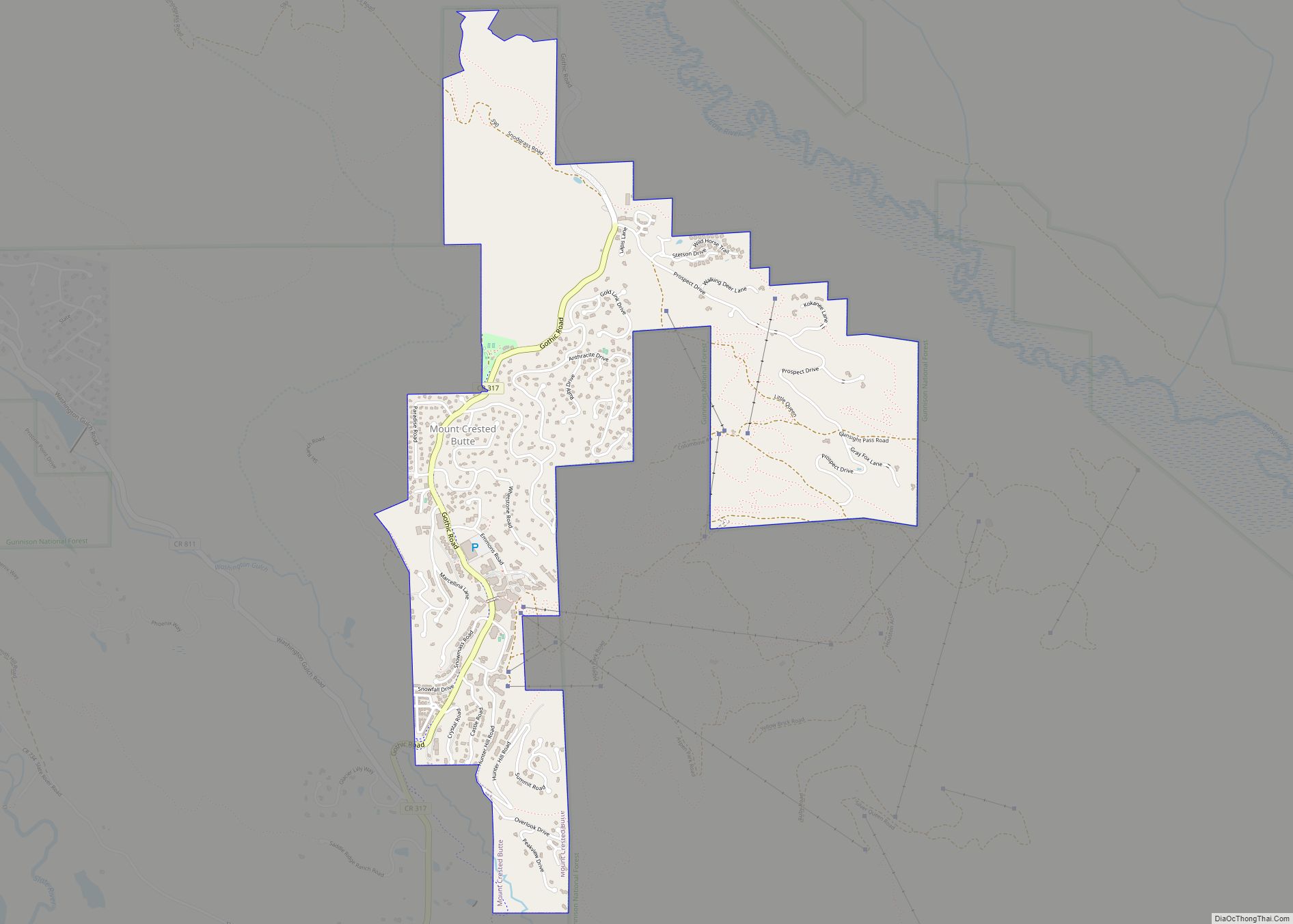
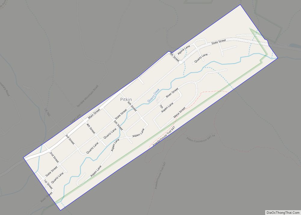
| Seat: | Gunnison |
| Largest city: | Gunnison |
| Total Area: | 3,260 sq mi (8,400 km²) |
| Land Area: | 3,239 sq mi (8,390 km²) |
| Total Population: | 17,281 |
| Population Density: | 5.2/sq mi (2.0/km²) |
| Time zone: | UTC−7 (Mountain) |
| Summer Time Zone (DST): | UTC−6 (MDT) |
| Website: | www.gunnisoncounty.org |
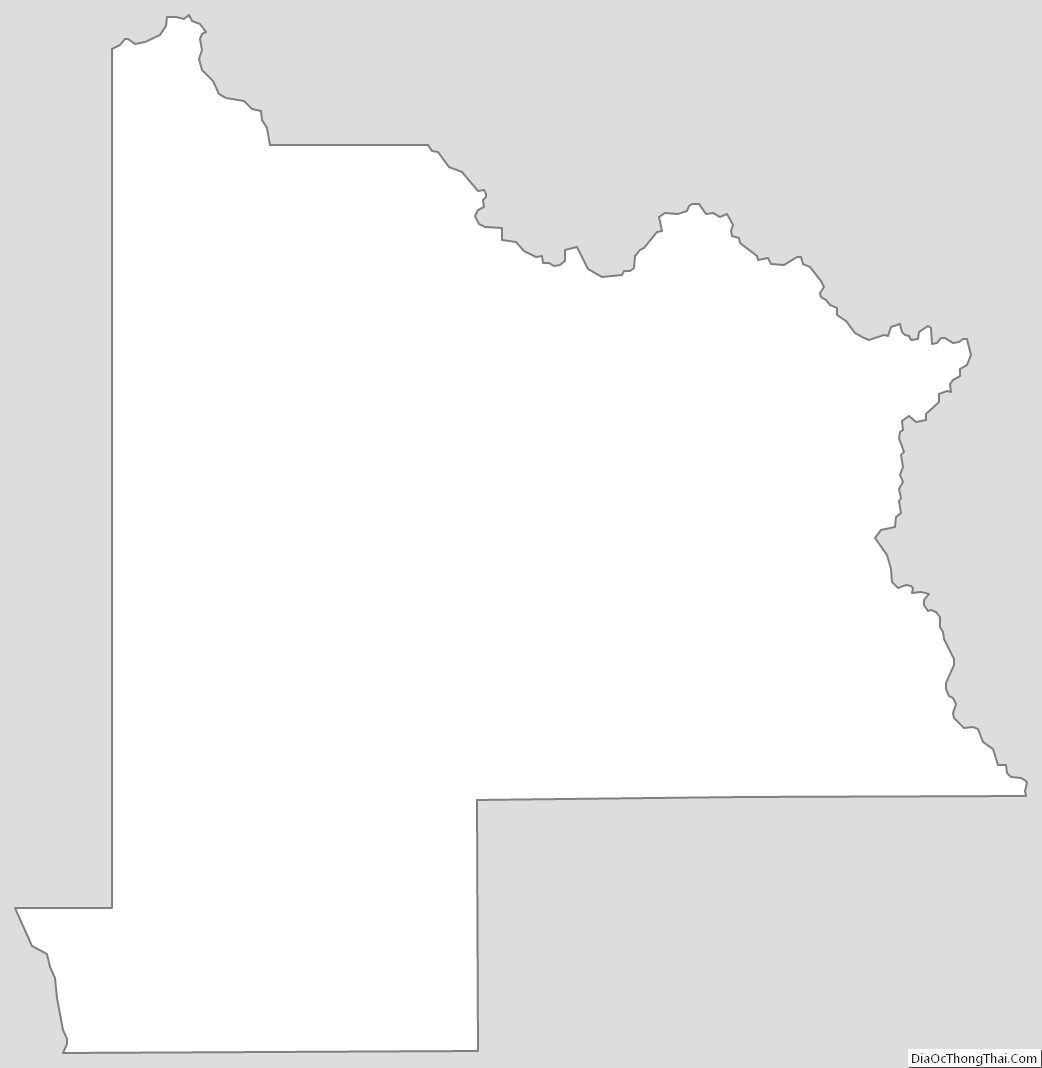
Gunnison County location map. Where is Gunnison County?
History
Archeological studies have dated the Ute people’s appearance in the Uncompahgre region of Colorado as early as 1150 A.D. Possibilities exist that they are descendants of an earlier people living in the area as far back as 1500 B.C. They were a nomadic people moving about the Western Slope of Colorado in the various parts of the year. In the early to mid-1600s the Spaniards of New Mexico introduced the horse which changed their patterns of hunting taking them across the divide to the eastern slopes and into conflict with the Plains Indians which soon became their bitter enemies.
The first recorded expedition of Western Colorado wilderness was led by Don Juan Rivera in 1765. In 1776, two Spanish priests, Fathers Escalante and Domínguez, led a party into the area around Montrose and Paonia.
The 1830s brought the mountainmen into the area to trap beaver. An old cabin located on Cochetopa Creek discovered by Sidney Jocknick was most likely built between 1830 and 1840 and a crude fort was discovered on a tributary of Tomichi Creek bore signs of a conflict.
In 1853, Capt. John W. Gunnison surveyed the area for the transcontinental railroad route.
In 1858 gold was discovered near Denver bringing the white man across the divide into the western slope in search of the precious metal. In 1859 a party settled on Texas Gulch in Union Park.
Placer gold was found at Washington Gulch in 1861 as part of the Colorado Gold Rush.
In 1861 the Territory of Colorado was organized. The territorial governor was made ex officio Superintentant of Indian Affairs. A conference on October 1, 1863, established a boundary line for a reservation. This treaty averted a possible dangerous situation by giving the Utes some cattle and sheep, a blacksmith and 20,000 dollars a year in goods and provisions. The government failed to fulfill any these obligations straining the relations further. The treaty of 1868 recognized Chief Ouray as the sole spokesman for seven tribes of the Ute People. He held this power over his people through diplomacy and understanding.
The Los Pinos Agency was developed through the Treaties of 1868 and 1873. The first agent was 2nd Lieutenant Calvin T. Speer. In 1871 a cow camp was started near the present site of Gunnison with James P. Kelley in charge. In this year, Jabez Nelson Trask, a Harvard grad, relieved Speer as agent upon orders from Governor Edward M. McCook. In 1872 Trask was replaced by Charles Adams.
In 1875 orders from Washington to move the agency to the Uncomphgre Valley were completed in November.
In 1876 Colorado entered the Union and Gunnison County was formed. 1879 was a year of expansion due to the miners, speculators and adventurers seeking wealth. The cattle industry was established by 1880. The short growing season was not conducive to farming and the ranchers had to level fields and construct irrigation ditches to water the fields for hay.
Gunnison County Road Map
Geography
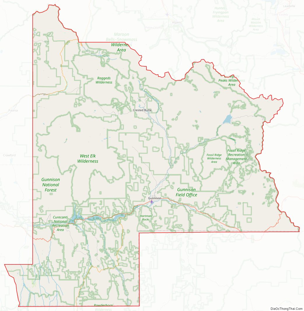
According to the U.S. Census Bureau, the county has a total area of 3,260 square miles (8,400 km), of which 3,239 square miles (8,390 km) is land and 21 square miles (54 km) (0.6%) is water. It is the fifth-largest county by area in Colorado. The county seat is Gunnison, Colorado which is located in a wide valley at the confluence of Tomichi Creek and Gunnison River. The county rests in the Gunnison Basin formed by the Continental Divide to the east, Collegiate Peaks Wilderness rises in the northeast, Maroon Bells–Snowmass Wilderness and the White River National Forest to the north, the West Elk Wilderness rises in the west of the county with Delta and Montrose Counties on its western slopes. The Uncompahgre Wilderness rises in the southwest of the county and the Powderhorn Wilderness east of there and Saquache County being south of Gunnison county eastward over to Marshall Pass southeast of the county.
Taylor Park Reservoir is a man-made lake created by the Taylor Dam constructed in 1934 with appropriations of 2,725,000 dollars.
Adjacent counties
- Pitkin County, Colorado — north
- Chaffee County, Colorado — east
- Saguache County, Colorado — southeast
- Hinsdale County, Colorado — south
- Ouray County, Colorado — southwest
- Delta County, Colorado — west
- Montrose County, Colorado — west
- Mesa County, Colorado — northwest
Major highways
- U.S. Highway 50
- State Highway 92
- State Highway 114
- State Highway 133
- State Highway 135
- State Highway 149
Gunnison County Topographic Map
Gunnison County Satellite Map
Gunnison County Outline Map