DuPage County (/duːˈpeɪdʒ/ doo-PAYJ) is a county in the U.S. state of Illinois, and one of the collar counties of the Chicago metropolitan area. As of the 2020 census, the population was 932,877, making it Illinois’ second-most populous county. Its county seat is Wheaton.
Known for its vast tallgrass prairies, DuPage County has become mostly developed and suburbanized, although some pockets of farmland remain in the county’s western and northern parts. Located in the Rust Belt, the area is one of few in the region whose economy quickly became dependent on the headquarters of several large corporations due to its close proximity to Chicago. As steel mills closed in the 1970s and 1980s, several acres that were formerly industrialized areas were converted into business parks to meet the growing tax base. The county has a mixed socioeconomic profile and residents of Hinsdale, Naperville and Oak Brook include some of the wealthiest people in the Midwest. However, other cities in the county such as Aurora and Downers Grove have faced issues regarding local small business growth, affordable housing and elevating crime rates. On the whole, the county enjoys above average median household income levels and low overall poverty levels when compared to the national average. In 2018, Niche ranked two DuPage municipalities (Clarendon Hills at #22 and Naperville at #128) amongst the best places to live in America.
| Name: | Dupage County |
|---|---|
| FIPS code: | 17-043 |
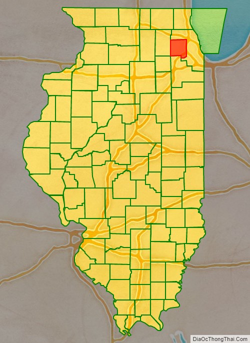
| State: | Illinois |
| Founded: | February 9, 1839 |
| Named for: | DuPage River |
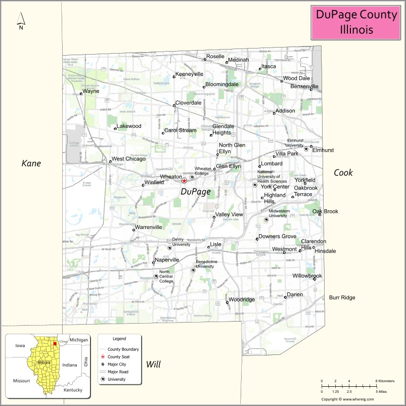
| Seat: | Wheaton |
| Largest city: | Aurora |
| Total Area: | 336 sq mi (870 km²) |
| Land Area: | 327 sq mi (850 km²) |
| Total Population: | 932,877 |
| Population Density: | 2,800/sq mi (1,100/km²) |
| Time zone: | UTC−6 (Central) |
| Summer Time Zone (DST): | UTC−5 (CDT) |
| Website: | www.dupageco.org |
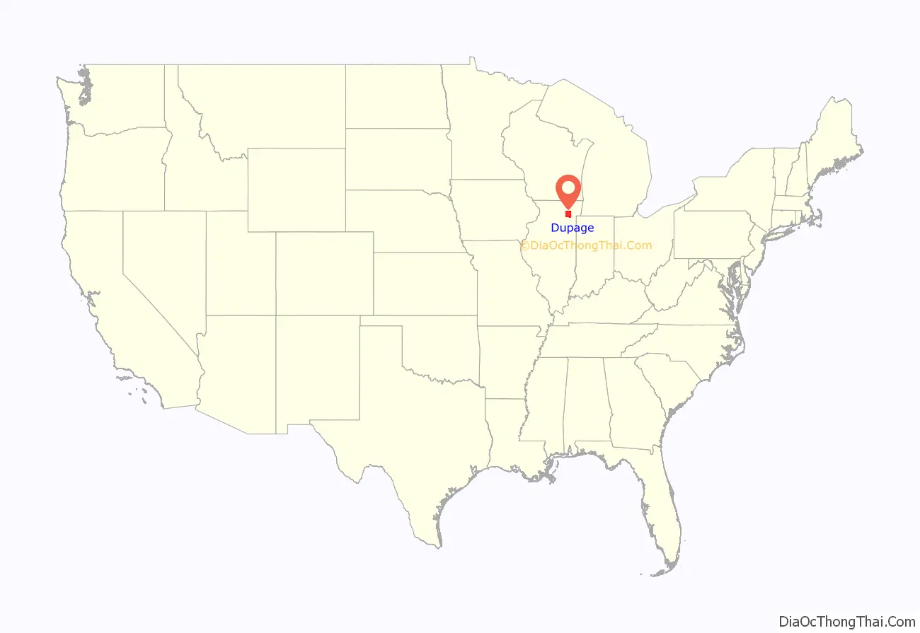
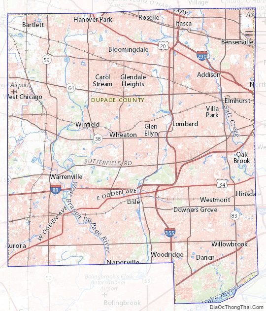
Dupage County location map. Where is Dupage County?
History
DuPage County was formed on February 9, 1839, out of Cook County. The county took its name from the DuPage River, which was, in turn, named after a French fur trapper, DuPage. The first written history to address the name, the 1882 History of DuPage County, Illinois, by Rufus Blanchard, relates:
The first white settler in DuPage County was Bailey Hobson who, with Lewis Stewart, built a house in 1831 for the Hobson family at a site about 2 miles south of present-day downtown Naperville. Hobson later built a mill to serve surrounding farmers. Today, the Hobson house still stands on Hobson Road in Naperville, and the location of the mill is commemorated with a millstone and monument in today’s Pioneer Park.
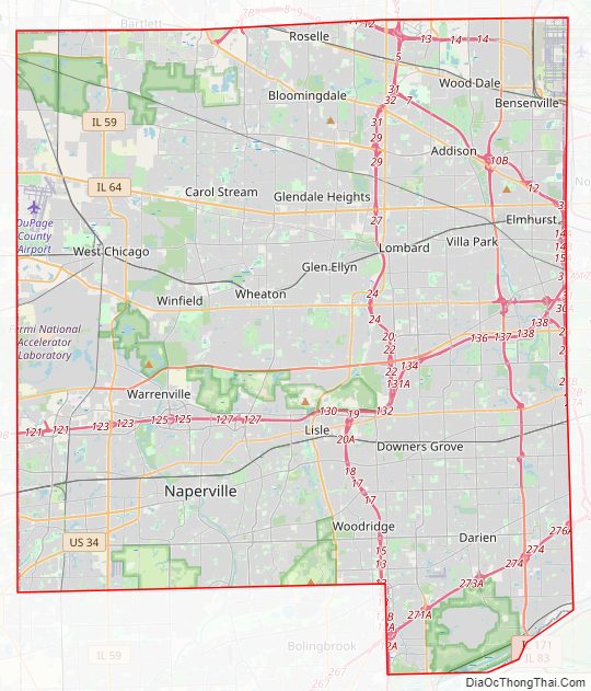
Dupage County Road Map
Geography
According to the U.S. Census Bureau, the county has a total area of 336 square miles (870 km), of which 327 square miles (850 km) is land and 8.9 square miles (23 km) (2.6%) is water. The DuPage River and the Salt Creek flow through DuPage County. According to the Forest Preserve District of DuPage County, the highest point in the county is located at the Mallard Lake Landfill, which at its highest point is 982 feet (299 m) above mean sea level.
Climate
In recent years, average temperatures in the county seat of Wheaton have ranged from a low of 14 °F (−10 °C) in January to a high of 87 °F (31 °C) in July, although a record low of −26 °F (−32 °C) was recorded in January 1985 and a record high of 105 °F (41 °C) was recorded in July 1995. Average monthly precipitation ranged from 1.56 inches (40 mm) in February to 4.60 inches (117 mm) in August.
Adjacent counties
Counties that are adjacent to DuPage include:
- Cook County (east and north)
- Will County (south)
- Kendall County (southwest; counties meet at a corner)
- Kane County (west)
Dupage County Topographic Map
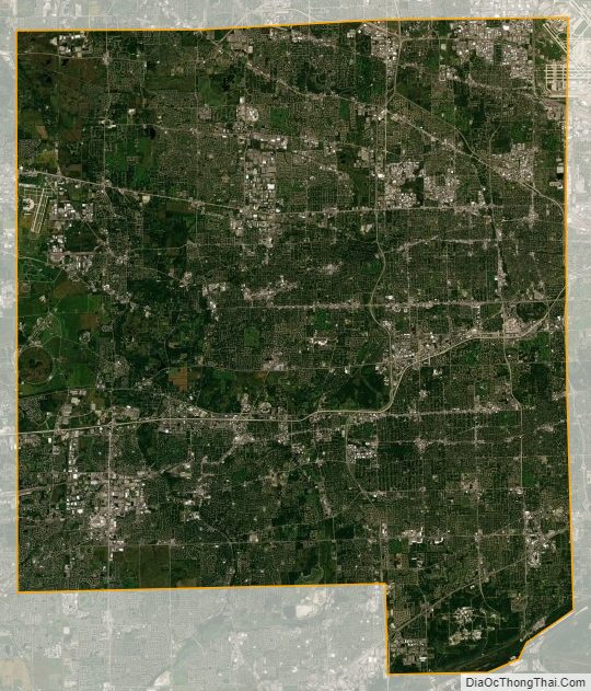
Dupage County Satellite Map
Dupage County Outline Map