Downers Grove is a village in DuPage County, Illinois, United States. It was founded in 1832 by Pierce Downer, whose surname serves as the eponym for the village. Per the 2020 census, the population of the village was 50,247. It is a southwest suburb of Chicago located between I-88 and I-55.
| Name: | Downers Grove village |
|---|---|
| LSAD Code: | 47 |
| LSAD Description: | village (suffix) |
| State: | Illinois |
| County: | DuPage County |
| Founded: | 1832 |
| Incorporated: | 1873 |
| Elevation: | 705 ft (215 m) |
| Total Area: | 14.80 sq mi (38.32 km²) |
| Land Area: | 14.65 sq mi (37.94 km²) |
| Water Area: | 0.15 sq mi (0.39 km²) |
| Total Population: | 50,247 |
| Population Density: | 3,430.53/sq mi (1,324.51/km²) |
| FIPS code: | 1720591 |
| Website: | www.downers.us |
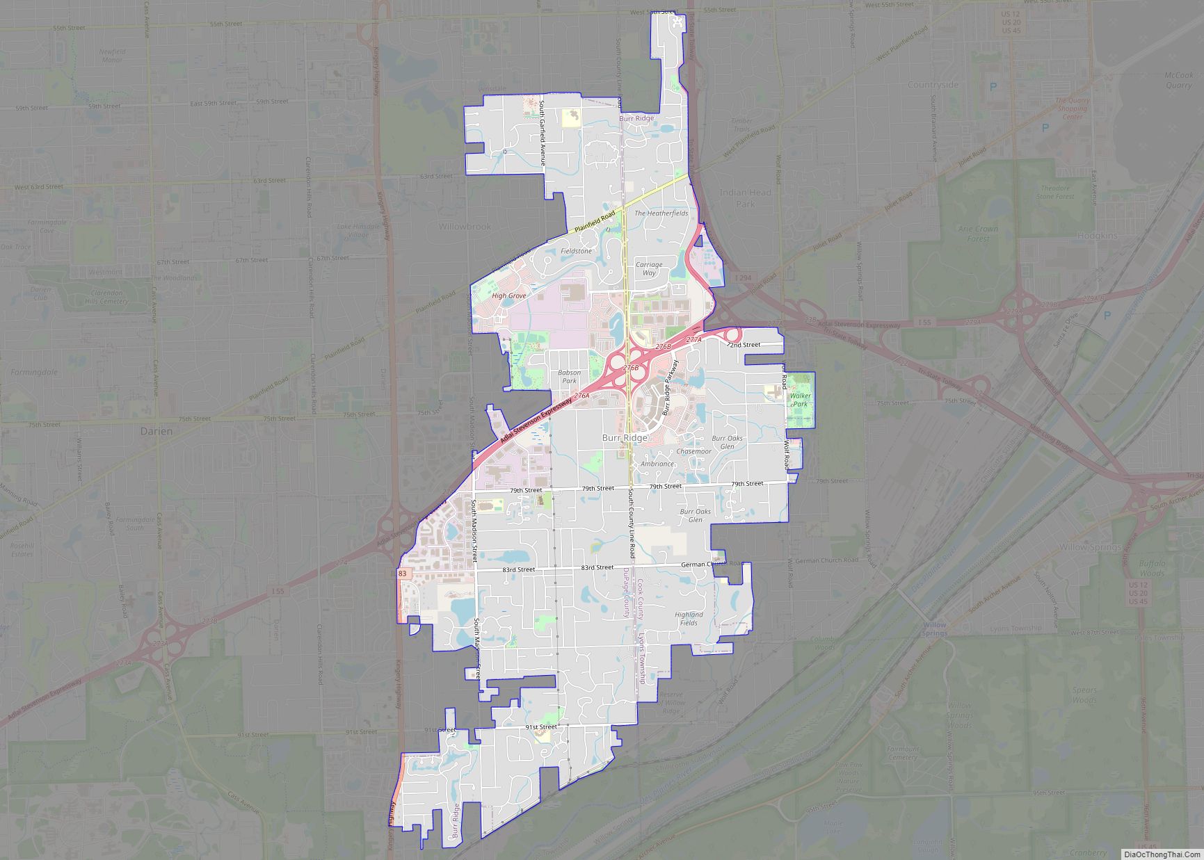
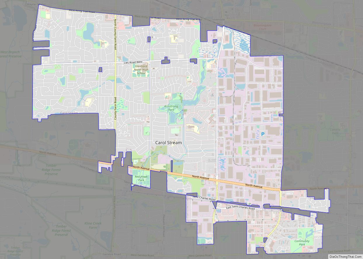
Online Interactive Map
Click on ![]() to view map in "full screen" mode.
to view map in "full screen" mode.
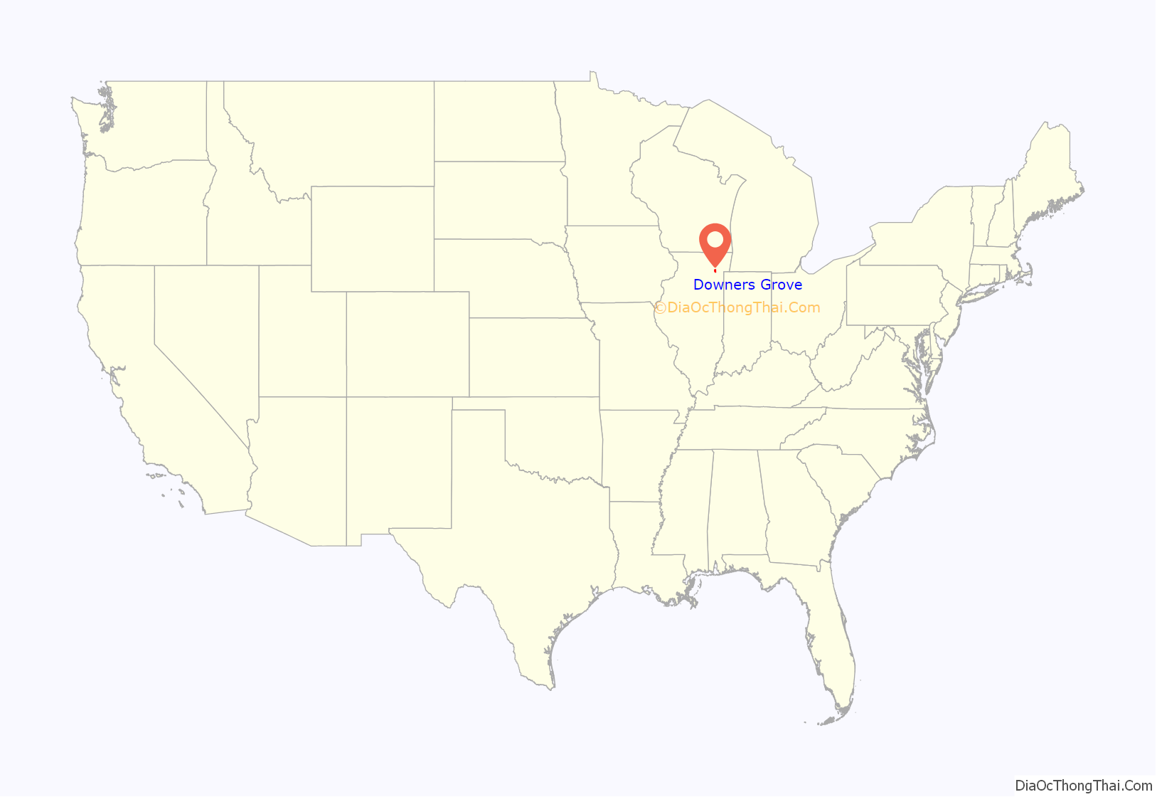
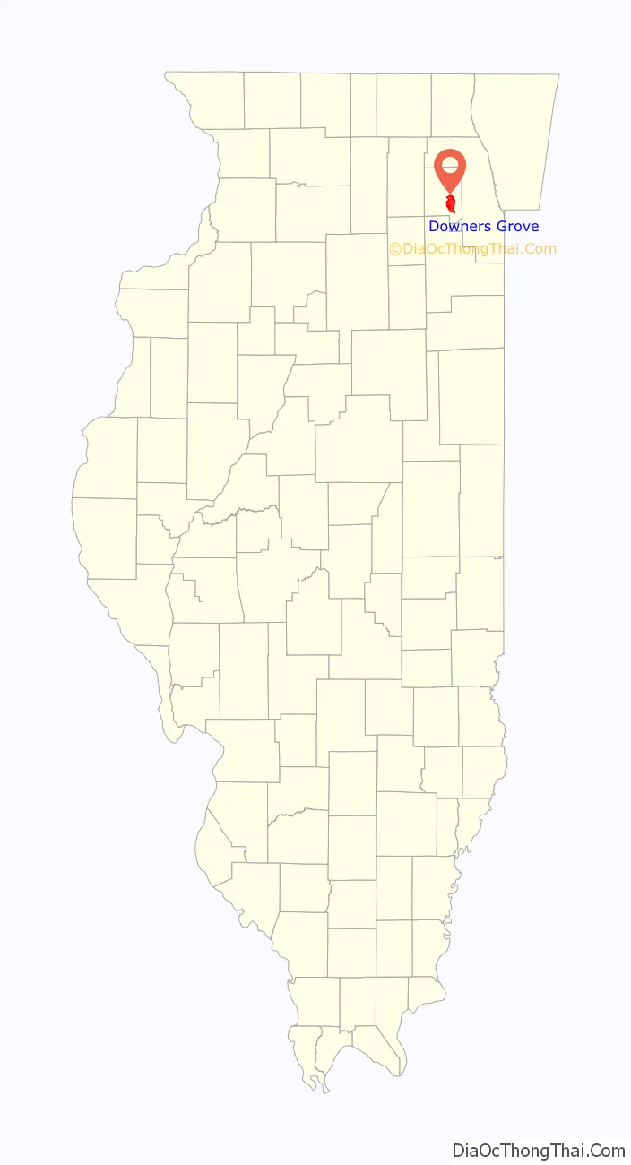
Downers Grove location map. Where is Downers Grove village?
History
Downers Grove was founded in 1832 by Pierce Downer, a farmer who traveled to Illinois from Rutland, New York, but was originally from Vermont. Downers Grove was named for a lush grove of old-growth bur oak trees surrounding the village, which stood out from the local savanna landscape. Its other early settlers included the Blodgett, Curtiss, Blanchard, Stanley, Lyman, and Carpenter families. The original settlers were mostly migrants from the Northeastern United States and Northern Europe. In 1839, Reverend Orange Lyman, a presbyterian minister, and his wife Maria Dewey Lyman arrived, and built what is believed to be the first home in Downers Grove. The first schoolhouse was built in 1844. In 1846, the Blodgett house was built by Israel and Avis Blodgett. It was the second (or third) home built in Downers Grove. Both the Lyman and Blodgett homes are of cultural significance, as they were both built by abolitionist families and served as former stops on the Underground Railroad.
The Chicago, Burlington and Quincy Railroad was extended from Aurora to Chicago through Downers Grove in 1864, boosting its population. The town was incorporated in March 1873. Its somewhat unusual spelling (“Apostrophe-free since 1873”) remains a minor historical mystery.
In April 1947, the wreck of a Burlington Railroad Twin Cities Zephyr passenger train killed three people, including the engineer. The streamliner struck a large tractor which had fallen from a freight train and two passenger cars crashed through a wall of the Main Street Station.
The construction of two major toll roads along the village’s northern and western boundaries, I-355 in 1989, and what is now referred to as I-88 in 1958, facilitated the village’s access to the rest of Chicago metropolitan area. I-55 is not far from the south edge of the village. Downers Grove has developed into a bustling Chicago suburb with many diverse businesses, including the headquarters for Devry University, FTD, Ambitech Engineering Corp, Dover, Heartland Food Corporation, and HAVI Global Solutions.
Housing
The housing stock in Downers Grove comprises a mixture; some, generally near the center of town, date from the middle of the 19th century, but housing styles of each succeeding generation are represented. Downers Grove has witnessed one of the highest teardown rates in the Chicago area; small older residences are being demolished and replaced with much larger new houses. Teardowns have been the source of much controversy within the village. Since they occupy much more land than the original houses, rainwater that was originally absorbed by their yards is directed into neighboring yards and streets, resulting in flooding. Concerns have been raised that teardowns reduce affordable housing in the town and promote gentrification.
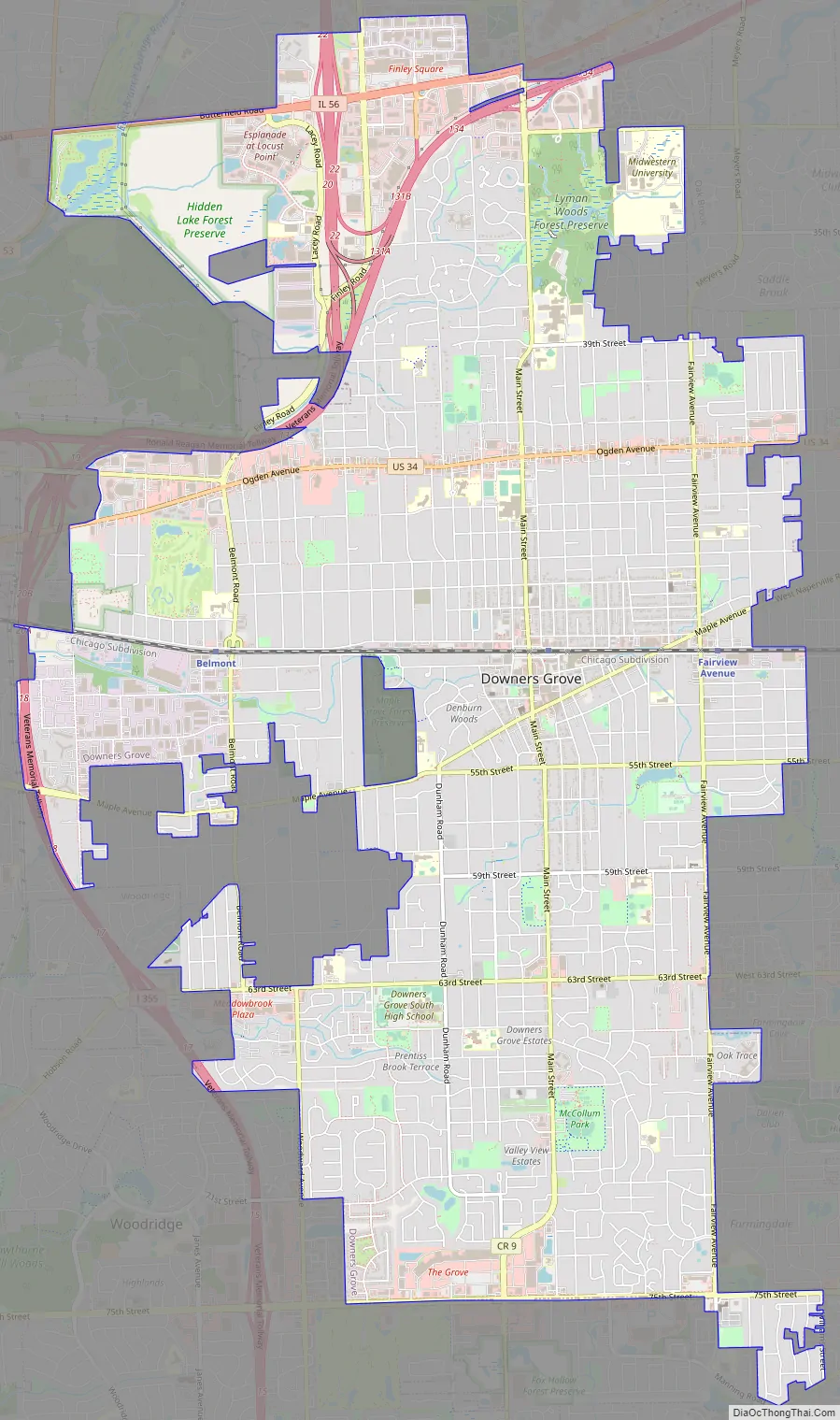
Downers Grove Road Map
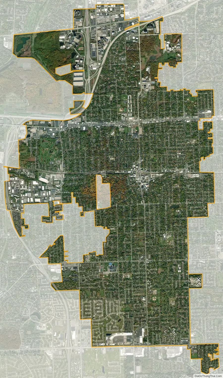
Downers Grove city Satellite Map
Geography
According to the 2010 census, Downers Grove has a total area of 14.457 square miles (37.44 km), of which 14.31 square miles (37.06 km) (or 98.98%) is land and 0.147 square miles (0.38 km) (or 1.02%) is water. Only the DuPage County communities of Bartlett, Aurora, Naperville and Bolingbrook have larger land areas. Within the town are two forest preserves: Lyman Woods and Maple Grove Forest Preserve. A small creek runs through Maple Grove forest preserve. Downers Grove has been designated a Tree City USA 28 times by the National Arbor Day Foundation.
Climate
Downers Grove is in a humid continental climate zone. On average, January is the coldest month, while July is the warmest month. August typically has the most precipitation, and February the least. The record high for Downers Grove was 105 °F (41 °C) in July 2005, and the record low of −26 °F (−32 °C) was set in January 1985.
See also
Map of Illinois State and its subdivision:- Adams
- Alexander
- Bond
- Boone
- Brown
- Bureau
- Calhoun
- Carroll
- Cass
- Champaign
- Christian
- Clark
- Clay
- Clinton
- Coles
- Cook
- Crawford
- Cumberland
- De Kalb
- De Witt
- Douglas
- Dupage
- Edgar
- Edwards
- Effingham
- Fayette
- Ford
- Franklin
- Fulton
- Gallatin
- Greene
- Grundy
- Hamilton
- Hancock
- Hardin
- Henderson
- Henry
- Iroquois
- Jackson
- Jasper
- Jefferson
- Jersey
- Jo Daviess
- Johnson
- Kane
- Kankakee
- Kendall
- Knox
- La Salle
- Lake
- Lake Michigan
- Lawrence
- Lee
- Livingston
- Logan
- Macon
- Macoupin
- Madison
- Marion
- Marshall
- Mason
- Massac
- McDonough
- McHenry
- McLean
- Menard
- Mercer
- Monroe
- Montgomery
- Morgan
- Moultrie
- Ogle
- Peoria
- Perry
- Piatt
- Pike
- Pope
- Pulaski
- Putnam
- Randolph
- Richland
- Rock Island
- Saint Clair
- Saline
- Sangamon
- Schuyler
- Scott
- Shelby
- Stark
- Stephenson
- Tazewell
- Union
- Vermilion
- Wabash
- Warren
- Washington
- Wayne
- White
- Whiteside
- Will
- Williamson
- Winnebago
- Woodford
- Alabama
- Alaska
- Arizona
- Arkansas
- California
- Colorado
- Connecticut
- Delaware
- District of Columbia
- Florida
- Georgia
- Hawaii
- Idaho
- Illinois
- Indiana
- Iowa
- Kansas
- Kentucky
- Louisiana
- Maine
- Maryland
- Massachusetts
- Michigan
- Minnesota
- Mississippi
- Missouri
- Montana
- Nebraska
- Nevada
- New Hampshire
- New Jersey
- New Mexico
- New York
- North Carolina
- North Dakota
- Ohio
- Oklahoma
- Oregon
- Pennsylvania
- Rhode Island
- South Carolina
- South Dakota
- Tennessee
- Texas
- Utah
- Vermont
- Virginia
- Washington
- West Virginia
- Wisconsin
- Wyoming